Addingham Moorside

Settlement in Yorkshire

England

Addingham Moorside

On hill path at Addingham Moorside with view towards Small Banks
On hill path at Addingham Moorside with view towards Small Banks Credit: Colin Park

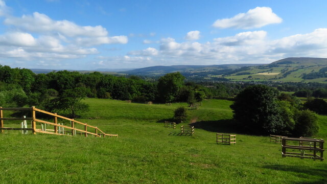
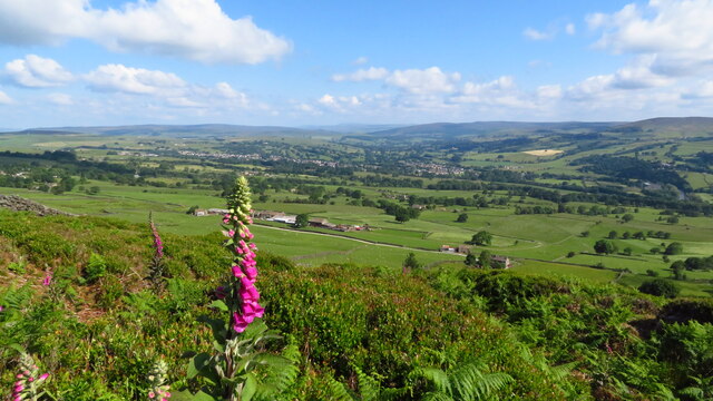
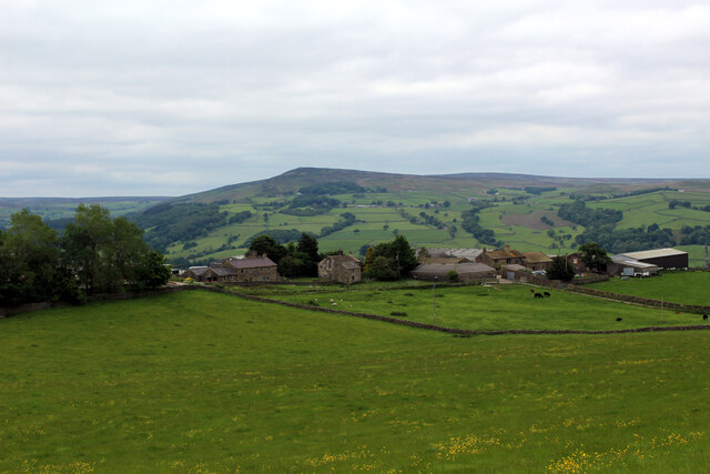
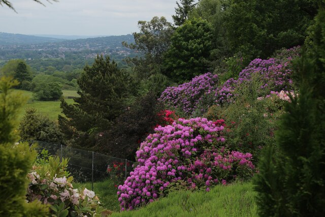
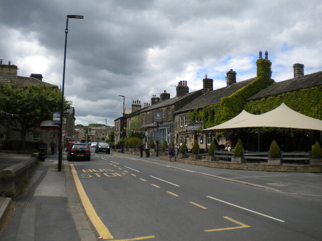
Addingham Moorside is a picturesque village located in the county of Yorkshire, England. Situated on the southern edge of the Yorkshire Dales National Park, it offers stunning views of the surrounding countryside and is renowned for its natural beauty.

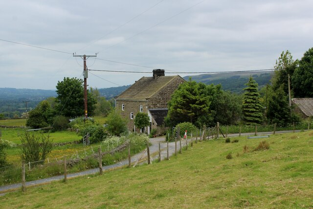
The village itself is small but charming, with a population of around 1,000 residents. It is characterized by its traditional stone-built houses and narrow winding streets, giving it a quintessential English village feel. The community is tight-knit and friendly, with a strong sense of pride in their village.

Addingham Moorside is surrounded by open moorland, providing ample opportunities for outdoor activities such as hiking, cycling, and birdwatching. The nearby Ilkley Moor is particularly popular among nature enthusiasts, offering breathtaking views across the valley.

In terms of amenities, the village has a local pub, The Fleece, which is a popular meeting point for residents and visitors alike. There is also a village hall that hosts various community events throughout the year.

The village is well-connected to nearby towns and cities, with regular bus services and good road links. The town of Ilkley is just a short drive away, offering a wider range of shops, restaurants, and cultural attractions.

Overall, Addingham Moorside is a peaceful and idyllic village that offers a tranquil escape from the hustle and bustle of city life. Its stunning natural surroundings and strong community spirit make it a truly special place to live or visit.

If you have any feedback on the listing, please let us know in the comments section below.

Addingham Moorside Images

Images are sourced within 2km of 53.926145/-1.886955 or Grid Reference SE0747. Thanks to Geograph Open Source API. All images are credited.
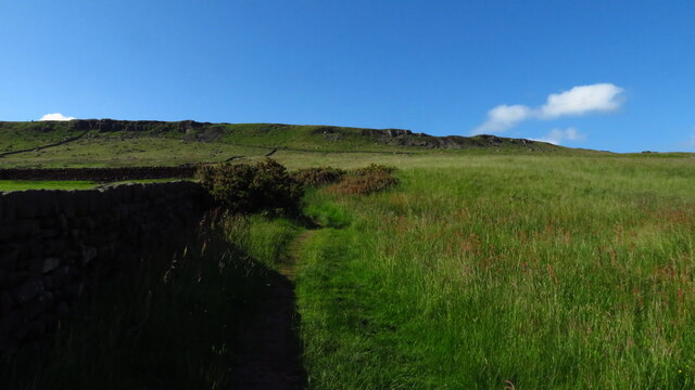
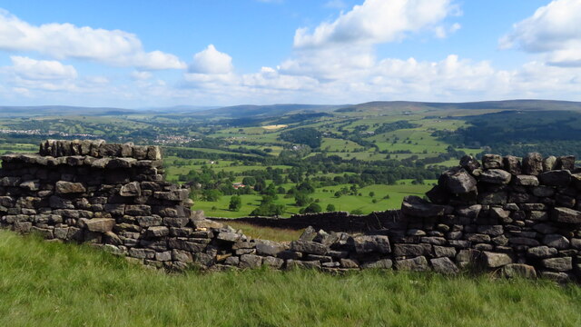
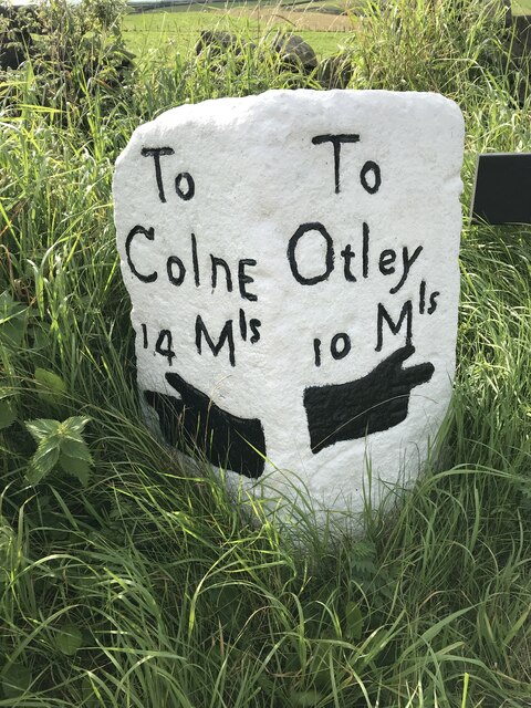
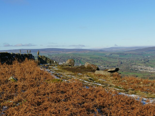
On hill path at Addingham Moorside with view towards Small Banks
Path leading uphill from Addingham Moorside towards Black Hill
Cragg House from Piper's Crag, Rombalds Moor
Broken down wall, E of Piper's Crag, Rombalds Moor
Milestone Brown Bank Lane / Turner Lane Junction Freshly painted and refurbished
Milestone Brown Bank Lane / Turner Lane Junction
Freshly painted and refurbished
Gildersber A view over Gildersber towards Beamley Beacon - as seen from Cocking Lane
Gildersber
A view over Gildersber towards Beamley Beacon - as seen from Cocking Lane
Rhododendrons at High Brocka Bank Dazzling floral display in the back garden of Brocka Bank
Rhododendrons at High Brocka Bank
Dazzling floral display in the back garden of Brocka Bank
Brocka Bank Farm
Brocka Bank Farm
Addingham, 135 Main Street The worn benchmark is cut into the 2nd course of stone on the front left of the property.
Addingham, 135 Main Street
The worn benchmark is cut into the 2nd course of stone on the front left of the property.
Addingham, 135 Main Street There is a worn benchmark cut into the 2nd course of stone on the front left of 135 Main Street.
Addingham, 135 Main Street
There is a worn benchmark cut into the 2nd course of stone on the front left of 135 Main Street.
The Sepulchre Stone Alongside the Dales High Way.
The Sepulchre Stone
Alongside the Dales High Way.
Main Street, Addingham
Old Milestone by the former A65, Ilkley Road, Addingham parish Carved stone post by the UC road (was A65), in parish of ADDINGHAM (BRADFORD District), Ilkley Road, old road into Addingham, 150m Southeast of Low Holme House, at wall end, under hedge just North of Milestone YW_SKOT07 SE0849 : Old Milestone by the former A65, Ilkley Road, Addingham parish, on North side of road. Erected by the Skipton & Otley turnpike trust in the 18th century. 

Inscription once read:-
(Skipton)
(7)
(Otley)
(8) 

Milestone Society National ID: YW_SKOT07a.
Old Milestone by the former A65, Ilkley Road, Addingham parish
Carved stone post by the UC road (was A65), in parish of ADDINGHAM (BRADFORD District), Ilkley Road, old road into Addingham, 150m Southeast of Low Holme House, at wall end, under hedge just North of Milestone YW_SKOT07 SE0849 : Old Milestone by the former A65, Ilkley Road, Addingham parish, on North side of road. Erected by the Skipton & Otley turnpike trust in the 18th century. Inscription once read:- (Skipton) (7) (Otley) (8) Milestone Society National ID: YW_SKOT07a.
Old Milestone by the former A65, Ilkley Road, Addingham parish Metal plate attached to stone post by the UC road (was A65), in parish of ADDINGHAM (BRADFORD District), Ilkley Road, old road into Addingham, 150m Southeast of Low Holme House, in verge under hedge near '40' sign, on North side of road, just South of Milestone YW_SKOT07a SE0849 : Old Milestone by the former A65, Ilkley Road, Addingham parish. West Riding iron casting, erected by the County Council in the 19th century. 

Inscription reads:-
: ILKLEY / 2¼ MILES / OTLEY / 8½ MILES : : SKIPTON & OTLEY / ROAD / ADDINGHAM : : BOLTON / BRIDGE / 3 MILES / SKIPTON / 7 MILES :

Grade II listed.
List Entry Number: 1133420 <span class="nowrap"><a title="https://historicengland.org.uk/listing/the-list/list-entry/1133420" rel="nofollow ugc noopener" href="https://historicengland.org.uk/listing/the-list/list-entry/1133420">Link</a><img style="margin-left:2px;" alt="External link" title="External link - shift click to open in new window" src="https://s1.geograph.org.uk/img/external.png" width="10" height="10"/></span>

Milestone Society National ID: YW_SKOT07.
Old Milestone by the former A65, Ilkley Road, Addingham parish
Metal plate attached to stone post by the UC road (was A65), in parish of ADDINGHAM (BRADFORD District), Ilkley Road, old road into Addingham, 150m Southeast of Low Holme House, in verge under hedge near '40' sign, on North side of road, just South of Milestone YW_SKOT07a SE0849 : Old Milestone by the former A65, Ilkley Road, Addingham parish. West Riding iron casting, erected by the County Council in the 19th century. Inscription reads:- : ILKLEY / 2¼ MILES / OTLEY / 8½ MILES : : SKIPTON & OTLEY / ROAD / ADDINGHAM : : BOLTON / BRIDGE / 3 MILES / SKIPTON / 7 MILES : Grade II listed. List Entry Number: 1133420 LinkExternal link Milestone Society National ID: YW_SKOT07.
Gateway in a wall on Ilkley Moor Rombalds Moor covers about 90 sq.km. between Wharfedale and Airedale. The highest point is 402m above sea level (grid ref for this shared description).  Parts of it also have local names referring to the nearest town, e.g. Hawksworth, Burley, Ilkley, Bingley and Morton Moors. 

The moor is particularly rich in remains of prehistoric activity. The most numerous relics are the rock carvings which can be found on many of the boulders and outcrops scattered across the moor. Burial monuments stone circles and a range of enclosed settlements are also known.  [source: Historic England, overall description covering several ancient monument sites]

There are several small reservoirs, originally built by local authorities, that collect water from the moors. The Rombalds Water Board was taken over by the Yorkshire Water Authority in 1973.
Gateway in a wall on Ilkley Moor
Rombalds Moor covers about 90 sq.km. between Wharfedale and Airedale. The highest point is 402m above sea level (grid ref for this shared description). Parts of it also have local names referring to the nearest town, e.g. Hawksworth, Burley, Ilkley, Bingley and Morton Moors. The moor is particularly rich in remains of prehistoric activity. The most numerous relics are the rock carvings which can be found on many of the boulders and outcrops scattered across the moor. Burial monuments stone circles and a range of enclosed settlements are also known. [source: Historic England, overall description covering several ancient monument sites] There are several small reservoirs, originally built by local authorities, that collect water from the moors. The Rombalds Water Board was taken over by the Yorkshire Water Authority in 1973.
Wet ground ahead! I did wonder whether to strike out across this area to get to the trig point on Long Ridge <a href="https://www.geograph.org.uk/photo/1475907">SE0846 : Trig point S5302 at Long Ridge End</a> 600 metres away, but the reeds suggested wet ground, and with snow cover too I didn't want to take any risks.
Wet ground ahead!
I did wonder whether to strike out across this area to get to the trig point on Long Ridge SE0846 : Trig point S5302 at Long Ridge End 600 metres away, but the reeds suggested wet ground, and with snow cover too I didn't want to take any risks.
Gate at Piper's Crag The wall marks a parish boundary, as marked by the boundary stone to the left of the gate <a href="https://www.geograph.org.uk/photo/6045387">SE0847 : Old Boundary Marker on Addingham High Moor,</a>.
Gate at Piper's Crag
The wall marks a parish boundary, as marked by the boundary stone to the left of the gate SE0847 : Old Boundary Marker on Addingham High Moor,.
View from the Dales High Way above Addingham The farm in the middle distance is Cragg House.
View from the Dales High Way above Addingham
The farm in the middle distance is Cragg House.
Show me another place!

Addingham Moorside is located at Grid Ref: SE0747 (Lat: 53.926145, Lng: -1.886955)

Division: West Riding

Unitary Authority: Bradford

Police Authority: West Yorkshire

What 3 Words

///display.revise.shipwreck. Near Addingham, West Yorkshire

Related Wikis

Addingham

Addingham (formerly Haddincham c. 972, Odingehem 1086) is a village and civil parish in the City of Bradford in West Yorkshire, England. It is situated...

Swastika Stone

The Swastika Stone is a stone adorned with a design that resembles a swastika, located on the Woodhouse Crag on the northern edge of Ilkley Moor in West...

Addingham railway station

Addingham railway station was on the Midland Railway route from Skipton to Ilkley. It served the village of Addingham in West Yorkshire, England. ��2...

St Peter's Church, Addingham

St Peter's Church is a Church of England parish church in Addingham, West Yorkshire. It is a Grade I listed building, with the main structure dating to...

Nearby Amenities

Located within 500m of 53.926145,-1.886955
Source: NPE
Lat/Long: 53.9289612/-1.8836465
Building: yes
Source: NPE
Lat/Long: 53.9284852/-1.8830032
Building: yes
Source: NPE
Lat/Long: 53.9276513/-1.8807716
Building: yes
Source: NPE
Lat/Long: 53.9265647/-1.8839044
Natural: spring
Source: OS 1:25k
Lat/Long: 53.9217085/-1.8864525
Beck House Farm
Building: yes
Source: NPE
Lat/Long: 53.9265716/-1.8866265
Barrier: cattle_grid
Source: Bing
Lat/Long: 53.9263802/-1.8936075
Barrier: stile
Lat/Long: 53.9243647/-1.887981
Power: pole
Lat/Long: 53.925938/-1.8936363
Power: pole
Lat/Long: 53.9258606/-1.8923864
Power: pole
Lat/Long: 53.9257887/-1.8912036
Power: pole
Lat/Long: 53.9257161/-1.8898276
Power: pole
Lat/Long: 53.9256371/-1.8886836
Power: pole
Lat/Long: 53.9255653/-1.8874822
Power: pole
Lat/Long: 53.9253612/-1.8863093
Power: pole
Lat/Long: 53.9251673/-1.8853051
Power: pole
Lat/Long: 53.9249596/-1.88418
Power: pole
Lat/Long: 53.9248465/-1.8836139
Generator Method: photovoltaic
Generator Output Electricity: yes
Generator Source: solar
Generator Type: solar_photovoltaic_panel
Power: generator
Lat/Long: 53.9262158/-1.8911176
Power: pole
Lat/Long: 53.924378/-1.880942
Power: pole
Lat/Long: 53.924558/-1.8819666
Power: pole
Lat/Long: 53.9274104/-1.8802741
Power: pole
Lat/Long: 53.9274009/-1.8815616
Power: pole
Lat/Long: 53.9273851/-1.8828169
Power: pole
Lat/Long: 53.9274262/-1.8849948
Power: pole
Lat/Long: 53.9275336/-1.8867356
Power: pole
Lat/Long: 53.9276409/-1.8885916
Power: pole
Lat/Long: 53.9277752/-1.8909198
Power: pole
Lat/Long: 53.9278399/-1.892041
Power: pole
Lat/Long: 53.9278905/-1.8932748
Lumb Beck Farm House Bed & Breakfast
Addr City: Ilkley
Addr Postcode: LS29 9JX
Addr Street: Moorside Lane
Addr Suburb: Addingham
Fhrs Id: 327225
Guest House: bed_and_breakfast
Tourism: guest_house
Lat/Long: 53.9265733/-1.8866658
Generator Method: photovoltaic
Generator Output Electricity: yes
Generator Source: solar
Generator Type: solar_photovoltaic_panel
Power: generator
Lat/Long: 53.9266396/-1.8894284
Barrier: stile
Lat/Long: 53.9295774/-1.8905896
Barrier: stile
Lat/Long: 53.9285324/-1.8932444
Barrier: stile
Lat/Long: 53.9276243/-1.8941114
The data included in this document is from www.openstreetmap.org. The data is made available under ODbL.

Have you been to Addingham Moorside?

Leave your review of Addingham Moorside below (or comments, questions and feedback).