Plaids
Settlement in Cromartyshire
Scotland
Plaids
Plaids is a picturesque village located in the historic county of Cromartyshire, Scotland. Nestled amidst rolling hills and surrounded by stunning natural landscapes, this charming village offers a serene and idyllic setting for both residents and visitors alike.
With a population of approximately 500, Plaids exudes a close-knit community atmosphere, where friendly locals are always ready to welcome newcomers. The village is known for its strong sense of tradition and heritage, with many buildings boasting beautiful architectural features that reflect its rich history.
Plaids is home to a range of amenities and facilities that cater to the needs of its residents. The village has a well-stocked local shop, providing essential groceries and other basic necessities. Additionally, there are a handful of cozy pubs and cafes where locals often gather, offering a warm and convivial atmosphere.
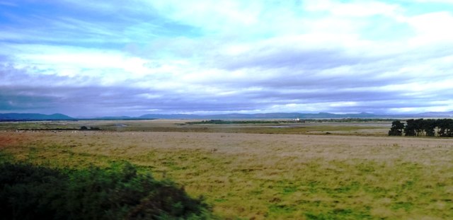
Nature lovers will be delighted by the abundance of outdoor activities available in Plaids. The village is surrounded by breathtaking landscapes, including lush forests, tranquil rivers, and rolling hills, making it a haven for hikers, cyclists, and nature enthusiasts. The nearby Cromarty Firth also offers opportunities for water-based activities such as sailing and fishing.
Plaids is well-connected to the wider region, with good transportation links to nearby towns and cities. It is located just a short drive from the town of Cromarty, known for its historic charm and scenic coastal views.
In conclusion, Plaids is a charming village in Cromartyshire that offers a tranquil and welcoming environment, beautiful natural surroundings, and a strong sense of community spirit. It is an ideal destination for those seeking a peaceful and picturesque Scottish getaway.
If you have any feedback on the listing, please let us know in the comments section below.
Plaids Images
Images are sourced within 2km of 57.803531/-3.9535657 or Grid Reference NH8481. Thanks to Geograph Open Source API. All images are credited.
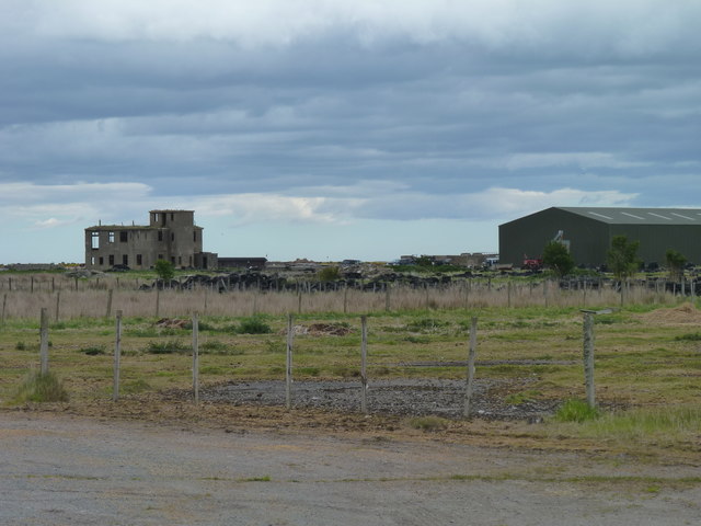
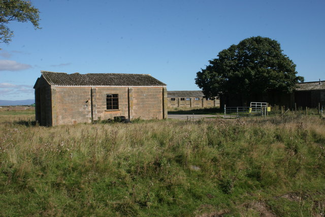
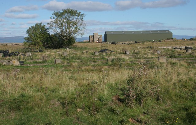
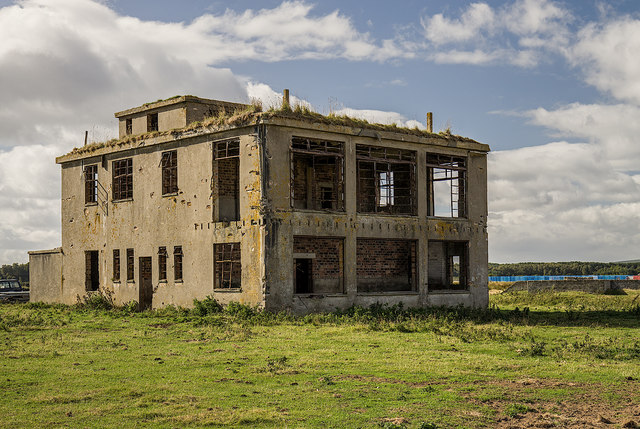
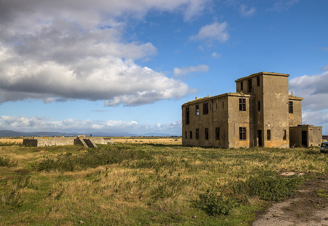
![Old buildings, Royal Air Force Station, Tain Airfield These long-deserted buildings form part of what is known as the &#039;Technical Site&#039; of the airfield. See Canmore for more details [<span class="nowrap"><a title="https://canmore.org.uk/site/109495/tain-airfield-royal-air-force-station-technical-site" rel="nofollow ugc noopener" href="https://canmore.org.uk/site/109495/tain-airfield-royal-air-force-station-technical-site">Link</a><img style="margin-left:2px;" alt="External link" title="External link - shift click to open in new window" src="https://s1.geograph.org.uk/img/external.png" width="10" height="10"/></span>].](https://s0.geograph.org.uk/geophotos/05/54/49/5544964_453ee90e.jpg)
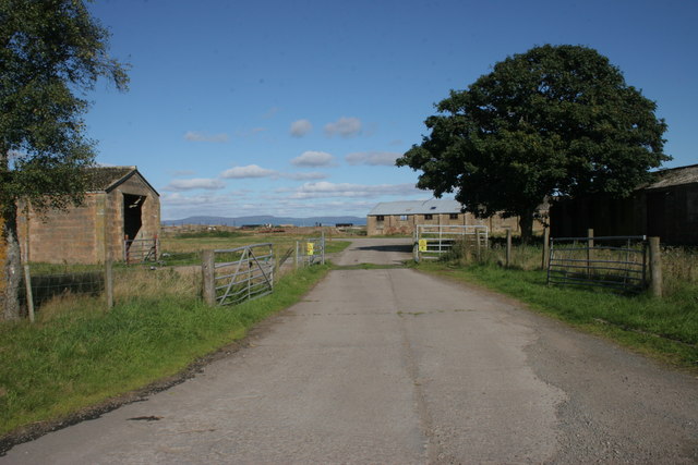
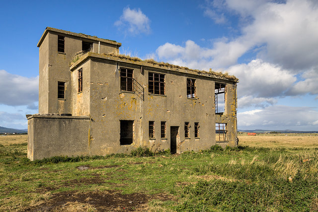
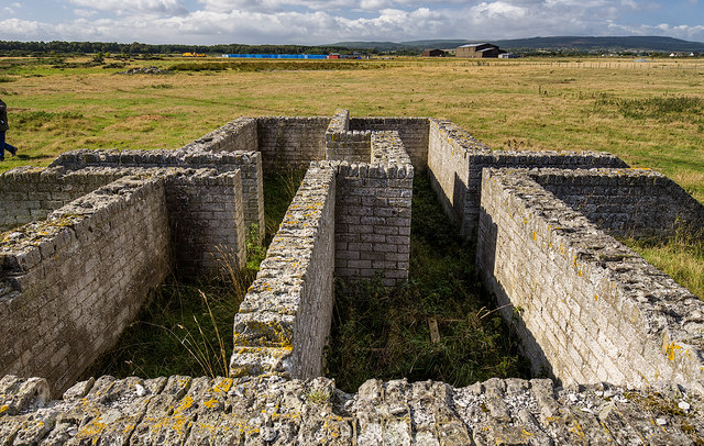
![Old buildings, Royal Air Force Station, Tain Airfield These long-deserted buildings form part of what is known as the &#039;Technical Site&#039; of the airfield. See Canmore for more details [<span class="nowrap"><a title="https://canmore.org.uk/site/109495/tain-airfield-royal-air-force-station-technical-site" rel="nofollow ugc noopener" href="https://canmore.org.uk/site/109495/tain-airfield-royal-air-force-station-technical-site">Link</a><img style="margin-left:2px;" alt="External link" title="External link - shift click to open in new window" src="https://s1.geograph.org.uk/img/external.png" width="10" height="10"/></span>].](https://s1.geograph.org.uk/geophotos/05/54/50/5545013_e3e26b29.jpg)
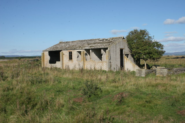
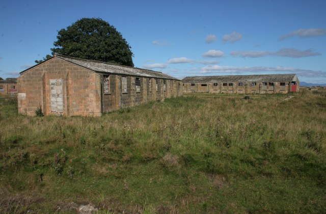
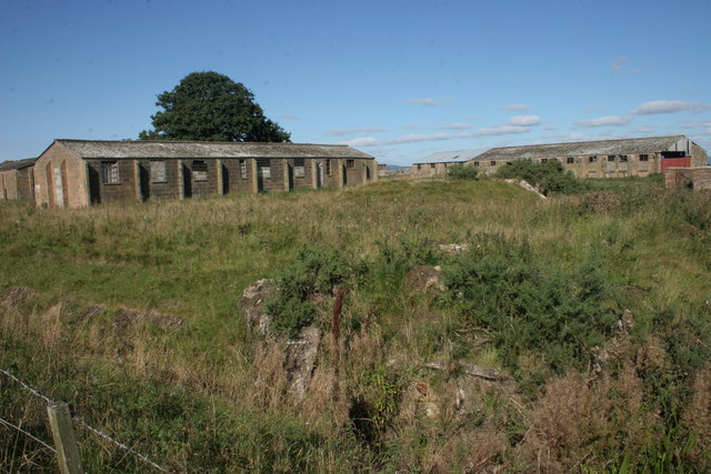
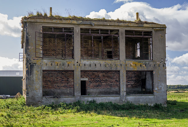
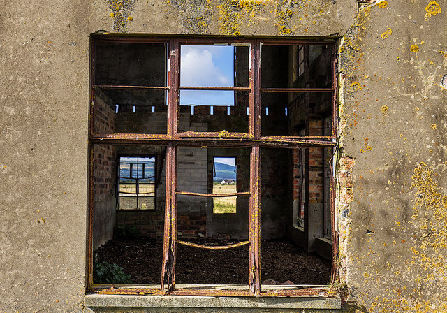
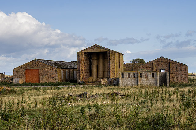
![Old buildings, Royal Air Force Station, Tain Airfield These long-deserted buildings form part of what is known as the &#039;Technical Site&#039; of the airfield. See Canmore for more details [<span class="nowrap"><a title="https://canmore.org.uk/site/109495/tain-airfield-royal-air-force-station-technical-site" rel="nofollow ugc noopener" href="https://canmore.org.uk/site/109495/tain-airfield-royal-air-force-station-technical-site">Link</a><img style="margin-left:2px;" alt="External link" title="External link - shift click to open in new window" src="https://s1.geograph.org.uk/img/external.png" width="10" height="10"/></span>]. A local farmer now uses one of the buildings to store his straw bales.](https://s3.geograph.org.uk/geophotos/05/54/50/5545019_af7146a3.jpg)
Plaids is located at Grid Ref: NH8481 (Lat: 57.803531, Lng: -3.9535657)
Unitary Authority: Highland
Police Authority: Highlands and Islands
What 3 Words
///scrapped.translated.custodial. Near Balintore, Highland
Related Wikis

Lochslin
Lochslin (Scottish Gaelic: Loch Slinn) is a small hamlet, situated northeast of the fresh water loch, Loch Eye in Tain, Ross-shire, Scottish Highlands...

Loch Slin Castle
Loch Slin Castle (sometimes spelt Lochslin) is a ruined castle near Fearn, Highland, Scotland. From the 15th to 17th centuries it was the seat of the Vass...

Tain Air Weapons Range
Tain Air Weapons Range is a Ministry of Defence air weapons range on the Dornoch Firth near Tain in Scotland. Royal Air Force aircrews from RAF Lossiemouth...

Loch Eye
Loch Eye is a shallow freshwater loch, located close to the east coast of Scotland between the Moray Firth, Dornoch Firth and Cromarty Firth. Covering...
Nearby Amenities
Located within 500m of 57.803531,-3.9535657Have you been to Plaids?
Leave your review of Plaids below (or comments, questions and feedback).