Acre Lea
Settlement in Cromartyshire
Scotland
Acre Lea
Acre Lea is a charming village located in the county of Cromartyshire, situated in the picturesque Highlands region of Scotland. With a population of around 500 residents, it offers a close-knit community atmosphere and a tranquil countryside setting.
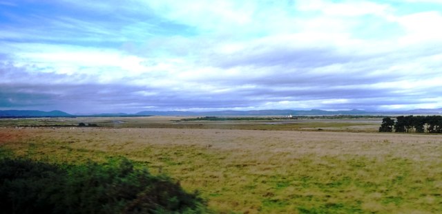
The village is known for its stunning natural beauty, surrounded by rolling green hills, lush forests, and breathtaking views of the Cromarty Firth. Acre Lea is a paradise for outdoor enthusiasts, with numerous walking trails and cycling routes that allow locals and visitors alike to explore the countryside and appreciate the region's diverse wildlife.
Acre Lea boasts a rich history, with some buildings dating back to the 18th century. The village's architecture reflects its Scottish heritage, with traditional stone cottages and charming thatched roofs dotting the landscape. One notable landmark is the Acre Lea Church, a beautiful stone structure that has been a focal point of the community for generations.
Despite its small size, Acre Lea offers a range of amenities to cater to its residents. The village has a local pub, a small convenience store, and a primary school, providing essential services for daily life. For more extensive shopping and entertainment options, the nearby town of Cromarty is just a short drive away.
Overall, Acre Lea is a hidden gem in the heart of Cromartyshire, offering a peaceful and idyllic setting for those seeking a slower pace of life, surrounded by stunning natural landscapes and a strong sense of community.
If you have any feedback on the listing, please let us know in the comments section below.
Acre Lea Images
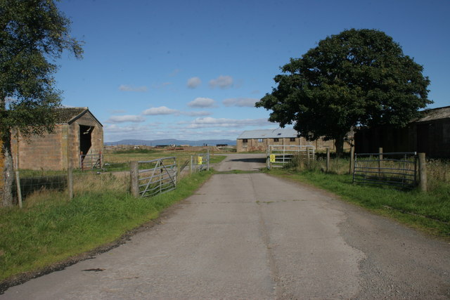
Images are sourced within 2km of 57.803531/-3.9535657 or Grid Reference NH8481. Thanks to Geograph Open Source API. All images are credited.
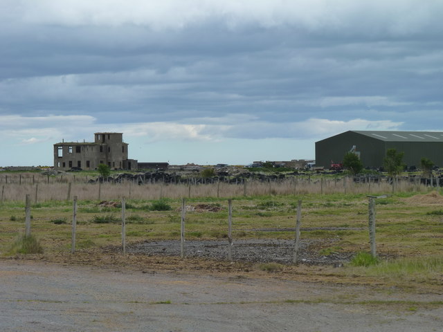
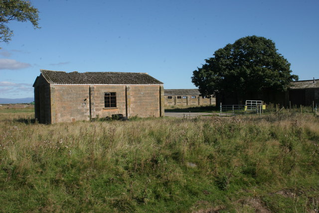
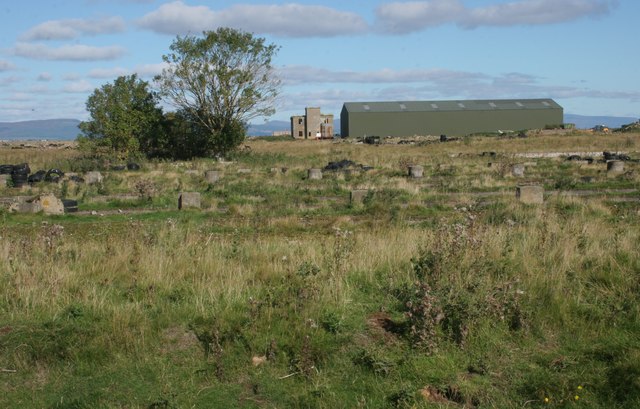
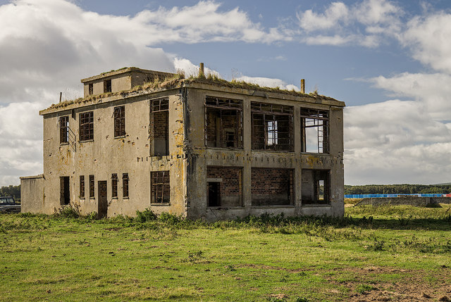
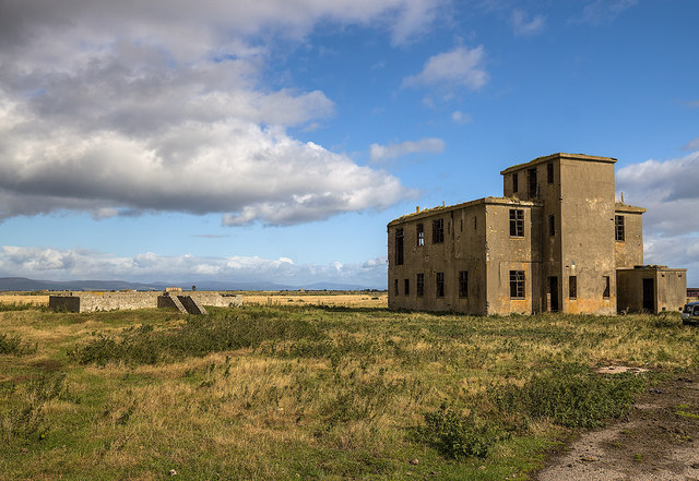
![Old buildings, Royal Air Force Station, Tain Airfield These long-deserted buildings form part of what is known as the &#039;Technical Site&#039; of the airfield. See Canmore for more details [<span class="nowrap"><a title="https://canmore.org.uk/site/109495/tain-airfield-royal-air-force-station-technical-site" rel="nofollow ugc noopener" href="https://canmore.org.uk/site/109495/tain-airfield-royal-air-force-station-technical-site">Link</a><img style="margin-left:2px;" alt="External link" title="External link - shift click to open in new window" src="https://s1.geograph.org.uk/img/external.png" width="10" height="10"/></span>].](https://s0.geograph.org.uk/geophotos/05/54/49/5544964_453ee90e.jpg)
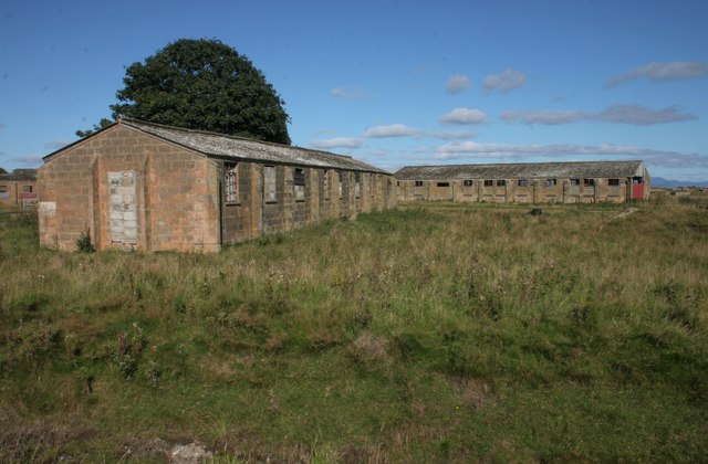
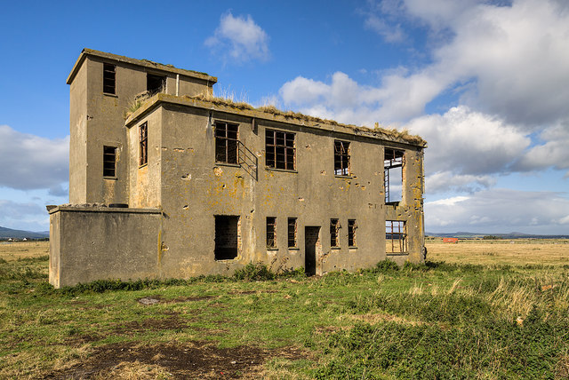
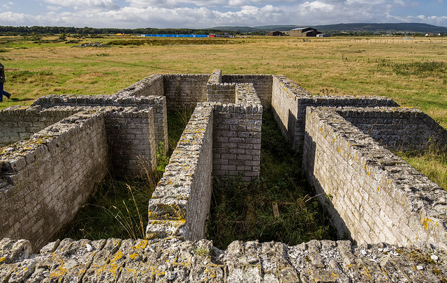
![Old buildings, Royal Air Force Station, Tain Airfield These long-deserted buildings form part of what is known as the &#039;Technical Site&#039; of the airfield. See Canmore for more details [<span class="nowrap"><a title="https://canmore.org.uk/site/109495/tain-airfield-royal-air-force-station-technical-site" rel="nofollow ugc noopener" href="https://canmore.org.uk/site/109495/tain-airfield-royal-air-force-station-technical-site">Link</a><img style="margin-left:2px;" alt="External link" title="External link - shift click to open in new window" src="https://s1.geograph.org.uk/img/external.png" width="10" height="10"/></span>].](https://s1.geograph.org.uk/geophotos/05/54/50/5545013_e3e26b29.jpg)
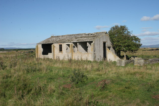
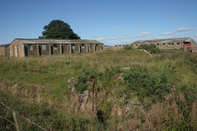
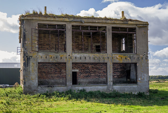
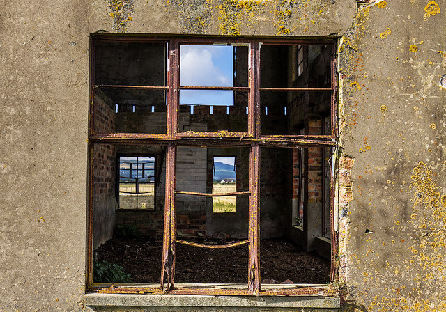
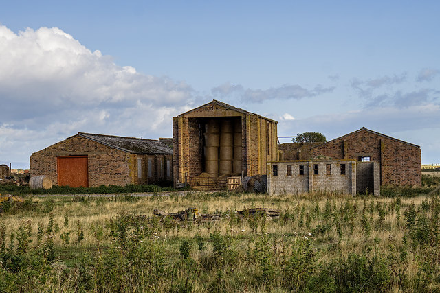
![Old buildings, Royal Air Force Station, Tain Airfield These long-deserted buildings form part of what is known as the &#039;Technical Site&#039; of the airfield. See Canmore for more details [<span class="nowrap"><a title="https://canmore.org.uk/site/109495/tain-airfield-royal-air-force-station-technical-site" rel="nofollow ugc noopener" href="https://canmore.org.uk/site/109495/tain-airfield-royal-air-force-station-technical-site">Link</a><img style="margin-left:2px;" alt="External link" title="External link - shift click to open in new window" src="https://s1.geograph.org.uk/img/external.png" width="10" height="10"/></span>]. A local farmer now uses one of the buildings to store his straw bales.](https://s3.geograph.org.uk/geophotos/05/54/50/5545019_af7146a3.jpg)
Acre Lea is located at Grid Ref: NH8481 (Lat: 57.803531, Lng: -3.9535657)
Unitary Authority: Highland
Police Authority: Highlands and Islands
What 3 Words
///scrapped.translated.custodial. Near Balintore, Highland
Related Wikis

Lochslin
Lochslin (Scottish Gaelic: Loch Slinn) is a small hamlet, situated northeast of the fresh water loch, Loch Eye in Tain, Ross-shire, Scottish Highlands...

Loch Slin Castle
Loch Slin Castle (sometimes spelt Lochslin) is a ruined castle near Fearn, Highland, Scotland. From the 15th to 17th centuries it was the seat of the Vass...

Tain Air Weapons Range
Tain Air Weapons Range is a Ministry of Defence air weapons range on the Dornoch Firth near Tain in Scotland. Royal Air Force aircrews from RAF Lossiemouth...

Loch Eye
Loch Eye is a shallow freshwater loch, located close to the east coast of Scotland between the Moray Firth, Dornoch Firth and Cromarty Firth. Covering...
Inver, Highland
Inver is a small village located on the south east shore of the Inver Bay at the point where the bay opens out into the Dornoch Firth and is in Ross-shire...

Hill of Fearn
Hill of Fearn (Scottish Gaelic: Baile an Droma) is a small village near Tain in Easter Ross, in the Scottish council area of Highland. == Geography... ==

Arboll
Arboll (Scottish Gaelic: Àrbol) is a place in the parish of Tarbat, Easter Ross, Highland, northern Scotland made up of several scattered farms. It is...
Morrich More
Morrich More is an extensive area of dune grassland with wetland communities, on the southern shore of the Dornoch Firth, Scotland. Morrich More lies east...
Nearby Amenities
Located within 500m of 57.803531,-3.9535657Have you been to Acre Lea?
Leave your review of Acre Lea below (or comments, questions and feedback).