Newton
Settlement in Cromartyshire
Scotland
Newton
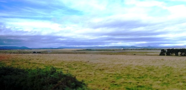
Newton is a small coastal village located in the picturesque region of Cromartyshire in Scotland. Situated on the northeastern coast, it overlooks the Moray Firth, offering stunning views of the sea and surrounding countryside. With a population of around 500 residents, Newton exudes a sense of tranquility and charm.
The village is renowned for its rich history, dating back to the 18th century when it was a bustling fishing port. Today, remnants of its maritime heritage can still be seen in the quaint harbor, where a few fishing boats can be spotted. The village has retained its traditional character, with charming stone cottages lining the narrow streets.
Nature enthusiasts are drawn to Newton for its spectacular natural beauty. The nearby coastline is home to a diverse range of wildlife, including seals, dolphins, and seabirds, providing ample opportunities for wildlife spotting and birdwatching. The surrounding countryside offers scenic walking trails, allowing visitors to explore the lush green hills and admire the breathtaking views.
Despite its small size, Newton boasts a close-knit and welcoming community. Residents take great pride in their village and actively participate in various community events and initiatives. The village also has a primary school, a community center, and a few local businesses catering to the needs of the residents.
Overall, Newton in Cromartyshire offers a peaceful and idyllic setting for those seeking a retreat from the bustle of city life. Its natural beauty, rich history, and warm community make it a hidden gem worth exploring.
If you have any feedback on the listing, please let us know in the comments section below.
Newton Images
Images are sourced within 2km of 57.803531/-3.9535657 or Grid Reference NH8481. Thanks to Geograph Open Source API. All images are credited.
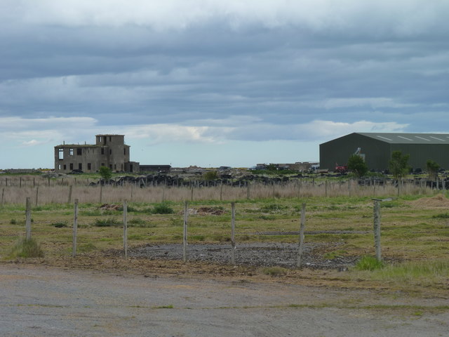
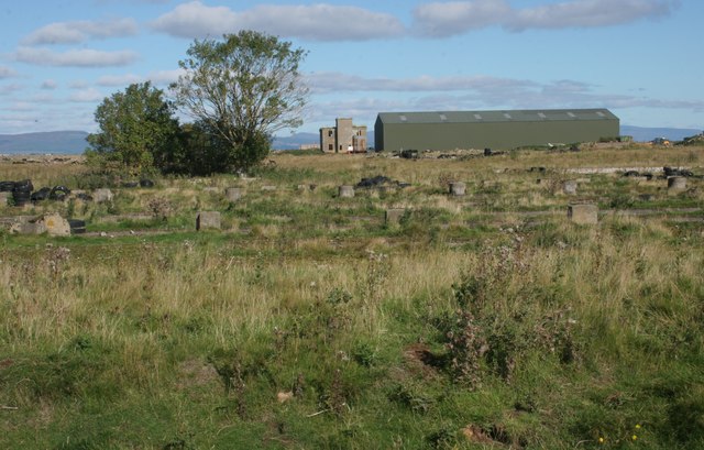
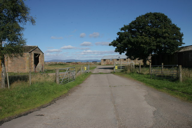
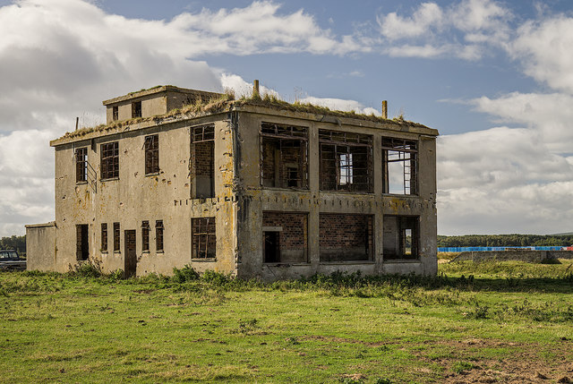
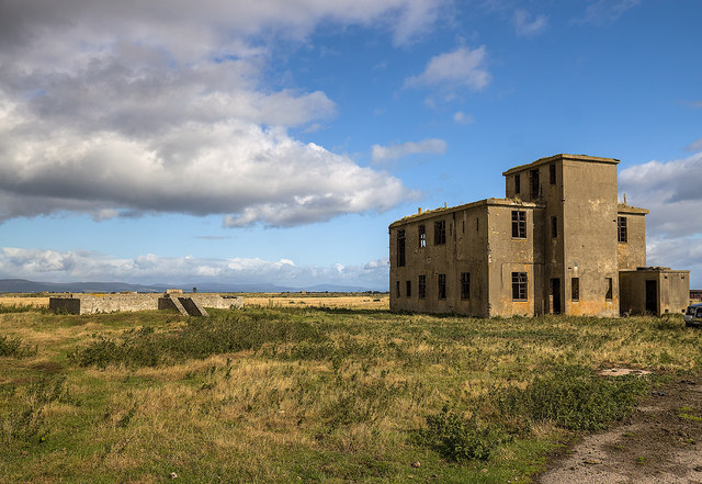
![Old buildings, Royal Air Force Station, Tain Airfield These long-deserted buildings form part of what is known as the &#039;Technical Site&#039; of the airfield. See Canmore for more details [<span class="nowrap"><a title="https://canmore.org.uk/site/109495/tain-airfield-royal-air-force-station-technical-site" rel="nofollow ugc noopener" href="https://canmore.org.uk/site/109495/tain-airfield-royal-air-force-station-technical-site">Link</a><img style="margin-left:2px;" alt="External link" title="External link - shift click to open in new window" src="https://s1.geograph.org.uk/img/external.png" width="10" height="10"/></span>].](https://s0.geograph.org.uk/geophotos/05/54/49/5544964_453ee90e.jpg)
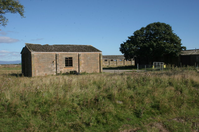
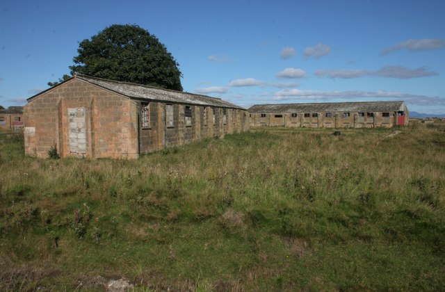
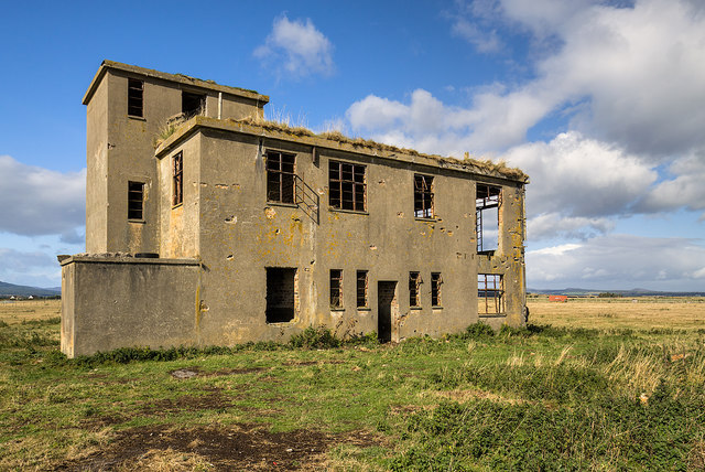
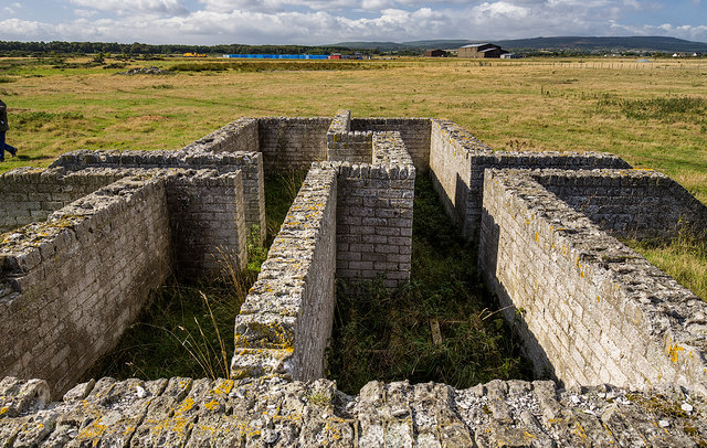
![Old buildings, Royal Air Force Station, Tain Airfield These long-deserted buildings form part of what is known as the &#039;Technical Site&#039; of the airfield. See Canmore for more details [<span class="nowrap"><a title="https://canmore.org.uk/site/109495/tain-airfield-royal-air-force-station-technical-site" rel="nofollow ugc noopener" href="https://canmore.org.uk/site/109495/tain-airfield-royal-air-force-station-technical-site">Link</a><img style="margin-left:2px;" alt="External link" title="External link - shift click to open in new window" src="https://s1.geograph.org.uk/img/external.png" width="10" height="10"/></span>].](https://s1.geograph.org.uk/geophotos/05/54/50/5545013_e3e26b29.jpg)
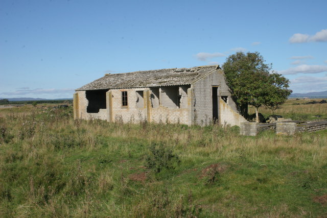
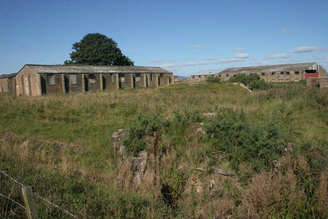
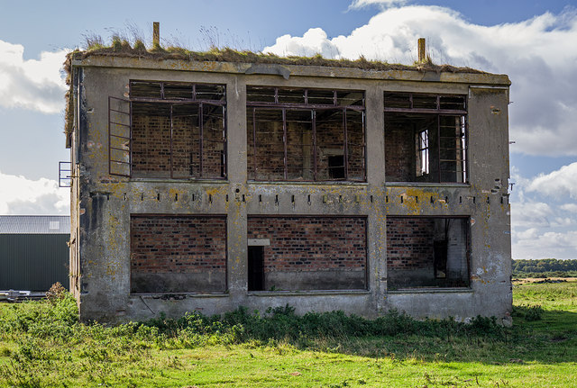
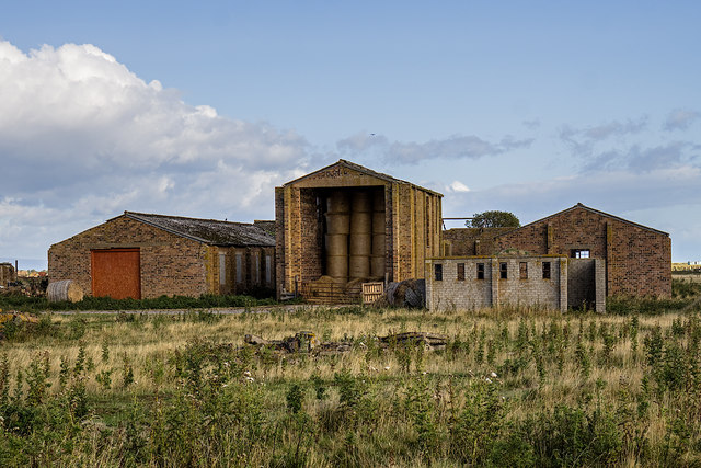
![Old buildings, Royal Air Force Station, Tain Airfield These long-deserted buildings form part of what is known as the &#039;Technical Site&#039; of the airfield. See Canmore for more details [<span class="nowrap"><a title="https://canmore.org.uk/site/109495/tain-airfield-royal-air-force-station-technical-site" rel="nofollow ugc noopener" href="https://canmore.org.uk/site/109495/tain-airfield-royal-air-force-station-technical-site">Link</a><img style="margin-left:2px;" alt="External link" title="External link - shift click to open in new window" src="https://s1.geograph.org.uk/img/external.png" width="10" height="10"/></span>]. A local farmer now uses one of the buildings to store his straw bales.](https://s3.geograph.org.uk/geophotos/05/54/50/5545019_af7146a3.jpg)
Newton is located at Grid Ref: NH8481 (Lat: 57.803531, Lng: -3.9535657)
Unitary Authority: Highland
Police Authority: Highlands and Islands
What 3 Words
///scrapped.translated.custodial. Near Balintore, Highland
Related Wikis

Lochslin
Lochslin (Scottish Gaelic: Loch Slinn) is a small hamlet, situated northeast of the fresh water loch, Loch Eye in Tain, Ross-shire, Scottish Highlands...

Loch Slin Castle
Loch Slin Castle (sometimes spelt Lochslin) is a ruined castle near Fearn, Highland, Scotland. From the 15th to 17th centuries it was the seat of the Vass...

Tain Air Weapons Range
Tain Air Weapons Range is a Ministry of Defence air weapons range on the Dornoch Firth near Tain in Scotland. Royal Air Force aircrews from RAF Lossiemouth...

Loch Eye
Loch Eye is a shallow freshwater loch, located close to the east coast of Scotland between the Moray Firth, Dornoch Firth and Cromarty Firth. Covering...
Inver, Highland
Inver is a small village located on the south east shore of the Inver Bay at the point where the bay opens out into the Dornoch Firth and is in Ross-shire...

Hill of Fearn
Hill of Fearn (Scottish Gaelic: Baile an Droma) is a small village near Tain in Easter Ross, in the Scottish council area of Highland. == Geography... ==

Arboll
Arboll (Scottish Gaelic: Àrbol) is a place in the parish of Tarbat, Easter Ross, Highland, northern Scotland made up of several scattered farms. It is...
Morrich More
Morrich More is an extensive area of dune grassland with wetland communities, on the southern shore of the Dornoch Firth, Scotland. Morrich More lies east...
Nearby Amenities
Located within 500m of 57.803531,-3.9535657Have you been to Newton?
Leave your review of Newton below (or comments, questions and feedback).