Pikeshill

Settlement in Hampshire New Forest

England

Pikeshill

Signage - A337 southbound
Signage - A337 southbound Credit: Dave Thompson

Pikeshill is a picturesque village located in the county of Hampshire, in the southern part of England. Situated on the outskirts of the town of Winchester, Pikeshill is known for its idyllic rural setting, surrounded by rolling hills and verdant farmland.

The village itself is relatively small, with a population of around 500 residents. Its origins date back to medieval times, and remnants of its historical past can still be seen in the form of charming thatched-roof cottages and a Norman church, St. Mary's, which stands as a testament to the village's heritage.

Pikeshill is renowned for its tranquil and peaceful atmosphere, making it a popular destination for those seeking a retreat from the hustle and bustle of city life. The surrounding countryside offers ample opportunities for outdoor activities such as hiking, cycling, and horseback riding, with several well-marked trails crisscrossing the area.

Despite its rural character, Pikeshill benefits from excellent transport links. The village is conveniently located near the A34 road, providing easy access to nearby towns and cities. The city of Winchester, with its rich history and cultural attractions, is just a short drive away.

Residents and visitors alike can enjoy the amenities provided by the village, including a local pub, a community center, and a primary school. The tight-knit community organizes various events throughout the year, fostering a strong sense of belonging and camaraderie among its residents.

Overall, Pikeshill offers a serene and charming escape, combining the beauty of the Hampshire countryside with a close-knit community and easy access to nearby urban centers.

If you have any feedback on the listing, please let us know in the comments section below.
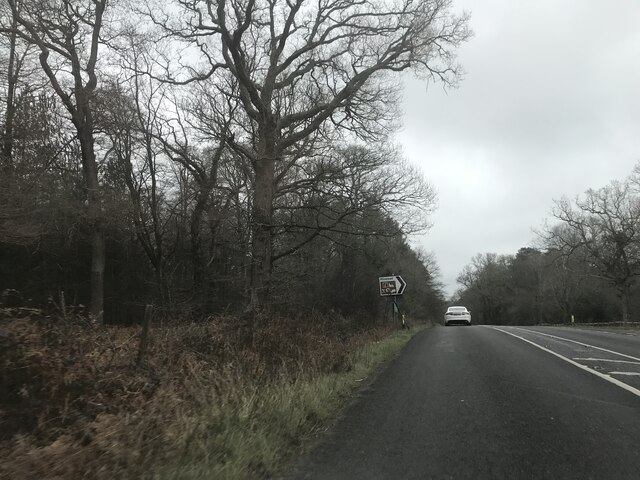
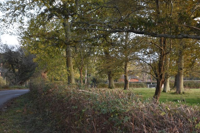
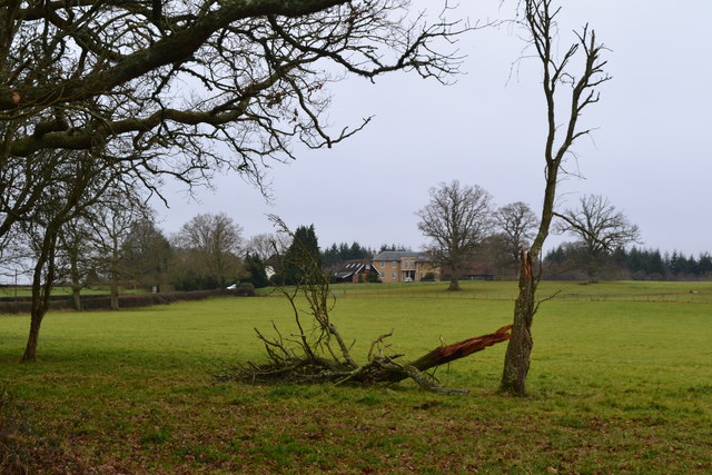
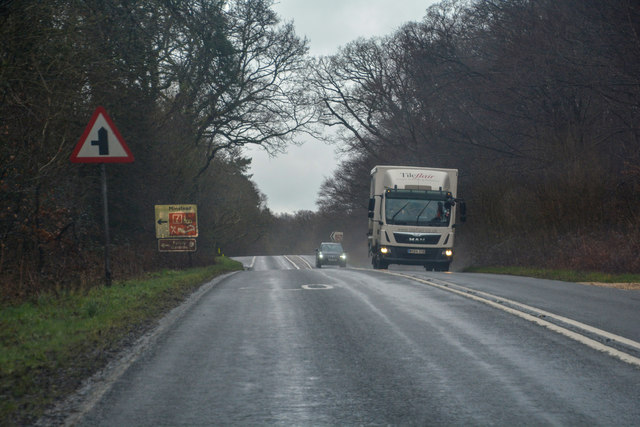
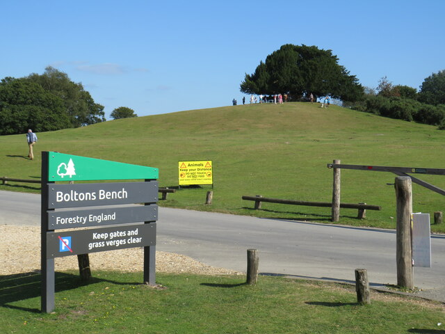
Pikeshill Images

Images are sourced within 2km of 50.878513/-1.581935 or Grid Reference SU2908. Thanks to Geograph Open Source API. All images are credited.

Signage - A337 southbound
Last of the light on trees beside Lyndhurst Road
View across field to William's Hill
New Forest : The A337 Looking along the A337.
New Forest : The A337
Looking along the A337.
Old Milestone by the A337, Furzey Lawn Inclosure, Minstead Parish Carved stone post by the A337, in parish of MINSTEAD (NEW FOREST District), Furzey Lawn Inclosure, by the road, on East side of road. Romsey rectangle stone, erected by the Cranbourne Chase & New Forest turnpike trust in the 19th century. 

Inscription reads:- : SARUM / 17 / ROMSEY / 9 :  

Grade II Listed. List Entry Number: 1351036  

Milestone Society National ID: HA_LHSA01.
Old Milestone by the A337, Furzey Lawn Inclosure, Minstead Parish
Carved stone post by the A337, in parish of MINSTEAD (NEW FOREST District), Furzey Lawn Inclosure, by the road, on East side of road. Romsey rectangle stone, erected by the Cranbourne Chase & New Forest turnpike trust in the 19th century. Inscription reads:- : SARUM / 17 / ROMSEY / 9 : Grade II Listed. List Entry Number: 1351036 Milestone Society National ID: HA_LHSA01.
Old Boundary Marker in Brockishill Inclosure, Minstead Parish Boundary Marker in parish of Minstead (New Forest District), Brockishill Inclosure, just North of stream forming boundary with Furzy Lawn Inclosure in woodland.

Surveyed

Milestone Society National ID: HA_MINCOP01pb
Old Boundary Marker in Brockishill Inclosure, Minstead
Parish Boundary Marker in parish of Minstead (New Forest District), Brockishill Inclosure, just North of stream forming boundary with Furzy Lawn Inclosure in woodland. Surveyed Milestone Society National ID: HA_MINCOP01pb
The A337 north of Lyndhurst
Lyndhurst - Meridien Modena (Ferrari garage) A line-up of four sleek Ferraris outside the Meridien Modena garage and showroom in Lyndhurst. There were plenty more of these exotic beasts in the showrooms and around the back.
Lyndhurst - Meridien Modena (Ferrari garage)
A line-up of four sleek Ferraris outside the Meridien Modena garage and showroom in Lyndhurst. There were plenty more of these exotic beasts in the showrooms and around the back.
Lyndhurst - St Michael & All Angels The 160' (49m) spire of St Michael & All Angels church in Lyndhurst rises impressively. This (mostly) red-brick church was built by W. White between 1858 and 1868. The interior is even more impressive than the exterior with a number of pre-Raphaelite features.
It is EH Grade I listed with details here <span class="nowrap"><a title="https://historicengland.org.uk/listing/the-list/list-entry/1094725" rel="nofollow ugc noopener" href="https://historicengland.org.uk/listing/the-list/list-entry/1094725">Link</a><img style="margin-left:2px;" alt="External link" title="External link - shift click to open in new window" src="https://s1.geograph.org.uk/img/external.png" width="10" height="10"/></span>
In the churchyard is the burial plot of "Mrs Reginald Hargeaves" who was born "Alice Liddell" - the inspiration for 'Alice' in Lewis Carroll's Alice stories (see <a href="https://www.geograph.org.uk/photo/6938112">SU2908 : The last resting place of Alice in Wonderland</a>)
Lyndhurst - St Michael & All Angels
The 160' (49m) spire of St Michael & All Angels church in Lyndhurst rises impressively. This (mostly) red-brick church was built by W. White between 1858 and 1868. The interior is even more impressive than the exterior with a number of pre-Raphaelite features. It is EH Grade I listed with details here LinkExternal link In the churchyard is the burial plot of "Mrs Reginald Hargeaves" who was born "Alice Liddell" - the inspiration for 'Alice' in Lewis Carroll's Alice stories (see SU2908 : The last resting place of Alice in Wonderland)
Lyndhurst - St Michael & All Angels - Exterior arch detail This gothic arched doorway is on the west front of St Michael & All Angels to the south of the spire. It has fine carving to the interior orders which rest on shafts that look like Purbeck marble to me.
See also <a href="https://www.geograph.org.uk/photo/6938092">SU2908 : Lyndhurst - St Michael & All Angels</a> and EH Grade I listing <span class="nowrap"><a title="https://historicengland.org.uk/listing/the-list/list-entry/1094725" rel="nofollow ugc noopener" href="https://historicengland.org.uk/listing/the-list/list-entry/1094725">Link</a><img style="margin-left:2px;" alt="External link" title="External link - shift click to open in new window" src="https://s1.geograph.org.uk/img/external.png" width="10" height="10"/></span>
Lyndhurst - St Michael & All Angels - Exterior arch detail
This gothic arched doorway is on the west front of St Michael & All Angels to the south of the spire. It has fine carving to the interior orders which rest on shafts that look like Purbeck marble to me. See also SU2908 : Lyndhurst - St Michael & All Angels and EH Grade I listing LinkExternal link
The last resting place of Alice in Wonderland This simple grave enclosure is the burial place of Mrs Reginald Hargreaves who was born Alice Liddell (4 May 1852 – 16 November 1934).
She is considered to be the inspiration for 'Alice' in 'Alice in Wonderland' and 'Alice Through the Looking Glass' by Lewis Carroll (Charles Lutwidge Dodgson 27 January 1832 – 14 January 1898) though experts differ on how closely the fictional Alice was based on her.
The grave is to be found beside the path on the southern side of <a href="https://www.geograph.org.uk/photo/6938092">SU2908 : Lyndhurst - St Michael & All Angels</a>
The slate plaque in front of the grave states:
THE GRAVE OF
MRS REGINALD HARGREAVES
THE "ALICE" IN LEWIS CARROLL'S
"ALICE IN WONDERLAND"
The last resting place of Alice in Wonderland
This simple grave enclosure is the burial place of Mrs Reginald Hargreaves who was born Alice Liddell (4 May 1852 – 16 November 1934). She is considered to be the inspiration for 'Alice' in 'Alice in Wonderland' and 'Alice Through the Looking Glass' by Lewis Carroll (Charles Lutwidge Dodgson 27 January 1832 – 14 January 1898) though experts differ on how closely the fictional Alice was based on her. The grave is to be found beside the path on the southern side of SU2908 : Lyndhurst - St Michael & All Angels The slate plaque in front of the grave states: THE GRAVE OF MRS REGINALD HARGREAVES THE "ALICE" IN LEWIS CARROLL'S "ALICE IN WONDERLAND"
Lyndhurst - The Crown hotel This large hotel in Lyndhurst dates to 1896. It features decorative tile hanging, both plain and beaver-tail.
It is viewed here from the mound which rises up to St Michael & All Angels church.
It is EH Grade II listed <span class="nowrap"><a title="https://historicengland.org.uk/listing/the-list/list-entry/1094723" rel="nofollow ugc noopener" href="https://historicengland.org.uk/listing/the-list/list-entry/1094723">Link</a><img style="margin-left:2px;" alt="External link" title="External link - shift click to open in new window" src="https://s1.geograph.org.uk/img/external.png" width="10" height="10"/></span>
Their own website: <span class="nowrap"><a title="https://www.crownhotel-lyndhurst.co.uk" rel="nofollow ugc noopener" href="https://www.crownhotel-lyndhurst.co.uk">Link</a><img style="margin-left:2px;" alt="External link" title="External link - shift click to open in new window" src="https://s1.geograph.org.uk/img/external.png" width="10" height="10"/></span>
Lyndhurst - The Crown hotel
This large hotel in Lyndhurst dates to 1896. It features decorative tile hanging, both plain and beaver-tail. It is viewed here from the mound which rises up to St Michael & All Angels church. It is EH Grade II listed LinkExternal link Their own website: LinkExternal link
Lyndhurst - St Michael & All Angels - interior A view into the chancel from the nave of St Michael & All Angels church in Lyndhurst. This EH Grade I listed <span class="nowrap"><a title="https://historicengland.org.uk/listing/the-list/list-entry/1094725" rel="nofollow ugc noopener" href="https://historicengland.org.uk/listing/the-list/list-entry/1094725">Link</a><img style="margin-left:2px;" alt="External link" title="External link - shift click to open in new window" src="https://s1.geograph.org.uk/img/external.png" width="10" height="10"/></span> church has a very fine interior. 
The East Window seen ahead is by Burne-Jones, and beneath it the fresco "The Wise and Foolish Virgins" painted onto the reredos by Lord Leighton. (see a clearer image of the latter here: <a href="https://www.geograph.org.uk/photo/343747">SU2908 : The Leighton Fresco, St Michael and All Angels church, Lyndhurst</a>).
Towards the top of the image can be seen two of the finely carved wooden angels that adorn the roof.
Lyndhurst - St Michael & All Angels - interior
A view into the chancel from the nave of St Michael & All Angels church in Lyndhurst. This EH Grade I listed LinkExternal link church has a very fine interior. The East Window seen ahead is by Burne-Jones, and beneath it the fresco "The Wise and Foolish Virgins" painted onto the reredos by Lord Leighton. (see a clearer image of the latter here: SU2908 : The Leighton Fresco, St Michael and All Angels church, Lyndhurst). Towards the top of the image can be seen two of the finely carved wooden angels that adorn the roof.
Lyndhurst - St Michael & All Angels - Pulpit detail The pulpit in St Michael & All Angels, Lyndhurst is finely carved, the figure on the right here is, I believe, St Michael slaying a dragon.
Lyndhurst - St Michael & All Angels - Pulpit detail
The pulpit in St Michael & All Angels, Lyndhurst is finely carved, the figure on the right here is, I believe, St Michael slaying a dragon.
New Forest at Lyndhurst A view taken from Bolton's Bench, looking eastwards into the New Forest.

The white building to the right of the image is a cricket pavilion, the cricket pitch is the fenced area in front of it.
New Forest at Lyndhurst
A view taken from Bolton's Bench, looking eastwards into the New Forest. The white building to the right of the image is a cricket pavilion, the cricket pitch is the fenced area in front of it.
Beaulieu Road, Lyndhurst Beaulieu Road is the B3056 road, linking the village of Lyndhurst with the village of Beaulieu.  It passes through part of The New Forest.

This image shows the road as it heads out of Lyndhurst.
Beaulieu Road, Lyndhurst
Beaulieu Road is the B3056 road, linking the village of Lyndhurst with the village of Beaulieu. It passes through part of The New Forest. This image shows the road as it heads out of Lyndhurst.
War Memorial, Lyndhurst A war memorial on the edge of the village of Lyndhurst, in The New Forest.
War Memorial, Lyndhurst
A war memorial on the edge of the village of Lyndhurst, in The New Forest.
Bolton's Bench, Lyndhurst Bolton's Bench is a landmark in The New Forest, on the edge of the village of Lyndhurst.  The bench surrounds the yew tree at the top of the mound in the centre of the image.

More information about Bolton's Bench can be found on the New Forest National Park information website: <span class="nowrap"><a title="https://www.new-forest-national-park.com/boltons-bench/" rel="nofollow ugc noopener" href="https://www.new-forest-national-park.com/boltons-bench/">Link</a><img style="margin-left:2px;" alt="External link" title="External link - shift click to open in new window" src="https://s1.geograph.org.uk/img/external.png" width="10" height="10"/></span>
Bolton's Bench, Lyndhurst
Bolton's Bench is a landmark in The New Forest, on the edge of the village of Lyndhurst. The bench surrounds the yew tree at the top of the mound in the centre of the image. More information about Bolton's Bench can be found on the New Forest National Park information website: LinkExternal link
Show me another place!

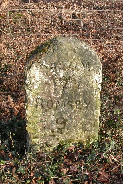
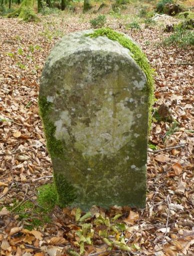
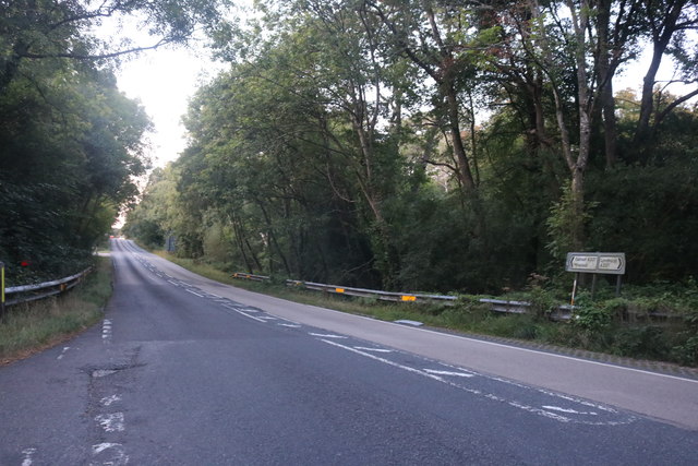
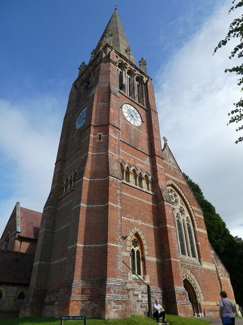
Pikeshill is located at Grid Ref: SU2908 (Lat: 50.878513, Lng: -1.581935)

Administrative County: Hampshire

District: New Forest

Police Authority: Hampshire

What 3 Words

///rescue.shampoos.plod. Near Lyndhurst, Hampshire

Related Wikis

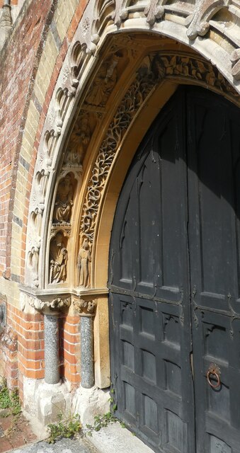
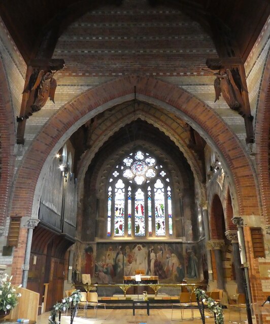
Christ Church, Emery Down

Christ Church is a Church of England church in Emery Down, Hampshire, England. It was designed by William Butterfield and constructed in 1863–64. The church...

Lyndhurst, Hampshire

Lyndhurst is a large village and civil parish situated in the New Forest National Park in Hampshire, England, about nine miles (14 km) south-west of Southampton...
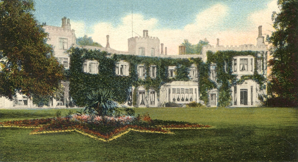
Glasshayes

Glasshayes House is a historic country house in Lyndhurst, in The New Forest, Hampshire. Used in the 20th century as the Grand Hotel, then the Lyndhurst...

Emery Down

Emery Down is a small village in the New Forest National Park in Hampshire, England. Its nearest town is Lyndhurst, which lies approximately 1.4 miles...

Bank, Hampshire

Bank is a village in the English county of Hampshire. The settlement is within the civil parish of Lyndhurst in the New Forest, and is located approximately...

Allum Green

Allum Green is a hamlet southwest of Lyndhurst, Hampshire, England. During the night of 5/6 September 1940 it was the scene of a Luftwaffe bombing raid...

Minstead Lodge

Minstead Lodge in Hampshire is a building of historical significance built in about 1830 and is Grade II listed on the English Heritage Register. Today...
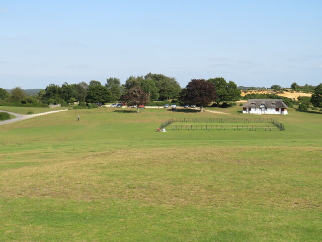
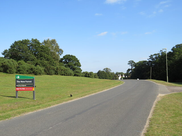
New Forest

The New Forest is one of the largest remaining tracts of unenclosed pasture land, heathland and forest in Southern England, covering southwest Hampshire...

Nearby Amenities

Located within 500m of 50.878513,-1.581935
Barrier: lift_gate
Lat/Long: 50.8773762/-1.5774445
Post Box
Brand: Royal Mail
Brand Wikidata: Q638098
Operator: Royal Mail
Operator Wikidata: Q638098
Post Box Mounting: wooden_post
Post Box Type: lamp
Ref: SO43 31D
Royal Cypher: EIIR
Royal Cypher Wikidata: Q33102113
Lat/Long: 50.8764223/-1.5768908
Booth: K6
Covered: booth
Disused Amenity: telephone
Note: in former telephone kiosk
Tourism: information
Lat/Long: 50.8764206/-1.5769338
Bus Stop
Broughton Road
Bus: yes
Naptan AtcoCode: 1900HA080885
Naptan Bearing: E
Naptan CommonName: Broughton Road
Naptan NaptanCode: hamajamd
Naptan Street: Broughton Road
Naptan Verified: no
Source: naptan_import
Lat/Long: 50.8795762/-1.5773055
Bus Stop
Broughton Road
Bus: yes
Naptan AtcoCode: 1900HA080886
Naptan Bearing: E
Naptan CommonName: Broughton Road
Naptan NaptanCode: hamajajw
Naptan Street: Broughton Road
Naptan Verified: no
Source: naptan_import
Lat/Long: 50.8795766/-1.577405
Bus Stop
Pikes Hill
Bus: yes
Naptan AtcoCode: 1900HA080887
Naptan Bearing: N
Naptan CommonName: Pikes Hill
Naptan Crossing: Pikes Hill
Naptan NaptanCode: hamajamg
Naptan Street: Romsey Road
Naptan Verified: no
Public Transport: platform
Source: naptan_import
Lat/Long: 50.8769589/-1.5771728
Bus Stop
Pikes Hill
Bus: yes
Naptan AtcoCode: 1900HA080888
Naptan Bearing: S
Naptan CommonName: Pikes Hill
Naptan Crossing: Racecourse View
Naptan NaptanCode: hamajamj
Naptan Street: Romsey Road
Naptan Verified: no
Public Transport: platform
Source: naptan_import
Lat/Long: 50.8766164/-1.5769627
Parking
Lat/Long: 50.8771813/-1.5779374
New Forest Magistrates Court
Building: yes
Note: Approx building location
Lat/Long: 50.8774225/-1.5780926
Pub
The White Rabbit
Brand: Chef & Brewer
Brand Wikidata: Q5089491
Website: https://www.chefandbrewer.com/pubs/hampshire/white-rabbit
Lat/Long: 50.8756665/-1.5765855
Barrier: cattle_grid
Lat/Long: 50.8794386/-1.5818408
Clinic
Fenwick2 Health & Wellbeing Centre
Lat/Long: 50.8794056/-1.5834828
Post Box
Collection Times: Mo-Fr 09:00, Sa 07:00
Operator: Royal Mail
Operator Wikidata: Q638098
Post Box Type: wall
Ref: SO43 74D
Royal Cypher: EVIIR
Royal Cypher Wikidata: Q33102324
Lat/Long: 50.8791109/-1.5815659
Direction: 240
Generator Method: photovoltaic
Generator Output Electricity: yes
Generator Solar Modules: 16
Generator Source: solar
Generator Type: solar_photovoltaic_panel
Location: roof
Power: generator
Lat/Long: 50.8754926/-1.579149
Direction: 240
Generator Method: photovoltaic
Generator Output Electricity: yes
Generator Solar Modules: 7https://osm.mathmos.net/addresses/pc-stats/NR/NR20/5/
Generator Source: solar
Generator Type: solar_photovoltaic_panel
Location: roof
Power: generator
Lat/Long: 50.8755641/-1.5792972
Direction: 240
Generator Method: photovoltaic
Generator Output Electricity: yes
Generator Solar Modules: 10
Generator Source: solar
Generator Type: solar_photovoltaic_panel
Location: roof
Power: generator
Lat/Long: 50.8755362/-1.5793213
Direction: 150
Generator Method: photovoltaic
Generator Output Electricity: yes
Generator Solar Modules: 10
Generator Source: solar
Generator Type: solar_photovoltaic_panel
Location: roof
Power: generator
Lat/Long: 50.8755193/-1.5792456
Direction: 150
Generator Method: photovoltaic
Generator Output Electricity: yes
Generator Solar Modules: 7
Generator Source: solar
Generator Type: solar_photovoltaic_panel
Location: roof
Power: generator
Lat/Long: 50.8755506/-1.5792529
Direction: 150
Generator Method: photovoltaic
Generator Output Electricity: yes
Generator Solar Modules: 8
Generator Source: solar
Generator Type: solar_photovoltaic_panel
Location: roof
Power: generator
Lat/Long: 50.8755565/-1.5793897
Source of the Beaulieu River
Drinking Water: no
Intermittent: no
Natural: spring
Lat/Long: 50.8796197/-1.5820532
Golf: pin
Lat/Long: 50.8792066/-1.5751409
Golf: pin
Lat/Long: 50.8784508/-1.5748264
Bunker's Hill
Place: locality
Lat/Long: 50.8804156/-1.5840217
The data included in this document is from www.openstreetmap.org. The data is made available under ODbL.

Have you been to Pikeshill?

Leave your review of Pikeshill below (or comments, questions and feedback).