Pickering Nook

Settlement in Durham

England

Pickering Nook

The tower of St Margaret's, Tanfield Tommy Armstrong, the famous 19th C. Ballad singer and composer is buried here. In 1861 this tiny village had a 'National School' as well as a 'Grammar School'! For more on the 'Church of St. Margaret of Antioch':
<span class="nowrap"><a title="http://www.stmargarets.derwentside.org.uk/noframes/history.htm" rel="nofollow ugc noopener" href="http://www.stmargarets.derwentside.org.uk/noframes/history.htm">Link</a><img style="margin-left:2px;" alt="External link" title="External link - shift click to open in new window" src="https://s1.geograph.org.uk/img/external.png" width="10" height="10"/></span>
The tower of St Margaret's, Tanfield Credit: Alan Fearon

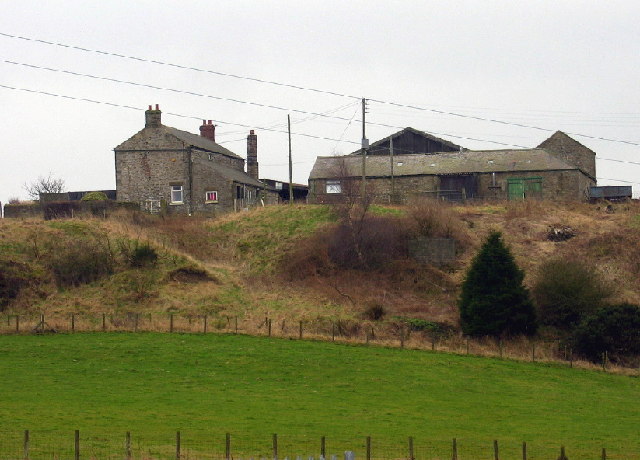
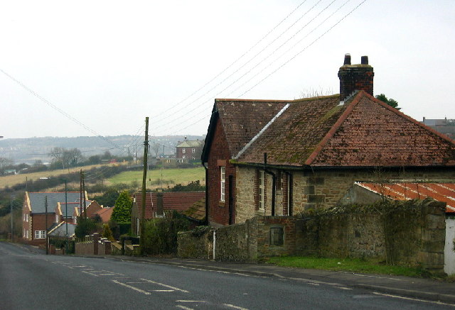
Pickering Nook is a small village located in County Durham, England. Situated approximately 10 miles southwest of Durham city, it is nestled in a picturesque rural landscape. The village is part of the larger civil parish of Hunwick and is surrounded by rolling hills and farmland.

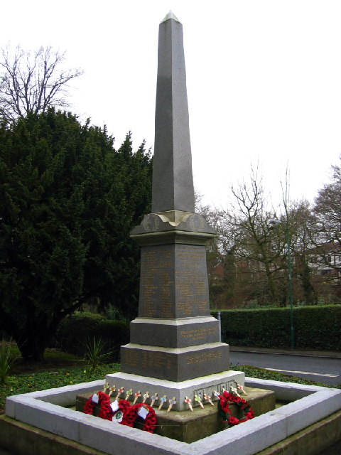
The origins of Pickering Nook can be traced back several centuries, with evidence of human settlement in the area dating back to the medieval period. Today, it retains a charming, traditional character with a close-knit community of residents.

The village is primarily residential, consisting of a mix of detached and semi-detached houses, along with a few small businesses. There are no major amenities within the village itself, but residents can easily access nearby towns and villages for shopping, healthcare, and other services.

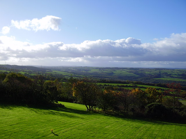
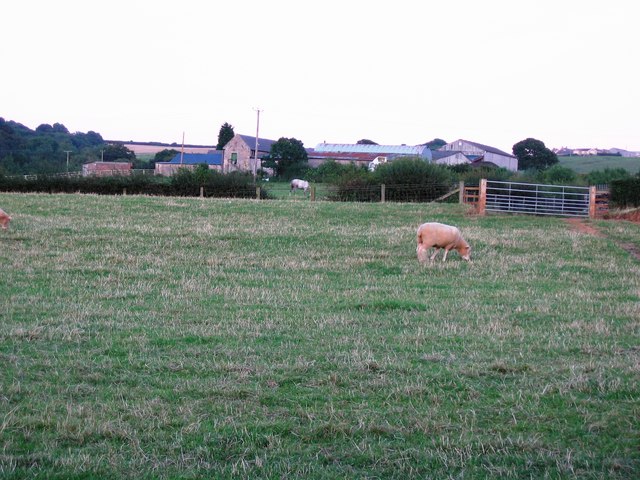
Nature lovers will appreciate the abundance of green spaces and scenic walks in and around Pickering Nook. The surrounding countryside offers breathtaking views and opportunities for outdoor activities such as hiking, cycling, and horseback riding.

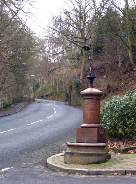
Transportation in the area primarily relies on private vehicles, as there is limited public transportation available. However, the village is well-connected to the wider region via a network of roads, making it relatively easy to reach neighboring towns and cities.

Pickering Nook offers a tranquil and peaceful lifestyle for its residents, with its idyllic setting and strong sense of community. It is a place where residents can enjoy the beauty of the English countryside while still having access to the amenities and services of larger towns nearby.

If you have any feedback on the listing, please let us know in the comments section below.

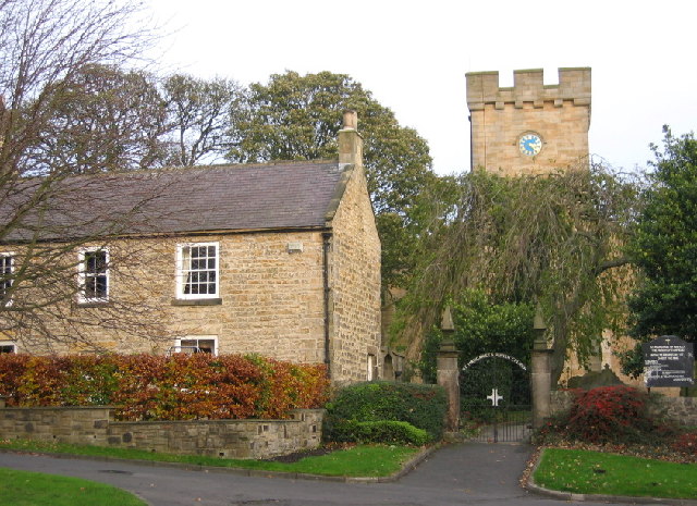
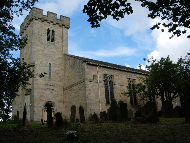
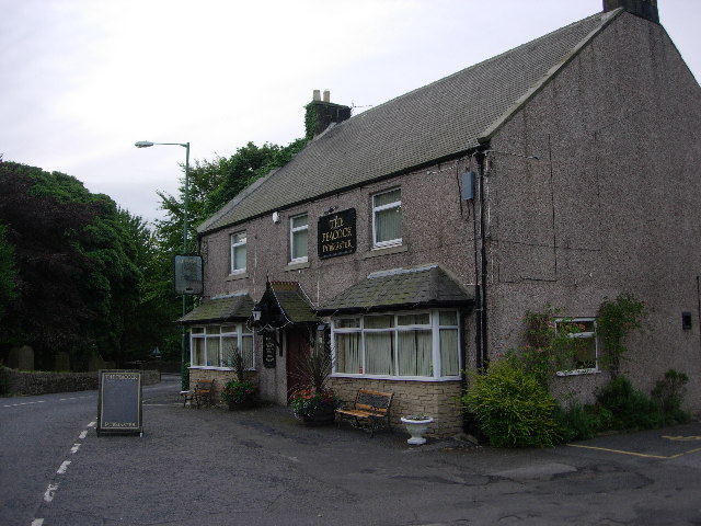
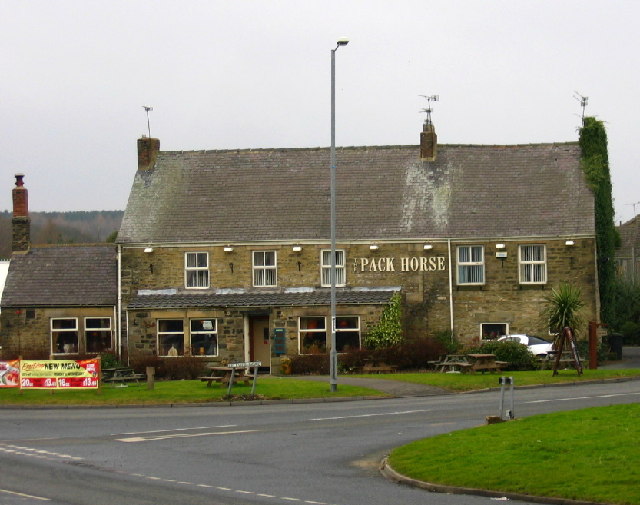
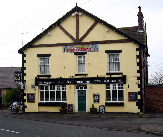
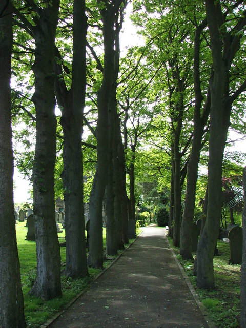
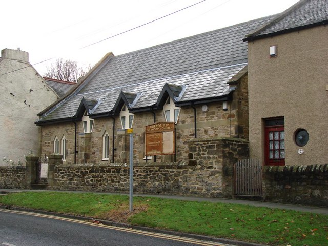
Pickering Nook Images

Images are sourced within 2km of 54.894232/-1.73257 or Grid Reference NZ1755. Thanks to Geograph Open Source API. All images are credited.

The tower of St Margaret's, Tanfield Tommy Armstrong, the famous 19th C. Ballad singer and composer is buried here. In 1861 this tiny village had a 'National School' as well as a 'Grammar School'! For more on the 'Church of St. Margaret of Antioch':
<span class="nowrap"><a title="http://www.stmargarets.derwentside.org.uk/noframes/history.htm" rel="nofollow ugc noopener" href="http://www.stmargarets.derwentside.org.uk/noframes/history.htm">Link</a><img style="margin-left:2px;" alt="External link" title="External link - shift click to open in new window" src="https://s1.geograph.org.uk/img/external.png" width="10" height="10"/></span>
The tower of St Margaret's, Tanfield
Tommy Armstrong, the famous 19th C. Ballad singer and composer is buried here. In 1861 this tiny village had a 'National School' as well as a 'Grammar School'! For more on the 'Church of St. Margaret of Antioch': LinkExternal link
Mountsett Crematorium
St. Margaret's Church, Tanfield
The Peacock Public House
The Pack Horse, Crookgate Just outside Burnopfield, this pub was destroyed by fire in 2002 but reopened after six months
The Pack Horse, Crookgate
Just outside Burnopfield, this pub was destroyed by fire in 2002 but reopened after six months
Crookbank Farm
Crookbank Farm
Roadside Pant On the B6314 near the end of its climb into Burnopfield, this fountain (with electric light!) was erected in 1905 in memory of a respected local resident, known especially for his "kindness to dumb animals".
Roadside Pant
On the B6314 near the end of its climb into Burnopfield, this fountain (with electric light!) was erected in 1905 in memory of a respected local resident, known especially for his "kindness to dumb animals".
War Memorial, Burnopfield A simple monument in pristine condition; obviously well cared for.
War Memorial, Burnopfield
A simple monument in pristine condition; obviously well cared for.
The Travellers Rest, High Friarside
Toft Gate Farm, near Pickering Nook
Clough Dene, near Tantobie Housing old and new - I know which I prefer!
Clough Dene, near Tantobie
Housing old and new - I know which I prefer!
Oak Tree Inn, Tantobie
Sycamore Lined Walkway that leads you to St James Church Burnopfield
Sycamore Lined Walkway
that leads you to St James Church Burnopfield
Trees at Mountsett Crematorium
Briar Terrace, Crookgate Bank
Loft House Farm Looking across pastureland towards Loft House Farm
Loft House Farm
Looking across pastureland towards Loft House Farm
Burnopfield Methodist Church
The Church of St James, Burnopfield
Show me another place!

Pickering Nook is located at Grid Ref: NZ1755 (Lat: 54.894232, Lng: -1.73257)

Unitary Authority: County Durham

Police Authority: Durham

What 3 Words

///midfield.autumn.minerals. Near Burnopfield, Co. Durham

Related Wikis

Pickering Nook

Pickering Nook is a small village in County Durham, in England. It is situated a few miles north of Annfield Plain and Stanley, on the A692 between Consett...

Hobson, County Durham

Hobson is a village in County Durham, in England. It is situated to the south of Burnopfield, north of Stanley and Annfield Plain. Hobson was a pit village...

Clough Dene

Clough Dene is a village in County Durham, England. It is situated a short distance to the north of Tantobie, a few miles from Stanley and Annfield Plain...

Tantobie

Tantobie is a former colliery village in County Durham, England. It is situated 2 miles to the northwest of Stanley and the same distance to the north...

White-le-Head

White-le-Head is a village in County Durham, in England, situated in close proximity to the village of Tantobie. It is located on the opposite side of...

West Kyo

West Kyo (also known locally as Old Kyo) is a small village in County Durham, England, United Kingdom. The name 'kyo' is derived from an old word for...

High Friarside

High Friarside is a village in County Durham, England. It is situated a short distance to the west of Burnopfield. == References ==

Hill Top, Stanley

Hill Top is a village in County Durham, England. It is situated to the west of Tantobie, near Stanley. == References ==

Nearby Amenities

Located within 500m of 54.894232,-1.73257
Traffic Signals
Traffic Signals Direction: both
Lat/Long: 54.8931709/-1.735219
Bus Stop
Road End (A692)
Bus: yes
Departures Board: timetable
Naptan AtcoCode: 13001477B
Naptan Bearing: NE
Naptan CommonName: Road End (A692)
Naptan Indicator: north east bound
Naptan Landmark: Landmark not known
Naptan NaptanCode: duradwgj
Naptan Notes: a692- opp sales garage- pickering nook
Naptan Street: A692 - Ewehurst Road
Naptan Verified: no
Public Transport: platform
Shelter: yes
Source: naptan_import
Lat/Long: 54.8925907/-1.7364268
Bus Stop
Road End (A692)
Naptan AtcoCode: 13001477F
Naptan Bearing: SW
Naptan CommonName: Road End (A692)
Naptan Indicator: south west bound
Naptan Landmark: Landmark not known
Naptan NaptanCode: duradwgm
Naptan Notes: a692- halfway between sales garage next terrace south west (terr has no name)- pickering nook
Naptan Street: A692 - Ewehurst Road
Naptan Verified: no
Shelter: yes
Source: naptan_import
Lat/Long: 54.8920533/-1.736764
Bus Stop
Hotel
Naptan AtcoCode: 13001478B
Naptan Bearing: NE
Naptan CommonName: Hotel
Naptan Indicator: north east bound
Naptan Landmark: Outside pub
Naptan NaptanCode: duradwgp
Naptan Street: A692 - Front Street
Naptan Verified: no
Shelter: yes
Source: naptan_import
Lat/Long: 54.8953232/-1.7320806
Bus Stop
Hotel
Bench: no
Naptan AtcoCode: 13001478F
Naptan Bearing: SW
Naptan CommonName: Hotel
Naptan Indicator: south west bound
Naptan Landmark: opposite no. 40
Naptan NaptanCode: duradwgt
Naptan Street: A692 - Front Street
Naptan Verified: no
Shelter: yes
Source: naptan_import
Lat/Long: 54.8958783/-1.7311414
Bus Stop
Clough Dene
Bench: no
Bin: no
Naptan AtcoCode: 13001501D
Naptan Bearing: SE
Naptan CommonName: Clough Dene
Naptan Indicator: south east bound
Naptan Landmark: Landmark not known
Naptan NaptanCode: duragajd
Naptan Notes: birk hill- b6173- clough dene
Naptan Street: B6173
Naptan Verified: no
Shelter: no
Source: naptan_import
Lat/Long: 54.8907206/-1.7314252
Bus Stop
Clough Dene
Naptan AtcoCode: 13001501H
Naptan Bearing: NW
Naptan CommonName: Clough Dene
Naptan Indicator: north west bound
Naptan Landmark: Landmark not known
Naptan NaptanCode: duragajg
Naptan Notes: 20m n of 15- b6173- clough dene
Naptan Street: B6173
Naptan Verified: no
Shelter: yes
Source: naptan_import
Lat/Long: 54.8908121/-1.7321417
Bus Stop
Road End (B6173)
Bus: yes
Naptan AtcoCode: 13001502D
Naptan Bearing: SE
Naptan CommonName: Road End (B6173)
Naptan Indicator: south east bound
Naptan Landmark: Landmark not known
Naptan NaptanCode: duragajm
Naptan Notes: b6173- sales garage- pickering nook
Naptan Street: B6173 - Clough End
Naptan Verified: no
Public Transport: platform
Shelter: yes
Source: naptan_import
Lat/Long: 54.8925076/-1.7348901
Bus Stop
Road End (B6173)
Bench: yes
Bus: yes
Naptan AtcoCode: 13001502H
Naptan Bearing: NW
Naptan CommonName: Road End (B6173)
Naptan Indicator: north west bound
Naptan Landmark: Landmark not known
Naptan NaptanCode: duragajp
Naptan Notes: opp sales garage- b6173- pickering nook
Naptan Street: B6173 - Clough End
Naptan Verified: no
Public Transport: platform
Shelter: yes
Source: naptan_import
Lat/Long: 54.892328/-1.7349848
Bus Stop
The Bothy
Bus: yes
Departures Board: timetable
Naptan AtcoCode: 13001530A
Naptan Bearing: N
Naptan CommonName: The Bothy
Naptan Indicator: north bound
Naptan Landmark: 20m north of entrance to The Meadows
Naptan NaptanCode: duragdmp
Naptan Street: Syke Road
Naptan Verified: no
Public Transport: platform
Shelter: yes
Source: naptan_import
Lat/Long: 54.895983/-1.7364037
Bus Stop
The Bothy
Naptan AtcoCode: 13001530E
Naptan Bearing: S
Naptan CommonName: The Bothy
Naptan Indicator: south bound
Naptan Landmark: 20m north of entrance to The Meadows
Naptan NaptanCode: duragdmt
Naptan Street: Syke Road
Naptan Verified: no
Source: naptan_import
Lat/Long: 54.8947222/-1.7360188
Noexit: yes
Lat/Long: 54.8958093/-1.733388
Noexit: yes
Lat/Long: 54.8961723/-1.7328423
Noexit: yes
Lat/Long: 54.8947969/-1.7354869
Noexit: yes
Lat/Long: 54.8961536/-1.7358489
Turning Circle
Lat/Long: 54.8948121/-1.734516
Noexit: yes
Lat/Long: 54.8907678/-1.7307327
Clough Dene
Place: hamlet
Source: OS 1:25k
Wikidata: Q5135799
Wikipedia: en:Clough Dene
Lat/Long: 54.8903562/-1.7313751
Noexit: yes
Lat/Long: 54.8937918/-1.735198
Noexit: yes
Lat/Long: 54.8956383/-1.734005
Noexit: yes
Lat/Long: 54.8965397/-1.73427
Noexit: yes
Lat/Long: 54.8966183/-1.7350042
Noexit: yes
Lat/Long: 54.8967397/-1.7341407
Post Box
Ref: NE16 315
Lat/Long: 54.8960635/-1.7311808
Noexit: yes
Lat/Long: 54.8911957/-1.7355934
Noexit: yes
Lat/Long: 54.8951219/-1.7343298
Noexit: yes
Lat/Long: 54.8963024/-1.7333174
Noexit: yes
Lat/Long: 54.8964898/-1.7330827
Noexit: yes
Lat/Long: 54.8965653/-1.7330143
Noexit: yes
Lat/Long: 54.8967828/-1.7327434
Noexit: yes
Lat/Long: 54.8975876/-1.7349305
Noexit: yes
Lat/Long: 54.8974834/-1.7347321
Noexit: yes
Lat/Long: 54.8966466/-1.7354461
Noexit: yes
Lat/Long: 54.8966004/-1.7360938
Noexit: yes
Lat/Long: 54.8936149/-1.7351352
Noexit: yes
Lat/Long: 54.8951437/-1.728879
Power: pole
Lat/Long: 54.8910675/-1.7329739
Power: pole
Lat/Long: 54.8909757/-1.7339408
Power: pole
Lat/Long: 54.8913676/-1.7348193
Power: pole
Lat/Long: 54.8917655/-1.735691
Power: pole
Transformer: distribution
Lat/Long: 54.8921574/-1.7365775
Crossing
Crossing: unmarked
Crossing Island: yes
Crossing Markings: no
Lat/Long: 54.8941347/-1.7336654
Noexit: yes
Lat/Long: 54.896363/-1.7303172
Crossing
Crossing: unmarked
Crossing Island: yes
Crossing Markings: no
Lat/Long: 54.8964775/-1.7304824
Crossing
Crossing: unmarked
Crossing Island: yes
Crossing Markings: no
Tactile Paving: no
Lat/Long: 54.8957076/-1.7362324
Traffic Signals
Traffic Signals Direction: forward
Lat/Long: 54.8930521/-1.7354147
Traffic Signals
Traffic Signals Direction: backward
Lat/Long: 54.8929994/-1.7355015
Traffic Signals
Traffic Signals Direction: forward
Lat/Long: 54.8927361/-1.7359331
Traffic Signals
Traffic Signals Direction: backward
Lat/Long: 54.892736/-1.735448
Noexit: yes
Lat/Long: 54.8950712/-1.7333722
Generator Method: photovoltaic
Generator Output Electricity: yes
Generator Source: solar
Generator Type: solar_photovoltaic_panel
Power: generator
Lat/Long: 54.896348/-1.7343928
Generator Method: photovoltaic
Generator Output Electricity: yes
Generator Source: solar
Generator Type: solar_photovoltaic_panel
Power: generator
Lat/Long: 54.8958262/-1.733104
Generator Method: photovoltaic
Generator Output Electricity: yes
Generator Source: solar
Generator Type: solar_photovoltaic_panel
Power: generator
Lat/Long: 54.894809/-1.7347804
Generator Method: photovoltaic
Generator Output Electricity: yes
Generator Source: solar
Generator Type: solar_photovoltaic_panel
Power: generator
Lat/Long: 54.8942537/-1.735341
Give Way
Direction: forward
Lat/Long: 54.8955491/-1.7318018
Noexit: yes
Lat/Long: 54.8957391/-1.7324482
Noexit: yes
Lat/Long: 54.8955278/-1.7338912
Noexit: yes
Lat/Long: 54.8955183/-1.7333211
Noexit: yes
Lat/Long: 54.8938912/-1.7349762
Noexit: yes
Lat/Long: 54.8949493/-1.7357433
Give Way
Direction: forward
Lat/Long: 54.8955837/-1.7361108
The data included in this document is from www.openstreetmap.org. The data is made available under ODbL.

Have you been to Pickering Nook?

Leave your review of Pickering Nook below (or comments, questions and feedback).