Bircotes

Settlement in Nottinghamshire Bassetlaw

England

Bircotes

Corner of Essex Road and Galway Road, Bircotes
Corner of Essex Road and Galway Road, Bircotes Credit: Neil Theasby

Bircotes is a village located in the Bassetlaw district of Nottinghamshire, England. Situated approximately 5 miles east of the town of Doncaster, it borders the neighbouring village of Harworth. The village is part of the wider area known as Bircotes and Harworth, which is commonly referred to as "Bircotes" by locals.

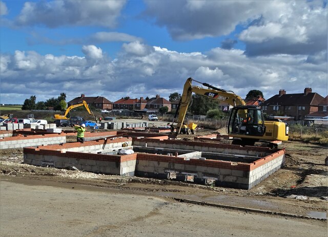
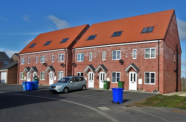
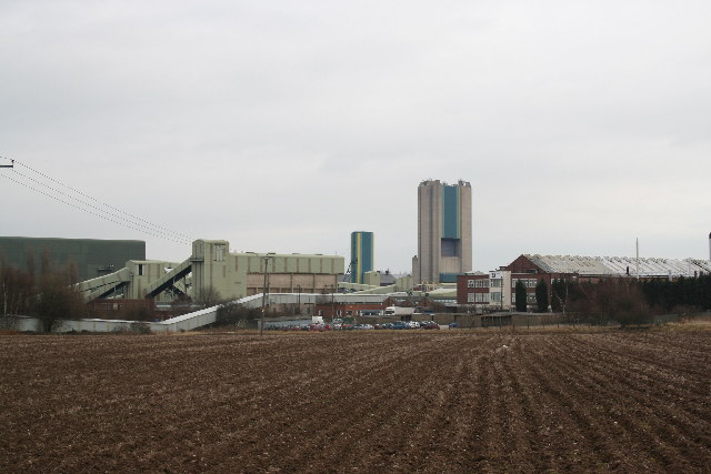
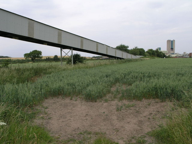
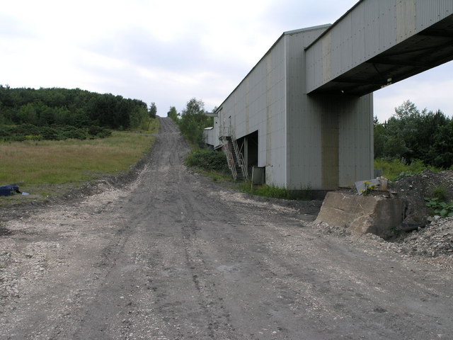
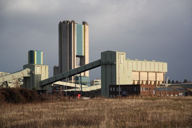
Originally an area dominated by coal mining and agriculture, Bircotes experienced significant growth during the 20th century due to its proximity to the coalfields and the development of the local mining industry. However, the decline in coal mining in the 1980s led to a shift in the village's economy, resulting in a diversification of industries and a growth in residential areas.

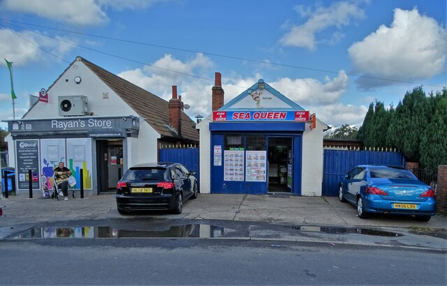
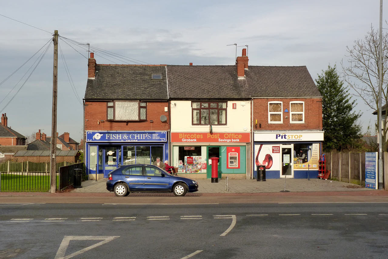
Today, Bircotes is a thriving community with a range of amenities and services. The village boasts a variety of shops, including supermarkets, convenience stores, and local businesses catering to the needs of its residents. Additionally, there are several pubs, restaurants, and takeaways offering a range of dining options.

Bircotes is well-served by public transportation, with regular bus services connecting the village to nearby towns and cities. The village is also conveniently located near major transport links, including the A1 motorway, providing easy access to other parts of the country.

For recreational activities, Bircotes benefits from several green spaces and parks, including the nearby Harworth and Bircotes Sports and Social Club. The village also has a community center that hosts various events and activities for residents of all ages.

Overall, Bircotes is a vibrant village with a rich history and a strong sense of community, offering a range of amenities and convenient transport links for its residents.

If you have any feedback on the listing, please let us know in the comments section below.
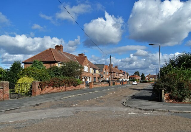
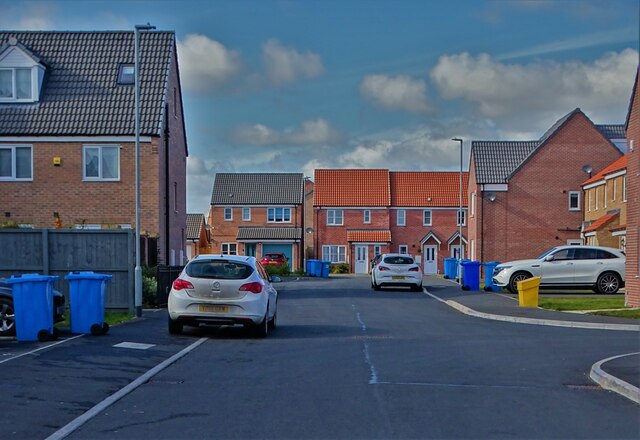
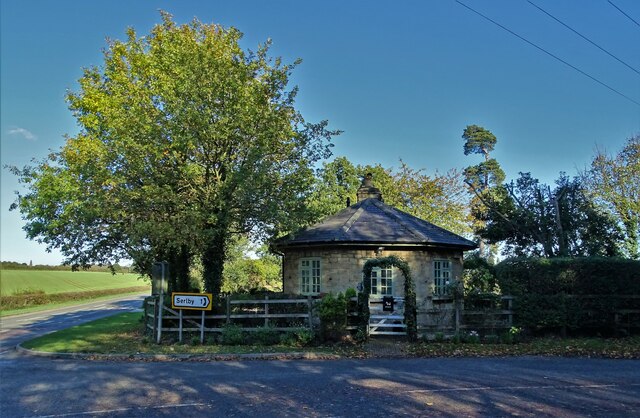
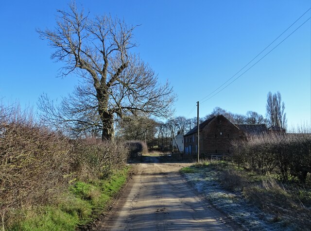
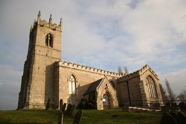
Bircotes Images

Images are sourced within 2km of 53.420147/-1.054992 or Grid Reference SK6291. Thanks to Geograph Open Source API. All images are credited.

Corner of Essex Road and Galway Road, Bircotes
Businesses on Essex Road, Bircotes
New housing development at Bircotes
Avalon Gardens New housing to the north of Harworth
Avalon Gardens
New housing to the north of Harworth
Modern housing at Harworth On Avalon Gardens. Honestly, who comes up with such fancy names?
Modern housing at Harworth
On Avalon Gardens. Honestly, who comes up with such fancy names?
House on Linton Close, Bawtry
Harworth Lodge, Serlby Park Former western gatehouse to the Serlby Hall estate
Harworth Lodge, Serlby Park
Former western gatehouse to the Serlby Hall estate
The end of High Common Lane Approaching Tickhill Grange
The end of High Common Lane
Approaching Tickhill Grange
Junction of Gibbet Hill Lane with the A614
Field view at Gibbet Hill
All Saints' church, Harworth, Notts. All Saints' church stands raised above the surrounding land, in close proximity to the pit villages of Harworth and Bircotes. Only the tower remains of the medieval church, the rest rebuilt by C.J.Neale in 1869 with a neo-Norman chancel, apparently incorporating some of the original Norman one.
All Saints' church, Harworth, Notts.
All Saints' church stands raised above the surrounding land, in close proximity to the pit villages of Harworth and Bircotes. Only the tower remains of the medieval church, the rest rebuilt by C.J.Neale in 1869 with a neo-Norman chancel, apparently incorporating some of the original Norman one.
Harworth Colliery The first shaft was sunk in 1919 and Harworth pit has produced millions of tons of top quality coal ever since. The Flying Scotsman was burning Harworth Coal when she covered the 392 miles from London to Edinburgh in 7 hours, 27 minutes in 1932.
Harworth Colliery
The first shaft was sunk in 1919 and Harworth pit has produced millions of tons of top quality coal ever since. The Flying Scotsman was burning Harworth Coal when she covered the 392 miles from London to Edinburgh in 7 hours, 27 minutes in 1932.
Owl Sanctuary This group of buildings, viewed from Gibbet Hill, is an owl sanctuary.
Owl Sanctuary
This group of buildings, viewed from Gibbet Hill, is an owl sanctuary.
Old Embankment This embankment once carried a railway branch from the east coast mainline to Harworth Colliery.
Old Embankment
This embankment once carried a railway branch from the east coast mainline to Harworth Colliery.
Entrance Lodge This interestingly shaped house appears to be a lodge at the entrance to Serlby Park.
Entrance Lodge
This interestingly shaped house appears to be a lodge at the entrance to Serlby Park.
Colliery Conveyor This structure carries spoil from Harworth Colliery, seen in the background, to the spoil heaps to the south west of the mine.
Colliery Conveyor
This structure carries spoil from Harworth Colliery, seen in the background, to the spoil heaps to the south west of the mine.
Colliery Conveyor 2 This conveyor starts two squares to the NE and is designed to carry spoil from Harworth Colliery to the spoil heaps to the south west of the mine.
Colliery Conveyor 2
This conveyor starts two squares to the NE and is designed to carry spoil from Harworth Colliery to the spoil heaps to the south west of the mine.
Wet and Dry The irrigation system is spraying much need water onto this sandy soil.
Wet and Dry
The irrigation system is spraying much need water onto this sandy soil.
Show me another place!

Bircotes is located at Grid Ref: SK6291 (Lat: 53.420147, Lng: -1.054992)

Administrative County: Nottinghamshire

District: Bassetlaw

Police Authority: Nottinghamshire

What 3 Words

///provide.speaks.originate. Near Bircotes, Nottinghamshire

Related Wikis

Serlby Park Academy

Serlby Park Academy is a mixed all-through school and sixth form located in the twin villages of Bircotes and Harworth in North Nottinghamshire. The school...

Bircotes

Bircotes is an area in the civil parish of Harworth and Bircotes in the Bassetlaw district of Nottinghamshire, England on the border with South Yorkshire...

Harworth Colliery F.C.

Harworth Colliery Football Club is an English football club based in Harworth and Bircotes, Nottinghamshire. The club are currently members of the Central...

Harworth Colliery

Harworth Colliery was a colliery near the town of Harworth Bircotes in Bassetlaw, Nottinghamshire, England. It was abandoned in 2006 due to troubles at...

Nearby Amenities

Located within 500m of 53.420147,-1.054992
Bircotes
Is In: Bassetlaw, Nottinghamshire, United Kingdom
Place: village
Source: npe
Wikidata: Q4454217
Wikipedia: en:Bircotes
Lat/Long: 53.4167902/-1.0578974
Turning Circle
Lat/Long: 53.4192108/-1.0562509
Mini Roundabout
Lat/Long: 53.4167601/-1.0596418
Bus Stop
Grosvenor Road
Bus: yes
Naptan AtcoCode: 3300BA0392
Naptan Bearing: S
Naptan CommonName: Grosvenor Road
Naptan Crossing: Scrooby Road
Naptan Indicator: S-bound
Naptan NaptanCode: ntsdjmaw
Naptan Notes: none
Naptan Street: Grosvenor Road
Naptan Verified: no
Public Transport: platform
Source: naptan_import
Lat/Long: 53.4170211/-1.0595563
Bus Stop
Beverley Road
Bus: yes
Naptan AtcoCode: 3300BA0393
Naptan Bearing: SE
Naptan CommonName: Beverley Road
Naptan Crossing: Beverley Road
Naptan Indicator: opp
Naptan NaptanCode: ntsdjmda
Naptan Notes: none
Naptan Street: Grosvenor Road
Naptan Verified: no
Public Transport: platform
Source: naptan_import
Lat/Long: 53.4201636/-1.0602243
Bus Stop
Beverley Road
Bus: yes
Naptan AtcoCode: 3300BA0395
Naptan Bearing: W
Naptan CommonName: Beverley Road
Naptan Crossing: Holderness Close
Naptan Indicator: W-bound
Naptan NaptanCode: ntsdjmdj
Naptan Notes: none
Naptan Street: Beverley Road
Naptan Verified: no
Public Transport: platform
Source: naptan_import
Lat/Long: 53.4204603/-1.0613764
Bus Stop
Waterslack Road
Bus: yes
Naptan AtcoCode: 3300BA0432
Naptan Bearing: S
Naptan CommonName: Waterslack Road
Naptan Crossing: Scrooby Road
Naptan Indicator: S-bound
Naptan NaptanCode: ntsdagtd
Naptan Notes: BW--3300BA0798
Naptan Street: Waterslack Road
Naptan Verified: no
Public Transport: platform
Source: naptan_import
Lat/Long: 53.4171889/-1.0534887
Bus Stop
Miners Welfare
Bus: yes
Naptan AtcoCode: 3300BA0433
Naptan Bearing: SW
Naptan CommonName: Miners Welfare
Naptan Crossing: Swinnow Road
Naptan Indicator: opp
Naptan Landmark: Miners Welfare
Naptan NaptanCode: ntsdagtg
Naptan Notes: none
Naptan Street: White House Road
Naptan Verified: no
Public Transport: platform
Source: naptan_import
Lat/Long: 53.4204619/-1.052468
Bus Stop
Miners Welfare
Bus: yes
Naptan AtcoCode: 3300BA0434
Naptan Bearing: E
Naptan CommonName: Miners Welfare
Naptan Crossing: Swinnow Road
Naptan Indicator: adj
Naptan Landmark: Miners Welfare
Naptan NaptanCode: ntsdagtj
Naptan Notes: none
Naptan Street: White House Road
Naptan Verified: no
Public Transport: platform
Source: naptan_import
Lat/Long: 53.4206316/-1.0523288
Bus Stop
Suffolk Road
Bus: yes
Naptan AtcoCode: 3300BA0438
Naptan Bearing: SW
Naptan CommonName: Suffolk Road
Naptan Crossing: Suffolk Road
Naptan Indicator: adj
Naptan NaptanCode: ntsdagwa
Naptan Notes: none
Naptan Street: Droversdale Road
Naptan Verified: no
Public Transport: platform
Source: naptan_import
Lat/Long: 53.4202437/-1.0476425
Bus Stop
Suffolk Road
Bus: yes
Naptan AtcoCode: 3300BA0439
Naptan Bearing: NE
Naptan CommonName: Suffolk Road
Naptan Crossing: Suffolk Road
Naptan Indicator: opp
Naptan NaptanCode: ntsdagwd
Naptan Notes: none
Naptan Street: Droversdale Road
Naptan Verified: no
Public Transport: platform
Source: naptan_import
Lat/Long: 53.4203616/-1.0477752
Bus Stop
Droversdale Road
Bus: yes
Naptan AtcoCode: 3300BA0440
Naptan Bearing: N
Naptan CommonName: Droversdale Road
Naptan Crossing: The Crescent
Naptan Indicator: N-bound
Naptan NaptanCode: ntsdagwg
Naptan Notes: BW--3300BA0870
Naptan Street: Droversdale Road
Naptan Verified: no
Public Transport: platform
Source: naptan_import
Lat/Long: 53.4173556/-1.0495728
Bus Stop
Sports Ground
Bus: yes
Naptan AtcoCode: 3300BA0463
Naptan Bearing: E
Naptan CommonName: Sports Ground
Naptan Crossing: Waterslack Road
Naptan Indicator: opp
Naptan Landmark: Sports Ground
Naptan NaptanCode: ntsgadgp
Naptan Notes: none
Naptan Street: Scrooby Road
Naptan Verified: no
Public Transport: platform
Source: naptan_import
Lat/Long: 53.4167094/-1.0530931
Bus Stop
Sports Ground
Bus: yes
Naptan AtcoCode: 3300BA0464
Naptan Bearing: W
Naptan CommonName: Sports Ground
Naptan Crossing: Waterslack Road
Naptan Indicator: adj
Naptan Landmark: Sports Ground
Naptan NaptanCode: ntsgadgt
Naptan Notes: none
Naptan Street: Scrooby Road
Naptan Verified: no
Public Transport: platform
Source: naptan_import
Lat/Long: 53.4166263/-1.0539526
Bus Stop
Cricket Ground
Bus: yes
Naptan AtcoCode: 3300BA0465
Naptan Bearing: E
Naptan CommonName: Cricket Ground
Naptan Indicator: opp
Naptan Landmark: Cricket Ground
Naptan NaptanCode: ntsgadgw
Naptan Notes: none
Naptan Street: Scrooby Road
Naptan Verified: no
Public Transport: platform
Source: naptan_import
Lat/Long: 53.4167822/-1.0566124
Bus Stop
Colliery
Bus: yes
Naptan AtcoCode: 3300BA0466
Naptan Bearing: W
Naptan CommonName: Colliery
Naptan Crossing: Grosvenor Road
Naptan Indicator: adj
Naptan Landmark: Colliery
Naptan NaptanCode: ntsgadja
Naptan Notes: none
Naptan Street: Scrooby Road
Naptan Verified: no
Public Transport: platform
Source: naptan_import
Lat/Long: 53.4166957/-1.0593227
Bus Stop
Grosvenor Road
Bus: yes
Naptan AtcoCode: 3300BA0660
Naptan Bearing: N
Naptan CommonName: Grosvenor Road
Naptan Crossing: Alexandra Road
Naptan Indicator: N-bound
Naptan NaptanCode: ntsdamda
Naptan Notes: None
Naptan Street: Grosvenor Road
Naptan Verified: no
Public Transport: platform
Source: naptan_import
Lat/Long: 53.417463/-1.0597421
North Border School
Naptan AtcoCode: 3300BA0689
Naptan Bearing: N
Naptan BusStopType: CUS
Naptan CommonName: North Border School
Naptan Crossing: Snipe Park Road
Naptan Indicator: o/s
Naptan Landmark: North Border School
Naptan NaptanCode: ntsdamdj
Naptan Notes: CUS
Naptan Street: Shrewsbury Road
Naptan Verified: no
Source: naptan_import
Lat/Long: 53.4177616/-1.0577042
Waterslack Road
Naptan AtcoCode: 3300BA0798
Naptan Bearing: N
Naptan BusStopType: CUS
Naptan CommonName: Waterslack Road
Naptan Crossing: Scrooby Road
Naptan Indicator: N-bound
Naptan NaptanCode: ntsgjmwg
Naptan Notes: CUS--3300BA0432
Naptan Street: Waterslack Road
Naptan Verified: no
Source: naptan_import
Lat/Long: 53.4172083/-1.0536688
Droversdale Road
Naptan AtcoCode: 3300BA0870
Naptan Bearing: S
Naptan BusStopType: CUS
Naptan CommonName: Droversdale Road
Naptan Crossing: The Crescent
Naptan Indicator: S-bound
Naptan NaptanCode: ntsgmadm
Naptan Notes: CUS--3300BA0440
Naptan Street: Droversdale Road
Naptan Verified: no
Source: naptan_import
Lat/Long: 53.4171656/-1.0494266
Turning Circle
Lat/Long: 53.418145/-1.0525635
Turning Circle
Lat/Long: 53.4196389/-1.058586
Generator Method: photovoltaic
Generator Output Electricity: yes
Generator Source: solar
Generator Type: solar_photovoltaic_panel
Location: roof
Power: generator
Lat/Long: 53.4202241/-1.0619542
Generator Method: photovoltaic
Generator Output Electricity: yes
Generator Source: solar
Generator Type: solar_photovoltaic_panel
Location: roof
Power: generator
Lat/Long: 53.4201861/-1.0620722
Generator Method: photovoltaic
Generator Output Electricity: yes
Generator Source: solar
Generator Type: solar_photovoltaic_panel
Location: roof
Power: generator
Lat/Long: 53.4201564/-1.0622143
Generator Method: photovoltaic
Generator Output Electricity: yes
Generator Source: solar
Generator Type: solar_photovoltaic_panel
Location: roof
Power: generator
Lat/Long: 53.4208703/-1.0603162
Generator Method: photovoltaic
Generator Output Electricity: yes
Generator Source: solar
Generator Type: solar_photovoltaic_panel
Location: roof
Power: generator
Lat/Long: 53.4209402/-1.0601065
Generator Method: photovoltaic
Generator Output Electricity: yes
Generator Source: solar
Generator Type: solar_photovoltaic_panel
Location: roof
Power: generator
Lat/Long: 53.4209762/-1.0600176
Generator Method: photovoltaic
Generator Output Electricity: yes
Generator Source: solar
Generator Type: solar_photovoltaic_panel
Location: roof
Power: generator
Lat/Long: 53.4210122/-1.0599181
Generator Method: photovoltaic
Generator Output Electricity: yes
Generator Source: solar
Generator Type: solar_photovoltaic_panel
Location: roof
Power: generator
Lat/Long: 53.4212558/-1.0602842
Generator Method: photovoltaic
Generator Output Electricity: yes
Generator Source: solar
Generator Type: solar_photovoltaic_panel
Location: roof
Power: generator
Lat/Long: 53.4212452/-1.0604015
Generator Method: photovoltaic
Generator Output Electricity: yes
Generator Source: solar
Generator Type: solar_photovoltaic_panel
Location: roof
Power: generator
Lat/Long: 53.421421/-1.0606468
Generator Method: photovoltaic
Generator Output Electricity: yes
Generator Source: solar
Generator Type: solar_photovoltaic_panel
Location: roof
Power: generator
Lat/Long: 53.4215333/-1.0601065
Generator Method: photovoltaic
Generator Output Electricity: yes
Generator Source: solar
Generator Type: solar_photovoltaic_panel
Location: roof
Power: generator
Lat/Long: 53.4218531/-1.0603127
Generator Method: photovoltaic
Generator Output Electricity: yes
Generator Source: solar
Generator Type: solar_photovoltaic_panel
Location: roof
Power: generator
Lat/Long: 53.4218362/-1.0604051
Generator Method: photovoltaic
Generator Output Electricity: yes
Generator Source: solar
Generator Type: solar_photovoltaic_panel
Location: roof
Power: generator
Lat/Long: 53.421815/-1.0605117
Generator Method: photovoltaic
Generator Output Electricity: yes
Generator Source: solar
Generator Type: solar_photovoltaic_panel
Location: roof
Power: generator
Lat/Long: 53.4218023/-1.0606397
Generator Method: photovoltaic
Generator Output Electricity: yes
Generator Source: solar
Generator Type: solar_photovoltaic_panel
Location: roof
Power: generator
Lat/Long: 53.4217832/-1.0607285
Generator Method: photovoltaic
Generator Output Electricity: yes
Generator Source: solar
Generator Type: solar_photovoltaic_panel
Location: roof
Power: generator
Lat/Long: 53.4219887/-1.060988
Generator Method: photovoltaic
Generator Output Electricity: yes
Generator Source: solar
Generator Type: solar_photovoltaic_panel
Location: roof
Power: generator
Lat/Long: 53.4220078/-1.0607819
Generator Method: photovoltaic
Generator Output Electricity: yes
Generator Source: solar
Generator Type: solar_photovoltaic_panel
Location: roof
Power: generator
Lat/Long: 53.4220332/-1.060661
Generator Method: photovoltaic
Generator Output Electricity: yes
Generator Source: solar
Generator Type: solar_photovoltaic_panel
Location: roof
Power: generator
Lat/Long: 53.4220374/-1.0605437
Generator Method: photovoltaic
Generator Output Electricity: yes
Generator Source: solar
Generator Type: solar_photovoltaic_panel
Location: roof
Power: generator
Lat/Long: 53.4223742/-1.0607356
Generator Method: photovoltaic
Generator Output Electricity: yes
Generator Source: solar
Generator Type: solar_photovoltaic_panel
Location: roof
Power: generator
Lat/Long: 53.4225903/-1.0609845
Generator Method: photovoltaic
Generator Output Electricity: yes
Generator Source: solar
Generator Type: solar_photovoltaic_panel
Location: roof
Power: generator
Lat/Long: 53.4226242/-1.06011
Generator Method: photovoltaic
Generator Output Electricity: yes
Generator Source: solar
Generator Type: solar_photovoltaic_panel
Location: roof
Power: generator
Lat/Long: 53.4226962/-1.0597972
Generator Method: photovoltaic
Generator Output Electricity: yes
Generator Source: solar
Generator Type: solar_photovoltaic_panel
Location: roof
Power: generator
Lat/Long: 53.4227161/-1.0596678
Generator Method: photovoltaic
Generator Output Electricity: yes
Generator Source: solar
Generator Type: solar_photovoltaic_panel
Location: roof
Power: generator
Lat/Long: 53.4227767/-1.0593743
Generator Method: photovoltaic
Generator Output Electricity: yes
Generator Source: solar
Generator Type: solar_photovoltaic_panel
Location: roof
Power: generator
Lat/Long: 53.422425/-1.0596835
Generator Method: photovoltaic
Generator Output Electricity: yes
Generator Source: solar
Generator Type: solar_photovoltaic_panel
Location: roof
Power: generator
Lat/Long: 53.42287/-1.0600674
Generator Method: photovoltaic
Generator Output Electricity: yes
Generator Source: solar
Generator Type: solar_photovoltaic_panel
Location: roof
Power: generator
Lat/Long: 53.4228982/-1.059981
Generator Method: photovoltaic
Generator Output Electricity: yes
Generator Source: solar
Generator Type: solar_photovoltaic_panel
Location: roof
Power: generator
Lat/Long: 53.4229531/-1.0596292
Generator Method: photovoltaic
Generator Output Electricity: yes
Generator Source: solar
Generator Type: solar_photovoltaic_panel
Location: roof
Power: generator
Lat/Long: 53.4229259/-1.0597472
Generator Method: photovoltaic
Generator Output Electricity: yes
Generator Source: solar
Generator Type: solar_photovoltaic_panel
Location: roof
Power: generator
Lat/Long: 53.4229163/-1.0598733
Generator Method: photovoltaic
Generator Output Electricity: yes
Generator Source: solar
Generator Type: solar_photovoltaic_panel
Location: roof
Power: generator
Lat/Long: 53.4228335/-1.0591272
Generator Method: photovoltaic
Generator Output Electricity: yes
Generator Source: solar
Generator Type: solar_photovoltaic_panel
Location: roof
Power: generator
Lat/Long: 53.4222181/-1.0590124
Generator Method: photovoltaic
Generator Output Electricity: yes
Generator Source: solar
Generator Type: solar_photovoltaic_panel
Location: roof
Power: generator
Lat/Long: 53.4222284/-1.0589156
Generator Method: photovoltaic
Generator Output Electricity: yes
Generator Source: solar
Generator Type: solar_photovoltaic_panel
Location: roof
Power: generator
Lat/Long: 53.4217422/-1.0588287
Generator Method: photovoltaic
Generator Output Electricity: yes
Generator Source: solar
Generator Type: solar_photovoltaic_panel
Location: roof
Power: generator
Lat/Long: 53.4220395/-1.058657
Generator Method: photovoltaic
Generator Output Electricity: yes
Generator Source: solar
Generator Type: solar_photovoltaic_panel
Location: roof
Power: generator
Lat/Long: 53.4217006/-1.0590325
Generator Method: photovoltaic
Generator Output Electricity: yes
Generator Source: solar
Generator Type: solar_photovoltaic_panel
Location: roof
Power: generator
Lat/Long: 53.4218253/-1.0592391
Generator Method: photovoltaic
Generator Output Electricity: yes
Generator Source: solar
Generator Type: solar_photovoltaic_panel
Location: roof
Power: generator
Lat/Long: 53.4217853/-1.0594778
Generator Method: photovoltaic
Generator Output Electricity: yes
Generator Source: solar
Generator Type: solar_photovoltaic_panel
Location: roof
Power: generator
Lat/Long: 53.4218061/-1.0593705
Generator Method: photovoltaic
Generator Output Electricity: yes
Generator Source: solar
Generator Type: solar_photovoltaic_panel
Location: roof
Power: generator
Lat/Long: 53.4217646/-1.0595931
Generator Method: photovoltaic
Generator Output Electricity: yes
Generator Source: solar
Generator Type: solar_photovoltaic_panel
Location: roof
Power: generator
Lat/Long: 53.4217422/-1.0597058
Generator Method: photovoltaic
Generator Output Electricity: yes
Generator Source: solar
Generator Type: solar_photovoltaic_panel
Location: roof
Power: generator
Lat/Long: 53.4205849/-1.0600089
Generator Method: photovoltaic
Generator Output Electricity: yes
Generator Source: solar
Generator Type: solar_photovoltaic_panel
Location: roof
Power: generator
Lat/Long: 53.4203484/-1.0593195
Generator Method: photovoltaic
Generator Output Electricity: yes
Generator Source: solar
Generator Type: solar_photovoltaic_panel
Location: roof
Power: generator
Lat/Long: 53.4204507/-1.0590084
Generator Method: photovoltaic
Generator Output Electricity: yes
Generator Source: solar
Generator Type: solar_photovoltaic_panel
Location: roof
Power: generator
Lat/Long: 53.4188922/-1.0597594
Generator Method: photovoltaic
Generator Output Electricity: yes
Generator Source: solar
Generator Type: solar_photovoltaic_panel
Location: roof
Power: generator
Lat/Long: 53.4175015/-1.0564496
Generator Method: photovoltaic
Generator Output Electricity: yes
Generator Source: solar
Generator Type: solar_photovoltaic_panel
Location: roof
Power: generator
Lat/Long: 53.4191223/-1.0566695
Generator Method: photovoltaic
Generator Output Electricity: yes
Generator Source: solar
Generator Type: solar_photovoltaic_panel
Location: roof
Power: generator
Lat/Long: 53.4205216/-1.0483197
Generator Method: photovoltaic
Generator Output Electricity: yes
Generator Source: solar
Generator Type: solar_photovoltaic_panel
Location: roof
Power: generator
Lat/Long: 53.4209724/-1.0492048
Generator Method: photovoltaic
Generator Output Electricity: yes
Generator Source: solar
Generator Type: solar_photovoltaic_panel
Location: roof
Power: generator
Lat/Long: 53.4204121/-1.0496444
Generator Method: photovoltaic
Generator Output Electricity: yes
Generator Source: solar
Generator Type: solar_photovoltaic_panel
Location: roof
Power: generator
Lat/Long: 53.4203953/-1.0610438
Generator Method: photovoltaic
Generator Output Electricity: yes
Generator Source: solar
Generator Type: solar_photovoltaic_panel
Location: roof
Power: generator
Lat/Long: 53.4181719/-1.0609499
Generator Method: photovoltaic
Generator Output Electricity: yes
Generator Source: solar
Generator Type: solar_photovoltaic_panel
Location: roof
Power: generator
Lat/Long: 53.4230523/-1.0607045
Generator Method: photovoltaic
Generator Output Electricity: yes
Generator Source: solar
Generator Type: solar_photovoltaic_panel
Location: roof
Power: generator
Lat/Long: 53.4235365/-1.0599427
Generator Method: photovoltaic
Generator Output Electricity: yes
Generator Source: solar
Generator Type: solar_photovoltaic_panel
Location: roof
Power: generator
Lat/Long: 53.4238266/-1.0591341
Generator Method: photovoltaic
Generator Output Electricity: yes
Generator Source: solar
Generator Type: solar_photovoltaic_panel
Location: roof
Power: generator
Lat/Long: 53.4191481/-1.0591045
Generator Method: photovoltaic
Generator Output Electricity: yes
Generator Source: solar
Generator Type: solar_photovoltaic_panel
Location: roof
Power: generator
Lat/Long: 53.4191968/-1.0591487
Camera Mount: pole
Camera Type: dome
Man Made: surveillance
Surveillance: public
Surveillance Type: camera
Surveillance Zone: town
Lat/Long: 53.4165817/-1.058019
Camera Mount: traffic_signals
Camera Type: dome
Contact Webcam: http://data.nottinghamtravelwise.org.uk/images229.jpg
Man Made: surveillance
Surveillance: public
Surveillance Type: camera
Surveillance Zone: traffic
Lat/Long: 53.4166661/-1.0582669
Camera Mount: pole
Camera Type: dome
Man Made: surveillance
Surveillance: public
Surveillance Type: camera
Lat/Long: 53.4198578/-1.0534645
Post Office
Bircotes Post Office
Addr City: Doncaster
Addr Country: GB
Addr Housenumber: 123
Addr Postcode: DN11 8AD
Addr Street: Scrooby Road
Addr Village: Bircotes
Brand: Post Office
Brand Wikidata: Q1783168
Check Date: 2022-05-27
Check Date Opening Hours: 2022-05-27
Contact Website: https://www.postoffice.co.uk/branch-finder/5373115/bircotes
Opening Hours: Mo-Fr 06:00-20:00; Sa,Su 08:00-20:00
Ref Pol Id: 132293
Lat/Long: 53.4169431/-1.058792
Plumtree House
Place: isolated_dwelling
Lat/Long: 53.423362/-1.0517156
The data included in this document is from www.openstreetmap.org. The data is made available under ODbL.

Have you been to Bircotes?

Leave your review of Bircotes below (or comments, questions and feedback).