Penrherber

Settlement in Carmarthenshire

Wales

Penrherber

House and postbox at Penrherber
House and postbox at Penrherber Credit: Eirian Evans

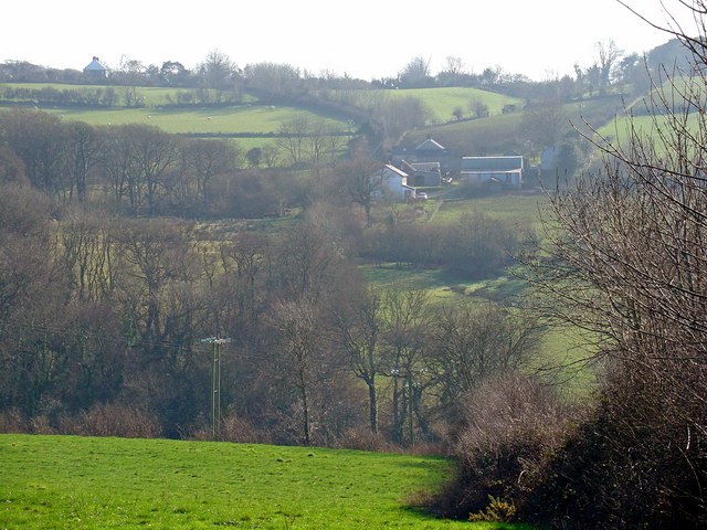
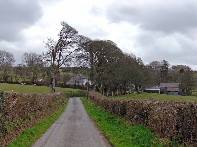
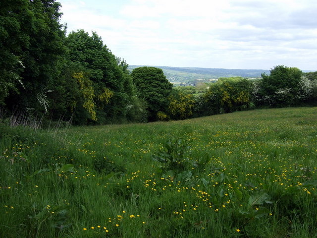
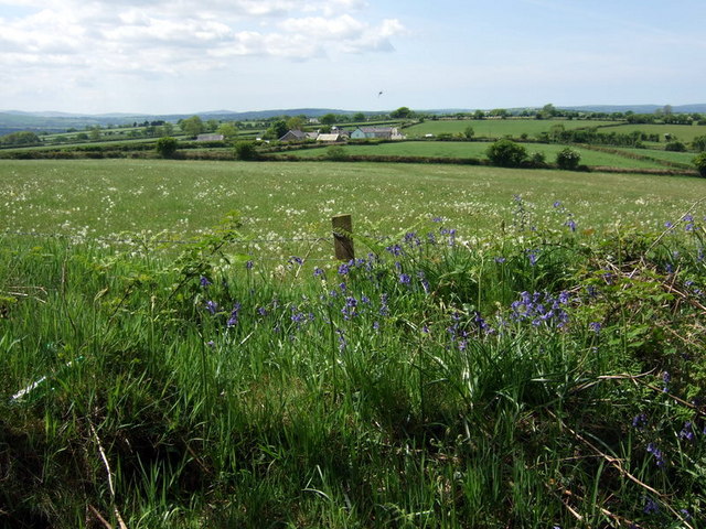
Penrherber is a small village located in the county of Carmarthenshire, Wales. Situated in the rural countryside, it lies approximately 8 miles northwest of the bustling town of Carmarthen. The village is nestled amidst rolling hills and lush green fields, offering picturesque views of the surrounding landscape.

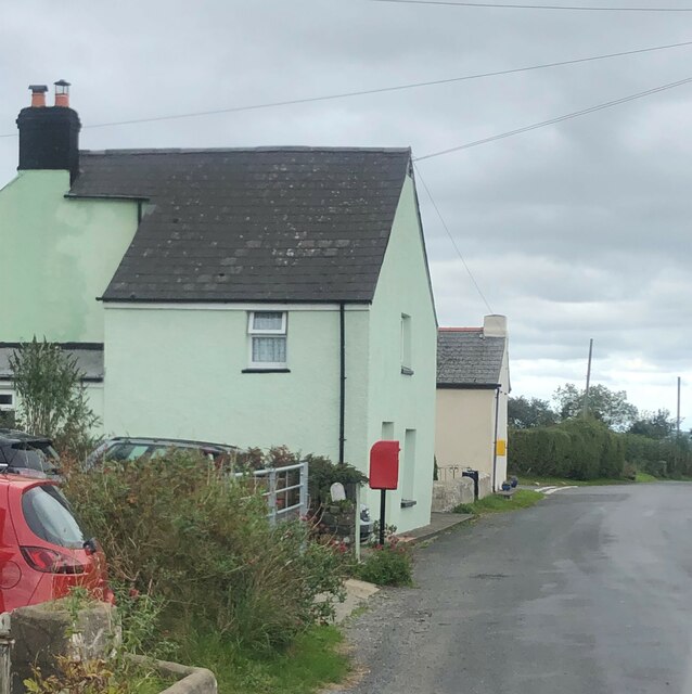
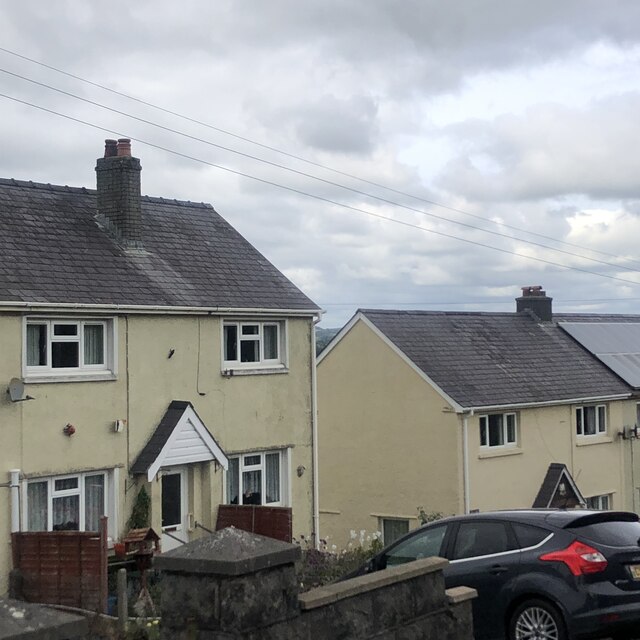
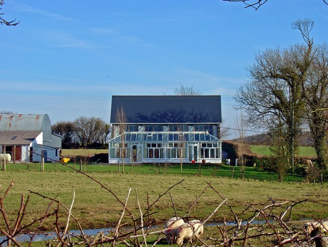
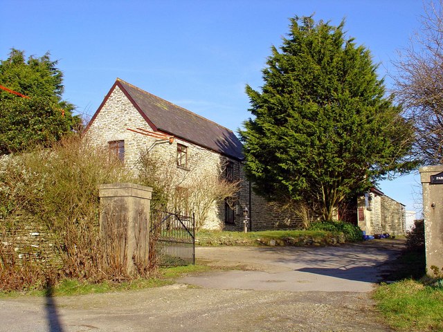
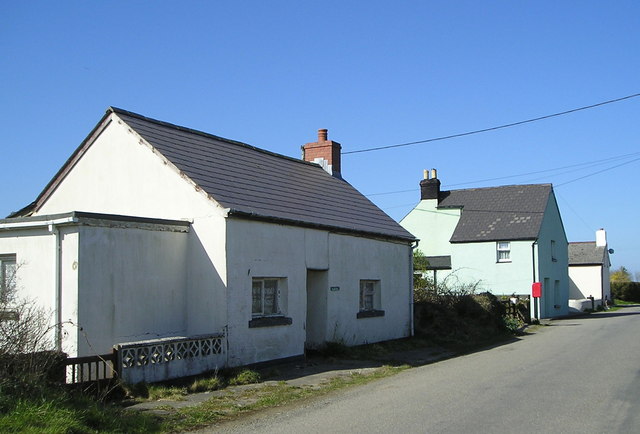
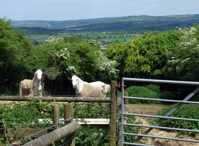
With a population of just over 200 residents, Penrherber exudes a peaceful and tight-knit community atmosphere. The village primarily consists of traditional Welsh stone houses, giving it a charming and rustic feel. The local economy is centered around agriculture, with farming being a significant occupation for many residents.

In terms of amenities, Penrherber provides limited facilities. The village does have a community hall, which serves as a hub for social gatherings and events. However, for more extensive amenities, residents typically rely on nearby towns such as Carmarthen, which offers a wider range of services including shops, schools, and healthcare facilities.

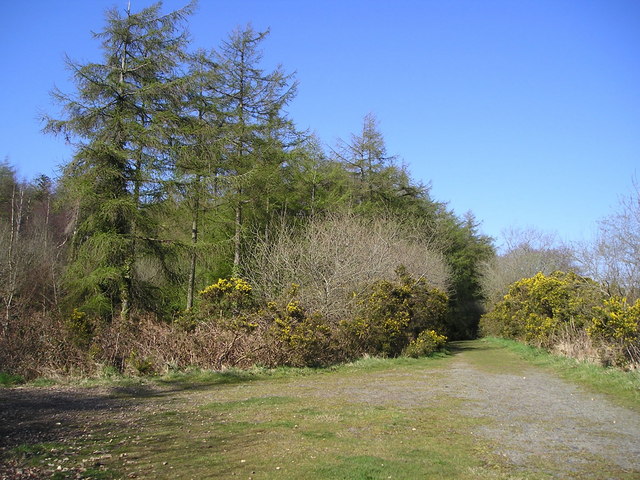
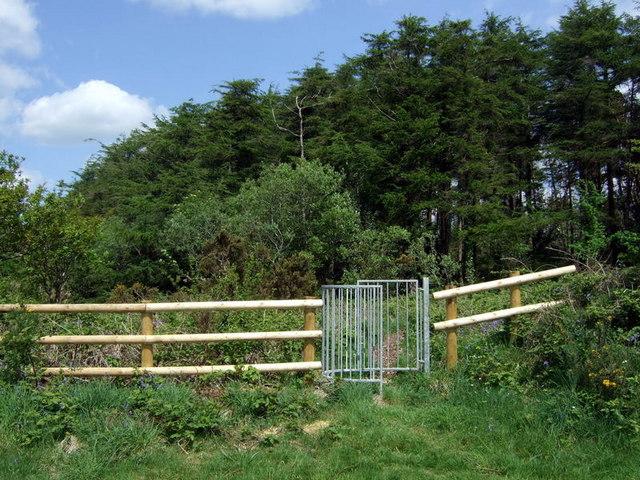
Nature lovers and outdoor enthusiasts will find plenty to explore in the area surrounding Penrherber. The village is within close proximity to several scenic walking and cycling routes, allowing residents and visitors to immerse themselves in the stunning Welsh countryside. Additionally, the nearby Brechfa Forest offers opportunities for hiking, mountain biking, and wildlife spotting.

Overall, Penrherber offers a tranquil and idyllic setting for those seeking a peaceful rural lifestyle, while still benefiting from the amenities and attractions of nearby towns.

If you have any feedback on the listing, please let us know in the comments section below.
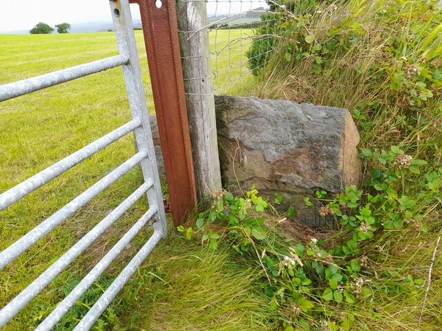
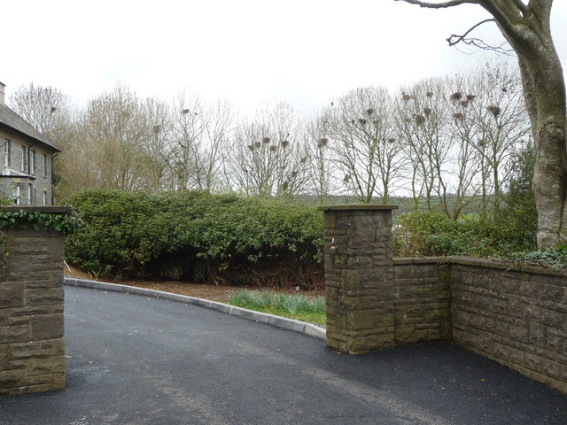
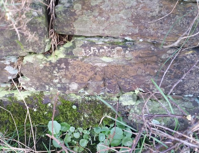
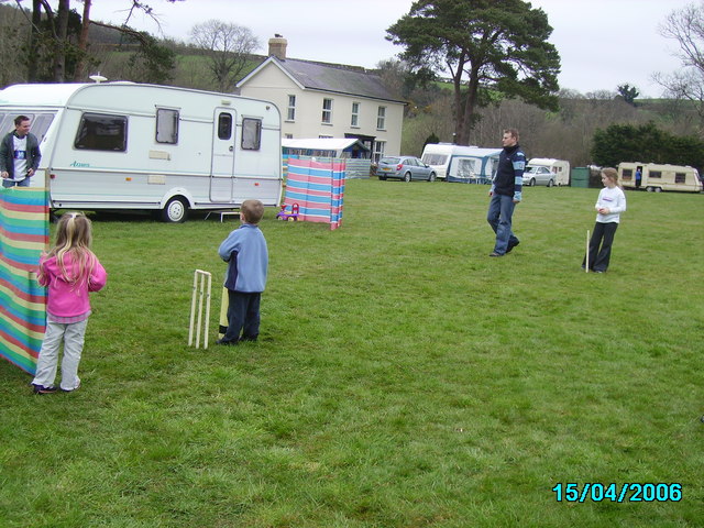
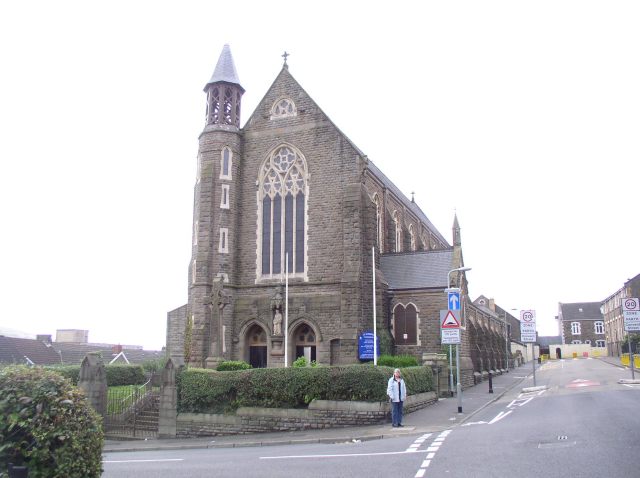
Penrherber Images

Images are sourced within 2km of 52.023167/-4.492299 or Grid Reference SN2939. Thanks to Geograph Open Source API. All images are credited.

House and postbox at Penrherber
Row of houses at Danyrhelyg South-west of Newcastle Emlyn
Row of houses at Danyrhelyg
South-west of Newcastle Emlyn
Stone gatepost on its side There is an Ordnance Survey cut mark on the stone. <a title="https://www.geograph.org.uk/photo/7535368" href="https://www.geograph.org.uk/photo/7535368">Link</a>
Stone gatepost on its side
There is an Ordnance Survey cut mark on the stone. Link
Ordnance Survey Cut Mark This OS cut mark can be found on the stone gatepost on its side SW side of the road. It marked a point 247.796m above mean sea level. <a title="https://www.geograph.org.uk/photo/7535365" href="https://www.geograph.org.uk/photo/7535365">Link</a>
Ordnance Survey Cut Mark
This OS cut mark can be found on the stone gatepost on its side SW side of the road. It marked a point 247.796m above mean sea level. Link
A rookery above Newcastle Emlyn This rookery stands out against the still budding treetops and the noise is pretty conspicuous; parent rooks 'caw' and hop and flap about and in the midst of the commotion I caught the piping of baby rooks demanding feeding.
A rookery above Newcastle Emlyn
This rookery stands out against the still budding treetops and the noise is pretty conspicuous; parent rooks 'caw' and hop and flap about and in the midst of the commotion I caught the piping of baby rooks demanding feeding.
Ordnance Survey Cut Mark This OS cut mark can be found on the wall at the road junction. It marks a point 183.113m above mean sea level.
Ordnance Survey Cut Mark
This OS cut mark can be found on the wall at the road junction. It marks a point 183.113m above mean sea level.
Ordnance Survey Cut Mark This OS cut mark can be found on the gatepost east side of the road. It marks a point 138.355m above mean sea level.
Ordnance Survey Cut Mark
This OS cut mark can be found on the gatepost east side of the road. It marks a point 138.355m above mean sea level.
Dolbryn caravan site Getting a few overs in before lunch at Dolbryn ,Newcastle Emlyn.
Dolbryn caravan site
Getting a few overs in before lunch at Dolbryn ,Newcastle Emlyn.
Pengwern Ganol Farm, Cenarth
Terfyn Mawr, Cenarth
Parc-y-lan
Parc-y-lan
Pengwern-uchaf, Cenarth
Cottages at Penrherber Adjoining the post box is the old post office.
Cottages at Penrherber
Adjoining the post box is the old post office.
Open Access Woodland
Two horses in coats On a warm day these two seemed overdressed and their paddock was pretty much cropped bare. They have a lovely view though, across the Teifi valley, if they care to look at it.
Note that in the hedge behind them, along with the may blossom, are the yellow flowers of the poisonous laburnum which seems to have become naturalised in this part of Carmarthenshire and Ceredigion and can be seen in great profusion in the hedges at this time of year: there appears to be no satisfactory explanation for this. See <span class="nowrap"><a title="http://www.newquay-westwales.co.uk/laburnum.htm" rel="nofollow ugc noopener" href="http://www.newquay-westwales.co.uk/laburnum.htm">Link</a><img style="margin-left:2px;" alt="External link" title="External link - shift click to open in new window" src="https://s1.geograph.org.uk/img/external.png" width="10" height="10"/></span>
Two horses in coats
On a warm day these two seemed overdressed and their paddock was pretty much cropped bare. They have a lovely view though, across the Teifi valley, if they care to look at it. Note that in the hedge behind them, along with the may blossom, are the yellow flowers of the poisonous laburnum which seems to have become naturalised in this part of Carmarthenshire and Ceredigion and can be seen in great profusion in the hedges at this time of year: there appears to be no satisfactory explanation for this. See LinkExternal link
Laburnum in the  hedgerow The buttercups in the foreground match the laburnum blossom along the field boundary.Typically, in this part of Carmarthenshire and throughout Ceredigion, these poisonous trees are well-established and grow in abundance: no-one knows why. Possibly at one time the wood, which is very tough, was used for hedging stakes and pegs which then took root. Although all parts of the laburnum contain a lethal alkaloid it is said that, as with ragwort, stock will not eat it unless desperate.
Laburnum in the hedgerow
The buttercups in the foreground match the laburnum blossom along the field boundary.Typically, in this part of Carmarthenshire and throughout Ceredigion, these poisonous trees are well-established and grow in abundance: no-one knows why. Possibly at one time the wood, which is very tough, was used for hedging stakes and pegs which then took root. Although all parts of the laburnum contain a lethal alkaloid it is said that, as with ragwort, stock will not eat it unless desperate.
Penrherber from the east Tiny hamlet on a crossroads southwest of Castell Newydd Emlyn/Newcastle Emlyn, viewed across the fields from Bwl-y-foel.
Penrherber from the east
Tiny hamlet on a crossroads southwest of Castell Newydd Emlyn/Newcastle Emlyn, viewed across the fields from Bwl-y-foel.
Bwl-y-foel This largely coniferous, hilltop woodland has recently been opened for public access, hence the unexpected brand-new gate. Its name, meaning 'Bald Knob', must predate the plantation.
Bwl-y-foel
This largely coniferous, hilltop woodland has recently been opened for public access, hence the unexpected brand-new gate. Its name, meaning 'Bald Knob', must predate the plantation.
Show me another place!

Penrherber is located at Grid Ref: SN2939 (Lat: 52.023167, Lng: -4.492299)

Unitary Authority: Carmarthenshire

Police Authority: Dyfed Powys

What 3 Words

///reception.boater.also. Near Newcastle Emlyn, Ceredigion

Related Wikis

Roman Catholic Diocese of Menevia

The Diocese of Menevia (Latin: Dioecesis Menevensis) is a Latin Church diocese of the Catholic Church in Wales. It is one of two suffragan dioceses in...

Ysgol Gyfun Emlyn

Ysgol Gyfun Emlyn is a mixed, community comprehensive school in Newcastle Emlyn, Carmarthenshire, Wales. It has around 520 pupils, catering for all abilities...
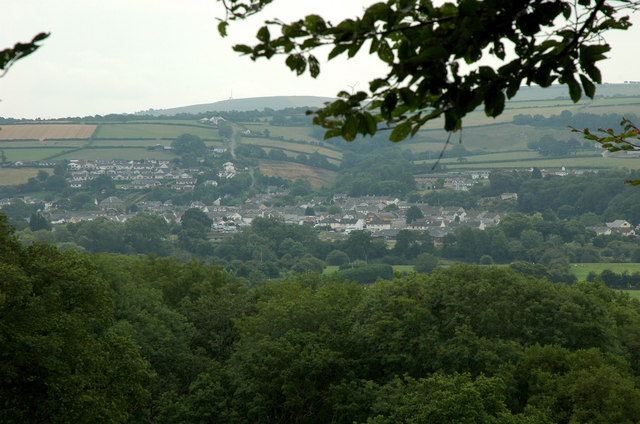
Newcastle Emlyn

Newcastle Emlyn (Welsh: Castellnewydd Emlyn) is a town on the River Teifi, straddling the counties of Ceredigion and Carmarthenshire in West Wales. It...

Cawdor Hall

Cawdor Hall (Welsh: Neuadd Cawdor), also known as Newcastle Emlyn Town Hall (Welsh: Neuadd y Dref Castellnewydd Emlyn), is a municipal building in the...

Nearby Amenities

Located within 500m of 52.023167,-4.492299
Penrherber
Is In: Ceredigion, Wales, UK
Place: hamlet
Wikidata: Q13130697
Wikipedia: cy:Penrherber
Lat/Long: 52.0233786/-4.4930868
Bŵl-y-foel
Ele: 224
Natural: peak
Lat/Long: 52.0225138/-4.4863454
Give Way
Direction: forward
Lat/Long: 52.0232198/-4.4935177
Give Way
Direction: backward
Lat/Long: 52.0232749/-4.493596
Give Way
Direction: backward
Lat/Long: 52.0245589/-4.4927769
Direction: S
Generator Method: photovoltaic
Generator Output Electricity: yes
Generator Solar Modules: 17
Generator Source: solar
Generator Type: solar_photovoltaic_panel
Location: roof
Power: generator
Lat/Long: 52.0226198/-4.4939554
The data included in this document is from www.openstreetmap.org. The data is made available under ODbL.

Have you been to Penrherber?

Leave your review of Penrherber below (or comments, questions and feedback).