Penrallt

Settlement in Montgomeryshire

Wales

Penrallt

Glyndwr's Way near Llanidloes
Glyndwr's Way near Llanidloes Credit: Dave Kelly

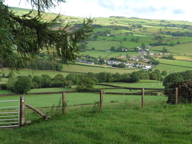
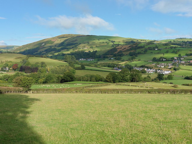
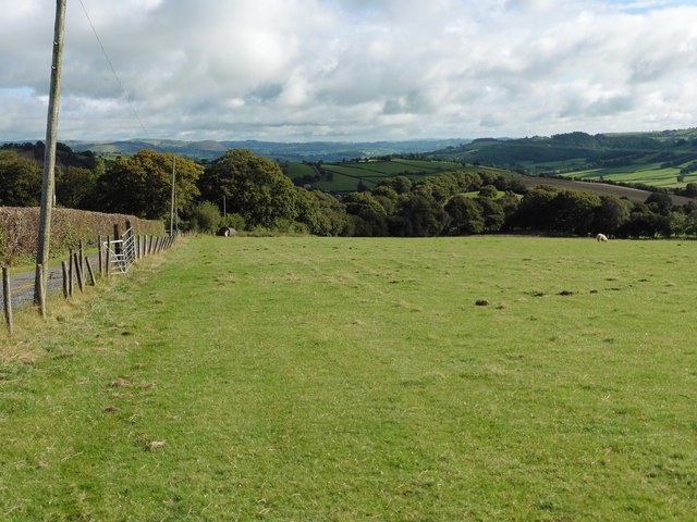
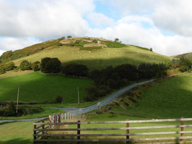
Penrallt is a small village located in Montgomeryshire, a historic county in Wales, United Kingdom. Situated in the heart of the beautiful Welsh countryside, Penrallt is surrounded by rolling hills, lush green fields, and picturesque landscapes. The village is nestled between the larger towns of Welshpool and Newtown, providing residents with easy access to amenities and services.

Penrallt is a close-knit community with a population of approximately 500 residents. The village is known for its serene and peaceful atmosphere, making it an ideal place to escape the hustle and bustle of city life. The local economy primarily revolves around agriculture, with many residents working in farming or related industries.

The village is home to a few small businesses, including a local convenience store, a pub, and a handful of shops. For more extensive shopping and entertainment options, residents can easily access the nearby towns. Penrallt also has a primary school, providing education for the local children.

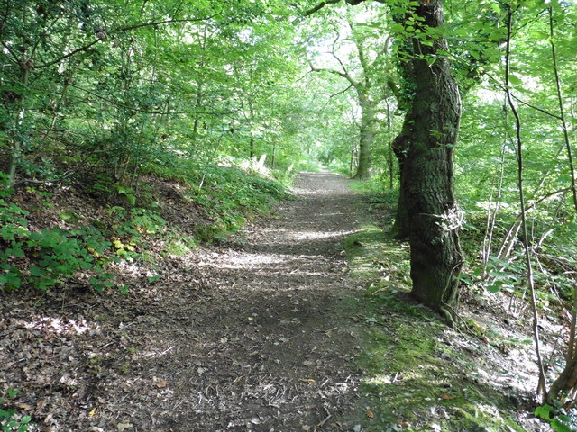
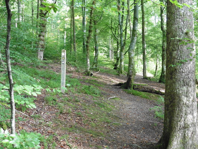
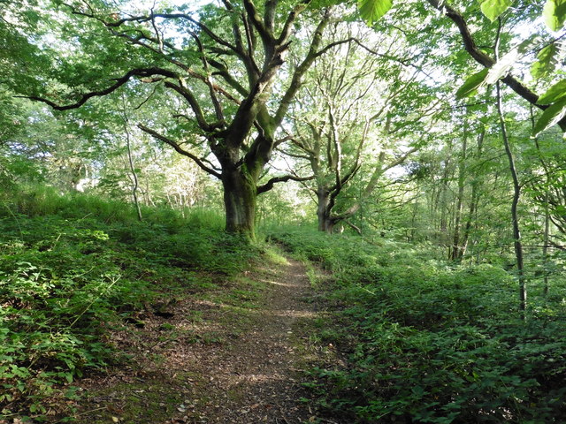
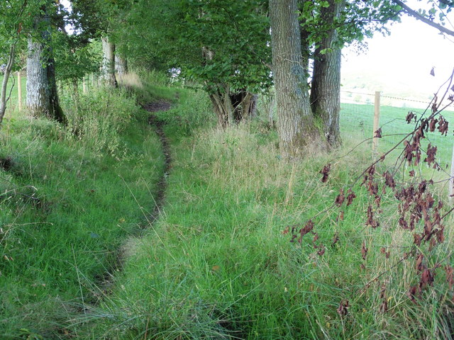
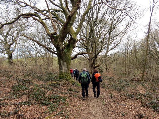
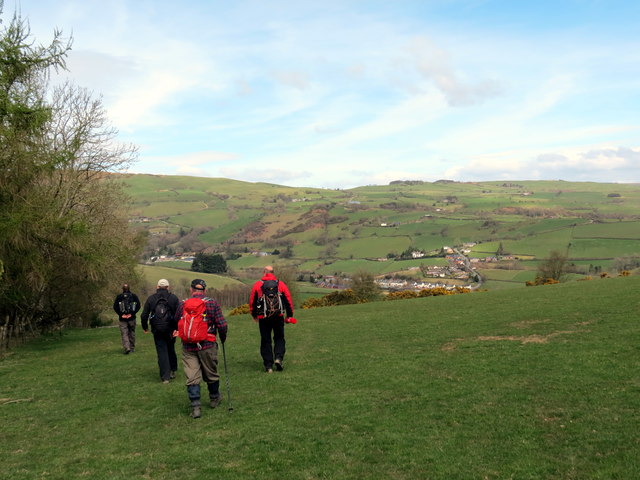
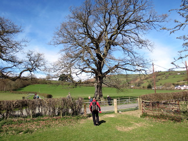
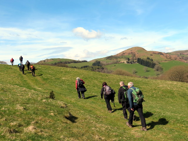
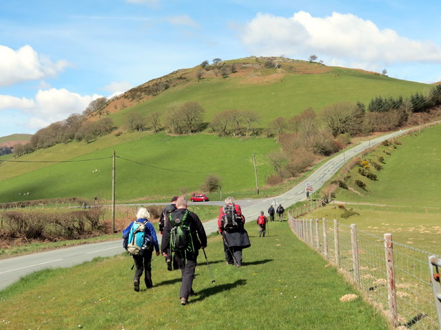
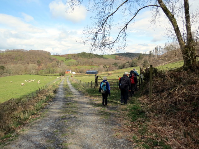
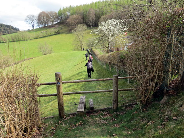
Nature lovers and outdoor enthusiasts are drawn to Penrallt due to its proximity to the Montgomeryshire Canal and the surrounding countryside. The area offers various walking and cycling trails, allowing residents and visitors to explore the stunning natural beauty of the region.

Overall, Penrallt is a quiet and peaceful village that offers a close-knit community, beautiful scenery, and a serene way of life. It is an idyllic place for those seeking a slower pace and a deep connection with nature.

If you have any feedback on the listing, please let us know in the comments section below.

Penrallt Images

Images are sourced within 2km of 52.461816/-3.5468695 or Grid Reference SN9586. Thanks to Geograph Open Source API. All images are credited.

Glyndwr's Way near Llanidloes
Glyndwr's Way near Llanidloes One of several route alterations North of Llanidloes
Glyndwr's Way near Llanidloes
One of several route alterations North of Llanidloes
Glyndwr's Way near Llanidloes
Glyndwr's Way by St Idloes golf club
Glyndwr's Way near Van Van may be seen in the distance
Glyndwr's Way near Van
Van may be seen in the distance
Glyndwr's Way near Van
Glyndwr's Way near to the B4518
Glyndwr's Way by the B4518
Ordnance Survey Flush Bracket S0731 This can be found on the wall of St Idloes Church in Llanidloes.
For more detail see : <span class="nowrap"><a title="http://www.bench-marks.org.uk/bm12516" rel="nofollow ugc noopener" href="http://www.bench-marks.org.uk/bm12516">Link</a><img style="margin-left:2px;" alt="External link" title="External link - shift click to open in new window" src="https://s1.geograph.org.uk/img/external.png" width="10" height="10"/></span>
Ordnance Survey Flush Bracket S0731
This can be found on the wall of St Idloes Church in Llanidloes. For more detail see : LinkExternal link
The Church of St Idloes in Llanidloes Viewed from the south.
The Church of St Idloes in Llanidloes
Viewed from the south.
Allt Goch Cerddwyr yn dilyn Llwybr Glynhir drwy goedwig Allt Goch.

Walkers following the Glyndwr Way through woods known as Allt Goch (trans red hill).
Allt Goch
Cerddwyr yn dilyn Llwybr Glynhir drwy goedwig Allt Goch. Walkers following the Glyndwr Way through woods known as Allt Goch (trans red hill).
Ger Bron y Geifr / Near Bron y Geifr Cerddwyr yn dilyn Llwybr Glyndwr. Yr anheddiad yn y pellter yw y Fan.

Walkers following the Glyndwr Way. The settlement in the distance is the Fan (trans. peak).
Ger Bron y Geifr / Near Bron y Geifr
Cerddwyr yn dilyn Llwybr Glyndwr. Yr anheddiad yn y pellter yw y Fan. Walkers following the Glyndwr Way. The settlement in the distance is the Fan (trans. peak).
Ger y Fan / Near Y Fan Cerddwyr yn dilyn Llwybr Glyndwr ger pentre o'r enw'r Fan.

Walkers following Glyndwr's Way near a village called Y Fan (the peak).
Ger y Fan / Near Y Fan
Cerddwyr yn dilyn Llwybr Glyndwr ger pentre o'r enw'r Fan. Walkers following Glyndwr's Way near a village called Y Fan (the peak).
Y Garth / Garth Hill Cerddwyr yn dilyn Llwybr Glyndwr ar fryn o'r enw'r Garth.

Walkers following Glyndwr's Way on Garth Hill.
Y Garth / Garth Hill
Cerddwyr yn dilyn Llwybr Glyndwr ar fryn o'r enw'r Garth. Walkers following Glyndwr's Way on Garth Hill.
Ger Bidffald/ Nead Bidffald Cerddwyr yn dilyn Llwybr Glyndwr ar hyd y B4518.

Walkers following Glyndwr's Way along the B4518.
Ger Bidffald/ Nead Bidffald
Cerddwyr yn dilyn Llwybr Glyndwr ar hyd y B4518. Walkers following Glyndwr's Way along the B4518.
Ger Rhyd y Gwreiddyn / Near Rhyd y Gwreiddyn Cerddwyr yn dilyn llwybr cyhoeddus ger Ffarm Rhyd y Gwreiddyn.

Walkers following a public footpath near Rhyd y Gwreiddyn Farm (ford of the stream source).
Ger Rhyd y Gwreiddyn / Near Rhyd y Gwreiddyn
Cerddwyr yn dilyn llwybr cyhoeddus ger Ffarm Rhyd y Gwreiddyn. Walkers following a public footpath near Rhyd y Gwreiddyn Farm (ford of the stream source).
Sticil Cwmeryr Bach / Cwmeryr Bach Stile Sticil wrth ymyl anhedd-dy o'r enw Cwmeryr Bach.

A stile at Cwmeryr Bach (trans. eagle valley)
Sticil Cwmeryr Bach / Cwmeryr Bach Stile
Sticil wrth ymyl anhedd-dy o'r enw Cwmeryr Bach. A stile at Cwmeryr Bach (trans. eagle valley)
Show me another place!

Penrallt is located at Grid Ref: SN9586 (Lat: 52.461816, Lng: -3.5468695)

Unitary Authority: Powys

Police Authority: Dyfed Powys

What 3 Words

///cuts.message.munch. Near Llanidloes, Powys

Nearby Locations

Penrallt

Related Wikis

Llanidloes War Memorial Hospital

Llanidloes War Memorial Hospital (Welsh: Ysbyty Coffa Rhyfel Llanidloes) is a health facility in Eastgate Street, Llanidloes, Powys, Wales. It is managed...

Afon Clywedog

The Afon Clywedog is an upland headwater tributary of the River Severn in Powys, Wales. It is approximately 29 km long and has its source on the flanks...

Van, Llanidloes

Van (Welsh: Y Fan) is a hamlet in Powys, Mid Wales, located to the north west of Llanidloes. Its name, an anglicisation of the local Welsh placename "Fan...

Garth and Van Road railway station

Garth and Van Road railway station served the village of Garth, in the historical county of Montgomeryshire, Wales, from 1873 to 1940 on the Van Railway...

Llanidloes

Llanidloes (Welsh pronunciation: [ɬanˈɪdlɔɨs]) is a town and community on the A470 and B4518 roads in Powys, within the historic county boundaries of Montgomeryshire...

Llanidloes Town F.C.

Llanidloes Town Football Club (Welsh: Clwb Pêl-droed Tref Llanidloes) are an association football club based in the town of Llanidloes, Wales. They currently...

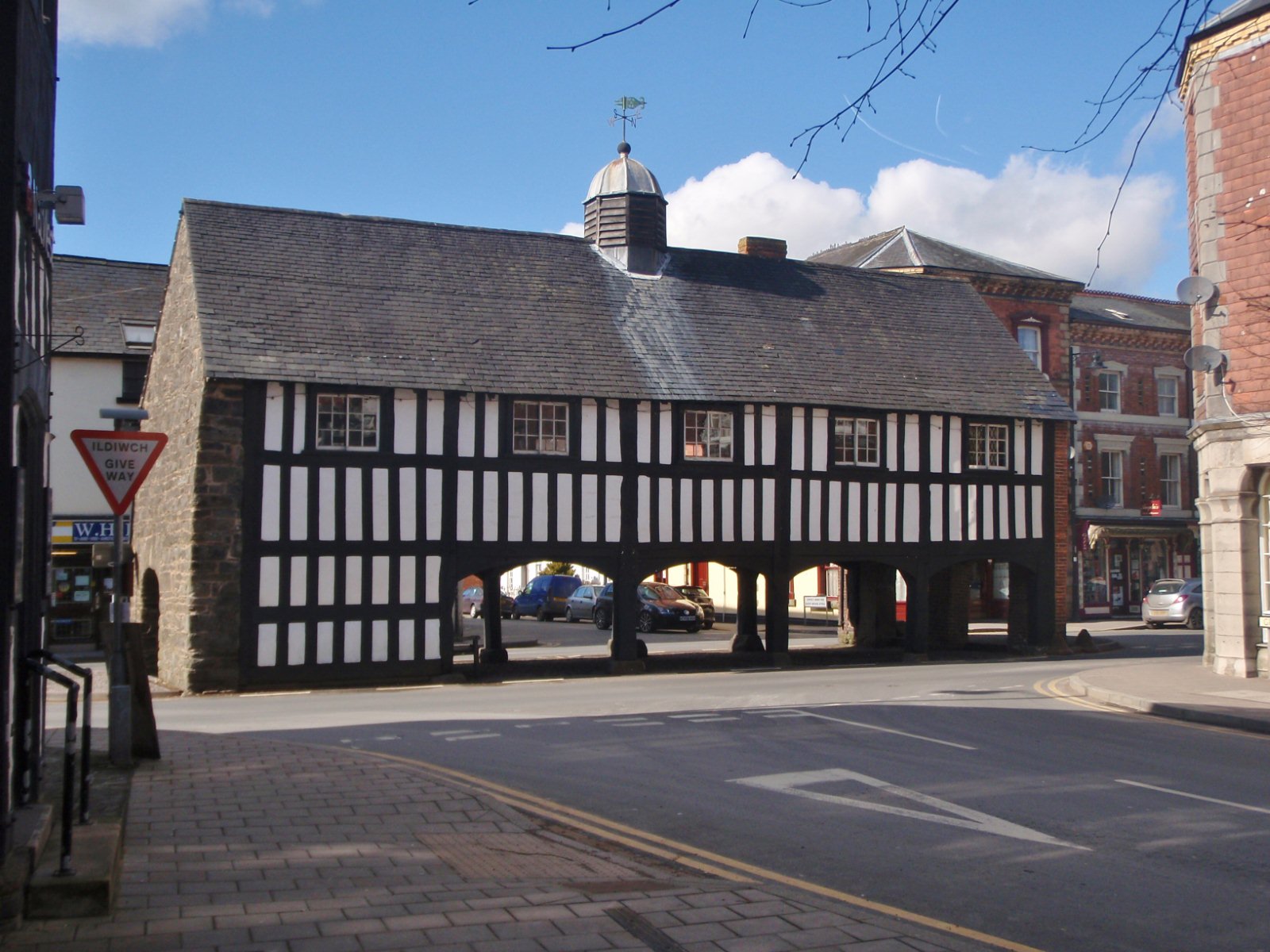
Old Market Hall, Llanidloes

The Old Market Hall is the oldest timber-framed market hall in Llanidloes, Wales, dating to the early 17th century. Until well into the 20th century a...

Llanidloes Town Hall

Llanidloes Town Hall (Welsh: Neuadd y Dref Llanidloes) is a municipal building in Great Oak Street, Llanidloes in Powys, Wales. The structure, which is...

Nearby Amenities

Located within 500m of 52.461816,-3.5468695
Bryn Dol-Llys
Place: locality
Lat/Long: 52.4593546/-3.5407906
Bryn-Llys
Ele: 301
Natural: peak
Lat/Long: 52.460296/-3.547421
Place: farm
Lat/Long: 52.464092/-3.5485288
Building: yes
Lat/Long: 52.4612158/-3.5512968
Direction: 145
Generator Method: photovoltaic
Generator Output Electricity: yes
Generator Solar Modules: 46
Generator Source: solar
Generator Type: solar_photovoltaic_panel
Location: roof
Power: generator
Lat/Long: 52.4611315/-3.5405756
The data included in this document is from www.openstreetmap.org. The data is made available under ODbL.

Have you been to Penrallt?

Leave your review of Penrallt below (or comments, questions and feedback).