Birchall

Settlement in Staffordshire Staffordshire Moorlands

England

Birchall

Farm buildings south-east of Leek, Staffordshire Seen from a passing train on the Churnet Valley Railway.
Farm buildings south-east of Leek, Staffordshire Credit: Roger D Kidd

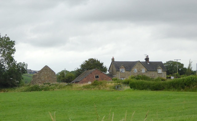
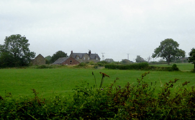
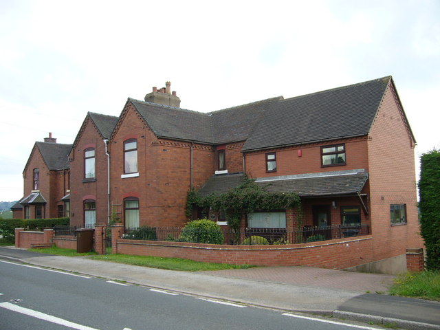
Birchall is a small village located in Staffordshire, England. It is situated in the district of Newcastle-under-Lyme, approximately 5 miles west of the town of Stoke-on-Trent. The village is nestled in a rural setting, surrounded by picturesque countryside and rolling hills.

Birchall has a rich history dating back several centuries. It was mentioned in the Domesday Book of 1086, indicating its existence even before the Norman Conquest. The village is known for its quaint charm and traditional architecture, with many of its buildings dating back to the 17th and 18th centuries.

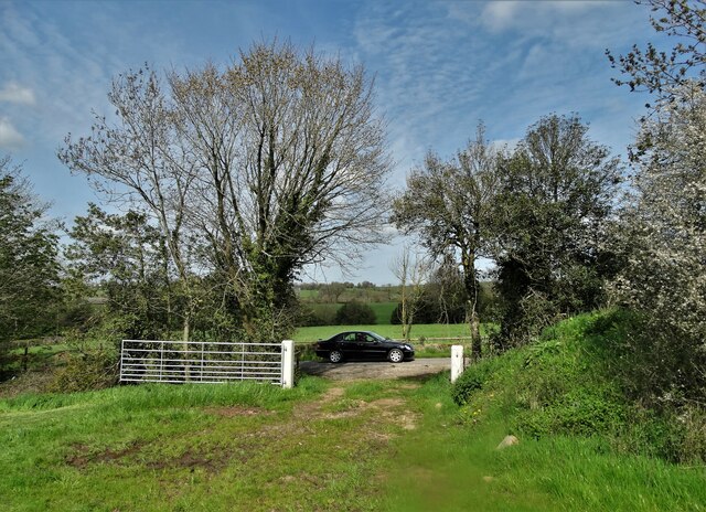
Despite its small size, Birchall boasts a close-knit community and a range of amenities. The village has a primary school, a church, and a local pub, serving as a social hub for residents. The surrounding countryside offers plenty of opportunities for outdoor activities such as hiking, cycling, and horse riding.

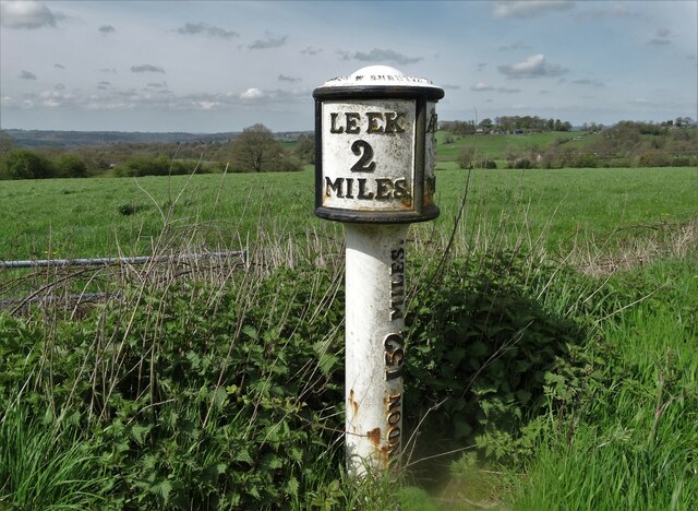
The village is well-connected to nearby towns and cities, with good road links to Stoke-on-Trent and Newcastle-under-Lyme. The M6 motorway is easily accessible, providing convenient access to other parts of the country.

In summary, Birchall is a charming and historic village in Staffordshire, England. With its idyllic rural setting, rich history, and strong sense of community, it offers a peaceful and picturesque lifestyle for its residents.

If you have any feedback on the listing, please let us know in the comments section below.
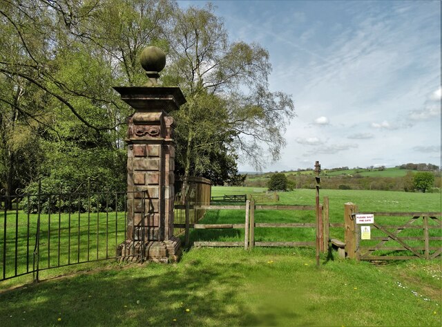
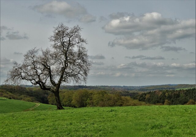
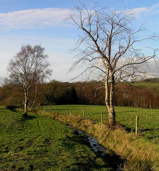
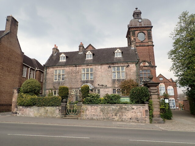
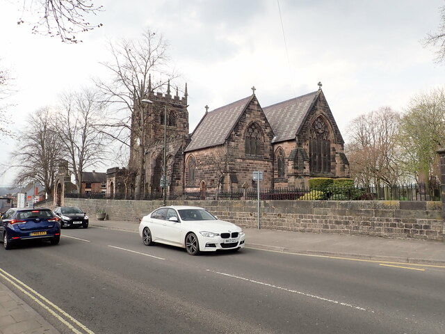
Birchall Images

Images are sourced within 2km of 53.089854/-2.01908 or Grid Reference SJ9854. Thanks to Geograph Open Source API. All images are credited.

Farm buildings south-east of Leek, Staffordshire Seen from a passing train on the Churnet Valley Railway.
Farm buildings south-east of Leek, Staffordshire
Seen from a passing train on the Churnet Valley Railway.
Farm buildings south-east of Leek, Staffordshire Buildings at Cliff Farm seen from a passing train on the Churnet Valley Railway.
Farm buildings south-east of Leek, Staffordshire
Buildings at Cliff Farm seen from a passing train on the Churnet Valley Railway.
Railway trackside south-east of Leek, Staffordshire A public footpath crosses the line here near Cliff Farm.

The preserved Churnet Valley Railway operates steam and diesel (sometimes both!) locomotives to haul trains between Kingsley and Froghall Station to Cheddleton, and sometimes beyond to Ipstones. <span class="nowrap"><a title="https://www.churnet-valley-railway.co.uk/" rel="nofollow ugc noopener" href="https://www.churnet-valley-railway.co.uk/">Link</a><img style="margin-left:2px;" alt="External link" title="External link - shift click to open in new window" src="https://s1.geograph.org.uk/img/external.png" width="10" height="10"/></span>
Railway trackside south-east of Leek, Staffordshire
A public footpath crosses the line here near Cliff Farm. The preserved Churnet Valley Railway operates steam and diesel (sometimes both!) locomotives to haul trains between Kingsley and Froghall Station to Cheddleton, and sometimes beyond to Ipstones. LinkExternal link
Farmland by the railway near Bradnop, Staffordshire Seen from a passing train approaching the footpath crossing near Cliff Farm.

The preserved Churnet Valley Railway operates steam and diesel (sometimes both!) locomotives to haul trains between Kingsley and Froghall Station to Cheddleton, and sometimes beyond to Ipstones. <span class="nowrap"><a title="https://www.churnet-valley-railway.co.uk/" rel="nofollow ugc noopener" href="https://www.churnet-valley-railway.co.uk/">Link</a><img style="margin-left:2px;" alt="External link" title="External link - shift click to open in new window" src="https://s1.geograph.org.uk/img/external.png" width="10" height="10"/></span>
Farmland by the railway near Bradnop, Staffordshire
Seen from a passing train approaching the footpath crossing near Cliff Farm. The preserved Churnet Valley Railway operates steam and diesel (sometimes both!) locomotives to haul trains between Kingsley and Froghall Station to Cheddleton, and sometimes beyond to Ipstones. LinkExternal link
Farm land south-east of Leek, Staffordshire Seen from a passing train, this telephoto assisted image shows Wildgoose Farm.
Farm land south-east of Leek, Staffordshire
Seen from a passing train, this telephoto assisted image shows Wildgoose Farm.
Pasture south-east of Leek, Staffordshire Looking at land by Wildgoose Farm on a very gloomy morning, seen from a passing Churnet Valley Railway train.
Pasture south-east of Leek, Staffordshire
Looking at land by Wildgoose Farm on a very gloomy morning, seen from a passing Churnet Valley Railway train.
Heritage milepost at Bradnop
By Ashenhurst Lane
By Ashenhurst Lane
At the entrance to Ashenhurst Hall Ashenhurst Hall was demolished in 1954
At the entrance to Ashenhurst Hall
Ashenhurst Hall was demolished in 1954
Countryside south of Ashenhurst
Stream running towards Ashenhurst
Railway Cottages Ashbourne Road, Bradnop. Back in 1905 there were no planning committees to say "you can't build in brick - the natural building material in this area is stone". So the North Staffordshire Railway <span class="nowrap"><a title="http://en.wikipedia.org/wiki/North_Staffordshire_Railway" rel="nofollow ugc noopener" href="http://en.wikipedia.org/wiki/North_Staffordshire_Railway">Link</a><img style="margin-left:2px;" alt="External link" title="External link - shift click to open in new window" src="https://s1.geograph.org.uk/img/external.png" width="10" height="10"/></span> erected the same pattern housing as everywhere else in their network. In this case it was for the staff of Bradnop Station nearby.
Railway Cottages
Ashbourne Road, Bradnop. Back in 1905 there were no planning committees to say "you can't build in brick - the natural building material in this area is stone". So the North Staffordshire Railway LinkExternal link erected the same pattern housing as everywhere else in their network. In this case it was for the staff of Bradnop Station nearby.
Brightly lit chevrons Lit by the rapidly westering sun.  They're on a bend in the A523 just to the east of Leek.
Brightly lit chevrons
Lit by the rapidly westering sun. They're on a bend in the A523 just to the east of Leek.
The A523 east of Leek
Ford below Cliff Farm
Farm crossing on the Cauldon Lowe Line In 2010, the Cauldon Lowe Branch Line was restored and reopened. This farm and footpath crossing was cleared and given new fencing, gates and signs.
Farm crossing on the Cauldon Lowe Line
In 2010, the Cauldon Lowe Branch Line was restored and reopened. This farm and footpath crossing was cleared and given new fencing, gates and signs.
Greystones House This attractive 17th century house in Leek is a grade II* listed building. The tower behind belongs to the Nicholson Institute, now Leek Public Library. The Institute was built in 1882
Greystones House
This attractive 17th century house in Leek is a grade II* listed building. The tower behind belongs to the Nicholson Institute, now Leek Public Library. The Institute was built in 1882
Parish Church of St Edward the Confessor The Parish Church is Leek's only medieval church, dedicated to Edward, King of England between 1042-1066. <span class="nowrap"><a title="https://www.search.staffspasttrack.org.uk/Details.aspx?&ResourceID=5362" rel="nofollow ugc noopener" href="https://www.search.staffspasttrack.org.uk/Details.aspx?&ResourceID=5362">Link</a><img style="margin-left:2px;" alt="External link" title="External link - shift click to open in new window" src="https://s1.geograph.org.uk/img/external.png" width="10" height="10"/></span>
Parish Church of St Edward the Confessor
The Parish Church is Leek's only medieval church, dedicated to Edward, King of England between 1042-1066. LinkExternal link
Show me another place!

Birchall is located at Grid Ref: SJ9854 (Lat: 53.089854, Lng: -2.01908)

Administrative County: Staffordshire

District: Staffordshire Moorlands

Police Authority: Staffordshire

What 3 Words

///widgets.dwarves.plankton. Near Leek, Staffordshire

Nearby Locations

Birchall

Related Wikis

Leek (Churnet Valley) railway station

Leek (Churnet Valley) railway station is the proposed and future terminus of the Churnet Valley Railway and is currently awaiting construction. It will...

Barnfields

Barnfields (also Barnfield) is an area in Leek, Staffordshire, England.

Leek Brook railway station

Leek Brook railway station is a passenger station in Staffordshire, Great Britain. == History == Leek Brook railway station was opened by the North Staffordshire...

All Saints' Church, Leek

All Saints' Church is an Anglican church in Leek, Staffordshire, England. It is a Grade I listed building. It was designed by Norman Shaw, and built in...

Nearby Amenities

Located within 500m of 53.089854,-2.01908
Post Box
Ref: ST13 641
Lat/Long: 53.0899572/-2.0187923
Post Box
Ref: ST13 747
Lat/Long: 53.088882/-2.0207532
Bus Stop
Sandybrook Lane
Bus: yes
Naptan AtcoCode: 3800C819601
Naptan Bearing: S
Naptan CommonName: Sandybrook Lane
Naptan Indicator: Adj
Naptan Landmark: Sandybrook Lane
Naptan Street: Cheddleton Road
Naptan Verified: no
Public Transport: platform
Source: naptan_import
Lat/Long: 53.0922177/-2.0214731
Bus Stop
Sandybrook Lane
Bus: yes
Naptan AtcoCode: 3800C819602
Naptan Bearing: N
Naptan CommonName: Sandybrook Lane
Naptan Indicator: Opp
Naptan Landmark: Sandybrook Lane
Naptan Street: Cheddleton Road
Naptan Verified: no
Public Transport: platform
Source: naptan_import
Lat/Long: 53.0924694/-2.0216674
Bus Stop
Birchall Lane
Bus: yes
Naptan AtcoCode: 3800C892201
Naptan Bearing: S
Naptan CommonName: Birchall Lane
Naptan Indicator: Adj
Naptan Landmark: Birchall Ln
Naptan Street: Cheddleton Rd
Naptan Verified: no
Public Transport: platform
Source: naptan_import
Lat/Long: 53.0886401/-2.0205158
Bus Stop
Birchall Lane
Bus: yes
Naptan AtcoCode: 3800C892202
Naptan Bearing: N
Naptan CommonName: Birchall Lane
Naptan Indicator: Opp
Naptan Landmark: Birchall Ln
Naptan Street: Cheddleton Rd
Naptan Verified: no
Public Transport: platform
Source: naptan_import
Lat/Long: 53.0889277/-2.0207697
Barrier: swing_gate
Bicycle: yes
Foot: yes
Swing Gate Type: double
Lat/Long: 53.0938347/-2.0220718
LIA 1855 LB
Historic: monument
Note: Boundary stone of the Leek Improvement Act of 1855
Lat/Long: 53.0938032/-2.0219392
Plague Stone
Historic: monument
Lat/Long: 53.0938897/-2.0219694
The data included in this document is from www.openstreetmap.org. The data is made available under ODbL.

Have you been to Birchall?

Leave your review of Birchall below (or comments, questions and feedback).