Pen-lon

Settlement in Anglesey

Wales

Pen-lon

Newborough sand dunes with denizens Semi-wild welsh ponies grazing on the dunes. We kept our carrots well hidden to avoid strenuous begging as they seemed keen to meet us.  :o)
Newborough sand dunes with denizens Credit: Peter Turner

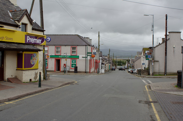
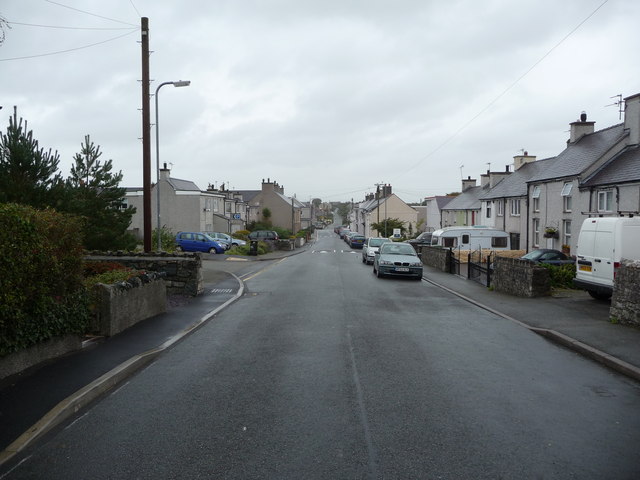
Pen-lon is a small village located on the Isle of Anglesey in North Wales, United Kingdom. Situated in a picturesque rural setting, it is nestled between the larger towns of Llanfairpwllgwyngyll and Menai Bridge. The village is known for its tranquil atmosphere and stunning natural beauty.

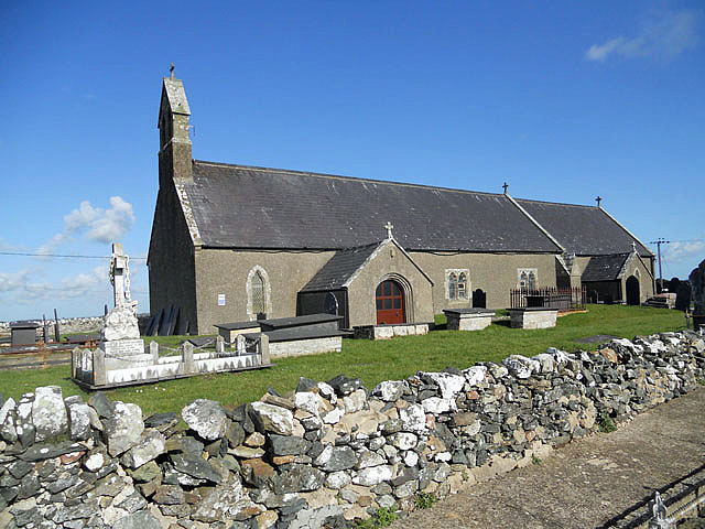
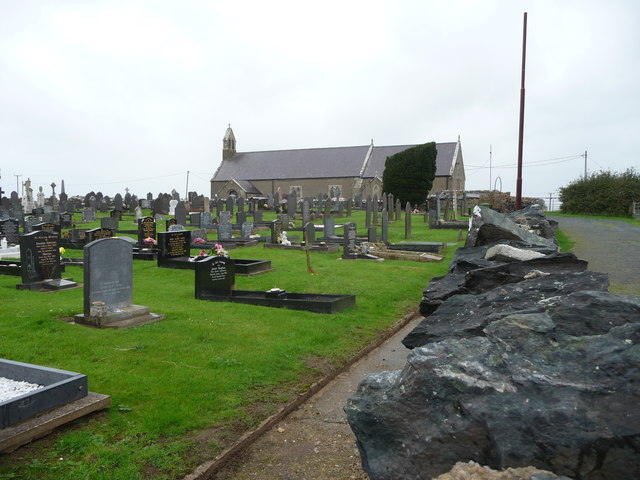
The primary feature of Pen-lon is its charming 19th-century church, St. Eilian's Church, which stands proudly at the heart of the village. This historic building boasts a striking stone exterior and a peaceful interior, making it a popular destination for visitors and locals alike. The churchyard is also a place of interest, as it contains several ancient gravestones, adding to the area's sense of history and heritage.

Although small in size, Pen-lon offers a range of amenities to its residents, including a community center and a village hall, which host various events throughout the year. The village is also home to a local pub, providing a social hub for locals and visitors to enjoy a drink and sample traditional Welsh cuisine.

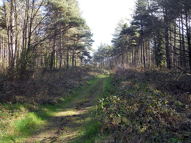
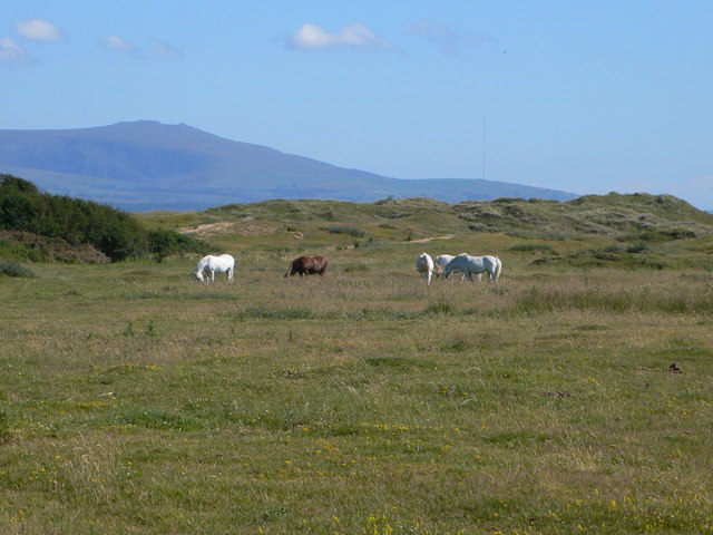
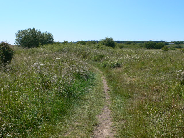
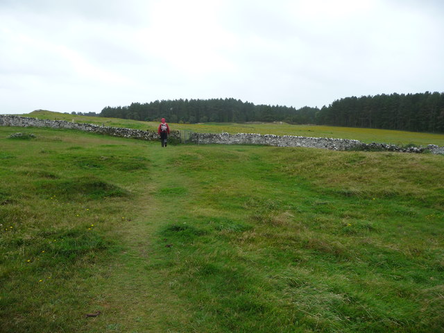
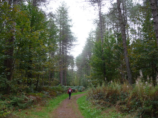
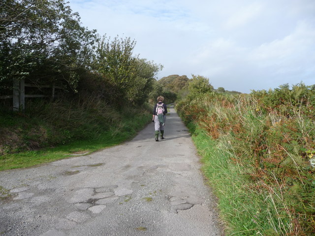
Surrounded by rolling green fields and scenic countryside, Pen-lon is the perfect place for outdoor enthusiasts. The village is in close proximity to several walking trails, offering breathtaking views of the surrounding landscape and opportunities for wildlife spotting.

Overall, Pen-lon provides a peaceful and idyllic setting for those seeking a rural retreat. Its historic church, community spirit, and natural beauty make it a charming destination for visitors to Anglesey.

If you have any feedback on the listing, please let us know in the comments section below.
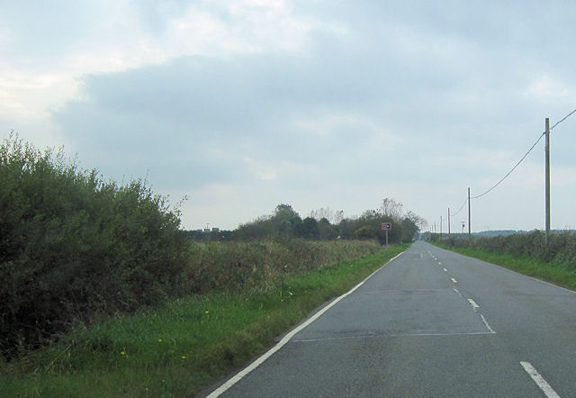
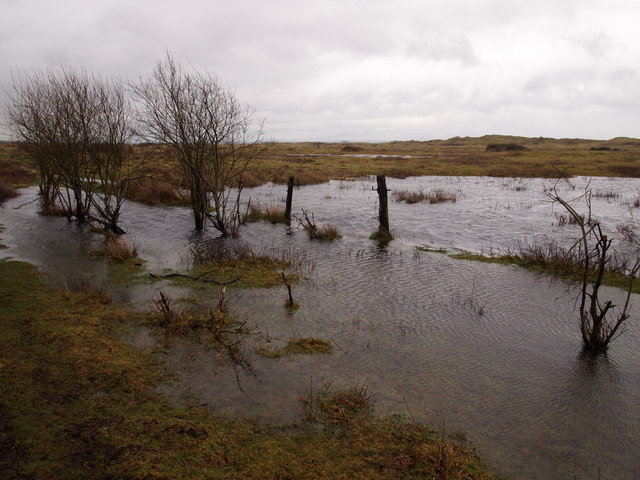
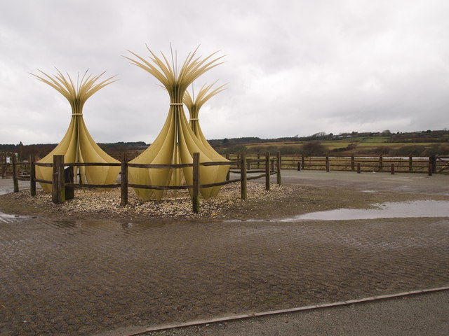
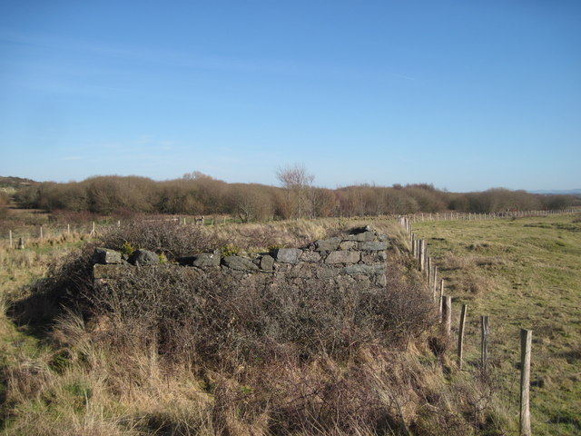
Pen-lon Images

Images are sourced within 2km of 53.158862/-4.3505104 or Grid Reference SH4264. Thanks to Geograph Open Source API. All images are credited.

Newborough sand dunes with denizens Semi-wild welsh ponies grazing on the dunes. We kept our carrots well hidden to avoid strenuous begging as they seemed keen to meet us.  :o)
Newborough sand dunes with denizens
Semi-wild welsh ponies grazing on the dunes. We kept our carrots well hidden to avoid strenuous begging as they seemed keen to meet us. :o)
The path gets narrower
St Peters Church
St Peters Church
Horses grazing on Newborough Warren The warren was created in the 13th century, but the death of rabbits due to myxomatosis in 1956 (and the absence of other large grazing animals) led to thick rank grassland and a decline in the species richness of the dunes. Horses were introduced  in 1986 to graze the dunes and this has reversed the decline and as a result the botanical species-richness of the grass has trebled. Snowdonia as a backdrop in the distance.
Horses grazing on Newborough Warren
The warren was created in the 13th century, but the death of rabbits due to myxomatosis in 1956 (and the absence of other large grazing animals) led to thick rank grassland and a decline in the species richness of the dunes. Horses were introduced in 1986 to graze the dunes and this has reversed the decline and as a result the botanical species-richness of the grass has trebled. Snowdonia as a backdrop in the distance.
The Path to Llanddwyn Beach through Newborough Warren
Shops, Newborough
Shops, Newborough
Part of Church Street, Newborough / Niwbwrch The village is sited in a pretty exposed spot near the south-western corner of Anglesey.
Part of Church Street, Newborough / Niwbwrch
The village is sited in a pretty exposed spot near the south-western corner of Anglesey.
Graveyard at Newborough / Niwbwrch A popular spot to lie relatives to rest. The church is beyond the adjacent wall.
Graveyard at Newborough / Niwbwrch
A popular spot to lie relatives to rest. The church is beyond the adjacent wall.
Footpath towards Newborough Forest The path crosses fields and pasture towards the large plantation.
Footpath towards Newborough Forest
The path crosses fields and pasture towards the large plantation.
Path in New borough Forest Much of the forestry plantation is given over to Corsican Pine but here along the sunlit path borders some broadleaved species have managed to grow.
Path in New borough Forest
Much of the forestry plantation is given over to Corsican Pine but here along the sunlit path borders some broadleaved species have managed to grow.
Lane to Newborough / Niwbwrch A lane rising towards Newborough and towards the site of Llys Rhosyr.
Lane to Newborough / Niwbwrch
A lane rising towards Newborough and towards the site of Llys Rhosyr.
The site of Llys Rhosyr, near Newborough Llys Rhosyr is an archaeological site of the ruins of a Welsh medieval commotal court. Archaeologists at Gwynedd Archaeological Trust consider it to have been a Welsh royal home, and have established an exhibition in the Pritchard-Jones Institute in the village on their findings. Excavations to date reveal that the enclosure had a large stone and thatch hall, associated accommodation and storage barns and very likely a farm close by.

A fierce sandstorm in the winter of 1332 buried the site and much of the surrounding area. Henry Rowlands mentions the site in his 18th century Mona Antiqua Restaurata. By the 20th century nothing was visible on the surface, though local people knew the precise location of the remains, which was always known as 'cae'r llys' ('the field of the court' in English).

From 1992,it was excavated by the Gwynedd Archaeological Trust, and was opened to the public for the first time in 1995. What remains here is the outline of the walls, only around a quarter of which are exposed, including the main surrounding wall and foundations and lower walls of three large buildings, possibly the hall, a chamber and storage barns. Many artifacts were recovered from the site, including pottery and silverware, indicating use by those of a high social status.
The site of Llys Rhosyr, near Newborough
Llys Rhosyr is an archaeological site of the ruins of a Welsh medieval commotal court. Archaeologists at Gwynedd Archaeological Trust consider it to have been a Welsh royal home, and have established an exhibition in the Pritchard-Jones Institute in the village on their findings. Excavations to date reveal that the enclosure had a large stone and thatch hall, associated accommodation and storage barns and very likely a farm close by. A fierce sandstorm in the winter of 1332 buried the site and much of the surrounding area. Henry Rowlands mentions the site in his 18th century Mona Antiqua Restaurata. By the 20th century nothing was visible on the surface, though local people knew the precise location of the remains, which was always known as 'cae'r llys' ('the field of the court' in English). From 1992,it was excavated by the Gwynedd Archaeological Trust, and was opened to the public for the first time in 1995. What remains here is the outline of the walls, only around a quarter of which are exposed, including the main surrounding wall and foundations and lower walls of three large buildings, possibly the hall, a chamber and storage barns. Many artifacts were recovered from the site, including pottery and silverware, indicating use by those of a high social status.
Houses on Dwyran by pass Close to Bryntirion looking west
Houses on Dwyran by pass
Close to Bryntirion looking west
A4080 Pen Lon straight Looking west approaching the Model village Turn off. Viewed from close to Clynnog
A4080 Pen Lon straight
Looking west approaching the Model village Turn off. Viewed from close to Clynnog
New house, Dwyran
New house, Dwyran
The Edge of Newborough Warren Old fence line on waterlogged ground.
The Edge of Newborough Warren
Old fence line on waterlogged ground.
Sculpture Depicting Marram Grass, Newborough Warren Llyn Rhos-ddu in the distance.
Sculpture Depicting Marram Grass, Newborough Warren
Llyn Rhos-ddu in the distance.
Old building at Clwt Gwlyb Clwt Gwlyb means 'damp spot' - an accurate description today.
Old building at Clwt Gwlyb
Clwt Gwlyb means 'damp spot' - an accurate description today.
Show me another place!

Pen-lon is located at Grid Ref: SH4264 (Lat: 53.158862, Lng: -4.3505104)

Unitary Authority: Isle of Anglesey

Police Authority: North Wales

What 3 Words

///supporter.endings.awestruck. Near Caernarfon, Gwynedd

Nearby Locations

Pen-lon Llyn Rhos-ddu

Related Wikis

Pen-Lôn

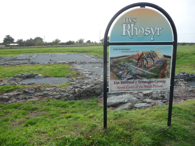
Pen-Lon is a village in the community of Rhosyr, Anglesey, Wales, located just south east of the larger village of Newborough. Attractions in the locality...

A4080 road

The A4080 is a British A road which is located on the Island of Anglesey, Wales. It follows a very roundabout route from the A5 road at Llanfairpwllgwyngyll...
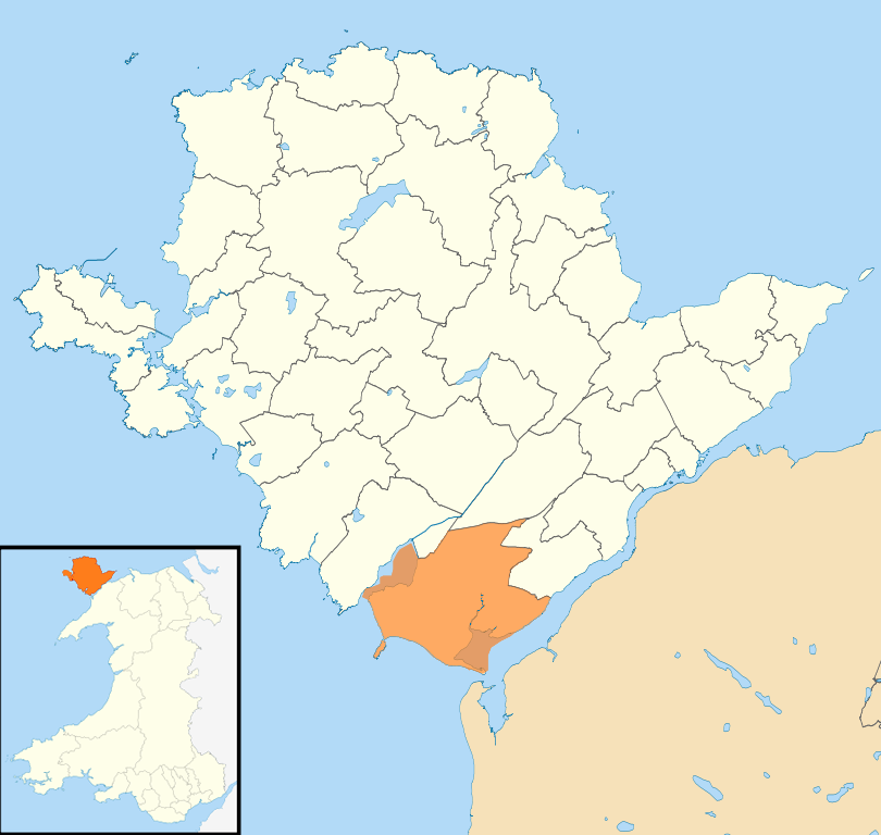
Rhosyr

Rhosyr is a community in the far southern corner of Anglesey, Wales. It includes the villages of Dwyran and Newborough, Llangeinwen and Llangaffo. The...

Newborough Warren

Newborough Warren (Welsh: Tywyn Niwbwrch) near the village of Newborough (Niwbwrch) in Anglesey, Wales, is a large dune and beach system of 2,269 hectares...

Nearby Amenities

Located within 500m of 53.158862,-4.3505104
Post Box
Collection Times: Mo-Fr 10:45; Sa 09:00
Operator: Royal Mail
Operator Wikidata: Q638098
Post Box Type: lamp
Ref: LL61 166
Royal Cypher: EIIR
Royal Cypher Wikidata: Q33102113
Lat/Long: 53.1588601/-4.3503614
Pen-Lôn
Place: village
Wikidata: Q16033773
Lat/Long: 53.1579018/-4.3504583
Power: pole
Lat/Long: 53.161915/-4.354684
Power: pole
Lat/Long: 53.1614728/-4.3555558
Material: wood
Power: pole
Lat/Long: 53.1623034/-4.3538827
Cafe
Whistle Stop Cafe
Addr City: Llanfairpwll
Addr Place: Parc
Addr Postcode: LL61 6RS
Alt Name: Anglesey Model Village
Breakfast: yes
Changing Table: yes
Changing Table Location: wheelchair_toilet
Diet Vegan: no
Diet Vegetarian: yes
Fhrs Id: 727333
Fhrs Local Authority Id: 5589
Internet Access: wlan
Internet Access Fee: no
Outdoor Seating: yes
Toilets: yes
Toilets Access: customers
Toilets Wheelchair: designated
Wheelchair: yes
Lat/Long: 53.1615102/-4.344511
Direction: SSE
Generator Method: photovoltaic
Generator Output Electricity: yes
Generator Solar Modules: 16
Generator Source: solar
Generator Type: solar_photovoltaic_panel
Location: roof
Power: generator
Lat/Long: 53.1573692/-4.3529989
Bus Stop
Bus: yes
Departures Board: timetable
Public Transport: platform
Shelter: no
Lat/Long: 53.1594819/-4.3494131
Bus Stop
Bus: yes
Public Transport: platform
Lat/Long: 53.1604843/-4.3473019
Bus Stop
Bench: no
Bin: no
Bus: yes
Departures Board: timetable
Public Transport: platform
Shelter: no
Lat/Long: 53.1595488/-4.3508519
Covered: no
Leisure: picnic_table
Lat/Long: 53.1566486/-4.3551946
Covered: no
Leisure: picnic_table
Lat/Long: 53.1566189/-4.3552349
Artwork Type: sculpture
Tourism: artwork
Lat/Long: 53.1566748/-4.3549097
Covered: no
Leisure: picnic_table
Lat/Long: 53.1564609/-4.3548158
Covered: no
Leisure: picnic_table
Lat/Long: 53.1564432/-4.3548869
Covered: no
Leisure: picnic_table
Lat/Long: 53.1564918/-4.3548929
Give Way
Direction: backward
Lat/Long: 53.1588656/-4.350466
Shower
Lat/Long: 53.1591679/-4.3489148
Shower
Lat/Long: 53.1590977/-4.3488106
Office: yes
Lat/Long: 53.1591322/-4.3484993
Shop: yes
Lat/Long: 53.1591219/-4.3485249
Leisure: outdoor_seating
Lat/Long: 53.1591862/-4.3486309
Leisure: outdoor_seating
Lat/Long: 53.159254/-4.3484993
Leisure: pitch
Sport: table_tennis
Lat/Long: 53.159061/-4.3485954
Waste Disposal
Lat/Long: 53.1590999/-4.3486722
The data included in this document is from www.openstreetmap.org. The data is made available under ODbL.

Have you been to Pen-lon?

Leave your review of Pen-lon below (or comments, questions and feedback).