Paulville

Settlement in West Lothian

Scotland

Paulville

An Overgrown Old Road, Bathgate This mysterious old road once went the short distance from Edinburgh Road to the other side of the railway line via a bridge, then petered out. The white house ahead sits on the far side of Edinburgh Road and the now demolished bridge is behind camera.
It appears on the first OS map of the 1850s, when both sides of the railway were farmland, so presumably it was there to allow the farmer(s) to move livestock across the railway. The current bridge buttresses look more modern though, which in itself isn't that unusual. However, since the road never really appears to have gone anywhere in particular, it seems a little odd that upgrades were made. In the 1890s the road is merely shown as a bridge, joining up with nothing on either side, and in the 1940s - its possible heyday - once South of the railway it turned into a track leading to sand pits.
An Overgrown Old Road, Bathgate Credit: Ian Dodds

Paulville is a small village located in the county of West Lothian, Scotland. Situated approximately 12 miles southeast of the county town of Livingston, Paulville is surrounded by picturesque countryside and offers a tranquil setting for its residents. The village is named after its founder, Paul Anderson, who established the community in the late 1980s.

With a population of around 500, Paulville has a close-knit community that prides itself on its friendly and welcoming atmosphere. The village is predominantly residential, with a mix of traditional stone-built houses and more modern properties. Several amenities can be found within the village, including a local convenience store, a primary school, and a community center which hosts various events and activities throughout the year.

Despite its rural location, Paulville benefits from good transport links. The nearby M8 motorway provides easy access to both Livingston and Edinburgh, making it an attractive location for commuters. Additionally, a regular bus service connects the village to surrounding towns and villages.

The village is surrounded by beautiful natural landscapes, including rolling hills and picturesque walking trails, making it a popular destination for outdoor enthusiasts. Nearby attractions include the stunning Almondell and Calderwood Country Park, which offers opportunities for walking, cycling, and wildlife spotting.

In summary, Paulville is a charming village in West Lothian, Scotland, known for its tight-knit community, picturesque surroundings, and convenient location.

If you have any feedback on the listing, please let us know in the comments section below.
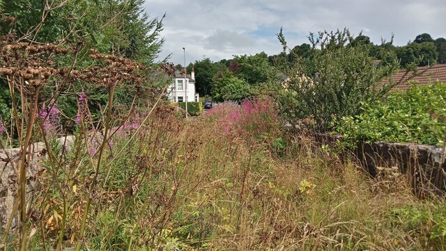
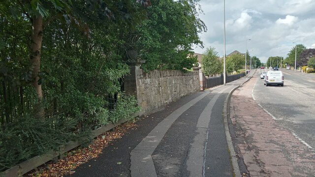
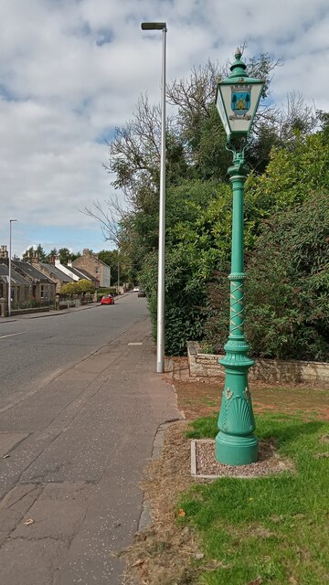
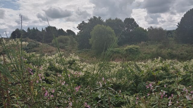
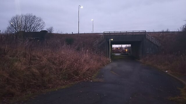
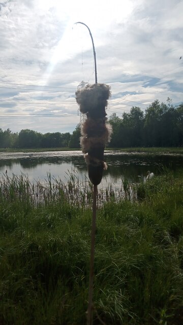
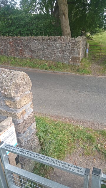
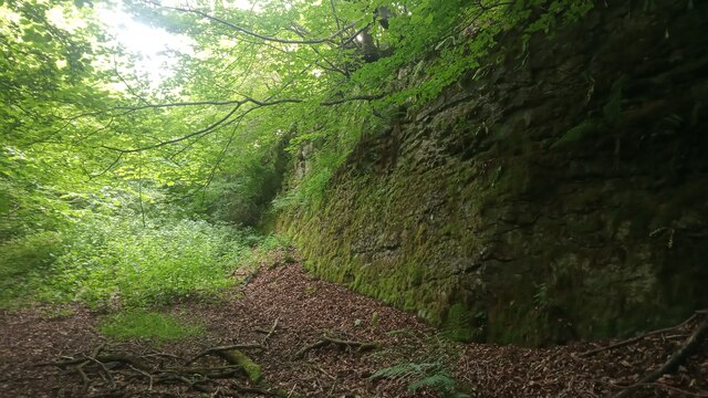
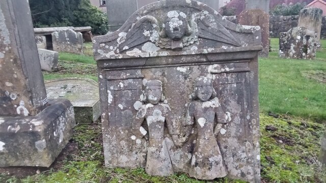
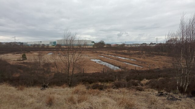
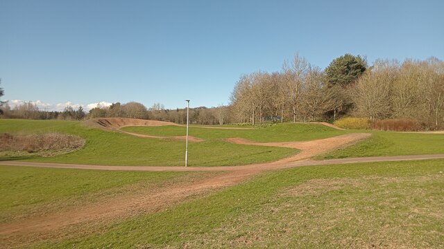
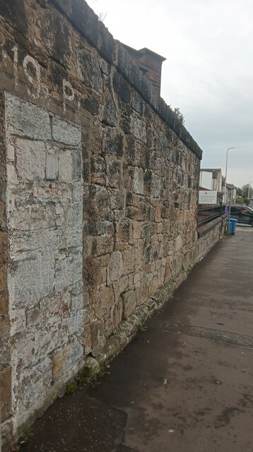
Paulville Images

Images are sourced within 2km of 55.897714/-3.6464196 or Grid Reference NS9768. Thanks to Geograph Open Source API. All images are credited.

An Overgrown Old Road, Bathgate This mysterious old road once went the short distance from Edinburgh Road to the other side of the railway line via a bridge, then petered out. The white house ahead sits on the far side of Edinburgh Road and the now demolished bridge is behind camera.
It appears on the first OS map of the 1850s, when both sides of the railway were farmland, so presumably it was there to allow the farmer(s) to move livestock across the railway. The current bridge buttresses look more modern though, which in itself isn't that unusual. However, since the road never really appears to have gone anywhere in particular, it seems a little odd that upgrades were made. In the 1890s the road is merely shown as a bridge, joining up with nothing on either side, and in the 1940s - its possible heyday - once South of the railway it turned into a track leading to sand pits.
An Overgrown Old Road, Bathgate
This mysterious old road once went the short distance from Edinburgh Road to the other side of the railway line via a bridge, then petered out. The white house ahead sits on the far side of Edinburgh Road and the now demolished bridge is behind camera. It appears on the first OS map of the 1850s, when both sides of the railway were farmland, so presumably it was there to allow the farmer(s) to move livestock across the railway. The current bridge buttresses look more modern though, which in itself isn't that unusual. However, since the road never really appears to have gone anywhere in particular, it seems a little odd that upgrades were made. In the 1890s the road is merely shown as a bridge, joining up with nothing on either side, and in the 1940s - its possible heyday - once South of the railway it turned into a track leading to sand pits.
Last in a Series Of Short Fancy Walls I didn't count them, but I reckon there are six or seven of these short walls on the Edinburgh Road in Bathgate leading towards the town centre from the Guildiehaugh (or Tesco as it is now more usually called) Roundabout. They all have an identical form, though probably vary in length a bit from section to section - the walls are just over five feet high and are always flanked by posts with ball finials which go a couple of feet higher.
Hopefully one day there will be a wall website to clear up these mysteries but at present, sadly, us wall-spotters have nowhere to go! Usually, walls like this mark the boundary of an old estate or something similar, but that seems highly unlikely in this case. The ground  behind the wall descends steeply to the railway line. I mention this because of the gaps between the wall sections - not one of the gaps, as is often the case, could possibly have been there to provide access to anywhere. Furthermore, even if the ground was flat, the gaps are so regular that even then there could never have been a need for so many points of access.
Each wall section is joined by a slightly concave stretch of metal railings. They could be there because the wall fell down, but then again, if that was the case, would it not have been cheaper just to replace the wall as opposed to erecting fancy posts at each end of the surviving walls?
Back then though, sometimes price wasn't a problem - life was tougher, but people expected things to look nicer, if it came from their taxes. In contrast the recent electrification of the railway lines has led to hundreds of ugly identikit concrete bridges everywhere round here, an architectural disaster in my book.
The wall is still a mystery though - before the railway came it was mainly farmland round here.
Last in a Series Of Short Fancy Walls
I didn't count them, but I reckon there are six or seven of these short walls on the Edinburgh Road in Bathgate leading towards the town centre from the Guildiehaugh (or Tesco as it is now more usually called) Roundabout. They all have an identical form, though probably vary in length a bit from section to section - the walls are just over five feet high and are always flanked by posts with ball finials which go a couple of feet higher. Hopefully one day there will be a wall website to clear up these mysteries but at present, sadly, us wall-spotters have nowhere to go! Usually, walls like this mark the boundary of an old estate or something similar, but that seems highly unlikely in this case. The ground behind the wall descends steeply to the railway line. I mention this because of the gaps between the wall sections - not one of the gaps, as is often the case, could possibly have been there to provide access to anywhere. Furthermore, even if the ground was flat, the gaps are so regular that even then there could never have been a need for so many points of access. Each wall section is joined by a slightly concave stretch of metal railings. They could be there because the wall fell down, but then again, if that was the case, would it not have been cheaper just to replace the wall as opposed to erecting fancy posts at each end of the surviving walls? Back then though, sometimes price wasn't a problem - life was tougher, but people expected things to look nicer, if it came from their taxes. In contrast the recent electrification of the railway lines has led to hundreds of ugly identikit concrete bridges everywhere round here, an architectural disaster in my book. The wall is still a mystery though - before the railway came it was mainly farmland round here.
Provost Lamp, Marjoribanks Street This old lamp has stood here for the last 30 years or so, save for a brief period a couple of years back when it was taken away to get tarted up a bit, and modified so it could once again be hooked up to the electricity. In days gone by it used to move about more regularly. The Provost of Bathgate used to have the honour of having the lamp positioned directly in front of his house, and it moved from place to place over time accordingly.
A provost is loosely the equivalent of a mayor in England, though the title seems to have become more ceremonial as time has gone on. Bathgate was a Burgh Council  - this meant it had a certain amount of autonomy in running its own affairs - until everything to do with local administration was shook up in Scotland in the mid 1970s. All its powers were then subsumed into West Lothian Council, which itself still has a provost, along with about two-thirds of Scotland's other local council areas.
The coat of arms adorning the lamp is fanciful in the extreme. There is no disputing that Bathgate once had a castle, but it is generally thought to have been uninhabited since the early 1300s, and a report of the late 1700s states that there wasn't a stone of it left at the time. Then, as now, it was a small unimpressive mound; it is currently located in the middle of Bathgate Golf Course.
The flag in between the two Saltires is supposedly that of a family who lived in the castle several hundreds of years ago. The water seems to arise from artistic license, as the moat was tiny, and there are - and were - only smallish ponds in the area, but these are quite a distance away. The uninspiring and meaningless Latin motto translates as : 'The common good between the walls'.
While it is perfectly fine in my book to retain the lamp in its original state, I would hope that, should there ever be a need for coats of arms here in the future, this lazy heraldry gets replaced. Quicksmart!
Provost Lamp, Marjoribanks Street
This old lamp has stood here for the last 30 years or so, save for a brief period a couple of years back when it was taken away to get tarted up a bit, and modified so it could once again be hooked up to the electricity. In days gone by it used to move about more regularly. The Provost of Bathgate used to have the honour of having the lamp positioned directly in front of his house, and it moved from place to place over time accordingly. A provost is loosely the equivalent of a mayor in England, though the title seems to have become more ceremonial as time has gone on. Bathgate was a Burgh Council - this meant it had a certain amount of autonomy in running its own affairs - until everything to do with local administration was shook up in Scotland in the mid 1970s. All its powers were then subsumed into West Lothian Council, which itself still has a provost, along with about two-thirds of Scotland's other local council areas. The coat of arms adorning the lamp is fanciful in the extreme. There is no disputing that Bathgate once had a castle, but it is generally thought to have been uninhabited since the early 1300s, and a report of the late 1700s states that there wasn't a stone of it left at the time. Then, as now, it was a small unimpressive mound; it is currently located in the middle of Bathgate Golf Course. The flag in between the two Saltires is supposedly that of a family who lived in the castle several hundreds of years ago. The water seems to arise from artistic license, as the moat was tiny, and there are - and were - only smallish ponds in the area, but these are quite a distance away. The uninspiring and meaningless Latin motto translates as : 'The common good between the walls'. While it is perfectly fine in my book to retain the lamp in its original state, I would hope that, should there ever be a need for coats of arms here in the future, this lazy heraldry gets replaced. Quicksmart!
Some Wild Land in Bathgate In between the vast new housing delevopment at Wester Inch and Bathgate Golf Course is quite a bit of wild and fairly scrubby land. A vast network of (mostly interlinking) tracks and paths - hugely confusing to everybody except the local dog-walkers - runs through most of it, particularly at the Western end.
Up-to-date maps, of all scales, wrongly show a track running through the length of the golf course. In reality these are often just short walkways between holes; to get from the far end of the course to the clubhouse a good few fairways have to be negotiated.
Local foragers should note that there were plenty of blackberries available to enjoy at this spot!
Some Wild Land in Bathgate
In between the vast new housing delevopment at Wester Inch and Bathgate Golf Course is quite a bit of wild and fairly scrubby land. A vast network of (mostly interlinking) tracks and paths - hugely confusing to everybody except the local dog-walkers - runs through most of it, particularly at the Western end. Up-to-date maps, of all scales, wrongly show a track running through the length of the golf course. In reality these are often just short walkways between holes; to get from the far end of the course to the clubhouse a good few fairways have to be negotiated. Local foragers should note that there were plenty of blackberries available to enjoy at this spot!
Bridge over Former Road This road once led to a huge truck and tractor manufacturing plant owned by British Leyland; it now leads to a footpath running alongside the houses at the South end of the Wester Inch area of Bathgate, which occupies the land the former factory was situated on. A railway line once ran under the bridge to the left, transporting coal from Riddochill Colliery to Bathgate's former second station, 'Bathgate Lower'.
There is an interesting (and easily-found online) report detailing the reasons behind the factory's demise, written just prior to its eventual closure in the mid 1980s, by none other than Alex Salmond, former First Minister of Scotland. It is obviously therefore very much of its time, and doesn't anticipate the extent of the subsequent decline in British manufacturing and, as would be expected from Mr Salmond, focuses on perceived regional injustices (which may or may not be the case), but reading it today you get the feeling that the writing was already on the wall. It is astounding these days to learn that in the mid 1960s, 40% of all vehicles on the road were produced by British Leyland (or whatever it happened to be calling itself at the time) and its subsidiaries.
The road under the bridge was actually just a slip road leading from and to the road above - now called the A7066 but previously the A8, which before the M8 motorway was built was the main road connecting Edinburgh and Glasgow.
Behind camera to the right is the old slip road, now covered in thick moss but still very obvious.
Bridge over Former Road
This road once led to a huge truck and tractor manufacturing plant owned by British Leyland; it now leads to a footpath running alongside the houses at the South end of the Wester Inch area of Bathgate, which occupies the land the former factory was situated on. A railway line once ran under the bridge to the left, transporting coal from Riddochill Colliery to Bathgate's former second station, 'Bathgate Lower'. There is an interesting (and easily-found online) report detailing the reasons behind the factory's demise, written just prior to its eventual closure in the mid 1980s, by none other than Alex Salmond, former First Minister of Scotland. It is obviously therefore very much of its time, and doesn't anticipate the extent of the subsequent decline in British manufacturing and, as would be expected from Mr Salmond, focuses on perceived regional injustices (which may or may not be the case), but reading it today you get the feeling that the writing was already on the wall. It is astounding these days to learn that in the mid 1960s, 40% of all vehicles on the road were produced by British Leyland (or whatever it happened to be calling itself at the time) and its subsidiaries. The road under the bridge was actually just a slip road leading from and to the road above - now called the A7066 but previously the A8, which before the M8 motorway was built was the main road connecting Edinburgh and Glasgow. Behind camera to the right is the old slip road, now covered in thick moss but still very obvious.
Bulrush and Swan on Half Loaf Pond The name of the pond is something of a curiosity, as it in no way resembles half a loaf of bread, which is obviously what first comes to mind. A good thing about there being a road running right past the pond is that the swan - unusually, there was no second swan milling about - is unfazed by anything, so just serenely does its own thing regardless of what you're up to.
I have often  seen the bulrush described as 'a sausage on a stick', which is a fair enough description, but to me they always look like burnt out sparklers. This one must be a survivor from last year as there are no leaves present and the stalk is brown and looks like bamboo. The fluffy stuff it is draped in has come from inside the sausage. Last year small flowers would have been growing out of the sausage - they eventually fall off and over time the sausage disintegrates and all the fluff, which apparently can contain as much as 20,000 seeds per plant, is exposed and blows away. There are videos on YouTube of (usually Scottish) men breaking the sausages apart and creating small fluffy mounds. They used to be used to stuff pillows and duvets back in the old days.
Bulrush and Swan on Half Loaf Pond
The name of the pond is something of a curiosity, as it in no way resembles half a loaf of bread, which is obviously what first comes to mind. A good thing about there being a road running right past the pond is that the swan - unusually, there was no second swan milling about - is unfazed by anything, so just serenely does its own thing regardless of what you're up to. I have often seen the bulrush described as 'a sausage on a stick', which is a fair enough description, but to me they always look like burnt out sparklers. This one must be a survivor from last year as there are no leaves present and the stalk is brown and looks like bamboo. The fluffy stuff it is draped in has come from inside the sausage. Last year small flowers would have been growing out of the sausage - they eventually fall off and over time the sausage disintegrates and all the fluff, which apparently can contain as much as 20,000 seeds per plant, is exposed and blows away. There are videos on YouTube of (usually Scottish) men breaking the sausages apart and creating small fluffy mounds. They used to be used to stuff pillows and duvets back in the old days.
Interesting and Worrying Writing on Gate This gate is one of two leading into the Petershill Wildlife Reserve just North of Bathgate. The writing on the top of the gate says:
AGGRESSIVE OLD MAN IN(?) BLUE BERGHAUS JACKET & BLONDE LABRADOR BITING PEOPLE AND CHASING WILDLIFE REPORTED TO POLICE 17/04/22 12PM
Apart from never having seen anything like this on a metal gate before, two things struck me - (1) The writer used all the space available but never looked like running out of gate, and  (2) To own an aggressive labrador you must surely be some kind of psychopath - luckily he was unarmed!
Interesting and Worrying Writing on Gate
This gate is one of two leading into the Petershill Wildlife Reserve just North of Bathgate. The writing on the top of the gate says: AGGRESSIVE OLD MAN IN(?) BLUE BERGHAUS JACKET & BLONDE LABRADOR BITING PEOPLE AND CHASING WILDLIFE REPORTED TO POLICE 17/04/22 12PM Apart from never having seen anything like this on a metal gate before, two things struck me - (1) The writer used all the space available but never looked like running out of gate, and (2) To own an aggressive labrador you must surely be some kind of psychopath - luckily he was unarmed!
The Hidden Part of Petershill Reserve Petershill Wildlife Reserve occupies most of the site of a former limestone quarry. The bit on the left of the very steep road leading North from Bathgate has two gates and is mostly situated where two former reservoirs had been created from the quarry ponds. The bit on the right of the road caught my attention because of the steep drops down from the stone wall that runs alongside the road, and the lack of any obvious water down below.
There is a stone wall surrounding this sunken area - broken in a few places, with the usual agricultural makeshift defences in place to avoid the rescuing of livestock.
I discovered upon my return that this bit was once part of the quarry too . The stone face pictured isn't actually a part of the perimeter wall as I, disoriented as usual, had initially thought, but is further South. Old maps, at the time of the reservoirs simply denote it as pond (with an area of 0.24 acres). Presumably this was drained at the same time the reservoirs were - in the 1980s. I am always intrigued as to how they manage to drain places that have turned into ponds and lakes, considering that the bodies of water  have formed due to the ground having been excavated to the bedrock. Anyway, all that remains of the pond today  is a big muddy puddle.
And this is actually a part of the Scottish Wildlife Trust managed reserve, they just don't tell anybody.
The Hidden Part of Petershill Reserve
Petershill Wildlife Reserve occupies most of the site of a former limestone quarry. The bit on the left of the very steep road leading North from Bathgate has two gates and is mostly situated where two former reservoirs had been created from the quarry ponds. The bit on the right of the road caught my attention because of the steep drops down from the stone wall that runs alongside the road, and the lack of any obvious water down below. There is a stone wall surrounding this sunken area - broken in a few places, with the usual agricultural makeshift defences in place to avoid the rescuing of livestock. I discovered upon my return that this bit was once part of the quarry too . The stone face pictured isn't actually a part of the perimeter wall as I, disoriented as usual, had initially thought, but is further South. Old maps, at the time of the reservoirs simply denote it as pond (with an area of 0.24 acres). Presumably this was drained at the same time the reservoirs were - in the 1980s. I am always intrigued as to how they manage to drain places that have turned into ponds and lakes, considering that the bodies of water have formed due to the ground having been excavated to the bedrock. Anyway, all that remains of the pond today is a big muddy puddle. And this is actually a part of the Scottish Wildlife Trust managed reserve, they just don't tell anybody.
Old Footsteps in the Snow Although these footsteps look recent it is certain that they are at least three, but perhaps four days old. Snow first fell in this part of Scotland at around 5am on the Saturday before the Wednesday this picture was taken. There were further small flurries throughout Saturday and Sunday and it has since grown increasingly colder, turning the snow into ice. I like to think that these footsteps were made by people starting and finishing their shifts at the nearby Morrisons supermarket during the first snowfall, but obviously have nothing to base this on!
This tarmacked path is part of the National Cycle Route 75, and this section links two supermarket car parks - Tesco and Morrisons - and must be about a mile and a half long. The bit pictured is marked as a track on a 1960s OS map; the section immediately South of here, behind camera, roughly follows the route of an old railway spur that used to transport coal from a colliery in Blackburn to a long-gone station, Bathgate Lower.
Old Footsteps in the Snow
Although these footsteps look recent it is certain that they are at least three, but perhaps four days old. Snow first fell in this part of Scotland at around 5am on the Saturday before the Wednesday this picture was taken. There were further small flurries throughout Saturday and Sunday and it has since grown increasingly colder, turning the snow into ice. I like to think that these footsteps were made by people starting and finishing their shifts at the nearby Morrisons supermarket during the first snowfall, but obviously have nothing to base this on! This tarmacked path is part of the National Cycle Route 75, and this section links two supermarket car parks - Tesco and Morrisons - and must be about a mile and a half long. The bit pictured is marked as a track on a 1960s OS map; the section immediately South of here, behind camera, roughly follows the route of an old railway spur that used to transport coal from a colliery in Blackburn to a long-gone station, Bathgate Lower.
Eye-catching grave, Old Bathgate Parish Churchyard This gravestone is pictured a few times online, but the only thing written about it anywhere is on the always-informative UndiscoveredScotland site. Underneath a picture of it, it says 'Adam and Eve Stone', and that's it. Had I not come across the description, though, I would have assumed it was commemorating the death of a child (who might possibly have been pictured holding the hand of a sibling/twin to indicate that they would both be reunited in heaven), or worse still, the death of two children at the same time. Although to our eyes today the figures look like two girls, in earlier times there wasn't often much difference between the depiction of males and females on gravestones.
If it is an Adam and Eve grave it is very crudely done as there is no tree or serpent present. Christianity's symbolism is often quite confusing; even the experts don't seem too sure if Adam and Eve are meant to represent the purity of heaven, tying in with the Garden of Eden's perfection before the forbidden fruit was eaten, or whether they are there to deliver a stern warning to people to stay on the path of righteousness.
The whole Adam and Eve story doesn't make that much sense really anyway. Why was it called 'The Tree of Good and Bad', and not just 'The Tree of Bad'? They must surely have eaten good things off good trees before that serpent came along with his tempting words?
Eye-catching grave, Old Bathgate Parish Churchyard
This gravestone is pictured a few times online, but the only thing written about it anywhere is on the always-informative UndiscoveredScotland site. Underneath a picture of it, it says 'Adam and Eve Stone', and that's it. Had I not come across the description, though, I would have assumed it was commemorating the death of a child (who might possibly have been pictured holding the hand of a sibling/twin to indicate that they would both be reunited in heaven), or worse still, the death of two children at the same time. Although to our eyes today the figures look like two girls, in earlier times there wasn't often much difference between the depiction of males and females on gravestones. If it is an Adam and Eve grave it is very crudely done as there is no tree or serpent present. Christianity's symbolism is often quite confusing; even the experts don't seem too sure if Adam and Eve are meant to represent the purity of heaven, tying in with the Garden of Eden's perfection before the forbidden fruit was eaten, or whether they are there to deliver a stern warning to people to stay on the path of righteousness. The whole Adam and Eve story doesn't make that much sense really anyway. Why was it called 'The Tree of Good and Bad', and not just 'The Tree of Bad'? They must surely have eaten good things off good trees before that serpent came along with his tempting words?
Grass, heather and ditches This was quite an odd spectacle to stumble across, looking a little like the remnants of some exotic irrigation farming system. Recent OS maps provide a big clue as until a few years ago there were trees in the field immediately ahead. Therefore as this is boggy land presumably the ridges and ditches were put in both fields  in order to keep trees above water.
The lines in the field further away are more complete, and present throughout; the ridges are covered in heather whilst the ditches, though still wet, have grass growing in them.
It is possible, if care is taken, to get across both fields without getting your feet wet.
Grass, heather and ditches
This was quite an odd spectacle to stumble across, looking a little like the remnants of some exotic irrigation farming system. Recent OS maps provide a big clue as until a few years ago there were trees in the field immediately ahead. Therefore as this is boggy land presumably the ridges and ditches were put in both fields in order to keep trees above water. The lines in the field further away are more complete, and present throughout; the ridges are covered in heather whilst the ditches, though still wet, have grass growing in them. It is possible, if care is taken, to get across both fields without getting your feet wet.
Short cycle track Depending on which large-scale online map you go to, this part of the oddly named 'Park of Peace' at the NorthWest edge of Bathgate (more research is required here, but I think the name has something to do with the fact that there are some war memorials within the park) is either broadly described as a play area, or specifically described as a 'cycle racing facility'.
It is obviously designed with fun in mind as, despite the bumps and berms, it is downhill all the way. However, the starting point and finishing point must only be 50 feet apart. So why not join them up, thereby facilitating (pun intended) proper races over several laps. As every true fan of cycling knows, it is the uphill struggles that are the most exciting. There is a vague grassy route between the two ends but it is obviously not designed to be ridden up.
I passed by on the first proper T-Shirt day of spring. Therefore all the targeted users were just drinking and socializing. Good on 'em - I have to admit I felt  twinge of jealousy!
Short cycle track
Depending on which large-scale online map you go to, this part of the oddly named 'Park of Peace' at the NorthWest edge of Bathgate (more research is required here, but I think the name has something to do with the fact that there are some war memorials within the park) is either broadly described as a play area, or specifically described as a 'cycle racing facility'. It is obviously designed with fun in mind as, despite the bumps and berms, it is downhill all the way. However, the starting point and finishing point must only be 50 feet apart. So why not join them up, thereby facilitating (pun intended) proper races over several laps. As every true fan of cycling knows, it is the uphill struggles that are the most exciting. There is a vague grassy route between the two ends but it is obviously not designed to be ridden up. I passed by on the first proper T-Shirt day of spring. Therefore all the targeted users were just drinking and socializing. Good on 'em - I have to admit I felt twinge of jealousy!
Doorway painted on a wall This is one of two. There is one behind camera exactly the same size which has '20 P' above it. They were painted in the 1990s to mark the former entrances to air raid shelters that were dug out of the banking behind the wall. There is a plaque nearby which says that it is all connected to 50th anniversary VE Day goings-on, and the writing above the imaginary lintels denotes how many people each air raid shelter could accommodate. The plaque also mentions that Challenge Anneka, a popular TV programme back then, filmed here at the time and that the challenge had something to do with relocating a war memorial. Whether the presenter, Anneka Rice, ever did a piece about the air raid shelters, or was filmed in front of them, is not mentioned.
Considering that Bathgate has (and also had during the war) a population of several thousand I should hope that there were a few more dotted about and that these two were highlighted due to their central location, on Bathgate's main road. Thankfully they were never really needed. The plaque states that only one bomb fell on Bathgate in World War Two and didn't explode. For those that know the area it fell on the West side of Whitburn Road, on the ground now occupied by the big surgery just up from Morrisons supermarket.
Doorway painted on a wall
This is one of two. There is one behind camera exactly the same size which has '20 P' above it. They were painted in the 1990s to mark the former entrances to air raid shelters that were dug out of the banking behind the wall. There is a plaque nearby which says that it is all connected to 50th anniversary VE Day goings-on, and the writing above the imaginary lintels denotes how many people each air raid shelter could accommodate. The plaque also mentions that Challenge Anneka, a popular TV programme back then, filmed here at the time and that the challenge had something to do with relocating a war memorial. Whether the presenter, Anneka Rice, ever did a piece about the air raid shelters, or was filmed in front of them, is not mentioned. Considering that Bathgate has (and also had during the war) a population of several thousand I should hope that there were a few more dotted about and that these two were highlighted due to their central location, on Bathgate's main road. Thankfully they were never really needed. The plaque states that only one bomb fell on Bathgate in World War Two and didn't explode. For those that know the area it fell on the West side of Whitburn Road, on the ground now occupied by the big surgery just up from Morrisons supermarket.
Yellow flowers There's a big cluster of these on the SouthEast side of the roundabout. I did my best to appear educated and come up with a Latin species name but can't. It may be some kind of Hawk's Beard, but if so the leaves don't match those on any online 'matches', in particular the angle of the veins from the central vein which is known as the 'midrib' - an unusually easy-to-remember word in botany.
Yellow flowers
There's a big cluster of these on the SouthEast side of the roundabout. I did my best to appear educated and come up with a Latin species name but can't. It may be some kind of Hawk's Beard, but if so the leaves don't match those on any online 'matches', in particular the angle of the veins from the central vein which is known as the 'midrib' - an unusually easy-to-remember word in botany.
New houses near Bathgate New residential development located on the A7066 between Bathgate and Armadale.
New houses near Bathgate
New residential development located on the A7066 between Bathgate and Armadale.
A North British 'Glen' 4-4-0 at Bathgate Locomotive Depot View  northward, just east of Bathgate Upper station, which was then on the ex-NB Edinburgh - Bathgate - Glasgow secondary line. Passenger services had ceased in 1956, so the Depot was then (1962) only servicing freight locomotives and had become mainly a dump for withdrawn engines: this D34, No. 62484 'Glen Lyon', had been condemned in 11/61, nearly a year before the photograph.
A North British 'Glen' 4-4-0 at Bathgate Locomotive Depot
View northward, just east of Bathgate Upper station, which was then on the ex-NB Edinburgh - Bathgate - Glasgow secondary line. Passenger services had ceased in 1956, so the Depot was then (1962) only servicing freight locomotives and had become mainly a dump for withdrawn engines: this D34, No. 62484 'Glen Lyon', had been condemned in 11/61, nearly a year before the photograph.
Condemned ex-NB 0-6-0 dumped with many other locomotives at Bathgate View NE, in a dump on the Edinburgh side of Bathgate (Upper) station on the ex-North British subsidiary Edinburgh - Glasgow line. This was one of about 25 withdrawn Scottish Region engines at that site awaiting disposal in September 1962; ex-NB Reid J35 0-6-0 No. 64479. Note the tender-cab, fitted for protection of the crew when running backwards in bad weather. (See also <a href="https://www.geograph.org.uk/photo/2328735">NS9768 : A North British 'Glen' 4-4-0 at Bathgate Locomotive Depot</a>).
Condemned ex-NB 0-6-0 dumped with many other locomotives at Bathgate
View NE, in a dump on the Edinburgh side of Bathgate (Upper) station on the ex-North British subsidiary Edinburgh - Glasgow line. This was one of about 25 withdrawn Scottish Region engines at that site awaiting disposal in September 1962; ex-NB Reid J35 0-6-0 No. 64479. Note the tender-cab, fitted for protection of the crew when running backwards in bad weather. (See also NS9768 : A North British 'Glen' 4-4-0 at Bathgate Locomotive Depot).
Shunting operations in the marshalling yard at Bathgate View NW, towards Bathgate (Upper), Airdrie and Glasgow; ex-North British Edinburgh - Bathgate - Glasgow line (closed to passengers 1956, reopened throughout in 2010). The locomotive shunting is ex-NB N15 0-6-2T No. 69156, with plenty of traffic in the Yard.
Shunting operations in the marshalling yard at Bathgate
View NW, towards Bathgate (Upper), Airdrie and Glasgow; ex-North British Edinburgh - Bathgate - Glasgow line (closed to passengers 1956, reopened throughout in 2010). The locomotive shunting is ex-NB N15 0-6-2T No. 69156, with plenty of traffic in the Yard.
Show me another place!

Paulville is located at Grid Ref: NS9768 (Lat: 55.897714, Lng: -3.6464196)

Unitary Authority: West Lothian

Police Authority: The Lothians and Scottish Borders

What 3 Words

///lyricist.translate.crossing. Near Bathgate, West Lothian

Nearby Locations

Paulville Bathgate

Related Wikis

Bathgate Upper railway station

Bathgate Upper railway station was a railway station serving the town of Bathgate in West Lothian, Scotland. It was located on the Bathgate and Coatbridge...

Bathgate railway station (1986)

Bathgate railway station was a railway station serving Bathgate in West Lothian, Scotland. It was located at the western end of the Edinburgh-Bathgate...

Reconnect Regal Theatre

Reconnect Regal Theatre is a performance art/movie theatre located in Bathgate, Scotland. == Reconnect == The Reconnect Regal is the first project of the...

Bathgate

Bathgate (Scots: Bathket or Bathkit, Scottish Gaelic: Both Chèit) is a town in West Lothian, Scotland, 5 miles (8 km) west of Livingston and adjacent to...

Nearby Amenities

Located within 500m of 55.897714,-3.6464196
Bathgate
Name Sco: Bathket
Place: town
Population: 23600
Population Date: mid-2020 estimate
Source Population: wikipedia
Wikidata: Q810794
Wikipedia: en:Bathgate
Lat/Long: 55.9009224/-3.6414828
Crossing
Button Operated: yes
Crossing: traffic_signals
Crossing Ref: pelican
Tactile Paving: yes
Lat/Long: 55.9020617/-3.6469412
Traffic Signals
Lat/Long: 55.9017983/-3.6446878
Traffic Calming: cushion
Lat/Long: 55.901734/-3.6479262
Place Of Worship
Sarajia Islamic Center
Addr City: Bathgate
Addr Housenumber: 5
Addr Street: Whitburn Road
Phone: +44 1506 635380
Postal Code: EH48 1HE
Religion: muslim
Lat/Long: 55.9006658/-3.6421959
Turning Circle
Lat/Long: 55.8950757/-3.6506534
Traffic Calming: table
Lat/Long: 55.8966819/-3.6533892
Traffic Calming: table
Lat/Long: 55.8980378/-3.6520233
Traffic Calming: table
Lat/Long: 55.8978549/-3.6542583
Traffic Calming: hump
Lat/Long: 55.897224/-3.6539172
Traffic Calming: table
Lat/Long: 55.8968959/-3.6518959
Barrier: bollard
Lat/Long: 55.9018916/-3.6460245
Note: https://www.youtube.com/watch?v=IXb00Poh3Q4 28:10
Lat/Long: 55.8965139/-3.6468026
Hooked on Cycling
Addr Housenumber: 17b
Addr Postcode: EH48 2AG
Addr Street: Glasgow Road
Shop: bicycle
Website: https://www.hookedoncycling.eu/
Lat/Long: 55.90129/-3.6503384
Traffic Signals
Traffic Signals: signal
Lat/Long: 55.9008531/-3.6418086
Toilets
Fee: yes
Female: yes
Male: yes
Opening Hours: 24/7
Wheelchair: yes
Lat/Long: 55.8993037/-3.6404631
Telephone
Booth: KX100
Covered: booth
Operator: BT
Operator Wikidata: Q593786
Lat/Long: 55.8993295/-3.6405007
Bicycle Parking
Bicycle Parking: stands
Capacity: 12
Covered: no
Lat/Long: 55.8993415/-3.6416165
Bicycle Parking
Bicycle Parking: stands
Capacity: 4
Covered: no
Source: survey
Lat/Long: 55.9014664/-3.650453
National Cycle Network Milepost
Flickr: https://www.flickr.com/photos/22985844@N07/51973559838/
Ncn Milepost: rowe
Sustrans Ref: MP90
Lat/Long: 55.8959331/-3.6467193
Post Box
Collection Times: Mo-Fr 09:00; Sa 07:00
Operator: Royal Mail
Post Box Type: pillar
Ref: EH48 17D
Royal Cypher: GR
Royal Cypher Wikidata: Q33102273
Lat/Long: 55.9016907/-3.6496234
Traffic Calming: hump
Lat/Long: 55.8982671/-3.6538391
Addr City: Bathgate
Addr Housenumber: 21-55
Addr Postcode: EH48 1TL
Addr Street: South Bridge Street
Entrance: yes
Wheelchair: yes
Lat/Long: 55.9015268/-3.6441444
Bus Stop
Naptan AtcoCode: 6290B031
Naptan Bearing: NW
Naptan CommonName: Old Railway Station
Naptan Indicator: at
Naptan Landmark: Old Railway Station Car Park
Naptan NaptanCode: 95623525
Naptan Street: King Street
Shelter: no
Lat/Long: 55.8996745/-3.6405501
Crossing
Button Operated: yes
Crossing: traffic_signals
Lat/Long: 55.8982922/-3.6450952
Bus Stop
Lat/Long: 55.8978253/-3.6445954
Entrance: yes
Lat/Long: 55.9006307/-3.6410638
Entrance: yes
Lat/Long: 55.9009075/-3.6411469
Entrance: yes
Lat/Long: 55.9002725/-3.6422583
Entrance: yes
Lat/Long: 55.8997669/-3.642232
Entrance: yes
Lat/Long: 55.8991975/-3.6412499
Entrance: yes
Lat/Long: 55.8993257/-3.6409898
Entrance: yes
Lat/Long: 55.8992701/-3.6431173
Entrance: yes
Lat/Long: 55.8992041/-3.6432047
Entrance: yes
Lat/Long: 55.897608/-3.6472742
Entrance: yes
Lat/Long: 55.8968556/-3.6446982
Entrance: yes
Lat/Long: 55.8969217/-3.6445139
Library
Bathgate Library
Lat/Long: 55.9015668/-3.6443901
Cafe
Lat/Long: 55.9013352/-3.6443915
Entrance: yes
Lat/Long: 55.9013684/-3.6433622
Crossing
Button Operated: yes
Crossing: traffic_signals
Crossing Ref: pelican
Lat/Long: 55.8997653/-3.6459877
Entrance: yes
Lat/Long: 55.9003571/-3.6426485
Recycling
Recycling Cans: yes
Recycling Clothes: yes
Recycling Glass: yes
Recycling Paper: no
Lat/Long: 55.9003872/-3.6444683
Crossing
Button Operated: yes
Crossing: traffic_signals
Crossing Ref: pelican
Tactile Paving: yes
Traffic Calming: hump
Lat/Long: 55.9014541/-3.6465562
Note: https://www.youtube.com/watch?v=IXb00Poh3Q4 28:10
Lat/Long: 55.8965007/-3.646745
Polkemmet Junction
Railway: junction
Lat/Long: 55.8970378/-3.6463986
Telephone
Booth: KX100
Covered: booth
Lat/Long: 55.9014266/-3.6434548
Bus Stop
Bench: yes
Check Date Shelter: 2022-12-28
Naptan AtcoCode: 6290B107
Naptan NaptanCode: 95623736
Shelter: yes
Lat/Long: 55.8971196/-3.6467924
Crossing
Crossing: traffic_signals
Crossing Island: yes
Tactile Paving: yes
Lat/Long: 55.9017441/-3.6443218
Crossing
Crossing: uncontrolled
Lat/Long: 55.8964642/-3.6458333
Atm
Lat/Long: 55.9010193/-3.6423099
Atm
Lat/Long: 55.9010129/-3.6411458
Atm
Lat/Long: 55.8969028/-3.6444031
Bus Stop
Bench: yes
Naptan AtcoCode: 6290B108
Naptan NaptanCode: 95623728
Shelter: yes
Lat/Long: 55.8951139/-3.649649
Bus Stop
Bench: yes
Naptan AtcoCode: 6290B109
Naptan NaptanCode: 95623729
Shelter: yes
Lat/Long: 55.8949004/-3.6502874
Bus Stop
Bench: yes
Check Date Shelter: 2022-12-28
Shelter: yes
Lat/Long: 55.8969186/-3.6470312
Bus Stop
Bench: no
Shelter: no
Lat/Long: 55.8993599/-3.645942
Bus Stop
Bench: no
Shelter: yes
Lat/Long: 55.900851/-3.6461652
Bus Stop
Shelter: yes
Lat/Long: 55.9008024/-3.6462889
Bus Stop
Menzies Road
Bench: no
Bus: yes
Naptan AtcoCode: 6290B024
Naptan Bearing: W
Naptan CommonName: Menzies Road
Naptan Indicator: after
Naptan NaptanCode: 95623626
Naptan Street: Glasgow Road
Public Transport: platform
Shelter: yes
Lat/Long: 55.9016754/-3.6474887
Bus Stop
Council Offices
Bench: yes
Bus: yes
Naptan AtcoCode: 6290B023
Naptan Bearing: W
Naptan CommonName: Council Offices
Naptan Indicator: at
Naptan NaptanCode: 95623739
Naptan Street: South Bridge Street
Public Transport: platform
Shelter: yes
Lat/Long: 55.9016119/-3.6440698
Bus Stop
Farmfoods
Bus: yes
Naptan AtcoCode: 6290B022
Naptan Bearing: W
Naptan CommonName: Farmfoods
Naptan Indicator: at
Naptan NaptanCode: 95623749
Naptan Street: South Bridge Street
Public Transport: platform
Shelter: yes
Lat/Long: 55.901354/-3.643231
Bus Stop
South Bridge Street at St David's House
Bus: yes
Naptan AtcoCode: 6290B021
Naptan NaptanCode: 95623695
Public Transport: platform
Shelter: yes
Lat/Long: 55.9013877/-3.6428351
Bus Stop
Union Road
Bench: yes
Naptan AtcoCode: 6290B020
Naptan Bearing: NW
Naptan CommonName: Union Road
Naptan Indicator: opp
Naptan Landmark: No.3
Naptan NaptanCode: 95623646
Naptan Street: King Street
Public Transport: platform
Shelter: yes
Tactile Paving: yes
Lat/Long: 55.9002944/-3.6410686
Bus Stop
Union Road
Bench: yes
Naptan AtcoCode: 6290B019
Naptan Bearing: SE
Naptan CommonName: Union Road
Naptan Indicator: after
Naptan Landmark: No.14 (most Westerly of 3 Shelters)
Naptan NaptanCode: 95623748
Naptan Street: King Street
Public Transport: platform
Shelter: yes
Tactile Paving: yes
Lat/Long: 55.9002816/-3.6408441
Pub
West Port Tavern
Addr City: Bathgate
Addr Housenumber: 15
Addr Postcode: EH48 1TR
Addr Street: South Bridge Street
Fhrs Id: 587642
Source Addr: FHRS Open Data
Lat/Long: 55.9017091/-3.6454362
Post Box
Collection Times: Mo-Fr 09:00; Sa 07:00
Operator: Royal Mail
Post Box Type: pillar
Ref: EH48 21D
Royal Cypher: scottish_crown
Lat/Long: 55.9005916/-3.6411794
Bus Stop
Millburn Road
Bench: yes
Naptan AtcoCode: 6290B025
Naptan Bearing: E
Naptan CommonName: Millburn Road
Naptan Indicator: after
Naptan NaptanCode: 95623624
Naptan Street: Glasgow Road
Public Transport: platform
Shelter: yes
Lat/Long: 55.901679/-3.6497211
Nightclub
Dreadnought Rock
Addr City: Bathgate
Addr Housenumber: 14-16
Addr Postcode: EH48 1AX
Addr Street: King Street
Fhrs Id: 588477
Source Addr: FHRS Open Data
Lat/Long: 55.9002402/-3.640627
Restaurant
Dragon Palace
Addr City: Bathgate
Addr Housenumber: 10-12
Addr Postcode: EH48 1AX
Addr Street: King Street
Cuisine: chinese
Fhrs Id: 1431672
Phone: +44 1506 632211
Source Addr: FHRS Open Data
Takeaway: yes
Lat/Long: 55.9003307/-3.640753
Bus Stop
Bench: yes
Check Date Shelter: 2022-12-28
Naptan AtcoCode: 6290B017
Naptan Bearing: SE
Naptan CommonName: Academy Street
Naptan Indicator: before
Naptan Landmark: 38-34 (most Easterly of 3 shelters)
Naptan NaptanCode: 95624239
Naptan Street: King Street
Shelter: yes
Tactile Paving: yes
Lat/Long: 55.8998836/-3.6402396
Crossing
Crossing: traffic_signals
Crossing Ref: pelican
Tactile Paving: yes
Traffic Calming: table
Lat/Long: 55.9001192/-3.6406956
Pretty Me
Shop: beauty
Lat/Long: 55.9004659/-3.6409638
HD ink Tattoo
Addr Housenumber: 2
Addr Postcode: EH48 1NS
Addr Street: Union Road
Shop: tattoo
Website: www.HDinkTattoos.co.uk
Lat/Long: 55.9005789/-3.6410345
Addr City: Bathgate
Addr Housenumber: 2
Addr Street: Union Road
Lat/Long: 55.900565/-3.6409254
Tatta
Shop: tattoo
Lat/Long: 55.9005943/-3.6407925
Hair by Jennifer
Shop: hairdresser
Lat/Long: 55.9005868/-3.6408568
Dream:u
Shop: beauty
Lat/Long: 55.9005064/-3.6408059
Addr City: Bathgate
Addr Housenumber: 7
Addr Postcode: EH48 1NS
Addr Street: Union Road
Lat/Long: 55.9006011/-3.6403962
PR @ Purple Orange
Addr City: Bathgate
Addr Housenumber: 7
Addr Postcode: EH48 1NS
Addr Street: Union Road
Shop: music
Lat/Long: 55.9006071/-3.6403231
Fast Food
Rubbals Takeway
Addr City: Bathgate
Addr Housenumber: 7a
Addr Postcode: EH48 1NS
Addr Street: Union Road
Air Conditioning: yes
Cuisine: pizza;burger;kebab
Delivery: yes
Diet Meat: yes
Drive Through: yes
Fhrs Id: 588432
Phone: +44 1506 633 667
Takeaway: yes
Website: rubbaltakeway.co.uk
Lat/Long: 55.9005703/-3.6404438
Fast Food
Subway
Addr City: Bathgate
Addr Housenumber: 39
Addr Postcode: EH48 1PG
Addr Street: George Street
Brand: Subway
Brand Wikidata: Q244457
Brand Wikipedia: en:Subway (restaurant)
Contact Website: https://restaurants.subway.com/united-kingdom/sc/bathgate/39-george-street
Cuisine: sandwich
Fhrs Id: 746016
Takeaway: yes
Lat/Long: 55.9012488/-3.6416182
Razor Sharp
Phone: +44 1506 657551
Shop: hairdresser
Lat/Long: 55.9011409/-3.6415793
Crossing
Crossing: uncontrolled
Lat/Long: 55.897166/-3.6445692
Parcel Locker
Amazon Hub Locker
Brand: Amazon Hub
Brand Wikidata: Q16974764
Operator: Amazon
Ref: carly
Lat/Long: 55.8968326/-3.644418
Traffic Calming: hump
Lat/Long: 55.8983751/-3.6530886
Addr City: Bathgate
Addr Housenumber: 55
Addr Street: King Street
Lat/Long: 55.8991031/-3.6392076
Addr City: Bathgate
Addr Housenumber: 53
Addr Street: King Street
Lat/Long: 55.8991337/-3.639278
Addr City: Bathgate
Addr Housenumber: 51
Addr Street: King Street
Lat/Long: 55.8991642/-3.6393484
Addr City: Bathgate
Addr Housenumber: 49
Addr Street: King Street
Lat/Long: 55.8991948/-3.6394188
Addr City: Bathgate
Addr Housenumber: 43
Addr Street: King Street
Lat/Long: 55.8992449/-3.6395189
Addr City: Bathgate
Addr Housenumber: 41
Addr Street: King Street
Lat/Long: 55.8992758/-3.6395905
Images
Shop: beauty
Lat/Long: 55.8993388/-3.6398435
Pharmacy
Lloyds Pharmacy
Brand: Lloyds Pharmacy
Brand Wikidata: Q6662870
Brand Wikipedia: en:LloydsPharmacy
Healthcare: pharmacy
Lat/Long: 55.8993825/-3.6404228
Fast Food
Khan's Tandoori
Addr City: Bathgate
Addr Housenumber: 29
Addr Postcode: EH48 1AZ
Addr Street: King Street
Cuisine: indian
Fhrs Id: 990306
Source Addr: FHRS Open Data
Takeaway: only
Lat/Long: 55.8994644/-3.6402491
Cafe
Cafe Cosy Corner
Addr City: Bathgate
Addr Housenumber: 31
Addr Postcode: EH48 1AZ
Addr Street: King Street
Fhrs Id: 1036684
Source Addr: FHRS Open Data
Takeaway: yes
Lat/Long: 55.8995069/-3.6401486
Drummond Miller
Addr Housenumber: 64
Addr Postcode: EH48 1TL
Addr Street: South Bridge Street
Office: estate_agent
Lat/Long: 55.901214/-3.6422373
Cafe
The Bus Stop
Lat/Long: 55.9014016/-3.6427342
Crossing
Button Operated: yes
Crossing: traffic_signals
Crossing Island: no
Tactile Paving: yes
Traffic Signals Sound: yes
Traffic Signals Vibration: yes
Lat/Long: 55.9018065/-3.6448927
Bicycle Parking
Bicycle Parking: stands
Capacity: 10
Covered: no
Lit: yes
Opening Hours: 24/7
Supervised: no
Lat/Long: 55.899408/-3.6405645
Newman Properties
Office: estate_agent
Lat/Long: 55.8999253/-3.6402056
Addr City: Bathgate
Addr Housenumber: 26-30
Addr Postcode: EH48 1AX
Addr Street: King Street
Lat/Long: 55.8999978/-3.6402708
Kingsgate Motor Company
Second Hand: only
Shop: car
Lat/Long: 55.8998073/-3.6409566
Restaurant
Heritage
Addr Housenumber: 14-16
Addr Postcode: EH48 4PS
Addr Street: North Bridge Street
Cuisine: indian
Phone: +44 1506 653012
Lat/Long: 55.9019423/-3.6451574
Addr City: Bathgate
Addr Housenumber: 69
Addr Postcode: EH48 1HE
Addr Street: Whitburn Road
Entrance: yes
Lat/Long: 55.898788/-3.6450129
Bus Stop
Bench: yes
Naptan AtcoCode: 6290B018
Naptan Bearing: SE
Naptan CommonName: Railway Station
Naptan Indicator: opp
Naptan Landmark: Railway Tavern (Middle of 3 shelters)
Naptan NaptanCode: 95623752
Naptan Street: King Street
Shelter: yes
Tactile Paving: yes
Lat/Long: 55.8999779/-3.640404
Bicycle Parking
Access: customers
Bicycle Parking: stands
Covered: yes
Lat/Long: 55.8969124/-3.6443335
U Little Beauty
Shop: beauty
Lat/Long: 55.8998663/-3.6432847
Fade Away
Shop: hairdresser
Lat/Long: 55.8997964/-3.64338
Entrance: yes
Lat/Long: 55.8997182/-3.645023
Fast Food
2 Good
Addr City: Bathgate
Addr Housenumber: 1
Addr Postcode: EH48 1HE
Addr Street: Whitburn Road
Cuisine: chinese
Fhrs Id: 1194162
Source Addr: FHRS Open Data
Takeaway: only
Lat/Long: 55.9007298/-3.6421072
Fast Food
Dhillon's
Addr City: Bathgate
Addr Housenumber: 3
Addr Postcode: EH48 1HE
Addr Street: Whitburn Road
Fhrs Id: 1209815
Source Addr: FHRS Open Data
Lat/Long: 55.9006847/-3.6421723
Leisureland
Leisure: amusement_arcade
Lat/Long: 55.9005986/-3.6422903
Costa Chiropractic
Shop: massage
Lat/Long: 55.9008355/-3.6419819
Money Station
Shop: pawnbroker
Lat/Long: 55.9010922/-3.6411993
Fast Food
baguette express
Cuisine: sandwich
Takeaway: yes
Lat/Long: 55.9011155/-3.6416721
Cafe
Dnisi
Lat/Long: 55.901076/-3.6418249
Bathgate Bargain Store
Addr Housenumber: 64C
Addr Street: South Bridge Street
Shop: hardware
Lat/Long: 55.901123/-3.6420496
The Personal Touch
Addr Housenumber: 64
Addr Street: South Bridge Street
Shop: clothes
Lat/Long: 55.9011839/-3.6421703
Dentist
South Bridge Street Dental Surgery
Lat/Long: 55.9012839/-3.6423896
Addr Housenumber: 62
Addr Street: South Bridge Street
Lat/Long: 55.9013417/-3.6425165
Entrance: yes
Lat/Long: 55.9008373/-3.6456853
Addr Housenumber: 10-12
Addr Street: North Bridge Street
Lat/Long: 55.9018991/-3.6454794
Addr Housenumber: 8a
Addr Street: North Bridge Street
Lat/Long: 55.9018986/-3.6455552
Addr Housenumber: 4
Addr Street: North Bridge Street
Lat/Long: 55.9018971/-3.6457302
Addr Housenumber: 6
Addr Street: North Bridge Street
Lat/Long: 55.901898/-3.6456417
Cafe
Bridge Cafe
Addr Housenumber: 6
Addr Postcode: EH48 4PS
Addr Street: North Bridge Street
Fhrs Id: 839376
Not Addr Postcode: EH48 2JA
Phone: +44 1506 650277
Source Addr Postcode: code-point_open
Lat/Long: 55.9019219/-3.6456397
Dentist
M-brace Orthodontics
Addr Housenumber: 4
Addr Postcode: EH48 4PS
Addr Street: North Bridge Street
Phone: +44 1506 653535
Website: https://www.m-braceorthodontics.com/
Lat/Long: 55.9019181/-3.6457785
Bathgate Barbers
Addr Housenumber: 8a
Addr Postcode: EH48 4PS
Addr Street: North Bridge Street
Phone: +44 1506 632115
Shop: hairdresser
Lat/Long: 55.9019185/-3.6455566
Brodies
Addr Housenumber: 10-12
Addr Postcode: EH48 4PS
Addr Street: North Bridge Street
Shop: funeral_directors
Lat/Long: 55.9019192/-3.6454761
Shop: convenience
Lat/Long: 55.9019185/-3.645281
Addr Housenumber: 20
Addr Street: North Bridge Street
Lat/Long: 55.9019688/-3.6448998
Jim Allan Motorcycles
Addr Housenumber: 20
Addr Postcode: EH48 4PS
Addr Street: North Bridge Street
Clothes: motorcycle
Contact Facebook: https://www.facebook.com/Jim.Allan.Motorcycles/
Repair: motorcycle;scooter
Second Hand: yes
Shop: motorcycle
Training: yes
Website: https://www.jim-allan.com/
Lat/Long: 55.9019888/-3.6449113
Addr Housenumber: 2
Addr Postcode: EH48 2AA
Addr Street: Glasgow Road
Lat/Long: 55.90188/-3.6463258
Krop & Co
Addr Housenumber: 2
Addr Postcode: EH48 2AA
Addr Street: Glasgow Road
Shop: hairdresser
Lat/Long: 55.9018982/-3.6463378
Crossing
Button Operated: yes
Crossing: traffic_signals
Crossing Ref: pelican
Tactile Paving: yes
Lat/Long: 55.9017501/-3.6471632
Bathgate Upper
Historic Railway: station
Railway: site
Wikidata: Q4869013
Wikipedia: en:Bathgate Upper railway station
Lat/Long: 55.8986087/-3.6410421
Bathgate West Junction
Historic Railway: junction
Railway: site
Lat/Long: 55.8983696/-3.6399986
Bathgate
Historic Railway: station
Railway: site
Wikidata: Q2541196
Wikipedia: en:Bathgate railway station (1986)
Lat/Long: 55.8994094/-3.6407128
Crossing
Crossing: traffic_signals
Crossing Island: no
Tactile Paving: yes
Lat/Long: 55.9007497/-3.6416538
Crossing
Crossing: traffic_signals
Crossing Island: no
Tactile Paving: yes
Lat/Long: 55.900756/-3.6419401
Crossing
Crossing: traffic_signals
Crossing Island: no
Tactile Paving: yes
Lat/Long: 55.9009314/-3.6419392
Cool Cuts
Shop: hairdresser
Lat/Long: 55.901773/-3.6491246
Car Parts Accessories
Shop: car_parts
Lat/Long: 55.9014223/-3.6505441
Shop: kitchen; bathroom
Lat/Long: 55.9013975/-3.6507446
Car Wash
Bathgate Hand Car Wash
Lat/Long: 55.9014817/-3.6497428
Fast Food
Gerry's
Takeaway: only
Lat/Long: 55.9014456/-3.6503443
Farmfoods
Addr City: Bathgate
Addr Housenumber: 6
Addr Postcode: EH48 1HH
Addr Street: Whitburn Road
Brand: Farmfoods
Brand Wikidata: Q5435841
Brand Wikipedia: en:Farmfoods
Fhrs Id: 1431666
Shop: frozen_food
Source Addr: FHRS Open Data
Website: https://www.farmfoods.co.uk/store-finder.php?branch_code=111
Lat/Long: 55.8990663/-3.6411402
WeaveDiva
Shop: beauty
Lat/Long: 55.9004193/-3.6408915
Fast Food
Fireaway
Cuisine: pizza
Takeaway: only
Lat/Long: 55.9003783/-3.6408272
Noexit: yes
Lat/Long: 55.9000643/-3.6416531
The data included in this document is from www.openstreetmap.org. The data is made available under ODbL.

Have you been to Paulville?

Leave your review of Paulville below (or comments, questions and feedback).