Park Street

Settlement in Sussex Horsham

England

Park Street

Downs Link, near Slinfold A view of the Downs Link path as it approaches Slinfold in West Sussex.  The path follows a dismantled railway line.  It also forms part of route 223 of the National Cycle Network.

Here, a public footpath crosses the Downs Link path.
Downs Link, near Slinfold Credit: Malc McDonald

Park Street is a charming village located in the county of Sussex, in the southeastern region of England. Situated just a few miles west of the bustling city of Brighton, Park Street offers a peaceful and idyllic setting for residents and visitors alike. This quaint village is nestled amidst the picturesque South Downs National Park, providing stunning views of rolling hills and lush green landscapes.

The heart of Park Street is its charming high street, lined with a variety of independent shops, cafes, and restaurants. Visitors can explore a range of boutiques offering unique clothing, accessories, and locally sourced products. The village is also known for its cozy pubs, where locals and tourists gather to enjoy traditional English fare and ales.

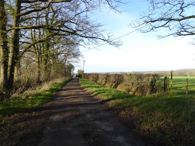
One of the highlights of Park Street is its proximity to beautiful outdoor spaces. The village is surrounded by numerous walking and cycling trails, allowing nature enthusiasts to immerse themselves in the stunning countryside. Nearby attractions include Devil's Dyke, a breathtaking valley with panoramic views, and Stanmer Park, a vast green expanse with woodlands, gardens, and a historic mansion.

Park Street is well-connected to the rest of Sussex, with excellent transportation links. The village is served by regular bus services, making it easy to explore the surrounding areas. Additionally, the nearby Hassocks train station provides direct access to Brighton, London, and other major cities.

With its picturesque surroundings, charming high street, and proximity to natural beauty spots, Park Street is a delightful destination that offers a perfect blend of tranquility and convenience.

If you have any feedback on the listing, please let us know in the comments section below.

Park Street Images

Images are sourced within 2km of 51.071382/-0.41477 or Grid Reference TQ1131. Thanks to Geograph Open Source API. All images are credited.

Downs Link, near Slinfold A view of the Downs Link path as it approaches Slinfold in West Sussex.  The path follows a dismantled railway line.  It also forms part of route 223 of the National Cycle Network.

Here, a public footpath crosses the Downs Link path.
Downs Link, near Slinfold
A view of the Downs Link path as it approaches Slinfold in West Sussex. The path follows a dismantled railway line. It also forms part of route 223 of the National Cycle Network. Here, a public footpath crosses the Downs Link path.
Pensfold Lane looking west past Morelands The property Morelands is hidden by trees in the picture.
Pensfold Lane looking west past Morelands
The property Morelands is hidden by trees in the picture.
Gateway and buildings at Pensfold Farm
Dwellings at Pensfold Farm See also <a title="https://www.geograph.org.uk/photo/1984971" href="https://www.geograph.org.uk/photo/1984971">Link</a> from 2010.
Dwellings at Pensfold Farm
See also Link from 2010.
The drive at Park Farm
Path turns away from golf course to enter wood
Footbridge in Tittlesfold Copse (1)
Footbridge in Tittlesfold Copse (2) An almost identical picture from 2011 is at <a title="https://www.geograph.org.uk/photo/2425817" href="https://www.geograph.org.uk/photo/2425817">Link</a>.
Footbridge in Tittlesfold Copse (2)
An almost identical picture from 2011 is at Link.
Footpath leaves wood to follow field edge
Footpath reaches stile and woodland south of Tittlesfold Farm
Footbridge in Tittlesfold Copse The footbridge carrying the public footpath across a small stream in Tittlesfold Copse taken in Bluebell season.
Footbridge in Tittlesfold Copse
The footbridge carrying the public footpath across a small stream in Tittlesfold Copse taken in Bluebell season.
Barns at Gemsbrook
Barns at Gemsbrook
Footpath and bridleway junction near Gemsbrook
Footbridge on Footpath 1368 The footpath runs up to the open area to the top right of the image and along the side of one of the fairways of the Slinfold Park Golf and Country Club before dog-legging into the lane leading to Park Farm.
Footbridge on Footpath 1368
The footpath runs up to the open area to the top right of the image and along the side of one of the fairways of the Slinfold Park Golf and Country Club before dog-legging into the lane leading to Park Farm.
Offset footpath junction on the Downs Link The right hand path leads to Warhams and the left to Violets Farm
Offset footpath junction on the Downs Link
The right hand path leads to Warhams and the left to Violets Farm
Stile at transition from light to shade
Surface spring or sinkhole? This natural looking hole has appeared, I think, as a result of an underground spring coming to the surface due to a blockage, then returning underground again. A similar occurrence happened at my father's house twice over a period of 40 years after heavy rain.
Surface spring or sinkhole?
This natural looking hole has appeared, I think, as a result of an underground spring coming to the surface due to a blockage, then returning underground again. A similar occurrence happened at my father's house twice over a period of 40 years after heavy rain.
Footbridge over small stream near Downs Link path The Downs Link path is on the embankment in the background
Footbridge over small stream near Downs Link path
The Downs Link path is on the embankment in the background
Show me another place!

Park Street is located at Grid Ref: TQ1131 (Lat: 51.071382, Lng: -0.41477)

Administrative County: West Sussex

District: Horsham

Police Authority: Sussex

What 3 Words

///dimension.pass.managers. Near Slinfold, West Sussex

Related Wikis

Slinfold railway station

Slinfold railway station was on the Cranleigh Line and served the village of Slinfold in West Sussex. == History == The line had a single track and opened...

Slinfold

Slinfold is a village and civil parish in the Horsham District of West Sussex, England. == Geography == The village is almost 4 miles (6.4 km) west of...

Slinfold Stream and Quarry

Slinfold Stream and Quarry is a 2.3-hectare (5.7-acre) geological Site of Special Scientific Interest west of Horsham in West Sussex. It is a Geological...

Rudgwick railway station

Rudgwick railway station was on the Cranleigh Line. It served the village of Rudgwick in West Sussex until June, 1965. == History == Rudgwick station opened...

Rudgwick

Rudgwick is a village and civil parish in the Horsham District of West Sussex, England. The village is 6 miles (10 km) west from Horsham on the north...

Five Oaks

Five Oaks is a large hamlet in the Horsham District of West Sussex, England. It lies about 1.7 miles (2.8 km) north of Billingshurst on the Roman road...

Itchingfield

Itchingfield is a small village and civil parish in the Horsham district of West Sussex, England. It lies on the Barns Green to Broadbridge Heath road...

Holy Trinity Church, Rudgwick

Holy Trinity Church is the Anglican parish church of Rudgwick, a village in the Horsham district of West Sussex, England. The oldest part of the church...

Nearby Amenities

Located within 500m of 51.071382,-0.41477
Bus Stop
Stane Street
Bus: yes
Naptan AtcoCode: 4400HR0024
Naptan Bearing: E
Naptan CommonName: Stane Street
Naptan Indicator: o/s 21
Naptan Landmark: Stane Street
Naptan NaptanCode: wsxatgat
Naptan Street: Park Street
Naptan Verified: no
Public Transport: platform
Source: naptan_import
Lat/Long: 51.0721279/-0.4144136
Bus Stop
Stane Street
Bus: yes
Naptan AtcoCode: 4400HR0025
Naptan Bearing: W
Naptan BusStopType: CUS
Naptan CommonName: Stane Street
Naptan Indicator: o/s Bakers End
Naptan Landmark: Stane Street
Naptan NaptanCode: wsxatgaw
Naptan Street: Park Street
Naptan Verified: no
Public Transport: platform
Source: naptan_import
Lat/Long: 51.0720141/-0.4143886
Bus Stop
A29
Bus: yes
Naptan AtcoCode: 4400HR0689
Naptan Bearing: NE
Naptan BusStopType: CUS
Naptan CommonName: A29
Naptan Indicator: HAR
Naptan Landmark: Hail & Ride
Naptan NaptanCode: wsxdwatg
Naptan Street: A29
Naptan Verified: no
Public Transport: platform
Source: naptan_import
Lat/Long: 51.0680448/-0.4185003
Bus Stop
A29
Bus: yes
Naptan AtcoCode: 4400HR0690
Naptan Bearing: SW
Naptan BusStopType: CUS
Naptan CommonName: A29
Naptan Indicator: HAR
Naptan Landmark: Hail & Ride
Naptan NaptanCode: wsxdwatj
Naptan Street: A29
Naptan Verified: no
Public Transport: platform
Source: naptan_import
Lat/Long: 51.0679874/-0.4182453
Bus Stop
A29 Stane Street
Bus: yes
Naptan AtcoCode: 4400HR1083
Naptan Bearing: NE
Naptan BusStopType: CUS
Naptan CommonName: A29 Stane Street
Naptan Indicator: HAR
Naptan Landmark: Hail & Ride
Naptan NaptanCode: wsxgdjgt
Naptan Street: A29 Stane Street
Naptan Verified: no
Public Transport: platform
Source: naptan_import
Lat/Long: 51.0720602/-0.4155085
Bus Stop
A29 Stane Street
Bus: yes
Naptan AtcoCode: 4400HR1084
Naptan Bearing: SW
Naptan BusStopType: CUS
Naptan CommonName: A29 Stane Street
Naptan Indicator: HAR
Naptan Landmark: Hail & Ride
Naptan NaptanCode: wsxgdjgw
Naptan Street: A29 Stane Street
Naptan Verified: no
Public Transport: platform
Source: naptan_import
Lat/Long: 51.0720571/-0.4152802
Man Made: mast
Lat/Long: 51.0677331/-0.4145007
Fountain
Lat/Long: 51.0682244/-0.4172165
Bridge Farm
Place: farm
Lat/Long: 51.0710727/-0.4171947
Slinfold
Historic Railway: station
Railway: site
Wikidata: Q7540664
Wikipedia: en:Slinfold railway station
Lat/Long: 51.0676423/-0.4127937
Priority: backward
Traffic Calming: choker
Lat/Long: 51.0720733/-0.4082454
Post Box
Collection Times: Mo-Fr 09:00; Sa 07:00
Operator: Royal Mail
Post Box Mounting: wall
Post Box Type: wall
Ref: RH13 47D
Royal Cypher: VR
Lat/Long: 51.0712875/-0.4104174
The data included in this document is from www.openstreetmap.org. The data is made available under ODbL.

Have you been to Park Street?

Leave your review of Park Street below (or comments, questions and feedback).