Papplewick

Settlement in Nottinghamshire Gedling

England

Papplewick

The outflow from Papplewick Dam Built to feed water to power a number of cotton mills along this section of the Leen valley.
The outflow from Papplewick Dam Credit: David Lally

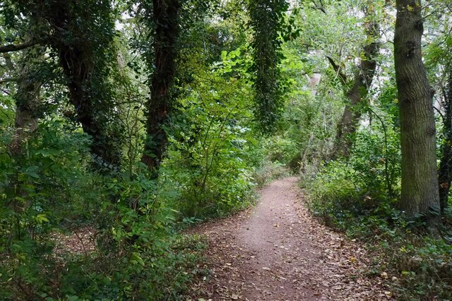
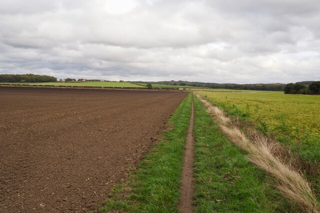
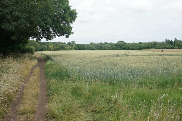
Papplewick is a small village located in the county of Nottinghamshire, England. Situated approximately eight miles north of Nottingham city centre, it lies within the district of Gedling. The village is surrounded by picturesque countryside and is known for its tranquil and rural atmosphere.

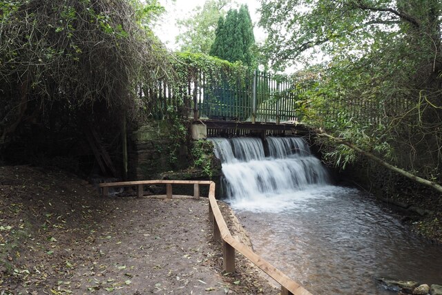
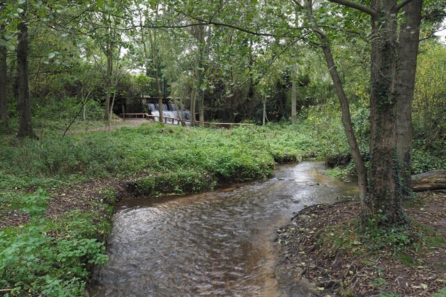
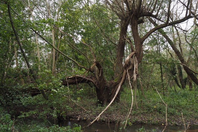
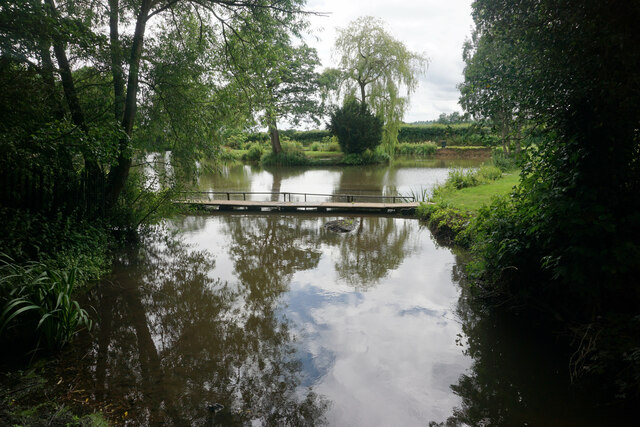
Papplewick has a rich history dating back to Roman times, with evidence of early settlements and artifacts discovered in the area. The village is named after the Papplewick Brook, which runs through it, providing a scenic backdrop. The brook is also home to a variety of wildlife, making it a popular spot for nature enthusiasts.

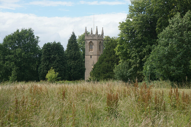
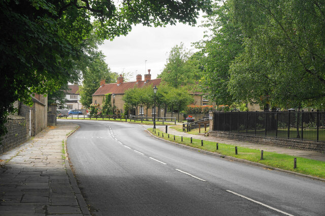
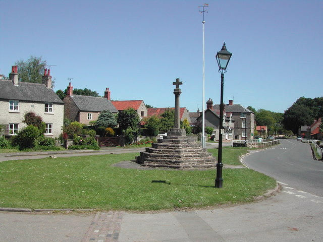
The village itself is characterized by its charming cottages and traditional architecture. The heart of Papplewick is centered around the village green, where the local cricket club plays during the summer months. The village also boasts a historic church, St. James' Church, which dates back to the 12th century and features beautiful stained glass windows.

Papplewick is a close-knit community with a strong sense of pride in its heritage. The village hosts various events throughout the year, including a summer fete and a Christmas market, which bring residents together and attract visitors from neighboring towns.

Despite its small size, Papplewick offers amenities such as a village hall, a primary school, and a local pub, ensuring that residents have access to essential services. The village is well-connected to nearby towns and cities through road links, making it an attractive place to live for those seeking a peaceful rural lifestyle within easy reach of urban areas.

If you have any feedback on the listing, please let us know in the comments section below.
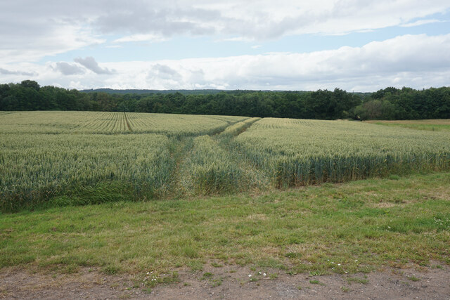
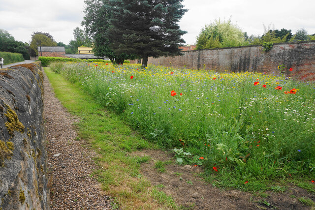
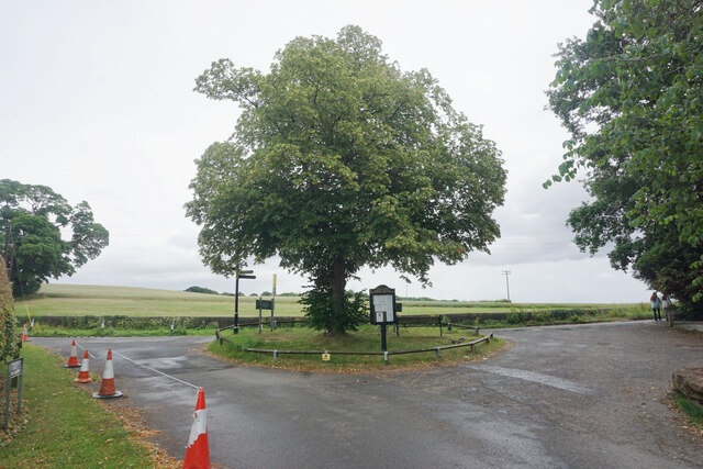
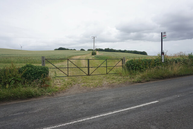
Papplewick Images

Images are sourced within 2km of 53.054194/-1.1829 or Grid Reference SK5451. Thanks to Geograph Open Source API. All images are credited.

The outflow from Papplewick Dam Built to feed water to power a number of cotton mills along this section of the Leen valley.
The outflow from Papplewick Dam
Built to feed water to power a number of cotton mills along this section of the Leen valley.
The River Leen With the outflow from Papplewick dam just upstream
The River Leen
With the outflow from Papplewick dam just upstream
Information board for Moor Pond Woods
A well-cracked crack willow On the banks of the River Leen in Papplewick Dam Wood.
A well-cracked crack willow
On the banks of the River Leen in Papplewick Dam Wood.
Wooded path near Castle Mill Part of the Papplewick Trail.
Wooded path near Castle Mill
Part of the Papplewick Trail.
Footpath on Papplewick Moor
Blocked culvert At the southern end of the Papplewick Trail, this excavated culvert entrance presumably would have carried the mill races under Moor Road?
Blocked culvert
At the southern end of the Papplewick Trail, this excavated culvert entrance presumably would have carried the mill races under Moor Road?
An interesting keystone In the arch of <a href="https://www.geograph.org.uk/photo/7005278">SK5450 : Blocked culvert</a>.  Possibly a Green Man representation?
An interesting keystone
In the arch of SK5450 : Blocked culvert. Possibly a Green Man representation?
Robin Hood Way, west of Seven Mile Wood, Papplewick
Arable land by Newstead Grange I think this is a barley crop.
Arable land by Newstead Grange
I think this is a barley crop.
Wheat field near Papplewick Part of the farmland attached to Newstead Grange.
Wheat field near Papplewick
Part of the farmland attached to Newstead Grange.
Wild flower display in Papplewick My camera does not really pick up the vibrancy of such a display.
Wild flower display in Papplewick
My camera does not really pick up the vibrancy of such a display.
Small island in Papplewick At the southern end of the south drive from Newstead Abbey.
Small island in Papplewick
At the southern end of the south drive from Newstead Abbey.
Bus stop in Papplewick The farm track behind leads up to King Edward's Plantation.
Bus stop in Papplewick
The farm track behind leads up to King Edward's Plantation.
St James' Church, Papplewick As viewed from a footpath which passes to the south.
St James' Church, Papplewick
As viewed from a footpath which passes to the south.
Pond on the River Leen
Footpath to Papplewick The path crosses a wheat field which is edged by Church Plantation.
Footpath to Papplewick
The path crosses a wheat field which is edged by Church Plantation.
Main Street, Linby Preserving some of its historical aspect.
Main Street, Linby
Preserving some of its historical aspect.
Show me another place!

Papplewick is located at Grid Ref: SK5451 (Lat: 53.054194, Lng: -1.1829)

Administrative County: Nottinghamshire

District: Gedling

Police Authority: Nottinghamshire

What 3 Words

///hillside.reduce.evoke. Near Hucknall, Nottinghamshire

Related Wikis

Papplewick

Papplewick is a village and civil parish in Nottinghamshire, England, 7.5 miles (12 km) north of Nottingham and 6 miles (10 km) south of Mansfield. It...

Papplewick Hall

Papplewick Hall is a Grade I listed English country house in Papplewick, Nottinghamshire. == History == It was completed around 1787 for the Hon. Frederick...

Hidden Valleys

Hidden Valleys is a name, coined in 2004, used to describe an area of interesting historical and scenic value between the city of Nottingham and the town...

Linby

Linby is a small village and civil parish in Nottinghamshire, England. The nearest town is Hucknall which is immediately to the south-west. The village...

Linby (Great Northern Railway) railway station

Linby (Great Northern Railway) was a railway station on the Great Northern Railway's Nottingham to Shirebrook line. == History == == Present day == No...

Linby railway station

Linby railway station was a station on what is now the Robin Hood Line. It was used predominantly to serve Linby Colliery. It shut in 1964. When the line...

Misk Hills

The Misk Hills consist of a gently undulating sandstone plateau between Hucknall and Annesley in the county of Nottinghamshire in the North East Midlands...

Hucknall station

Hucknall station, also formerly known as Hucknall Byron station, is a railway station and tram stop in Hucknall, Nottinghamshire, England. It is located...

Nearby Amenities

Located within 500m of 53.054194,-1.1829
Papplewick
Is In: Nottinghamshire, United Kingdom
Place: village
Wikidata: Q2037177
Wikipedia: en:Papplewick
Lat/Long: 53.0548487/-1.1805396
Parking
Access: yes
Description: Layby
Ele: 76
Fee: no
Parking: layby
Lat/Long: 53.0541673/-1.1893988
Bus Stop
Main Street
Both Ways: yes
Local Ref: GE0032
Naptan AtcoCode: 3300GE0032
Naptan Bearing: N
Naptan CommonName: Main Street
Naptan Crossing: West View Court
Naptan Indicator: N-bound
Naptan NaptanCode: ntsdmgdg
Naptan Notes: BW
Naptan Street: Main Street
Naptan Verified: yes
Public Transport: platform
Shelter: no
Source: naptan_import
Lat/Long: 53.0557216/-1.1828524
Bus Stop
Blacksmiths Court
Both Ways: yes
Local Ref: GE0076
Naptan AtcoCode: 3300GE0076
Naptan Bearing: W
Naptan CommonName: Blacksmiths Court
Naptan Crossing: Blacksmiths Court
Naptan Indicator: opp
Naptan NaptanCode: ntsatgda
Naptan Notes: BW
Naptan Street: Linby Lane
Naptan Verified: yes
Public Transport: platform
Shelter: yes
Source: naptan_import
Lat/Long: 53.0540722/-1.1835103
Bus Stop
Linby Lane
Naptan AtcoCode: 3300GE0077
Naptan Bearing: E
Naptan CommonName: Linby Lane
Naptan Indicator: E-bound
Naptan Landmark: The Poplars
Naptan NaptanCode: ntsatgdg
Naptan Notes: BW
Naptan Street: Linby Lane
Naptan Verified: no
Public Transport: platform
Source: naptan_import
Lat/Long: 53.0540429/-1.1857936
Bus Stop
Blidworth Waye
Local Ref: GE0731
Naptan AtcoCode: 3300GE0731
Naptan Bearing: S
Naptan BusStopType: CUS
Naptan CommonName: Blidworth Waye
Naptan Indicator: opp 83
Naptan NaptanCode: ntsgjgmp
Naptan Notes: CUS--3300GE0030
Naptan Street: Blidworth Waye
Naptan Verified: yes
Public Transport: platform
Shelter: no
Source: naptan_import
Lat/Long: 53.0584539/-1.181443
Linby Lane
Naptan AtcoCode: 3300GE0761
Naptan Bearing: W
Naptan BusStopType: CUS
Naptan CommonName: Linby Lane
Naptan Indicator: o/s 37
Naptan Landmark: The Poplars
Naptan NaptanCode: ntsgmwta
Naptan Notes: CUS--3300GE0077
Naptan Street: Linby Lane
Naptan Verified: no
Source: naptan_import
Lat/Long: 53.0539617/-1.1857504
Blacksmiths Court
Naptan AtcoCode: 3300GE0762
Naptan Bearing: E
Naptan BusStopType: CUS
Naptan CommonName: Blacksmiths Court
Naptan Crossing: Blacksmiths Court
Naptan Indicator: adj
Naptan NaptanCode: ntsgmwtd
Naptan Notes: CUS--3300GE0076
Naptan Street: Linby Lane
Naptan Verified: no
Public Transport: platform
Source: naptan_import
Lat/Long: 53.0541626/-1.1835832
Main Street
Naptan AtcoCode: 3300GE0763
Naptan Bearing: S
Naptan BusStopType: CUS
Naptan CommonName: Main Street
Naptan Crossing: West View Court
Naptan Indicator: S-bound
Naptan NaptanCode: ntsgmwtg
Naptan Notes: CUS--3300GE0032
Naptan Street: Main Street
Naptan Verified: yes
Physically Present: no
Source: naptan_import;writing on other bus stop at side of road
Lat/Long: 53.055604/-1.1827204
Post Box
Collection Times: Mo-Fr 17:00; Sa 09:30
Post Box Manufacturer: W.T. Allen & Co. London
Post Box Type: wall
Ref: NG15 29
Royal Cypher: EIIR
Royal Cypher Wikidata: Q33102113
Source: survey
Lat/Long: 53.0544787/-1.1829852
Check Date: 2022-11-28
Description: Papplewick Trail information board
Information: board
Tourism: information
Lat/Long: 53.0514693/-1.1828951
Parking
Description: Patch of dirt at side of road
Ele: 68.8596191
Parking: street_side
Lat/Long: 53.0504592/-1.1823215
Bench
Ele: 84.9615479
Lat/Long: 53.0574741/-1.1823524
Entrance: main
Lat/Long: 53.0537657/-1.1847258
Paths in Papplewick and Linby
Board Type: notice
Information: board
Tourism: information
Lat/Long: 53.0572914/-1.1827188
Bench
Backrest: yes
Lat/Long: 53.0572812/-1.1854224
Barrier: kissing_gate
Lat/Long: 53.0562809/-1.1884712
Bench
Lat/Long: 53.0545174/-1.1887718
Bench
Lat/Long: 53.0554158/-1.1886867
Bench
Lat/Long: 53.0543155/-1.1887472
Bench
Lat/Long: 53.054301/-1.1886694
Crossing
Lat/Long: 53.0538743/-1.1873348
Kindergarten
Papplewick Pre-School Group
Addr Postcode: NG15 8FB
Addr Street: Linby Lane
Max Age: 4
Min Age: 2
Source: survey
Source Addr: interpolation
Website: http://www.papplewickpreschool.co.uk/
Lat/Long: 53.0538483/-1.1845007
Leisure: fitness_station
Source: survey
Lat/Long: 53.0531124/-1.1846442
Access: yes
Leisure: playground
Operator: Papplewick Parish Council
Lat/Long: 53.0531498/-1.1849569
Defibrillator
Defibrillator Location: outside Papplewick & Linby Village Hall
Emergency: defibrillator
Indoor: no
Source: survey
Lat/Long: 53.0537511/-1.1847266
Bench
Backrest: yes
Source: survey
Lat/Long: 53.0541192/-1.1828493
HE Ref: 1265299
Listed Status: Grade II
Man Made: gate_pier
Source Listed Status: Historic England
Lat/Long: 53.0579711/-1.1867227
HE Ref: 1265299
Listed Status: Grade II
Man Made: gate_pier
Source Listed Status: Historic England
Lat/Long: 53.0579933/-1.1866771
Bench
Lat/Long: 53.0522353/-1.1853143
Barrier: swing_gate
Lat/Long: 53.053862/-1.1847923
Direction: S
Generator Method: photovoltaic
Generator Output Electricity: yes
Generator Solar Modules: 7
Generator Source: solar
Generator Type: solar_photovoltaic_panel
Location: roof
Power: generator
Lat/Long: 53.053579/-1.1772218
Direction: S
Generator Method: photovoltaic
Generator Output Electricity: yes
Generator Solar Modules: 12
Generator Source: solar
Generator Type: solar_photovoltaic_panel
Location: roof
Power: generator
Lat/Long: 53.0536425/-1.1789849
Direction: W
Generator Method: photovoltaic
Generator Output Electricity: yes
Generator Solar Modules: 16
Generator Source: solar
Generator Type: solar_photovoltaic_panel
Location: roof
Power: generator
Lat/Long: 53.0555755/-1.1834646
Direction: 170
Generator Method: photovoltaic
Generator Output Electricity: yes
Generator Solar Modules: 4
Generator Source: solar
Generator Type: solar_photovoltaic_panel
Location: roof
Power: generator
Lat/Long: 53.0537733/-1.1853348
Direction: 170
Generator Method: photovoltaic
Generator Output Electricity: yes
Generator Solar Modules: 4
Generator Source: solar
Generator Type: solar_photovoltaic_panel
Location: roof
Power: generator
Lat/Long: 53.051511/-1.1822695
Direction: 170
Generator Method: photovoltaic
Generator Output Electricity: yes
Generator Solar Modules: 4
Generator Source: solar
Generator Type: solar_photovoltaic_panel
Location: roof
Power: generator
Lat/Long: 53.0522123/-1.182252
Clock
Barometer: no
Date: no
Display: sundial
Hygrometer: no
Support: ground
Thermometer: no
Wikidata: Q26521451
Lat/Long: 53.0575836/-1.1826751
Direction: 170
Generator Method: photovoltaic
Generator Output Electricity: yes
Generator Solar Modules: 4
Generator Source: solar
Generator Type: solar_photovoltaic_panel
Location: roof
Power: generator
Lat/Long: 53.05348/-1.1884613
Direction: S
Generator Method: photovoltaic
Generator Output Electricity: yes
Generator Solar Modules: 7
Generator Source: solar
Generator Type: solar_photovoltaic_panel
Location: roof
Power: generator
Lat/Long: 53.0535424/-1.1770365
Power: pole
Lat/Long: 53.0529387/-1.1757208
Power: pole
Lat/Long: 53.051033/-1.1857697
Power: pole
Lat/Long: 53.0520334/-1.1841993
Power: pole
Lat/Long: 53.0524655/-1.1834992
Power: pole
Lat/Long: 53.0525364/-1.1825497
Power: pole
Lat/Long: 53.0524945/-1.1817169
Power: pole
Lat/Long: 53.0524203/-1.1805595
Power: pole
Lat/Long: 53.0525896/-1.1789824
Power: pole
Lat/Long: 53.052775/-1.1772953
Direction: 10
Man Made: surveillance
Surveillance: public
Surveillance Type: ALPR
Surveillance Zone: traffic
Lat/Long: 53.0532946/-1.1828223
Direction: 80
Man Made: surveillance
Surveillance: public
Surveillance Type: ALPR
Surveillance Zone: traffic
Lat/Long: 53.0539749/-1.1855849
The data included in this document is from www.openstreetmap.org. The data is made available under ODbL.

Have you been to Papplewick?

Leave your review of Papplewick below (or comments, questions and feedback).