Pampisford

Settlement in Cambridgeshire South Cambridgeshire

England

Pampisford

College Farm, Pampisford, Cambridgeshire
College Farm, Pampisford, Cambridgeshire Credit: Robert Edwards

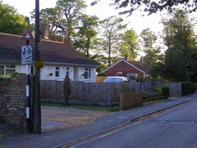
Pampisford is a small village located in the county of Cambridgeshire, England. Situated approximately 8 miles south of the city of Cambridge, Pampisford is a rural community with a population of around 500 residents.

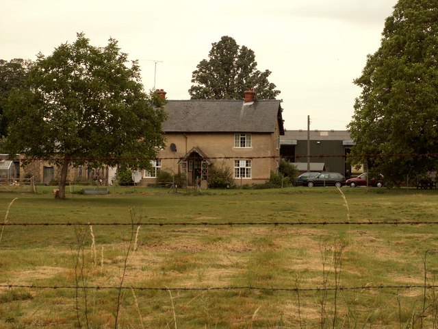
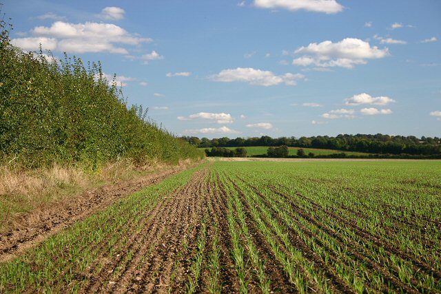
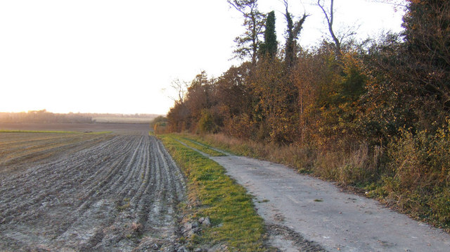
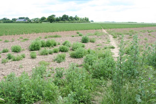
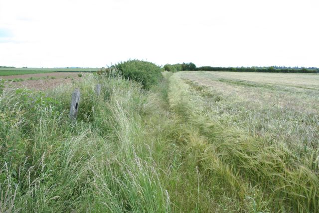
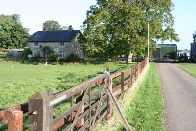
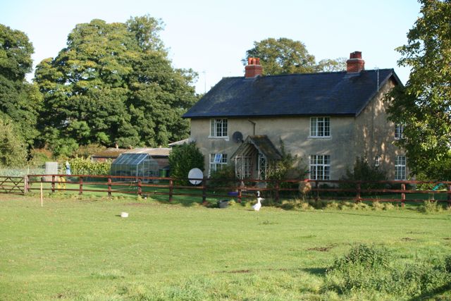
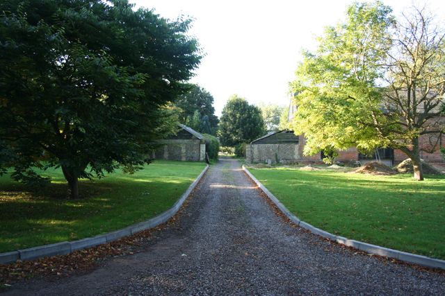
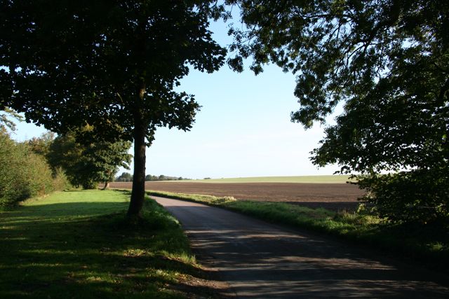
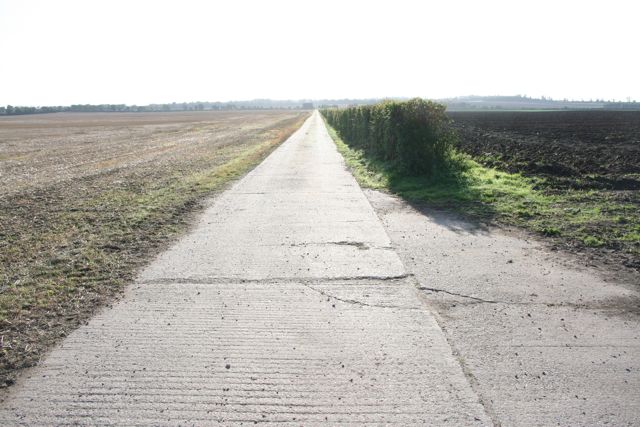
The village is known for its picturesque countryside, characterized by rolling hills, farmland, and charming cottages. Pampisford is set in the heart of the Cambridgeshire countryside, offering a peaceful and idyllic setting for its inhabitants.

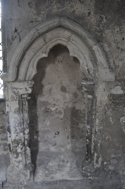
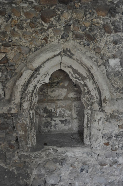
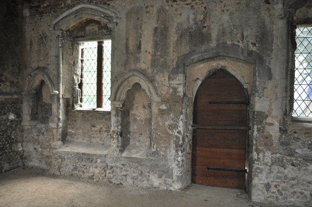
One of the notable landmarks in Pampisford is the All Saints Church, a historic building dating back to the 13th century. The church features stunning architectural details and is a focal point for the community, hosting regular religious services and community events.

Despite its small size, Pampisford offers some amenities for its residents. The village has a local pub, The Chequers, which serves as a social hub for the community. Additionally, there is a village hall that hosts various activities and events throughout the year.

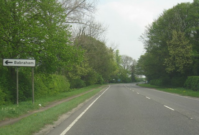
The village is conveniently located near major transportation routes, with the M11 motorway passing close by, providing easy access to Cambridge and other nearby towns and cities. The proximity to Cambridge also offers residents access to a wider range of amenities, including shopping centers, restaurants, and cultural attractions.

Pampisford is a close-knit community that values its rural charm and peaceful atmosphere. It is a desirable place to live for those seeking a tranquil countryside lifestyle within easy reach of urban amenities.

If you have any feedback on the listing, please let us know in the comments section below.

Pampisford Images

Images are sourced within 2km of 52.111263/0.183532 or Grid Reference TL4948. Thanks to Geograph Open Source API. All images are credited.

College Farm, Pampisford, Cambridgeshire
Field at Pampisford A farm track runs along the left side of the hedgerow, leading to farmland between the A505 and the A11.
Field at Pampisford
A farm track runs along the left side of the hedgerow, leading to farmland between the A505 and the A11.
Track and ploughed field South of Hinxton Grange at sunset.
Track and ploughed field
South of Hinxton Grange at sunset.
Track from Babraham to Sawston At this point it crosses a dismantled railway.
Track from Babraham to Sawston
At this point it crosses a dismantled railway.
Track from Babraham to Sawston Showing the line of the dismantled railway.
Track from Babraham to Sawston
Showing the line of the dismantled railway.
College Farm
College Farm
College Farm
College Farm
Home Farm
Home Farm
The Road to Babraham near Home Farm Peaceful and calm fields yet just yards from the busy A505 and A11
The Road to Babraham near Home Farm
Peaceful and calm fields yet just yards from the busy A505 and A11
Straight concrete farm track at Pampisford Looking more like the air strip at nearby Duxford than a farm track.
Straight concrete farm track at Pampisford
Looking more like the air strip at nearby Duxford than a farm track.
A11 heading south The road coming in to the left is an old course of the A11 (pre the modern dual carriageway). It follows the route of an old Roman Road.
A11 heading south
The road coming in to the left is an old course of the A11 (pre the modern dual carriageway). It follows the route of an old Roman Road.
Babraham turning - A505
A505 approaching the A11
Mill Lane, Sawston One of two pre-Worboys road signs that can be found either side of the local school. This sign is across the road from the local fire station.
Mill Lane, Sawston
One of two pre-Worboys road signs that can be found either side of the local school. This sign is across the road from the local fire station.
Mill Lane, Sawston Historic pre-Worboys school road sign as seen from entering from the High Street
Mill Lane, Sawston
Historic pre-Worboys school road sign as seen from entering from the High Street
Duxford Chapel A small 14th century chapel once part of hospital. The building is opened and run by English Heritage. See <span class="nowrap"><a title="http://www.english-heritage.org.uk/daysout/properties/duxford-chapel/" rel="nofollow ugc noopener" href="http://www.english-heritage.org.uk/daysout/properties/duxford-chapel/">Link</a><img style="margin-left:2px;" alt="External link" title="External link - shift click to open in new window" src="https://s1.geograph.org.uk/img/external.png" width="10" height="10"/></span>
Duxford Chapel
A small 14th century chapel once part of hospital. The building is opened and run by English Heritage. See LinkExternal link
Duxford Chapel Easter sepulchre and southern doorway.
Duxford Chapel
Easter sepulchre and southern doorway.
Show me another place!

Pampisford is located at Grid Ref: TL4948 (Lat: 52.111263, Lng: 0.183532)

Administrative County: Cambridgeshire

District: South Cambridgeshire

Police Authority: Cambridgeshire

What 3 Words

///troll.trousers.daylight. Near Sawston, Cambridgeshire

Related Wikis

Pampisford

Pampisford is a village, south of Cambridge, on the A505 road near Sawston, Cambridgeshire, England. The remaining section of a defensive ditch, dug to...

Sawston Hall Meadows

Sawston Hall Meadows is a 7.4-hectare (18-acre) biological Site of Special Scientific Interest in Sawston in Cambridgeshire.This site has spring fed peat...
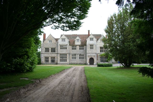
Sawston Hall

Sawston Hall is a Grade I listed Tudor manor house in Sawston, Cambridgeshire dating from the 16th century. It has many fine features, such as the magnificent...

Hanley Grange

Hanley Grange is the name given to an eco-town planned for land north of Hinxton in South Cambridgeshire. Initial proposals for 8,000 homes rising to...

Nearby Amenities

Located within 500m of 52.111263,0.183532
Pampisford
Is In: Cambridgeshire, England, UK
Place: village
Population: 350
Source Population: http://www.scambs.gov.uk/CommunityandLiving/VillageServicesAndAmenities/
Wikidata: Q2119953
Lat/Long: 52.1115476/0.184173
Rectory Farm
Note Retag: CS #48756035
Place: farm
Lat/Long: 52.1111012/0.183288
Post Box
Collection Times: Mo-Fr 09:00; Sa 07:00
Operator: Royal Mail
Post Box Type: lamp
Ref: CB22 453
Royal Cypher: EIIR
Royal Cypher Wikidata: Q33102113
Source: survey
Lat/Long: 52.1108646/0.1850306
Bus Stop
High Street
Naptan AtcoCode: 0500SPAMP004
Naptan Bearing: SE
Naptan CommonName: High Street
Naptan Indicator: near
Naptan Landmark: High Street
Naptan NaptanCode: cmbgapat
Naptan ShortCommonName: High Street
Naptan Street: Brewery Road
Naptan Verified: no
Source: naptan_import
Lat/Long: 52.1109029/0.184565
Bus Stop
High Street
Naptan AtcoCode: 0500SPAMP006
Naptan Bearing: NW
Naptan CommonName: High Street
Naptan Indicator: opp
Naptan Landmark: High Street
Naptan NaptanCode: cmbgapda
Naptan ShortCommonName: High Street
Naptan Street: Brewery Road
Naptan Verified: no
Public Transport: platform
Source: naptan_import
Lat/Long: 52.1109684/0.1841755
Bus Stop
Brewery Road
Naptan AtcoCode: 0500SPAMP008
Naptan Bearing: E
Naptan BusStopType: CUS
Naptan CommonName: Brewery Road
Naptan Indicator: opp 61
Naptan Landmark: Brewery Road
Naptan NaptanCode: cmbgapdj
Naptan ShortCommonName: Brewery Road
Naptan Street: Brewery Road
Naptan Verified: no
Source: naptan_import
Lat/Long: 52.1127595/0.1780247
Bus Stop
Brewery Road
Naptan AtcoCode: 0500SPAMP009
Naptan Bearing: W
Naptan CommonName: Brewery Road
Naptan Indicator: o/s 61
Naptan Landmark: Brewery Road
Naptan NaptanCode: cmbgapdm
Naptan ShortCommonName: Brewery Road
Naptan Street: Brewery Road
Naptan Verified: no
Public Transport: platform
Source: naptan_import
Lat/Long: 52.1126697/0.1780204
Parking
Parking: street_side
Lat/Long: 52.1067886/0.1829026
Parking
Access: yes
Fee: no
Parking: street_side
Lat/Long: 52.1086602/0.1856983
Generator Method: photovoltaic
Generator Output Electricity: yes
Generator Source: solar
Generator Type: solar_photovoltaic_panel
Location: roof
Power: generator
Lat/Long: 52.1102232/0.1853836
Generator Method: photovoltaic
Generator Output Electricity: yes
Generator Source: solar
Generator Type: solar_photovoltaic_panel
Location: roof
Power: generator
Lat/Long: 52.1100321/0.1858824
Generator Method: photovoltaic
Generator Output Electricity: yes
Generator Source: solar
Generator Type: solar_photovoltaic_panel
Location: roof
Power: generator
Lat/Long: 52.1099037/0.1857537
Generator Method: photovoltaic
Generator Output Electricity: yes
Generator Source: solar
Generator Type: solar_photovoltaic_panel
Location: roof
Power: generator
Lat/Long: 52.1099564/0.1854157
Generator Method: photovoltaic
Generator Output Electricity: yes
Generator Source: solar
Generator Type: solar_photovoltaic_panel
Location: roof
Power: generator
Lat/Long: 52.1099498/0.1852682
Generator Method: photovoltaic
Generator Output Electricity: yes
Generator Source: solar
Generator Type: solar_photovoltaic_panel
Location: roof
Power: generator
Lat/Long: 52.1099465/0.1851261
Generator Method: photovoltaic
Generator Output Electricity: yes
Generator Source: solar
Generator Type: solar_photovoltaic_panel
Location: roof
Power: generator
Lat/Long: 52.1098559/0.1848149
Generator Method: photovoltaic
Generator Output Electricity: yes
Generator Source: solar
Generator Type: solar_photovoltaic_panel
Location: roof
Power: generator
Lat/Long: 52.1099135/0.1848552
Generator Method: photovoltaic
Generator Output Electricity: yes
Generator Source: solar
Generator Type: solar_photovoltaic_panel
Location: roof
Power: generator
Lat/Long: 52.1101656/0.185008
Generator Method: photovoltaic
Generator Output Electricity: yes
Generator Source: solar
Generator Type: solar_photovoltaic_panel
Location: roof
Power: generator
Lat/Long: 52.1102183/0.1850805
Generator Method: photovoltaic
Generator Output Electricity: yes
Generator Source: solar
Generator Type: solar_photovoltaic_panel
Location: roof
Power: generator
Lat/Long: 52.112022/0.1828006
Leisure: park
Lat/Long: 52.1130924/0.18132
Bench
Inscription: In memory of Dick Brown
Lat/Long: 52.1127818/0.181
Bench
Lat/Long: 52.112773/0.181124
PCA Pre-Construct Archaeology
Office: company
Lat/Long: 52.1105391/0.1835354
Telephone
Booth: K6
Covered: booth
Listed Status: Grade II
Phone: +44 1223 834817
Wikidata: Q26561843
Lat/Long: 52.1117525/0.1852883
The data included in this document is from www.openstreetmap.org. The data is made available under ODbL.

Have you been to Pampisford?

Leave your review of Pampisford below (or comments, questions and feedback).