Billingborough

Settlement in Lincolnshire South Kesteven

England

Billingborough

Billingborough St. Andrews Church
Billingborough St. Andrews Church Credit: JOHN BLAKESTON

Billingborough is a small village located in the South Kesteven district of Lincolnshire, England. Situated approximately 14 miles east of Grantham and 13 miles south of Sleaford, it has a population of around 1,600 residents.

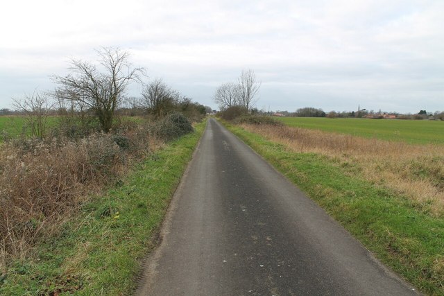
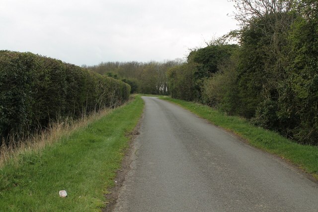
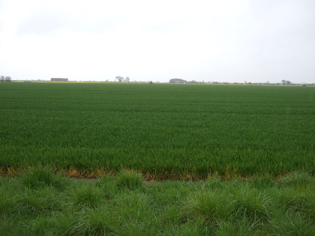
The village is situated on the B1177 road, surrounded by picturesque countryside and farmland. It is known for its peaceful and rural setting, making it an attractive place for those seeking a quieter lifestyle away from the hustle and bustle of larger towns.

Billingborough offers a range of amenities for its residents, including a primary school, a medical practice, and a post office. The village also has a range of local businesses, including shops, pubs, and restaurants, providing essential services and a sense of community.

For outdoor enthusiasts, Billingborough is surrounded by beautiful countryside, offering opportunities for walking, cycling, and exploring nature. The nearby River Bourne provides a peaceful spot for fishing and picnicking.

The village has a rich history, with evidence of settlement dating back to the Roman period. The St. Andrew's Church, a Grade II listed building, is a prominent feature of the village and dates back to the 13th century.

Overall, Billingborough offers a charming and idyllic countryside setting, with a close-knit community and a range of amenities to cater to the needs of its residents.

If you have any feedback on the listing, please let us know in the comments section below.

Billingborough Images

Images are sourced within 2km of 52.89285/-0.341893 or Grid Reference TF1134. Thanks to Geograph Open Source API. All images are credited.

Billingborough St. Andrews Church
Billingborough St. Andrews Church Entrance gate
Billingborough St. Andrews Church
Entrance gate
Church Farm Leading down to Billingborough Church
Church Farm
Leading down to Billingborough Church
Horbling St. Andrews Church
Track off Stow Lane
Track off Stow Lane
Track to Sewage Works at Horbling
Sandygate Lane towards Horbling
A Private Track off Birthorpe Road, Birthorpe
Birthorpe road towards Billingborough
Neslam Road
Neslam Road
Public footpath and Track off Cow Gate
Abbey Church of St Andrew, Sempringham This is the site of the famous St Mary's Priory founded by the crippled priest St. Gilbert in about 1139 as a home for his white-robed Gilbertian order, the only purely English monastic order and the only one which catered for men and women alike. It was sited to the south of the present church but was surrendered and destroyed in 1558 and all that remains today are signs of earthworks, although excavations have been carried out that revealed the foundations together with fish ponds and the old well. 
The present church of St Andrew's was once much larger than the present building but a Norman chancel and transept were taken down in 1788 after becoming dilapidated, leaving the tower unusually at the east end of the building. A priest's door was also removed and in 1899, the arch was returned and incorporated into a new porch that was designed to protect the original Norman door.
Abbey Church of St Andrew, Sempringham
This is the site of the famous St Mary's Priory founded by the crippled priest St. Gilbert in about 1139 as a home for his white-robed Gilbertian order, the only purely English monastic order and the only one which catered for men and women alike. It was sited to the south of the present church but was surrendered and destroyed in 1558 and all that remains today are signs of earthworks, although excavations have been carried out that revealed the foundations together with fish ponds and the old well. The present church of St Andrew's was once much larger than the present building but a Norman chancel and transept were taken down in 1788 after becoming dilapidated, leaving the tower unusually at the east end of the building. A priest's door was also removed and in 1899, the arch was returned and incorporated into a new porch that was designed to protect the original Norman door.
Neslam Road The road clips the corner of this square here.
Neslam Road
The road clips the corner of this square here.
Track from St Andrew's church joins Pointon Road
Farmland off Neslam Road
Neslam Road towards Sempringham
Farmland off Neslam Road
Show me another place!

Billingborough is located at Grid Ref: TF1134 (Lat: 52.89285, Lng: -0.341893)

Division: Parts of Kesteven

Administrative County: Lincolnshire

District: South Kesteven

Police Authority: Lincolnshire

What 3 Words

///forgot.denoting.dispose. Near Billingborough, Lincolnshire

Nearby Locations

Billingborough

Related Wikis

Billingborough

Billingborough is a village and civil parish in the South Kesteven district of Lincolnshire, England. It is situated approximately 10 miles (16 km) north...

St Andrew's Church, Billingborough

St Andrew's Church is a Grade I listed Anglican parish church dedicated to Andrew the Apostle, in Billingborough, Lincolnshire, England. The church is...

Billingborough and Horbling railway station

Billingborough and Horbling railway station was a station serving the villages of Billingborough, Horbling and Threekingham, Lincolnshire on the Great...

Sempringham

Sempringham is a village in the civil parish of Pointon and Sempringham, in the South Kesteven district of Lincolnshire, England. It is situated 2 miles...

Nearby Amenities

Located within 500m of 52.89285,-0.341893
Billingborough
Is In: Lincolnshire, England, UK
Place: village
Lat/Long: 52.8938586/-0.3409855
Brewery Lane
Naptan AtcoCode: 270000008741
Naptan Bearing: NW
Naptan BusStopType: CUS
Naptan CommonName: Brewery Lane
Naptan Indicator: opp
Naptan Landmark: Brewery Lane
Naptan NaptanCode: lingtwda
Naptan Street: High Street
Naptan Verified: no
Source: naptan_import
Lat/Long: 52.8911962/-0.3413821
Brewery Lane
Naptan AtcoCode: 270000008742
Naptan Bearing: SE
Naptan BusStopType: CUS
Naptan CommonName: Brewery Lane
Naptan Indicator: adj
Naptan Landmark: Brewery Lane
Naptan NaptanCode: lingtwdg
Naptan Street: High Street
Naptan Verified: no
Source: naptan_import
Lat/Long: 52.8914026/-0.3413593
Fortesque Arms PH
Naptan AtcoCode: 270000008743
Naptan Bearing: N
Naptan BusStopType: CUS
Naptan CommonName: Fortesque Arms PH
Naptan Indicator: opp
Naptan Landmark: Fortesque Arms PH
Naptan NaptanCode: lingtwdj
Naptan Street: High Street
Naptan Verified: no
Source: naptan_import
Lat/Long: 52.892661/-0.3419802
Fortesque Arms PH
Naptan AtcoCode: 270000008744
Naptan Bearing: S
Naptan BusStopType: CUS
Naptan CommonName: Fortesque Arms PH
Naptan Indicator: adj
Naptan Landmark: Fortesque Arms PH
Naptan NaptanCode: lingtwdm
Naptan Street: High Street
Naptan Verified: no
Source: naptan_import
Lat/Long: 52.8926947/-0.3418154
High Street
Naptan AtcoCode: 270000008745
Naptan Bearing: W
Naptan BusStopType: CUS
Naptan CommonName: High Street
Naptan Indicator: adj
Naptan Landmark: High Street
Naptan NaptanCode: lingtwdp
Naptan Street: Station Road
Naptan Verified: no
Source: naptan_import
Lat/Long: 52.8949476/-0.341551
High Street
Naptan AtcoCode: 270000008746
Naptan Bearing: E
Naptan BusStopType: CUS
Naptan CommonName: High Street
Naptan Indicator: opp
Naptan Landmark: High Street
Naptan NaptanCode: lingtwdt
Naptan Street: Station Road
Naptan Verified: no
Source: naptan_import
Lat/Long: 52.8950088/-0.3414298
George & Dragon PH
Naptan AtcoCode: 270000008747
Naptan Bearing: NE
Naptan BusStopType: CUS
Naptan CommonName: George & Dragon PH
Naptan Indicator: adj
Naptan Landmark: George & Dragon PH
Naptan NaptanCode: lingtwdw
Naptan Street: Victoria Street
Naptan Verified: no
Source: naptan_import
Lat/Long: 52.8952246/-0.3407823
Bus Stop
George & Dragon PH
Bus: yes
Naptan AtcoCode: 2700LBC00360
Naptan Bearing: S
Naptan CommonName: George & Dragon PH
Naptan Indicator: opp
Naptan Landmark: George & Dragon PH
Naptan NaptanCode: linadmpg
Naptan Street: Victoria Street
Naptan Verified: no
Public Transport: platform
Source: naptan_import
Lat/Long: 52.8950681/-0.3405206
Piper Holt Farm
Place: farm
Source: Bing
Lat/Long: 52.8954357/-0.344937
Pub
The Fortesque Arms
Addr City: Billingborough
Addr Housenumber: 27
Addr Postcode: NG34 0QB
Addr Street: High Street
Fhrs Authority: South Kesteven
Fhrs Id: 238511
Fhrs Local Authority Id: 3941
Source: Bing
Lat/Long: 52.8927571/-0.3417065
Pub
George & Dragon
Wikidata: Q26603773
Lat/Long: 52.8953454/-0.3407253
Hurn Farm
Place: farm
Source: Bing
Lat/Long: 52.8934667/-0.3373853
Power: pole
Lat/Long: 52.8939197/-0.3490995
Power: pole
Lat/Long: 52.8939412/-0.34793
Power: pole
Lat/Long: 52.8939676/-0.3467578
Power: pole
Lat/Long: 52.8890877/-0.3449647
Power: pole
Lat/Long: 52.889254/-0.3435156
Power: pole
Lat/Long: 52.8894011/-0.3421777
Power: pole
Lat/Long: 52.8895442/-0.3408527
Power: pole
Lat/Long: 52.8895983/-0.340406
Power: pole
Lat/Long: 52.8898356/-0.3383009
Power: pole
Lat/Long: 52.8899406/-0.346393
Power: pole
Lat/Long: 52.8901979/-0.3370677
Power: pole
Lat/Long: 52.8904509/-0.3434458
Power: pole
Lat/Long: 52.8908196/-0.3464233
Power: pole
Lat/Long: 52.8920632/-0.3464807
Power: pole
Lat/Long: 52.8927981/-0.3464988
Power: pole
Lat/Long: 52.8934819/-0.3465381
Power: pole
Lat/Long: 52.8940153/-0.3464664
Addr Housenumber: 27
Addr Street: Grosvenor Road
Lat/Long: 52.8916578/-0.3362273
Addr Housenumber: 1
Addr Street: Allen Close
Lat/Long: 52.8921672/-0.3416535
Addr Housenumber: 3
Addr Street: Allen Close
Lat/Long: 52.8921327/-0.3416421
Addr Housenumber: 5
Addr Street: Allen Close
Lat/Long: 52.8920941/-0.3416307
Nisa Local
Addr City: Billingborough
Addr Housenumber: 14
Addr Postcode: NG34 0QA
Addr Street: High Street
Brand: Nisa Local
Brand Wikidata: Q16999069
Brand Wikipedia: en:Nisa (retailer)
Fhrs Authority: South Kesteven
Fhrs Id: 1266226
Fhrs Local Authority Id: 88694
Shop: convenience
Lat/Long: 52.8943376/-0.3416279
Social Facility
Old Hall Rest Home
Addr City: Billingborough
Addr Housename: The Old Hall
Addr Housenumber: 1
Addr Postcode: NG34 0QA
Addr Street: High Street
Fhrs Authority: South Kesteven
Fhrs Id: 238342
Fhrs Local Authority Id: 3924
Social Facility: assisted_living
Social Facility For: senior
Lat/Long: 52.8944513/-0.3405118
Defibrillator
Access: yes
Addr Postcode: NG34 0QD
Defibrillator Location: Wall of Billingborough Fire Station on High Street
Emergency: defibrillator
Indoor: no
Ref GB The Circuit: AB7880F2-B62E-40C4-9162-AF0B00A21784
Lat/Long: 52.8944582/-0.3414887
Fast Food
Billingborough Fish Bar
Addr City: Billingborough
Addr Housenumber: 22
Addr Postcode: NG34 0QA
Addr Street: High Street
Fhrs Authority: South Kesteven
Fhrs Id: 1298344
Fhrs Local Authority Id: 89044
Lat/Long: 52.8940872/-0.3417429
Post 'N' More
Addr City: Billingborough
Addr Housenumber: 40
Addr Postcode: NG34 0QB
Addr Street: High Street
Fhrs Authority: South Kesteven
Fhrs Id: 238523
Fhrs Local Authority Id: 3944
Shop: convenience
Lat/Long: 52.8933218/-0.3420889
Dobson's Convience Store
Addr City: Billingborough
Addr Housenumber: 74
Addr Postcode: NG34 0QD
Addr Street: High Street
Brand: Premier
Brand Wikidata: Q7240340
Fhrs Authority: South Kesteven
Fhrs Id: 238585
Fhrs Local Authority Id: 3947
Shop: convenience
Website: https://www.premier-stores.co.uk/our-stores/dobson-convenience-store
Lat/Long: 52.8915482/-0.3416866
Man Made: flagpole
Lat/Long: 52.8928562/-0.3397548
Post Box
Post Box Type: wall
Royal Cypher: EIIR
Lat/Long: 52.8933588/-0.3419989
Shop: books
Lat/Long: 52.8929955/-0.341739
The data included in this document is from www.openstreetmap.org. The data is made available under ODbL.

Have you been to Billingborough?

Leave your review of Billingborough below (or comments, questions and feedback).