Billesley Common

Settlement in Worcestershire

England

Billesley Common

Highfield Roundabout, Hall Green
Highfield Roundabout, Hall Green Credit: Darius Khan

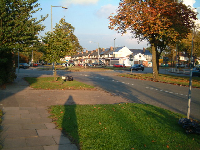
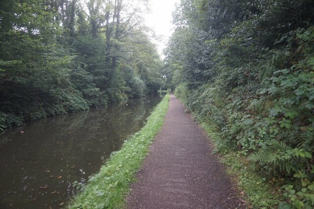
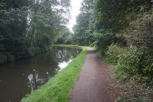
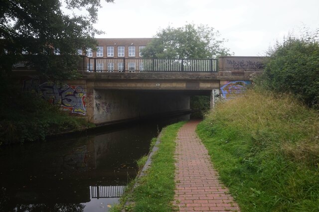
Billesley Common is a public park located in the county of Worcestershire, England. Situated in the southern part of Birmingham, it covers an area of approximately 27 acres. The common is bordered by Yardley Wood Road to the east, Trittiford Road to the south, Brook Lane to the west, and Hollybank Road to the north.

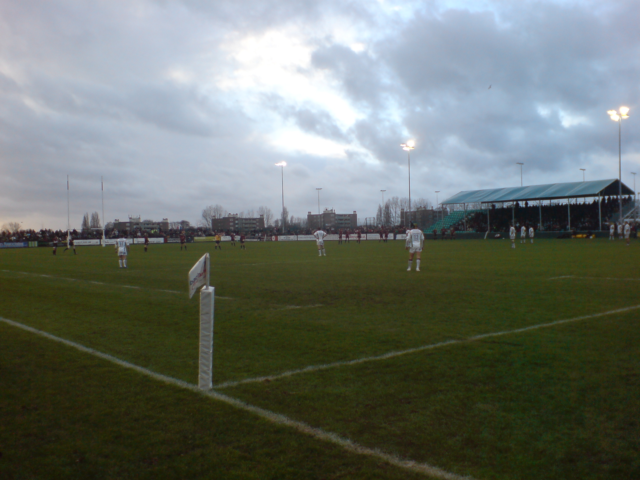
Billesley Common offers a variety of facilities and amenities for visitors of all ages. Its open green spaces provide ample room for recreational activities such as walking, jogging, and picnicking. The common also features a children's playground equipped with swings, slides, and climbing frames, making it a popular destination for families. Furthermore, there are several sports fields, including football and rugby pitches, which are regularly used by local clubs and schools for training and matches.

In addition to its natural beauty and recreational opportunities, Billesley Common holds historical significance. It was once part of the Billesley Hall Estate, a grand mansion that stood on the grounds until it was demolished in the 1950s. The remnants of the estate's gardens can still be seen within the common, adding a touch of nostalgia to the park's landscape.

With its convenient location and diverse offerings, Billesley Common serves as a cherished community space for residents of Worcestershire and Birmingham. It is accessible by public transportation and has parking facilities available for those who prefer to drive. Overall, Billesley Common provides a peaceful retreat and a place for outdoor enjoyment in the heart of the West Midlands.

If you have any feedback on the listing, please let us know in the comments section below.

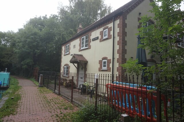
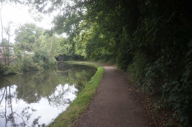
Billesley Common Images

Images are sourced within 2km of 52.422933/-1.876001 or Grid Reference SP0880. Thanks to Geograph Open Source API. All images are credited.

Highfield Roundabout, Hall Green
Highfield Road, Hall Green
St Peters Church, Hall Green In 1923 following the growth of population in the area, and a generous gift of land from Colonel Jervaise, a small wooden building was erected and opened as a chapel (in September 1923) dedicated to St. Cadoc.

Continued growth in numbers over the next 30 years eventually saw this building re-dedicated in 1954 to St. Peter and the appointment of the first resident priest, Fr. Joseph Adlam. Some 5 years later plans were made for a more permanent building when on April 18th 1959 tragedy struck. A fire engulfed the wooden church, that had served for so long, and plans for expansion lay in ashes.

Using firstly a small wooden hut and later, the newly built parish hall, services were to continue for over four years before the completion of our wonderful new building.

The foundation stone was laid on July 14th 1962 and building eventually completed for the official opening in 1964. Over the next two years life reverted to normal with the parish hall being used for social and group meetings rather than religious services. Father Adlam was unfortunately unable to enjoy the ‘fruits of his labours’ for very long. He died suddenly on November 4th 1966. At his funeral the Bishop of Aston, The Right Rev. David Porter, said ‘Your new church is the finest memorial that Joseph Adlam could possibly have. It epitomises all that he lived for, hoped for, and slaved for and, if ever a man could die happy in the knowledge of a task fulfilled, it was he.’
St Peters Church, Hall Green
In 1923 following the growth of population in the area, and a generous gift of land from Colonel Jervaise, a small wooden building was erected and opened as a chapel (in September 1923) dedicated to St. Cadoc. Continued growth in numbers over the next 30 years eventually saw this building re-dedicated in 1954 to St. Peter and the appointment of the first resident priest, Fr. Joseph Adlam. Some 5 years later plans were made for a more permanent building when on April 18th 1959 tragedy struck. A fire engulfed the wooden church, that had served for so long, and plans for expansion lay in ashes. Using firstly a small wooden hut and later, the newly built parish hall, services were to continue for over four years before the completion of our wonderful new building. The foundation stone was laid on July 14th 1962 and building eventually completed for the official opening in 1964. Over the next two years life reverted to normal with the parish hall being used for social and group meetings rather than religious services. Father Adlam was unfortunately unable to enjoy the ‘fruits of his labours’ for very long. He died suddenly on November 4th 1966. At his funeral the Bishop of Aston, The Right Rev. David Porter, said ‘Your new church is the finest memorial that Joseph Adlam could possibly have. It epitomises all that he lived for, hoped for, and slaved for and, if ever a man could die happy in the knowledge of a task fulfilled, it was he.’
Highfield House, Hall Green - Days before demolition Highfield House is another historical building. It was built in 1850, making it the oldest house and the third oldest building in Hall Green. It was the farm house for Highfield Farm. The house was built in Georgian style with beautiful Neo-Classical features. It also retains the original sash windows. The demolition of the locally listed building has been proposed by developers, who want to build homes on the surrounding land. The ground floor of the house still has its wooden shutters fitted to the inside of each window frame which were closed and secured at night. The present day use for these shutters was to keep the house warm at night as they were very effective for excluding draughts but their original purpose was one of fortification against attack. When the house was built many isolated houses were a target for burglars, brigands and armed assault.
Highfield House, Hall Green - Days before demolition
Highfield House is another historical building. It was built in 1850, making it the oldest house and the third oldest building in Hall Green. It was the farm house for Highfield Farm. The house was built in Georgian style with beautiful Neo-Classical features. It also retains the original sash windows. The demolition of the locally listed building has been proposed by developers, who want to build homes on the surrounding land. The ground floor of the house still has its wooden shutters fitted to the inside of each window frame which were closed and secured at night. The present day use for these shutters was to keep the house warm at night as they were very effective for excluding draughts but their original purpose was one of fortification against attack. When the house was built many isolated houses were a target for burglars, brigands and armed assault.
Highfield Road Araucaria araucana
Highfield Road
Araucaria araucana
Stratford-upon-Avon Canal towards bridge #6
Canal boat Brasso, Stratford-upon-Avon Canal
Stratford-upon-Avon Canal towards bridge #6
Stratford-upon-Avon Canal at School Road Bridge, bridge #6
Stratford-upon-Avon Canal towards bridge #5
Stratford-upon-Avon Canal at Yardley Wood Bridge, bridge #5
Canal Cottage, Stratford-upon-Avon Canal near bridge #5
Plaque at Canal Cottage Near bridge #5, Stratford upon Avon Canal.
Plaque at Canal Cottage
Near bridge #5, Stratford upon Avon Canal.
Stratford-upon-Avon Canal towards bridge #4
Show me another place!

Billesley Common is located at Grid Ref: SP0880 (Lat: 52.422933, Lng: -1.876001)

Unitary Authority: Birmingham

Police Authority: West Midlands

What 3 Words

///souk.lamp.shared. Near Shirley, West Midlands

Nearby Locations

Billesley Common

Related Wikis

Kings Heath Boys

Kings Heath Boys is a boys' community school located in Kings Heath, south Birmingham, England. It has a comprehensive admissions policy, and in 2023 had...

Billesley Common

Billesley Common is a recreational area of public open space in South Birmingham, England. It is situated along the Yardley Wood Road, between the suburbs...

Swanshurst School

Swanshurst School is a secondary school and sixth form for girls aged 11 to 19 years, located in Birmingham, England.It is a community school administered...

Warstock

Warstock is a district within the city of Birmingham, UK, in the southernmost suburbs roughly 1 km east of the A435 and within the ward of Highter's Heath...

Nearby Amenities

Located within 500m of 52.422933,-1.876001
Mini Roundabout
Direction: clockwise
Source: survey
Lat/Long: 52.4194491/-1.874896
Post Box
Post Box Type: pillar
Ref: B13 438
Royal Cypher: EIIR
Royal Cypher Wikidata: Q33102113
Source: survey
Lat/Long: 52.4207035/-1.8744706
Telephone
Booth: KXPlus
Covered: booth
Source: survey
Lat/Long: 52.4249346/-1.8719327
Michael's NISA
Shop: supermarket
Source: survey
Lat/Long: 52.4249961/-1.8716221
Mini Roundabout
Direction: clockwise
Lat/Long: 52.4206778/-1.8778707
Bus Stop
Haunch Lane / Yardley Wood Rd
NaPTANAreaCode: 43000448401
Asset Ref: 610616
Bench: yes
Bin: no
Bus: yes
Lit: yes
Naptan AtcoCode: 43000448401
Naptan Bearing: NW
Naptan BusStopType: MKD
Naptan CommonName: Yardley Wood Rd
Naptan Indicator: after
Naptan NaptanCode: nwmptgdj
Naptan PlusbusZoneRef: BHAMNWS
Naptan Status: ACT
Naptan StopType: BCT
Naptan Street: HAUNCH LANE
Naptan Towards: Kings Heath, Cotteridge
Public Transport: platform
Route Ref: 18;27;76
Shelter: yes
Shelter Ref: 610659
Source: WMCA
Tactile Paving: no
Lat/Long: 52.4198304/-1.8761187
Bus Stop
Haunch Lane / Yardley Wood Rd
NaPTANAreaCode: 43000448402
Bench: yes
Bin: yes
Bus: yes
Lit: yes
Naptan AtcoCode: 43000448402
Naptan Bearing: SE
Naptan BusStopType: MKD
Naptan CommonName: Yardley Wood Rd
Naptan Indicator: before
Naptan NaptanCode: nwmptgdm
Naptan PlusbusZoneRef: BHAMNWS
Naptan Status: ACT
Naptan StopType: BCT
Naptan Street: HAUNCH LANE
Naptan Towards: Shirley, Yardley Wood
Public Transport: platform
Route Ref: 18;27;76
Shelter: yes
Shelter Ref: 610616
Source: WMCA
Tactile Paving: yes
Lat/Long: 52.4198576/-1.8757748
Bus Stop
Haunch Lane / Hollybank Rd
Bench: no
Bin: yes
Bus: yes
Lit: no
Naptan AtcoCode: 43000448503
Naptan Bearing: NW
Naptan BusStopType: MKD
Naptan CommonName: Hollybank Rd
Naptan Indicator: after
Naptan NaptanCode: nwmgmtpg
Naptan PlusbusZoneRef: BHAMNWS
Naptan Status: ACT
Naptan StopType: BCT
Naptan Street: HAUNCH LANE
Naptan Towards: Cotteridge
Naptan Verified: no
Public Transport: platform
Route Ref: 18
Shelter: no
Source: WMCA
Tactile Paving: no
Lat/Long: 52.4208069/-1.8782998
Bus Stop
Haunch Lane / Hollybank Rd
Bench: no
Bin: no
Bus: yes
Lit: yes
Naptan AtcoCode: 43000448504
Naptan Bearing: SE
Naptan BusStopType: MKD
Naptan CommonName: Hollybank Rd
Naptan Indicator: before
Naptan NaptanCode: nwmgmtpj
Naptan PlusbusZoneRef: BHAMNWS
Naptan Status: ACT
Naptan StopType: BCT
Naptan Street: HAUNCH LANE
Naptan Towards: Yardley Wood
Naptan Verified: no
Public Transport: platform
Route Ref: 18
Shelter: no
Source: WMCA
Tactile Paving: no
Lat/Long: 52.4211677/-1.8788561
Bus Stop
Hollybank Rd / Hollybank Close
NaPTANAreaCode: 43000415501
Bus: yes
Naptan AtcoCode: 43000415501
Naptan Bearing: S
Naptan BusStopType: MKD
Naptan CommonName: Hollybank Close
Naptan Indicator: opp
Naptan NaptanCode: nwmgmdpd
Naptan PlusbusZoneRef: BHAMNWS
Naptan Status: ACT
Naptan StopType: BCT
Naptan Street: HOLLYBANK RD
Naptan Towards: Yardley Wood
Public Transport: platform
Route Ref: 27;76
Shelter: yes
Shelter Ref: 610652
Source: WMCA
Lat/Long: 52.4251634/-1.8795599
Bus Stop
Hollybank Rd / Hollybank Close
NaPTANAreaCode: 43000415502
Bus: yes
Naptan AtcoCode: 43000415502
Naptan Bearing: N
Naptan BusStopType: MKD
Naptan CommonName: Hollybank Close
Naptan Indicator: adj
Naptan NaptanCode: nwmgmdpg
Naptan PlusbusZoneRef: BHAMNWS
Naptan Status: ACT
Naptan StopType: BCT
Naptan Street: HOLLYBANK RD
Naptan Towards: Kings Heath
Public Transport: platform
Route Ref: 27;76
Shelter: yes
Shelter Ref: 610648
Source: WMCA
Lat/Long: 52.424617/-1.8794045
Bus Stop
Hollybank Rd / Haunch Lane
NaPTANAreaCode: 43000415801
Bus: yes
Naptan AtcoCode: 43000415801
Naptan Bearing: S
Naptan BusStopType: MKD
Naptan CommonName: Haunch Lane
Naptan Indicator: before
Naptan NaptanCode: nwmgmdpm
Naptan PlusbusZoneRef: BHAMNWS
Naptan Status: ACT
Naptan StopType: BCT
Naptan Street: HOLLYBANK RD
Naptan Towards: Yardley Wood
Public Transport: platform
Route Ref: 27;76
Shelter: yes
Shelter Ref: 610653
Source: WMCA
Lat/Long: 52.4221466/-1.8778335
Bus Stop
Hollybank Rd / Haunch Lane
NaPTANAreaCode: 43000415802
Asset Ref: 610642
Bus: yes
Naptan AtcoCode: 43000415802
Naptan Bearing: N
Naptan BusStopType: MKD
Naptan CommonName: Haunch Lane
Naptan Indicator: after
Naptan NaptanCode: nwmgmdpt
Naptan PlusbusZoneRef: BHAMNWS
Naptan Status: ACT
Naptan StopType: BCT
Naptan Street: HOLLYBANK RD
Naptan Towards: Kings Heath
Public Transport: platform
Route Ref: 27;76
Shelter: yes
Shelter Ref: 610642
Source: WMCA
Lat/Long: 52.4217098/-1.8779125
Bus Stop
Yardley Wood Rd / Bondfield Rd
NaPTANAreaCode: 43000422201
Bus: yes
Naptan AtcoCode: 43000422201
Naptan Bearing: N
Naptan BusStopType: MKD
Naptan CommonName: Bondfield Rd
Naptan Indicator: opp
Naptan NaptanCode: nwmgmgdp
Naptan PlusbusZoneRef: BHAMNWS
Naptan Status: ACT
Naptan StopType: BCT
Naptan Street: YARDLEY WOOD RD
Naptan Towards: Birmingham
Naptan Verified: no
Public Transport: platform
Route Ref: 2
Shelter: yes
Shelter Ref: 610612
Source: WMCA
Lat/Long: 52.425419/-1.8718776
Bus Stop
Yardley Wood Rd / Bondfield Rd
NaPTANAreaCode: 43000422202
Asset Ref: 610613
Bus: yes
Naptan AtcoCode: 43000422202
Naptan Bearing: S
Naptan BusStopType: MKD
Naptan CommonName: Bondfield Rd
Naptan Indicator: adj
Naptan NaptanCode: nwmgmgdt
Naptan PlusbusZoneRef: BHAMNWS
Naptan Status: ACT
Naptan StopType: BCT
Naptan Street: YARDLEY WOOD RD
Naptan Towards: Maypole
Public Transport: platform
Route Ref: 2
Shelter: yes
Shelter Ref: 610613
Source: WMCA
Tactile Paving: no
Lat/Long: 52.4251974/-1.8717642
Bus Stop
Yardley Wood Rd / Bromwall Rd
Bus: yes
Naptan AtcoCode: 43000422301
Naptan Bearing: S
Naptan BusStopType: MKD
Naptan CommonName: Bromwall Rd
Naptan Indicator: adj
Naptan NaptanCode: nwmgmgdw
Naptan PlusbusZoneRef: BHAMNWS
Naptan Status: ACT
Naptan StopType: BCT
Naptan Street: YARDLEY WOOD RD
Naptan Towards: Maypole
Public Transport: platform
Route Ref: 2
Shelter: no
Source: WMCA
Tactile Paving: yes
Lat/Long: 52.4232437/-1.8730169
Bus Stop
Yardley Wood Rd / Bromwall Rd
NaPTANAreaCode: 43000422302
Bus: yes
Naptan AtcoCode: 43000422302
Naptan Bearing: N
Naptan BusStopType: MKD
Naptan CommonName: Bromwall Rd
Naptan Indicator: opp
Naptan NaptanCode: nwmgmgja
Naptan PlusbusZoneRef: BHAMNWS
Naptan Status: ACT
Naptan StopType: BCT
Naptan Street: YARDLEY WOOD RD
Naptan Towards: Birmingham
Public Transport: platform
Route Ref: 2
Shelter: yes
Shelter Ref: 610614
Source: WMCA
Lat/Long: 52.4237133/-1.8729561
Bus Stop
Yardley Wood Rd / Haunch Lane
NaPTANAreaCode: 43000423101
Bus: yes
Naptan AtcoCode: 43000423101
Naptan Bearing: NE
Naptan BusStopType: MKD
Naptan CommonName: Haunch Lane
Naptan Indicator: after
Naptan NaptanCode: nwmptdtw
Naptan PlusbusZoneRef: BHAMNWS
Naptan Status: ACT
Naptan StopType: BCT
Naptan Street: YARDLEY WOOD RD
Naptan Towards: Birmingham
Public Transport: platform
Route Ref: 2
Shelter: yes
Shelter Ref: 610690
Source: WMCA
Lat/Long: 52.4199431/-1.8749819
Bus Stop
Yardley Wood Rd / Haunch Lane
NaPTANAreaCode: 43000423102
Bus: yes
Naptan AtcoCode: 43000423102
Naptan Bearing: SW
Naptan BusStopType: MKD
Naptan CommonName: Haunch Lane
Naptan Indicator: before
Naptan NaptanCode: nwmptdwa
Naptan PlusbusZoneRef: BHAMNWS
Naptan Status: ACT
Naptan StopType: BCT
Naptan Street: YARDLEY WOOD RD
Naptan Towards: Maypole
Public Transport: platform
Route Ref: 2
Shelter: yes
Shelter Ref: 610615
Source: WMCA
Lat/Long: 52.4204989/-1.8745697
Bus Stop
Chinn Brook Rd / Hallstead Rd
Bus: yes
Naptan AtcoCode: 43000423401
Naptan Bearing: W
Naptan BusStopType: MKD
Naptan CommonName: Hallstead Rd
Naptan Indicator: opp
Naptan NaptanCode: nwmgmgjw
Naptan PlusbusZoneRef: BHAMNWS
Naptan Status: ACT
Naptan StopType: BCT
Naptan Street: CHINN BROOK RD
Naptan Towards: Kings Heath
Naptan Verified: no
Public Transport: platform
Route Ref: 27;76
Source: WMCA
Lat/Long: 52.4199286/-1.8709827
Bus Stop
Chinn Brook Rd / Hallstead Rd
Bus: yes
Naptan AtcoCode: 43000423402
Naptan Bearing: E
Naptan BusStopType: MKD
Naptan CommonName: Hallstead Rd
Naptan Indicator: adj
Naptan NaptanCode: nwmgmgma
Naptan PlusbusZoneRef: BHAMNWS
Naptan Status: ACT
Naptan StopType: BCT
Naptan Street: CHINN BROOK RD
Naptan Towards: Shirley
Naptan Verified: no
Public Transport: platform
Route Ref: 27;76
Source: WMCA
Lat/Long: 52.4199651/-1.8714973
Turning Circle
Source: bing
Lat/Long: 52.4200162/-1.8798908
Restaurant
Sweet Chillies
Source: survey
Lat/Long: 52.4212517/-1.873843
Brand: National Grid
Brand Wikidata: Q1465461
Operator: National Grid Electricity Distribution Plc
Operator Old: Western Power Distribution
Operator Wikidata: Q7988183
Owner: National Grid Electricity Distribution (West Midlands) Plc
Owner Wikidata: Q114397791
Power: substation
Source: visual survey;estimate
Lat/Long: 52.4201008/-1.876178
Fast Food
Mei Garden
Cuisine: chinese
Source: survey
Lat/Long: 52.4211605/-1.878075
Select & Save
Shop: supermarket
Source: survey
Lat/Long: 52.4219202/-1.8775815
Hi-style
Shop: hairdresser
Source: survey
Lat/Long: 52.4210958/-1.8783469
Barrier: bollard
Source: survey
Lat/Long: 52.4255018/-1.8718297
Bench
Source: survey
Lat/Long: 52.4237184/-1.873016
Post Box
Post Box Type: pillar
Ref: B13 787
Royal Cypher: EIIR
Source: GPS Survey
Lat/Long: 52.4249223/-1.8718622
Barrier: bollard
Lat/Long: 52.4239974/-1.8775432
Fast Food
Good Taste
Cuisine: chinese
Source: survey
Lat/Long: 52.4253934/-1.8713551
Barrier: bollard
Source: survey
Lat/Long: 52.4257265/-1.8727467
Michaels Off Licence
Addr City: Birmingham
Addr Housenumber: 738
Addr Postcode: B13 0JD
Addr Street: Yardley Wood Road
Shop: alcohol
Source: survey
Lat/Long: 52.424916/-1.871658
Bench
Backrest: no
Source: survey
Lat/Long: 52.4201006/-1.8756743
Crossing
Check Date Crossing: 2021-07-02
Crossing: uncontrolled
Source: bing
Lat/Long: 52.4256261/-1.8716652
Give Way
Direction: forward
Lat/Long: 52.4193698/-1.8749014
Mini Roundabout
Source: survey
Lat/Long: 52.4204437/-1.8776877
Give Way
Lat/Long: 52.4207245/-1.8779951
Give Way
Lat/Long: 52.4207303/-1.8777994
Mini Roundabout
Source: survey
Lat/Long: 52.4196581/-1.8749793
Turning Circle
Source: bing
Lat/Long: 52.4245867/-1.8805396
Post Box
Collection Times: Mo-Fr 17:00; Sa 12:30
Post Box Type: pillar
Ref: B13 327
Royal Cypher: GR
Royal Cypher Wikidata: Q33102273
Source: Warwicks Aerial Imagery OGL v2
Lat/Long: 52.4211671/-1.8787222
Give Way
Source: Warwicks Aerial Imagery OGL v2
Lat/Long: 52.4212631/-1.8776798
Post Office
Hollybank Post Office
Addr City: Birmingham
Addr Housenumber: 306
Addr Postcode: B13 0QS
Addr Street: Haunch Lane
Brand: Post Office
Brand Wikidata: Q1783168
Opening Hours: Mo-Fr 07:00-19:00; Sa 08:30-17:30; Su 09:00-18:00
Ref Pol Id: 10619
Website: https://www.postoffice.co.uk/branch-finder/2672014/holly-bank
Lat/Long: 52.4212528/-1.8787026
Give Way
Lat/Long: 52.4205887/-1.8778038
Give Way
Lat/Long: 52.4205233/-1.8777475
Give Way
Lat/Long: 52.4203679/-1.8777555
Give Way
Lat/Long: 52.4204112/-1.8775289
Give Way
Lat/Long: 52.4197389/-1.875709
Give Way
Direction: backward
Lat/Long: 52.4194404/-1.8747635
Give Way
Direction: backward
Lat/Long: 52.4195107/-1.874915
Give Way
Direction: forward
Lat/Long: 52.4195663/-1.8749512
Give Way
Direction: backward
Lat/Long: 52.4196587/-1.8751108
Give Way
Direction: backward
Lat/Long: 52.4196955/-1.8749486
Crossing
Crossing: unmarked
Crossing Island: no
Tactile Paving: yes
Lat/Long: 52.4198501/-1.8759515
Generator Method: photovoltaic
Generator Output Electricity: yes
Generator Source: solar
Generator Type: solar_photovoltaic_panel
Location: roof
Power: generator
Lat/Long: 52.4248971/-1.881929
Generator Method: photovoltaic
Generator Output Electricity: yes
Generator Source: solar
Generator Type: solar_photovoltaic_panel
Location: roof
Power: generator
Lat/Long: 52.4249094/-1.8818808
Generator Method: photovoltaic
Generator Output Electricity: yes
Generator Source: solar
Generator Type: solar_photovoltaic_panel
Location: roof
Power: generator
Lat/Long: 52.4240417/-1.8820618
Generator Method: photovoltaic
Generator Output Electricity: yes
Generator Source: solar
Generator Type: solar_photovoltaic_panel
Location: roof
Power: generator
Lat/Long: 52.4214262/-1.8823998
Generator Method: photovoltaic
Generator Output Electricity: yes
Generator Source: solar
Generator Type: solar_photovoltaic_panel
Location: roof
Power: generator
Lat/Long: 52.4232991/-1.8827766
Generator Method: photovoltaic
Generator Output Electricity: yes
Generator Source: solar
Generator Type: solar_photovoltaic_panel
Location: roof
Power: generator
Lat/Long: 52.420713/-1.8698148
Generator Method: photovoltaic
Generator Output Electricity: yes
Generator Source: solar
Generator Type: solar_photovoltaic_panel
Location: roof
Power: generator
Lat/Long: 52.4207605/-1.869776
Generator Method: photovoltaic
Generator Output Electricity: yes
Generator Source: solar
Generator Type: solar_photovoltaic_panel
Location: roof
Power: generator
Lat/Long: 52.4201699/-1.8713558
Generator Method: photovoltaic
Generator Output Electricity: yes
Generator Source: solar
Generator Type: solar_photovoltaic_panel
Location: roof
Power: generator
Lat/Long: 52.419653/-1.8717715
Generator Method: photovoltaic
Generator Output Electricity: yes
Generator Source: solar
Generator Type: solar_photovoltaic_panel
Location: roof
Power: generator
Lat/Long: 52.419725/-1.8713182
Power: substation
Ref: 724796
Source: wpd_opendata
Lat/Long: 52.4217959/-1.8821074
325th Birmingham, 1st Billesley Scout Group
Addr City: Birmingham
Addr Housename: Holy Cross Community Centre
Addr Housenumber: 29
Addr Postcode: B13 0NS
Addr Street: Beauchamp Road
Brand: The Scout Association
Brand Wikidata: Q849740
Club: scout
Opening Hours: Tu-Sa 17:00-21:30
Operator: The Scout Association
Phone: +44 7872 591449
Scout: land
Website: https://www.billesleyscouts.org.uk/
Lat/Long: 52.4212616/-1.8723184
The data included in this document is from www.openstreetmap.org. The data is made available under ODbL.

Have you been to Billesley Common?

Leave your review of Billesley Common below (or comments, questions and feedback).