Bildeston

Settlement in Suffolk Babergh

England

Bildeston

Church of All Saints, Hitcham <span class="nowrap"><a title="https://historicengland.org.uk/listing/the-list/list-entry/1285593?section=official-list-entry" rel="nofollow ugc noopener" href="https://historicengland.org.uk/listing/the-list/list-entry/1285593?section=official-list-entry">Link</a><img style="margin-left:2px;" alt="External link" title="External link - shift click to open in new window" src="https://s1.geograph.org.uk/img/external.png" width="10" height="10"/></span>
Church of All Saints, Hitcham Credit: Sandy Gerrard

Bildeston is a charming village located in the county of Suffolk, England. Situated in the Babergh district, it is nestled in the picturesque countryside, surrounded by rolling hills and lush green fields. With a population of around 1,000 residents, it exudes a tranquil and close-knit community atmosphere.

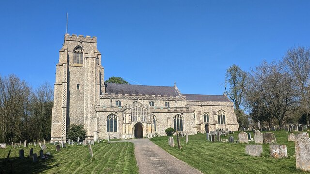
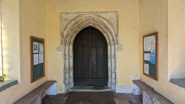
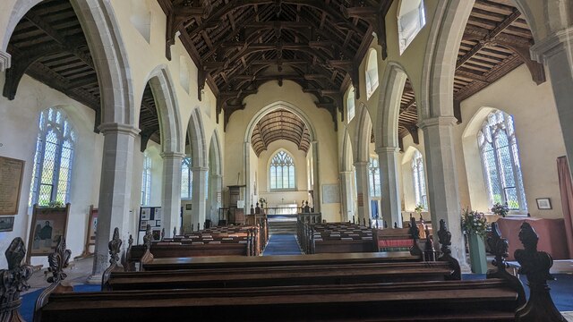
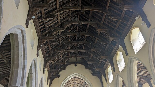
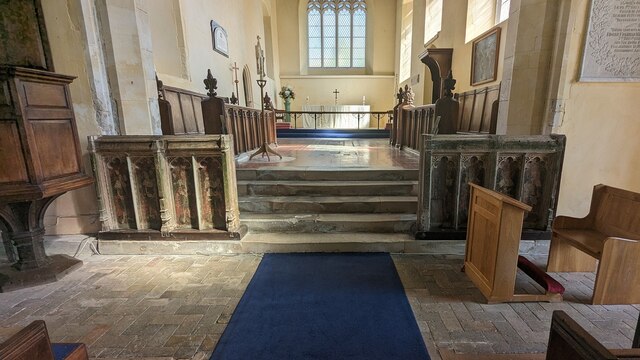
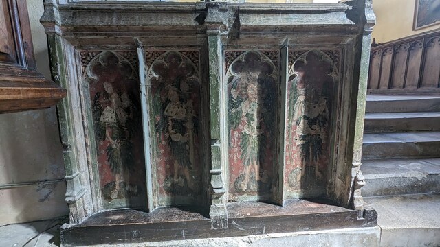
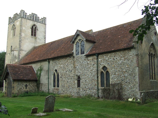
The village boasts a rich history, dating back to medieval times. It is home to several historic buildings, such as the impressive St. Mary Magdalene Church, which showcases stunning architecture and intricate stained glass windows. The village center is lined with beautiful timber-framed buildings, adding to its timeless charm.

Bildeston offers a range of amenities to cater to its residents' needs. It has a well-stocked village shop, a post office, and a local pub, The Crown, which serves delicious food and drink. The village also has a primary school, providing education for the younger population.

Nature lovers and outdoor enthusiasts will appreciate the surrounding countryside, which offers scenic walking and cycling routes. The village is also within close proximity to the Dedham Vale Area of Outstanding Natural Beauty, providing even more opportunities for exploration.

Bildeston hosts various community events throughout the year, including a popular summer fete and a Christmas market, which bring residents together and showcase the village's vibrant spirit.

Overall, Bildeston, Suffolk offers a peaceful and idyllic rural lifestyle, with its historic charm, friendly community, and access to stunning natural landscapes.

If you have any feedback on the listing, please let us know in the comments section below.

Bildeston Images

Images are sourced within 2km of 52.107853/0.908244 or Grid Reference TL9949. Thanks to Geograph Open Source API. All images are credited.

Church of All Saints, Hitcham <span class="nowrap"><a title="https://historicengland.org.uk/listing/the-list/list-entry/1285593?section=official-list-entry" rel="nofollow ugc noopener" href="https://historicengland.org.uk/listing/the-list/list-entry/1285593?section=official-list-entry">Link</a><img style="margin-left:2px;" alt="External link" title="External link - shift click to open in new window" src="https://s1.geograph.org.uk/img/external.png" width="10" height="10"/></span>
Church of All Saints, Hitcham
Doorway at Church of All Saints, Hitcham <span class="nowrap"><a title="https://historicengland.org.uk/listing/the-list/list-entry/1285593?section=official-list-entry" rel="nofollow ugc noopener" href="https://historicengland.org.uk/listing/the-list/list-entry/1285593?section=official-list-entry">Link</a><img style="margin-left:2px;" alt="External link" title="External link - shift click to open in new window" src="https://s1.geograph.org.uk/img/external.png" width="10" height="10"/></span>
Doorway at Church of All Saints, Hitcham
Interior of Church of All Saints, Hitcham <span class="nowrap"><a title="https://historicengland.org.uk/listing/the-list/list-entry/1285593?section=official-list-entry" rel="nofollow ugc noopener" href="https://historicengland.org.uk/listing/the-list/list-entry/1285593?section=official-list-entry">Link</a><img style="margin-left:2px;" alt="External link" title="External link - shift click to open in new window" src="https://s1.geograph.org.uk/img/external.png" width="10" height="10"/></span>
Interior of Church of All Saints, Hitcham
Double-hammer beam roof at Church of All Saints, Hitcham <span class="nowrap"><a title="https://historicengland.org.uk/listing/the-list/list-entry/1285593?section=official-list-entry" rel="nofollow ugc noopener" href="https://historicengland.org.uk/listing/the-list/list-entry/1285593?section=official-list-entry">Link</a><img style="margin-left:2px;" alt="External link" title="External link - shift click to open in new window" src="https://s1.geograph.org.uk/img/external.png" width="10" height="10"/></span>
Double-hammer beam roof at Church of All Saints, Hitcham
Rood Screen Dado at Church of All Saints, Hitcham <span class="nowrap"><a title="http://www.suffolkchurches.co.uk/hitcham.htm" rel="nofollow ugc noopener" href="http://www.suffolkchurches.co.uk/hitcham.htm">Link</a><img style="margin-left:2px;" alt="External link" title="External link - shift click to open in new window" src="https://s1.geograph.org.uk/img/external.png" width="10" height="10"/></span>
Rood Screen Dado at Church of All Saints, Hitcham
Closer Look at Rood Screen Dado at Church of All Saints, Hitcham <span class="nowrap"><a title="http://www.suffolkchurches.co.uk/hitcham.htm" rel="nofollow ugc noopener" href="http://www.suffolkchurches.co.uk/hitcham.htm">Link</a><img style="margin-left:2px;" alt="External link" title="External link - shift click to open in new window" src="https://s1.geograph.org.uk/img/external.png" width="10" height="10"/></span>
Closer Look at Rood Screen Dado at Church of All Saints, Hitcham
B1078 northeast of High Street Farm
B1078 northeast of Great Copt Hall
Ordnance Survey Flush Bracket 2102 This can be found on the wall of High Street Farm House.
For more detail see : <span class="nowrap"><a title="http://www.bench-marks.org.uk/bm2008" rel="nofollow ugc noopener" href="http://www.bench-marks.org.uk/bm2008">Link</a><img style="margin-left:2px;" alt="External link" title="External link - shift click to open in new window" src="https://s1.geograph.org.uk/img/external.png" width="10" height="10"/></span>
Ordnance Survey Flush Bracket 2102
This can be found on the wall of High Street Farm House. For more detail see : LinkExternal link
All Saints Church, Hitcham
Pumping station, Hitcham
Farmland, Hitcham
Farmland, Hitcham
B1115 towards Hadleigh
Hitcham parish church All Saints.
Hitcham parish church
All Saints.
Hitcham village sign The sign, erected for the silver jubilee of Queen Elizabeth II, has a direct message, that the parish has an agricultural heritage. The horseshoes tell of horses, blacksmiths and farriers. The scythe and sheaf, of arable farming and labouring in the fields. The parish contains the hamlets of Bird Street, Cook's Green and Cross Green but these are not referred to on the sign. <a title="https://www.geograph.org.uk/photo/6764502" href="https://www.geograph.org.uk/photo/6764502">Link</a>
Hitcham village sign
The sign, erected for the silver jubilee of Queen Elizabeth II, has a direct message, that the parish has an agricultural heritage. The horseshoes tell of horses, blacksmiths and farriers. The scythe and sheaf, of arable farming and labouring in the fields. The parish contains the hamlets of Bird Street, Cook's Green and Cross Green but these are not referred to on the sign. Link
B1115 near Hitcham church
Track to Clayhill Farm
Little used road to Clayhill Farm
Show me another place!

Bildeston is located at Grid Ref: TL9949 (Lat: 52.107853, Lng: 0.908244)

Administrative County: Suffolk

District: Babergh

Police Authority: Suffolk

What 3 Words

///snuck.struggle.countries. Near Bildeston, Suffolk

Nearby Locations

Bildeston Bildeston

Related Wikis

Bildeston

Bildeston is a village and civil parish in the Babergh district of Suffolk, England. Located around 5 miles (8 km) north of Hadleigh, in 2005 it had a...

Cosford Hundred

Cosford was a hundred of Suffolk, consisting of 30,712 acres (124.29 km2).The hundred consisted of Hadleigh, the only town of any size, and seventeen other...

Hitcham, Suffolk

Hitcham is a village and civil parish in Suffolk, England. Located on the B1115 road, between Hadleigh and Stowmarket, it is part of Babergh district....

Nedging

Nedging is a village and former civil parish on the B1115 road, now in the parish of Nedging-with-Naughton, in the Babergh district, in the county of Suffolk...

Chelsworth

Chelsworth is a village and civil parish in Suffolk, England. It lies on the B1115 road, 10 miles in either direction from Sudbury and Stowmarket. It is...

Nedging-with-Naughton

Nedging-with-Naughton is a civil parish in the Babergh district of the county of Suffolk, England. Located on the B1078 between Bildeston and Needham Market...

Nedging Tye

Nedging Tye is a hamlet on the B1078 road, in the civil parish of Nedging-with-Naughton, in the Babergh district, in the county of Suffolk, England. The...

Wattisham

Wattisham is a village and civil parish near to the town of Stowmarket in Suffolk, England. From the 2011 Census the population of the parish was 110,...

Nearby Amenities

Located within 500m of 52.107853,0.908244
Bildeston
Name Ru: Билдстон
Place: village
Source: npe
Wikidata: Q860798
Lat/Long: 52.1069481/0.9098846
Bus Stop
Clock Tower
Naptan AtcoCode: 390010497
Naptan Bearing: NW
Naptan CommonName: Clock Tower
Naptan Indicator: adj
Naptan Landmark: Clock Tower
Naptan NaptanCode: sufagmaw
Naptan Street: High Street
Naptan Verified: no
Public Transport: platform
Source: naptan_import
Lat/Long: 52.1077699/0.9083253
Bus Stop
Clock Tower
Naptan AtcoCode: 390010498
Naptan Bearing: SE
Naptan BusStopType: CUS
Naptan CommonName: Clock Tower
Naptan Indicator: opp
Naptan Landmark: Clock Tower
Naptan NaptanCode: sufagmda
Naptan Street: High Street
Naptan Verified: no
Public Transport: platform
Source: naptan_import
Lat/Long: 52.1077346/0.9084887
Power: pole
Lat/Long: 52.1058159/0.9036109
Power: pole
Lat/Long: 52.1062993/0.9022468
Power: pole
Lat/Long: 52.1105675/0.9044569
Power: pole
Lat/Long: 52.1113845/0.9048351
Power: pole
Lat/Long: 52.1086073/0.9035745
Power: pole
Lat/Long: 52.1063866/0.9032526
Power: pole
Lat/Long: 52.1049731/0.9043067
Power: pole
Lat/Long: 52.1042384/0.9049129
Power: pole
Lat/Long: 52.1070477/0.902863
Power: pole
Lat/Long: 52.1077655/0.9031829
Power: pole
Lat/Long: 52.1095742/0.9040063
King's Head Brewery
Addr City: Bildeston
Addr Housenumber: 132
Addr Postcode: IP7 7ED
Addr Street: High Street
Craft: brewery
Lat/Long: 52.1082637/0.9083488
Telephone
Booth: K6
Covered: booth
Listed Status: Grade II
Phone: +44 1449 740238
Source: bing
Lat/Long: 52.1077391/0.908281
Post Box
Post Box Type: pillar
Ref: IP7 1228
Royal Cypher: EIIR
Royal Cypher Wikidata: Q33102113
Source: bing
Lat/Long: 52.1077443/0.9082794
Historic: memorial
Memorial: war_memorial
Lat/Long: 52.1076409/0.9083315
Post Box
Ref: IP7 1350
Lat/Long: 52.1094289/0.9112128
Shop: convenience
Lat/Long: 52.1076845/0.9086033
Post Office
Bildeston Post Office
Addr Postcode: IP7 7EB
Branch: Bildeston
Brand: Post Office
Brand Wikidata: Q1783168
Check Date: 2020-02-20
Ref Pol Id: 116960
Website: https://www.postoffice.co.uk/branch-finder/184458x/bildeston
Lat/Long: 52.1077174/0.9085684
Post Box
Operator: Royal Mail
Operator Wikidata: Q638098
Post Box Mounting: pier
Post Box Type: lamp
Ref: IP7 1449
Lat/Long: 52.1045838/0.9105146
The Bildeston Crown
Addr Country: GB
Addr Housenumber: 104
Addr Postcode: IP7 7EB
Addr Street: High Street
Fhrs Id: 1517984
Tourism: hotel
Website: https://thebildestoncrown.com/
Lat/Long: 52.1072169/0.9090112
Pub
Red Lion
Addr City: Bildeston
Addr Street: High Street
Lat/Long: 52.1056472/0.9090366
Waste Basket
Lat/Long: 52.1077333/0.9082236
Leisure: playground
Lat/Long: 52.1056451/0.9111715
Bench
Backrest: yes
Covered: no
Lat/Long: 52.107723/0.9082369
Waste Basket
Lat/Long: 52.1077259/0.9082937
Addr City: Bildeston
Addr Housenumber: 80A
Addr Postcode: IP7 7EJ
Addr Street: Brooksfield
Lat/Long: 52.1097876/0.9132794
Addr City: Bildeston
Addr Housenumber: 80
Addr Postcode: IP7 7EJ
Addr Street: Brooksfield
Lat/Long: 52.1097286/0.9133172
Addr City: Bildeston
Addr Housenumber: 78
Addr Postcode: IP7 7EJ
Addr Street: Brooksfield
Lat/Long: 52.1096952/0.9133872
Addr City: Bildeston
Addr Housenumber: 78A
Addr Postcode: IP7 7EJ
Addr Street: Brooksfield
Lat/Long: 52.1096874/0.9134894
The data included in this document is from www.openstreetmap.org. The data is made available under ODbL.

Have you been to Bildeston?

Leave your review of Bildeston below (or comments, questions and feedback).