Bilborough

Settlement in Nottinghamshire

England

Bilborough

Pond Way, Wollaton The entry to Martin's Reach housing development on an area formerly occupied by allotment gardens.
Pond Way, Wollaton Credit: Alan Murray-Rust

Bilborough is a suburban area located in the city of Nottingham, in the county of Nottinghamshire, England. Situated approximately four miles northwest of Nottingham city centre, it is bordered by the districts of Wollaton, Beechdale, Strelley, and Aspley.

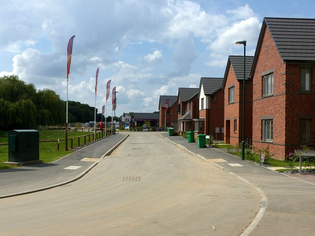
Originally a small village, Bilborough has experienced significant growth and urban development since the mid-20th century. The area is primarily residential, with a mix of housing types including detached and semi-detached houses, as well as a number of apartment complexes. The population is diverse, with a mix of families, professionals, and students.

Bilborough is well-served by public transportation, with several bus routes connecting it to the city centre and surrounding areas. The area also has easy access to major roads, including the A52 and the M1 motorway, providing convenient links to other parts of the country.

For recreational activities, Bilborough boasts several parks and green spaces, including Bracebridge Drive Park and Bilborough Park. These areas offer opportunities for outdoor activities, such as walking, jogging, and picnicking. Additionally, there are a variety of amenities and facilities in the area, including schools, shops, healthcare services, and a community center.

Overall, Bilborough is a thriving suburban area that offers a peaceful and convenient living environment for its residents. Its proximity to Nottingham city centre and excellent transport links make it an attractive place to live for those seeking a balance between urban convenience and suburban tranquility.

If you have any feedback on the listing, please let us know in the comments section below.

Bilborough Images

Images are sourced within 2km of 52.966068/-1.225732 or Grid Reference SK5241. Thanks to Geograph Open Source API. All images are credited.

Pond Way, Wollaton The entry to Martin's Reach housing development on an area formerly occupied by allotment gardens.
Pond Way, Wollaton
The entry to Martin's Reach housing development on an area formerly occupied by allotment gardens.
The entrance to Martin's Pond The new gates were installed in July 2020; created with local children from Fernwood School and Artist Richard Janes.
The entrance to Martin's Pond
The new gates were installed in July 2020; created with local children from Fernwood School and Artist Richard Janes.
Footpath alongside the stream Harrison's Plantation nature reserve, linked with Martin's Pond and Raleigh Pond, forms a green oasis in the middle of suburban development. It is mixed broadleaf woodland which has developed a natural woodland character over the years. The path is a public right of way.
Footpath alongside the stream
Harrison's Plantation nature reserve, linked with Martin's Pond and Raleigh Pond, forms a green oasis in the middle of suburban development. It is mixed broadleaf woodland which has developed a natural woodland character over the years. The path is a public right of way.
Woodyard Park – 1 A large new housing development on the site of the former Siemens Training Centre.
Woodyard Park – 1
A large new housing development on the site of the former Siemens Training Centre.
Woodyard Park – 2 A large new housing development on the site of the former Siemens Training Centre.
Woodyard Park – 2
A large new housing development on the site of the former Siemens Training Centre.
Woodyard Lane The southern approach to the railway bridge. There has been some recent tree clearance compared with John Sutton's 2011 view <a title="https://www.geograph.org.uk/photo/2473437" href="https://www.geograph.org.uk/photo/2473437">Link</a> , taken from a few metres further back.
Woodyard Lane
The southern approach to the railway bridge. There has been some recent tree clearance compared with John Sutton's 2011 view Link , taken from a few metres further back.
East from Woodyard Lane railway bridge Since John Sutton took this view <a title="https://www.geograph.org.uk/photo/2473446" href="https://www.geograph.org.uk/photo/2473446">Link</a> in 2011, some of the blocks of flats in the distance have been demolished and there has been considerable tree growth alongside the railway.
East from Woodyard Lane railway bridge
Since John Sutton took this view Link in 2011, some of the blocks of flats in the distance have been demolished and there has been considerable tree growth alongside the railway.
Primary Substation, Bilborough Taken on an attempt to recreate this 'First' for the square <a title="https://www.geograph.org.uk/photo/18959" href="https://www.geograph.org.uk/photo/18959">Link</a> . Not replicable without access to the upper floor of the Nottingham City Council depot at Woolsthorpe Close!
Primary Substation, Bilborough
Taken on an attempt to recreate this 'First' for the square Link . Not replicable without access to the upper floor of the Nottingham City Council depot at Woolsthorpe Close!
“Please do not lean or sit” The condition of the wall is self explanatory; it was probably attacked by a heavy vehicle making its way to the Council depot at the top of the road.
“Please do not lean or sit”
The condition of the wall is self explanatory; it was probably attacked by a heavy vehicle making its way to the Council depot at the top of the road.
The start of Hollington Road, Beechdale, Nottingham Recreating this 'First' for the square <a title="https://www.geograph.org.uk/photo/51204" href="https://www.geograph.org.uk/photo/51204">Link</a>
The start of Hollington Road, Beechdale, Nottingham
Recreating this 'First' for the square Link
"Government Buildings" Recreating this 'First' for the square <a title="https://www.geograph.org.uk/photo/51212" href="https://www.geograph.org.uk/photo/51212">Link</a> . The Government Buildings were vacated around 2010 and have been replaced by new housing.
"Government Buildings"
Recreating this 'First' for the square Link . The Government Buildings were vacated around 2010 and have been replaced by new housing.
New development Brownsmill Way and Softwood Mews.
New development
Brownsmill Way and Softwood Mews.
Radford to Trowell Railway In Bilborough. Opened in 1875 by the Midland Railway.
Radford to Trowell Railway
In Bilborough. Opened in 1875 by the Midland Railway.
Radford to Trowell Railway Opened in 1875 by the Midland Railway.
Radford to Trowell Railway
Opened in 1875 by the Midland Railway.
Council Estate, Cockington Road, Bilborough Recreating this 'First' for the square <a title="https://www.geograph.org.uk/photo/51192" href="https://www.geograph.org.uk/photo/51192">Link</a> .

Very little has changed.
Council Estate, Cockington Road, Bilborough
Recreating this 'First' for the square Link . Very little has changed.
Bridleway cross on Trowell Moor Two historically main routes which would have provided transport for the early coal-miming industry of the area. Straight ahead is now the Robin Hood Way with the Broxtowe Country Trail joining from the right.
Bridleway cross on Trowell Moor
Two historically main routes which would have provided transport for the early coal-miming industry of the area. Straight ahead is now the Robin Hood Way with the Broxtowe Country Trail joining from the right.
Barley crop alongside the Robin Hood Way Shaw's Plantation in the distance.
Barley crop alongside the Robin Hood Way
Shaw's Plantation in the distance.
Bridleway junction The bridleway from Trowell (right) - part of the Robin Hood Way - meets Strelley Lane.
Bridleway junction
The bridleway from Trowell (right) - part of the Robin Hood Way - meets Strelley Lane.
Show me another place!

Bilborough is located at Grid Ref: SK5241 (Lat: 52.966068, Lng: -1.225732)

Unitary Authority: Nottingham

Police Authority: Nottinghamshire

What 3 Words

///army.trying.cafe. Near Basford, Nottinghamshire

Nearby Locations

Bilborough

Related Wikis

Bilborough

Bilborough is a suburb of the city of Nottingham, in the Nottingham district, in the ceremonial county of Nottinghamshire, England. The population of the...

Bilborough College

Bilborough Sixth Form College is a sixth-form college in Nottingham, England. The college has students from across the conurbation. A third of its students...

Nottingham University Samworth Academy

Nottingham University Samworth Academy (formerly William Sharp School) is a coeducational secondary school and sixth form with academy status, located...

Harvey Hadden Stadium

The Harvey Hadden Stadium is a purpose-built athletics stadium in the Bilborough district of Nottingham, England which is the home of Notts Athletics Club...

Nearby Amenities

Located within 500m of 52.966068,-1.225732
Pub
The Pelican
Addr City: Nottingham
Addr Postcode: NG8 4PN
Addr Street: Bracebridge Drive
Fhrs Id: 217459
Source Addr: NCC Open Data Licensed premises
Lat/Long: 52.9644935/-1.2300595
Source: Bing
Traffic Calming: hump
Lat/Long: 52.9651041/-1.2315737
Source: Bing
Traffic Calming: hump
Lat/Long: 52.9645279/-1.2316989
Source: Bing
Traffic Calming: hump
Lat/Long: 52.9650341/-1.2304414
Source: Bing
Traffic Calming: hump
Lat/Long: 52.964262/-1.230502
Turning Circle
Source: Yahoo
Lat/Long: 52.9626888/-1.2256241
Turning Circle
Source: Yahoo
Lat/Long: 52.9684109/-1.2242983
Entrance: main
Lat/Long: 52.965015/-1.2271196
Turning Circle
Source: Yahoo
Lat/Long: 52.9628302/-1.2295438
Source: Bing
Traffic Calming: hump
Lat/Long: 52.9657921/-1.2264224
Source: Bing
Traffic Calming: hump
Lat/Long: 52.9653854/-1.2313982
Turning Circle
Source: Yahoo
Lat/Long: 52.9640293/-1.2239527
Turning Circle
Source: Yahoo
Lat/Long: 52.9660995/-1.2235803
Turning Circle
Source: Yahoo
Lat/Long: 52.9694392/-1.2303006
Turning Circle
Source: Yahoo
Lat/Long: 52.9690156/-1.2299575
Car Wash
Shine Hand Car Wash
Addr City: Nottingham
Addr Postcode: NG8 4PL
Addr Street: Bracebridge Drive
Car Wash: hand
Source: survey
Source Addr Postcode: NCC open data planning
Lat/Long: 52.9639526/-1.229822
Bus Stop
Chingford Road
Bus: yes
Ele: 97.218262
Local Ref: BI32
Naptan AtcoCode: 3390BI32
Naptan Bearing: NW
Naptan CommonName: Chingford Road
Naptan Indicator: Stop BI32
Naptan Landmark: Cairncross Road
Naptan NaptanCode: ntmagtdw
Naptan PlusbusZoneRef: NTNG
Naptan Street: Wigman Road
Naptan Verified: yes
Public Transport: platform
Ref: BI32
Shelter: no
Source: GPS;survey
Lat/Long: 52.9686533/-1.2270803
Bus Stop
Darnhall Crescent
Bus: yes
Ele: 93.132813
Local Ref: BI21
Naptan AtcoCode: 3390BI21
Naptan Bearing: S
Naptan CommonName: Darnhall Crescent
Naptan Indicator: Stop BI21
Naptan Landmark: Darnhall Crescent
Naptan NaptanCode: ntmagtaj
Naptan PlusbusZoneRef: NTNG
Naptan Street: Bracebridge Drive
Naptan Verified: yes
Public Transport: platform
Ref: BI21
Shelter: no
Source: naptan_import;GPS;survey
Lat/Long: 52.9654716/-1.2267518
Bus Stop
Bracebridge Drive Shops
Bus: yes
Ele: 89.768066
Local Ref: BI20
Naptan AtcoCode: 3390BI20
Naptan Bearing: NE
Naptan CommonName: Bracebridge Drive Shops
Naptan Indicator: Stop BI20
Naptan Landmark: Bilborough Library
Naptan NaptanCode: ntmagtag
Naptan PlusbusZoneRef: NTNG
Naptan Street: Bracebridge Drive
Naptan Verified: no
Public Transport: platform
Source: naptan_import;GPS;survey
Lat/Long: 52.9647383/-1.2287302
Post Box
Collection Times: Mo-Fr 17:00; Sa 11:30
Post Box Design: type_k
Post Box Type: pillar
Ref: NG8 330
Ref GB Uprn: 10022953349
Royal Cypher: EIIR
Royal Cypher Wikidata: Q33102113
Source: survey
Lat/Long: 52.9644227/-1.2288208
Post Office
Bilborough Post Office
Addr City: Nottingham
Addr Housenumber: 79-81
Addr Postcode: NG8 4PL
Addr Street: Bracebridge Drive
Branch: Bilborough
Brand: Post Office
Brand Wikidata: Q1783168
Check Date: 2020-02-20
Contact Website: https://www.postoffice.co.uk/branch-finder/1732277/bilborough
Ref Pol Id: 4720
Shop: stationery
Source: survey
Source Addr Housenumber: NCC open data planning
Source Postcode: ONS
Lat/Long: 52.9643261/-1.2287338
Bus Stop
Graylands Road
Bus: yes
Local Ref: BI05
Naptan AtcoCode: 3390BI05
Naptan Bearing: W
Naptan CommonName: Graylands Road
Naptan Indicator: Stop BI05
Naptan Landmark: Harvey Hadden Stadium
Naptan NaptanCode: ntmadgwd
Naptan PlusbusZoneRef: NTNG
Naptan Street: Wigman Road
Naptan Verified: yes
Public Transport: platform
Shelter: yes
Source: naptan_import
Lat/Long: 52.965251/-1.2191324
Bus Stop
Bracebridge Drive End
Bus: yes
Local Ref: BI06
Naptan AtcoCode: 3390BI06
Naptan Bearing: SW
Naptan CommonName: Bracebridge Drive End
Naptan Indicator: Stop BI06
Naptan Landmark: Wigman Road
Naptan NaptanCode: ntmadgwg
Naptan PlusbusZoneRef: NTNG
Naptan Street: Bracebridge Drive
Naptan Verified: no
Public Transport: platform
Source: naptan_import
Lat/Long: 52.9664062/-1.2239358
Bus Stop
Darnhall Crescent
Bus: yes
Local Ref: BI07
Naptan AtcoCode: 3390BI07
Naptan Bearing: SW
Naptan CommonName: Darnhall Crescent
Naptan Indicator: Stop BI07
Naptan Landmark: Shops
Naptan NaptanCode: ntmadgwj
Naptan PlusbusZoneRef: NTNG
Naptan Street: Bracebridge Drive
Naptan Verified: yes
Public Transport: platform
Shelter: no
Source: naptan_import
Lat/Long: 52.9650666/-1.2275269
Bus Stop
Bracebridge Drive Shops
Bus: yes
Local Ref: BI08
Naptan AtcoCode: 3390BI08
Naptan Bearing: SW
Naptan CommonName: Bracebridge Drive Shops
Naptan Indicator: Stop BI08
Naptan Landmark: Bilborough Shopping Centre
Naptan NaptanCode: ntmadgwm
Naptan PlusbusZoneRef: NTNG
Naptan Street: Bracebridge Drive
Naptan Verified: yes
Public Transport: platform
Shelter: yes
Source: naptan_import
Lat/Long: 52.9644089/-1.2292274
Bus Stop
Bracebridge Drive End
Bus: yes
Local Ref: BI22
Naptan AtcoCode: 3390BI22
Naptan Bearing: SE
Naptan CommonName: Bracebridge Drive End
Naptan Indicator: Stop BI22
Naptan Landmark: Bilborough Park
Naptan NaptanCode: ntmagtam
Naptan PlusbusZoneRef: NTNG
Naptan Street: Wigman Road
Naptan Verified: yes
Public Transport: platform
Shelter: yes
Source: naptan_import
Lat/Long: 52.9665085/-1.2230853
Bus Stop
Fairnley Road
Bus: yes
Local Ref: BI29
Naptan AtcoCode: 3390BI29
Naptan Bearing: SE
Naptan CommonName: Fairnley Road
Naptan Indicator: Stop BI29
Naptan Landmark: Opposite Fairnley Road
Naptan NaptanCode: ntmagtdm
Naptan PlusbusZoneRef: NTNG
Naptan Street: Wigman Road
Naptan Verified: yes
Public Transport: platform
Shelter: yes
Source: naptan_import
Lat/Long: 52.9698848/-1.2280132
Bus Stop
Chingford Road
Bus: yes
Local Ref: BI30
Naptan AtcoCode: 3390BI30
Naptan Bearing: SE
Naptan CommonName: Chingford Road
Naptan Indicator: Stop BI30
Naptan Landmark: Chingford Road
Naptan NaptanCode: ntmagtdp
Naptan PlusbusZoneRef: NTNG
Naptan Street: Wigman Road
Naptan Verified: no
Public Transport: platform
Source: naptan_import
Lat/Long: 52.9678651/-1.2257114
Bus Stop
Bracebridge Drive End
Bus: yes
Local Ref: BI31
Naptan AtcoCode: 3390BI31
Naptan Bearing: NW
Naptan CommonName: Bracebridge Drive End
Naptan Indicator: Stop BI31
Naptan Landmark: Bracebridge Drive
Naptan NaptanCode: ntmagtdt
Naptan PlusbusZoneRef: NTNG
Naptan Street: Wigman Road
Naptan Verified: no
Public Transport: platform
Source: naptan_import
Lat/Long: 52.9667487/-1.2240786
Bus Stop
Fairnley Road
Bus: yes
Local Ref: BI33
Naptan AtcoCode: 3390BI33
Naptan Bearing: NW
Naptan CommonName: Fairnley Road
Naptan Indicator: Stop BI33
Naptan Landmark: Fairnley Road
Naptan NaptanCode: ntmagtga
Naptan PlusbusZoneRef: NTNG
Naptan Street: Wigman Road
Naptan Verified: yes
Public Transport: platform
Shelter: yes
Source: naptan_import
Lat/Long: 52.9698053/-1.228238
Bus Stop
Hoylake Crescent
Bus: yes
Local Ref: BI55
Naptan AtcoCode: 3390BI55
Naptan Bearing: NW
Naptan CommonName: Hoylake Crescent
Naptan Indicator: Stop BI55
Naptan Landmark: Darnhall Crescent
Naptan NaptanCode: ntmagtjg
Naptan PlusbusZoneRef: NTNG
Naptan Street: Melbury Road
Naptan Verified: no
Public Transport: platform
Source: naptan_import
Lat/Long: 52.9660177/-1.229169
Bus Stop
Hornchurch Road
Both Ways: yes
Bus: yes
Local Ref: BI56
Naptan AtcoCode: 3390BI56
Naptan Bearing: NW
Naptan CommonName: Hornchurch Road
Naptan Indicator: Stop BI56
Naptan Landmark: Fairnley Road
Naptan NaptanCode: ntmajagp
Naptan PlusbusZoneRef: NTNG
Naptan Street: Melbury Road
Naptan Verified: yes
Public Transport: platform
Shelter: no
Source: naptan_import
Lat/Long: 52.9688889/-1.2310984
Bus Stop
Cairncross Road
Addr Street: Caincross Road
Bus: yes
Local Ref: BI59
Naptan AtcoCode: 3390BI59
Naptan Bearing: NW
Naptan CommonName: Cairncross Road
Naptan Indicator: Stop BI59
Naptan Landmark: Cairncross Road
Naptan NaptanCode: ntmajaja
Naptan PlusbusZoneRef: NTNG
Naptan Street: Melbury Road
Naptan Verified: yes
Public Transport: platform
Shelter: no
Source: naptan_import
Lat/Long: 52.9670823/-1.2297606
Bus Stop
Darnhall Crescent
Both Ways: yes
Bus: yes
Local Ref: BI60
Naptan AtcoCode: 3390BI60
Naptan Bearing: SE
Naptan CommonName: Darnhall Crescent
Naptan Indicator: Stop BI60
Naptan Landmark: Melbury Road
Naptan NaptanCode: ntmajajd
Naptan PlusbusZoneRef: NTNG
Naptan Street: Darnhall Crescent
Naptan Verified: yes
Public Transport: platform
Shelter: no
Source: naptan_import
Lat/Long: 52.9657127/-1.2278791
Bus Stop
Clether Road
Bus: yes
Local Ref: BI68
Naptan AtcoCode: 3390BI68
Naptan Bearing: W
Naptan CommonName: Clether Road
Naptan Indicator: Stop BI68
Naptan Landmark: Clether Road
Naptan NaptanCode: ntmajamd
Naptan PlusbusZoneRef: NTNG
Naptan Street: Glaisdale Drive
Naptan Verified: yes
Public Transport: platform
Source: naptan_import
Lat/Long: 52.9619084/-1.2262847
Bus Stop
Clether Road
Bus: yes
Local Ref: BI71
Naptan AtcoCode: 3390BI71
Naptan Bearing: E
Naptan CommonName: Clether Road
Naptan Indicator: Stop BI71
Naptan Landmark: Clether Road
Naptan NaptanCode: ntmajamj
Naptan PlusbusZoneRef: NTNG
Naptan Street: Glaisdale Drive
Naptan Verified: no
Public Transport: platform
Source: naptan_import
Lat/Long: 52.9620761/-1.2257702
Bus Stop
Moorhouse Road
Bus: yes
Local Ref: BI72
Naptan AtcoCode: 3390BI72
Naptan Bearing: E
Naptan CommonName: Moorhouse Road
Naptan Indicator: Stop BI72
Naptan Landmark: Moorhouse Road
Naptan NaptanCode: ntmajamp
Naptan PlusbusZoneRef: NTNG
Naptan Street: Glaisdale Drive
Naptan Verified: no
Public Transport: platform
Source: naptan_import
Lat/Long: 52.9621173/-1.2224345
Source: GPS
Traffic Calming: hump
Lat/Long: 52.9693463/-1.2290029
Source: GPS
Traffic Calming: hump
Lat/Long: 52.968668/-1.2283567
Source: GPS
Traffic Calming: hump
Lat/Long: 52.9681227/-1.2277288
Source: GPS
Traffic Calming: hump
Lat/Long: 52.9675384/-1.2269547
Source: GPS
Traffic Calming: hump
Lat/Long: 52.9670154/-1.2261273
Source: GPS
Traffic Calming: hump
Lat/Long: 52.9664555/-1.2251102
Entrance: main
Lat/Long: 52.9636538/-1.2279337
Addr Housenumber: 100
Source: survey
Lat/Long: 52.9625886/-1.2280174
Addr City: Nottingham
Addr Housenumber: 9
Addr Postcode: NG8 3BU
Addr Street: Calveley Road
Source: survey
Source Addr: survey
Source Postcode: extrapolation
Lat/Long: 52.9687722/-1.22283
Addr City: Nottingham
Addr Housenumber: 8
Addr Postcode: NG8 3BU
Addr Street: Calveley Road
Source: survey
Source Addr: survey
Source Postcode: NROSH Open Data
Lat/Long: 52.9684749/-1.2231358
Fast Food
Jiang Nan
Addr City: Nottingham
Addr Housenumber: 37
Addr Postcode: NG8 3BS
Addr Street: Chingford Road
Cuisine: chinese
Fhrs Id: 896378
Old Fhrs Id: 765337
Old Name: Jade Garden
Old Name 2: Chingford Inn
Source: survey
Source Addr: NCC Open Data
Lat/Long: 52.9690694/-1.2237313
Addr City: Nottingham
Addr Housenumber: 3
Addr Postcode: NG8 3BU
Addr Street: Calveley Road
Source: survey
Source Addr: survey
Source Postcode: extrapolation
Lat/Long: 52.9689917/-1.2230446
Addr City: Nottingham
Addr Housenumber: 6
Addr Postcode: NG8 3BU
Addr Street: Calveley Road
Source: survey
Source Addr: survey
Source Postcode: NROSH Open Data
Lat/Long: 52.9685426/-1.2232485
Addr City: Nottingham
Addr Housenumber: 2
Addr Postcode: NG8 3BX
Addr Street: Stanwick Close
Source: survey
Source Postcode: NROSH Open Data
Lat/Long: 52.9688463/-1.2224277
Chingford Stores
Addr City: Nottingham
Addr Housenumber: 39
Addr Postcode: NG8 3BS
Addr Street: Chingford Road
Brand: Premier Express
Fhrs Id: 218153
Shop: convenience
Source: survey
Source Addr: NCC Open Data
Lat/Long: 52.9690209/-1.22386
Addr City: Nottingham
Addr Housenumber: 5
Addr Postcode: NG8 3BU
Addr Street: Calveley Road
Source: survey
Source Addr: survey
Source Postcode: NROSH Open Data
Lat/Long: 52.9689014/-1.2229588
Addr City: Nottingham
Addr Housenumber: 11
Addr Postcode: NG8 3BU
Addr Street: Calveley Road
Source: survey
Source Addr: survey
Source Postcode: NROSH Open Data
Lat/Long: 52.968714/-1.2227764
Addr City: Nottingham
Addr Housenumber: 1
Addr Postcode: NG8 3BU
Addr Street: Calveley Road
Source: survey
Source Addr: survey
Source Postcode: NROSH Open Data
Lat/Long: 52.9690434/-1.2230929
Addr City: Nottingham
Addr Housenumber: 1
Addr Postcode: NG8 3BX
Addr Street: Stanwick Close
Source: survey
Source Postcode: NROSH Open Data
Lat/Long: 52.9688012/-1.2225457
Addr City: Nottingham
Addr Housenumber: 7
Addr Postcode: NG8 3BU
Addr Street: Calveley Road
Source: survey
Source Addr: survey
Source Postcode: NROSH Open Data
Lat/Long: 52.9688303/-1.2228998
Bilborough Convenience Store
Addr City: Nottingham
Addr Housenumber: 18
Addr Postcode: NG8 4FJ
Addr Street: Graylands Road
Brand: Premier
Brand Wikidata: Q7240340
Brand Wikipedia: en:Premier Stores
Fhrs Id: 1138290
Operator: Premier
Shop: convenience
Source: survey
Source Addr: NCC Open Data
Website: https://www.premier-stores.co.uk/our-stores/billborough-convenience-store
Lat/Long: 52.9639495/-1.2201104
H.K. Baxter
Addr City: Nottingham
Addr Housenumber: 83
Addr Postcode: NG8 4PL
Addr Street: Bracebridge Drive
Shop: hardware
Source: survey
Source Addr Housenumber: interpolation
Source Postcode: ONS
Lat/Long: 52.964284/-1.2288646
Fast Food
Panda Garden
Addr City: Nottingham
Addr Housenumber: 61a
Addr Postcode: NG8 4PH
Addr Street: Bracebridge Drive
Cuisine: chinese
Fhrs Id: 1684516
Source: survey
Source Housenumber: NCC Open Data
Source Postcode: ONS
Lat/Long: 52.9648783/-1.2272925
Fast Food
Andy's Fish Bar
Addr City: Nottingham
Addr Housenumber: 89
Addr Postcode: NG8 4PL
Addr Street: Bracebridge Drive
Cuisine: fish_and_chips
Fhrs Id: 216770
Source: survey
Source Housenumber: NCC Open Data
Source Postcode: ONS
Lat/Long: 52.964174/-1.229165
Doctors
Bilborough Medical & Dental Centre
Contact Twitter: https://twitter.com/NCGPANottm
Healthcare: doctor
Phone: +44 115 9292 354
Website: https://www.bilboroughmedicalcentre.co.uk/
Lat/Long: 52.9647843/-1.2289372
Bitza Allsorts
Addr City: Nottingham
Addr Housenumber: 93
Addr Postcode: NG8 4PL
Addr Street: Bracebridge Drive
Description: "Cards, gifts, household, toiletries, toys, clothes"
Discount: variety_store
Shop: variety_store
Source: survey
Source Addr Housenumber: interpolation
Source Postcode: ONS
Tat: yes
Lat/Long: 52.9640964/-1.2293844
Cafe
Berry Tasty
Addr City: Nottingham
Addr Housenumber: 67
Addr Postcode: NG8 4PH
Addr Street: Bracebridge Drive
Source: survey
Source Housenumber: NCC Open Data
Source Postcode: ONS
Lat/Long: 52.9647547/-1.2276318
Stapletons
Addr City: Nottingham
Addr Housenumber: 85
Addr Postcode: NG8 4PL
Addr Street: Bracebridge Drive
Shop: florist
Source: survey
Source Housenumber: NCC Open Data
Source Postcode: ONS
Lat/Long: 52.9642484/-1.2289665
Legends Barbers
Addr City: Nottingham
Addr Housenumber: 61
Addr Postcode: NG8 4PH
Addr Street: Bracebridge Drive
Shop: hairdresser
Source: survey
Source Housenumber: interpolation
Source Postcode: ONS
Lat/Long: 52.9649074/-1.2272015
The Olde Block
Addr City: Nottingham
Addr Housenumber: 87
Addr Postcode: NG8 4PL
Addr Street: Bracebridge Drive
Fixme: Confirm shop type
Shop: deli
Source: survey
Source Housenumber: NCC Open Data
Source Postcode: ONS
Lat/Long: 52.9642095/-1.2290738
Fast Food
Greggs
Addr City: Nottingham
Addr Housenumber: 65
Addr Postcode: NG8 4PH
Addr Street: Bracebridge Drive
Brand: Greggs
Brand Wikidata: Q3403981
Brand Wikipedia: en:Greggs
Contact Website: https://www.greggs.co.uk/shop-finder?shop-code=1787
Cuisine: sandwich;bakery
Fhrs Id: 216373
Shop: bakery
Source: survey
Source Housenumber: NCC Open Data
Source Postcode: ONS
Takeaway: yes
Lat/Long: 52.9647814/-1.2275446
Co-op Food
Addr City: Nottingham
Addr Housenumber: 75
Addr Postcode: NG8 4PH
Addr Street: Bracebridge Drive
Brand: Co-op Food
Brand Wikidata: Q3277439
Fhrs Id: 216422
Operator: The Co-operative Group
Operator Wikidata: Q117202
Shop: supermarket
Source: survey
Source Housenumber: NCC Open Data
Source Postcode: ONS
Website: https://www.coop.co.uk/store-finder/NG8-4PH/73-75-bracebridge-drive
Lat/Long: 52.9645391/-1.2279889
Bargain Booze
Addr City: Nottingham
Addr Housenumber: 69
Addr Postcode: NG8 4PH
Addr Street: Bracebridge Drive
Brand: Bargain Booze
Brand Wikidata: Q16971315
Brand Wikipedia: en:Bargain Booze
Fhrs Id: 1302289
Shop: alcohol
Source: survey
Source Housenumber: NCC Open Data
Source Postcode: ONS
Lat/Long: 52.9647274/-1.2277304
Sue Ryder
Addr City: Nottingham
Addr Postcode: NG8 4PH
Addr Street: Bracebridge Drive
Brand: Sue Ryder
Brand Wikidata: Q7634271
Brand Wikipedia: en:Sue Ryder (charity)
Shop: charity
Source: survey
Source Addr: NCC Open Data
Source Postcode: ONS
Lat/Long: 52.9647/-1.2278174
The Salvation Army
Addr City: Nottingham
Addr Housenumber: 95
Addr Postcode: NG8 4PL
Addr Street: Bracebridge Drive
Brand: The Salvation Army
Brand Wikidata: Q188307
Brand Wikipedia: en:The Salvation Army
Shop: charity
Source: survey
Source Addr Housenumber: NCC open data business rates accounts
Source Postcode: ONS
Lat/Long: 52.9640447/-1.2294917
Pharmacy
Well Pharmacy
Addr City: Nottingham
Addr Housenumber: 75
Addr Postcode: NG8 4PH
Addr Street: Bracebridge Drive
Brand: Well Pharmacy
Brand Wikidata: Q7726524
Brand Wikipedia: en:Well Pharmacy
Healthcare: pharmacy
Shop: chemist
Source: survey
Source Housenumber: NCC Open Data
Source Postcode: ONS
Website: https://finder.well.co.uk/store/billborough
Lat/Long: 52.9646433/-1.2279143
William Hill
Addr City: Nottingham
Addr Housenumber: 91
Addr Postcode: NG8 4PL
Addr Street: Bracebridge Drive
Brand: William Hill
Brand Wikidata: Q4053147
Brand Wikipedia: en:William Hill (bookmaker)
Shop: bookmaker
Source: survey
Source Addr Housenumber: NCC open data planning
Source Postcode: ONS
Lat/Long: 52.9641224/-1.229283
The Attic
Addr City: Nottingham
Addr Postcode: NG8 4PL
Addr Street: Bracebridge Drive
Alt Shop: beauty
Shop: hairdresser
Source: survey
Source Postcode: ONS
Lat/Long: 52.9640803/-1.2293152
Heron Foods
Addr City: Nottingham
Addr Housenumber: 63
Addr Postcode: NG8 4PH
Addr Street: Bracebridge Drive
Brand: Heron Foods
Brand Wikidata: Q5743472
Brand Wikipedia: en:Heron Foods
Contact Website: https://heronfoods.com/store/bilborough/
Fhrs Id: 217561
Shop: supermarket
Source: survey
Source Housenumber: NCC Open Data
Source Postcode: ONS
Lat/Long: 52.9648218/-1.2274186
Crossing
Crossing: uncontrolled
Crossing Island: no
Crossing Markings: zebra
Crossing Ref: zebra
Source: Bing
Tactile Paving: yes
Lat/Long: 52.9645431/-1.2290336
Post Box
Collection Times: Mo-Fr 09:00; Sa 07:00
Post Box Design: type_b
Post Box Type: pillar
Ref: NG8 250D
Ref GB Uprn: 10015454648
Royal Cypher: GVIR
Royal Cypher Wikidata: Q33102169
Source: survey
Lat/Long: 52.9665042/-1.2239558
Source: survey
Traffic Calming: cushion
Lat/Long: 52.9687237/-1.2309345
Bilborough
Place: suburb
Source: local_knowledge
Wikidata: Q4907620
Wikipedia: en:Bilborough
Lat/Long: 52.9687304/-1.2277774
Power: substation
Source: survey
Lat/Long: 52.9664142/-1.2330011
Power: substation
Source: survey
Lat/Long: 52.9665306/-1.2330741
Addr City: Nottingham
Addr Housenumber: 35
Addr Postcode: NG8 4AF
Addr Street: Melford Road
Entrance: yes
Source: survey
Source Postcode: NROSH
Lat/Long: 52.9674821/-1.2270648
Addr City: Nottingham
Addr Housenumber: 35a
Addr Postcode: NG8 4AF
Addr Street: Melford Road
Entrance: yes
Source: survey
Source Postcode: NROSH
Lat/Long: 52.9674229/-1.2270497
Addr City: Nottingham
Addr Housenumber: 37
Addr Postcode: NG8 4AF
Addr Street: Melford Road
Entrance: yes
Source: survey
Source Postcode: NROSH
Lat/Long: 52.967501/-1.2270913
Addr City: Nottingham
Addr Housenumber: 37a
Addr Postcode: NG8 4AF
Addr Street: Melford Road
Entrance: yes
Source: survey
Source Postcode: NROSH
Lat/Long: 52.96752/-1.2271846
Pharmacy
Boots
Addr City: Nottingham
Addr Postcode: NG8 4PN
Addr Street: Bracebridge Drive
Brand: Boots
Brand Wikidata: Q6123139
Brand Wikipedia: en:Boots (company)
Healthcare: pharmacy
Source: survey
Lat/Long: 52.9648444/-1.2287202
Post Box
Collection Times: Mo-Fr 16:15; Sa 10:00
Post Box Type: pillar
Ref: NG8 254
Ref GB Uprn: 10015319561
Royal Cypher: EIIR
Royal Cypher Wikidata: Q33102113
Source: survey
Lat/Long: 52.9620885/-1.2234238
Source: Bing
Traffic Calming: hump
Lat/Long: 52.9638683/-1.231443
Source: Bing
Traffic Calming: hump
Lat/Long: 52.9658477/-1.2314996
Source: Bing
Traffic Calming: hump
Lat/Long: 52.9662505/-1.2323814
Recycling
Bracebridge Drive Shops Recycling Site
Recycling Type: container
Source: survey
Lat/Long: 52.9644222/-1.2281723
Bus Stop
Cairncross Road
Addr Street: Caincross Road
Bus: yes
Local Ref: BI97
Naptan AtcoCode: 3390BI97
Naptan NaptanCode: ntmwtmpm
Public Transport: platform
Shelter: no
Source: survey
Lat/Long: 52.9671643/-1.2296691
NG8 Tyres
Addr City: Nottingham
Addr Postcode: NG8 4PL
Addr Street: Bracebridge Drive
Shop: tyres
Source: survey
Source Addr Postcode: interpolation
Lat/Long: 52.96393/-1.2295812
Bicycle Parking
Bicycle Parking: stands
Capacity: 4
Covered: no
Source: survey
Lat/Long: 52.964465/-1.2286931
Telephone
Booth: KX100
Door: no
Source: survey
Lat/Long: 52.9645396/-1.2283534
Bicycle Parking
Bicycle Parking: stands
Capacity: 4
Covered: no
Source: survey
Lat/Long: 52.9645673/-1.2284494
Atm
Lloyds Bank
Brand: Lloyds Bank
Brand Wikidata: Q1152847
Brand Wikipedia: en:Lloyds Bank
Capacity: 2
Operator: Lloyds Bank
Operator Wikidata: Q1152847
Lat/Long: 52.9650337/-1.2270349
Crossing
Crossing: uncontrolled
Crossing Island: no
Crossing Markings: zebra
Crossing Ref: zebra
Source: Bing
Tactile Paving: yes
Lat/Long: 52.9651714/-1.2273414
Entrance: main
Lat/Long: 52.9641567/-1.2264012
Telephone
Booth: KX100
Door: no
Source: survey
Lat/Long: 52.9693261/-1.2237494
Barrier: cycle_barrier
Cycle Barrier: squeeze
Lat/Long: 52.9670126/-1.2241414
Barrier: cycle_barrier
Cycle Barrier: squeeze
Lat/Long: 52.9685161/-1.22292
Atm
Source: survey
Lat/Long: 52.9643425/-1.2288176
Addr City: Nottingham
Addr Housenumber: 108
Addr Postcode: NG8 4FD
Addr Street: Graylands Road
Source: survey
Source Postcode: NROSH Open Data
Lat/Long: 52.9639946/-1.2276455
Addr City: Nottingham
Addr Housenumber: 106
Addr Postcode: NG8 4FD
Addr Street: Graylands Road
Source: survey
Source Postcode: NROSH Open Data
Lat/Long: 52.9639413/-1.2275731
Addr City: Nottingham
Addr Housenumber: 102
Addr Postcode: NG8 4FD
Addr Street: Graylands Road
Source: survey
Source Postcode: NROSH Open Data
Lat/Long: 52.9638023/-1.2274282
Addr City: Nottingham
Addr Housenumber: 104
Addr Postcode: NG8 4FD
Addr Street: Graylands Road
Source: survey
Source Postcode: NROSH Open Data
Lat/Long: 52.9638604/-1.2275033
Addr City: Nottingham
Addr Housenumber: 110
Addr Postcode: NG8 4FD
Addr Street: Graylands Road
Source: survey
Source Postcode: NROSH Open Data
Lat/Long: 52.9640607/-1.2277018
Addr City: Nottingham
Addr Housenumber: 110a
Addr Postcode: NG8 4FD
Addr Street: Graylands Road
Source: survey
Source Postcode: NROSH Open Data
Lat/Long: 52.964106/-1.2277608
Direction: forward
Maxspeed: 20 mph
Traffic Sign: maxspeed
Lat/Long: 52.9660252/-1.2219845
Direction: forward
Maxspeed: 30 mph
Traffic Sign: maxspeed
Lat/Long: 52.9659726/-1.222018
Generator Location: roof
Generator Method: photovoltaic
Generator Output Electricity: yes
Generator Source: solar
Generator Type: solar_photovoltaic_panel
Note: roof household
Notional Area: 15 sq m
Power: generator
Lat/Long: 52.9654567/-1.2315443
Generator Location: roof
Generator Method: photovoltaic
Generator Output Electricity: yes
Generator Source: solar
Generator Type: solar_photovoltaic_panel
Note: roof household
Notional Area: 15 sq m
Power: generator
Lat/Long: 52.9659753/-1.2309609
Generator Location: roof
Generator Method: photovoltaic
Generator Output Electricity: yes
Generator Source: solar
Generator Type: solar_photovoltaic_panel
Note: roof household
Notional Area: 15 sq m
Power: generator
Lat/Long: 52.9660318/-1.2308657
Generator Location: roof
Generator Method: photovoltaic
Generator Output Electricity: yes
Generator Source: solar
Generator Type: solar_photovoltaic_panel
Note: roof household
Notional Area: 15 sq m
Power: generator
Lat/Long: 52.9668872/-1.2317187
Generator Location: roof
Generator Method: photovoltaic
Generator Output Electricity: yes
Generator Source: solar
Generator Type: solar_photovoltaic_panel
Note: roof household
Notional Area: 15 sq m
Power: generator
Lat/Long: 52.9626207/-1.2287132
Generator Location: roof
Generator Method: photovoltaic
Generator Output Electricity: yes
Generator Source: solar
Generator Type: solar_photovoltaic_panel
Note: roof household
Notional Area: 15 sq m
Power: generator
Lat/Long: 52.9627103/-1.228779
Generator Location: roof
Generator Method: photovoltaic
Generator Output Electricity: yes
Generator Source: solar
Generator Type: solar_photovoltaic_panel
Note: roof household
Notional Area: 15 sq m
Power: generator
Lat/Long: 52.9627031/-1.2284826
Generator Location: roof
Generator Method: photovoltaic
Generator Output Electricity: yes
Generator Source: solar
Generator Type: solar_photovoltaic_panel
Note: roof household
Notional Area: 15 sq m
Power: generator
Lat/Long: 52.9628016/-1.2285496
Generator Location: roof
Generator Method: photovoltaic
Generator Output Electricity: yes
Generator Source: solar
Generator Type: solar_photovoltaic_panel
Note: roof household
Notional Area: 15 sq m
Power: generator
Lat/Long: 52.962905/-1.2286113
Generator Location: roof
Generator Method: photovoltaic
Generator Output Electricity: yes
Generator Source: solar
Generator Type: solar_photovoltaic_panel
Note: roof household
Notional Area: 15 sq m
Power: generator
Lat/Long: 52.9628275/-1.2288594
Generator Location: roof
Generator Method: photovoltaic
Generator Output Electricity: yes
Generator Source: solar
Generator Type: solar_photovoltaic_panel
Note: roof household
Notional Area: 15 sq m
Power: generator
Lat/Long: 52.962926/-1.2289386
Generator Location: roof
Generator Method: photovoltaic
Generator Output Electricity: yes
Generator Source: solar
Generator Type: solar_photovoltaic_panel
Note: roof household
Notional Area: 15 sq m
Power: generator
Lat/Long: 52.9624252/-1.2285255
Generator Location: roof
Generator Method: photovoltaic
Generator Output Electricity: yes
Generator Source: solar
Generator Type: solar_photovoltaic_panel
Note: roof household
Notional Area: 15 sq m
Power: generator
Lat/Long: 52.9624082/-1.2287132
Generator Location: roof
Generator Method: photovoltaic
Generator Output Electricity: yes
Generator Source: solar
Generator Type: solar_photovoltaic_panel
Note: roof household
Notional Area: 15 sq m
Power: generator
Lat/Long: 52.9623371/-1.2288849
Generator Location: roof
Generator Method: photovoltaic
Generator Output Electricity: yes
Generator Source: solar
Generator Type: solar_photovoltaic_panel
Note: roof household
Notional Area: 15 sq m
Power: generator
Lat/Long: 52.9622959/-1.2290418
Generator Location: roof
Generator Method: photovoltaic
Generator Output Electricity: yes
Generator Source: solar
Generator Type: solar_photovoltaic_panel
Note: roof household
Notional Area: 15 sq m
Power: generator
Lat/Long: 52.9622782/-1.2292926
Generator Location: roof
Generator Method: photovoltaic
Generator Output Electricity: yes
Generator Source: solar
Generator Type: solar_photovoltaic_panel
Note: roof household
Notional Area: 15 sq m
Power: generator
Lat/Long: 52.9618621/-1.2279528
Generator Location: roof
Generator Method: photovoltaic
Generator Orientation: 148
Generator Output Electricity: yes
Generator Source: solar
Generator Type: solar_photovoltaic_panel
Note: roof household
Notional Area: 15 sq m
Power: generator
Lat/Long: 52.9681344/-1.2270529
Generator Location: roof
Generator Method: photovoltaic
Generator Orientation: 228
Generator Output Electricity: yes
Generator Source: solar
Generator Type: solar_photovoltaic_panel
Note: roof household
Notional Area: 7,5 sq m
Power: generator
Source: Digital Globe Standard Imagery
Lat/Long: 52.9680553/-1.2257732
Generator Location: roof
Generator Method: photovoltaic
Generator Output Electricity: yes
Generator Source: solar
Generator Type: solar_photovoltaic_panel
Note: roof household
Notional Area: 15 sq m
Power: generator
Source: ESRI World Imagery
Lat/Long: 52.9686218/-1.226461
Generator Location: roof
Generator Method: photovoltaic
Generator Output Electricity: yes
Generator Source: solar
Generator Type: solar_photovoltaic_panel
Note: roof household
Notional Area: 15 sq m
Power: generator
Source: ESRI World Imagery
Lat/Long: 52.9686138/-1.2265146
Generator Location: roof
Generator Method: photovoltaic
Generator Orientation: 135
Generator Output Electricity: yes
Generator Source: solar
Generator Type: solar_photovoltaic_panel
Note: roof household
Notional Area: 15 sq m
Power: generator
Source: survey
Lat/Long: 52.9684737/-1.2260266
Generator Location: roof
Generator Method: photovoltaic
Generator Orientation: 225
Generator Output Electricity: yes
Generator Source: solar
Generator Type: solar_photovoltaic_panel
Note: roof household
Notional Area: 15 sq m
Power: generator
Source: survey
Lat/Long: 52.9684673/-1.2260776
Generator Location: roof
Generator Method: photovoltaic
Generator Output Electricity: yes
Generator Source: solar
Generator Type: solar_photovoltaic_panel
Note: roof household
Notional Area: 15 sq m
Power: generator
Source: survey
Lat/Long: 52.9626199/-1.2296548
Source: survey
Traffic Calming: cushion
Lat/Long: 52.9634997/-1.2316898
Addr City: Nottingham
Addr Housenumber: 25
Addr Postcode: NG8 4ET
Addr Street: Staverton Road
Source Addr: survey
Source Postcode: NCC Planning Applications Open Data
Lat/Long: 52.9640117/-1.2202294
Addr City: Nottingham
Addr Housenumber: 8
Addr Postcode: NG8 3BX
Addr Street: Stanwick Close
Source Addr: interpolation
Source Postcode: NROSH Open Data
Lat/Long: 52.9692562/-1.2224355
Addr City: Nottingham
Addr Housenumber: 9
Addr Postcode: NG8 3BX
Addr Street: Stanwick Close
Source Addr: interpolation
Source Postcode: NROSH Open Data
Lat/Long: 52.9692853/-1.2223256
Addr City: Nottingham
Addr Housenumber: 10
Addr Postcode: NG8 3BX
Addr Street: Stanwick Close
Source Addr: interpolation
Source Postcode: NROSH Open Data
Lat/Long: 52.9693095/-1.2222263
Addr City: Nottingham
Addr Housenumber: 7
Addr Postcode: NG8 3BX
Addr Street: Stanwick Close
Source Addr: interpolation
Source Postcode: NROSH Open Data
Lat/Long: 52.9692207/-1.2225643
Addr City: Nottingham
Addr Housenumber: 6
Addr Postcode: NG8 3BX
Addr Street: Stanwick Close
Source Addr: interpolation
Source Postcode: NROSH Open Data
Lat/Long: 52.9691302/-1.222634
Addr City: Nottingham
Addr Housenumber: 5
Addr Postcode: NG8 3BX
Addr Street: Stanwick Close
Source Addr: interpolation
Source Postcode: NROSH Open Data
Lat/Long: 52.9690688/-1.2225294
Addr City: Nottingham
Addr Housenumber: 4
Addr Postcode: NG8 3BX
Addr Street: Stanwick Close
Source Addr: NCC Sreetlights Open Data
Source Postcode: NROSH Open Data
Lat/Long: 52.9690058/-1.2224758
Addr City: Nottingham
Addr Housenumber: 3
Addr Postcode: NG8 3BX
Addr Street: Stanwick Close
Source Addr: NCC Sreetlights Open Data
Source Postcode: NROSH Open Data
Lat/Long: 52.9689557/-1.2224168
Addr City: Nottingham
Addr Housenumber: 15
Addr Postcode: NG8 3BX
Addr Street: Stanwick Close
Source Addr: NCC Sreetlights Open Data
Source Postcode: NROSH Open Data
Lat/Long: 52.9694533/-1.2217811
Addr City: Nottingham
Addr Housenumber: 11
Addr Postcode: NG8 3BX
Addr Street: Stanwick Close
Source Addr: NCC Sreetlights Open Data
Source Postcode: NROSH Open Data
Lat/Long: 52.9693434/-1.2221593
Addr City: Nottingham
Addr Housenumber: 20
Addr Postcode: NG8 3BX
Addr Street: Stanwick Close
Source Addr: NCC Sreetlights Open Data
Source Postcode: NROSH Open Data
Lat/Long: 52.9695001/-1.2211561
Addr City: Nottingham
Addr Housenumber: 19
Addr Postcode: NG8 3BX
Addr Street: Stanwick Close
Source Addr: NCC Sreetlights Open Data
Source Postcode: NROSH Open Data
Lat/Long: 52.9695857/-1.2212366
Addr City: Nottingham
Addr Housenumber: 21
Addr Postcode: NG8 3BX
Addr Street: Stanwick Close
Source Addr: NCC Sreetlights Open Data
Source Postcode: NROSH Open Data
Lat/Long: 52.969438/-1.2211078
Addr City: Nottingham
Addr Housenumber: 22
Addr Postcode: NG8 3BX
Addr Street: Stanwick Close
Source Addr: NCC Sreetlights Open Data
Source Postcode: NROSH Open Data
Lat/Long: 52.9694072/-1.2210623
Addr City: Nottingham
Addr Housenumber: 23
Addr Postcode: NG8 3BX
Addr Street: Stanwick Close
Source Addr: interpolation
Source Postcode: NROSH Open Data
Lat/Long: 52.9693628/-1.221014
Addr City: Nottingham
Addr Housenumber: 26
Addr Postcode: NG8 3BX
Addr Street: Stanwick Close
Source Addr: interpolation
Source Postcode: NROSH Open Data
Lat/Long: 52.969387/-1.2207055
Addr City: Nottingham
Addr Housenumber: 24
Addr Postcode: NG8 3BX
Addr Street: Stanwick Close
Source Addr: NCC Sreetlights Open Data
Source Postcode: NROSH Open Data
Lat/Long: 52.9693225/-1.2209013
Addr City: Nottingham
Addr Housenumber: 25
Addr Postcode: NG8 3BX
Addr Street: Stanwick Close
Source Addr: NCC Sreetlights Open Data
Source Postcode: NROSH Open Data
Lat/Long: 52.969353/-1.2208048
Source: Bing
Traffic Calming: hump
Lat/Long: 52.9683726/-1.2258849
Source: Bing
Traffic Calming: hump
Lat/Long: 52.9688378/-1.2249514
Source: Bing
Traffic Calming: hump
Lat/Long: 52.9662831/-1.2274204
Generator Location: roof
Generator Method: photovoltaic
Generator Output Electricity: yes
Generator Source: solar
Generator Type: solar_photovoltaic_panel
Note: roof household
Notional Area: 15 sq m
Power: generator
Lat/Long: 52.9655166/-1.2320908
Bilborough Ward
Political Division: ward
Lat/Long: 52.9697941/-1.2249488
Generator Method: photovoltaic
Generator Output Electricity: yes
Generator Source: solar
Generator Type: solar_photovoltaic_panel
Location: roof
Note: roof household
Notional Area: 21 sq m
Power: generator
Lat/Long: 52.9685176/-1.2271895
Generator Method: photovoltaic
Generator Output Electricity: yes
Generator Source: solar
Generator Type: solar_photovoltaic_panel
Location: roof
Note: roof household
Notional Area: 21 sq m
Power: generator
Lat/Long: 52.9677777/-1.2285708
Generator Method: photovoltaic
Generator Output Electricity: yes
Generator Source: solar
Generator Type: solar_photovoltaic_panel
Location: roof
Note: roof household
Notional Area: 21 sq m
Power: generator
Lat/Long: 52.9679667/-1.2286459
Generator Method: photovoltaic
Generator Output Electricity: yes
Generator Source: solar
Generator Type: solar_photovoltaic_panel
Location: roof
Note: roof household
Notional Area: 21 sq m
Power: generator
Lat/Long: 52.9674029/-1.229008
Generator Location: roof
Generator Method: photovoltaic
Generator Output Electricity: yes
Generator Source: solar
Generator Type: solar_photovoltaic_panel
Note: roof household
Notional Area: 15 sq m
Power: generator
Lat/Long: 52.9638355/-1.2282684
Direction: 145
Generator Method: photovoltaic
Generator Output Electricity: yes
Generator Solar Modules: 12
Generator Source: solar
Generator Type: solar_photovoltaic_panel
Location: roof
Power: generator
Lat/Long: 52.9637997/-1.2304191
Direction: 170
Generator Method: photovoltaic
Generator Output Electricity: yes
Generator Solar Modules: 40
Generator Source: solar
Generator Type: solar_photovoltaic_panel
Location: roof
Power: generator
Lat/Long: 52.9672173/-1.2189816
Direction: 170
Generator Method: photovoltaic
Generator Output Electricity: yes
Generator Solar Modules: 40
Generator Source: solar
Generator Type: solar_photovoltaic_panel
Location: roof
Power: generator
Lat/Long: 52.9671951/-1.2191338
Direction: 170
Generator Method: photovoltaic
Generator Output Electricity: yes
Generator Solar Modules: 40
Generator Source: solar
Generator Type: solar_photovoltaic_panel
Location: roof
Power: generator
Lat/Long: 52.9672767/-1.2191666
Direction: 170
Generator Method: photovoltaic
Generator Output Electricity: yes
Generator Solar Modules: 40
Generator Source: solar
Generator Type: solar_photovoltaic_panel
Location: roof
Power: generator
Lat/Long: 52.9672997/-1.2190151
Direction: 170
Generator Method: photovoltaic
Generator Output Electricity: yes
Generator Solar Modules: 40
Generator Source: solar
Generator Type: solar_photovoltaic_panel
Location: roof
Power: generator
Lat/Long: 52.9673207/-1.2188857
Direction: 170
Generator Method: photovoltaic
Generator Output Electricity: yes
Generator Solar Modules: 30
Generator Source: solar
Generator Type: solar_photovoltaic_panel
Location: roof
Power: generator
Lat/Long: 52.9672278/-1.2188495
Direction: 170
Generator Method: photovoltaic
Generator Output Electricity: yes
Generator Solar Modules: 13
Generator Source: solar
Generator Type: solar_photovoltaic_panel
Location: roof
Power: generator
Lat/Long: 52.9672666/-1.2188602
Direction: 170
Generator Method: photovoltaic
Generator Output Electricity: yes
Generator Solar Modules: 30
Generator Source: solar
Generator Type: solar_photovoltaic_panel
Location: roof
Power: generator
Lat/Long: 52.9671663/-1.2192576
Direction: 170
Generator Method: photovoltaic
Generator Output Electricity: yes
Generator Solar Modules: 12
Generator Source: solar
Generator Type: solar_photovoltaic_panel
Location: roof
Power: generator
Lat/Long: 52.9672052/-1.219267
Direction: 170
Generator Method: photovoltaic
Generator Output Electricity: yes
Generator Solar Modules: 40
Generator Source: solar
Generator Type: solar_photovoltaic_panel
Location: roof
Power: generator
Lat/Long: 52.9672574/-1.2192874
Direction: 170
Generator Method: photovoltaic
Generator Output Electricity: yes
Generator Solar Modules: 14
Generator Source: solar
Generator Type: solar_photovoltaic_panel
Location: roof
Power: generator
Lat/Long: 52.9673113/-1.2193134
Direction: 170
Generator Method: photovoltaic
Generator Output Electricity: yes
Generator Solar Modules: 7
Generator Source: solar
Generator Type: solar_photovoltaic_panel
Location: roof
Power: generator
Lat/Long: 52.9673213/-1.2191847
Direction: 170
Generator Method: photovoltaic
Generator Output Electricity: yes
Generator Solar Modules: 32
Generator Source: solar
Generator Type: solar_photovoltaic_panel
Location: roof
Power: generator
Lat/Long: 52.9673831/-1.2190439
Direction: 170
Generator Method: photovoltaic
Generator Output Electricity: yes
Generator Solar Modules: 40
Generator Source: solar
Generator Type: solar_photovoltaic_panel
Location: roof
Power: generator
Lat/Long: 52.9673958/-1.2189158
Direction: 170
Generator Method: photovoltaic
Generator Output Electricity: yes
Generator Solar Modules: 30
Generator Source: solar
Generator Type: solar_photovoltaic_panel
Location: roof
Power: generator
Lat/Long: 52.9673718/-1.2192052
Direction: 170
Generator Method: photovoltaic
Generator Output Electricity: yes
Generator Solar Modules: 28
Generator Source: solar
Generator Type: solar_photovoltaic_panel
Location: roof
Power: generator
Lat/Long: 52.9673516/-1.2193305
Direction: 170
Generator Method: photovoltaic
Generator Output Electricity: yes
Generator Solar Modules: 40
Generator Source: solar
Generator Type: solar_photovoltaic_panel
Location: roof
Power: generator
Lat/Long: 52.96743/-1.219367
Direction: 170
Generator Method: photovoltaic
Generator Output Electricity: yes
Generator Solar Modules: 40
Generator Source: solar
Generator Type: solar_photovoltaic_panel
Location: roof
Power: generator
Lat/Long: 52.9674507/-1.2192344
Direction: 170
Generator Method: photovoltaic
Generator Output Electricity: yes
Generator Solar Modules: 30
Generator Source: solar
Generator Type: solar_photovoltaic_panel
Location: roof
Power: generator
Lat/Long: 52.9674703/-1.2189456
Direction: 170
Generator Method: photovoltaic
Generator Output Electricity: yes
Generator Solar Modules: 30
Generator Source: solar
Generator Type: solar_photovoltaic_panel
Location: roof
Power: generator
Lat/Long: 52.9674942/-1.2188191
Direction: 170
Generator Method: photovoltaic
Generator Output Electricity: yes
Generator Solar Modules: 15
Generator Source: solar
Generator Type: solar_photovoltaic_panel
Location: roof
Power: generator
Lat/Long: 52.9675305/-1.218834
Direction: 170
Generator Method: photovoltaic
Generator Output Electricity: yes
Generator Solar Modules: 15
Generator Source: solar
Generator Type: solar_photovoltaic_panel
Location: roof
Power: generator
Lat/Long: 52.9675112/-1.2189627
Direction: 170
Generator Method: photovoltaic
Generator Output Electricity: yes
Generator Solar Modules: 15
Generator Source: solar
Generator Type: solar_photovoltaic_panel
Location: roof
Power: generator
Lat/Long: 52.9674929/-1.2190942
Direction: 170
Generator Method: photovoltaic
Generator Output Electricity: yes
Generator Solar Modules: 22
Generator Source: solar
Generator Type: solar_photovoltaic_panel
Location: roof
Power: generator
Lat/Long: 52.9674483/-1.2190765
Crossing
Crossing: marked
Lat/Long: 52.9666522/-1.21846
Access: customers
Leisure: swimming_pool
Length: 50
Location: indoor
Swimming Pool: indoor
Lat/Long: 52.9666799/-1.2192275
Harvey Haddon Sports Village
Leisure: fitness_centre
Location: indoor
Lat/Long: 52.9669965/-1.2186133
Direction: 145
Generator Method: photovoltaic
Generator Output Electricity: yes
Generator Solar Modules: 8
Generator Source: solar
Generator Type: solar_photovoltaic_panel
Location: roof
Power: generator
Lat/Long: 52.9639668/-1.2310294
Direction: 235
Generator Method: photovoltaic
Generator Output Electricity: yes
Generator Solar Modules: 8
Generator Source: solar
Generator Type: solar_photovoltaic_panel
Location: roof
Power: generator
Lat/Long: 52.9639733/-1.2310823
Direction: 145
Generator Method: photovoltaic
Generator Output Electricity: yes
Generator Solar Modules: 10
Generator Source: solar
Generator Type: solar_photovoltaic_panel
Location: roof
Power: generator
Lat/Long: 52.9634336/-1.2312453
Direction: 195
Generator Method: photovoltaic
Generator Output Electricity: yes
Generator Solar Modules: 10
Generator Source: solar
Generator Type: solar_photovoltaic_panel
Location: roof
Power: generator
Lat/Long: 52.9635396/-1.2300893
Give Way
Direction: forward
Lat/Long: 52.9645755/-1.2285357
Crossing
Crossing: unmarked
Crossing Island: yes
Crossing Markings: no
Tactile Paving: yes
Lat/Long: 52.9647692/-1.2284494
The data included in this document is from www.openstreetmap.org. The data is made available under ODbL.

Have you been to Bilborough?

Leave your review of Bilborough below (or comments, questions and feedback).