Otham Hole
Settlement in Kent Maidstone
England
Otham Hole
Otham Hole is a small village located in the county of Kent, England. Situated approximately 7 miles southeast of Maidstone, it lies within the civil parish of Bearsted. The village is known for its picturesque countryside and tranquil atmosphere, making it an ideal destination for those seeking a peaceful retreat.
Otham Hole is characterized by its charming rural landscape, consisting of rolling hills, meadows, and woodlands. The village is surrounded by farmland, with agriculture playing a significant role in the local economy. The area is particularly renowned for its apple orchards and hop gardens, reflecting the region's agricultural heritage.
In terms of amenities, Otham Hole offers a range of facilities to cater to the needs of its residents. These include a village hall, a primary school, and a local pub, providing a sense of community and fostering social interactions.
The village is also well-positioned for outdoor enthusiasts, with numerous walking and cycling routes in the surrounding area. Otham Hole benefits from its proximity to the Kent Downs, an Area of Outstanding Natural Beauty, which offers breathtaking scenery and a variety of outdoor activities.
In conclusion, Otham Hole, Kent, is a charming village that offers residents and visitors a peaceful and scenic environment. With its rural landscape, agricultural heritage, and range of amenities, the village provides an idyllic setting for those seeking a slower pace of life in the heart of the Kent countryside.
If you have any feedback on the listing, please let us know in the comments section below.
Otham Hole Images
Images are sourced within 2km of 51.245147/0.575441 or Grid Reference TQ7952. Thanks to Geograph Open Source API. All images are credited.
![Otham ways [1] A ford on Stoneacre Lane, a public byway.
Otham is a small, widely spread village, on the south eastern edge of Maidstone some 2¾ miles from the town centre and 15 miles northwest of Ashford. There are plans to add another 1250 houses to the village which currently has 204 dwellings.](https://s3.geograph.org.uk/geophotos/07/07/76/7077659_96cd57ff.jpg)
![Otham ways [2] From Stoneacre Lane the footpath leads, eventually, to Leeds.
Otham is a small, widely spread village, on the south eastern edge of Maidstone some 2¾ miles from the town centre and 15 miles northwest of Ashford. There are plans to add another 1250 houses to the village which currently has 204 dwellings.](https://s0.geograph.org.uk/geophotos/07/07/76/7077660_c9dbb29c.jpg)
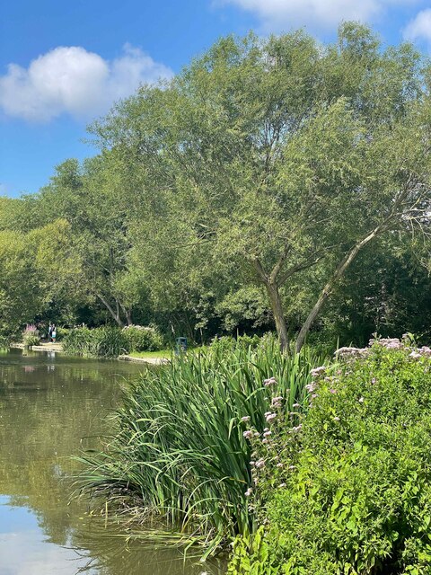
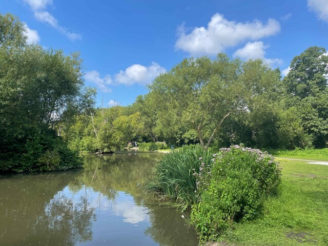
![Otham features [1] Seen from Stoneacre Lane is this large pond.
Otham is a small, widely spread village, on the south eastern edge of Maidstone some 2¾ miles from the town centre and 15 miles northwest of Ashford. There are plans to add another 1250 houses to the village which currently has 204 dwellings.](https://s1.geograph.org.uk/geophotos/07/07/76/7077661_0d095e93.jpg)
![Stoneacre [1] Stoneacre is a small half-timbered house in Stoneacre Lane, Otham. Built in the 15th century and altered in the 16th century. Purchased in 1920 in a ruinous state by Aymer Vallance who reconstructed it as a Tudor yeoman&#039;s dwelling. In 1928 the property was presented to the National Trust. There is much history and detail at: <span class="nowrap"><a title="https://en.wikipedia.org/wiki/Stoneacre,_Kent" rel="nofollow ugc noopener" href="https://en.wikipedia.org/wiki/Stoneacre,_Kent">Link</a><img style="margin-left:2px;" alt="External link" title="External link - shift click to open in new window" src="https://s1.geograph.org.uk/img/external.png" width="10" height="10"/></span> The house is listed, grade II*, with details at: <span class="nowrap"><a title="https://historicengland.org.uk/listing/the-list/list-entry/1250995" rel="nofollow ugc noopener" href="https://historicengland.org.uk/listing/the-list/list-entry/1250995">Link</a><img style="margin-left:2px;" alt="External link" title="External link - shift click to open in new window" src="https://s1.geograph.org.uk/img/external.png" width="10" height="10"/></span>
Otham is a small, widely spread village, on the southeastern edge of Maidstone, some 2¾ miles from the town centre and 15 miles northwest of Ashford. There are plans to add another 1250 houses to the village which currently has 204 dwellings.](https://s2.geograph.org.uk/geophotos/07/07/76/7077666_ade60e5a.jpg)
![Stoneacre [2] The rear of the house.
Stoneacre is a small half-timbered house in Stoneacre Lane, Otham. Built in the 15th century and altered in the 16th century. Purchased in 1920 in a ruinous state by Aymer Vallance who reconstructed it as a Tudor yeoman&#039;s dwelling. In 1928 the property was presented to the National Trust. There is much history and detail at: <span class="nowrap"><a title="https://en.wikipedia.org/wiki/Stoneacre,_Kent" rel="nofollow ugc noopener" href="https://en.wikipedia.org/wiki/Stoneacre,_Kent">Link</a><img style="margin-left:2px;" alt="External link" title="External link - shift click to open in new window" src="https://s1.geograph.org.uk/img/external.png" width="10" height="10"/></span> The house is listed, grade II*, with details at: <span class="nowrap"><a title="https://historicengland.org.uk/listing/the-list/list-entry/1250995" rel="nofollow ugc noopener" href="https://historicengland.org.uk/listing/the-list/list-entry/1250995">Link</a><img style="margin-left:2px;" alt="External link" title="External link - shift click to open in new window" src="https://s1.geograph.org.uk/img/external.png" width="10" height="10"/></span>
Otham is a small, widely spread village, on the southeastern edge of Maidstone, some 2¾ miles from the town centre and 15 miles northwest of Ashford. There are plans to add another 1250 houses to the village which currently has 204 dwellings.](https://s0.geograph.org.uk/geophotos/07/07/76/7077668_520d7df6.jpg)
![Stoneacre [3] Inside the house.
Stoneacre is a small half-timbered house in Stoneacre Lane, Otham. Built in the 15th century and altered in the 16th century. Purchased in 1920 in a ruinous state by Aymer Vallance who reconstructed it as a Tudor yeoman&#039;s dwelling. In 1928 the property was presented to the National Trust. There is much history and detail at: <span class="nowrap"><a title="https://en.wikipedia.org/wiki/Stoneacre,_Kent" rel="nofollow ugc noopener" href="https://en.wikipedia.org/wiki/Stoneacre,_Kent">Link</a><img style="margin-left:2px;" alt="External link" title="External link - shift click to open in new window" src="https://s1.geograph.org.uk/img/external.png" width="10" height="10"/></span> The house is listed, grade II*, with details at: <span class="nowrap"><a title="https://historicengland.org.uk/listing/the-list/list-entry/1250995" rel="nofollow ugc noopener" href="https://historicengland.org.uk/listing/the-list/list-entry/1250995">Link</a><img style="margin-left:2px;" alt="External link" title="External link - shift click to open in new window" src="https://s1.geograph.org.uk/img/external.png" width="10" height="10"/></span>
Otham is a small, widely spread village, on the southeastern edge of Maidstone, some 2¾ miles from the town centre and 15 miles northwest of Ashford. There are plans to add another 1250 houses to the village which currently has 204 dwellings.](https://s1.geograph.org.uk/geophotos/07/07/76/7077669_4608e9f0.jpg)
![Stoneacre [4] The fine king post roof of the double height hall.
Stoneacre is a small half-timbered house in Stoneacre Lane, Otham. Built in the 15th century and altered in the 16th century. Purchased in 1920 in a ruinous state by Aymer Vallance who reconstructed it as a Tudor yeoman&#039;s dwelling. In 1928 the property was presented to the National Trust. There is much history and detail at: <span class="nowrap"><a title="https://en.wikipedia.org/wiki/Stoneacre,_Kent" rel="nofollow ugc noopener" href="https://en.wikipedia.org/wiki/Stoneacre,_Kent">Link</a><img style="margin-left:2px;" alt="External link" title="External link - shift click to open in new window" src="https://s1.geograph.org.uk/img/external.png" width="10" height="10"/></span> The house is listed, grade II*, with details at: <span class="nowrap"><a title="https://historicengland.org.uk/listing/the-list/list-entry/1250995" rel="nofollow ugc noopener" href="https://historicengland.org.uk/listing/the-list/list-entry/1250995">Link</a><img style="margin-left:2px;" alt="External link" title="External link - shift click to open in new window" src="https://s1.geograph.org.uk/img/external.png" width="10" height="10"/></span>
Otham is a small, widely spread village, on the southeastern edge of Maidstone, some 2¾ miles from the town centre and 15 miles northwest of Ashford. There are plans to add another 1250 houses to the village which currently has 204 dwellings.](https://s3.geograph.org.uk/geophotos/07/07/76/7077671_faf0df8b.jpg)
![Stoneacre [5] Part of the garden.
Stoneacre is a small half-timbered house in Stoneacre Lane, Otham. Built in the 15th century and altered in the 16th century. Purchased in 1920 in a ruinous state by Aymer Vallance who reconstructed it as a Tudor yeoman&#039;s dwelling. In 1928 the property was presented to the National Trust. There is much history and detail at: <span class="nowrap"><a title="https://en.wikipedia.org/wiki/Stoneacre,_Kent" rel="nofollow ugc noopener" href="https://en.wikipedia.org/wiki/Stoneacre,_Kent">Link</a><img style="margin-left:2px;" alt="External link" title="External link - shift click to open in new window" src="https://s1.geograph.org.uk/img/external.png" width="10" height="10"/></span> The house is listed, grade II*, with details at: <span class="nowrap"><a title="https://historicengland.org.uk/listing/the-list/list-entry/1250995" rel="nofollow ugc noopener" href="https://historicengland.org.uk/listing/the-list/list-entry/1250995">Link</a><img style="margin-left:2px;" alt="External link" title="External link - shift click to open in new window" src="https://s1.geograph.org.uk/img/external.png" width="10" height="10"/></span>
Otham is a small, widely spread village, on the southeastern edge of Maidstone, some 2¾ miles from the town centre and 15 miles northwest of Ashford. There are plans to add another 1250 houses to the village which currently has 204 dwellings.](https://s0.geograph.org.uk/geophotos/07/07/76/7077672_1a28408f.jpg)
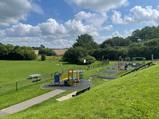
![Otham features [2] A play area on the village green.
Otham is a small, widely spread village, on the southeastern edge of Maidstone, some 2¾ miles from the town centre and 15 miles northwest of Ashford. There are plans to add another 1250 houses to the village which currently has 204 dwellings.](https://s3.geograph.org.uk/geophotos/07/07/76/7077675_3eac8804.jpg)
![Otham features [3] The village sign and war memorial on a corner of the village green.
Otham is a small, widely spread village, on the southeastern edge of Maidstone, some 2¾ miles from the town centre and 15 miles northwest of Ashford. There are plans to add another 1250 houses to the village which currently has 204 dwellings.](https://s2.geograph.org.uk/geophotos/07/07/76/7077678_825997ce.jpg)
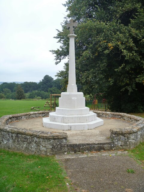
![Otham features [4] The village sign was erected in 1994 for the centenary of the parish council. A plaque reads &#039;Otham Parish Council 1894-1994 the tools that shaped our village&#039;.
Otham is a small, widely spread village, on the southeastern edge of Maidstone, some 2¾ miles from the town centre and 15 miles northwest of Ashford. There are plans to add another 1250 houses to the village which currently has 204 dwellings.](https://s1.geograph.org.uk/geophotos/07/07/76/7077681_ecbd11ef.jpg)
![Otham houses [1] Oddly named Madam Taylors, this was originally built as a house, later subdivided into three cottages and now recombined into one house. Built in the mid or late 16th century, altered later and restored circa 1975. Timber framed and rendered, all under a tile roof. Listed, grade II, with details at: <span class="nowrap"><a title="https://historicengland.org.uk/listing/the-list/list-entry/1250967" rel="nofollow ugc noopener" href="https://historicengland.org.uk/listing/the-list/list-entry/1250967">Link</a><img style="margin-left:2px;" alt="External link" title="External link - shift click to open in new window" src="https://s1.geograph.org.uk/img/external.png" width="10" height="10"/></span>
Otham is a small, widely spread village, on the southeastern edge of Maidstone, some 2¾ miles from the town centre and 15 miles northwest of Ashford. There are plans to add another 1250 houses to the village which currently has 204 dwellings.](https://s2.geograph.org.uk/geophotos/07/07/76/7077686_d6c86367.jpg)
![Otham features [5] This fine garden wall to Madam Taylors <a href="https://www.geograph.org.uk/photo/7077686">TQ7953 : Otham houses [1]</a> was built in the 18th century. Constructed of chequered red and grey brick on a galleted stone plinth. Listed, grade II, with details at: <span class="nowrap"><a title="https://historicengland.org.uk/listing/the-list/list-entry/1250974" rel="nofollow ugc noopener" href="https://historicengland.org.uk/listing/the-list/list-entry/1250974">Link</a><img style="margin-left:2px;" alt="External link" title="External link - shift click to open in new window" src="https://s1.geograph.org.uk/img/external.png" width="10" height="10"/></span>
Otham is a small, widely spread village, on the southeastern edge of Maidstone, some 2¾ miles from the town centre and 15 miles northwest of Ashford. There are plans to add another 1250 houses to the village which currently has 204 dwellings.](https://s3.geograph.org.uk/geophotos/07/07/76/7077691_18d29279.jpg)
Otham Hole is located at Grid Ref: TQ7952 (Lat: 51.245147, Lng: 0.575441)
Administrative County: Kent
District: Maidstone
Police Authority: Kent
What 3 Words
///amicably.scripted.lawful. Near Maidstone, Kent
Nearby Locations
Related Wikis

Bearsted F.C.
Bearsted Football Club is a football club located in Bearsted, near Maidstone, in Kent, England. The club are currently members of the Southern Counties...
Synyards
Synyards is a late 15th-century house in Otham, Kent. The house was built in the late 15th century with additions in the 16th century and in 1663. It is...

Otham
Otham is a village and civil parish in the Maidstone district of Kent, England. The population of the civil parish at the 2011 census was 523, with 204...

Stoneacre, Kent
Stoneacre is a small National Trust property in Otham, near Maidstone, Kent in southern England. The property is a half-timbered yeoman farmer's house...
Otham Manor
Otham Manor, previously known as Wardes, is a late 14th-century manor house in Otham, Kent. The house was built in the late 14th century, probably around...
Senacre Technology College
Senacre Technology College was a secondary school in Maidstone, Kent. The school became a Technology College in September 1994.The school closed in 2008...

Langley, Kent
Langley is a village and civil parish in the Maidstone District of Kent, England. The parish is located on the A274 road leading south from Maidstone to...
Willington, Kent
Willington is a suburb of Maidstone, in the Maidstone district, in the county of Kent, England. == References == The geographic coordinates are from the...
Nearby Amenities
Located within 500m of 51.245147,0.575441Have you been to Otham Hole?
Leave your review of Otham Hole below (or comments, questions and feedback).