Belts Wood
Wood, Forest in Kent Maidstone
England
Belts Wood
Belts Wood is a charming and picturesque woodland area located in Kent, England. It is situated within the larger expanse of the High Weald Area of Outstanding Natural Beauty, and covers an area of approximately 100 hectares. The wood is predominantly made up of ancient oak and beech trees, which lend a sense of timelessness and tranquility to the surroundings.
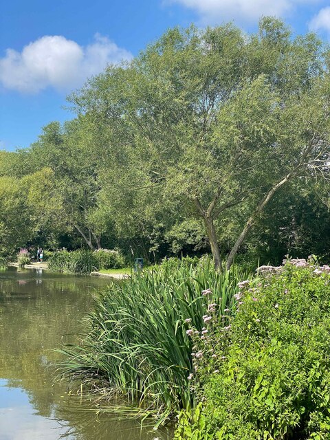
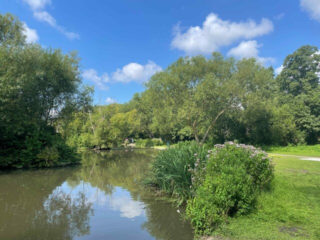
Belts Wood is known for its diverse flora and fauna, making it a haven for nature enthusiasts and wildlife lovers. The forest floor is carpeted with a rich variety of wildflowers, including bluebells, primroses, and wood anemones, creating a stunning display during the spring months. The dense foliage and tall trees provide a habitat for a wide range of bird species, such as woodpeckers, owls, and warblers. It is not uncommon to spot deer and rabbits grazing amidst the trees, adding to the sense of natural beauty and serenity.
The wood offers numerous walking trails and pathways that wind through its enchanting landscape, allowing visitors to explore its nooks and crannies. These trails cater to different levels of fitness and interest, ranging from gentle strolls to more challenging hikes. Along the way, visitors may come across ancient ruins and remnants of old settlements, providing glimpses into the area's rich history.
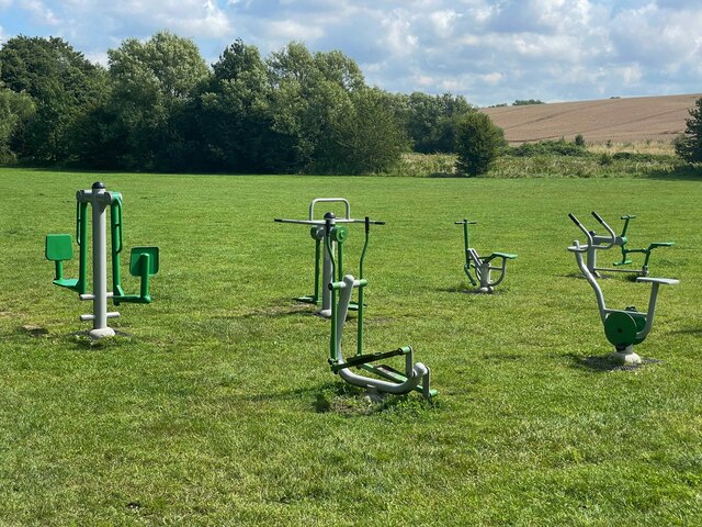
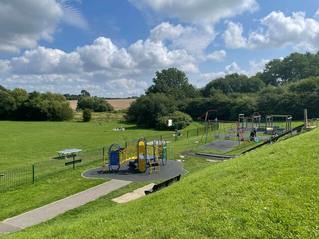
Belts Wood is a popular destination for outdoor recreational activities, such as picnicking, photography, and wildlife spotting. It also serves as an educational resource, with various guided tours and events organized by local conservation groups and forest rangers. With its natural beauty, diverse ecosystem, and historical significance, Belts Wood is truly a gem within the Kent countryside.
If you have any feedback on the listing, please let us know in the comments section below.
Belts Wood Images
Images are sourced within 2km of 51.244137/0.57135172 or Grid Reference TQ7952. Thanks to Geograph Open Source API. All images are credited.
![Otham ways [1] A ford on Stoneacre Lane, a public byway.
Otham is a small, widely spread village, on the south eastern edge of Maidstone some 2¾ miles from the town centre and 15 miles northwest of Ashford. There are plans to add another 1250 houses to the village which currently has 204 dwellings.](https://s3.geograph.org.uk/geophotos/07/07/76/7077659_96cd57ff.jpg)
![Otham ways [2] From Stoneacre Lane the footpath leads, eventually, to Leeds.
Otham is a small, widely spread village, on the south eastern edge of Maidstone some 2¾ miles from the town centre and 15 miles northwest of Ashford. There are plans to add another 1250 houses to the village which currently has 204 dwellings.](https://s0.geograph.org.uk/geophotos/07/07/76/7077660_c9dbb29c.jpg)
![Otham features [1] Seen from Stoneacre Lane is this large pond.
Otham is a small, widely spread village, on the south eastern edge of Maidstone some 2¾ miles from the town centre and 15 miles northwest of Ashford. There are plans to add another 1250 houses to the village which currently has 204 dwellings.](https://s1.geograph.org.uk/geophotos/07/07/76/7077661_0d095e93.jpg)
![Stoneacre [1] Stoneacre is a small half-timbered house in Stoneacre Lane, Otham. Built in the 15th century and altered in the 16th century. Purchased in 1920 in a ruinous state by Aymer Vallance who reconstructed it as a Tudor yeoman&#039;s dwelling. In 1928 the property was presented to the National Trust. There is much history and detail at: <span class="nowrap"><a title="https://en.wikipedia.org/wiki/Stoneacre,_Kent" rel="nofollow ugc noopener" href="https://en.wikipedia.org/wiki/Stoneacre,_Kent">Link</a><img style="margin-left:2px;" alt="External link" title="External link - shift click to open in new window" src="https://s1.geograph.org.uk/img/external.png" width="10" height="10"/></span> The house is listed, grade II*, with details at: <span class="nowrap"><a title="https://historicengland.org.uk/listing/the-list/list-entry/1250995" rel="nofollow ugc noopener" href="https://historicengland.org.uk/listing/the-list/list-entry/1250995">Link</a><img style="margin-left:2px;" alt="External link" title="External link - shift click to open in new window" src="https://s1.geograph.org.uk/img/external.png" width="10" height="10"/></span>
Otham is a small, widely spread village, on the southeastern edge of Maidstone, some 2¾ miles from the town centre and 15 miles northwest of Ashford. There are plans to add another 1250 houses to the village which currently has 204 dwellings.](https://s2.geograph.org.uk/geophotos/07/07/76/7077666_ade60e5a.jpg)
![Stoneacre [2] The rear of the house.
Stoneacre is a small half-timbered house in Stoneacre Lane, Otham. Built in the 15th century and altered in the 16th century. Purchased in 1920 in a ruinous state by Aymer Vallance who reconstructed it as a Tudor yeoman&#039;s dwelling. In 1928 the property was presented to the National Trust. There is much history and detail at: <span class="nowrap"><a title="https://en.wikipedia.org/wiki/Stoneacre,_Kent" rel="nofollow ugc noopener" href="https://en.wikipedia.org/wiki/Stoneacre,_Kent">Link</a><img style="margin-left:2px;" alt="External link" title="External link - shift click to open in new window" src="https://s1.geograph.org.uk/img/external.png" width="10" height="10"/></span> The house is listed, grade II*, with details at: <span class="nowrap"><a title="https://historicengland.org.uk/listing/the-list/list-entry/1250995" rel="nofollow ugc noopener" href="https://historicengland.org.uk/listing/the-list/list-entry/1250995">Link</a><img style="margin-left:2px;" alt="External link" title="External link - shift click to open in new window" src="https://s1.geograph.org.uk/img/external.png" width="10" height="10"/></span>
Otham is a small, widely spread village, on the southeastern edge of Maidstone, some 2¾ miles from the town centre and 15 miles northwest of Ashford. There are plans to add another 1250 houses to the village which currently has 204 dwellings.](https://s0.geograph.org.uk/geophotos/07/07/76/7077668_520d7df6.jpg)
![Stoneacre [3] Inside the house.
Stoneacre is a small half-timbered house in Stoneacre Lane, Otham. Built in the 15th century and altered in the 16th century. Purchased in 1920 in a ruinous state by Aymer Vallance who reconstructed it as a Tudor yeoman&#039;s dwelling. In 1928 the property was presented to the National Trust. There is much history and detail at: <span class="nowrap"><a title="https://en.wikipedia.org/wiki/Stoneacre,_Kent" rel="nofollow ugc noopener" href="https://en.wikipedia.org/wiki/Stoneacre,_Kent">Link</a><img style="margin-left:2px;" alt="External link" title="External link - shift click to open in new window" src="https://s1.geograph.org.uk/img/external.png" width="10" height="10"/></span> The house is listed, grade II*, with details at: <span class="nowrap"><a title="https://historicengland.org.uk/listing/the-list/list-entry/1250995" rel="nofollow ugc noopener" href="https://historicengland.org.uk/listing/the-list/list-entry/1250995">Link</a><img style="margin-left:2px;" alt="External link" title="External link - shift click to open in new window" src="https://s1.geograph.org.uk/img/external.png" width="10" height="10"/></span>
Otham is a small, widely spread village, on the southeastern edge of Maidstone, some 2¾ miles from the town centre and 15 miles northwest of Ashford. There are plans to add another 1250 houses to the village which currently has 204 dwellings.](https://s1.geograph.org.uk/geophotos/07/07/76/7077669_4608e9f0.jpg)
![Stoneacre [4] The fine king post roof of the double height hall.
Stoneacre is a small half-timbered house in Stoneacre Lane, Otham. Built in the 15th century and altered in the 16th century. Purchased in 1920 in a ruinous state by Aymer Vallance who reconstructed it as a Tudor yeoman&#039;s dwelling. In 1928 the property was presented to the National Trust. There is much history and detail at: <span class="nowrap"><a title="https://en.wikipedia.org/wiki/Stoneacre,_Kent" rel="nofollow ugc noopener" href="https://en.wikipedia.org/wiki/Stoneacre,_Kent">Link</a><img style="margin-left:2px;" alt="External link" title="External link - shift click to open in new window" src="https://s1.geograph.org.uk/img/external.png" width="10" height="10"/></span> The house is listed, grade II*, with details at: <span class="nowrap"><a title="https://historicengland.org.uk/listing/the-list/list-entry/1250995" rel="nofollow ugc noopener" href="https://historicengland.org.uk/listing/the-list/list-entry/1250995">Link</a><img style="margin-left:2px;" alt="External link" title="External link - shift click to open in new window" src="https://s1.geograph.org.uk/img/external.png" width="10" height="10"/></span>
Otham is a small, widely spread village, on the southeastern edge of Maidstone, some 2¾ miles from the town centre and 15 miles northwest of Ashford. There are plans to add another 1250 houses to the village which currently has 204 dwellings.](https://s3.geograph.org.uk/geophotos/07/07/76/7077671_faf0df8b.jpg)
![Stoneacre [5] Part of the garden.
Stoneacre is a small half-timbered house in Stoneacre Lane, Otham. Built in the 15th century and altered in the 16th century. Purchased in 1920 in a ruinous state by Aymer Vallance who reconstructed it as a Tudor yeoman&#039;s dwelling. In 1928 the property was presented to the National Trust. There is much history and detail at: <span class="nowrap"><a title="https://en.wikipedia.org/wiki/Stoneacre,_Kent" rel="nofollow ugc noopener" href="https://en.wikipedia.org/wiki/Stoneacre,_Kent">Link</a><img style="margin-left:2px;" alt="External link" title="External link - shift click to open in new window" src="https://s1.geograph.org.uk/img/external.png" width="10" height="10"/></span> The house is listed, grade II*, with details at: <span class="nowrap"><a title="https://historicengland.org.uk/listing/the-list/list-entry/1250995" rel="nofollow ugc noopener" href="https://historicengland.org.uk/listing/the-list/list-entry/1250995">Link</a><img style="margin-left:2px;" alt="External link" title="External link - shift click to open in new window" src="https://s1.geograph.org.uk/img/external.png" width="10" height="10"/></span>
Otham is a small, widely spread village, on the southeastern edge of Maidstone, some 2¾ miles from the town centre and 15 miles northwest of Ashford. There are plans to add another 1250 houses to the village which currently has 204 dwellings.](https://s0.geograph.org.uk/geophotos/07/07/76/7077672_1a28408f.jpg)
![Otham features [2] A play area on the village green.
Otham is a small, widely spread village, on the southeastern edge of Maidstone, some 2¾ miles from the town centre and 15 miles northwest of Ashford. There are plans to add another 1250 houses to the village which currently has 204 dwellings.](https://s3.geograph.org.uk/geophotos/07/07/76/7077675_3eac8804.jpg)
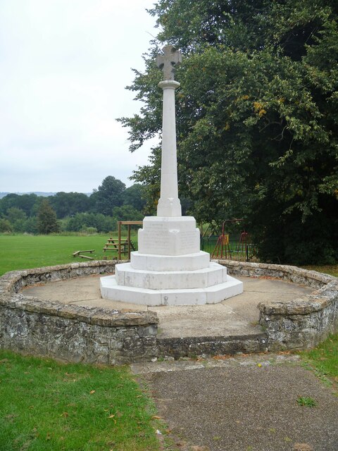
![Otham features [3] The village sign and war memorial on a corner of the village green.
Otham is a small, widely spread village, on the southeastern edge of Maidstone, some 2¾ miles from the town centre and 15 miles northwest of Ashford. There are plans to add another 1250 houses to the village which currently has 204 dwellings.](https://s2.geograph.org.uk/geophotos/07/07/76/7077678_825997ce.jpg)
![Otham features [4] The village sign was erected in 1994 for the centenary of the parish council. A plaque reads &#039;Otham Parish Council 1894-1994 the tools that shaped our village&#039;.
Otham is a small, widely spread village, on the southeastern edge of Maidstone, some 2¾ miles from the town centre and 15 miles northwest of Ashford. There are plans to add another 1250 houses to the village which currently has 204 dwellings.](https://s1.geograph.org.uk/geophotos/07/07/76/7077681_ecbd11ef.jpg)
![Otham houses [1] Oddly named Madam Taylors, this was originally built as a house, later subdivided into three cottages and now recombined into one house. Built in the mid or late 16th century, altered later and restored circa 1975. Timber framed and rendered, all under a tile roof. Listed, grade II, with details at: <span class="nowrap"><a title="https://historicengland.org.uk/listing/the-list/list-entry/1250967" rel="nofollow ugc noopener" href="https://historicengland.org.uk/listing/the-list/list-entry/1250967">Link</a><img style="margin-left:2px;" alt="External link" title="External link - shift click to open in new window" src="https://s1.geograph.org.uk/img/external.png" width="10" height="10"/></span>
Otham is a small, widely spread village, on the southeastern edge of Maidstone, some 2¾ miles from the town centre and 15 miles northwest of Ashford. There are plans to add another 1250 houses to the village which currently has 204 dwellings.](https://s2.geograph.org.uk/geophotos/07/07/76/7077686_d6c86367.jpg)
![Otham features [5] This fine garden wall to Madam Taylors <a href="https://www.geograph.org.uk/photo/7077686">TQ7953 : Otham houses [1]</a> was built in the 18th century. Constructed of chequered red and grey brick on a galleted stone plinth. Listed, grade II, with details at: <span class="nowrap"><a title="https://historicengland.org.uk/listing/the-list/list-entry/1250974" rel="nofollow ugc noopener" href="https://historicengland.org.uk/listing/the-list/list-entry/1250974">Link</a><img style="margin-left:2px;" alt="External link" title="External link - shift click to open in new window" src="https://s1.geograph.org.uk/img/external.png" width="10" height="10"/></span>
Otham is a small, widely spread village, on the southeastern edge of Maidstone, some 2¾ miles from the town centre and 15 miles northwest of Ashford. There are plans to add another 1250 houses to the village which currently has 204 dwellings.](https://s3.geograph.org.uk/geophotos/07/07/76/7077691_18d29279.jpg)
Belts Wood is located at Grid Ref: TQ7952 (Lat: 51.244137, Lng: 0.57135172)
Administrative County: Kent
District: Maidstone
Police Authority: Kent
What 3 Words
///prompt.gallons.vacancies. Near Maidstone, Kent
Nearby Locations
Related Wikis

Bearsted F.C.
Bearsted Football Club is a football club located in Bearsted, near Maidstone, in Kent, England. The club are currently members of the Southern Counties...
Synyards
Synyards is a late 15th-century house in Otham, Kent. The house was built in the late 15th century with additions in the 16th century and in 1663. It is...
Senacre Technology College
Senacre Technology College was a secondary school in Maidstone, Kent. The school became a Technology College in September 1994.The school closed in 2008...

Otham
Otham is a village and civil parish in the Maidstone district of Kent, England. The population of the civil parish at the 2011 census was 523, with 204...
Otham Manor
Otham Manor, previously known as Wardes, is a late 14th-century manor house in Otham, Kent. The house was built in the late 14th century, probably around...

Stoneacre, Kent
Stoneacre is a small National Trust property in Otham, near Maidstone, Kent in southern England. The property is a half-timbered yeoman farmer's house...

Langley, Kent
Langley is a village and civil parish in the Maidstone District of Kent, England. The parish is located on the A274 road leading south from Maidstone to...
Park Wood, Maidstone
Park Wood is a suburb of Maidstone, Kent. == History == Before the Second World War most of the area around the village of Park Wood was mainly woodland...
Nearby Amenities
Located within 500m of 51.244137,0.57135172Have you been to Belts Wood?
Leave your review of Belts Wood below (or comments, questions and feedback).