Biggings

Settlement in Shetland

Scotland

Biggings

Papa Stour from Huxter, Sandness
Papa Stour from Huxter, Sandness Credit: Mike Pennington

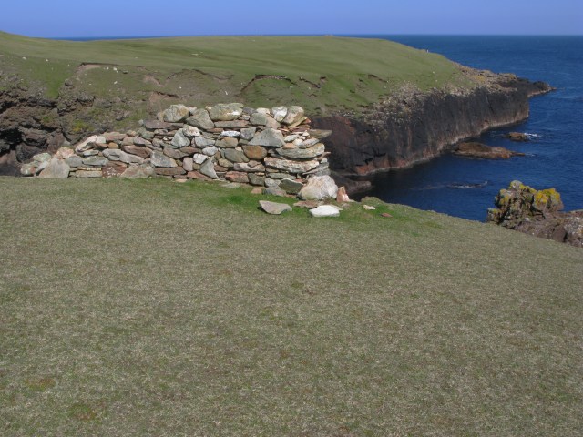
Biggings is a small village located on the island of Bressay, in the Shetland Islands of Scotland. Situated on the eastern coast of the island, it offers picturesque views of the North Sea and is surrounded by stunning natural beauty. The village is approximately 5 miles east of Lerwick, the capital of the Shetland Islands.

Known for its peaceful and idyllic setting, Biggings is a popular destination for those seeking tranquility and a close connection with nature. The village is characterized by its traditional stone houses, some of which date back several centuries. These charming houses, along with the lush green fields and rugged coastline, give Biggings a distinct and timeless charm.

Despite its small size, Biggings boasts a strong sense of community. The villagers are friendly and welcoming, and there is a close-knit atmosphere that can be felt throughout the area. The village has a community hall which serves as a gathering place for various social events and activities.

Nature lovers will find plenty to explore around Biggings. Bressay is known for its rich birdlife, and the area is home to various species of seabirds, including puffins, guillemots, and razorbills. The coastline offers opportunities for scenic walks and offers breathtaking views of the surrounding islands.

Overall, Biggings is a hidden gem in the Shetland Islands, offering a peaceful retreat for those in search of natural beauty and a close-knit community.

If you have any feedback on the listing, please let us know in the comments section below.

Biggings Images

Images are sourced within 2km of 60.324194/-1.6812626 or Grid Reference HU1760. Thanks to Geograph Open Source API. All images are credited.

Papa Stour from Huxter, Sandness
Plantiecrub near Flaes Point A plantiecrub is a small walled enclosure in which cabbage seedlings are grown until they are big enough to plant out in croft gardens. They are usually built well away from the croft to protect the seedlings against the crofters' hens.
Plantiecrub near Flaes Point
A plantiecrub is a small walled enclosure in which cabbage seedlings are grown until they are big enough to plant out in croft gardens. They are usually built well away from the croft to protect the seedlings against the crofters' hens.
Ruined Meal Mills Several traditional mills straddle this little burn. Inside the building was a fixed lower millstone, and a rotating upper millstone driven by the water falling on to the paddles below, which were mounted at 45º to the vertical drive shaft.
Ruined Meal Mills
Several traditional mills straddle this little burn. Inside the building was a fixed lower millstone, and a rotating upper millstone driven by the water falling on to the paddles below, which were mounted at 45º to the vertical drive shaft.
The Loch that Ebbs and Flows The interior of Papa Stour is mainly moorland, though there are several lochans in the central part. This one's curious name reflects its closeness to the sea, from which it is cut off only by an ayre or shingle spit.
The Loch that Ebbs and Flows
The interior of Papa Stour is mainly moorland, though there are several lochans in the central part. This one's curious name reflects its closeness to the sea, from which it is cut off only by an ayre or shingle spit.
Hurdibrack The last stretch of the footpath back from the west side of the island. In the middle distance is the wall which crosses the entire island, separating the arable land in the east from the pasture to the west.
Hurdibrack
The last stretch of the footpath back from the west side of the island. In the middle distance is the wall which crosses the entire island, separating the arable land in the east from the pasture to the west.
The Wall This is the wall which cuts across the whole island. The west side (left) has a steep face to prevent animals climbing over it. The east (right) side has a sloping face so that any animals which have managed to cross it can easily be driven back on to the pasture land.
The Wall
This is the wall which cuts across the whole island. The west side (left) has a steep face to prevent animals climbing over it. The east (right) side has a sloping face so that any animals which have managed to cross it can easily be driven back on to the pasture land.
Robie's Noust This is a very dull shot of a square which would certainly have yielded a more interesting image if we had had time to explore it before the ferry left.
Robie's Noust
This is a very dull shot of a square which would certainly have yielded a more interesting image if we had had time to explore it before the ferry left.
The Dales As with the next-door square, HU1861 would certainly have yielded a more interesting shot if we had not had to rush to catch the ferry!
The Dales
As with the next-door square, HU1861 would certainly have yielded a more interesting shot if we had not had to rush to catch the ferry!
Papa Stour Pier and Ferry The ferry runs regularly but infrequently, so that day trips to the island are only possible on Fridays or Saturdays.
Papa Stour Pier and Ferry
The ferry runs regularly but infrequently, so that day trips to the island are only possible on Fridays or Saturdays.
Ruined House
Ruined House
Ruined house The number of ruined buildings on the island seem to far outnumber those still habitable or used.
Ruined house
The number of ruined buildings on the island seem to far outnumber those still habitable or used.
Road and ruins This is the main road for the island.  Even this close to the pier the ruins of abandoned crofts can be found just off the road.
Road and ruins
This is the main road for the island. Even this close to the pier the ruins of abandoned crofts can be found just off the road.
View towards Papa Stour Airstrip The cleared and smoothed ground in the upper right of the image is the airstrip for Papa Stour which is located in <a href="https://www.geograph.org.uk/gridref/HU1759">HU1759</a>.
View towards Papa Stour Airstrip
The cleared and smoothed ground in the upper right of the image is the airstrip for Papa Stour which is located in HU1759.
View from North Ness The view here is from North Ness towards the highest point on the island.

The ground shown in the foreground is typical of this rather barren area.
View from North Ness
The view here is from North Ness towards the highest point on the island. The ground shown in the foreground is typical of this rather barren area.
The "New" Pier The image here is taken from the old pier looking towards the new pier.

The line of rusting fenceposts serves no useful purpose.

The rocks along the shoreline are very popular with young seals - although they proved to be somewhat camera-shy.
The "New" Pier
The image here is taken from the old pier looking towards the new pier. The line of rusting fenceposts serves no useful purpose. The rocks along the shoreline are very popular with young seals - although they proved to be somewhat camera-shy.
A puzzling wall The purpose of this isolated section of wall is far from clear: you might think that perhaps it was in place to stop sheep wandering down onto the rocks beyond, but it would seem to be easy enough for them to walk around the wall.
A puzzling wall
The purpose of this isolated section of wall is far from clear: you might think that perhaps it was in place to stop sheep wandering down onto the rocks beyond, but it would seem to be easy enough for them to walk around the wall.
Ruined homestead
Ruined homestead
Oystercatcher nest with eggs This nest was located in the pebbles at the high-point of the beach.  The eggs are camouflaged to be hard to see amongst the pebbles - although thankfully these were just noticeable enough to escape being trodden on.

The oystercatchers seem to be surviving relatively well on the island, whilst the previously abundant tern population has been largely destroyed by the skuas.
Oystercatcher nest with eggs
This nest was located in the pebbles at the high-point of the beach. The eggs are camouflaged to be hard to see amongst the pebbles - although thankfully these were just noticeable enough to escape being trodden on. The oystercatchers seem to be surviving relatively well on the island, whilst the previously abundant tern population has been largely destroyed by the skuas.
Show me another place!

Biggings is located at Grid Ref: HU1760 (Lat: 60.324194, Lng: -1.6812626)

Unitary Authority: Shetland Islands

Police Authority: Highlands and Islands

What 3 Words

///powers.flux.cubic. Near Walls, Shetland Islands

Related Wikis

Biggings

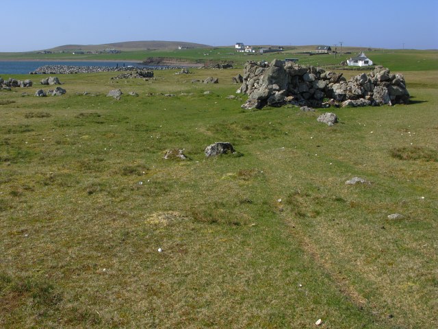
Biggings is a village on the island of Papa Stour, in Shetland, Scotland. Papa Stour's church is situated at the south of Biggings. A homestead of Duke...

Forewick Holm

Forewick Holm is a 1-hectare (2.5-acre) island in the Sound of Papa in the Shetland islands, Scotland. Located between Papa Stour and the Sandness peninsula...

Papa Stour Airstrip

Papa Stour Airstrip is a small airstrip in the village of Biggings on the island of Papa Stour. Shetland, Scotland. == History == Papa Stour Airstrip opened...

Brei Holm

Brei Holm is a tiny tidal islet in the western Shetland Islands. It is due east of Papa Stour, to which it is connected at low tide, just outside Housa...

Maiden Stack

The Maiden Stack or Frau Stack is a tiny stack in the western Shetland Islands to the north of Brei Holm and east of Housa Voe in Papa Stour. It is so...

Papa Stour

Papa Stour (Scots: Papa Stour) is one of the Shetland Islands in Scotland, with a population of under fifteen people, some of whom immigrated after an...

Sandness

Sandness (the "d" is not pronounced locally) is a headland and district in the west of Shetland Mainland, Scotland. Sandness was a civil parish, which...

Bousta

Bousta is a settlement on Mainland, in Shetland, Scotland. Bousta is situated in the parish of Walls and Sandness.Scott's Hawkweed is native to the pastures...

Nearby Amenities

Located within 500m of 60.324194,-1.6812626
Biggings
Place: hamlet
Wikidata: Q4906925
Wikipedia: en:Biggings
Lat/Long: 60.3253133/-1.6809482
Power: pole
Lat/Long: 60.3241054/-1.6729926
Power: pole
Lat/Long: 60.3241446/-1.6743525
Power: pole
Lat/Long: 60.3241904/-1.675699
Power: pole
Lat/Long: 60.324276/-1.6787205
Power: pole
Lat/Long: 60.3239258/-1.6798323
Power: pole
Lat/Long: 60.3234783/-1.6794112
Power: pole
Lat/Long: 60.3243198/-1.6802145
Power: pole
Lat/Long: 60.324029/-1.6884378
Power: pole
Lat/Long: 60.3237986/-1.6891566
Power: pole
Lat/Long: 60.3263553/-1.6824212
Power: pole
Lat/Long: 60.3267371/-1.6828517
Power: pole
Lat/Long: 60.3271162/-1.6832943
Power: pole
Lat/Long: 60.3272709/-1.6846756
Power: pole
Lat/Long: 60.3274412/-1.6860543
Power: pole
Lat/Long: 60.3231894/-1.6893275
Power: pole
Lat/Long: 60.3226895/-1.6894643
Power: pole
Lat/Long: 60.3243312/-1.6874526
Power: pole
Lat/Long: 60.3246472/-1.6864575
Power: pole
Lat/Long: 60.3247372/-1.6853364
Power: pole
Lat/Long: 60.3248341/-1.6841777
Power: pole
Lat/Long: 60.3249244/-1.6830297
Power: pole
Lat/Long: 60.325028/-1.6819139
Power: pole
Lat/Long: 60.3250904/-1.6809617
Power: pole
Lat/Long: 60.3246273/-1.6805164
Power: pole
Lat/Long: 60.3242306/-1.6771831
Seamark Type: landmark
Lat/Long: 60.3231147/-1.6792162
Power: pole
Lat/Long: 60.3257183/-1.6816784
Power: pole
Lat/Long: 60.3277037/-1.6827252
Power: pole
Lat/Long: 60.3280845/-1.6823657
The data included in this document is from www.openstreetmap.org. The data is made available under ODbL.

Have you been to Biggings?

Leave your review of Biggings below (or comments, questions and feedback).