Biggleswade

Settlement in Bedfordshire

England

Biggleswade

Approaching Biggleswade, Beds The eastern approach to Biggleswade from Dunton Lane; where town meets country.
Approaching Biggleswade, Beds Credit: Rodney Burton

The requested URL returned error: 429 Too Many Requests

If you have any feedback on the listing, please let us know in the comments section below.
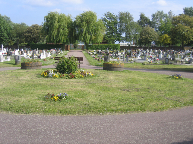
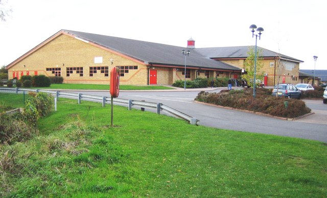
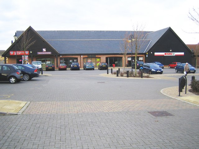
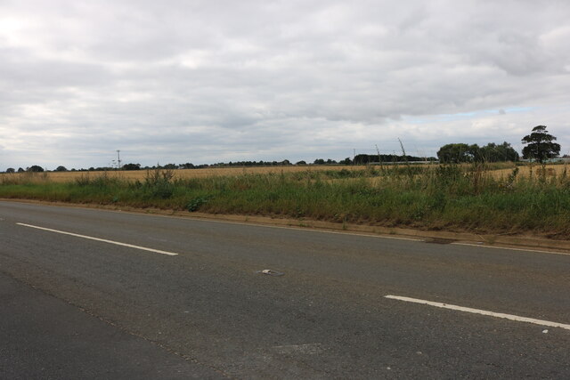
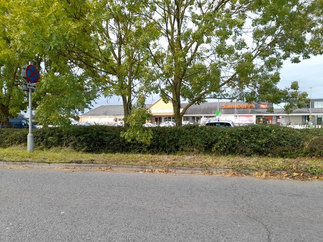
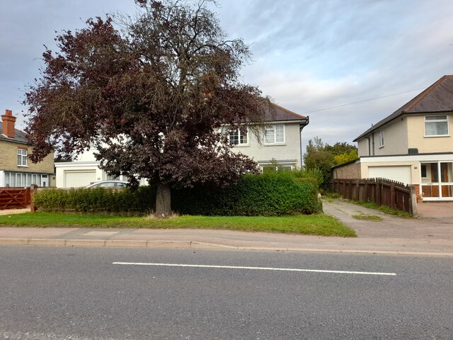
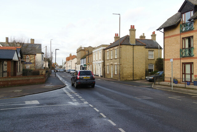
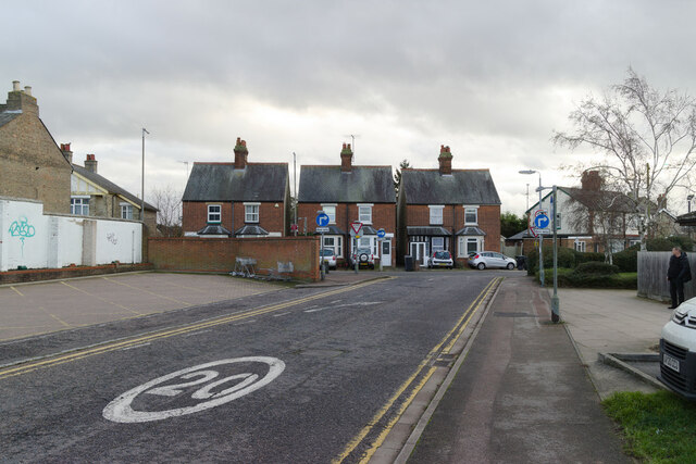
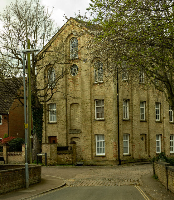
Biggleswade Images

Images are sourced within 2km of 52.086816/-0.263227 or Grid Reference TL1944. Thanks to Geograph Open Source API. All images are credited.

Approaching Biggleswade, Beds The eastern approach to Biggleswade from Dunton Lane; where town meets country.
Approaching Biggleswade, Beds
The eastern approach to Biggleswade from Dunton Lane; where town meets country.
Biggleswade Town Cemetery, Beds off Stratton Way, an overflow cemetery for the one in Drove Road. <a href="https://www.geograph.org.uk/photo/175001">TL1944 : Biggleswade Cemetery, Beds</a>
Biggleswade Town Cemetery, Beds
off Stratton Way, an overflow cemetery for the one in Drove Road. TL1944 : Biggleswade Cemetery, Beds
Footpath east of Biggleswade, Beds close to the new development around the Saxon Centre.
Footpath east of Biggleswade, Beds
close to the new development around the Saxon Centre.
Allotments, Biggleswade, Beds beyond the end of Chambers Way, in a part of the town with encroaching new development. Kennel Farm is in the distance.
Allotments, Biggleswade, Beds
beyond the end of Chambers Way, in a part of the town with encroaching new development. Kennel Farm is in the distance.
Biggleswade: Saxon Pool & Leisure Centre The near building houses an 8 lane 25 metre swimming pool with a separate learners' pool. The nearby lifebelt stand is not for the pool (!) but for a deep pond off to the left which may be a remnant of an old moat in Stratton Park.
Biggleswade: Saxon Pool & Leisure Centre
The near building houses an 8 lane 25 metre swimming pool with a separate learners' pool. The nearby lifebelt stand is not for the pool (!) but for a deep pond off to the left which may be a remnant of an old moat in Stratton Park.
Biggleswade: The Saxon Centre Not, as might be inferred from its title, a repository for recording Biggleswade's history and heritage, but a local shopping centre. Spar and TGF Pizza are prominent occupiers of the retail space.
Biggleswade: The Saxon Centre
Not, as might be inferred from its title, a repository for recording Biggleswade's history and heritage, but a local shopping centre. Spar and TGF Pizza are prominent occupiers of the retail space.
Biggleswade: The Saxon Centre: Saffron House On the opposite side of the Saxon Centre plaza from <a href="https://www.geograph.org.uk/photo/613200">TL2044 : Biggleswade: The Saxon Centre</a> is this new development of twelve two bedroom apartments.
Biggleswade: The Saxon Centre: Saffron House
On the opposite side of the Saxon Centre plaza from TL2044 : Biggleswade: The Saxon Centre is this new development of twelve two bedroom apartments.
Biggleswade Retail Park Halfords, Argos, Rosebys, Brantano Footwear and Laura Ashley are here.
Homebase and Matalan are adjacent.
Biggleswade Retail Park
Halfords, Argos, Rosebys, Brantano Footwear and Laura Ashley are here. Homebase and Matalan are adjacent.
Hill Lane, Upper Caldecote
Sainsbury's on Hill Lane, Biggleswade On the corner of the A1 to the left
Sainsbury's on Hill Lane, Biggleswade
On the corner of the A1 to the left
Quince Stoneworks on High Street, Biggleswade Quince began in 1973 as Quince Monumental Masons <span class="nowrap"><a title="https://m.facebook.com/quincestoneworksltd/" rel="nofollow ugc noopener" href="https://m.facebook.com/quincestoneworksltd/">Link</a><img style="margin-left:2px;" alt="External link" title="External link - shift click to open in new window" src="https://s1.geograph.org.uk/img/external.png" width="10" height="10"/></span>
Quince Stoneworks on High Street, Biggleswade
Quince began in 1973 as Quince Monumental Masons LinkExternal link
Houses on London Road, Biggleswade
Shortmead Street, Biggleswade At the junction with Ivel Gardens.
Shortmead Street, Biggleswade
At the junction with Ivel Gardens.
Foundry Lane approaching Saffron Road
Cut Bench Mark, St Andrew's Church Bench Mark Database: <span class="nowrap"><a title="https://www.bench-marks.org.uk/bm161295" rel="nofollow ugc noopener" href="https://www.bench-marks.org.uk/bm161295">Link</a><img style="margin-left:2px;" alt="External link" title="External link - shift click to open in new window" src="https://s1.geograph.org.uk/img/external.png" width="10" height="10"/></span>
Cut Bench Mark, St Andrew's Church
Bench Mark Database: LinkExternal link
Western end of St Andrew's Churchyard There is a cut bench mark to the left of the photograph, although sadly hidden in shadow. A closer view can be seen here: <a href="https://www.geograph.org.uk/photo/7059832">TL1844 : Cut Bench Mark, St Andrew's Church</a>.
Western end of St Andrew's Churchyard
There is a cut bench mark to the left of the photograph, although sadly hidden in shadow. A closer view can be seen here: TL1844 : Cut Bench Mark, St Andrew's Church.
Field path through after-harvest stubble Looking westward in the direction of The Hill House.
Field path through after-harvest stubble
Looking westward in the direction of The Hill House.
Biggleswade : former Ivel Mill building Converted into residential accommodation.
Biggleswade : former Ivel Mill building
Converted into residential accommodation.
Show me another place!

Biggleswade is located at Grid Ref: TL1944 (Lat: 52.086816, Lng: -0.263227)

Unitary Authority: Central Bedfordshire

Police Authority: Bedfordshire

What 3 Words

///trick.energetic.consonant. Near Biggleswade, Bedfordshire

Nearby Locations

Biggleswade

Related Wikis

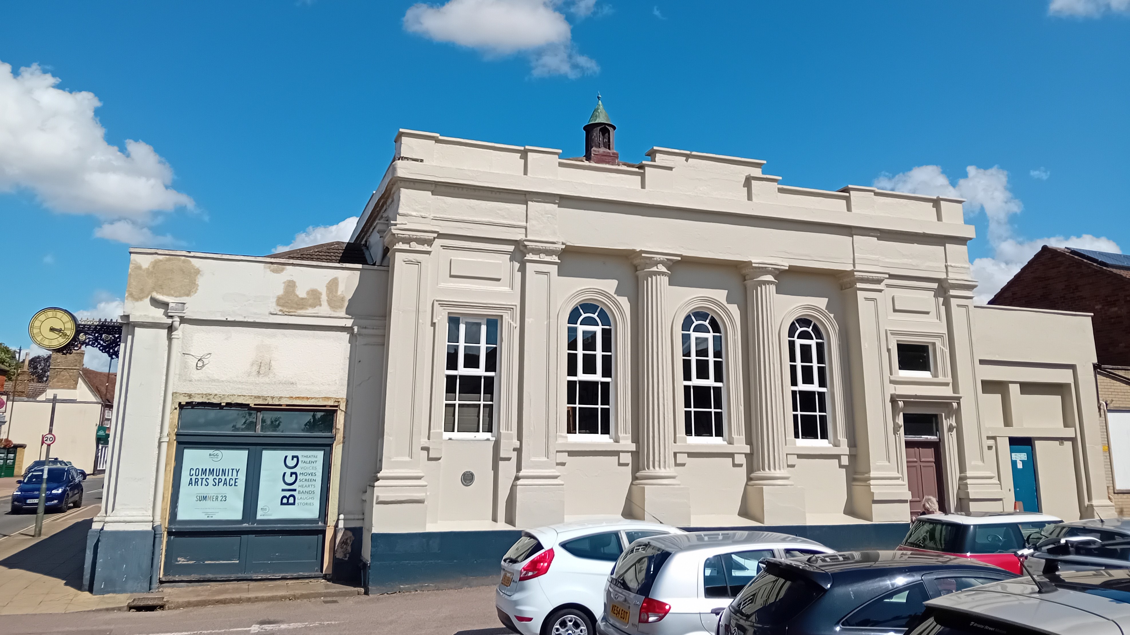
Old Town Hall, Biggleswade

The Old Town Hall is a former municipal building in the High Street, Biggleswade, Bedfordshire, England. The structure, which most recently operated as...

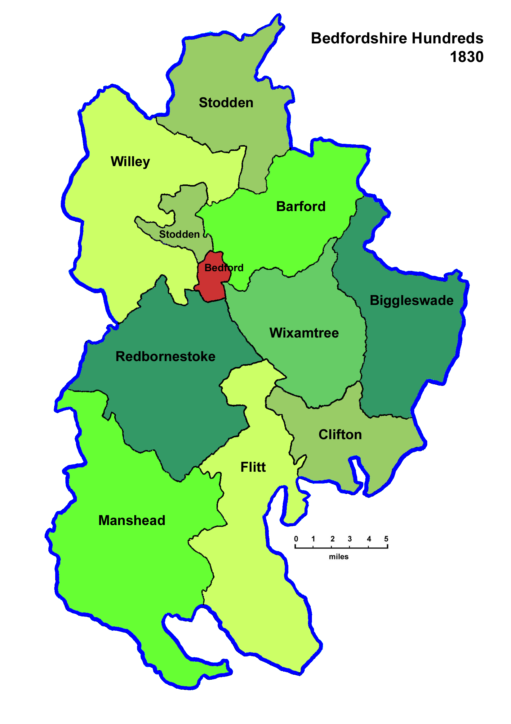
Hundred of Biggleswade

Biggleswade was a historic 'hundred' of English county of Bedfordshire. The hundred consisted of the town of Biggleswade and its surrounding area. The...

Biggleswade Urban District

The town of Biggleswade in Bedfordshire, England was administered as a Local Government District from 1892 to 1894 and an Urban District from 1894 to 1974...

Biggleswade Rural District

Biggleswade was a rural district in Bedfordshire, England from 1894 to 1974. As initially created the district entirely surrounded but did not include...

Nearby Amenities

Located within 500m of 52.086816,-0.263227
Biggleswade
Addr Country: GB
Is In: Bedfordshire
Place: town
Population: 17000
Wikidata: Q2224167
Wikipedia: en:Biggleswade
Lat/Long: 52.0882012/-0.2589013
Traffic Signals
Traffic Signals: signal
Lat/Long: 52.0893838/-0.2625255
Mini Roundabout
Direction: clockwise
Lat/Long: 52.087351/-0.2639114
Crossing
Crossing: zebra
Crossing Island: no
Crossing Markings: zebra
Source: gps
Tactile Paving: yes
Lat/Long: 52.0851678/-0.2665691
Mini Roundabout
Direction: clockwise
Lat/Long: 52.0868269/-0.2632464
Crossing
Crossing: marked
Crossing Island: no
Tactile Paving: yes
Lat/Long: 52.0866188/-0.2590094
Turning Circle
Turning Circle: hammer
Lat/Long: 52.0848694/-0.2568378
Crossing
Crossing: uncontrolled
Crossing Island: no
Crossing Markings: dots
Tactile Paving: yes
Lat/Long: 52.0865798/-0.2608848
Turning Circle
Turning Circle: square
Lat/Long: 52.0837523/-0.267763
Bus Stop
Bench: no
Bin: no
Public Transport: platform
Shelter: no
Lat/Long: 52.0864001/-0.2584503
Bus Stop
Lat/Long: 52.0859505/-0.2589779
Post Box
Operator: Post Office
Lat/Long: 52.0827547/-0.2639401
Power: substation
Lat/Long: 52.0823611/-0.2628694
Bus Stop
Bench: no
Bin: yes
Public Transport: platform
Shelter: no
Lat/Long: 52.0864783/-0.2583142
Bus Stop
Lat/Long: 52.0861806/-0.2592965
Power: substation
Substation: minor_distribution
Lat/Long: 52.0837291/-0.2590465
Bus Stop
Lat/Long: 52.083358/-0.2655589
Crossing
Crossing: traffic_signals
Tactile Paving: yes
Lat/Long: 52.0873002/-0.2644253
Turning Circle
Turning Circle: hammer
Lat/Long: 52.0849742/-0.2672495
Post Box
Collection Times: Mo-Fr 09:00; Sa 07:00
Drive Through: no
Operator: Royal Mail
Post Box Type: lamp
Source: https://www.royalmail.com/services-near-you#
Lat/Long: 52.08378/-0.2651002
Post Box
Brand: Royal Mail
Brand Wikidata: Q638098
Collection Plate: CP1
Collection Times: Mo-Fr 16:15; Sa 11:30
Operator: Royal Mail
Operator Wikidata: Q638098
Post Box Type: wall
Ref: SG18 21
Royal Cypher: VR
Royal Cypher Wikidata: Q33102356
Source: survey
Lat/Long: 52.0869432/-0.2648234
Post Box
Brand: Royal Mail
Brand Wikidata: Q638098
Collection Plate: CP1
Collection Times: Mo-Fr 09:00; Sa 07:00
Operator: Royal Mail
Operator Wikidata: Q638098
Post Box Type: pillar
Ref: SG18 3D
Royal Cypher: EIIR
Royal Cypher Wikidata: Q33102113
Source: survey
Lat/Long: 52.0868229/-0.25932
Crossing
Crossing: zebra
Crossing Island: no
Source: gps
Tactile Paving: yes
Lat/Long: 52.0865519/-0.2631893
Bank
Nationwide
Atm: yes
Brand: Nationwide
Brand Wikidata: Q846735
Brand Wikipedia: en:Nationwide Building Society
Website: https://www.nationwide.co.uk/branches/biggleswade/29-high-street
Lat/Long: 52.0869548/-0.2645796
Bus Stop
Lat/Long: 52.08474/-0.2666167
Crossing
Source: gps
Lat/Long: 52.0869397/-0.262372
Bus Stop
Bench: yes
Bin: no
Naptan AtcoCode: 021026022
Naptan NaptanCode: ahlajdga
Shelter: yes
Tactile Paving: yes
Lat/Long: 52.0849554/-0.262306
Post Office
Biggleswade Post Office
Addr City: Biggleswade
Addr Country: GB
Addr Postcode: SG18 8AY
Addr Street: Bonds Lane
Brand: Post Office
Brand Wikidata: Q1783168
Contact Website: https://www.postoffice.co.uk/branch-finder/1581066/biggleswade
Ref Pol Id: 22754
Source Ref Pol Id: pol_branch_list_2022‑05‑27
Lat/Long: 52.0853705/-0.2640952
Building: residential
Power: substation
Substation: minor_distribution
Lat/Long: 52.0847138/-0.2660683
Pub
Pembroke Arms
Addr City: Biggleswade
Addr Country: GB
Addr Housenumber: 29
Addr Postcode: SG18 8BE
Addr Street: Hitchin Street
Fhrs Id: 1316884
Lat/Long: 52.0853413/-0.2653205
Post Box
Brand: Royal Mail
Brand Wikidata: Q638098
Collection Times: Mo-Fr 17:45; Sa 12:00
Operator: Royal Mail
Operator Wikidata: Q638098
Post Box Type: wall
Ref: SG18 5
Royal Cypher: no
Source: survey
Lat/Long: 52.0858723/-0.2628954
Power: substation
Lat/Long: 52.0858504/-0.2638607
Man Made: monument
Lat/Long: 52.0867467/-0.2630333
Noexit: yes
Lat/Long: 52.0882248/-0.2635479
Crossing
Crossing: marked
Crossing Island: no
Tactile Paving: yes
Lat/Long: 52.089252/-0.2625441
Post Box
Post Box Type: lamp
Lat/Long: 52.0909214/-0.2656912
Crossing
Crossing: zebra
Crossing Island: no
Source: gps
Tactile Paving: yes
Lat/Long: 52.0882227/-0.2669485
Place Of Worship
Brethren's Meeting Room
Denomination: brethren
Religion: christian
Lat/Long: 52.0883138/-0.2622166
Pub
The Old Maltings
Lat/Long: 52.0873691/-0.265225
Building: residential
Power: substation
Substation: minor_distribution
Lat/Long: 52.0870497/-0.2683502
Power: substation
Lat/Long: 52.0892995/-0.2627178
Power: substation
Lat/Long: 52.0902401/-0.2651074
Power: substation
Lat/Long: 52.0893911/-0.2676742
Bus Stop
Bus: yes
Departures Board: timetable
Public Transport: platform
Shelter: no
Lat/Long: 52.087802/-0.2666974
Post Box
Post Box Type: pillar
Lat/Long: 52.09/-0.267436
Bus Stop
Lat/Long: 52.087524/-0.2666896
Crossing
Crossing: zebra
Crossing Island: no
Crossing Markings: zebra
Crossing Ref: zebra
Tactile Paving: yes
Lat/Long: 52.0870323/-0.2599949
Direction: backward
Traffic Calming: chicane
Lat/Long: 52.0871736/-0.2591047
Power: substation
Lat/Long: 52.088949/-0.2581991
Post Box
Post Box Type: lamp
Lat/Long: 52.0895797/-0.2582472
Pub
The Wheatsheaf
Addr City: Biggleswade
Addr Country: GB
Addr Housenumber: 5
Addr Postcode: SG18 0LS
Addr Street: Lawrence Road
Fhrs Authority: Central Bedfordshire
Fhrs Id: 1173510
Fhrs Local Authority Id: 92466
Source: gps
Source Name: survey
Lat/Long: 52.0892271/-0.2602788
Biggleswade
Naptan AtcoCode: 9100BIGLSWD
Network: National Rail
Network Website: https://www.nationalrail.co.uk/stations/biw/
Network Wikidata: Q26334
Railway: station
Ref Crs: BIW
Ref Tiploc: BIGLSWD
Source: NPE
Wheelchair: no
Wikidata: Q2751241
Wikipedia: en:Biggleswade railway station
Lat/Long: 52.0850343/-0.260819
Biggleswade
Public Transport: stop_position
Railway: stop
Ref: 1
Train: yes
Lat/Long: 52.0839339/-0.260495
Crossing
Crossing: marked
Lat/Long: 52.0868647/-0.2653715
Traffic Calming: island
Lat/Long: 52.0870133/-0.2663942
Mini Roundabout
Direction: clockwise
Lat/Long: 52.0868826/-0.2662483
Addr City: Biggleswade
Addr Country: GB
Addr Housenumber: 36
Addr Postcode: SG18 0JL
Addr Street: High Street
Amenity Disused: restaurant
Old Name: PizzaExpress
Lat/Long: 52.0868301/-0.2626997
Cafe
Surfin' Cafe
Addr City: Biggleswade
Addr Country: GB
Addr County: Bedfordshire
Addr Housename: Market House
Addr Housenumber: 30
Addr Postcode: SG18 8AQ
Addr Street: Market Square
Addr Unit: 3,4
Cuisine: coffee_shop
Fhrs Id: 450118
Lat/Long: 52.0866943/-0.2641728
Bank
Halifax
Atm: yes
Brand: Halifax
Brand Wikidata: Q3310164
Brand Wikipedia: en:Halifax (bank)
Drive Through: no
Lat/Long: 52.0867905/-0.265002
Fast Food
Greggs
Addr City: Biggleswade
Addr Country: GB
Addr Housenumber: 3
Addr Postcode: SG18 8AP
Addr Street: Market Square
Brand: Greggs
Brand Wikidata: Q3403981
Brand Wikipedia: en:Greggs
Contact Website: https://www.greggs.co.uk/shop-finder?shop-code=1577
Cuisine: sandwich;bakery
Drive Through: no
Fhrs Authority: Central Bedfordshire
Fhrs Id: 450120
Fhrs Local Authority Id: 11201
Takeaway: yes
Lat/Long: 52.0865275/-0.2653026
Pharmacy
Lloyds Pharmacy
Addr City: Biggleswade
Addr Country: GB
Addr Housenumber: 22
Addr Postcode: SG18 8AP
Addr Street: Market Square
Addr Unit: Unit 1
Brand: Lloyds Pharmacy
Brand Wikidata: Q6662870
Brand Wikipedia: en:LloydsPharmacy
Fhrs Authority: Central Bedfordshire
Fhrs Id: 1173485
Fhrs Local Authority Id: 81064
Healthcare: pharmacy
Lat/Long: 52.0864683/-0.2636692
Fast Food
UK Fried Chicken
Addr City: Biggleswade
Addr Country: GB
Addr Housenumber: 8
Addr Postcode: SG18 0JL
Addr Street: High Street
Cuisine: chicken;pizza;burger
Fhrs Authority: Central Bedfordshire
Fhrs Id: 450345
Fhrs Local Authority Id: 1816
Lat/Long: 52.0867167/-0.2662096
Post Depot
Royal Mail Delivery Office
Operator: Royal Mail
Operator Type: private
Operator Wikidata: Q638098
Lat/Long: 52.085831/-0.2627482
Doctors
Ivel Medical Centre
Addr City: Biggleswade
Healthcare: doctor
Website: https://www.ivelmedicalcentre.co.uk/
Lat/Long: 52.0885518/-0.2594472
Bus Stop
Bus: yes
Naptan AtcoCode: 021026171
Naptan NaptanCode: ahlawjga
Public Transport: platform
Ref: A
Lat/Long: 52.0865474/-0.2650755
Crossing
Button Operated: yes
Crossing: traffic_signals
Crossing Island: no
Kerb: lowered
Tactile Paving: yes
Traffic Signals Sound: yes
Traffic Signals Vibration: yes
Lat/Long: 52.0868678/-0.2643906
Traffic Calming: table
Lat/Long: 52.0868374/-0.2636075
Barrier: kissing_gate
Foot: yes
Horse: no
Material: metal
Motor Vehicle: no
Lat/Long: 52.0852764/-0.2678832
Crossing
Crossing: unmarked
Crossing Island: no
Crossing Markings: no
Tactile Paving: no
Lat/Long: 52.0859233/-0.2629601
Crossing
Crossing: unmarked
Tactile Paving: no
Lat/Long: 52.086517/-0.2643236
Crossing
Crossing: zebra
Crossing Island: no
Crossing Markings: zebra
Tactile Paving: yes
Lat/Long: 52.0849172/-0.2615707
Biggleswade
Public Transport: stop_position
Railway: stop
Ref: 4
Train: yes
Lat/Long: 52.0851146/-0.260997
Turning Circle
Turning Circle: knuckle
Lat/Long: 52.0837653/-0.2585495
Crossing
Lat/Long: 52.0843526/-0.2589436
Parking
Access: private
Fee: no
Parking: surface
Surface: asphalt
Lat/Long: 52.0897229/-0.2667964
Shop: yes
Lat/Long: 52.0898586/-0.2673685
Bicycle Parking
Access: yes
Bicycle Parking: rack
Capacity: 15
Covered: yes
Fee: no
Supervised: no
Surface: concrete
Lat/Long: 52.084748/-0.2613732
Bicycle Parking
Access: yes
Bicycle Parking: stands
Capacity: 30
Fee: no
Surface: concrete
Lat/Long: 52.0850903/-0.261453
Turning Circle
Turning Circle: knuckle
Lat/Long: 52.0848215/-0.2660761
Traffic Calming: island
Lat/Long: 52.0870161/-0.2596217
Social Facility
Beaumont Park Nursing Home
Addr City: Biggleswade
Addr Country: GB
Addr Postcode: SG18 0AT
Addr Street: Shortmead Street
Fhrs Authority: Central Bedfordshire
Fhrs Id: 450822
Fhrs Local Authority Id: 70082
Social Facility: nursing_home
Lat/Long: 52.0890294/-0.2681619
Restaurant
Biggles Lounge
Addr City: Biggleswade
Addr Country: GB
Addr Housenumber: 4-6
Addr Postcode: SG18 0AP
Addr Street: Shortmead Street
Fhrs Authority: Central Bedfordshire
Fhrs Id: 450228
Fhrs Local Authority Id: 1556
Lat/Long: 52.0873649/-0.2664211
N R Daws
Office: insurance
Lat/Long: 52.0874473/-0.2664319
Hollywood Dogs
Shop: pet
Lat/Long: 52.0886454/-0.2669549
Pedals
Addr City: Biggleswade
Addr Housenumber: 72
Addr Postcode: SG18 0AP
Addr Street: Shortmead Street
Opening Hours: Tu-Fr 09:30-13:15,14:30-17:00; Sa 09:30-12:30,13:30-16:00
Opening Hours Covid19: Tu-Fr 09:30-13:15,14:30-17:00; Sa 09:30-12:30,13:30-16:00; Mo,Su 10:00-12:00
Phone: +44 1767 313418
Shop: bicycle
Website: https://www.pedalsbiggleswade.co.uk/
Lat/Long: 52.0894546/-0.2672714
Urban & Rural
Office: estate_agent
Lat/Long: 52.0895321/-0.2672955
Biggleswade Express
Addr City: Biggleswade
Addr Country: GB
Addr Housenumber: 94
Addr Postcode: SG18 0AP
Addr Street: Shortmead Street
Fhrs Authority: Central Bedfordshire
Fhrs Id: 450406
Fhrs Local Authority Id: 2062
Shop: convenience
Lat/Long: 52.0899359/-0.2673572
Restaurant
New Jade Garden
Addr City: Biggleswade
Addr Country: GB
Addr Housenumber: 100
Addr Postcode: SG18 0AP
Addr Street: Shortmead Street
Fhrs Authority: Central Bedfordshire
Fhrs Id: 450200
Fhrs Local Authority Id: 1494
Lat/Long: 52.0900809/-0.2673599
Sapphire
Shop: hairdresser
Lat/Long: 52.0903479/-0.2649674
Restaurant
The Viceroy Beds
Addr City: Biggleswade
Addr Country: GB
Addr Housenumber: 51
Addr Postcode: SG18 0BY
Addr Street: Sun Street
Fhrs Authority: Central Bedfordshire
Fhrs Id: 1103876
Fhrs Local Authority Id: 169553
Lat/Long: 52.0910367/-0.2653563
Social Club
Biggleswade & District Liberal Club
Access: permissive
Addr City: Biggleswade
Addr Country: GB
Addr Housenumber: 67
Addr Postcode: SG18 0JH
Addr Street: High Street
Fhrs Authority: Central Bedfordshire
Fhrs Id: 450824
Fhrs Local Authority Id: 70113
Lat/Long: 52.0869983/-0.2627757
Restaurant
Stairway Music Bar & Kitchen
Addr City: Biggleswade
Addr Country: GB
Addr Housenumber: 67
Addr Postcode: SG18 0JH
Addr Street: High Street
Fhrs Authority: Central Bedfordshire
Fhrs Id: 615326
Fhrs Local Authority Id: 1982
Lat/Long: 52.08704/-0.2627711
The Gentlemans Lounge
Shop: hairdresser
Lat/Long: 52.0869967/-0.262721
The Silver Box
Shop: jewelry
Lat/Long: 52.0869958/-0.2628325
Cafe
Cafe Mocha
Addr City: Biggleswade
Addr Country: GB
Addr Housenumber: 59
Addr Postcode: SG18 0JH
Addr Street: High Street
Fhrs Authority: Central Bedfordshire
Fhrs Id: 451092
Fhrs Local Authority Id: 79676
Lat/Long: 52.0869775/-0.2629976
Mr Bransons
Shop: clothes
Lat/Long: 52.0869674/-0.263092
R&R Consotrium
Shop: jewelry
Lat/Long: 52.0869557/-0.2632188
City Point
Addr City: Biggleswade
Addr Country: GB
Addr Housenumber: 53
Addr Postcode: SG18 0JH
Addr Street: High Street
Fhrs Authority: Central Bedfordshire
Fhrs Id: 450248
Fhrs Local Authority Id: 1592
Shop: newsagent
Lat/Long: 52.0869479/-0.2633325
Bedford Daycare Hospice
Shop: charity
Lat/Long: 52.0869468/-0.2634489
Satchells
Office: estate_agent
Lat/Long: 52.0869448/-0.2635531
Skipps Florist
Addr City: Biggleswade
Addr Country: GB
Addr Housenumber: 43
Addr Postcode: SG18 0JH
Addr Street: High Street
Fhrs Authority: Central Bedfordshire
Fhrs Id: 1173240
Fhrs Local Authority Id: 159706
Shop: florist
Lat/Long: 52.086953/-0.2638307
Tracey Jane
Shop: clothes
Lat/Long: 52.0869515/-0.2643452
Frankie's Barbershop and Tanning Salon
Shop: hairdresser
Lat/Long: 52.0869521/-0.2644522
Age UK
Brand: Age UK
Brand Wikidata: Q4691850
Brand Wikipedia: en:Age UK
Shop: charity
Lat/Long: 52.086957/-0.2646752
Timpson
Brand: Timpson
Brand Wikidata: Q7807658
Contact Website: https://www.timpson.co.uk/stores/biggleswade-high-street-1
Craft: key_cutter
Lat/Long: 52.0869635/-0.2651182
Sellers and Letters
Office: estate_agent
Lat/Long: 52.0869688/-0.2652549
Cafe
Jones' Cafe
Addr City: Biggleswade
Addr Country: GB
Addr Housenumber: 15
Addr Postcode: SG18 0JE
Addr Street: High Street
Fhrs Authority: Central Bedfordshire
Fhrs Id: 1057037
Fhrs Local Authority Id: 162638
Lat/Long: 52.0869794/-0.2654965
Cafe
Blend Coffee & Shake House
Addr City: Biggleswade
Addr Country: GB
Addr Housenumber: 5
Addr Postcode: SG18 0JE
Addr Street: High Street
Fhrs Authority: Central Bedfordshire
Fhrs Id: 1138610
Fhrs Local Authority Id: 170574
Lat/Long: 52.08698/-0.2660899
Woodwards
Office: lawyer
Lat/Long: 52.0870472/-0.266225
Cafe
The Courtyard Cafe
Addr City: Biggleswade
Addr Country: GB
Addr Housenumber: 6
Addr Postcode: SG18 0JA
Addr Street: High Street
Fhrs Authority: Central Bedfordshire
Fhrs Id: 539747
Fhrs Local Authority Id: 96975
Lat/Long: 52.0869767/-0.2665257
Thomas Cook
Brand: Thomas Cook
Brand Wikidata: Q2141800
Brand Wikipedia: en:Thomas Cook Group
Shop: travel_agency
Lat/Long: 52.0867322/-0.2660671
Red Kite
Shop: frame
Lat/Long: 52.0867094/-0.2658793
Cooperative Funeralcare
Shop: funeral_directors
Lat/Long: 52.0867199/-0.2656974
Fast Food
Bar Salento
Lat/Long: 52.0867282/-0.2655506
1st Choice Staff Recruitment
Office: employment_agency
Lat/Long: 52.0867847/-0.2653134
Cancer Research
Shop: charity
Lat/Long: 52.0868/-0.2646892
Snappy Snaps
Brand: Snappy Snaps
Brand Wikidata: Q7547351
Brand Wikipedia: en:Snappy Snaps
Shop: photo
Lat/Long: 52.0867994/-0.2645371
Phone Touch
Shop: mobile_phone
Lat/Long: 52.0867579/-0.2643813
Fast Food
Beego's Sandwich Bar
Addr City: Biggleswade
Addr Country: GB
Addr Housenumber: 32
Addr Postcode: SG18 0JL
Addr Street: High Street
Fhrs Authority: Central Bedfordshire
Fhrs Id: 450825
Fhrs Local Authority Id: 70119
Lat/Long: 52.0867605/-0.2642799
Bus Stop Shop
Addr City: Biggleswade
Addr Country: GB
Addr Housenumber: 34
Addr Postcode: SG18 0JL
Addr Street: High Street
Fhrs Authority: Central Bedfordshire
Fhrs Id: 450831
Fhrs Local Authority Id: 70206
Shop: newsagent
Lat/Long: 52.0867638/-0.264178
Buttons
Opening Hours: Tu,We,Fr 10:00-04:00, Sa 10:00-02:00
Shop: fabric
Lat/Long: 52.0868432/-0.2623589
Enterprise Personnel
Office: employment_agency
Lat/Long: 52.0868632/-0.2622069
KBME
Shop: kitchen
Lat/Long: 52.0868688/-0.2621216
The Hair & Makeup Studio
Shop: hairdresser
Lat/Long: 52.086882/-0.2620183
Restaurant
Pera Kitchen
Addr City: Biggleswade
Addr Country: GB
Addr Housenumber: 50
Addr Postcode: SG18 0LJ
Addr Street: High Street
Fhrs Authority: Central Bedfordshire
Fhrs Id: 1099989
Fhrs Local Authority Id: 168688
Lat/Long: 52.0868828/-0.2619097
Belvoir
Office: estate_agent
Lat/Long: 52.0868861/-0.2618037
Bar
Blu
Lat/Long: 52.0868927/-0.2616555
Clear Vision Direct
Shop: optician
Lat/Long: 52.0868952/-0.2615637
Fast Food
Town Grill
Addr City: Biggleswade
Addr Country: GB
Addr Housenumber: 58
Addr Postcode: SG18 0LJ
Addr Street: High Street
Fhrs Authority: Central Bedfordshire
Fhrs Id: 1173377
Fhrs Local Authority Id: 171220
Lat/Long: 52.0869051/-0.2614094
Smart Gents
Shop: hairdresser
Lat/Long: 52.0869067/-0.2613156
Tanning Factory & Beauty Clinic
Shop: beauty
Lat/Long: 52.0869858/-0.2602521
Black Line Fever Tattoo
Shop: tattoo
Lat/Long: 52.0869734/-0.2604184
VK Convenience
Addr City: Biggleswade
Addr Country: GB
Addr Housenumber: 72
Addr Postcode: SG18 0LJ
Addr Street: High Street
Fhrs Authority: Central Bedfordshire
Fhrs Id: 1024079
Fhrs Local Authority Id: 165943
Shop: convenience
Lat/Long: 52.0869644/-0.2601139
Adam Loveday Eyecare
Shop: optician
Lat/Long: 52.0871433/-0.260092
Fast Food
Domino's
Addr City: Biggleswade
Addr Country: GB
Addr Housenumber: 97
Addr Postcode: SG18 0LA
Addr Street: High Street
Brand: Domino's
Brand Wikidata: Q839466
Brand Wikipedia: en:Domino's Pizza
Contact Website: https://www.dominos.co.uk/pizza-near-me/biggleswade/97-high-street
Cuisine: pizza
Drive Through: no
Fhrs Id: 739904
Takeaway: yes
Lat/Long: 52.0871292/-0.2602238
Fast Food
Nonno Joe's
Addr City: Biggleswade
Addr Country: GB
Addr Housenumber: 95
Addr Postcode: SG18 0LA
Addr Street: High Street
Fhrs Authority: Central Bedfordshire
Fhrs Id: 1041514
Fhrs Local Authority Id: 165792
Lat/Long: 52.0871191/-0.2603537
Mayura Newsagent
Addr City: Biggleswade
Addr Country: GB
Addr Housenumber: 89
Addr Postcode: SG18 0LA
Addr Street: High Street
Fhrs Authority: Central Bedfordshire
Fhrs Id: 1038468
Fhrs Local Authority Id: 166646
Shop: newsagent
Lat/Long: 52.0870649/-0.2613156
Vapertrails
Shop: tobacco
Lat/Long: 52.0870575/-0.2614483
UK Kitchen 4 U
Shop: kitchen
Lat/Long: 52.0870509/-0.2615181
Q Stoneworks
Craft: stonemason
Lat/Long: 52.0870418/-0.2616777
Fast Food
Indian Spice
Addr City: Biggleswade
Addr Country: GB
Addr Housenumber: 81a
Addr Postcode: SG18 0LA
Addr Street: High Street
Fhrs Authority: Central Bedfordshire
Fhrs Id: 551922
Fhrs Local Authority Id: 151869
Lat/Long: 52.0870278/-0.2617756
Fast Food
Periasta
Addr City: Biggleswade
Addr Country: GB
Addr Housenumber: 81
Addr Postcode: SG18 0LA
Addr Street: High Street
Fhrs Authority: Central Bedfordshire
Fhrs Id: 964746
Fhrs Local Authority Id: 162451
Lat/Long: 52.0870287/-0.2618413
Country Properties
Office: estate_agent
Lat/Long: 52.0870262/-0.2619217
Juicy Vapes
Shop: tobacco
Lat/Long: 52.0870687/-0.2643489
Sweet Alley
Addr City: Biggleswade
Addr Country: GB
Addr Housenumber: 1-3
Addr Postcode: SG18 0LF
Addr Street: Abbots Walk
Fhrs Authority: Central Bedfordshire
Fhrs Id: 818216
Fhrs Local Authority Id: 72976
Shop: confectionery
Lat/Long: 52.0870688/-0.2644632
Pauls Shoe Repairs
Shop: shoes
Lat/Long: 52.08719/-0.2644871
Cafe
Coffee Licious
Addr City: Biggleswade
Addr Country: GB
Addr Housenumber: 4-8
Addr Postcode: SG18 0LF
Addr Street: Abbots Walk
Fhrs Authority: Central Bedfordshire
Fhrs Id: 450911
Fhrs Local Authority Id: 71914
Lat/Long: 52.0872133/-0.264373
Kimz Nail Salon
Shop: beauty
Lat/Long: 52.0873998/-0.2634203
Fast Food
Nuxie's Kitchen
Addr City: Biggleswade
Addr Country: GB
Addr Housenumber: 9
Addr Postcode: SG18 0LF
Addr Street: Abbots Walk
Fhrs Authority: Central Bedfordshire
Fhrs Id: 1060649
Fhrs Local Authority Id: 167142
Lat/Long: 52.0872388/-0.2645018
Lashes by Amy
Shop: beauty
Lat/Long: 52.0873072/-0.2663662
Cafe
Cafe Eight
Addr City: Biggleswade
Addr Country: GB
Addr Housenumber: 8
Addr Postcode: SG18 8AS
Addr Street: Market Square
Fhrs Authority: Central Bedfordshire
Fhrs Id: 451259
Fhrs Local Authority Id: 93235
Lat/Long: 52.0862087/-0.265123
Paddy Power
Brand: Paddy Power
Brand Wikidata: Q3888718
Brand Wikipedia: en:Paddy Power
Shop: bookmaker
Lat/Long: 52.0862277/-0.2650264
Pharmacy
Boots
Addr City: Biggleswade
Addr Country: GB
Addr County: Bedfordshire
Addr Housenumber: 9
Addr Postcode: SG18 8AS
Addr Street: Market Square
Brand: Boots
Brand Wikidata: Q6123139
Brand Wikipedia: en:Boots UK
Fhrs Id: 818139
Healthcare: pharmacy
Operator: Boots UK Ltd
Lat/Long: 52.0862425/-0.2649151
Coral
Brand: Coral
Brand Wikidata: Q54621344
Brand Wikipedia: en:Coral (bookmaker)
Shop: bookmaker
Lat/Long: 52.0863224/-0.2645543
Restaurant
Rosso Lounge
Addr City: Biggleswade
Addr Country: GB
Addr Housenumber: 15
Addr Postcode: SG18 8AS
Addr Street: Market Square
Brand: Lounges
Brand Wikidata: Q114313933
Changing Table: yes
Fhrs Authority: Central Bedfordshire
Fhrs Id: 1068657
Fhrs Local Authority Id: 166647
Toilets Access: customers
Website: https://thelounges.co.uk/rosso/
Lat/Long: 52.0863472/-0.2644296
Yours
Shop: clothes
Lat/Long: 52.0863982/-0.2641708
M&Co
Brand: M&Co
Brand Wikidata: Q6711808
Brand Wikipedia: en:M&Co.
Shop: clothes
Lat/Long: 52.0864147/-0.2640501
Card Factory
Addr City: Biggleswade
Addr Country: GB
Addr Housenumber: 19
Addr Postcode: SG18 8AS
Addr Street: Market Square
Brand: Card Factory
Brand Wikidata: Q5038192
Brand Wikipedia: en:Card Factory
Fhrs Authority: Central Bedfordshire
Fhrs Id: 1046712
Fhrs Local Authority Id: 166804
Shop: gift
Lat/Long: 52.0864177/-0.2639797
Specsavers
Brand: Specsavers
Brand Wikidata: Q2000610
Brand Wikipedia: en:Specsavers
Contact Website: https://www.specsavers.co.uk/stores/biggleswade
Shop: optician
Lat/Long: 52.0864419/-0.2638993
Fast Food
Subway
Addr City: Biggleswade
Addr Country: GB
Addr Housenumber: 20
Addr Postcode: SG18 8AS
Addr Street: Market Square
Brand: Subway
Brand Wikidata: Q244457
Brand Wikipedia: en:Subway (restaurant)
Contact Website: https://restaurants.subway.com/united-kingdom/en/biggleswade/20-22-market-square
Cuisine: sandwich
Drive Through: no
Fhrs Authority: Central Bedfordshire
Fhrs Id: 844873
Fhrs Local Authority Id: 158722
Takeaway: yes
Lat/Long: 52.0864502/-0.2638226
La Vida
Shop: hairdresser
Lat/Long: 52.0863661/-0.2630281
Bar
Drink Biggleswade
Shop: bar
Lat/Long: 52.0863167/-0.2630174
J M Nails
Shop: beauty
Lat/Long: 52.0862672/-0.2630094
Cafe
Cravin Coffee
Addr City: Biggleswade
Addr Country: GB
Addr Housename: Railway Station
Addr Postcode: SG18 8AL
Addr Street: Station Road
Fhrs Authority: Central Bedfordshire
Fhrs Id: 546559
Fhrs Local Authority Id: 93993
Lat/Long: 52.0847921/-0.2613786
Restaurant
Biggleswade Masonic Centre
Addr City: Biggleswade
Addr Country: GB
Addr Housename: Masonic Rooms
Addr Housenumber: 5
Addr Postcode: SG18 8BA
Addr Street: St Andrew's Street
Fhrs Authority: Central Bedfordshire
Fhrs Id: 1173391
Fhrs Local Authority Id: 2026
Lat/Long: 52.0860216/-0.2663219
Bar
St Andrews Room
Addr City: Biggleswade
Addr Country: GB
Addr Housenumber: 5
Addr Postcode: SG18 8BA
Addr Street: St Andrew's Street
Fhrs Authority: Central Bedfordshire
Fhrs Id: 990025
Fhrs Local Authority Id: 162686
Lat/Long: 52.0860002/-0.2661583
Bar
Conservative Club
Addr City: Biggleswade
Addr Country: GB
Addr Postcode: SG18 8BA
Addr Street: St Andrews Street
Fhrs Authority: Central Bedfordshire
Fhrs Id: 1088650
Fhrs Local Authority Id: 168578
Lat/Long: 52.0863315/-0.2666035
Kindergarten
Brambley Tots Day Nursery
Addr City: Biggleswade
Addr Country: GB
Addr Housename: Ivel House
Addr Postcode: SG18 8AZ
Addr Street: Mill Lane
Fhrs Authority: Central Bedfordshire
Fhrs Id: 451056
Fhrs Local Authority Id: 78685
Lat/Long: 52.0851943/-0.2669978
Hallmark
Brand: Hallmark
Brand Wikidata: Q1521910
Brand Wikipedia: en:Hallmark Cards
Shop: gift
Lat/Long: 52.0861304/-0.2652034
Howell's Newsagents
Addr City: Biggleswade
Addr Country: GB
Addr Housenumber: 3
Addr Postcode: SG18 8AX
Addr Street: Hitchin Street
Fhrs Authority: Central Bedfordshire
Fhrs Id: 451169
Fhrs Local Authority Id: 81728
Shop: newsagent
Lat/Long: 52.0860785/-0.2652101
Maxwells Beauty Therapy
Shop: beauty
Lat/Long: 52.0860035/-0.2652235
Fast Food
Jumbo
Addr City: Biggleswade
Addr Country: GB
Addr Housenumber: 9
Addr Postcode: SG18 8AX
Addr Street: Hitchin Street
Fhrs Authority: Central Bedfordshire
Fhrs Id: 451146
Fhrs Local Authority Id: 80464
Lat/Long: 52.0859368/-0.2652517
Pictures Of Lily
Shop: tattoo
Lat/Long: 52.085898/-0.2652584
Cafe
Siggy's Cafe
Addr City: Biggleswade
Addr Country: GB
Addr Housenumber: 15
Addr Postcode: SG18 8AX
Addr Street: Hitchin Street
Fhrs Authority: Central Bedfordshire
Fhrs Id: 451087
Fhrs Local Authority Id: 79561
Lat/Long: 52.0858/-0.2652571
Sheldon Electricals
Shop: electronics
Lat/Long: 52.0857579/-0.2652571
RATS
Shop: charity
Lat/Long: 52.0856994/-0.2652745
Spectra Carpets
Shop: carpet
Lat/Long: 52.085575/-0.2652544
Fast Food
Mei's Kitchen
Addr City: Biggleswade
Addr Country: GB
Addr Housenumber: 23
Addr Postcode: SG18 8AX
Addr Street: Hitchin Street
Fhrs Authority: Central Bedfordshire
Fhrs Id: 555914
Fhrs Local Authority Id: 152375
Lat/Long: 52.0854778/-0.2652973
Dentist
Pyramid Dental
Healthcare: dentist
Lat/Long: 52.084961/-0.265194
Parkes Print & Design
Shop: copyshop
Lat/Long: 52.0849124/-0.2652624
Fast Food
BBQ Kebab & Pizza
Lat/Long: 52.0851382/-0.2654797
Butler Gould
Shop: florist
Lat/Long: 52.0852816/-0.2654663
Fast Food
Raj Bengal Express
Addr City: Biggleswade
Addr Country: GB
Addr Housenumber: 22
Addr Postcode: SG18 8BE
Addr Street: Hitchin Street
Fhrs Authority: Central Bedfordshire
Fhrs Id: 1068660
Fhrs Local Authority Id: 167898
Lat/Long: 52.0853204/-0.2654623
Bobby's Unisex Salon
Shop: hairdresser
Lat/Long: 52.0856327/-0.2654971
American Nails
Beauty: nails
Brand: American Nails
Shop: beauty
Lat/Long: 52.0856846/-0.2654958
Gunns Bakery
Addr City: Biggleswade
Addr Country: GB
Addr Housenumber: 12
Addr Postcode: SG18 8AX
Addr Street: Hitchin Street
Fhrs Authority: Central Bedfordshire
Fhrs Id: 451123
Fhrs Local Authority Id: 80081
Shop: bakery
Lat/Long: 52.085734/-0.2654918
Maxwells for Men
Shop: hairdresser
Lat/Long: 52.0859541/-0.2654596
Allders
Shop: optician
Lat/Long: 52.0860233/-0.2654475
Peacocks
Brand: Peacocks
Brand Wikidata: Q7157762
Brand Wikipedia: en:Peacocks (clothing)
Contact Website: https://www.peacocks.co.uk/store-finder/index/storeDetail/id/109/
Shop: clothes
Lat/Long: 52.0861779/-0.2655679
Harrisons Jewellers
Shop: jewelry
Lat/Long: 52.0866974/-0.2642767
Acorn
Office: estate_agent
Lat/Long: 52.0867009/-0.2643883
Harrolds
Addr City: Biggleswade
Addr Housenumber: 29a
Addr Postcode: SG18 8AQ
Addr Street: Market Place
Shop: optician
Lat/Long: 52.0867262/-0.2645395
Wilson Peacock
Addr City: Biggleswade
Addr Housenumber: 29
Addr Postcode: SG18 0JL
Addr Street: Market Place
Office: estate_agent
Lat/Long: 52.0867254/-0.2646919
Card Zone
Shop: gift
Lat/Long: 52.0867393/-0.2653052
Piggotts Family Butcher
Addr City: Biggleswade
Addr Country: GB
Addr Housenumber: 1a
Addr Postcode: SG18 8AP
Addr Street: Market Square
Fhrs Authority: Central Bedfordshire
Fhrs Id: 1068656
Fhrs Local Authority Id: 165688
Shop: butcher
Lat/Long: 52.0866685/-0.2653056
Thomas Morris
Office: estate_agent
Lat/Long: 52.0866209/-0.2652782
Pharmacy
Superdrug
Brand: Superdrug
Brand Wikidata: Q7643261
Brand Wikipedia: en:Superdrug
Healthcare: pharmacy
Lat/Long: 52.0863574/-0.2653784
Fast Food
Ocean's Fish & Chips
Addr City: Biggleswade
Addr Country: GB
Addr Housenumber: 6
Addr Postcode: SG18 8AP
Addr Street: Market Square
Fhrs Authority: Central Bedfordshire
Fhrs Id: 1067486
Fhrs Local Authority Id: 165676
Lat/Long: 52.0862849/-0.2653925
The Retreat Beauty Spa
Addr City: Biggleswade
Addr Country: GB
Addr Housenumber: 4
Addr Postcode: SG18 8EB
Addr Street: London Road
Fhrs Authority: Central Bedfordshire
Fhrs Id: 539738
Fhrs Local Authority Id: 151849
Shop: beauty
Wikidata: Q26430843
Lat/Long: 52.0865936/-0.2594769
Addr City: Biggleswade
Addr Country: GB
Addr Housenumber: 4a
Addr Postcode: SG18 8EB
Addr Street: London Road
Disused Name: Stratton Guest House
Disused Tourism: guest_house
Fhrs Authority: Central Bedfordshire
Fhrs Id: 1075520
Fhrs Local Authority Id: 81041
Lat/Long: 52.0865436/-0.2597595
Mapletree Catering
Addr City: Biggleswade
Addr Country: GB
Addr Housenumber: 35a
Addr Postcode: SG18 8DJ
Addr Street: Saffron Road
Craft: caterer
Fhrs Authority: Central Bedfordshire
Fhrs Id: 450832
Fhrs Local Authority Id: 70223
Lat/Long: 52.084118/-0.2648225
Crossing
Lat/Long: 52.0854096/-0.2626619
Crossing
Lat/Long: 52.0844636/-0.2581596
Biggleswade
Public Transport: stop_position
Railway: stop
Ref: 2
Train: yes
Lat/Long: 52.0839331/-0.260632
Biggleswade
Public Transport: stop_position
Railway: stop
Ref: 3
Train: yes
Lat/Long: 52.0851294/-0.2608502
Crossing
Crossing: unmarked
Crossing Island: no
Crossing Markings: no
Tactile Paving: no
Lat/Long: 52.0882633/-0.2602038
Biggleswade War Memorial
Historic: memorial
Material: stone
Memorial: celtic_cross
Lat/Long: 52.0867451/-0.2637021
Bicycle Parking
Access: yes
Bicycle Parking: stands
Colour: green
Covered: no
Description: 2 x bicycle-shaped 1 x wheel-shaoed
Fee: no
Lat/Long: 52.0867669/-0.263405
Bicycle Parking
Access: yes
Bicycle Parking: stands
Colour: green
Covered: no
Description: 2 x bicycle-shaped 1 x wheel-shaoed
Fee: no
Lat/Long: 52.0863008/-0.265139
Crossing
Crossing: unmarked
Tactile Paving: no
Lat/Long: 52.0856595/-0.262829
Crossing
Lat/Long: 52.085761/-0.2637326
Crossing
Lat/Long: 52.0858357/-0.2634383
Noexit: yes
Lat/Long: 52.0862615/-0.2651845
Crossing
Lat/Long: 52.085895/-0.2634209
Crossing
Lat/Long: 52.0858847/-0.2641768
Crossing
Lat/Long: 52.0826999/-0.265286
Crossing
Lat/Long: 52.0848946/-0.25824
Bus Stop
Bus: yes
Naptan AtcoCode: 021026038
Naptan NaptanCode: ahlajdjw
Public Transport: platform
Lat/Long: 52.0911813/-0.2630723
Bus Stop
Bus: yes
Public Transport: platform
Lat/Long: 52.0901024/-0.2620715
Give Way
Direction: forward
Lat/Long: 52.0911701/-0.2622583
Direction: 85
Generator Method: photovoltaic
Generator Output Electricity: yes
Generator Solar Modules: 8
Generator Source: solar
Generator Type: solar_photovoltaic_panel
Location: roof
Power: generator
Lat/Long: 52.0903252/-0.2630351
Direction: 265
Generator Method: photovoltaic
Generator Output Electricity: yes
Generator Solar Modules: 8
Generator Source: solar
Generator Type: solar_photovoltaic_panel
Location: roof
Power: generator
Lat/Long: 52.0903249/-0.2630907
Direction: 85
Generator Method: photovoltaic
Generator Output Electricity: yes
Generator Solar Modules: 12
Generator Source: solar
Generator Type: solar_photovoltaic_panel
Location: roof
Power: generator
Lat/Long: 52.0906843/-0.2630526
Direction: 265
Generator Method: photovoltaic
Generator Output Electricity: yes
Generator Solar Modules: 10
Generator Source: solar
Generator Type: solar_photovoltaic_panel
Location: roof
Power: generator
Lat/Long: 52.0906831/-0.2631084
Direction: 175
Generator Method: photovoltaic
Generator Output Electricity: yes
Generator Solar Modules: 40
Generator Source: solar
Generator Type: solar_photovoltaic_panel
Location: roof
Power: generator
Lat/Long: 52.0830748/-0.2618451
Direction: 170
Generator Method: photovoltaic
Generator Output Electricity: yes
Generator Solar Modules: 12
Generator Source: solar
Generator Type: solar_photovoltaic_panel
Location: roof
Power: generator
Lat/Long: 52.0826216/-0.2642438
Fixme: solar panel?
Lat/Long: 52.0840603/-0.2660289
Direction: 175
Generator Method: photovoltaic
Generator Output Electricity: yes
Generator Solar Modules: 10
Generator Source: solar
Generator Type: solar_photovoltaic_panel
Location: roof
Power: generator
Lat/Long: 52.0840674/-0.2662738
Direction: 175
Generator Method: photovoltaic
Generator Output Electricity: yes
Generator Solar Modules: 33
Generator Source: solar
Generator Type: solar_photovoltaic_panel
Location: roof
Power: generator
Lat/Long: 52.0853672/-0.2656825
Direction: 265
Generator Method: photovoltaic
Generator Output Electricity: yes
Generator Solar Modules: 9
Generator Source: solar
Generator Type: solar_photovoltaic_panel
Location: roof
Power: generator
Lat/Long: 52.0853522/-0.2655716
Turning Circle
Turning Circle: knuckle
Lat/Long: 52.0860073/-0.26708
Traffic Calming: table
Lat/Long: 52.0868654/-0.2659254
Direction: 175
Generator Method: photovoltaic
Generator Output Electricity: yes
Generator Solar Modules: 100
Generator Source: solar
Generator Type: solar_photovoltaic_panel
Location: roof
Power: generator
Lat/Long: 52.0852307/-0.2639682
Direction: 355
Generator Method: photovoltaic
Generator Output Electricity: yes
Generator Solar Modules: 100
Generator Source: solar
Generator Type: solar_photovoltaic_panel
Location: roof
Power: generator
Lat/Long: 52.0852445/-0.2639703
Direction: 165
Generator Method: photovoltaic
Generator Output Electricity: yes
Generator Solar Modules: 10
Generator Source: solar
Generator Type: solar_photovoltaic_panel
Location: roof
Power: generator
Lat/Long: 52.0864779/-0.2625649
Direction: 255
Generator Method: photovoltaic
Generator Output Electricity: yes
Generator Solar Modules: 13
Generator Source: solar
Generator Type: solar_photovoltaic_panel
Location: roof
Power: generator
Lat/Long: 52.0865601/-0.2626148
Direction: 75
Generator Method: photovoltaic
Generator Output Electricity: yes
Generator Solar Modules: 13
Generator Source: solar
Generator Type: solar_photovoltaic_panel
Location: roof
Power: generator
Lat/Long: 52.0865642/-0.2625869
Crossing
Crossing: marked
Lat/Long: 52.0869622/-0.2618441
Parking
Lat/Long: 52.0876384/-0.2633206
Crossing
Crossing: unmarked
Lat/Long: 52.0874541/-0.2638721
Bus Stop
Bus: yes
Public Transport: platform
Shelter: no
Lat/Long: 52.0873418/-0.264813
Turning Circle
Turning Circle: knuckle
Lat/Long: 52.0879835/-0.2680367
Turning Circle
Turning Circle: knuckle
Lat/Long: 52.0868669/-0.2683817
Direction: 150
Generator Method: photovoltaic
Generator Output Electricity: yes
Generator Solar Modules: 20
Generator Source: solar
Generator Type: solar_photovoltaic_panel
Location: roof
Power: generator
Lat/Long: 52.0870684/-0.2690579
Direction: 160
Generator Method: photovoltaic
Generator Output Electricity: yes
Generator Solar Modules: 10
Generator Source: solar
Generator Type: solar_photovoltaic_panel
Location: roof
Power: generator
Lat/Long: 52.0882766/-0.2697
Turning Circle
Turning Circle: knuckle
Lat/Long: 52.088042/-0.2692894
Crossing
Crossing: marked
Crossing Island: no
Tactile Paving: yes
Lat/Long: 52.0902182/-0.2675558
Direction: 165
Generator Method: photovoltaic
Generator Output Electricity: yes
Generator Solar Modules: 16
Generator Source: solar
Generator Type: solar_photovoltaic_panel
Location: roof
Power: generator
Lat/Long: 52.0842587/-0.2580916
Direction: 165
Generator Method: photovoltaic
Generator Output Electricity: yes
Generator Solar Modules: 10
Generator Source: solar
Generator Type: solar_photovoltaic_panel
Location: roof
Power: generator
Lat/Long: 52.0842826/-0.2582717
Direction: 260
Generator Method: photovoltaic
Generator Output Electricity: yes
Generator Solar Modules: 6
Generator Source: solar
Generator Type: solar_photovoltaic_panel
Location: roof
Power: generator
Lat/Long: 52.0847918/-0.2584005
Direction: 70
Generator Method: photovoltaic
Generator Output Electricity: yes
Generator Solar Modules: 8
Generator Source: solar
Generator Type: solar_photovoltaic_panel
Location: roof
Power: generator
Lat/Long: 52.0850217/-0.2579459
Direction: 165
Generator Method: photovoltaic
Generator Output Electricity: yes
Generator Solar Modules: 10
Generator Source: solar
Generator Type: solar_photovoltaic_panel
Location: roof
Power: generator
Lat/Long: 52.0870923/-0.2587476
Direction: 165
Generator Method: photovoltaic
Generator Output Electricity: yes
Generator Solar Modules: 16
Generator Source: solar
Generator Type: solar_photovoltaic_panel
Location: roof
Power: generator
Lat/Long: 52.087199/-0.2580653
Direction: 80
Generator Method: photovoltaic
Generator Output Electricity: yes
Generator Solar Modules: 8
Generator Source: solar
Generator Type: solar_photovoltaic_panel
Location: roof
Power: generator
Lat/Long: 52.0846593/-0.2587852
Direction: 80
Generator Method: photovoltaic
Generator Output Electricity: yes
Generator Solar Modules: 8
Generator Source: solar
Generator Type: solar_photovoltaic_panel
Location: roof
Power: generator
Lat/Long: 52.084698/-0.2587544
Direction: 260
Generator Method: photovoltaic
Generator Output Electricity: yes
Generator Solar Modules: 8
Generator Source: solar
Generator Type: solar_photovoltaic_panel
Location: roof
Power: generator
Lat/Long: 52.0846793/-0.258896
Direction: 260
Generator Method: photovoltaic
Generator Output Electricity: yes
Generator Solar Modules: 8
Generator Source: solar
Generator Type: solar_photovoltaic_panel
Location: roof
Power: generator
Lat/Long: 52.0846519/-0.2588498
Direction: 260
Generator Method: photovoltaic
Generator Output Electricity: yes
Generator Solar Modules: 8
Generator Source: solar
Generator Type: solar_photovoltaic_panel
Location: roof
Power: generator
Lat/Long: 52.0844754/-0.2593393
Direction: 80
Generator Method: photovoltaic
Generator Output Electricity: yes
Generator Solar Modules: 8
Generator Source: solar
Generator Type: solar_photovoltaic_panel
Location: roof
Power: generator
Lat/Long: 52.0844812/-0.2592875
Crossing
Lat/Long: 52.0843162/-0.2594583
Direction: 165
Generator Method: photovoltaic
Generator Output Electricity: yes
Generator Solar Modules: 10
Generator Source: solar
Generator Type: solar_photovoltaic_panel
Location: roof
Power: generator
Lat/Long: 52.0841961/-0.2586064
Direction: 120
Generator Method: photovoltaic
Generator Output Electricity: yes
Generator Solar Modules: 8
Generator Source: solar
Generator Type: solar_photovoltaic_panel
Location: roof
Power: generator
Lat/Long: 52.0895593/-0.2619771
Crossing
Crossing: marked
Lat/Long: 52.0894495/-0.2624526
Barrier: kerb
Kerb: lowered
Tactile Paving: yes
Lat/Long: 52.0894163/-0.2626736
Crossing
Crossing: marked
Tactile Paving: yes
Lat/Long: 52.0894401/-0.2626451
Direction: 245
Generator Method: photovoltaic
Generator Output Electricity: yes
Generator Solar Modules: 8
Generator Source: solar
Generator Type: solar_photovoltaic_panel
Location: roof
Power: generator
Lat/Long: 52.0856005/-0.2583614
Fixme: solar panels?
Lat/Long: 52.0855999/-0.2582923
Direction: 250
Generator Method: photovoltaic
Generator Output Electricity: yes
Generator Solar Modules: 8
Generator Source: solar
Generator Type: solar_photovoltaic_panel
Location: roof
Power: generator
Lat/Long: 52.0896902/-0.2586864
Direction: 155
Generator Method: photovoltaic
Generator Output Electricity: yes
Generator Solar Modules: 9
Generator Source: solar
Generator Type: solar_photovoltaic_panel
Location: roof
Power: generator
Lat/Long: 52.089743/-0.2578183
Generator Method: photovoltaic
Generator Output Electricity: yes
Generator Solar Modules: 38
Generator Source: solar
Generator Type: solar_photovoltaic_panel
Location: roof
Power: generator
Tilted: no
Lat/Long: 52.0886768/-0.2584721
Generator Method: photovoltaic
Generator Output Electricity: yes
Generator Solar Modules: 108
Generator Source: solar
Generator Type: solar_photovoltaic_panel
Location: roof
Power: generator
Tilted: no
Lat/Long: 52.0881295/-0.258137
Generator Method: photovoltaic
Generator Output Electricity: yes
Generator Solar Modules: 44
Generator Source: solar
Generator Type: solar_photovoltaic_panel
Location: roof
Power: generator
Tilted: no
Lat/Long: 52.087466/-0.2592162
Direction: 160
Generator Method: photovoltaic
Generator Output Electricity: yes
Generator Solar Modules: 8
Generator Source: solar
Generator Type: solar_photovoltaic_panel
Location: roof
Power: generator
Lat/Long: 52.0891339/-0.2597485
Post Box
Brand: Royal Mail
Brand Wikidata: Q638098
Collection Times: Mo-Fr 17:15; Sa 11:45
Operator: Royal Mail
Operator Wikidata: Q638098
Post Box Type: pillar
Ref: SG18 10
Royal Cypher: EIIR
Royal Cypher Wikidata: Q33102113
Source: survey
Lat/Long: 52.0854341/-0.2640924
Post Box
Brand: Royal Mail
Brand Wikidata: Q638098
Collection Times: Mo-Fr 16:45; Sa 11:00
Indoor: yes
Operator: Royal Mail
Operator Wikidata: Q638098
Post Box Type: pillar
Ref: SG18 50
Royal Cypher: EIIR
Royal Cypher Wikidata: Q33102113
Source: survey
Lat/Long: 52.0880993/-0.2645895
Jones' Fitness
Leisure: fitness_centre
Lat/Long: 52.0872466/-0.265417
Bank
Lloyd's Bannk
Lat/Long: 52.0869571/-0.2641648
Allders Opticians
Shop: optician
Lat/Long: 52.0869556/-0.2639767
Jacob Roberts
Shop: kitchen
Lat/Long: 52.0869557/-0.2638986
Crossing
Lat/Long: 52.0843469/-0.2614448
Crossing
Lat/Long: 52.0846265/-0.2618877
Crossing
Crossing: uncontrolled
Lat/Long: 52.0845928/-0.2614378
Crossing
Crossing: unmarked
Crossing Island: no
Crossing Markings: no
Tactile Paving: no
Lat/Long: 52.0860555/-0.2624259
Barrier: cycle_barrier
Bicycle: yes
Foot: yes
Horse: yes
Lat/Long: 52.0853744/-0.2685974
Vending Machine
Currency GBP: yes
Operator: Thameslink
Payment Cash: yes
Payment Contactless: yes
Payment Credit Cards: yes
Payment Debit Cards: yes
Vending: public_transport_tickets
Lat/Long: 52.0850242/-0.2613525
The data included in this document is from www.openstreetmap.org. The data is made available under ODbL.

Have you been to Biggleswade?

Leave your review of Biggleswade below (or comments, questions and feedback).