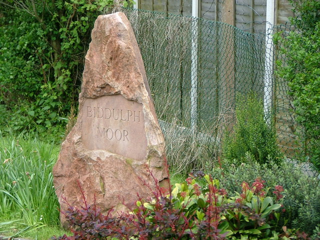
Biddulph Moor

Settlement in Staffordshire Staffordshire Moorlands

England

Biddulph Moor

Three Nooks Farm from Top Road Site of a failed attempt to drill for a gas field in 1999 after consent was refused by Staffordshire County Council.
Three Nooks Farm from Top Road Credit: Neil Lewin

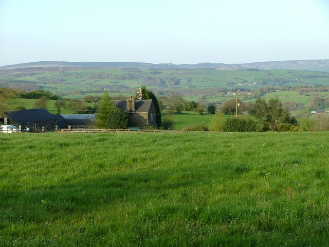
Biddulph Moor is a village located in the Staffordshire Moorlands district of Staffordshire, England. Situated on the western edge of the Staffordshire Peak District, it is surrounded by picturesque countryside and offers stunning views of the nearby Staffordshire countryside and the Cheshire Plain.

The village is known for its rural and tranquil atmosphere, making it an ideal destination for those seeking a peaceful retreat. Biddulph Moor is characterized by its charming stone cottages, well-tended gardens, and traditional architecture, which adds to its quaint and traditional appeal.

The village boasts a rich history, with evidence of settlements dating back to the Bronze Age. It was primarily an agricultural community, but in recent years, it has seen a transition towards a more residential area.

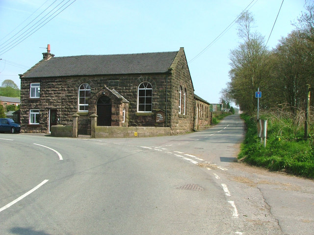
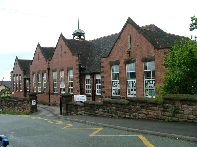
Despite its small size, Biddulph Moor offers a range of amenities to cater to the needs of its residents and visitors. These include a local pub, a post office, a primary school, and several shops. The village is also well-connected to the nearby towns of Biddulph and Congleton, which provide additional services and amenities.

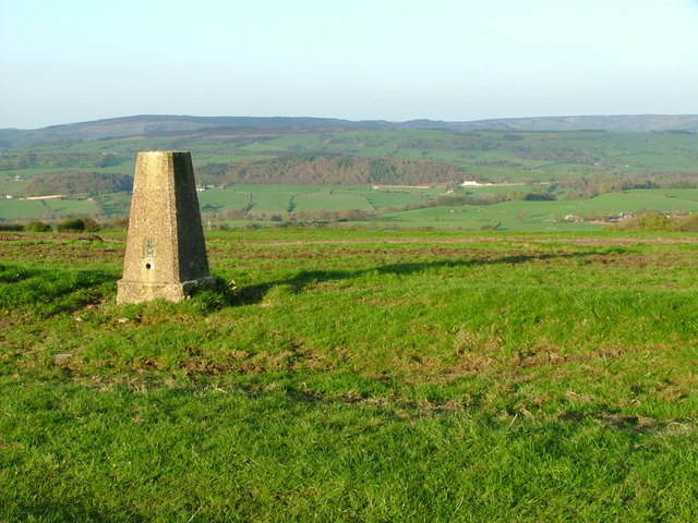
Nature lovers and outdoor enthusiasts will find plenty to enjoy in Biddulph Moor. The surrounding countryside offers numerous walking and cycling trails, allowing visitors to explore the area's natural beauty. The village is also close to several notable attractions, including the National Trust's Biddulph Grange Garden, a stunning Victorian garden renowned for its unique design and exotic plant collections.

In conclusion, Biddulph Moor is a charming village nestled in the Staffordshire countryside, offering a peaceful and idyllic setting for residents and visitors alike.

If you have any feedback on the listing, please let us know in the comments section below.

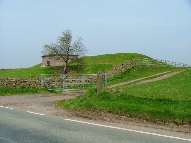
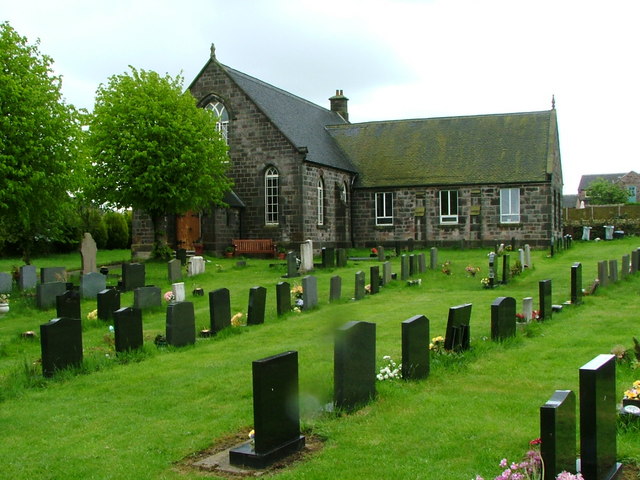
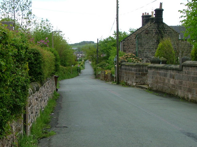
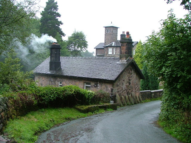
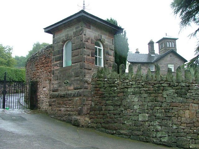
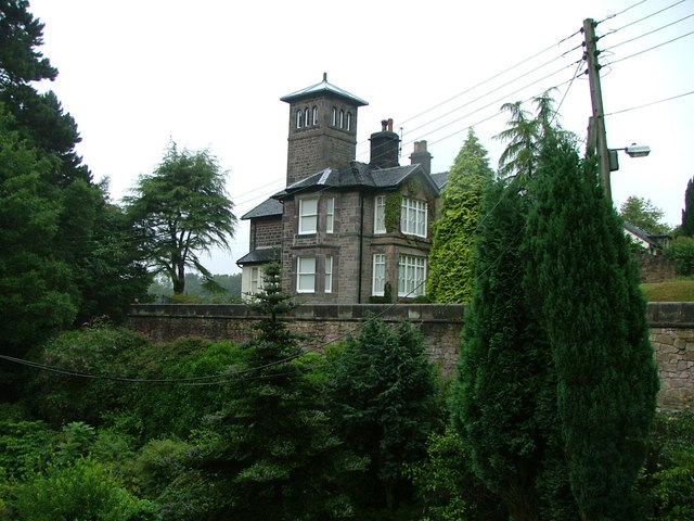
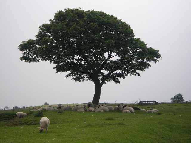
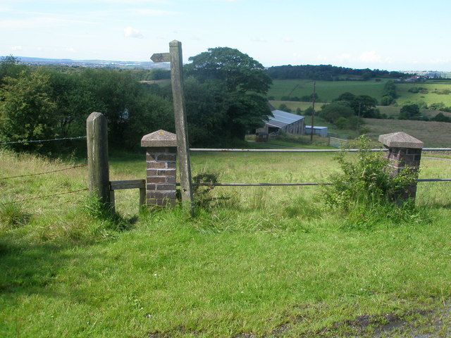
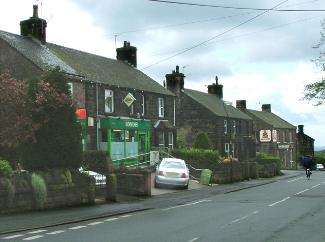
Biddulph Moor Images

Images are sourced within 2km of 53.123569/-2.143424 or Grid Reference SJ9058. Thanks to Geograph Open Source API. All images are credited.

Three Nooks Farm from Top Road Site of a failed attempt to drill for a gas field in 1999 after consent was refused by Staffordshire County Council.
Three Nooks Farm from Top Road
Site of a failed attempt to drill for a gas field in 1999 after consent was refused by Staffordshire County Council.
Trig Point overlooking Horton Valley The woodland in the distance is surrounding Rudyard Reservoir (SJ9459)
Trig Point overlooking Horton Valley
The woodland in the distance is surrounding Rudyard Reservoir (SJ9459)
Biddulph Park Methodist Chapel Established in 1860. The left hand part of the building is a private dwelling, not surprisingly called Chapel Cottage.
Biddulph Park Methodist Chapel
Established in 1860. The left hand part of the building is a private dwelling, not surprisingly called Chapel Cottage.
Date stone of Biddulph Park Chapel
Reservoir This enclosed reservoir serves Biddulph Moor
Reservoir
This enclosed reservoir serves Biddulph Moor
New Street Methodist Church, Biddulph Moor
Hot Lane This was one of the main roads through Biddulph Moor
Hot Lane
This was one of the main roads through Biddulph Moor
Biddulph Moor First School
Stone Sign
Stone Sign
Biddulph Moor Village Centre Two pubs, two shops (which between them form a Post Office, hairdresser, newsagent, video rental and two off-licences plus parking for the chip-van on Friday tea-time) and several churches. ie a 21st century self-sufficient village.
Biddulph Moor Village Centre
Two pubs, two shops (which between them form a Post Office, hairdresser, newsagent, video rental and two off-licences plus parking for the chip-van on Friday tea-time) and several churches. ie a 21st century self-sufficient village.
The source of the River Trent This 'well' is the start of the River Trent complete with a commemorative stone marked 1935.
The source of the River Trent
This 'well' is the start of the River Trent complete with a commemorative stone marked 1935.
Trent Head Well Overall view of the source of the River Trent. The actual well is at the bottom right.
Trent Head Well
Overall view of the source of the River Trent. The actual well is at the bottom right.
Trent Head Well II A commemorative gate and protective fence fitted by Staffordshire Moorlands District Council in 1996.
Trent Head Well II
A commemorative gate and protective fence fitted by Staffordshire Moorlands District Council in 1996.
Hurst Cottage Built on a slope by a narrow bridge by a sharp bend with a brook running alongside. Not the most obvious place to build but a beautiful situation
Hurst Cottage
Built on a slope by a narrow bridge by a sharp bend with a brook running alongside. Not the most obvious place to build but a beautiful situation
Spring House A small gatehouse at the entrance to this fantastic towered house.
Spring House
A small gatehouse at the entrance to this fantastic towered house.
Spring House pictured across the gardens of Hurst Cottage
Spring House
pictured across the gardens of Hurst Cottage
Sheep may safely graze. In the shade of the one tree in their field.
Sheep may safely graze.
In the shade of the one tree in their field.
Footpath to Cowall Moor
Show me another place!

Biddulph Moor is located at Grid Ref: SJ9058 (Lat: 53.123569, Lng: -2.143424)

Administrative County: Staffordshire

District: Staffordshire Moorlands

Police Authority: Staffordshire

What 3 Words

///gladiator.loaf.remotes. Near Biddulph, Staffordshire

Related Wikis

Biddulph Moor

Biddulph Moor is a village located on the hill which bears the same name. It is in Biddulph parish and is a part of the Staffordshire Moorlands district...

Biddulph Grange Country Park

Biddulph Grange Country Park is a country park in Biddulph, UK. It was originally part of Biddulph Grange. == Contents == The 73 acres (0.30 km2) park...

Biddulph Grange

Biddulph Grange is a National Trust landscaped garden, in Biddulph near Stoke-on-Trent, Staffordshire, England. It is separate from Biddulph Grange Country...

Biddulph

Biddulph is a town in Staffordshire, England, 8.5 miles (14 km) north of Stoke-on-Trent and 4.5 miles (7 km) south-east of Congleton, Cheshire. == Origin... ==

Biddulph railway station

Biddulph railway station was a railway station opened by the North Staffordshire Railway in 1864. Originally named Gillow Heath the station was renamed...

Biddulph High School

Biddulph High School is a mixed upper school (termed 'high school') and sixth form located in the Knypersley area of Biddulph in the English county of...

Braddocks Hay

Braddocks Hay is a village in Staffordshire, England. Population details for the 2011 census can be found under Biddulph

Knypersley Hall

Knypersley Hall is an 18th-century Georgian style country mansion at Biddulph, Staffordshire, England. It is protected as a Grade II* listed building....

Nearby Amenities

Located within 500m of 53.123569,-2.143424
Biddulph Moor
Place: village
Wikidata: Q4904079
Lat/Long: 53.1207549/-2.1407871
Bus Stop
Cedar Grove
Naptan AtcoCode: 3800C801900
Naptan Bearing: N
Naptan CommonName: Cedar Grove
Naptan Indicator: Adj
Naptan Landmark: Cedar Gr
Naptan PlusbusZoneRef: STOKEOT
Naptan Street: Cherry Tree Ln
Naptan Verified: no
Source: naptan_import
Lat/Long: 53.1205043/-2.1427451
Bus Stop
Rose & Crown PH
Naptan AtcoCode: 3800C802200
Naptan Bearing: SW
Naptan CommonName: Rose & Crown PH
Naptan Indicator: Adj
Naptan Landmark: Rose & Crown PH
Naptan PlusbusZoneRef: STOKEOT
Naptan Street: New Street
Naptan Verified: no
Source: naptan_import
Lat/Long: 53.1204432/-2.1410864
Bus Stop
Rose & Crown PH
Naptan AtcoCode: 3800C802201
Naptan Bearing: NE
Naptan CommonName: Rose & Crown PH
Naptan Indicator: Opp
Naptan Landmark: Rose & Crown PH
Naptan PlusbusZoneRef: STOKEOT
Naptan Street: New St
Naptan Verified: no
Source: naptan_import
Lat/Long: 53.120623/-2.1410422
Bus Stop
Farmside Lane
Naptan AtcoCode: 3800C802400
Naptan Bearing: E
Naptan CommonName: Farmside Lane
Naptan Indicator: Adj
Naptan Landmark: Farmside Ln
Naptan PlusbusZoneRef: STOKEOT
Naptan Street: Wraggs Ln
Naptan Verified: no
Source: naptan_import
Lat/Long: 53.1196355/-2.1399481
Turning Circle
Lat/Long: 53.1196921/-2.142354
Turning Circle
Lat/Long: 53.1203518/-2.1422981
Barrier: stile
Lat/Long: 53.1197347/-2.1464677
Pub
Rose & Crown
Addr Housenumber: 440
Addr Postcode: ST8 7HZ
Addr Street: New Street
Opening Hours: Mo-Su 17:00-00:00
Operator: Joules Brewery
Lat/Long: 53.1205368/-2.1408915
Moor Test Centre
Addr Housenumber: 5
Addr Postcode: ST8 7JD
Addr Street: Rudyard Road
Opening Hours: Mo-Fr 08:00-17:00
Shop: car_repair
Lat/Long: 53.1215329/-2.139119
Biddulph Moor Post Office
Addr Housenumber: 448
Addr Postcode: ST8 7HZ
Addr Street: New Street
Shop: convenience
Lat/Long: 53.1208329/-2.1403801
Village News & Garden
Addr Housenumber: 453
Addr Postcode: ST8 7LP
Addr Street: New Street
Shop: newsagent
Lat/Long: 53.1207102/-2.1410512
Pharmacy
Well Pharmacy
Addr Housenumber: 396
Addr Postcode: ST8 7LR
Addr Street: New Street
Brand: Well Pharmacy
Brand Wikidata: Q7726524
Dispensing: yes
Healthcare: pharmacy
Website: https://finder.well.co.uk/store/biddulph-moor-new-street
Lat/Long: 53.1196289/-2.1417548
Defibrillator
Booth: K6
Covered: booth
Defibrillator Location: inside old red phone box in Biddulph Moor - near Rose & Crown pub
Disused Amenity: telephone
Emergency: defibrillator
Man Made: telephone_box
Lat/Long: 53.1209815/-2.1407195
Post Box
Post Box Type: pillar
Royal Cypher: GVIR
Royal Cypher Wikidata: Q33102169
Lat/Long: 53.1208859/-2.1404226
Generator Method: photovoltaic
Generator Output Electricity: yes
Generator Source: solar
Generator Type: solar_photovoltaic_panel
Location: roof
Power: generator
Lat/Long: 53.1209787/-2.1419677
Generator Method: photovoltaic
Generator Output Electricity: yes
Generator Source: solar
Generator Type: solar_photovoltaic_panel
Location: roof
Power: generator
Lat/Long: 53.1210273/-2.1420459
Generator Method: photovoltaic
Generator Output Electricity: yes
Generator Source: solar
Generator Type: solar_photovoltaic_panel
Location: roof
Power: generator
Lat/Long: 53.1202448/-2.1421602
Generator Method: photovoltaic
Generator Output Electricity: yes
Generator Source: solar
Generator Type: solar_photovoltaic_panel
Location: roof
Power: generator
Lat/Long: 53.1207326/-2.1422235
Generator Method: photovoltaic
Generator Output Electricity: yes
Generator Source: solar
Generator Type: solar_photovoltaic_panel
Location: roof
Power: generator
Lat/Long: 53.1208072/-2.1424707
Turning Circle
Lat/Long: 53.1233446/-2.1402543
Turning Circle
Lat/Long: 53.1192147/-2.142966
Turning Circle
Lat/Long: 53.1207894/-2.1419707
Turning Circle
Lat/Long: 53.120445/-2.1434372
The data included in this document is from www.openstreetmap.org. The data is made available under ODbL.

Have you been to Biddulph Moor?

Leave your review of Biddulph Moor below (or comments, questions and feedback).