Bideford

Settlement in Devon Torridge

England

Bideford

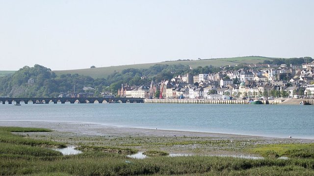
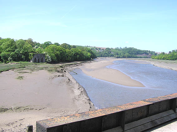
Bideford Long Bridge and view of the town Taken from the new flyover bridge on the A39, this view looks down the River Torridge towards Bideford Long Bridge, Bideford quayside and the area on the other side of the river known as East-the-Water.
Bideford Long Bridge and view of the town Credit: Mike Crowe

Bideford is a historic market town located in the county of Devon, England. Situated on the estuary of the River Torridge, it is known for its picturesque setting and rich maritime heritage. With a population of around 17,000 residents, Bideford offers a charming blend of old-world charm and modern amenities.

The town's history dates back to the medieval era, and evidence of its past can be seen in the narrow streets, historic buildings, and the iconic Bideford Long Bridge, which was originally constructed in the 13th century. The town's quayside area, known as the "Old Port," is lined with quaint shops, cafes, and pubs, providing visitors with a glimpse into its maritime past.

Bideford is also renowned for its stunning natural beauty. The nearby North Devon coastline offers breathtaking views and is a haven for outdoor enthusiasts. Popular attractions include the expansive sandy beaches of Westward Ho! and the picturesque fishing village of Clovelly.

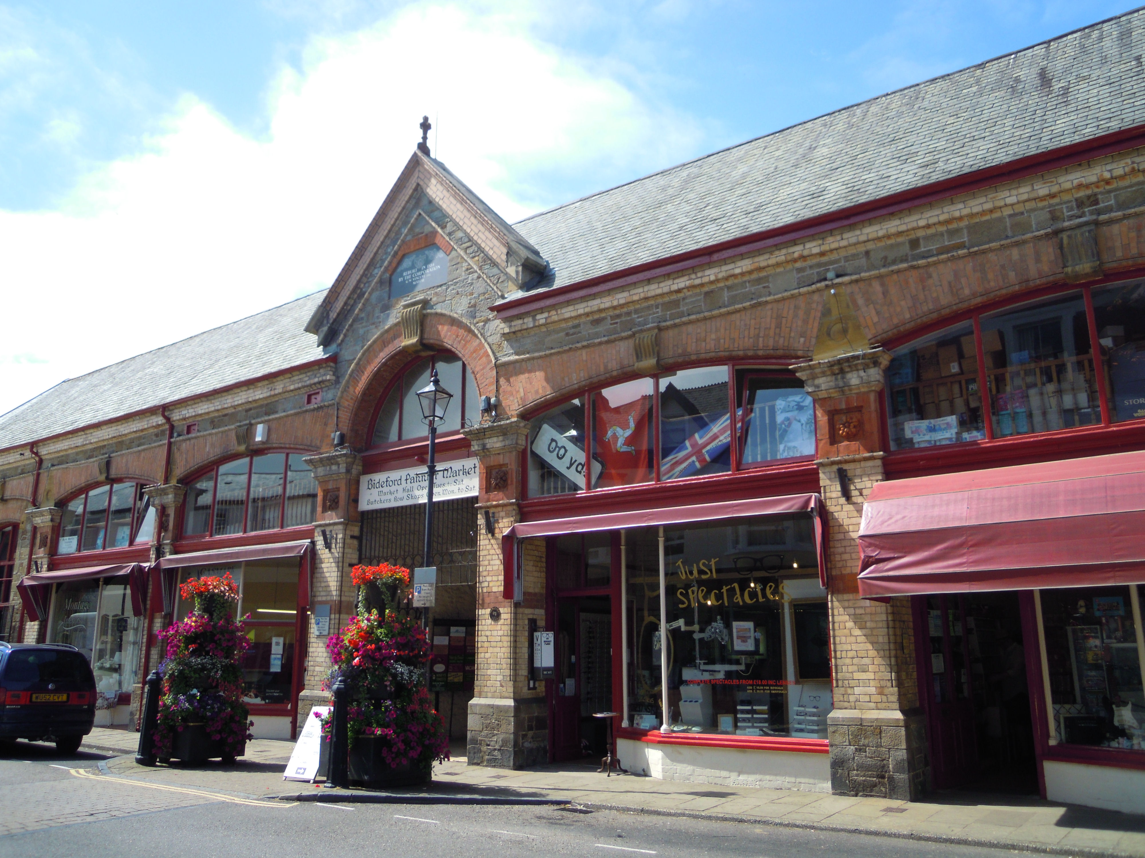
In addition to its historical and natural attractions, Bideford boasts a thriving community with a range of amenities. The town center features a variety of independent shops, supermarkets, and a bustling pannier market. It also offers a selection of restaurants, pubs, and entertainment venues, ensuring there is something for everyone.

Transport links in Bideford are well-established, with regular bus services connecting the town to nearby areas, including Barnstaple and the popular tourist destination of Bude. The town is also easily accessible by car, situated just off the A39 Atlantic Highway.

Overall, Bideford is a charming town that offers a blend of rich history, natural beauty, and a vibrant community, making it an appealing destination for visitors and residents alike.

If you have any feedback on the listing, please let us know in the comments section below.

Bideford Images

Images are sourced within 2km of 51.016743/-4.204874 or Grid Reference SS4526. Thanks to Geograph Open Source API. All images are credited.
Bideford Long Bridge and view of the town Taken from the new flyover bridge on the A39, this view looks down the River Torridge towards Bideford Long Bridge, Bideford quayside and the area on the other side of the river known as East-the-Water.
Bideford Long Bridge and view of the town
Taken from the new flyover bridge on the A39, this view looks down the River Torridge towards Bideford Long Bridge, Bideford quayside and the area on the other side of the river known as East-the-Water.
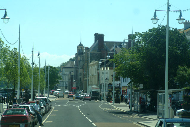
Bideford Quayside and main through road A view looking up the main road adjacent top the quayside, looking towards Bideford Long Bridge. The town centre is on the hill to the right of the picture. The quayside still sees some use. Before the construction of the new flyover, all traffic used this road en route from Barnstaple into North Cornwall.
Bideford Quayside and main through road
A view looking up the main road adjacent top the quayside, looking towards Bideford Long Bridge. The town centre is on the hill to the right of the picture. The quayside still sees some use. Before the construction of the new flyover, all traffic used this road en route from Barnstaple into North Cornwall.
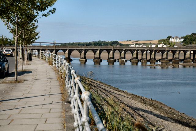
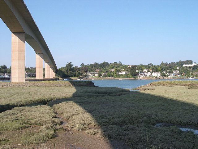
High level road bridge across the Torridge Estuary This was taken from the eastern bank of the estuary looking over to the suburbs of Bideford on the opposite bank.
High level road bridge across the Torridge Estuary
This was taken from the eastern bank of the estuary looking over to the suburbs of Bideford on the opposite bank.
Bideford and the Longbridge
Bideford Old Bridge
Bideford Old Bridge
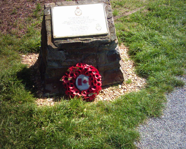
Memorial stone for a crashed WW2 bomber At the edge of the Tarka Trail (cycle way) on the former railway line between Bideford and Torrington.
Memorial stone for a crashed WW2 bomber
At the edge of the Tarka Trail (cycle way) on the former railway line between Bideford and Torrington.
Butcher's shop in Bideford The shopfront has a statue of a newsboy, with the placard "Western Express 1d"
Butcher's shop in Bideford
The shopfront has a statue of a newsboy, with the placard "Western Express 1d"
Bideford station on the Tarka Trail has been brought back to life by a partnership between Devon County Council and the Bideford & Instow Railway Group. The Group rebuilt the signalbox as an exact replica of the original on the old foundations.
Bideford station
on the Tarka Trail has been brought back to life by a partnership between Devon County Council and the Bideford & Instow Railway Group. The Group rebuilt the signalbox as an exact replica of the original on the old foundations.
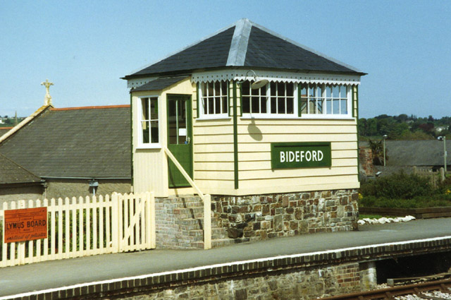
Bideford: signalbox at Bideford Station Replica of original signalbox built by the London & South Western Railway. The station survives at East-the-Water
Bideford: signalbox at Bideford Station
Replica of original signalbox built by the London & South Western Railway. The station survives at East-the-Water
Torridge Estuary near 'The Cleve' Taken from the South West Coastpath.
Torridge Estuary near 'The Cleve'
Taken from the South West Coastpath.
Torridge Bridge Taken from near the Tarka trail
Torridge Bridge
Taken from near the Tarka trail
Still Standing Wreck by the bridge
Still Standing
Wreck by the bridge
December in sunglasses I like to take the "Old road" at Bideford across the river on the way home from my parents', to catch my breath and calm down. At this point I'm 30 odd miles from my Mum and Dad and 120 miles from the Wife, My god that's a flat out dash back to "her in doors!".
The only way to get my camera to take this picture was to take it through my sunglasses which was the way that I saw it as I drove across the bridge.
December in sunglasses
I like to take the "Old road" at Bideford across the river on the way home from my parents', to catch my breath and calm down. At this point I'm 30 odd miles from my Mum and Dad and 120 miles from the Wife, My god that's a flat out dash back to "her in doors!". The only way to get my camera to take this picture was to take it through my sunglasses which was the way that I saw it as I drove across the bridge.
River Torridge from Landcross viaduct The old line from Barnstaple and Bideford to Halwill Junction
River Torridge from Landcross viaduct
The old line from Barnstaple and Bideford to Halwill Junction
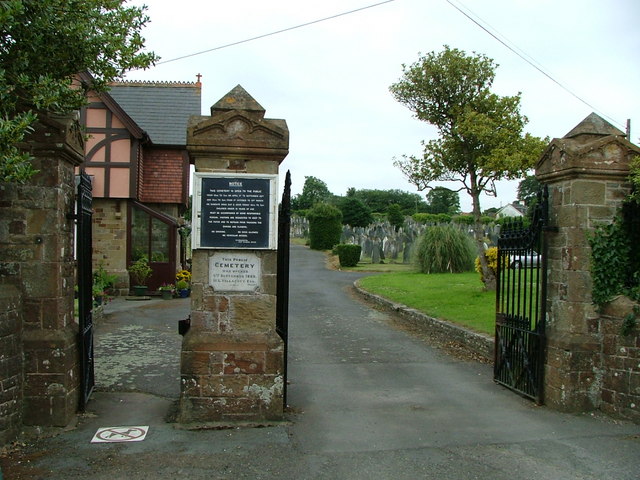
Bideford Cemetery Opened 6th September 1889 by W L Vellacott Esq
Bideford Cemetery
Opened 6th September 1889 by W L Vellacott Esq
ML1301 passing under Bideford Bridge, January 1943 The boat and its two sisters were built at Blackmore's Yard, which used to be just above the Bridge.  They were the largest craft to squeeze through.  Timing was important, to get adequate headroom and depth under the keel.
ML1301 passing under Bideford Bridge, January 1943
The boat and its two sisters were built at Blackmore's Yard, which used to be just above the Bridge. They were the largest craft to squeeze through. Timing was important, to get adequate headroom and depth under the keel.
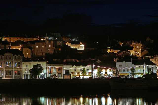
Bideford at night across the river Torridge
Charles Kingsley statue and gull, Bideford quayside
Show me another place!

Bideford is located at Grid Ref: SS4526 (Lat: 51.016743, Lng: -4.204874)

Administrative County: Devon

District: Torridge

Police Authority: Devon and Cornwall

What 3 Words

///escapes.prop.stooping. Near Bideford, Devon

Nearby Locations

Bideford East-the-Water

Have you been to Bideford?

Leave your review of Bideford below (or comments, questions and feedback).
Nearby Amenities

Located within 500m of 51.016743,-4.204874
Source: PGS
Lat/Long: 51.0198275/-4.2002116
Source: PGS
Lat/Long: 51.0188302/-4.2006159
Source: PGS
Lat/Long: 51.0177576/-4.2012869
Source: PGS
Lat/Long: 51.0173143/-4.2015079
Source: PGS
Lat/Long: 51.0165602/-4.2018862
Source: PGS
Lat/Long: 51.016116/-4.2020199
Source: PGS
Lat/Long: 51.0156256/-4.2022209
Source: PGS
Lat/Long: 51.0152044/-4.2023959
Source: PGS
Lat/Long: 51.0148804/-4.2025075
Source: PGS
Lat/Long: 51.0135927/-4.2028336
Source: PGS
Lat/Long: 51.0127589/-4.2031021
Source: PGS
Lat/Long: 51.0122864/-4.2057833
Source: PGS
Lat/Long: 51.0124227/-4.2056814
Source: PGS
Lat/Long: 51.0126853/-4.2057195
Source: PGS
Lat/Long: 51.0127896/-4.2057984
Source: PGS
Lat/Long: 51.0137653/-4.2056412
Source: PGS
Lat/Long: 51.0141262/-4.2054392
Source: PGS
Lat/Long: 51.0151324/-4.204968
Source: PGS
Lat/Long: 51.0165736/-4.2047373
Source: PGS
Lat/Long: 51.0168722/-4.2046828
Source: PGS
Lat/Long: 51.0170902/-4.2044723
Source: PGS
Lat/Long: 51.0188834/-4.2039412
Source: PGS
Lat/Long: 51.0201181/-4.2035966
Source: PGS
Lat/Long: 51.0203434/-4.2034974
Source: PGS
Lat/Long: 51.0208502/-4.2032744
Mini Roundabout
Direction: clockwise
Lat/Long: 51.0137881/-4.2060585
Mini Roundabout
Direction: clockwise
Lat/Long: 51.0167678/-4.2047865
Crossing
Crossing Island: yes
Lat/Long: 51.0208976/-4.2061147
Mini Roundabout
Direction: clockwise
Lat/Long: 51.0160834/-4.2014135
Bideford
Place: town
Postal Code: EX39
Wikidata: Q1234840
Wikipedia: en:Bideford
Lat/Long: 51.0181448/-4.2064223
Corner House Guest House
Addr City: Bideford
Addr Housenumber: 14
Addr Postcode: EX39 2ND
Addr Street: The Strand
Email: cornerhousestrand@gmail.com
Guest House: bed_and_breakfast
Internet Access: wlan
Operator: Steve and Melanie
Phone: +44 1237 473722
Rooms: 5
Source: website;business card
Tourism: guest_house
Website: http://cornerhouseguesthouse.co.uk
Lat/Long: 51.0204267/-4.208022
Recycling
Lat/Long: 51.0205672/-4.204248
Library
Bideford Library
Addr City: Bideford
Addr Postcode: EX39 2HR
Addr Street: Bridge Street
Internet Access: wlan
Opening Hours: Mo-Tu, Th-Fr 09:30-18:00; Sa 09:30-13:30
Phone: +44 1237 476075
Website: https://www.devon.gov.uk/bideford_library
Wheelchair: limited
Wheelchair Description: Disabled access is not avaliable after 5:30pm or on Saturdays
Wikidata: Q26496694
Lat/Long: 51.0167271/-4.2050248
Tantons Hotel
Created By: Potlatch 0.10f
Tourism: hotel
Wikidata: Q26580488
Lat/Long: 51.0163158/-4.2050834
Place Of Worship
Bideford Baptist Church
Building: church
Denomination: baptist
Religion: christian
Lat/Long: 51.0190091/-4.2069939
Place Of Worship
Lavington United Reform Church
Addr City: Bideford
Addr Postcode: EX39 2QE
Addr Street: Bridgeland Street
Building: church
Denomination: united_reformed
Religion: christian
Source Postcode: FHRS Open Data
Lat/Long: 51.0199256/-4.2063862
Pub
Joiners Arms
Addr City: Bideford
Addr County: Devon
Addr Housenumber: 6
Addr Postcode: EX39 2DR
Addr Street: Market Place
Fhrs Id: 846054
Phone: +44 1237 472675
Source Addr: FHRS Open Data
Wikidata: Q80476830
Lat/Long: 51.0171066/-4.2079254
Restaurant
Belluno
Addr City: Bideford
Addr County: Devon
Addr Housenumber: 37
Addr Postcode: EX39 2DY
Addr Street: Silver Street
Cuisine: italian
Fhrs Id: 964202
Source Addr: FHRS Open Data
Lat/Long: 51.0165252/-4.2073527
Pub
White Hart Inn
Addr City: Bideford
Addr Postcode: EX39 2JG
Addr Street: Queen Street
Fhrs Id: 745174
Food: yes
Source Addr: FHRS Open Data
Lat/Long: 51.019441/-4.2046456
Crossing
Crossing Island: yes
Lat/Long: 51.0208689/-4.2051352
Pub
Black Smith Arms
Created By: Potlatch 0.10f
Wikidata: Q26505075
Lat/Long: 51.0149452/-4.2020293
Barrier: bollard
Lat/Long: 51.0146571/-4.1990331
Created By: Potlatch 0.10f
Historic: memorial
Lat/Long: 51.0161332/-4.1982356
Police
Created By: Potlatch 0.10f
Lat/Long: 51.0158632/-4.2051536
Created By: Potlatch 0.10f
Historic: memorial
Memorial: bust
Lat/Long: 51.0160792/-4.2015659
East The Water
Created By: Potlatch 0.10f
Place: suburb
Lat/Long: 51.0166515/-4.1980125
Post Box
Created By: Potlatch 0.10f
Lat/Long: 51.0146753/-4.1991368
Cafe
Costa Coffee
Addr City: Bideford
Addr County: Devon
Addr Housenumber: 86
Addr Postcode: EX39 2HL
Addr Street: High Street
Brand: Costa
Brand Wikidata: Q608845
Brand Wikipedia: en:Costa Coffee
Cuisine: coffee_shop
Fhrs Id: 1156692
Internet Access: yes
Internet Access Fee: no
Source Addr: FHRS Open Data
Takeaway: yes
Lat/Long: 51.0179823/-4.2048435
Crossing
Button Operated: yes
Crossing: traffic_signals
Crossing Ref: puffin
Kerb: flush
Tactile Paving: yes
Lat/Long: 51.0187873/-4.2043528
Bicycle Parking
Bicycle Parking: stands
Check Date: 2023-03-15
Covered: no
Lat/Long: 51.0170014/-4.2046436
Bus Stop
Bideford Quay Stop D
Bench: yes
Bin: yes
Bus: yes
Public Transport: platform
Shelter: yes
Lat/Long: 51.0184162/-4.2045555
Bus Stop
Bideford Quay Stop C
Bench: yes
Bus: yes
Public Transport: platform
Shelter: yes
Lat/Long: 51.0182449/-4.2045885
Telephone
Booth: KX100
Covered: booth
Lat/Long: 51.0183605/-4.2045875
Tourism: information
Lat/Long: 51.0157536/-4.200912
Post Box
Operator: Royal Mail
Operator Wikidata: Q638098
Post Box Type: wall
Ref: EX39 3
Lat/Long: 51.0171572/-4.2102751
Telephone
Booth: K6
Colour: red
Covered: booth
Listed Status: Grade II
Operator: BT
Operator Wikidata: Q593786
Lat/Long: 51.0167104/-4.2077839
Post Box
Operator: Royal Mail
Operator Wikidata: Q638098
Post Box Type: pillar
Ref: EX39 60
Royal Cypher: EIIR
Royal Cypher Wikidata: Q33102113
Lat/Long: 51.0171286/-4.2071718
Telephone
Booth: KX100
Covered: booth
Operator: BT
Operator Wikidata: Q593786
Lat/Long: 51.0173971/-4.2104912
Ferry Terminal
Ferry: yes
Public Transport: station
Lat/Long: 51.0190474/-4.2038816
Leisure: slipway
Lat/Long: 51.0135529/-4.2030255
Source: PGS
Lat/Long: 51.0137307/-4.2028447
Railway: buffer_stop
Lat/Long: 51.014919/-4.20149
Railway: buffer_stop
Lat/Long: 51.0149264/-4.2015234
Railway: level_crossing
Lat/Long: 51.0153607/-4.2012189
Railway: level_crossing
Lat/Long: 51.01537/-4.2012529
Bicycle Parking
Bicycle Parking: stands
Capacity: 6
Covered: no
Lat/Long: 51.0205519/-4.2037612
Taxi
Bideford Quay Taxi Rank
Capacity: 8
Operator: Torridge District Council
Lat/Long: 51.0181969/-4.2044537
Post Office
Bideford Post Office
Addr City: Bideford
Addr Country: GB
Addr Postcode: EX39 2EX
Branch: Bideford
Brand: Post Office
Brand Wikidata: Q1783168
Check Date: 2020-02-20
Contact Website: https://www.postoffice.co.uk/branch-finder/0085197/bideford
Operator: Post Office
Operator Wikidata: Q1783168
Ref Pol Id: 33
Lat/Long: 51.0201539/-4.2042214
Tourist Information
Information: office
Tourism: information
Lat/Long: 51.0211055/-4.205077
Historic: memorial
Lat/Long: 51.0206416/-4.2040819
Crossing
Bicycle: yes
Crossing: traffic_signals
Crossing Ref: toucan
Kerb: flush
Tactile Paving: yes
Lat/Long: 51.0203628/-4.2038818
Post Box
Post Box Type: wall
Royal Cypher: EIIR
Royal Cypher Wikidata: Q33102113
Lat/Long: 51.019933/-4.2077214
Atm
Lat/Long: 51.0201246/-4.2041494
Post Box
Check Date: 2023-03-15
Post Box Type: pillar
Lat/Long: 51.0180322/-4.204733
Post Box
Addr City: Bideford
Collection Times: Mo-Fr 09:00; Sa 07:00
Colour: yellow
Inscription: This post box was presented to the people of Bideford by the Landivisiau twinning committee in May 1992.
Post Box Design: french_lamp
Post Box Mounting: wall
Post Box Type: lamp
Ref: EX39 183D
Lat/Long: 51.0210744/-4.2052162
Telephone
Booth: KX100
Covered: booth
Lat/Long: 51.0201354/-4.2040873
Artwork Type: statue
Historic: memorial
Image: https://archive.org/details/bideford-2021-09-11/DSCN5515.JPG
Inscription: Kingsley
Tourism: artwork
Lat/Long: 51.020734/-4.2037372
Addr City: Bideford
Entrance: main
Lat/Long: 51.0210742/-4.205152
Post Box
Check Date: 2023-03-15
Post Box Apertures: 2
Post Box Type: wall
Ref: EX39 181
Lat/Long: 51.0201176/-4.204153
Bench
Lat/Long: 51.0159475/-4.2007558
Pub
The Anchor
Addr City: Bideford
Addr County: Devon
Addr Housenumber: 11
Addr Postcode: EX39 2DJ
Addr Street: Honestone Street
Fhrs Id: 233613
Source Addr: FHRS Open Data
Wikidata: Q80476227
Lat/Long: 51.0165875/-4.2080428
Liberal Democrats
Office: political_party
Lat/Long: 51.0177799/-4.208207
Millennium Milepost Bideford
Description: 1) Barnstaple 9 2) Great Torrington 6
Image: https://www.cyclestreets.net/location/194715/cyclestreets194715.jpg
Information: guidepost
Ncn Milepost: mills
Sustrans Ref: MP 1
Tourism: information
Lat/Long: 51.0160879/-4.2007303
Direction: SSE
Generator Method: photovoltaic
Generator Output Electricity: yes
Generator Solar Modules: 30
Generator Source: solar
Generator Type: solar_photovoltaic_panel
Location: roof
Power: generator
Lat/Long: 51.0186342/-4.1993201
Direction: S
Generator Method: photovoltaic
Generator Output Electricity: yes
Generator Solar Modules: 9
Generator Source: solar
Generator Type: solar_photovoltaic_panel
Location: roof
Power: generator
Lat/Long: 51.0151328/-4.1997941
Direction: W
Generator Method: photovoltaic
Generator Output Electricity: yes
Generator Solar Modules: 4
Generator Source: solar
Generator Type: solar_photovoltaic_panel
Location: roof
Power: generator
Lat/Long: 51.0151142/-4.1997385
Direction: W
Generator Method: photovoltaic
Generator Output Electricity: yes
Generator Solar Modules: 2
Generator Source: solar
Generator Type: solar_photovoltaic_panel
Location: roof
Power: generator
Lat/Long: 51.015083/-4.1997351
Direction: S
Generator Method: photovoltaic
Generator Output Electricity: yes
Generator Solar Modules: 16
Generator Source: solar
Generator Type: solar_photovoltaic_panel
Location: roof
Power: generator
Lat/Long: 51.0149047/-4.1989908
Direction: WSW
Generator Method: photovoltaic
Generator Output Electricity: yes
Generator Solar Modules: 10
Generator Source: solar
Generator Type: solar_photovoltaic_panel
Location: roof
Power: generator
Lat/Long: 51.013272/-4.2020955
Generator Method: photovoltaic
Generator Output Electricity: yes
Generator Source: solar
Generator Type: solar_photovoltaic_panel
Location: roof
Power: generator
Lat/Long: 51.0177327/-4.200692
Direction: ESE
Generator Method: photovoltaic
Generator Output Electricity: yes
Generator Solar Modules: 10
Generator Source: solar
Generator Type: solar_photovoltaic_panel
Location: roof
Power: generator
Lat/Long: 51.0166197/-4.1980903
Direction: SSW
Generator Method: photovoltaic
Generator Output Electricity: yes
Generator Solar Modules: 6
Generator Source: solar
Generator Type: solar_photovoltaic_panel
Location: roof
Power: generator
Lat/Long: 51.0166389/-4.1980155
Direction: 185
Generator Method: photovoltaic
Generator Output Electricity: yes
Generator Solar Modules: 16
Generator Source: solar
Generator Type: solar_photovoltaic_panel
Location: roof
Power: generator
Lat/Long: 51.0166824/-4.2116812
Direction: SSW
Generator Method: photovoltaic
Generator Output Electricity: yes
Generator Solar Modules: 16
Generator Source: solar
Generator Type: solar_photovoltaic_panel
Location: roof
Power: generator
Lat/Long: 51.0149293/-4.2065934
Direction: ESE
Generator Method: photovoltaic
Generator Output Electricity: yes
Generator Solar Modules: 14
Generator Source: solar
Generator Type: solar_photovoltaic_panel
Location: roof
Power: generator
Lat/Long: 51.0134527/-4.2085111
Direction: ESE
Generator Method: photovoltaic
Generator Output Electricity: yes
Generator Solar Modules: 13
Generator Source: solar
Generator Type: solar_photovoltaic_panel
Location: roof
Power: generator
Lat/Long: 51.0137446/-4.2070275
Direction: 100
Generator Method: photovoltaic
Generator Output Electricity: yes
Generator Solar Modules: 6
Generator Source: solar
Generator Type: solar_photovoltaic_panel
Location: roof
Power: generator
Lat/Long: 51.0150396/-4.2056675
Direction: 280
Generator Method: photovoltaic
Generator Output Electricity: yes
Generator Solar Modules: 6
Generator Source: solar
Generator Type: solar_photovoltaic_panel
Location: roof
Power: generator
Lat/Long: 51.0150542/-4.2057042
Direction: 190
Generator Method: photovoltaic
Generator Output Electricity: yes
Generator Solar Modules: 11
Generator Source: solar
Generator Type: solar_photovoltaic_panel
Location: roof
Power: generator
Lat/Long: 51.0153146/-4.2056162
Direction: SW
Generator Method: photovoltaic
Generator Output Electricity: yes
Generator Solar Modules: 16
Generator Source: solar
Generator Type: solar_photovoltaic_panel
Location: roof
Power: generator
Lat/Long: 51.0138861/-4.2071256
Direction: ESE
Generator Method: photovoltaic
Generator Output Electricity: yes
Generator Solar Modules: 12
Generator Source: solar
Generator Type: solar_photovoltaic_panel
Location: roof
Power: generator
Lat/Long: 51.0131226/-4.2086442
Direction: ESE
Generator Method: photovoltaic
Generator Output Electricity: yes
Generator Solar Modules: 6
Generator Source: solar
Generator Type: solar_photovoltaic_panel
Location: surface
Power: generator
Lat/Long: 51.0152159/-4.2083232
Direction: WNW
Generator Method: photovoltaic
Generator Output Electricity: yes
Generator Solar Modules: 6
Generator Source: solar
Generator Type: solar_photovoltaic_panel
Location: surface
Power: generator
Lat/Long: 51.0152236/-4.2083944
Direction: S
Generator Method: photovoltaic
Generator Output Electricity: yes
Generator Solar Modules: 7
Generator Source: solar
Generator Type: solar_photovoltaic_panel
Location: roof
Power: generator
Lat/Long: 51.016111/-4.2075828
Direction: S
Generator Method: photovoltaic
Generator Output Electricity: yes
Generator Solar Modules: 15
Generator Source: solar
Generator Type: solar_photovoltaic_panel
Location: roof
Power: generator
Lat/Long: 51.0195902/-4.2052585
Direction: SSE
Generator Method: photovoltaic
Generator Output Electricity: yes
Generator Solar Modules: 36
Generator Source: solar
Generator Type: solar_photovoltaic_panel
Location: roof
Power: generator
Lat/Long: 51.0191443/-4.2070144
Bideford
Historic Railway: station
Railway: site
Wikidata: Q4904099
Wikipedia: en:Bideford railway station
Lat/Long: 51.0154267/-4.2011784
Pub
Heavitree Arms
Lat/Long: 51.0187549/-4.2062249
Bench
Lat/Long: 51.0174174/-4.2103487
Information: guidepost
Tourism: information
Lat/Long: 51.0179894/-4.2047239
Telephone
Booth: KX100
Covered: booth
Lat/Long: 51.0183697/-4.2045865
Post Depot
Royal Mail
Operator: Royal Mail
Operator Type: private
Operator Wikidata: Q638098
Lat/Long: 51.0203927/-4.2045946
Give Way
Lat/Long: 51.0198523/-4.2040898
Bench
Backrest: yes
Lat/Long: 51.0203058/-4.2040522
Street Lamp
Lat/Long: 51.0204441/-4.2039791
Bench
Backrest: yes
Lat/Long: 51.0204633/-4.2042061
Bench
Backrest: yes
Lat/Long: 51.0204454/-4.2041595
Bench
Backrest: yes
Lat/Long: 51.0204425/-4.2041085
Give Way
Lat/Long: 51.0206407/-4.2038228
Street Lamp
Lat/Long: 51.0207951/-4.2042453
Street Lamp
Lat/Long: 51.020774/-4.2041749
Street Lamp
Lat/Long: 51.0206538/-4.2040133
Street Lamp
Lat/Long: 51.0197701/-4.2066224
Social Facility
Citizens Advice
Social Facility: advice
Social Facility For: all
Lat/Long: 51.0198739/-4.2065439
Vending Machine
Vending: parking_tickets
Lat/Long: 51.0197547/-4.2060997
Street Lamp
Lat/Long: 51.0197684/-4.2055871
Give Way
Lat/Long: 51.0205811/-4.2076553
Man Made: surveillance
Surveillance: public
Surveillance Type: camera
Lat/Long: 51.0196081/-4.2069382
Addr Housename: The Studio
Addr Housenumber: 14a
Lat/Long: 51.0197482/-4.206845
Barrier: bollard
Bollard: foldable
Lat/Long: 51.0191254/-4.2065543
Webbers
Note: Estate agent has two separate brands on signage
Office: estate_agent
Lat/Long: 51.0192648/-4.2065372
Fine & Country
Note: Estate agent has two separate brands on signage
Office: estate_agent
Lat/Long: 51.0192939/-4.2065641
Fire Hydrant
Emergency: fire_hydrant
Fire Hydrant Type: underground
Lat/Long: 51.0195244/-4.206847
Street Lamp
Lat/Long: 51.0192635/-4.2075129
Designers Florist
Shop: florist
Lat/Long: 51.0197463/-4.2068685
Atm
Brand: Barclays
Brand Wikidata: Q245343
Operator: Barclays
Operator Wikidata: Q245343
Lat/Long: 51.0179271/-4.2052402
Street Lamp
Lat/Long: 51.0179166/-4.2053095
Street Lamp
Lat/Long: 51.0178259/-4.2054898
Pharmacy
Well Pharmacy
Brand: Well Pharmacy
Brand Wikidata: Q7726524
Healthcare: pharmacy
Website: https://finder.well.co.uk/store/bideford-high-street
Lat/Long: 51.0177382/-4.2058218
Atm
Brand: Lloyds Bank
Brand Wikidata: Q1152847
Operator: Lloyds Bank
Operator Wikidata: Q1152847
Lat/Long: 51.0177866/-4.2054791
Atm
Brand: Lloyds Bank
Brand Wikidata: Q1152847
Operator: Lloyds Bank
Operator Wikidata: Q1152847
Lat/Long: 51.0177865/-4.2054462
Shop: beauty
Lat/Long: 51.0187624/-4.2051103
Addr Housenumber: 8A
Addr Street: Cooper Street
Lat/Long: 51.0187472/-4.2049695
Barrier: bollard
Lat/Long: 51.0187121/-4.2050005
Street Lamp
Lat/Long: 51.0186902/-4.2049953
Discovering Bideford
Information: map
Tourism: information
Lat/Long: 51.0187431/-4.2048747
Bideford Town Council
Government: town_council
Office: government
Lat/Long: 51.0187615/-4.2049232
Crossing
Crossing: unmarked
Crossing Markings: no
Kerb: flush
Tactile Paving: yes
Traffic Calming: table
Lat/Long: 51.0198554/-4.2042005
Street Lamp
Lat/Long: 51.0208322/-4.2059056
Give Way
Lat/Long: 51.0209031/-4.2056916
Man Made: surveillance
Surveillance: public
Surveillance Type: camera
Lat/Long: 51.0209039/-4.2034902
Crossing
Crossing: unmarked
Crossing Markings: no
Kerb: flush
Traffic Calming: table
Lat/Long: 51.0208464/-4.20396
Street Lamp
Lat/Long: 51.0207137/-4.2038302
Crossing
Crossing: unmarked
Kerb: flush
Lat/Long: 51.0208864/-4.2039012
Crossing
Crossing: unmarked
Crossing Markings: no
Kerb: flush
Traffic Calming: table
Lat/Long: 51.0206523/-4.2037737
Crossing
Crossing: unmarked
Crossing Markings: no
Kerb: flush
Traffic Calming: table
Lat/Long: 51.0208148/-4.2035754
Street Lamp
Lat/Long: 51.0201911/-4.2040502
Street Lamp
Lat/Long: 51.0197026/-4.2041869
Bicycle Parking
Bicycle Parking: stands
Capacity: 6
Lat/Long: 51.0197296/-4.2042118
Crossing
Crossing: unmarked
Crossing Island: yes
Crossing Markings: no
Image: https://archive.org/details/bideford-2021-09-11/DSCN5512.JPG
Kerb: flush
Tactile Paving: yes
Lat/Long: 51.0197057/-4.2040714
Bench
Backrest: yes
Lat/Long: 51.019517/-4.2042708
Vending Machine
Vending: parking_tickets
Lat/Long: 51.0193694/-4.2042983
Barrier: bollard
Lat/Long: 51.0188318/-4.204435
Bench
Backrest: no
Lat/Long: 51.0187674/-4.2044431
Waste Basket
Waste: trash
Lat/Long: 51.0187594/-4.2042352
Man Made: planter
Lat/Long: 51.0187183/-4.2042433
Bench
Backrest: no
Lat/Long: 51.0187392/-4.2042449
Life Ring
Emergency: life_ring
Lat/Long: 51.0188059/-4.2041229
Vending Machine
Vending: parking_tickets
Lat/Long: 51.0176172/-4.2045019
Crossing
Crossing: unmarked
Crossing Island: yes
Crossing Markings: no
Kerb: flush
Tactile Paving: yes
Lat/Long: 51.0177007/-4.2046499
The River Rooms
Addr Housenumber: 8A
Addr Street: The Quay
Lat/Long: 51.0176682/-4.2049071
Defibrillator
Access: yes
Colour: blue
Defibrillator Location: On outside wall of Port Manager office
Emergency: defibrillator
Indoor: no
Lat/Long: 51.0187517/-4.2041999
Bench
Backrest: no
Lat/Long: 51.0187792/-4.2042325
Entrance: main
Lat/Long: 51.0191186/-4.2040658
Entrance: service
Lat/Long: 51.0189572/-4.2041303
Entrance: main
Female: yes
Lat/Long: 51.0188757/-4.2041264
Entrance: main
Wheelchair: designated
Lat/Long: 51.0189227/-4.2041515
Entrance: main
Male: yes
Lat/Long: 51.0189554/-4.2041143
Bench
Backrest: yes
Material: stone
Lat/Long: 51.0191741/-4.2040448
Bus Stop
Bideford Quay Stop B
Shelter: yes
Lat/Long: 51.0191209/-4.2041393
Bus Stop
Bideford Quay Stop A
Shelter: yes
Lat/Long: 51.0193622/-4.204073
Man Made: planter
Lat/Long: 51.0195398/-4.2039824
Waste Basket
Waste: trash
Lat/Long: 51.0194575/-4.2040032
Bench
Backrest: yes
Material: wood
Lat/Long: 51.0194698/-4.2039979
Barrier: bollard
Bollard: fixed
Lat/Long: 51.0194276/-4.2040233
Barrier: bollard
Bollard: fixed
Lat/Long: 51.0195216/-4.2039958
Barrier: bollard
Bollard: fixed
Lat/Long: 51.0196161/-4.203969
Barrier: bollard
Bollard: fixed
Lat/Long: 51.0197106/-4.2039409
Barrier: bollard
Bollard: fixed
Lat/Long: 51.0198127/-4.2039107
Barrier: bollard
Bollard: fixed
Lat/Long: 51.0200084/-4.203855
Bench
Backrest: yes
Material: wood
Lat/Long: 51.0196545/-4.2039388
Bench
Backrest: yes
Material: wood
Lat/Long: 51.0198599/-4.2038832
Waste Basket
Waste: trash
Lat/Long: 51.0198359/-4.2038886
Bench
Backrest: yes
Material: wood
Lat/Long: 51.0200519/-4.2038262
Barrier: bollard
Bollard: fixed
Lat/Long: 51.0201016/-4.2038208
Barrier: bollard
Bollard: fixed
Lat/Long: 51.0202008/-4.2038047
Waste Basket
Waste: trash
Lat/Long: 51.0202699/-4.2037692
Bench
Backrest: yes
Material: wood
Lat/Long: 51.0202438/-4.2037746
Barrier: kerb
Kerb: flush
Lat/Long: 51.0206864/-4.2037867
Barrier: kerb
Kerb: lowered
Lat/Long: 51.0206243/-4.2036195
Barrier: kerb
Kerb: lowered
Lat/Long: 51.0206103/-4.2036719
Barrier: kerb
Kerb: flush
Lat/Long: 51.020615/-4.2037665
Barrier: kerb
Kerb: lowered
Lat/Long: 51.0204264/-4.2036996
Barrier: bollard
Bollard: fixed
Lat/Long: 51.0203899/-4.2037511
Barrier: bollard
Bollard: fixed
Lat/Long: 51.0204838/-4.2037394
Barrier: bollard
Bollard: fixed
Lat/Long: 51.0205766/-4.2037394
Bench
Backrest: yes
Material: wood
Lat/Long: 51.0208539/-4.2036891
Vending Machine
Vending: parking_tickets
Lat/Long: 51.0210009/-4.2036525
Bench
Backrest: yes
Material: wood
Lat/Long: 51.0210574/-4.2042299
Street Lamp
Lat/Long: 51.0210342/-4.2042433
Bus Stop
Naptan AtcoCode: 1100DEA10511
Naptan NaptanCode: dvnagjdw
Shelter: no
Lat/Long: 51.0209305/-4.2045785
Bench
Backrest: yes
Material: wood
Lat/Long: 51.0210768/-4.2044847
Bench
Backrest: yes
Material: wood
Lat/Long: 51.0210701/-4.2046577
Bicycle Parking
Bicycle Parking: stands
Capacity: 6
Lat/Long: 51.021022/-4.2046751
Bench
Backrest: yes
Material: wood
Lat/Long: 51.0209731/-4.2047764
Bench
Backrest: yes
Material: wood
Lat/Long: 51.0209678/-4.2050248
Bench
Backrest: yes
Material: wood
Lat/Long: 51.020971/-4.2049011
Barrier: bollard
Foot: yes
Lat/Long: 51.0209457/-4.2051453
Barrier: bollard
Foot: yes
Lat/Long: 51.0209655/-4.2055374
Crossing
Crossing: traffic_signals
Crossing Ref: pelican
Kerb: lowered
Tactile Paving: yes
Lat/Long: 51.0170942/-4.2047833
Crossing
Crossing: unmarked
Crossing Island: yes
Lat/Long: 51.0166817/-4.2048223
Bench
Backrest: yes
Lat/Long: 51.0170417/-4.2045745
Bench
Backrest: yes
Lat/Long: 51.0170797/-4.204543
Bench
Backrest: yes
Lat/Long: 51.0171206/-4.2045115
Discovering Bideford
Information: map
Tourism: information
Lat/Long: 51.0209296/-4.206617
Vending Machine
Vending: parking_tickets
Lat/Long: 51.020925/-4.2065942
Discovering Bideford
Information: map
Tourism: information
Lat/Long: 51.0208004/-4.2056062
Vending Machine
Vending: parking_tickets
Lat/Long: 51.0208177/-4.2045534
Discovering Bideford
Information: map
Tourism: information
Lat/Long: 51.0208191/-4.2045256
Discovering Bideford
Information: map
Tourism: information
Lat/Long: 51.0210448/-4.2038953
Bench
Backrest: yes
Material: wood
Lat/Long: 51.0210925/-4.203851
Information: guidepost
Tourism: information
Lat/Long: 51.0209001/-4.2040783
Man Made: planter
Lat/Long: 51.0205715/-4.2041125
Crossing
Crossing: unmarked
Crossing Island: yes
Kerb: lowered
Tactile Paving: yes
Lat/Long: 51.0208449/-4.2041852
Tactile Paving: yes
Lat/Long: 51.0203594/-4.2039967
Bench
Backrest: yes
Lat/Long: 51.0203311/-4.2040381
Entrance: main
Lat/Long: 51.0200953/-4.2041645
Crossing
Crossing: unmarked
Kerb: flush
Lat/Long: 51.019992/-4.2041525
Information: guidepost
Tourism: information
Lat/Long: 51.0197844/-4.2042547
Underwood Wright
Office: surveyor
Lat/Long: 51.0197153/-4.204419
Bench
Backrest: yes
Material: wood
Lat/Long: 51.0196144/-4.2042453
Barrier: bollard
Foot: yes
Lat/Long: 51.019418/-4.2043713
Information: guidepost
Tourism: information
Lat/Long: 51.0188151/-4.2044404
Street Lamp
Lat/Long: 51.0187835/-4.2047402
Bench
Material: wood
Lat/Long: 51.0187632/-4.2047462
Bench
Material: wood
Lat/Long: 51.0188037/-4.2047348
Bench
Backrest: no
Material: wood
Lat/Long: 51.01874/-4.2044525
Barrier: bollard
Lat/Long: 51.0187084/-4.2044599
Bench
Backrest: no
Material: wood
Lat/Long: 51.0188362/-4.2047187
Barrier: bollard
Lat/Long: 51.0187248/-4.2047455
Street Lamp
Lat/Long: 51.0187223/-4.2047294
Barrier: bollard
Lat/Long: 51.0186995/-4.2045534
Barrier: bollard
Lat/Long: 51.018698/-4.2045373
Bench
Backrest: no
Material: wood
Lat/Long: 51.0187198/-4.2047019
Bench
Material: wood
Lat/Long: 51.018712/-4.2046375
Bench
Backrest: no
Material: wood
Lat/Long: 51.0187054/-4.2045826
Departures Board: yes
Note: A fairly large screen with bus departures
Lat/Long: 51.0184827/-4.2045323
Discovering Bideford
Information: map
Tourism: information
Lat/Long: 51.0184681/-4.2045796
Vending Machine
Vending: parking_tickets
Lat/Long: 51.0184679/-4.2045859
Atm
Brand: HSBC UK
Lat/Long: 51.018533/-4.2047349
Atm
Brand: HSBC UK
Lat/Long: 51.0185016/-4.2047498
Fast Food
Souper Toasty
Lat/Long: 51.0184882/-4.2048776
Restaurant
The Spice
Cuisine: indian
Indoor Seating: yes
Takeaway: yes
Lat/Long: 51.0185063/-4.2048642
Dentist
The Quay Dental Practice
Lat/Long: 51.0180942/-4.2048642
Barrier: bollard
Lat/Long: 51.0178411/-4.2048173
Barrier: bollard
Lat/Long: 51.0179179/-4.2047985
Barrier: bollard
Lat/Long: 51.0178061/-4.204712
Crossing
Crossing: unmarked
Kerb: flush
Lat/Long: 51.0180651/-4.204646
Crossing
Crossing: unmarked
Kerb: flush
Tactile Paving: yes
Traffic Calming: table
Lat/Long: 51.0178724/-4.2047792
Addr Housenumber: 8B
Addr Street: The Quay
Lat/Long: 51.0176798/-4.2049044
Street Lamp
Lat/Long: 51.0206723/-4.2055324
Description: very unusual sewer vent pipe with a bronze weather vane on top
Man Made: sewer_vent
Wikimedia Commons: File:Sewer ventilation pipe - geograph.org.uk - 3036494.jpg
Lat/Long: 51.017837/-4.2001607
Direction: WSW
Generator Method: photovoltaic
Generator Output Electricity: yes
Generator Solar Modules: 10
Generator Source: solar
Generator Type: solar_photovoltaic_panel
Location: roof
Power: generator
Lat/Long: 51.0184286/-4.2060439
Direction: SSE
Generator Method: photovoltaic
Generator Output Electricity: yes
Generator Solar Modules: 5
Generator Source: solar
Generator Type: solar_photovoltaic_panel
Location: roof
Power: generator
Lat/Long: 51.0183987/-4.2061234
Barrier: bollard
Lat/Long: 51.0134676/-4.2004397
The data included in this document is from www.openstreetmap.org. The data is made available under ODbL.