Ford, Old

Settlement in Middlesex

England

Ford, Old

Old Milepost by the A11, Bow Road, Poplar parish Cast iron post by the A11, in parish of POPLAR (TOWER HAMLETS District), Bow Road E3, opposite Wellington Way, in front of shopping parade in pavement, on North side of road. Wedlake iron casting, erected by the Middlesex & Essex turnpike trust in the 19th century. 

Inscription reads:-
: STRATFORD 1½ : : LONDON / 2 / BOW PARISH : : WHITE / CHAPEL / CHURCH / 2 :
Maker:-
: WEDLAKE / HORNCHURCH / ESSEX. : 

Milestone Society National ID: MX_LILF02.
Old Milepost by the A11, Bow Road, Poplar parish Credit: John Dunford

Ford is a small village located in the county of Middlesex, England. Situated approximately 15 miles west of central London, it forms part of the London Borough of Hillingdon. The village is nestled between the towns of Uxbridge and Hayes, and is bordered by Yeading Brook and the Grand Union Canal.

Historically, Ford was an agricultural settlement and has retained its rural charm despite being within close proximity to the bustling city. The village is characterized by its picturesque landscapes, with open fields, meadows, and pockets of woodland dotting the area. It offers a peaceful retreat from the urban hustle and bustle, attracting residents seeking a balance between country living and access to city amenities.

Ford is home to a tight-knit community, with a population of around 2,000 residents. The village has a primary school, a village hall, and a local church, which serves as a focal point for community gatherings and events. The surrounding area offers various recreational opportunities, including walking and cycling trails along the canal and nearby parks.

In terms of transportation, Ford benefits from excellent connectivity. The nearby A40 and M40 motorways provide convenient access to the wider region, while public transport options include several bus routes and railway stations within a short distance.

Overall, Ford offers a peaceful and idyllic setting for those seeking a rural lifestyle while maintaining easy access to the amenities and opportunities of a major city.

If you have any feedback on the listing, please let us know in the comments section below.
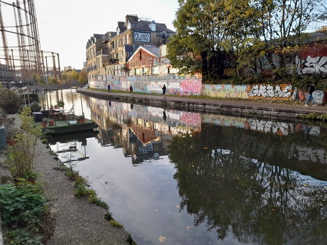
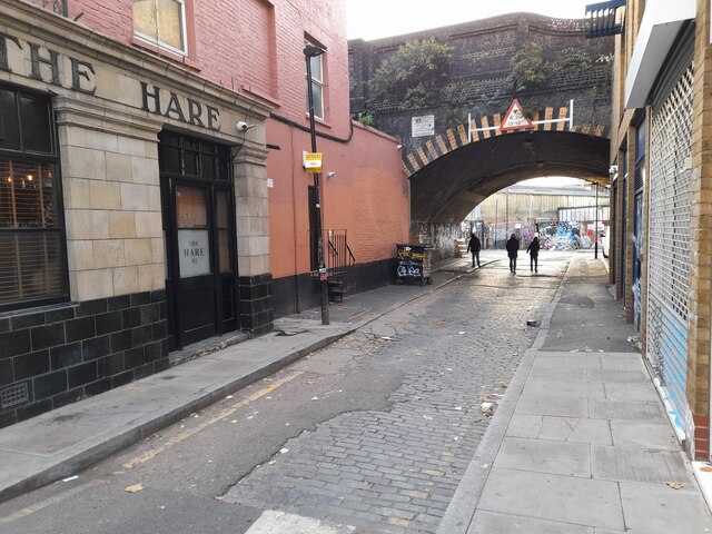
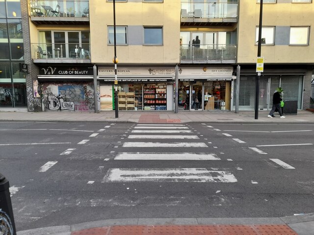
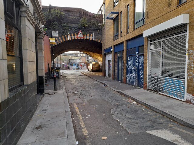
Ford, Old Images

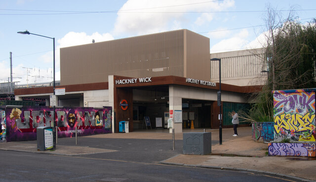
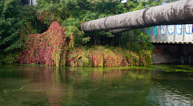
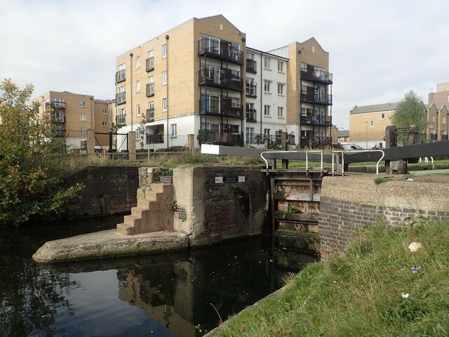
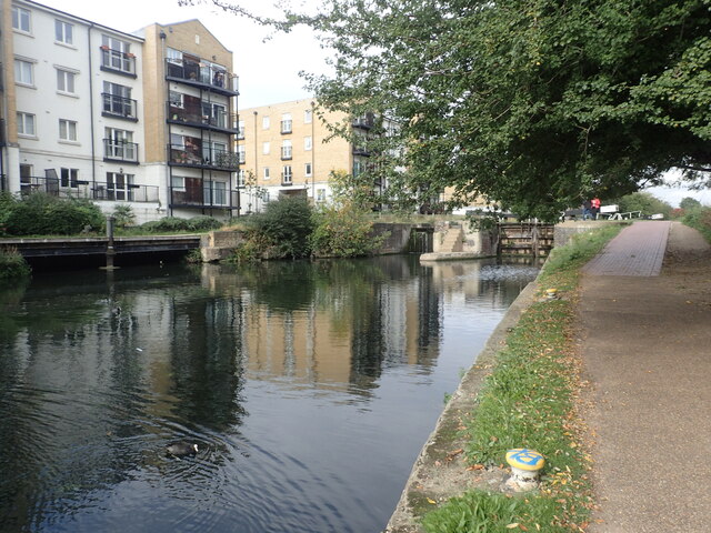
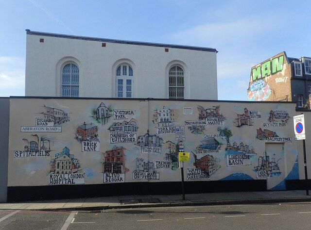
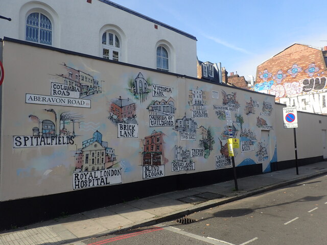
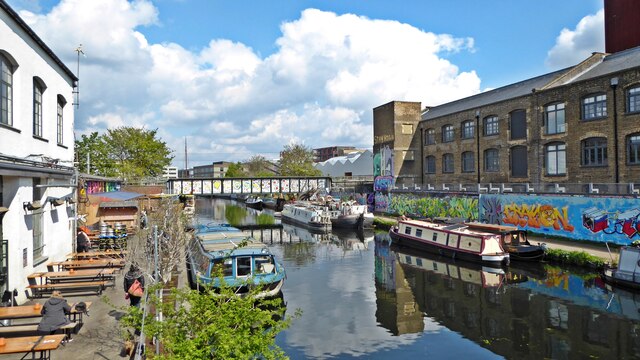
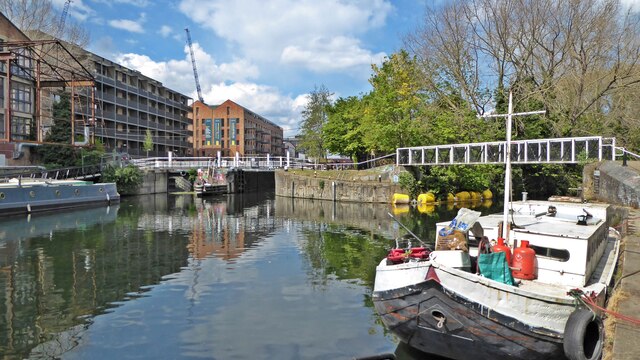
Images are sourced within 2km of 51.534319/-0.034085 or Grid Reference TQ3683. Thanks to Geograph Open Source API. All images are credited.

Old Milepost by the A11, Bow Road, Poplar parish Cast iron post by the A11, in parish of POPLAR (TOWER HAMLETS District), Bow Road E3, opposite Wellington Way, in front of shopping parade in pavement, on North side of road. Wedlake iron casting, erected by the Middlesex & Essex turnpike trust in the 19th century. 

Inscription reads:-
: STRATFORD 1½ : : LONDON / 2 / BOW PARISH : : WHITE / CHAPEL / CHURCH / 2 :
Maker:-
: WEDLAKE / HORNCHURCH / ESSEX. : 

Milestone Society National ID: MX_LILF02.
Old Milepost by the A11, Bow Road, Poplar parish
Cast iron post by the A11, in parish of POPLAR (TOWER HAMLETS District), Bow Road E3, opposite Wellington Way, in front of shopping parade in pavement, on North side of road. Wedlake iron casting, erected by the Middlesex & Essex turnpike trust in the 19th century. Inscription reads:- : STRATFORD 1½ : : LONDON / 2 / BOW PARISH : : WHITE / CHAPEL / CHURCH / 2 : Maker:- : WEDLAKE / HORNCHURCH / ESSEX. : Milestone Society National ID: MX_LILF02.
Stratford : swan pedalo, Queen Elizabeth Olympic Park
Hackney Wick : "The Lord Napier" revisited Recently re-opened after an extended period of closure. The building in 2014 at <a href="https://www.geograph.org.uk/photo/4105977">TQ3784 : "The Lord Napier" revisited</a>.
Hackney Wick : "The Lord Napier" revisited
Recently re-opened after an extended period of closure. The building in 2014 at TQ3784 : "The Lord Napier" revisited.
Hackney Wick : graffiti with a message <span class="nowrap"><a title="https://thecreativeconversation.wordpress.com/2020/05/10/the-city-of-hypocrisy-the-gentrification-of-hackney-is-pushing-out-the-creatives-that-helped-transform-its-reputation-in-the-first-place/" rel="nofollow ugc noopener" href="https://thecreativeconversation.wordpress.com/2020/05/10/the-city-of-hypocrisy-the-gentrification-of-hackney-is-pushing-out-the-creatives-that-helped-transform-its-reputation-in-the-first-place/">Link</a><img style="margin-left:2px;" alt="External link" title="External link - shift click to open in new window" src="https://s1.geograph.org.uk/img/external.png" width="10" height="10"/></span>
Hackney Wick : graffiti with a message
Hackney Wick Station : platform mural
Hackney Wick Station Station on the London Overground system.
Hackney Wick Station
Station on the London Overground system.
Hackney Cut : Autumn colours and pipeline
The Regent's Canal at Johnson's Lock Construction of a national canal network began in the late 18th century, but initially the canal from the Midlands ended at Paddington, and there was no link to eastern London until the Regent's Canal was built. It was the brainchild of engineer Thomas Homer who, in 1812, presented a plan to the Grand Junction Company (which owned the canal from London to Birmingham) for the creation of a waterway from Limehouse to Paddington. To begin with the project progressed quickly, largely passing through what was then agricultural land, but it was soon hampered by financial problems. Stubborn and greedy landowners asked inflated prices for property along the preferred route, and, to make matters worse, Thomas Homer disappeared in 1815 taking the company's funds with him. New legislation passed in 1817 enabled the work to be completed by 1820 using funds borrowed from the Treasury.

The canals were initially a success, particularly for transporting coal, building materials and other bulky loads, but the rise of the railways not long after the canals were built substantially reduced their importance. Now they are primarily a leisure facility. What was then the Central Electricity Generating Board laid cables under some of the towpaths in the 1970s and made them suitable for pedestrians again.

This is the Regent's Canal at Johnson's Lock alongside Mile End Park.
The Regent's Canal at Johnson's Lock
Construction of a national canal network began in the late 18th century, but initially the canal from the Midlands ended at Paddington, and there was no link to eastern London until the Regent's Canal was built. It was the brainchild of engineer Thomas Homer who, in 1812, presented a plan to the Grand Junction Company (which owned the canal from London to Birmingham) for the creation of a waterway from Limehouse to Paddington. To begin with the project progressed quickly, largely passing through what was then agricultural land, but it was soon hampered by financial problems. Stubborn and greedy landowners asked inflated prices for property along the preferred route, and, to make matters worse, Thomas Homer disappeared in 1815 taking the company's funds with him. New legislation passed in 1817 enabled the work to be completed by 1820 using funds borrowed from the Treasury. The canals were initially a success, particularly for transporting coal, building materials and other bulky loads, but the rise of the railways not long after the canals were built substantially reduced their importance. Now they are primarily a leisure facility. What was then the Central Electricity Generating Board laid cables under some of the towpaths in the 1970s and made them suitable for pedestrians again. This is the Regent's Canal at Johnson's Lock alongside Mile End Park.
Mural in Aberavon Road, Mile End This is not far from Mile End station and shows many of the major attractions of the Borough of Tower Hamlets - see also <a title="https://www.geograph.org.uk/photo/6992392" href="https://www.geograph.org.uk/photo/6992392">Link</a>
Mural in Aberavon Road, Mile End
This is not far from Mile End station and shows many of the major attractions of the Borough of Tower Hamlets - see also Link
Mural in Aberavon Road, Mile End This is not far from Mile End station and shows many of the major attractions of the Borough of Tower Hamlets - see also <a title="https://www.geograph.org.uk/photo/6992391" href="https://www.geograph.org.uk/photo/6992391">Link</a>
Mural in Aberavon Road, Mile End
This is not far from Mile End station and shows many of the major attractions of the Borough of Tower Hamlets - see also Link
River Lee Navigation, Hackney Wick Looking north from the bridge at White Post Lane.  On the left is the Crate Brewery - one of several beer and street food venues that have helped to transform this previously rundown canal backwater into a party hotspot.
River Lee Navigation, Hackney Wick
Looking north from the bridge at White Post Lane. On the left is the Crate Brewery - one of several beer and street food venues that have helped to transform this previously rundown canal backwater into a party hotspot.
Old Ford Locks The River Lea veers off to the right under the footbridge while the River Lea Navigation continues north through the locks.
Old Ford Locks
The River Lea veers off to the right under the footbridge while the River Lea Navigation continues north through the locks.
The Regent's Canal in Haggerston Once the clocks go back it's time to explore new places closer to home. I'd never been here before.
The Regent's Canal in Haggerston
Once the clocks go back it's time to explore new places closer to home. I'd never been here before.
Hare Row, Haggerston
Zebra crossing on Cambridge Heath Road, Haggerston
Hare Row, Haggerston
Path by Regent's Canal, Haggerston
Show me another place!

Ford, Old is located at Grid Ref: TQ3683 (Lat: 51.534319, Lng: -0.034085)

Unitary Authority: Tower Hamlets

Police Authority: Metropolitan

What 3 Words

///joined.thigh.region. Near Hackney, London

Related Wikis

St Paul's, Old Ford

St Paul's, Old Ford, is a late 19th-century church in Old Ford, London, England. It is an Anglican church in the Diocese of London. == History == St Paul...

Chisenhale Gallery

Chisenhale Gallery is a non-profit contemporary art gallery based in London's East End. The gallery occupies the ground level of a former veneer factory...

Underage Festival

The Underage Festival was a music festival in Victoria Park, London that was open only to those between 13 and 17. The festival took place at the beginning...

Victoria Park, London

Victoria Park (known colloquially as Vicky Park or the People's Park) is a park in the London Borough of Tower Hamlets in East London, England. It is the...

Nearby Amenities

Located within 500m of 51.534319,-0.034085
Crossing
Crossing: uncontrolled
Crossing Island: yes
Crossing Markings: zebra;dots
Crossing Ref: zebra
Kerb: lowered
Tactile Paving: yes
Lat/Long: 51.533344/-0.0410517
Crossing
Crossing: uncontrolled
Crossing Island: yes
Crossing Ref: zebra
Tactile Paving: yes
Traffic Calming: table
Lat/Long: 51.5339128/-0.0395011
Crossing
Crossing: marked
Crossing Island: no
Kerb: lowered
Tactile Paving: yes
Lat/Long: 51.5319279/-0.0348713
Roman Road Market
Bus: yes
Local Ref: OL
Public Transport: stop_position
Lat/Long: 51.5348924/-0.0273953
Cycleway: asl
Direction: backward
Lat/Long: 51.5360467/-0.028043
Traffic Calming: table
Lat/Long: 51.5311863/-0.0361623
Barrier: bollard
Bicycle: yes
Bollard: fixed
Foot: yes
Lat/Long: 51.5358303/-0.0341383
Post Box
Brand: Royal Mail
Brand Wikidata: Q638098
Collection Times: Mo-Fr 09:00; Sa 07:00
Note: Security plate
Operator: Royal Mail
Operator Wikidata: Q638098
Post Box Design: type_b
Post Box Type: pillar
Ref: E3 2D
Royal Cypher: VR
Royal Cypher Wikidata: Q33102356
Source: survey
Lat/Long: 51.5301379/-0.0349722
Traffic Calming: table
Lat/Long: 51.5323113/-0.0280627
Ref GB Tflcid: RWG014208
Traffic Calming: hump
Lat/Long: 51.5344607/-0.0307071
Ref GB Tflcid: RWG013423
Traffic Calming: hump
Lat/Long: 51.5372104/-0.0295682
Post Box
Brand: Royal Mail
Brand Wikidata: Q638098
Collection Times: Mo-Fr 09:00; Sa 07:00
Operator: Royal Mail
Operator Wikidata: Q638098
Post Box Design: type_a
Post Box Type: pillar
Ref: E3 14D
Royal Cypher: EIIR
Royal Cypher Wikidata: Q33102113
Source: survey
Lat/Long: 51.5361814/-0.0281728
Ref GB Tflcid: RWG014207
Traffic Calming: hump
Lat/Long: 51.5342464/-0.030677
Crossing
Crossing: unmarked
Traffic Calming: table
Lat/Long: 51.5359445/-0.0309492
Ref GB Tflcid: RWG013395
Traffic Calming: hump
Lat/Long: 51.536204/-0.0330041
Crossing
Crossing: unmarked
Traffic Calming: table
Lat/Long: 51.5358676/-0.0320391
Crossing
Crossing: uncontrolled
Crossing Island: no
Crossing Ref: zebra
Tactile Paving: yes
Lat/Long: 51.5342556/-0.0269102
Telephone
Booth: NWCapped
Check Date: 2023-05-13
Covered: booth
Mapillary: 1183142125468898
Note: not BT
Lat/Long: 51.5341652/-0.0269091
Noexit: yes
Lat/Long: 51.5353799/-0.0271784
Ref GB Tflcid: RWG041846
Traffic Calming: hump
Lat/Long: 51.5354064/-0.0296237
Ref GB Tflcid: RWG041847
Traffic Calming: hump
Lat/Long: 51.5352804/-0.029996
Library
Idea Store, Bow
Internet Access: wlan
Opening Hours: Mo-Th 09:00-21:00; Fr 09:00-18:00; Sa 09:00-17:00; Su 11:00-15:00
Website: https://www.ideastore.co.uk/idea-store-bow
Wikidata: Q55125877
Lat/Long: 51.5327503/-0.029746
Ref GB Tflcid: RWG014269
Traffic Calming: hump
Lat/Long: 51.5330078/-0.0297994
Doctors
St. Stephen's Health Centre
Addr City: London
Addr Housename: Bow Community Centre
Addr Housenumber: 12
Addr Postcode: E3 5ED
Addr Street: William Place
Healthcare: doctor
Wheelchair: yes
Lat/Long: 51.5322104/-0.0310944
Telephone
Check Date: 2023-12-17
Colour: black
Note: not BT
Lat/Long: 51.5348987/-0.0338801
Post Box
Brand: Royal Mail
Brand Wikidata: Q638098
Collection Times: Mo-Fr 09:00; Sa 07:00
Operator: Royal Mail
Operator Wikidata: Q638098
Post Box Design: type_a
Post Box Manufacturer: Machan, Scotland
Post Box Type: pillar
Ref: E3 3D
Royal Cypher: EIIR
Royal Cypher Wikidata: Q33102113
Source: survey
Lat/Long: 51.534668/-0.0336873
Pub
Young Prince
Addr City: London
Addr Housenumber: 448
Addr Postcode: E3 5LU
Addr Street: Roman Road
Fhrs Id: 149692
Source Addr: FHRS Open Data
Lat/Long: 51.5319557/-0.034095
Shop: doityourself
Lat/Long: 51.531868/-0.0342731
Snap
Addr City: London
Addr Housenumber: 465
Addr Street: Roman Road
Level: 0
Shop: gift
Lat/Long: 51.5320764/-0.034483
Restaurant
Roman Tandoori
Addr City: London
Addr Housenumber: 432
Addr Postcode: E3 5LU
Addr Street: Roman Road
Cuisine: indian
Fhrs Id: 149659
Fhrs Local Authority Id: 9646
Source Addr: FHRS Open Data
Lat/Long: 51.53181/-0.034469
Telephone
Booth: KXPlus
Check Date: 2024-03-29
Covered: booth
Operator: BT
Lat/Long: 51.5318637/-0.035369
Entrance: yes
Lat/Long: 51.5318134/-0.0358102
Entrance: yes
Lat/Long: 51.5315456/-0.0372146
Entrance: yes
Lat/Long: 51.5314149/-0.0378379
Post Box
Brand: Royal Mail
Brand Wikidata: Q638098
Collection Times: Mo-Fr 09:00; Sa 07:00
Operator: Royal Mail
Operator Wikidata: Q638098
Post Box Design: type_a
Post Box Type: pillar
Ref: E3 32D
Royal Cypher: GR
Royal Cypher Wikidata: Q33102273
Source: survey
Lat/Long: 51.5311687/-0.0389555
Parnell Mini Market
Addr City: London
Addr Housenumber: 117a
Addr Postcode: E3 2RT
Addr Street: Parnell Road
Fhrs Id: 99739
Shop: convenience
Source Addr: FHRS Open Data
Lat/Long: 51.5359598/-0.0281488
Addr City: London
Addr Housenumber: 301
Addr Postcode: E3 5PR
Addr Street: Old Ford Road
Lat/Long: 51.5357599/-0.0305068
Addr City: London
Addr Housenumber: 313
Addr Postcode: E3 5PR
Addr Street: Old Ford Road
Lat/Long: 51.5358193/-0.0301145
Addr City: London
Addr Housenumber: 281
Addr Postcode: E3 5BL
Addr Street: Old Ford Road
Lat/Long: 51.5355329/-0.0318207
Addr City: London
Addr Housenumber: 295
Addr Postcode: E3 5BL
Addr Street: Old Ford Road
Lat/Long: 51.535611/-0.0313711
Addr City: London
Addr Housenumber: 131
Addr Interpolation: odd
Addr Postcode: E3 2JF
Addr Street: Parnell Road
Lat/Long: 51.5363432/-0.0283269
Addr City: London
Addr Housenumber: 3
Addr Postcode: E3 5PN
Addr Street: Sycamore Avenue
Lat/Long: 51.5362624/-0.0301619
Addr City: London
Addr Housenumber: 3
Addr Postcode: E3 5PH
Addr Street: Willow Tree Close
Lat/Long: 51.5357169/-0.0325467
Addr City: London
Addr Housenumber: 16
Addr Postcode: E3 5PH
Addr Street: Willow Tree Close
Lat/Long: 51.535808/-0.0329589
Addr City: London
Addr Housenumber: 17
Addr Postcode: E3 5PH
Addr Street: Willow Tree Close
Lat/Long: 51.5358171/-0.0331458
Addr City: London
Addr Housenumber: 24
Addr Postcode: E3 5PH
Addr Street: Willow Tree Close
Lat/Long: 51.5355664/-0.0329021
Barber’s Inspiration
Addr City: London
Addr Housenumber: 1
Addr Interpolation: all
Addr Postcode: E3 2JD
Addr Street: Eden Way
Phone: +44 7527 437387
Shop: hairdresser
Lat/Long: 51.5359175/-0.0286337
Addr Housenumber: 2
Addr Street: Arbery Road
Lat/Long: 51.5300138/-0.035388
Barrier: bollard
Bicycle: yes
Bollard: fixed
Foot: yes
Maxwidth: 1
Motorcycle: no
Lat/Long: 51.5303785/-0.034076
Addr Housenumber: 23
Addr Street: Viking Close
Lat/Long: 51.5303286/-0.0339109
Addr Housenumber: 18
Addr Street: Viking Close
Lat/Long: 51.5303802/-0.0337357
Addr Housenumber: 6
Addr Street: Stanfield Road
Lat/Long: 51.5300518/-0.0348203
Addr Housenumber: 1
Addr Street: Stanfield Road
Lat/Long: 51.5301362/-0.0345235
Addr Housenumber: 29
Addr Street: Stanfield Road
Lat/Long: 51.5301584/-0.0344361
Addr Housenumber: 24
Addr Street: Stanfield Road
Lat/Long: 51.5302243/-0.0341977
Addr Housenumber: 37
Addr Street: Medway Road
Lat/Long: 51.5300985/-0.0352301
Addr Housenumber: 64
Addr Street: Medway Road
Lat/Long: 51.529885/-0.0346246
Ref GB Tflcid: RWG014212
Traffic Calming: hump
Lat/Long: 51.534233/-0.0312593
Ref GB Tflcid: RWG041845
Traffic Calming: hump
Lat/Long: 51.5351805/-0.0312352
Ref GB Tflcid: RWG014209
Traffic Calming: hump
Lat/Long: 51.534545/-0.0312402
Ref GB Tflcid: RWG014202
Traffic Calming: hump
Lat/Long: 51.5348138/-0.0299977
Bicycle Parking
Bicycle Parking: stands
Capacity: 12
Covered: no
Mapillary: 1164796450637944
Survey Date: 2019-01-19
Lat/Long: 51.5327644/-0.029528
Parking
Fee: yes
Parking: surface
Lat/Long: 51.5325376/-0.032714
Barrier: bollard
Bicycle: yes
Foot: yes
Motor Vehicle: no
Lat/Long: 51.5321864/-0.0313508
Telephone
Booth: KX100
Check Date: 2024-03-29
Covered: booth
Lat/Long: 51.5329047/-0.0303158
Ref GB Tflcid: RWG071856
Traffic Calming: hump
Lat/Long: 51.5337595/-0.0351951
Ref GB Tflcid: RWG071304
Traffic Calming: hump
Lat/Long: 51.5331478/-0.0367463
Barrier: bollard
Lat/Long: 51.5333421/-0.0359772
Ref GB Tflcid: RWG071507
Traffic Calming: hump
Lat/Long: 51.532806/-0.0332276
Toilets
Fee: yes
Lat/Long: 51.532468/-0.0328813
Ace Cars London Ltd
Addr City: London
Addr Housenumber: 503
Addr Street: Roman Road
Contact Phone: +44 20 8980 6666
Contact Website: http://acecarslondonltd.com/
Level: 0
Office: taxi
Shop: taxi
Lat/Long: 51.532343/-0.0331182
Fast Food
Chilli Garlic Restaurant
Addr City: London
Addr Housenumber: 501
Addr Postcode: E3 5LX
Addr Street: Roman Road
Fhrs Id: 703314
Fhrs Local Authority Id: 156162
Level: 0
Old Name: The Saucy Plaice
Lat/Long: 51.5323313/-0.0331805
Roman Furniture
Addr City: London
Addr Housenumber: 497-499
Addr Street: Roman Road
Level: 0
Shop: furniture
Lat/Long: 51.5323139/-0.033274
Laxmi news
Addr City: London
Addr Housenumber: 495
Addr Postcode: E3 5LX
Addr Street: Roman Road
Fhrs Id: 362567
Fhrs Local Authority Id: 9656
Level: 0
Shop: newsagent
Lat/Long: 51.5322964/-0.0333675
Tolga Supermarket
Addr City: London
Addr Housenumber: 493
Addr Postcode: E3 5LX
Addr Street: Roman Road
Fhrs Id: 68478
Level: 0
Shop: convenience
Lat/Long: 51.5322848/-0.0334298
Addr City: London
Addr Housenumber: 487
Addr Street: Roman Road
Level: 0
Old Name: Roman
Shop: yes
Was Office: estate_agent
Lat/Long: 51.5322498/-0.0336167
Fast Food
New Lotus House
Addr City: London
Addr Housenumber: 485
Addr Postcode: E3 5LX
Addr Street: Roman Road
Cuisine: chinese
Fhrs Id: 92404
Fhrs Local Authority Id: 26007
Level: 0
Old Name: Roman Empire
Lat/Long: 51.5322382/-0.033679
Post Box
Brand: Royal Mail
Brand Wikidata: Q638098
Collection Times: Mo-Fr 16:00; Sa 10:30
Note: Security plate
Operator: Royal Mail
Operator Wikidata: Q638098
Post Box Design: type_a
Post Box Type: pillar
Ref: E3 7
Royal Cypher: EIIR
Royal Cypher Wikidata: Q33102113
Source: survey
Lat/Long: 51.5321905/-0.0337302
Roman Nails
Addr City: London
Addr Housenumber: 479
Addr Street: Roman Road
Level: 0
Shop: beauty
Lat/Long: 51.5322033/-0.033866
Fast Food
Domino's
Addr City: London
Addr Housenumber: 473
Addr Postcode: E3 5LX
Addr Street: Roman Road
Brand: Domino's
Brand Wikidata: Q839466
Brand Wikipedia: en:Domino's Pizza
Contact Website: https://www.dominos.co.uk/pizza-near-me/london/473-roman-road
Cuisine: pizza
Delivery: yes
Diet Gluten Free: yes
Diet Vegetarian: yes
Fhrs Id: 92512
Level: 0
Takeaway: yes
Wheelchair: yes
Lat/Long: 51.5321683/-0.0340529
Addr Housenumber: 33
Addr Street: St Stephen's Road
Lat/Long: 51.5311311/-0.031511
Reids Hair & Sunbed
Addr City: London
Addr Housenumber: 471
Addr Street: Roman Road
Level: 0
Shop: beauty
Lat/Long: 51.5321103/-0.034274
Cafe
Hiland
Addr City: London
Addr Housenumber: 467
Addr Postcode: E3 5LX
Addr Street: Roman Road
Cuisine: coffee_shop
Fhrs Id: 913720
Fhrs Local Authority Id: 196509
Level: 0
Website: http://hilandcoffee.co.uk/
Lat/Long: 51.5320877/-0.0344133
Dennington's
Addr City: London
Addr Housenumber: 461
Addr Street: Roman Road
Contact Phone: +44 20 8981 1121
Level: 0
Operator: interflora
Shop: florist
Wheelchair: yes
Lat/Long: 51.5320538/-0.0346223
Fast Food
Spice Hut
Addr City: London
Addr Housenumber: 457
Addr Postcode: E3 5LX
Addr Street: Roman Road
Cuisine: chicken
Fhrs Id: 92513
Fhrs Local Authority Id: 26075
Level: 0
Old Name: Chicken Delight
Lat/Long: 51.5320313/-0.0347616
Roman Travel
Addr City: London
Addr Housenumber: 453
Addr Street: Roman Road
Contact Phone: +44 20 8981 5252
Level: 0
Old Name: Finnesse lifestyle
Shop: travel_agency
Was Shop: clothes
Lat/Long: 51.5320087/-0.034901
Pretty Little Nails
Addr City: London
Addr Housenumber: 451
Addr Street: Roman Road
Contact Phone: +44 20 8981 4453
Level: 0
Old Name: Shock Wave Afro Caribbean Hair
Shop: beauty
Was Shop: hairdresser
Lat/Long: 51.5319974/-0.0349706
The Eggfree Cake Box
Addr City: London
Addr Housenumber: 449
Addr Postcode: E3 5LX
Addr Street: Roman Road
Clothes: wedding
Diet Lacto Vegetarian: only
Diet Vegetarian: yes
Fhrs Id: 67408
Fhrs Local Authority Id: 150395
Level: 0
Old Name: Amazing Grace (Bridal)
Shop: bakery
Was Shop: clothes
Lat/Long: 51.5319861/-0.0350403
Entrance: yes
Lat/Long: 51.5319235/-0.0352277
Roman Cars
Addr City: London
Addr Street: Roman Road
Contact Phone: +44 20 8980 6201;+44 20 8980 6202
Level: 0
Shop: taxi
Lat/Long: 51.5318707/-0.0359021
Entrance: yes
Lat/Long: 51.5318811/-0.0354366
Entrance: yes
Lat/Long: 51.5318398/-0.0356646
Entrance: yes
Lat/Long: 51.5318268/-0.0357363
Entrance: yes
Lat/Long: 51.5317961/-0.0359055
Entrance: yes
Lat/Long: 51.5317663/-0.0360747
Entrance: yes
Lat/Long: 51.5317158/-0.0363581
Entrance: yes
Lat/Long: 51.5316777/-0.0365748
Entrance: yes
Lat/Long: 51.5317394/-0.0362267
Entrance: yes
Lat/Long: 51.5316624/-0.0366578
Entrance: yes
Lat/Long: 51.5315934/-0.0369916
Entrance: yes
Lat/Long: 51.5315632/-0.0371321
Entrance: yes
Lat/Long: 51.5315276/-0.0372993
Entrance: yes
Lat/Long: 51.5315185/-0.0373416
Entrance: yes
Lat/Long: 51.5313929/-0.0379464
Entrance: yes
Lat/Long: 51.5313781/-0.0380158
Entrance: yes
Lat/Long: 51.5313167/-0.0383129
Entrance: yes
Lat/Long: 51.5312464/-0.0386924
Entrance: yes
Lat/Long: 51.5312284/-0.0387807
Entrance: yes
Lat/Long: 51.5311644/-0.0390899
Bus Stop
Ford Road
Bench: no
Bin: no
Bus: yes
Check Date Shelter: 2024-03-29
Local Ref: K
Naptan AtcoCode: 490006904E
Naptan Bearing: E
Naptan CommonName: Ford Road
Naptan Indicator: Stop RL
Naptan Street: ROMAN ROAD
Passenger Information Display: no
Public Transport: platform
Ref: 47585
Shelter: no
Tactile Paving: no
Lat/Long: 51.53225/-0.0334145
Bus Stop
Ford Road
Bench: no
Bin: yes
Bus: yes
Covered: no
Lit: no
Local Ref: B
Naptan AtcoCode: 490006904W
Naptan Bearing: W
Naptan CommonName: Ford Road
Naptan Indicator: Stop RR
Naptan Street: ROMAN ROAD
Public Transport: platform
Ref: 54466
Shelter: no
Tactile Paving: no
Lat/Long: 51.5322237/-0.0329013
Bus Stop
Medway Road
Bench: yes
Bin: yes
Check Date Shelter: 2024-03-29
Lit: no
Local Ref: J
Naptan AtcoCode: 490009786E
Naptan Bearing: E
Naptan CommonName: Medway Road Roman Road
Naptan Indicator: Stop RK
Naptan Street: ROMAN ROAD
Public Transport: platform
Ref: 71104
Shelter: yes
Tactile Paving: no
Lat/Long: 51.5318392/-0.0355483
Bus Stop
Medway Road
Bench: yes
Bin: yes
Check Date Bench: 2024-03-29
Covered: no
Local Ref: C
Naptan AtcoCode: 490009786W
Naptan Bearing: W
Naptan CommonName: Medway Road Roman Road
Naptan Indicator: Stop RS
Public Transport: platform
Ref: 72544
Shelter: yes
Tactile Paving: no
Lat/Long: 51.5316373/-0.0361781
Bus Stop
Old Ford Road
Covered: no
Local Ref: OB
Naptan AtcoCode: 490010552N
Naptan Bearing: N
Naptan CommonName: Old Ford
Naptan Indicator: Stop OB
Public Transport: platform
Ref: 71899
Shelter: yes
Lat/Long: 51.5354345/-0.0278535
Bus Stop
Old Ford Road
Bench: yes
Local Ref: OK
Naptan AtcoCode: 490010552S
Naptan Bearing: S
Naptan CommonName: Old Ford
Naptan Indicator: Stop PC
Naptan Street: PARNELL ROAD
Public Transport: platform
Ref: 47846
Shelter: yes
Tactile Paving: no
Lat/Long: 51.5367988/-0.0284553
Bus Stop
Parnell Road
Bench: no
Covered: no
Local Ref: ON
Naptan AtcoCode: 490010561E
Naptan Bearing: E
Naptan CommonName: Parnell Road
Naptan Indicator: Stop ON
Naptan Street: OLD FORD ROAD
Public Transport: platform
Ref: 53591
Shelter: yes
Lat/Long: 51.5358014/-0.0293517
Bus Stop
Parnell Road
Bench: yes
Covered: no
Local Ref: OC
Naptan AtcoCode: 490010561W
Naptan Bearing: W
Naptan CommonName: Parnell Road
Naptan Indicator: Stop OC
Naptan Street: OLD FORD ROAD
Public Transport: platform
Ref: 76060
Shelter: yes
Tactile Paving: no
Lat/Long: 51.5357405/-0.0289362
Bus Stop
Roman Road Market
Bench: yes
Bin: yes
Check Date Shelter: 2021-08-14
Lit: yes
Local Ref: OL
Naptan AtcoCode: 490011654S
Naptan Bearing: S
Naptan CommonName: Roman Road Market
Naptan Indicator: Stop OL
Naptan Street: PARNELL ROAD
Public Transport: platform
Ref: 59213
Shelter: yes
Tactile Paving: no
Lat/Long: 51.5349219/-0.02732
Bus Stop
Alice Lane
Bench: no
Covered: no
Local Ref: L
Naptan AtcoCode: 490012461N
Naptan Bearing: N
Naptan CommonName: Old Ford Road
Naptan Indicator: Stop SM
Naptan Street: ST STEPHEN'S ROAD
Public Transport: platform
Ref: 52213
Shelter: no
Lat/Long: 51.5340544/-0.0334934
Bus Stop
Alice Lane
Bench: yes
Bin: yes
Covered: no
Lit: yes
Local Ref: A
Naptan AtcoCode: 490012461S
Naptan Bearing: S
Naptan CommonName: Old Ford Road
Naptan Indicator: Stop SQ
Public Transport: platform
Ref: 57459
Shelter: yes
Tactile Paving: no
Lat/Long: 51.5345878/-0.0337059
Bus Stop
Waterside Close
Bench: yes
Bin: yes
Lit: yes
Local Ref: OD
Naptan AtcoCode: 490014284N
Naptan Bearing: N
Naptan CommonName: Waterside Close
Naptan Indicator: OD
Naptan Street: PARNELL ROAD
Public Transport: platform
Ref: 71392
Shelter: yes
Tactile Paving: no
Lat/Long: 51.5371677/-0.0288841
Noexit: yes
Lat/Long: 51.5377388/-0.0294029
Parnell Road
Bus: yes
Local Ref: OC
Public Transport: stop_position
Lat/Long: 51.5357741/-0.0289625
Barrier: bollard
Lat/Long: 51.5348973/-0.0338156
Crossing
Crossing: uncontrolled
Crossing Island: no
Crossing Ref: zebra
Tactile Paving: yes
Lat/Long: 51.5350082/-0.033785
Ref GB Tflcid: RWG014225
Traffic Calming: hump
Lat/Long: 51.5339379/-0.0319423
Ref GB Tflcid: RWG014224
Traffic Calming: hump
Lat/Long: 51.5337564/-0.032586
Cycleway: asl
Direction: backward
Lat/Long: 51.5326159/-0.032421
Traffic Signals
Crossing: no
Traffic Signals: traffic_lights
Traffic Signals Direction: forward
Lat/Long: 51.5323503/-0.0326311
Crossing
Button Operated: yes
Crossing: traffic_signals
Crossing Island: yes
Crossing Ref: pelican
Tactile Paving: yes
Lat/Long: 51.5324075/-0.0325193
Ref GB Tflcid: RWG014399
Traffic Calming: hump
Lat/Long: 51.5320907/-0.0316763
Ref GB Tflcid: RWG014437
Traffic Calming: cushion
Lat/Long: 51.5305655/-0.0308626
Crossing
Crossing: unmarked
Lat/Long: 51.5317533/-0.0304242
Ref GB Tflcid: RWG014214
Traffic Calming: hump
Lat/Long: 51.5345406/-0.0318174
Entrance: main
Lat/Long: 51.5336317/-0.0283057
Entrance: yes
Lat/Long: 51.5314663/-0.0375868
Waste Basket
Source: GPS track (within 5 meters)
Lat/Long: 51.5343867/-0.0378629
Barrier: cycle_barrier
Cycle Barrier: triple
Source: GPS
Lat/Long: 51.5358536/-0.0347271
Bicycle Rental
Driffield Road
Bicycle Rental: docking_station
Brand: Santander Cycles
Brand Wikidata: Q807961
Capacity: 16
Local: Old Ford
Network: tfl_cycle_hire
Official Name: Driffield Road, Old Ford
Official Ref: 521
Operator: Serco
Lat/Long: 51.5340906/-0.0373181
Bicycle Rental
Gunmakers Lane
Bicycle Rental: docking_station
Brand: Santander Cycles
Brand Wikidata: Q807961
Capacity: 16
Local: Old Ford
Network: tfl_cycle_hire
Official Name: Gunmakers Lane, Old Ford
Official Ref: 459
Operator: Serco
Payment Credit Cards: yes
Lat/Long: 51.535155/-0.0334074
Bicycle Rental
Ford Road
Bicycle Rental: docking_station
Brand: Santander Cycles
Brand Wikidata: Q807961
Capacity: 18
Local: Old Ford
Network: tfl_cycle_hire
Official Name: Ford Road, Old Ford
Official Ref: 517
Operator: Serco
Payment Credit Cards: yes
Lat/Long: 51.5325055/-0.0329675
Bicycle Rental
Hewison Street
Bicycle Rental: docking_station
Brand: Santander Cycles
Brand Wikidata: Q807961
Capacity: 18
Local: Old Ford
Network: tfl_cycle_hire
Official Name: Hewison Street, Old Ford
Official Ref: 471
Operator: Serco
Payment Credit Cards: yes
Lat/Long: 51.5332329/-0.0280081
Source: bing
Traffic Calming: cushion
Lat/Long: 51.5308834/-0.037495
Source: bing
Traffic Calming: cushion
Lat/Long: 51.5310484/-0.0367081
Vending Machine
Source: survey
Vending: parking_tickets
Lat/Long: 51.530168/-0.0314015
Note: 20 mph speed limit sign eastbound
Lat/Long: 51.5303021/-0.0308254
The Roman Baths
Covered: yes
Shop: bathroom_furnishing
Source: +44 20 8983 5445
Sport: swimming
Lat/Long: 51.5327746/-0.03212
Entrance: yes
Lat/Long: 51.5376429/-0.0354626
Toilets
Fee: no
Wheelchair: yes
Lat/Long: 51.5377202/-0.0355001
Bicycle Parking
Bicycle Parking: stands
Capacity: 10
Covered: no
Lat/Long: 51.5376308/-0.035872
Crossing
Crossing: uncontrolled
Crossing Island: no
Crossing Ref: zebra
Tactile Paving: yes
Lat/Long: 51.5342416/-0.0370158
Addr City: London
Addr Housenumber: 44-56
Lat/Long: 51.5344515/-0.0314445
Cafe
G. Kelly
Addr City: London
Addr Housenumber: 526
Addr Postcode: E3 5ES
Addr Street: Roman Road
Cuisine: pie_and_mash
Diet Vegan: yes
Diet Vegetarian: yes
Fhrs Id: 149770
Fhrs Local Authority Id: 9662
Opening Hours: Tu,We,Su 11:00-16:00;Th 11:00-19:00;Fr-Sa 10:00-19:00
Smoking: no
Source Addr Postcode: FHRS Open Data
Start Date: 1939
Lat/Long: 51.5323778/-0.0314852
Bairstow Eves
Addr City: London
Addr Housenumber: 488
Addr Postcode: E3 5LU
Addr Street: Roman Road
Brand: Bairstow Eves
Brand Wikidata: Q81074787
Office: estate_agent
Phone: +44 20 8278 7012
Website: https://www.bairstoweves.co.uk/forsaleoffice/Bow/1971
Lat/Long: 51.5320149/-0.0338197
Addr Housenumber: 1
Addr Street: Medway Buildings
Lat/Long: 51.531434/-0.0356437
Addr Housenumber: 19
Addr Street: Norman Grove
Lat/Long: 51.5310575/-0.0337684
Addr Housenumber: 1
Addr Street: Norman Grove
Lat/Long: 51.5306769/-0.0333722
Addr Housenumber: 33
Addr Street: Norman Grove
Lat/Long: 51.5313124/-0.033972
Addr Housenumber: 51
Addr Street: Norman Grove
Lat/Long: 51.531583/-0.0342158
Addr Housenumber: 5
Addr Street: Medway Buildings
Lat/Long: 51.5310786/-0.0353329
Addr Housenumber: 7
Addr Street: Medway Buildings
Lat/Long: 51.5310389/-0.0354334
Addr Housenumber: 9
Addr Street: Medway Buildings
Lat/Long: 51.5313065/-0.0357102
Ref GB Tflcid: RWG070976
Traffic Calming: cushion
Lat/Long: 51.5302268/-0.0345832
Crossing
Crossing: uncontrolled
Crossing Ref: zebra
Kerb: lowered
Tactile Paving: yes
Lat/Long: 51.5312411/-0.0383991
Entrance: yes
Lat/Long: 51.5312918/-0.0384329
Addr Housenumber: 63
Addr Street: Usher Road
Lat/Long: 51.5334497/-0.027428
Medway Road
Bus: yes
Direction: forward
Local Ref: J
Public Transport: stop_position
Lat/Long: 51.5318115/-0.0355385
Alice Lane
Bus: yes
Local Ref: L
Public Transport: stop_position
Lat/Long: 51.5340595/-0.0334
Parnell Road
Bus: yes
Local Ref: ON
Public Transport: stop_position
Lat/Long: 51.5357407/-0.029342
Drinking Water
Access: yes
Bottle: no
Check Date: 2022-07-31
Dog: yes
Fee: no
Fountain: bubbler
Lat/Long: 51.5344191/-0.0388333
Ford Road
Bus: yes
Local Ref: B
Public Transport: stop_position
Lat/Long: 51.5322809/-0.0329107
Alice Lane
Bus: yes
Local Ref: A
Public Transport: stop_position
Lat/Long: 51.5345942/-0.0337904
Old Ford Road
Bus: yes
Local Ref: OB
Public Transport: stop_position
Lat/Long: 51.5354431/-0.0277772
Medway Road
Bus: yes
Local Ref: C
Public Transport: stop_position
Lat/Long: 51.5316817/-0.0362221
Traffic Signals
Crossing: no
Traffic Signals: traffic_lights
Traffic Signals Direction: forward
Lat/Long: 51.5323802/-0.032064
Motorcycle Parking
Addr City: London
Addr Country: GB
Covered: no
Lat/Long: 51.5319147/-0.0360959
Crossing
Button Operated: yes
Crossing: traffic_signals
Crossing Island: no
Crossing Ref: pelican
Kerb: flush
Tactile Paving: yes
Traffic Signals Sound: no
Traffic Signals Vibration: yes
Lat/Long: 51.5323982/-0.0322821
Ford Road
Bus: yes
Local Ref: K
Public Transport: stop_position
Lat/Long: 51.5321821/-0.0334437
Addr Housenumber: 9
Addr Street: Medhurst Close
Lat/Long: 51.5302605/-0.0369518
Cafe
The Peanut Vendor
Addr City: London
Addr Housenumber: 6
Addr Postcode: E3 5GG
Addr Street: Gunmakers Lane
Email: info@thepeanutvendor.co.uk
Opening Hours: Mo-Fr 08:00-18:00; Sa 09:30-18:00; Su 10:00-18:00
Phone: +44 20 8981 8613
Shop: houseware
Website: https://www.thepeanutvendor.co.uk/
Lat/Long: 51.5353556/-0.034018
Cafe
Old Ford Cafe
Addr City: London
Addr Housenumber: 462
Addr Postcode: E3 5JP
Addr Street: Old Ford Road
Fhrs Id: 149549
Source Addr: FHRS Open Data
Lat/Long: 51.5351087/-0.032807
Old Ford Convenience Store
Addr City: London
Addr Housenumber: 464
Addr Postcode: E3 5JP
Addr Street: Old Ford Road
Fhrs Id: 362541
Shop: convenience
Lat/Long: 51.5351249/-0.0327426
New Image
Addr City: London
Addr Housenumber: 466
Addr Postcode: E3 5JP
Addr Street: Old Ford Road
Shop: hairdresser
Lat/Long: 51.5351362/-0.0326689
Addr Housenumber: 4
Addr Street: Nightingale Mews
Lat/Long: 51.5327954/-0.0405444
Addr Housenumber: 6
Addr Street: Chisenhale Road
Lat/Long: 51.5339722/-0.0375993
Addr Housenumber: 62
Addr Street: Chisenhale Road
Lat/Long: 51.533212/-0.0392065
Addr Housenumber: 69
Addr Street: Chisenhale Road
Lat/Long: 51.5326939/-0.0398415
Addr Housenumber: 75
Addr Street: Chisenhale Road
Lat/Long: 51.5326215/-0.0400213
Addr Housenumber: 21
Addr Street: Chisenhale Road
Lat/Long: 51.5334997/-0.0381339
Addr Housenumber: 35
Addr Street: Chisenhale Road
Lat/Long: 51.5333252/-0.0385134
Addr Housenumber: 330
Addr Street: Old Ford Road
Lat/Long: 51.5335421/-0.0400123
Addr Housenumber: 362
Addr Street: Old Ford Road
Lat/Long: 51.5339656/-0.0388665
Addr Housenumber: 19
Addr Street: Hawthorn Avenue
Lat/Long: 51.5368417/-0.0315024
Addr Housenumber: 25
Addr Street: Hawthorn Avenue
Lat/Long: 51.5369764/-0.0315536
Addr City: London
Addr Housenumber: 179
Addr Postcode: E3 2JW
Addr Street: Parnell Road
Lat/Long: 51.5374095/-0.0291028
Addr City: London
Addr Housenumber: 1
Addr Postcode: E3 2JN
Addr Street: Hampstead Walk
Lat/Long: 51.537327/-0.0293278
Addr City: London
Addr Housenumber: 11
Addr Postcode: E3 2JN
Addr Street: Hampstead Walk
Lat/Long: 51.5377109/-0.0294778
Addr City: London
Addr Housenumber: 31
Addr Postcode: E3 5BF
Addr Street: Birdsfield Lane
Lat/Long: 51.5363912/-0.0328999
Addr City: London
Addr Housenumber: 23
Addr Postcode: E3 5BF
Addr Street: Birdsfield Lane
Lat/Long: 51.5364963/-0.0326764
Addr City: London
Addr Housenumber: 15
Addr Postcode: E3 5BF
Addr Street: Birdsfield Lane
Lat/Long: 51.5364142/-0.03235
Addr City: London
Addr Housenumber: 21
Addr Postcode: E3 5BF
Addr Street: Birdsfield Lane
Lat/Long: 51.5365543/-0.0324116
Addr City: London
Addr Housenumber: 1
Addr Postcode: E3 5PF
Addr Street: Barge Lane
Lat/Long: 51.5362308/-0.0322663
Addr City: London
Addr Housenumber: 19
Addr Postcode: E3 5PF
Addr Street: Barge Lane
Lat/Long: 51.5361215/-0.0328374
Addr City: London
Addr Housenumber: 23
Addr Postcode: E3 5PF
Addr Street: Barge Lane
Lat/Long: 51.5360049/-0.0331704
Addr City: London
Addr Housenumber: 37
Addr Postcode: E3 5PF
Addr Street: Barge Lane
Lat/Long: 51.5358064/-0.033515
Addr City: London
Addr Housenumber: 39
Addr Postcode: E3 5PF
Addr Street: Barge Lane
Lat/Long: 51.5357877/-0.0336206
Addr City: London
Addr Housenumber: 1
Addr Postcode: E3 5BF
Addr Street: Birdsfield Lane
Lat/Long: 51.5357528/-0.0321899
Addr City: London
Addr Housenumber: 13
Addr Postcode: E3 5BF
Addr Street: Birdsfield Lane
Lat/Long: 51.5360313/-0.0323116
Addr City: London
Addr Housenumber: 2
Addr Postcode: E3 5BF
Addr Street: Birdsfield Lane
Lat/Long: 51.5359735/-0.0318581
Addr City: London
Addr Housenumber: 14
Addr Postcode: E3 5BF
Addr Street: Birdsfield Lane
Lat/Long: 51.5364049/-0.0320257
Addr City: London
Addr Housenumber: 1
Addr Postcode: E3 5BA
Addr Street: Jasmine Square
Lat/Long: 51.5361945/-0.0316519
Addr City: London
Addr Housenumber: 3
Addr Postcode: E3 5BA
Addr Street: Jasmine Square
Lat/Long: 51.5362196/-0.0314908
Addr City: London
Addr Housenumber: 14
Addr Postcode: E3 5BA
Addr Street: Jasmine Square
Lat/Long: 51.5358176/-0.0318763
Addr City: London
Addr Housenumber: 5
Addr Postcode: E3 5BA
Addr Street: Jasmine Square
Lat/Long: 51.5359288/-0.0312435
Addr City: London
Addr Housenumber: 4
Addr Postcode: E3 5PL
Addr Street: Hawthorn Avenue
Lat/Long: 51.5360892/-0.0307845
Addr City: London
Addr Housenumber: 8
Addr Postcode: E3 5PL
Addr Street: Hawthorn Avenue
Lat/Long: 51.5361892/-0.0308252
Addr Housenumber: 1
Addr Street: Hawthorn Avenue
Lat/Long: 51.5362524/-0.0312319
Addr Housenumber: 17
Addr Street: Hawthorn Avenue
Lat/Long: 51.5365888/-0.0313664
Addr Housenumber: 3
Addr Street: Hornbeam Square
Lat/Long: 51.5365247/-0.0317869
Addr Housenumber: 1
Addr Street: Hornbeam Square
Lat/Long: 51.5365498/-0.0316259
Addr City: London
Addr Housenumber: 13
Addr Postcode: E3 5PN
Addr Street: Sycamore Avenue
Lat/Long: 51.5368186/-0.0304147
Addr City: London
Addr Housenumber: 25
Addr Postcode: E3 5PN
Addr Street: Sycamore Avenue
Lat/Long: 51.5370689/-0.0305117
Addr City: London
Addr Housenumber: 4
Addr Postcode: E3 5PW
Addr Street: Sycamore Avenue
Lat/Long: 51.5363465/-0.0298359
Addr City: London
Addr Housenumber: 44
Addr Postcode: E3 5PW
Addr Street: Sycamore Avenue
Lat/Long: 51.5372258/-0.0301774
Addr City: London
Addr Housenumber: 1
Addr Postcode: E3 2JB
Addr Street: Waterside Close
Lat/Long: 51.5371851/-0.0289663
Addr City: London
Addr Housenumber: 8
Addr Postcode: E3 2JB
Addr Street: Waterside Close
Lat/Long: 51.5371102/-0.0294041
Addr City: London
Addr Housenumber: 17
Addr Postcode: E3 2JB
Addr Street: Waterside Close
Lat/Long: 51.5373715/-0.0297806
Addr City: London
Addr Housenumber: 9
Addr Postcode: E3 2JB
Addr Street: Waterside Close
Lat/Long: 51.5370334/-0.0296471
Addr City: London
Addr Housenumber: 24
Addr Postcode: E3 2JA
Addr Street: Cedar Close
Lat/Long: 51.5368482/-0.029539
Addr City: London
Addr Housenumber: 14
Addr Postcode: E3 2JA
Addr Street: Cedar Close
Lat/Long: 51.5364386/-0.0293704
Addr City: London
Addr Housenumber: 1
Addr Postcode: E3 2JA
Addr Street: Cedar Close
Lat/Long: 51.5365899/-0.0288954
Addr City: London
Addr Housenumber: 5
Addr Postcode: E3 2JA
Addr Street: Cedar Close
Lat/Long: 51.5364962/-0.0291228
Addr City: London
Addr Housenumber: 28
Addr Postcode: E3 2JA
Addr Street: Cedar Close
Lat/Long: 51.5368711/-0.0290966
Addr City: London
Addr Housenumber: 25
Addr Postcode: E3 2JA
Addr Street: Cedar Close
Lat/Long: 51.5368409/-0.0292729
Addr City: London
Addr Housenumber: 145
Addr Postcode: E3 2JW
Addr Street: Parnell Road
Lat/Long: 51.5369012/-0.0288169
Addr City: London
Addr Housenumber: 151
Addr Postcode: E3 2JW
Addr Street: Parnell Road
Lat/Long: 51.5370137/-0.0288743
Addr City: London
Addr Housenumber: 137
Addr Postcode: E3 2JW
Addr Street: Parnell Road
Lat/Long: 51.5365743/-0.0285421
Addr City: London
Addr Housenumber: 143
Addr Postcode: E3 2JW
Addr Street: Parnell Road
Lat/Long: 51.5366827/-0.0286449
Addr City: London
Addr Housenumber: 11
Addr Postcode: E3 5PN
Addr Street: Sycamore Avenue
Lat/Long: 51.5364295/-0.0302336
Traffic Calming: bump
Lat/Long: 51.5357678/-0.0319984
Addr City: London
Addr Housenumber: 22
Addr Postcode: E3 5PH
Addr Street: Willow Tree Close
Lat/Long: 51.5356622/-0.0329552
Addr City: London
Addr Housenumber: 14
Addr Postcode: E3 5PH
Addr Street: Willow Tree Close
Lat/Long: 51.5358422/-0.0328783
Addr City: London
Addr Housenumber: 7
Addr Postcode: E3 5PH
Addr Street: Willow Tree Close
Lat/Long: 51.5358126/-0.0326346
Barrier: bollard
Lat/Long: 51.5364738/-0.0292632
Ref GB Tflcid: RWG013356
Traffic Calming: table
Lat/Long: 51.5362333/-0.0299784
Addr City: London
Addr Housenumber: 13
Addr Postcode: E3 2JD
Addr Street: Eden Way
Lat/Long: 51.5363952/-0.0288634
Addr City: London
Addr Housenumber: 19
Addr Postcode: E3 2JD
Addr Street: Eden Way
Lat/Long: 51.5364856/-0.0284471
Addr City: London
Addr Housenumber: 21
Addr Postcode: E3 2JD
Addr Street: Eden Way
Lat/Long: 51.5362776/-0.0285606
Addr City: London
Addr Housenumber: 30
Addr Postcode: E3 2JD
Addr Street: Eden Way
Lat/Long: 51.5359438/-0.0283869
Addr City: London
Addr Housenumber: 12
Addr Postcode: E3 2JD
Addr Street: Eden Way
Lat/Long: 51.5363042/-0.0288491
Addr City: London
Addr Housenumber: 1
Addr Postcode: E3 2JD
Addr Street: Eden Way
Lat/Long: 51.5359044/-0.0285817
Addr City: London
Addr Housenumber: 9
Addr Postcode: E3 2JD
Addr Street: Eden Way
Lat/Long: 51.5362023/-0.0287419
Addr City: London
Addr Housenumber: 133
Addr Postcode: E3 2JF
Addr Street: Parnell Road
Lat/Long: 51.5363801/-0.028362
Addr City: London
Addr Housenumber: 119
Addr Postcode: E3 2JF
Addr Street: Parnell Road
Lat/Long: 51.5359871/-0.028171
Addr Housenumber: 6
Addr Street: Lea Square
Lat/Long: 51.5352189/-0.0270735
Addr Housenumber: 9
Addr Street: Lea Square
Lat/Long: 51.5355205/-0.0272787
Addr Housenumber: 80
Addr Street: Parnell Road
Lat/Long: 51.5345758/-0.0268674
Addr Housenumber: 84
Addr Street: Parnell Road
Lat/Long: 51.5349257/-0.0271171
Addr Housenumber: 94
Addr Street: Parnell Road
Lat/Long: 51.5351489/-0.0272683
Addr Housenumber: 98
Addr Street: Parnell Road
Lat/Long: 51.5354805/-0.0274515
Addr Housenumber: 102
Addr Street: Parnell Road
Lat/Long: 51.5355819/-0.0275155
Addr Housenumber: 574
Addr Street: Old Ford Road
Lat/Long: 51.535836/-0.0274304
Addr Housenumber: 55
Addr Street: St Stephen's Road
Lat/Long: 51.5316847/-0.0319836
Addr Housenumber: 69
Addr Street: St Stephen's Road
Lat/Long: 51.5319758/-0.0321742
Addr Housenumber: 7
Addr Street: Lombard Place
Lat/Long: 51.5324187/-0.0348198
Addr Housenumber: 13
Addr Street: Lombard Place
Lat/Long: 51.5324928/-0.0345105
Addr Housenumber: 8
Addr Street: Lombard Place
Lat/Long: 51.5322599/-0.0346817
Addr Housenumber: 2
Addr Street: Lombard Place
Lat/Long: 51.5323311/-0.034411
Addr Housenumber: 132
Addr Street: St Stephen's Road
Lat/Long: 51.5336664/-0.032831
Addr Housenumber: 164
Addr Street: St Stephen's Road
Lat/Long: 51.5341515/-0.0331945
Addr Housenumber: 12
Addr Street: Allen Road
Lat/Long: 51.5340709/-0.0320298
Addr Housenumber: 1
Addr Street: Allen Road
Lat/Long: 51.5338869/-0.0326566
Addr Housenumber: 34
Addr Street: Alice Lane
Lat/Long: 51.5344187/-0.0321468
Addr Housenumber: 2
Addr Street: Alice Lane
Lat/Long: 51.5342025/-0.0329412
Addr Housenumber: 1
Addr Street: Alice Lane
Lat/Long: 51.5346379/-0.0331031
Addr Housenumber: 5
Addr Street: Alice Lane
Lat/Long: 51.5346684/-0.0329687
Addr Housenumber: 62
Addr Street: Beale Road
Lat/Long: 51.5343241/-0.0319335
Addr Housenumber: 65
Addr Street: Beale Road
Lat/Long: 51.534209/-0.0319348
Addr Housenumber: 15
Addr Street: McCullum Road
Lat/Long: 51.5348026/-0.0309007
Addr Housenumber: 3
Addr Street: McCullum Road
Lat/Long: 51.5349956/-0.0308992
Addr Housenumber: 10
Addr Street: Annie Besant Close
Lat/Long: 51.535477/-0.0284758
Addr Housenumber: 19
Addr Street: Annie Besant Close
Lat/Long: 51.5352249/-0.0282209
Addr Housenumber: 1
Addr Street: Annie Besant Close
Lat/Long: 51.5352652/-0.0293609
Addr Housenumber: 9
Addr Street: Annie Besant Close
Lat/Long: 51.5353709/-0.0289654
Addr Housenumber: 49
Addr Street: Annie Besant Close
Lat/Long: 51.5350915/-0.0292551
Addr Housenumber: 38
Addr Street: Annie Besant Close
Lat/Long: 51.5352356/-0.028704
Addr Housenumber: 94
Addr Street: Armagh Road
Lat/Long: 51.5348688/-0.0290818
Addr Housenumber: 76
Addr Street: Armagh Road
Lat/Long: 51.5346041/-0.0289012
Addr Housenumber: 35
Addr Street: Annie Besant Close
Lat/Long: 51.5347122/-0.0285435
Addr Housenumber: 22
Addr Street: Annie Besant Close
Lat/Long: 51.5348537/-0.0278818
Addr Housenumber: 79
Addr Street: Armagh Road
Lat/Long: 51.5339336/-0.0288393
Addr Housenumber: 67
Addr Street: Armagh Road
Lat/Long: 51.533753/-0.0287139
Addr Housenumber: 13
Addr Street: Pulteney Close
Lat/Long: 51.5346402/-0.0301643
Addr Housenumber: 1
Addr Street: Pulteney Close
Lat/Long: 51.5346381/-0.0295093
Addr Housenumber: 524
Addr Street: Old Ford Road
Lat/Long: 51.5355897/-0.0295048
Addr Housenumber: 542
Addr Street: Old Ford Road
Lat/Long: 51.5356479/-0.0289732
Addr Housenumber: 546
Addr Street: Old Ford Road
Lat/Long: 51.5356708/-0.0287612
Addr Housenumber: 572
Addr Street: Old Ford Road
Lat/Long: 51.5357526/-0.0280883
Addr Housenumber: 1
Addr Street: Athelstane Grove
Lat/Long: 51.5305135/-0.0312936
Addr Housenumber: 19
Addr Street: Athelstane Grove
Lat/Long: 51.5301321/-0.0324963
Addr Housenumber: 38
Addr Street: Athelstane Grove
Lat/Long: 51.530647/-0.0315218
Addr Housenumber: 23
Addr Street: Athelstane Grove
Lat/Long: 51.5303612/-0.0324597
Addr Housenumber: 40
Addr Street: Saxon Road
Lat/Long: 51.5310915/-0.0317168
Addr Housenumber: 14
Addr Street: Saxon Road
Lat/Long: 51.5308412/-0.0325266
Addr Housenumber: 13
Addr Street: St Stephen's Road
Lat/Long: 51.5307539/-0.031195
Addr Housenumber: 13
Addr Street: St Stephen's Road
Lat/Long: 51.5303943/-0.0308992
Addr Housenumber: 33
Addr Street: St Stephen's Road
Lat/Long: 51.5305839/-0.0310612
Addr Housenumber: 1
Addr Street: Stoneleigh Mews
Lat/Long: 51.5305073/-0.0348993
Addr Housenumber: 3
Addr Street: Stoneleigh Mews
Lat/Long: 51.5306245/-0.0350117
Addr Housenumber: 62
Addr Street: Medway Road
Lat/Long: 51.5301881/-0.034946
Addr Housenumber: 36
Addr Street: Medway Road
Lat/Long: 51.5306675/-0.0354337
Addr Housenumber: 32
Addr Street: Medway Road
Lat/Long: 51.5307552/-0.0355117
Addr Housenumber: 4
Addr Street: Medway Road
Lat/Long: 51.5312936/-0.0360517
Addr Housenumber: 386
Addr Street: Roman Road
Lat/Long: 51.5315636/-0.0362409
Addr Housenumber: 410
Addr Street: Roman Road
Lat/Long: 51.5317203/-0.0354427
Addr Housenumber: 57
Addr Street: Lyal Road
Lat/Long: 51.5303886/-0.0343576
Addr Housenumber: 86
Addr Street: Lyal Road
Lat/Long: 51.5315354/-0.0352898
Addr Housenumber: 29
Addr Street: Lyal Road
Lat/Long: 51.5304431/-0.0340813
Addr Housenumber: 1
Addr Street: Lyal Road
Lat/Long: 51.5315588/-0.0349729
Addr Housenumber: 27
Addr Street: Selwyn Road
Lat/Long: 51.530475/-0.0334307
Addr Housenumber: 7
Addr Street: Selwyn Road
Lat/Long: 51.5300923/-0.0331153
Addr Housenumber: 1
Addr Street: Selwyn Road
Lat/Long: 51.5298917/-0.0329864
Addr Housenumber: 5
Addr Street: Selwyn Road
Lat/Long: 51.5299835/-0.0330539
Addr Housenumber: 34
Addr Street: Cardigan Road
Lat/Long: 51.5323411/-0.0279337
Addr Housenumber: 36
Addr Street: Cardigan Road
Lat/Long: 51.5323909/-0.027943
Addr Housenumber: 60
Addr Street: Cardigan Road
Lat/Long: 51.53282/-0.0283696
Addr Housenumber: 600
Addr Street: Roman Road
Lat/Long: 51.5335745/-0.0279659
Addr Housenumber: 610
Addr Street: Roman Road
Lat/Long: 51.5337222/-0.027589
Addr Housenumber: 67
Addr Street: Usher Road
Lat/Long: 51.5336412/-0.0275037
Addr Housenumber: 40
Addr Street: Hewison Street
Lat/Long: 51.5325402/-0.0274832
Addr Housenumber: 38
Addr Street: Hewison Street
Lat/Long: 51.5325785/-0.0275271
Addr Housenumber: 24
Addr Street: Hewison Street
Lat/Long: 51.5327733/-0.0277166
Addr Housenumber: 23
Addr Street: Hewison Street
Lat/Long: 51.532934/-0.0274963
Addr Housenumber: 612
Addr Street: Roman Road
Lat/Long: 51.5338049/-0.0273544
Addr Housenumber: 615
Addr Street: Roman Road
Lat/Long: 51.5339449/-0.0275343
Addr Housenumber: 633
Addr Street: Roman Road
Lat/Long: 51.5341292/-0.0270521
Addr Housenumber: 89
Addr Street: Allen Road
Lat/Long: 51.5337421/-0.0315756
Addr Housenumber: 86
Addr Street: Allen Road
Lat/Long: 51.5338464/-0.0316428
Addr Housenumber: 3
Addr Street: Wrights Road
Lat/Long: 51.5337573/-0.0312472
Addr Housenumber: 19
Addr Street: Wrights Road
Lat/Long: 51.5338635/-0.0308463
Addr Housenumber: 18
Addr Street: Libra Road
Lat/Long: 51.5338615/-0.029299
Addr Housenumber: 2
Addr Street: Libra Road
Lat/Long: 51.5336313/-0.0291249
Addr Housenumber: 53
Addr Street: Lyal Road
Lat/Long: 51.5300856/-0.0340939
Addr Housenumber: 33
Addr Street: Lyal Road
Lat/Long: 51.5301909/-0.0338638
Addr Housenumber: 41
Addr Street: Lyal Road
Lat/Long: 51.5298933/-0.0336173
Addr Housenumber: 599
Addr Street: Roman Road
Lat/Long: 51.5336705/-0.0282551
Addr Housenumber: 613
Addr Street: Roman Road
Lat/Long: 51.5338548/-0.0277729
Giant Flower
Artist Name: Gideon Peterson & Helena Roden
Artwork Type: sculpture
Start Date: 2013
Survey Date: 2021-09-19
Tourism: artwork
Lat/Long: 51.5371625/-0.0284897
Tesco Express
Addr City: London
Addr Housenumber: 66
Addr Postcode: E3 5EQ
Addr Street: Vernon Road
Brand: Tesco Express
Brand Wikidata: Q98456772
Brand Wikipedia: en:Tesco
Fhrs Id: 634032
Shop: convenience
Website: https://www.tesco.com/store-locator/bow/66-vernon-rd
Lat/Long: 51.5326271/-0.0294582
Cafe
Muxima
Addr City: London
Addr Housenumber: 618
Addr Postcode: E3 2RW
Addr Street: Roman Road
Fhrs Id: 654231
Website: http://muxima.co.uk/
Lat/Long: 51.5338663/-0.0271872
Crossing
Crossing: unmarked
Crossing Island: no
Tactile Paving: yes
Lat/Long: 51.5356587/-0.0297173
Crossing
Crossing: unmarked
Crossing Island: no
Traffic Calming: table
Lat/Long: 51.5357561/-0.0298018
Ref GB Tflcid: RWG014213
Traffic Calming: hump
Lat/Long: 51.5342136/-0.0316688
Ref GB Tflcid: RWG014211
Traffic Calming: hump
Lat/Long: 51.5343304/-0.031259
Old Ford Road
Bus: yes
Local Ref: OK
Public Transport: stop_position
Lat/Long: 51.5367814/-0.0285192
Waterside Close
Bus: yes
Local Ref: OD
Public Transport: stop_position
Lat/Long: 51.5371689/-0.0287854
Bench
Backrest: yes
Source: gps+mapnoter
Lat/Long: 51.5367448/-0.0333187
Waste Basket
Source: gps+mapnoter
Waste: trash
Lat/Long: 51.5376101/-0.0313579
Waste Basket
Source: gps+mapnoter
Lat/Long: 51.5369398/-0.0326157
Bench
Backrest: yes
Source: gps+mapnoter
Lat/Long: 51.538001/-0.0307169
Wildflower Meadow
Source: gps+mapnoter
Lat/Long: 51.5362693/-0.0342816
Bench
Backrest: yes
Source: gps+mapnoter
Lat/Long: 51.5372601/-0.0321007
Waste Basket
Source: gps+mapnoter
Lat/Long: 51.5362992/-0.0343323
Answer: A
Marker: post
Note: marker post
Orienteering: marker
Ref: 16
Source: gps+mapnoter
Sport: orienteering
Lat/Long: 51.5361924/-0.0343323
Waste Basket
Source: gps+mapnoter
Lat/Long: 51.5361907/-0.0345415
Waste Basket
Source: gps+mapnoter
Lat/Long: 51.5382077/-0.0350055
Fixme: fnc
Source: gps+mapnoter
Lat/Long: 51.5382211/-0.0350189
Waste Basket
Source: gps+mapnoter
Lat/Long: 51.538298/-0.0348275
Bench
Source: gps+mapnoter
Lat/Long: 51.5386482/-0.0345039
Waste Basket
Source: gps+mapnoter
Lat/Long: 51.5380075/-0.0369072
Fixme: several picnic benches to map here
Source: gps+mapnoter
Lat/Long: 51.5380075/-0.0367355
Waste Basket
Source: gps+mapnoter
Lat/Long: 51.5380843/-0.0375858
Bench
Backrest: yes
Mapillary: 795376304747323
Source: gps+mapnoter
Survey Date: 2018-06-08
Lat/Long: 51.537996/-0.0377658
Artwork Type: sculpture
Tourism: artwork
Lat/Long: 51.5335304/-0.0298785
Crossing
Crossing: unmarked
Lat/Long: 51.5342005/-0.0335939
Cafe
Loafing
Addr City: London
Addr Housenumber: 409
Addr Postcode: E3 5QS
Addr Street: Roman Road
Diet Vegan: yes
Diet Vegetarian: yes
Fhrs Id: 1174109
Fhrs Local Authority Id: 201885
Internet Access: wlan
Internet Access Fee: customers
Level: 0
Outdoor Seating: yes
Start Date: 2019
Lat/Long: 51.5316704/-0.0367308
Entrance: yes
Lat/Long: 51.5311826/-0.0390023
Crossing
Crossing: uncontrolled
Crossing Island: no
Crossing Ref: zebra
Tactile Paving: yes
Lat/Long: 51.5347736/-0.0339187
Noexit: yes
Lat/Long: 51.5367879/-0.0307058
Camera Mount: pole
Camera Type: panning
Man Made: surveillance
Operator: Tower Hamlets Council
Surveillance: public
Surveillance Type: camera
Lat/Long: 51.5324834/-0.0314388
Traffic Calming: cushion
Lat/Long: 51.5321456/-0.0320839
Street Lamp
Lat/Long: 51.5322519/-0.0321104
Entrance: main
Lat/Long: 51.5313209/-0.0316449
Street Lamp
Ref: Roman Road 113
Lat/Long: 51.5325898/-0.0310539
Bow & North Poplar One Stop Shop
Addr City: London
Addr Housename: John Onslow House
Addr Housenumber: 1
Addr Street: Ewart Place
Office: government
Operator: Tower Hamlets Council
Phone: +44 20 7364 5000
Lat/Long: 51.5324484/-0.0303049
Street Lamp
Ref: Roman Road 112
Lat/Long: 51.5326515/-0.0311559
Street Lamp
Lat/Long: 51.5329368/-0.0298604
Clock
Display: analog
Faces: 2
Support: wall_mounted
Lat/Long: 51.5328998/-0.0299214
Street Lamp
Lat/Long: 51.5328071/-0.0302593
Street Lamp
Lat/Long: 51.5351772/-0.0332996
Camera Mount: pole
Camera Type: dome
Man Made: surveillance
Operator: Tower Hamlets Council
Ref: 058
Surveillance: public
Surveillance Type: camera
Lat/Long: 51.5333043/-0.0290235
Street Lamp
Lat/Long: 51.5330659/-0.0294664
Bench
Backrest: yes
Lat/Long: 51.5330703/-0.0298402
Bench
Backrest: yes
Lat/Long: 51.5330507/-0.0298905
Street Lamp
Ref: Roman Road 118
Lat/Long: 51.5330273/-0.0299113
Vernon Hall
Erected By: Bow Neighbourhood
Historic: memorial
Inscription: Vernon Hall. Restoration completed 1989
Memorial: plaque
Openplaques Id: 50115
Scheme: Bow Heritage Trail
Lat/Long: 51.5328955/-0.0299361
Vernon Hall Roman Road
Erected By: Bow Neighbourhood
Historic: memorial
Inscription: Vernon Hall Roman Road. Formerly Bow Library from 1901 to 1962. Two thirds of the original cost of £6000 was met by Passmore Edwards.
Memorial: plaque
Openplaques Id: 50114
Scheme: Historic Buildings of Bow
Lat/Long: 51.5328976/-0.0299289
Crossing
Crossing: unmarked
Lat/Long: 51.5301959/-0.0352436
Barrier: bollard
Lat/Long: 51.5327922/-0.0293187
Barrier: bollard
Lat/Long: 51.5334685/-0.0292413
Crossing
Crossing: uncontrolled
Crossing Island: no
Crossing Ref: zebra
Kerb: flush
Tactile Paving: yes
Traffic Calming: table
Lat/Long: 51.5313201/-0.0314657
Bicycle Parking
Covered: yes
Lat/Long: 51.5319366/-0.0299921
Barrier: bollard
Lat/Long: 51.5329453/-0.0288441
Barrier: bollard
Lat/Long: 51.5317501/-0.0305286
Crossing
Crossing: unmarked
Lat/Long: 51.530107/-0.0349703
Crossing
Crossing: unmarked
Lat/Long: 51.5335148/-0.0291941
Give Way
Direction: backward
Lat/Long: 51.5305733/-0.0333937
Give Way
Direction: backward
Lat/Long: 51.5307166/-0.0333166
Crossing
Check Date: 2017-06-15
Crossing: unmarked
Crossing Continuous: no
Crossing Island: no
Crossing Markings: no
Kerb: flush
Ref GB Tflcid: RWG014417
Surface: asphalt
Traffic Calming: table
Lat/Long: 51.5316574/-0.0303373
Crossing
Crossing: unmarked
Crossing Island: no
Tactile Paving: no
Lat/Long: 51.5348122/-0.029324
Crossing
Crossing: unmarked
Crossing Island: no
Tactile Paving: no
Lat/Long: 51.5337127/-0.0285747
Crossing
Crossing: uncontrolled
Crossing Island: no
Crossing Ref: zebra
Tactile Paving: yes
Lat/Long: 51.5356798/-0.0299816
Crossing
Crossing: unmarked
Crossing Island: no
Tactile Paving: no
Lat/Long: 51.5349726/-0.0294423
Crossing
Check Date: 2017-06-13
Crossing: unmarked
Crossing Continuous: no
Crossing Island: no
Crossing Markings: no
Kerb: flush
Ref GB Tflcid: RWG013603
Surface: paving_stones
Tactile Paving: yes
Traffic Calming: table
Lat/Long: 51.5368441/-0.0286566
Crossing
Crossing: unmarked
Tactile Paving: no
Lat/Long: 51.5340756/-0.02883
Crossing
Crossing: unmarked
Tactile Paving: yes
Lat/Long: 51.5363811/-0.028136
Mini Roundabout
Lat/Long: 51.5349431/-0.034041
Generator Source: solar
Generator Type: solar_photovoltaic_panel
Power: generator
Lat/Long: 51.5307464/-0.0370064
Landmark: spire
Lat/Long: 51.5330574/-0.0389577
Leisure: picnic_table
Lat/Long: 51.5378047/-0.0357209
Leisure: picnic_table
Lat/Long: 51.5379399/-0.0371016
Leisure: picnic_table
Lat/Long: 51.5379642/-0.0375286
Leisure: picnic_table
Lat/Long: 51.5379271/-0.0378027
Leisure: picnic_table
Lat/Long: 51.5377709/-0.0358304
Leisure: picnic_table
Lat/Long: 51.5378855/-0.0373237
Leisure: picnic_table
Lat/Long: 51.5379253/-0.0374206
Leisure: picnic_table
Lat/Long: 51.537928/-0.0376829
Leisure: picnic_table
Lat/Long: 51.537765/-0.0359296
Leisure: picnic_table
Lat/Long: 51.5379248/-0.0372398
Leisure: picnic_table
Lat/Long: 51.5378691/-0.0377461
Clock
Display: analog
Support: wall_mounted
Visibility: area
Lat/Long: 51.5370717/-0.0396297
Crossing
Crossing: unmarked
Crossing Island: no
Kerb: flush
Tactile Paving: yes
Traffic Calming: table
Lat/Long: 51.5320942/-0.0341568
Entrance: staircase
Lat/Long: 51.5312552/-0.0386493
Entrance: staircase
Lat/Long: 51.5312381/-0.0387332
Entrance: staircase
Lat/Long: 51.531224/-0.0388001
Entrance: yes
Lat/Long: 51.5312137/-0.0388501
Entrance: yes
Lat/Long: 51.5311457/-0.0391806
Crossing
Crossing: unmarked
Kerb: flush
Tactile Paving: yes
Traffic Calming: table
Lat/Long: 51.5312737/-0.0385118
Give Way
Direction: forward
Lat/Long: 51.5312593/-0.0385065
Waste Basket
Lat/Long: 51.5312483/-0.0385809
Crossing
Crossing: unmarked
Crossing Island: no
Kerb: flush
Tactile Paving: yes
Traffic Calming: table
Lat/Long: 51.5314414/-0.0376563
Give Way
Direction: forward
Traffic Sign: GB:1003A
Lat/Long: 51.5314337/-0.0376522
Entrance: staircase
Lat/Long: 51.5314061/-0.0378803
Entrance: staircase
Lat/Long: 51.5314012/-0.0379036
Entrance: home
Lat/Long: 51.5313737/-0.038037
Give Way
Direction: forward
Traffic Sign: GB:1003A
Lat/Long: 51.5316089/-0.0368251
Crossing
Crossing: unmarked
Crossing Island: no
Kerb: flush
Tactile Paving: yes
Traffic Calming: table
Lat/Long: 51.5316163/-0.036829
Entrance: home
Lat/Long: 51.5315535/-0.0371777
Entrance: home
Lat/Long: 51.5315494/-0.0371966
Entrance: home
Lat/Long: 51.5315246/-0.0373136
Addr City: London
Addr Housenumber: 397A
Addr Street: Roman Road
Entrance: home
Lat/Long: 51.5315216/-0.0373271
Waste Basket
Lat/Long: 51.5314668/-0.0374939
Entrance: home
Lat/Long: 51.5314961/-0.037447
Entrance: home
Lat/Long: 51.5314922/-0.0374657
Waste Basket
Lat/Long: 51.5317755/-0.0359336
Give Way
Direction: backward
Traffic Sign: GB:1003A
Lat/Long: 51.5317629/-0.0359795
Addr City: London
Addr Housenumber: 423A
Addr Street: Roman Road
Entrance: staircase
Lat/Long: 51.5317417/-0.0362139
Entrance: staircase
Lat/Long: 51.5317197/-0.0363365
Entrance: staircase
Lat/Long: 51.5317076/-0.0364041
Addr City: London
Addr Housenumber: 411A-411C
Addr Street: Roman Road
Entrance: staircase
Lat/Long: 51.5316598/-0.0366726
Crossing
Crossing: unmarked
Kerb: flush
Tactile Paving: yes
Traffic Calming: table
Lat/Long: 51.5317736/-0.0359853
Entrance: yes
Lat/Long: 51.5317229/-0.0363187
Addr City: London
Addr Housename: Old Library House
Addr Housenumber: 369a
Addr Postcode: E3 5QR
Addr Street: Roman Road
Disused Amenity: cafe
Level: 0
Old Name 2018-2019: Loafing
Start Date: 2018
Lat/Long: 51.5312766/-0.038605
Crossing
Crossing: uncontrolled
Crossing Island: no
Crossing Ref: zebra
Kerb: lowered
Tactile Paving: yes
Lat/Long: 51.531591/-0.0367187
Give Way
Direction: forward
Traffic Sign: GB:1003A
Lat/Long: 51.5319191/-0.0351217
Bicycle Parking
Bicycle Parking: stands
Capacity: 2
Covered: no
Lat/Long: 51.5319445/-0.0351121
Entrance: staircase
Lat/Long: 51.5318842/-0.0354199
Entrance: staircase
Lat/Long: 51.5318694/-0.0355014
Entrance: staircase
Lat/Long: 51.5318567/-0.0355713
Entrance: staircase
Lat/Long: 51.5318347/-0.0356928
Entrance: staircase
Lat/Long: 51.5318315/-0.0357106
Entrance: staircase
Lat/Long: 51.5318197/-0.0357755
Crossing
Crossing: unmarked
Crossing Island: no
Kerb: flush
Tactile Paving: yes
Traffic Calming: table
Lat/Long: 51.5319294/-0.0351272
Entrance: yes
Lat/Long: 51.5319015/-0.0353241
Entrance: yes
Lat/Long: 51.5318939/-0.0353663
Entrance: yes
Lat/Long: 51.5318644/-0.035529
Entrance: yes
Lat/Long: 51.5318517/-0.0355993
Pride Tattoos
Addr City: London
Addr Housenumber: 463
Addr Street: Roman Road
Level: 0
Shop: tattoo
Lat/Long: 51.5320651/-0.0345527
The Liquid Parlour
Addr City: London
Addr Housenumber: 459
Addr Street: Roman Road
Level: 0
Shop: e-cigarette
Lat/Long: 51.5320426/-0.034692
Jakss
Addr City: London
Addr Housenumber: 469
Addr Street: Roman Road
Level: 0
Shop: clothes
Lat/Long: 51.532099/-0.0343437
Gadget Exchange
Addr City: London
Addr Housenumber: 455
Addr Street: Roman Road
Level: 0
Shop: electronics
Lat/Long: 51.53202/-0.0348313
Man Made: surveillance
Lat/Long: 51.5323003/-0.0329945
Crossing
Crossing: unmarked
Crossing Island: no
Kerb: flush
Tactile Paving: yes
Traffic Calming: table
Lat/Long: 51.5323109/-0.0329603
Addr City: London
Addr Housenumber: 489
Addr Street: Roman Road
Disused Shop: yes
Level: 0
Lat/Long: 51.5322615/-0.0335544
Tommy's UK
Addr City: London
Addr Housenumber: 491
Addr Street: Roman Road
Contact Phone: +44 20 8980 8877
Contact Website: http://www.tommysuk.com/
Level: 0
Shop: baby_goods
Start Date: 1979
Lat/Long: 51.5322731/-0.0334921
Cafe
Semz Cafe
Addr City: London
Addr Housenumber: 483
Addr Postcode: E3 5LX
Addr Street: Roman Road
Fhrs Id: 92312
Fhrs Local Authority Id: 25989
Level: 0
Lat/Long: 51.5322265/-0.0337414
Addr City: London
Addr Housenumber: 481
Addr Street: Roman Road
Disused Shop: clothes
Level: 0
Old Name: E3 Labels
Lat/Long: 51.5322149/-0.0338037
Addr City: London
Addr Housenumber: 475
Addr Street: Roman Road
Level: 0
Old Name: Roman Nails
Was Shop: beauty
Lat/Long: 51.53218/-0.0339906
Fleshformers
Addr City: London
Addr Housenumber: 477
Addr Street: Roman Road
Level: 0
Shop: tattoo
Lat/Long: 51.5321916/-0.0339283
Entrance: yes
Lat/Long: 51.5317013/-0.0364422
Crossing
Button Operated: yes
Crossing: traffic_signals
Crossing Island: no
Crossing Ref: pelican
Tactile Paving: yes
Traffic Signals Sound: yes
Traffic Signals Vibration: yes
Lat/Long: 51.5358269/-0.0279598
Traffic Signals
Traffic Signals Direction: backward
Lat/Long: 51.5360899/-0.028055
Cycleway: asl
Direction: forward
Lat/Long: 51.5358643/-0.0282491
Traffic Signals
Traffic Signals Direction: backward
Lat/Long: 51.5357581/-0.0279333
Traffic Signals
Traffic Signals Direction: forward
Lat/Long: 51.535855/-0.0283191
Crossing
Button Operated: yes
Crossing: traffic_signals
Crossing Island: no
Crossing Ref: pelican
Tactile Paving: yes
Traffic Signals Sound: yes
Traffic Signals Vibration: yes
Lat/Long: 51.5360192/-0.0280311
Crossing
Button Operated: yes
Crossing: traffic_signals
Crossing Ref: pelican
Tactile Paving: yes
Lat/Long: 51.5359301/-0.0278305
Crossing
Button Operated: yes
Crossing: traffic_signals
Crossing Island: no
Crossing Ref: pelican
Tactile Paving: yes
Lat/Long: 51.5358783/-0.0281628
Cycleway: asl
Direction: backward
Lat/Long: 51.5357984/-0.0279486
Restaurant
The East Turkish Kebab
Addr City: London
Addr Housenumber: 510
Addr Postcode: E3 5ES
Addr Street: Roman Road
Fhrs Id: 84966
Lat/Long: 51.5322551/-0.0320275
Cafe
Randolfi's Refreshment Bar
Addr City: London
Addr Housenumber: 514
Addr Postcode: E3 5ES
Addr Street: Roman Road
Fhrs Id: 149760
Lat/Long: 51.5322909/-0.031876
Cafe
Roman Bagel Cafe
Addr City: London
Addr Housenumber: 516
Addr Postcode: E3 5ES
Addr Street: Roman Road
Fhrs Id: 90443
Lat/Long: 51.5323118/-0.0317969
Fair Price Cash & Carry
Addr City: London
Addr Housenumber: 524
Addr Postcode: E3 5ES
Addr Street: Roman Road
Fhrs Id: 90783
Shop: convenience
Lat/Long: 51.5323635/-0.0315608
Fast Food
Chickies Point
Addr City: London
Addr Housenumber: 590
Addr Postcode: E3 5ES
Addr Street: Roman Road
Fhrs Id: 78324
Lat/Long: 51.5334047/-0.0284709
Answer: X
Marker: post
Orienteering: marker
Ref: 15
Sport: orienteering
Lat/Long: 51.5379472/-0.0316452
Bench
Answer: P
Backrest: yes
Marker: plate
Orienteering: marker
Ref: 18
Sport: orienteering
Lat/Long: 51.5342091/-0.0392505
Answer: X
Marker: post
Orienteering: marker
Ref: 2
Sport: orienteering
Lat/Long: 51.5360387/-0.0390234
Answer: L
Marker: post
Orienteering: marker
Ref: 17
Sport: orienteering
Lat/Long: 51.5362039/-0.03631
Bicycle Parking
Bicycle Parking: stands
Capacity: 10
Covered: no
Lat/Long: 51.5375512/-0.0354588
Bench: yes
Leisure: picnic_table
Lat/Long: 51.5383027/-0.0346287
Bench: yes
Leisure: picnic_table
Lat/Long: 51.5383339/-0.0346291
Bench: yes
Leisure: picnic_table
Lat/Long: 51.5383033/-0.0347279
Leisure: picnic_table
Lat/Long: 51.5382529/-0.0353095
Leisure: picnic_table
Lat/Long: 51.5382635/-0.0352515
Leisure: picnic_table
Lat/Long: 51.5381851/-0.0352846
Leisure: picnic_table
Lat/Long: 51.5381297/-0.0352611
Leisure: picnic_table
Lat/Long: 51.538248/-0.0351806
Bicycle Parking
Bicycle Parking: stands
Capacity: 10
Covered: no
Survey Date: 2021-04-24
Lat/Long: 51.5378477/-0.0353907
Leisure: pitch
Sport: table_tennis
Lat/Long: 51.5376267/-0.0353913
Entrance: yes
Lat/Long: 51.5306134/-0.0381539
Addr Housename: 17 Exmoor House
Entrance: yes
Lat/Long: 51.5305885/-0.0379473
Street Lamp
Lamp Mount: straight_mast
Lat/Long: 51.5322123/-0.0282396
Parking Entrance
Tesco
Access: customers
Name Fa: تسکو
Lat/Long: 51.532424/-0.0283029
Give Way
Direction: backward
Lat/Long: 51.5322965/-0.0281062
Addr City: London
Addr Housenumber: 623A
Addr Street: Roman Road
Entrance: home
Lat/Long: 51.5340083/-0.0272989
Street Lamp
Ref: Roman Road 132
Lat/Long: 51.5339521/-0.0273947
Entrance: home
Lat/Long: 51.5339689/-0.0276336
Entrance: main
Lat/Long: 51.5339098/-0.0275652
Entrance: main
Lat/Long: 51.5339294/-0.0275126
Give Way
Direction: backward
Lat/Long: 51.5338555/-0.0276453
Vending Machine
Vending: parking_tickets
Lat/Long: 51.5338261/-0.0277166
Street Lamp
Lat/Long: 51.533822/-0.02773
Addr City: London
Addr Housenumber: 609A
Addr Street: Roman Road
Entrance: home
Lat/Long: 51.5337835/-0.0278866
Money Transfer
Shahporan
Lat/Long: 51.5338213/-0.0280106
Entrance: home
Lat/Long: 51.5337155/-0.0280705
Entrance: home
Lat/Long: 51.5337104/-0.0280842
Entrance: main
Lat/Long: 51.5337728/-0.0279154
Entrance: home
Lat/Long: 51.5337791/-0.0278984
Addr City: London
Addr Housenumber: 605A
Addr Street: Roman Road
Entrance: home
Lat/Long: 51.5337388/-0.0280074
Street Lamp
Lat/Long: 51.5337227/-0.0284153
Street Lamp
Ref: Roman Road 129
Lat/Long: 51.5336768/-0.028121
Entrance: home
Lat/Long: 51.5337228/-0.0283716
Street Lamp
Lat/Long: 51.5335391/-0.0284646
Vending Machine
Vending: parking_tickets
Lat/Long: 51.5335467/-0.0284395
Entrance: home
Lat/Long: 51.5334317/-0.0287956
Entrance: main
Lat/Long: 51.5334103/-0.0288508
Addr Housenumber: 6
Addr Street: Centurion Lane
Lat/Long: 51.5334979/-0.0288981
Entrance: home
Lat/Long: 51.5333778/-0.0289346
Entrance: main
Lat/Long: 51.5333626/-0.0289738
Street Lamp
Ref: Roman Road 124
Lat/Long: 51.5333802/-0.0288773
Bench
Backrest: yes
Material: wood
Seats: 3
Survey Date: 2020-10-22
Lat/Long: 51.535661/-0.0355602
Bench
Backrest: yes
Material: wood
Seats: 4
Survey Date: 2020-10-22
Lat/Long: 51.5339793/-0.0401514
Bench
Backrest: yes
Material: wood
Seats: 4
Survey Date: 2020-10-22
Lat/Long: 51.5346972/-0.037756
Wolf Apartments
Addr Housenumber: 546
Addr Street: Roman Road
Landuse: residential
Residential: apartments
Lat/Long: 51.5326563/-0.0306043
Old Bakery Apartments∑
Landuse: residential
Residential: apartments
Lat/Long: 51.5329571/-0.0296333
Bicycle: yes
Information: guidepost
Tourism: information
Lat/Long: 51.5363792/-0.0345589
Telephone
Atm: yes
Booth: KXPlus
Check Date: 2024-03-29
Colour: grey
Note: phone box converted into atm with phone outside
Lat/Long: 51.5318662/-0.0353576
Telephone
Atm: yes
Booth: KXPlus
Check Date: 2024-03-29
Colour: black
Note: phone box converted to atm with phone on outside
Lat/Long: 51.5328277/-0.0305648
Parcel Locker
Locker InPost
Brand: InPost
Brand Wikidata: Q3182097
Brand Wikipedia: en:InPost
Operator: InPost
Parcel Mail In: yes
Lat/Long: 51.5359417/-0.0281776
Leisure: pitch
Sport: table_tennis
Survey Date: 2021-04-24
Lat/Long: 51.537605/-0.0354688
Traffic Calming: hump
Lat/Long: 51.5299674/-0.0328659
Traffic Calming: hump
Lat/Long: 51.5303276/-0.0331622
Cycleway: asl
Direction: forward
Lat/Long: 51.5323769/-0.0325707
Traffic Signals
Crossing: no
Traffic Signals: traffic_lights
Traffic Signals Direction: forward
Lat/Long: 51.5323033/-0.0321956
Traffic Signals
Crossing: no
Traffic Signals: traffic_lights
Traffic Signals Direction: backward
Lat/Long: 51.5326549/-0.0324258
Crossing
Crossing: traffic_signals
Crossing Island: yes
Crossing Ref: pelican
Lat/Long: 51.532583/-0.0324279
Crossing
Button Operated: yes
Crossing: traffic_signals
Crossing Island: no
Crossing Ref: pelican
Kerb: flush
Tactile Paving: yes
Lat/Long: 51.5323692/-0.0321364
Barrier: bollard
Lat/Long: 51.5341467/-0.033582
Yes
Barrier: bollard
Bollard: removable
Emergency: yes
Lat/Long: 51.5332525/-0.0279988
Barrier: kerb
Kerb: flush
Tactile Paving: no
Lat/Long: 51.5330218/-0.0298996
Give Way
Direction: forward
Lat/Long: 51.5332827/-0.0290931
Yes
Barrier: bollard
Bollard: foldable
Emergency: yes
Lat/Long: 51.5335688/-0.0272976
Give Way
Direction: forward
Lat/Long: 51.5338207/-0.0275625
Bench
Backrest: no
Material: wood
Survey Date: 2021-09-18
Lat/Long: 51.5359733/-0.0343897
Bench
Backrest: no
Material: wood
Survey Date: 2021-09-18
Lat/Long: 51.5359185/-0.0346351
Artist Name: Gideon Peterson & Helena Roden
Artwork Type: sculpture
Start Date: 2012
Survey Date: 2021-09-19
Tourism: artwork
Lat/Long: 51.5363214/-0.028683
Events Venue
Old Ford Jazz Club
Music: jazz
Lat/Long: 51.5349953/-0.0330424
Artwork Type: sculpture
Description: Gigantic flower
Tourism: artwork
Lat/Long: 51.5344937/-0.0341475
Artwork Type: sculpture
Description: Gigantic flower
Tourism: artwork
Lat/Long: 51.5345037/-0.0340483
Cafe
The Beans
Cuisine: coffee_shop
Takeaway: yes
Lat/Long: 51.5328144/-0.0323032
Bicycle Parking
Access: private
Bicycle Parking: shed
Capacity: 6
Covered: yes
Operator: cyclehoop
Source: Survey
Lat/Long: 51.5336489/-0.0378547
Barrier: bollard
Lat/Long: 51.5331032/-0.0393117
Traffic Calming: cushion
Lat/Long: 51.5326266/-0.0392195
Traffic Calming: cushion
Lat/Long: 51.5329257/-0.038462
Give Way
Direction: forward
Lat/Long: 51.5337396/-0.0379017
Give Way
Direction: forward
Lat/Long: 51.5336803/-0.0379322
Traffic Calming: hump
Lat/Long: 51.5335196/-0.0383655
Crossing
Crossing: unmarked
Crossing Island: no
Tactile Paving: yes
Lat/Long: 51.5326682/-0.0392424
Barrier: bollard
Bollard: fixed
Lat/Long: 51.534137/-0.0372007
Barrier: cycle_barrier
Lat/Long: 51.5363344/-0.0290673
Barrier: bollard
Lat/Long: 51.5366082/-0.0293196
Give Way
Direction: backward
Lat/Long: 51.5368478/-0.0286406
Barrier: bollard
Lat/Long: 51.5326995/-0.0325487
Barrier: bollard
Lat/Long: 51.5328879/-0.0327817
Barrier: bollard
Lat/Long: 51.5329447/-0.0328117
Barrier: bollard
Lat/Long: 51.5327801/-0.0334128
Bicycle Parking
Bicycle Parking: stands
Capacity: 4
Lat/Long: 51.5332444/-0.0327009
Traffic Calming: bump
Lat/Long: 51.5342072/-0.0333338
Traffic Calming: bump
Lat/Long: 51.5341763/-0.0342997
Traffic Calming: bump
Lat/Long: 51.5343955/-0.0344575
Traffic Calming: bump
Lat/Long: 51.535546/-0.0322622
Traffic Calming: bump
Lat/Long: 51.5361241/-0.032064
Barrier: bollard
Lat/Long: 51.535875/-0.0319872
Barrier: bollard
Lat/Long: 51.5360272/-0.0310745
Barrier: block
Foot: yes
Lat/Long: 51.5362348/-0.0332275
Barrier: bollard
Lat/Long: 51.536469/-0.0322202
Barrier: bollard
Lat/Long: 51.5366586/-0.0323391
Barrier: bollard
Lat/Long: 51.5366742/-0.0322868
Barrier: bollard
Lat/Long: 51.5352888/-0.0338639
Barrier: bollard
Bicycle: yes
Foot: yes
Lat/Long: 51.5356591/-0.0341029
Waste Basket
Lat/Long: 51.5357566/-0.0338925
Crossing
Crossing: unmarked
Lat/Long: 51.5348036/-0.0347228
Crossing
Crossing: unmarked
Lat/Long: 51.5347298/-0.0350765
Barrier: block
Foot: yes
Lat/Long: 51.5358645/-0.0337126
Kerb: lowered
Lat/Long: 51.5341683/-0.0371807
Barrier: bollard
Lat/Long: 51.536874/-0.0313234
Barrier: bollard
Lat/Long: 51.5364625/-0.0284024
Barrier: bollard
Lat/Long: 51.5359151/-0.0285218
Bicycle Parking
Bicycle Parking: hoop
Capacity: 2
Lat/Long: 51.5338933/-0.0275627
Bicycle Parking
Bicycle Parking: stands
Capacity: 2
Lat/Long: 51.5338763/-0.0277441
Bicycle Parking
Bicycle Parking: stands
Capacity: 2
Lat/Long: 51.5338181/-0.0275793
Bicycle Parking
Bicycle Parking: stands
Capacity: 6
Lat/Long: 51.532324/-0.0312838
Bicycle Parking
Bicycle Parking: stands
Capacity: 2
Covered: no
Lat/Long: 51.5314707/-0.0376182
Bicycle Parking
Bicycle Parking: lockers
Capacity: 6
On Carriageway: yes
Lat/Long: 51.5314268/-0.0385317
Bicycle Parking
Bicycle Parking: lockers
Capacity: 6
On Carriageway: yes
Lat/Long: 51.5329354/-0.0395302
Bicycle Parking
Bicycle Parking: stands
Capacity: 2
Covered: no
Lat/Long: 51.5314379/-0.0377425
Bicycle Parking
Bicycle Parking: stands
Capacity: 20
Covered: yes
Lat/Long: 51.536614/-0.0304807
Bicycle Parking
Bicycle Parking: stands
Capacity: 4
Lat/Long: 51.5351318/-0.0331137
Bicycle Parking
Bicycle Parking: stands
Capacity: 4
Lat/Long: 51.5347914/-0.0312517
Bicycle Parking
Bicycle Parking: lockers
Capacity: 2
Note: Own lock
Lat/Long: 51.5338411/-0.0346371
Bicycle Parking
Bicycle Parking: lockers
Capacity: 2
Note: Own lock
Lat/Long: 51.5339044/-0.0343733
Bicycle Parking
Bicycle Parking: lockers
Capacity: 2
Note: Own lock
Lat/Long: 51.5342144/-0.0353078
Bicycle Parking
Bicycle Parking: lockers
Capacity: 2
Note: Own lock
Lat/Long: 51.5338779/-0.0344807
Bicycle Parking
Bicycle Parking: lockers
Capacity: 4
Note: Own lock
Lat/Long: 51.5339535/-0.034206
Bicycle Parking
Bicycle Parking: stands
Capacity: 4
Lat/Long: 51.5342401/-0.0354413
Bicycle Parking
Bicycle Parking: lockers
Capacity: 2
Note: Own lock
Lat/Long: 51.5338533/-0.0345833
Bicycle Parking
Bicycle Parking: lockers
Capacity: 2
Note: Own lock
Lat/Long: 51.5338709/-0.0345117
Bicycle Parking
Bicycle Parking: stands
Capacity: 6
Covered: no
Lat/Long: 51.5324843/-0.0326502
Bicycle Parking
Bicycle Parking: stands
Capacity: 6
Covered: no
Fixme: Check bike parking type
Lat/Long: 51.5325133/-0.0323522
Bicycle Parking
Bicycle Parking: stands
Capacity: 4
Lat/Long: 51.5326674/-0.0304454
Bicycle Parking
Bicycle Parking: stands
Capacity: 4
Covered: no
Lat/Long: 51.53285/-0.0304957
Bicycle Parking
Bicycle Parking: stands
Capacity: 2
Covered: no
Lat/Long: 51.533179/-0.0294319
Bicycle Parking
Bicycle Parking: stands
Capacity: 2
Covered: no
Lat/Long: 51.5330897/-0.029705
Bicycle Parking
Bicycle Parking: hoop
Capacity: 2
Lat/Long: 51.5326831/-0.0305983
Bicycle Parking
Bicycle Parking: stands
Capacity: 4
Covered: no
Lat/Long: 51.5328972/-0.0302994
Bicycle Parking
Bicycle Parking: stands
Capacity: 2
Covered: no
Lat/Long: 51.5329571/-0.030104
Bicycle Parking
Bicycle Parking: stands
Capacity: 2
Covered: no
Lat/Long: 51.5332561/-0.0292209
Bicycle Parking
Bicycle Parking: stands
Capacity: 2
Covered: no
Lat/Long: 51.5329835/-0.0300212
Bicycle Parking
Bicycle Parking: hoop
Capacity: 4
Lat/Long: 51.532619/-0.0304085
Bicycle Parking
Bicycle Parking: hoop
Capacity: 2
Lat/Long: 51.5327264/-0.0304957
Crossing
Check Date: 2017-06-12
Crossing: unmarked
Crossing Continuous: no
Crossing Island: no
Crossing Markings: no
Kerb: flush
Ref GB Tflcid: RWG013376
Surface: paving_stones
Traffic Calming: table
Lat/Long: 51.5371684/-0.0304644
Crossing
Check Date: 2017-03-06
Crossing: uncontrolled
Crossing Continuous: no
Crossing Island: no
Crossing Markings: surface
Kerb: flush
Ref GB Tflcid: RWG071029
Surface: asphalt
Tactile Paving: yes
Traffic Calming: table
Lat/Long: 51.5321247/-0.0335039
Crossing
Check Date: 2017-08-27
Crossing: uncontrolled
Crossing Continuous: no
Crossing Island: no
Crossing Markings: surface
Kerb: flush
Ref GB Tflcid: RWG041841
Surface: paving_stones
Tactile Paving: no
Traffic Calming: table
Lat/Long: 51.5367152/-0.0311779
Crossing
Check Date: 2017-06-15
Crossing: uncontrolled
Crossing Continuous: no
Crossing Island: no
Crossing Markings: surface
Kerb: lowered
Ref GB Tflcid: RWG014266
Surface: paving_stones
Tactile Paving: yes
Lat/Long: 51.5327356/-0.0305642
Crossing
Check Date: 2017-08-27
Crossing: unmarked
Crossing Continuous: no
Crossing Island: no
Crossing Markings: no
Kerb: flush
Ref GB Tflcid: RWG041839
Surface: paving_stones
Tactile Paving: yes
Traffic Calming: table
Lat/Long: 51.5356596/-0.0308202
Crossing
Check Date: 2017-08-27
Crossing: unmarked
Crossing Continuous: no
Crossing Island: no
Crossing Markings: no
Kerb: flush
Ref GB Tflcid: RWG041842
Tactile Paving: no
Traffic Calming: table
Lat/Long: 51.5367424/-0.0313574
Crossing
Check Date: 2017-08-27
Crossing: unmarked
Crossing Continuous: no
Crossing Island: no
Crossing Markings: no
Fixme Traffic Calming: table
Kerb: flush
Ref GB Tflcid: RWG041840
Surface: paving_stones
Tactile Paving: no
Lat/Long: 51.5373212/-0.0289601
Crossing
Check Date: 2017-03-06
Crossing: uncontrolled
Crossing Continuous: no
Crossing Island: no
Crossing Markings: surface
Kerb: flush
Ref GB Tflcid: RWG071013
Surface: asphalt
Tactile Paving: yes
Traffic Calming: table
Lat/Long: 51.5318051/-0.0353081
Crossing
Check Date: 2017-06-15
Crossing: unmarked
Crossing Continuous: no
Crossing Island: no
Kerb: lowered
Ref GB Tflcid: RWG014406
Surface: concrete
Tactile Paving: no
Lat/Long: 51.5320257/-0.0319278
Crossing
Crossing: unmarked
Crossing Markings: no
Fixme: The pedestrian crossing of the side road here may be either via a speed table or a "Copenhagen Crossing" (not checked when imported) #tflcid #surveyme
Tactile Paving: no
Lat/Long: 51.5303241/-0.0307554
Crossing
Check Date: 2017-06-12
Crossing: uncontrolled
Crossing Continuous: no
Crossing Island: no
Crossing Markings: surface
Kerb: flush
Ref GB Tflcid: RWG013382
Surface: paving_stones
Tactile Paving: no
Traffic Calming: table
Lat/Long: 51.5362724/-0.0309956
Crossing
Check Date: 2017-03-06
Crossing: uncontrolled
Crossing Continuous: no
Crossing Island: no
Crossing Markings: surface
Kerb: flush
Ref GB Tflcid: RWG071011
Surface: asphalt
Tactile Paving: yes
Traffic Calming: table
Lat/Long: 51.5315874/-0.0365209
Traffic Calming: cushion
Lat/Long: 51.52996/-0.0349172
Traffic Calming: cushion
Lat/Long: 51.5301053/-0.0339682
Traffic Calming: hump
Lat/Long: 51.5301136/-0.035463
Bicycle Parking
Bicycle Parking: stands
Capacity: 3
Lat/Long: 51.5326437/-0.0305634
Bicycle Parking
Bicycle Parking: stands
Capacity: 10
Covered: no
Lat/Long: 51.5324276/-0.0327944
Defibrillator
Check Date: 2022-07-17
Emergency: defibrillator
Indoor: yes
Lat/Long: 51.537703/-0.0354851
Bicycle: yes
Information: guidepost
Tourism: information
Lat/Long: 51.5359631/-0.0278642
Ref GB Tflcid: RWG014217
Traffic Calming: hump
Lat/Long: 51.5343931/-0.0327927
Ref GB Tflcid: RWG014216
Traffic Calming: hump
Lat/Long: 51.5345427/-0.0320869
Ref GB Tflcid: RWG014210
Traffic Calming: hump
Lat/Long: 51.5347817/-0.0312384
Ref GB Tflcid: RWG013324
Traffic Calming: hump
Lat/Long: 51.5356475/-0.0302812
Ref GB Tflcid: RWG071855
Traffic Calming: hump
Lat/Long: 51.5342883/-0.0355384
Ref GB Tflcid: RWG071871
Traffic Calming: hump
Lat/Long: 51.5334997/-0.0337167
Ref GB Tflcid: RWG014206
Traffic Calming: hump
Lat/Long: 51.5339307/-0.0305454
Ref GB Tflcid: RWG071872
Traffic Calming: hump
Lat/Long: 51.533172/-0.0334951
Ref GB Tflcid: RWG071508
Traffic Calming: hump
Lat/Long: 51.5328532/-0.0330308
Ref GB Tflcid: RWG013379
Traffic Calming: hump
Lat/Long: 51.5365803/-0.0312044
Ref GB Tflcid: RWG013367
Traffic Calming: hump
Lat/Long: 51.5367888/-0.0302213
Ref GB Tflcid: RWG071014
Traffic Calming: cushion
Lat/Long: 51.5317236/-0.0352657
Ref GB Tflcid: RWG014423
Traffic Calming: yes
Lat/Long: 51.5313468/-0.0304184
Ref GB Tflcid: RWG014436
Traffic Calming: cushion
Lat/Long: 51.5310078/-0.0312117
Ref GB Tflcid: RWG071018
Traffic Calming: cushion
Lat/Long: 51.5304715/-0.0342741
Ref GB Tflcid: RWG071017
Traffic Calming: cushion
Lat/Long: 51.5309289/-0.0346471
Ref GB Tflcid: RWG014397
Traffic Calming: hump
Lat/Long: 51.5319107/-0.0309744
Ref GB Tflcid: RWG014412
Traffic Calming: cushion
Lat/Long: 51.5315426/-0.0316249
Ref GB Tflcid: RWG071370
Traffic Calming: cushion
Lat/Long: 51.5333922/-0.0377702
Ref GB Tflcid: RWG071369
Traffic Calming: cushion
Lat/Long: 51.5328135/-0.0374635
Ref GB Tflcid: RWG071271
Traffic Calming: hump
Lat/Long: 51.5338653/-0.0376393
Ref GB Tflcid: RWG071243
Traffic Calming: hump
Lat/Long: 51.5328514/-0.0398003
Ref GB Tflcid: RWG071261
Traffic Calming: cushion
Lat/Long: 51.5327823/-0.0383842
Ref GB Tflcid: RWG071297
Traffic Calming: hump
Lat/Long: 51.5336571/-0.03705
Ref GB Tflcid: RWG071010
Traffic Calming: cushion
Lat/Long: 51.5314592/-0.0364065
Ref GB Tflcid: RWG071254
Traffic Calming: cushion
Lat/Long: 51.531708/-0.037801
Ref GB Tflcid: RWG071101
Traffic Calming: cushion
Lat/Long: 51.5313327/-0.039445
Ref GB Tflcid: RWG071097
Traffic Calming: cushion
Lat/Long: 51.5319297/-0.0397669
Ref GB Tflcid: RWG072589
Traffic Calming: cushion
Lat/Long: 51.5323686/-0.0381596
Ref GB Tflcid: RWG071366
Traffic Calming: cushion
Lat/Long: 51.5322839/-0.0371828
Ref GB Tflcid: RWG072588
Traffic Calming: cushion
Lat/Long: 51.5315506/-0.0386569
Ref GB Tflcid: RWG071314
Traffic Calming: hump
Lat/Long: 51.5321071/-0.0361681
Ref GB Tflcid: RWG071364
Traffic Calming: cushion
Lat/Long: 51.5318483/-0.036952
Ref GB Tflcid: RWG072586
Traffic Calming: cushion
Lat/Long: 51.5321441/-0.0389672
Ref GB Tflcid: RWG071098
Traffic Calming: hump
Lat/Long: 51.5323849/-0.0400123
Ref GB Tflcid: RWG071309
Traffic Calming: hump
Lat/Long: 51.532608/-0.0364426
Bicycle Parking
Access: private
Bicycle Parking: shed
Capacity: 6
Covered: yes
On Carriageway: yes
Operator: Cyclehoop Rentals
Ref GB Tflcid: RWG067237
Lat/Long: 51.5336484/-0.0370882
Bench
Backrest: yes
Lat/Long: 51.5369845/-0.0393843
Bench
Backrest: yes
Lat/Long: 51.5370112/-0.0393655
Bench
Lat/Long: 51.5369125/-0.0397731
Bench
Lat/Long: 51.5369004/-0.0397267
Bench
Lat/Long: 51.5368329/-0.0397465
Bench
Lat/Long: 51.5368612/-0.0398451
Bench
Backrest: yes
Lat/Long: 51.5369393/-0.0392939
Bench
Backrest: yes
Lat/Long: 51.5370018/-0.039259
Bench
Backrest: yes
Lat/Long: 51.5372352/-0.0395403
Bench
Backrest: yes
Lat/Long: 51.5372253/-0.0394962
Bench
Backrest: yes
Lat/Long: 51.5372763/-0.0394306
Bench
Backrest: yes
Lat/Long: 51.5371552/-0.0394369
Bench
Backrest: yes
Lat/Long: 51.5371402/-0.0394273
Bench
Backrest: yes
Lat/Long: 51.5371217/-0.0394154
Bench
Backrest: yes
Lat/Long: 51.5371039/-0.0394041
Bench
Backrest: yes
Lat/Long: 51.5370886/-0.0393943
Bench
Backrest: yes
Lat/Long: 51.5369448/-0.0394966
Bench
Backrest: yes
Lat/Long: 51.536938/-0.0395244
Bench
Backrest: yes
Lat/Long: 51.5369315/-0.0395514
Bench
Backrest: yes
Lat/Long: 51.5369245/-0.0395805
Bench
Backrest: yes
Lat/Long: 51.5369187/-0.0396046
Bench
Lat/Long: 51.5370168/-0.0398571
Bench
Lat/Long: 51.536999/-0.039846
Bench
Lat/Long: 51.5369821/-0.0398354
Camera Mount: pole
Man Made: surveillance
Surveillance Type: camera
Lat/Long: 51.5368598/-0.039184
Bench
Backrest: yes
Lat/Long: 51.5359459/-0.0351045
Barrier: bollard
Lat/Long: 51.5318429/-0.0333744
Barrier: bollard
Lat/Long: 51.5328538/-0.0352603
Barrier: bollard
Lat/Long: 51.532384/-0.0349724
Noexit: yes
Lat/Long: 51.5331615/-0.0362714
Barrier: bollard
Lat/Long: 51.5332219/-0.0360418
Barrier: bollard
Lat/Long: 51.5320728/-0.0290846
Cafe
A.F/P Coffee Shop
Addr Housenumber: 482
Addr Street: Roman Road
Cuisine: coffee_shop
Website: https://afallenpoete.com/
Lat/Long: 51.5321721/-0.0331102
Restaurant
Ona's Bento Sushi Bar
Addr Housenumber: 486
Addr Street: Roman Road
Cuisine: sushi
Lat/Long: 51.5321865/-0.0330311
Noexit: yes
Lat/Long: 51.5348251/-0.0358015
Noexit: yes
Lat/Long: 51.5345929/-0.0363868
Give Way
Direction: forward
Lat/Long: 51.5315982/-0.0365305
Give Way
Direction: backward
Lat/Long: 51.5311748/-0.0362042
Barrier: kerb
Kerb: flush
Tactile Paving: yes
Lat/Long: 51.5317673/-0.036019
Barrier: kerb
Kerb: flush
Tactile Paving: yes
Lat/Long: 51.531782/-0.0359391
Barrier: kerb
Kerb: flush
Tactile Paving: yes
Lat/Long: 51.5319224/-0.0351659
Give Way
Direction: forward
Lat/Long: 51.5318193/-0.0353148
Give Way
Direction: backward
Lat/Long: 51.537328/-0.0289229
Give Way
Direction: forward
Lat/Long: 51.5321337/-0.0335081
Barrier: kerb
Kerb: flush
Tactile Paving: yes
Lat/Long: 51.5368088/-0.0286294
Barrier: kerb
Kerb: flush
Tactile Paving: yes
Lat/Long: 51.5316669/-0.0303062
Entrance: yes
Lat/Long: 51.5377538/-0.035574
Barrier: kerb
Kerb: lowered
Tactile Paving: yes
Lat/Long: 51.5333097/-0.0410201
Barrier: kerb
Kerb: lowered
Tactile Paving: yes
Lat/Long: 51.5333856/-0.04109
The data included in this document is from www.openstreetmap.org. The data is made available under ODbL.

Have you been to Ford, Old?

Leave your review of Ford, Old below (or comments, questions and feedback).