Ockeridge

Settlement in Worcestershire Malvern Hills

England

Ockeridge

Country scene north of The Coppice Leisure Park
Country scene north of The Coppice Leisure Park Credit: Alex McGregor

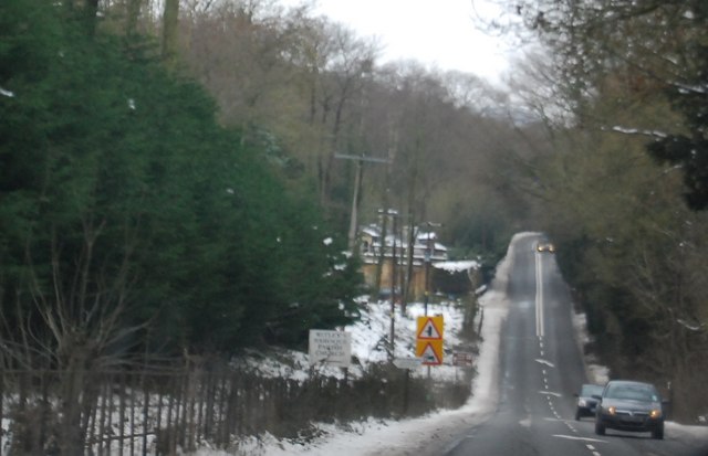
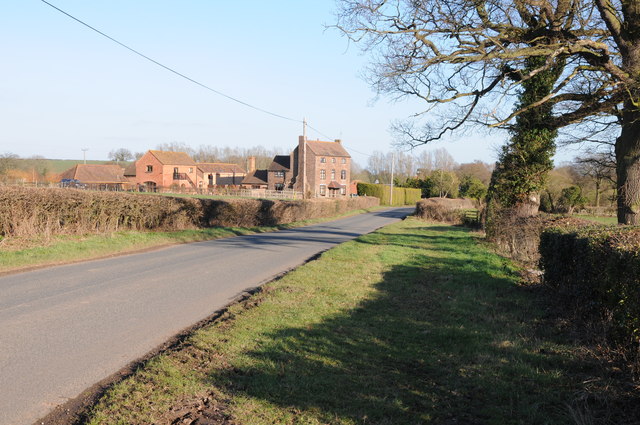
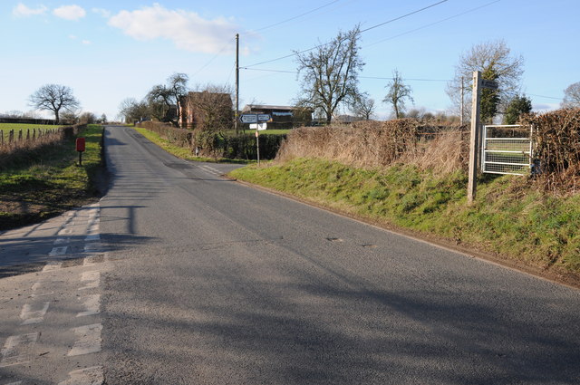
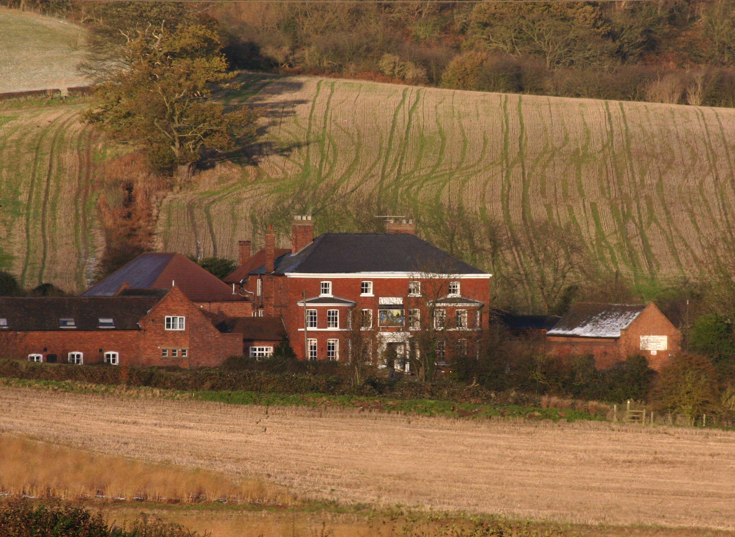
Ockeridge is a small village located in the county of Worcestershire, England. Situated approximately 10 miles north of Worcester, it lies within the administrative district of Wychavon. The village is nestled amidst the picturesque countryside, offering residents and visitors a serene and tranquil environment.

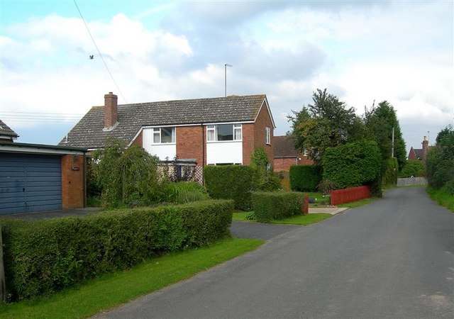
Ockeridge is primarily a residential area with a population of around 300 people. The village is known for its charming cottages and traditional architecture, which add to its quaint and idyllic appeal. The local community is close-knit and friendly, fostering a welcoming atmosphere for newcomers and tourists alike.

Despite its small size, Ockeridge boasts several amenities that cater to the needs of its residents. These include a village hall, a primary school, and a local pub, which serves as a social hub for villagers. Additionally, the village benefits from its proximity to nearby towns and cities, providing access to a wider range of amenities, educational institutions, and employment opportunities.

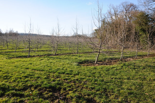
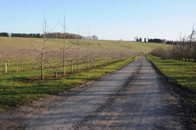
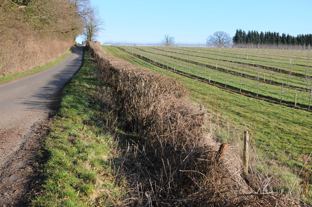
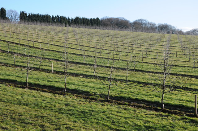
The surrounding natural beauty of Ockeridge offers ample opportunities for outdoor activities and exploration. The village is surrounded by rolling hills, lush meadows, and enchanting woodland, providing an ideal environment for hiking, cycling, and nature walks. The nearby River Severn also offers opportunities for fishing and boating.

Ockeridge benefits from good transport links, with the A449 road passing nearby, connecting the village to Worcester and other major towns in the region. The village is also well-served by public transportation, with regular bus services connecting to neighboring areas.

In summary, Ockeridge is a charming and peaceful village in Worcestershire, offering a high quality of life amidst its beautiful rural setting.

If you have any feedback on the listing, please let us know in the comments section below.

Ockeridge Images

Images are sourced within 2km of 52.258392/-2.323021 or Grid Reference SO7862. Thanks to Geograph Open Source API. All images are credited.

Country scene north of The Coppice Leisure Park
Entering Little Witley (A4133)
A4133, Little Witley
A4133 entering Little Whitley Westbound
A4133 entering Little Whitley
Westbound
Road junction at Little Witley opposite The Lodge
St Michael’s Church, Little Witley Although there has been a church from the 13th Century, the present building dates from 1867 when it was re-built in the ‘Early English’ style by Abraham Edward Perkins, Worcester’s church architect. The new nave walls were built on the lower red sandstone courses of the old church but the footprint was extended with the addition of an apsidal east end and vestry.
St Michael’s Church, Little Witley
Although there has been a church from the 13th Century, the present building dates from 1867 when it was re-built in the ‘Early English’ style by Abraham Edward Perkins, Worcester’s church architect. The new nave walls were built on the lower red sandstone courses of the old church but the footprint was extended with the addition of an apsidal east end and vestry.
Entering Wichenford Thirty MPH speed limit signs at Wichenford.
Entering Wichenford
Thirty MPH speed limit signs at Wichenford.
Wichenford Road through the village of Wichenford.
Wichenford
Road through the village of Wichenford.
Orchards at Woodhouse Farm Cider apple trees in an orchard at Woodhouse farm near Wichenford.
Orchards at Woodhouse Farm
Cider apple trees in an orchard at Woodhouse farm near Wichenford.
Apple orchard Cider apple trees in an orchard at Woodhouse Farm near Wichenford.
Apple orchard
Cider apple trees in an orchard at Woodhouse Farm near Wichenford.
Oak tree Oak tree near Woodhouse Farm, Wichenford.
Oak tree
Oak tree near Woodhouse Farm, Wichenford.
Road to King's Green Road to King's Green near Wichenford.
Road to King's Green
Road to King's Green near Wichenford.
Road past Rimmer's Farm Country road past Rimmer's Farm near Wichenford.
Road past Rimmer's Farm
Country road past Rimmer's Farm near Wichenford.
Staggered crossroads Staggered crossroads near Wichenford with the road to the right going to Witton Hill and Rosses lane, a no through road on the left.
Staggered crossroads
Staggered crossroads near Wichenford with the road to the right going to Witton Hill and Rosses lane, a no through road on the left.
Apple trees A young orchard of apple trees near Prickley Green Farm, Martley.
Apple trees
A young orchard of apple trees near Prickley Green Farm, Martley.
Acres of trees Acres of apple trees at Hockham's Farm.
Acres of trees
Acres of apple trees at Hockham's Farm.
Road to Ockeridge Country road to Ockeridge passing acres of apple orchards.
Road to Ockeridge
Country road to Ockeridge passing acres of apple orchards.
Orchard of apple trees Orchard of apple trees near Hockham's Farm.
Orchard of apple trees
Orchard of apple trees near Hockham's Farm.
Show me another place!

Ockeridge is located at Grid Ref: SO7862 (Lat: 52.258392, Lng: -2.323021)

Administrative County: Worcestershire

District: Malvern Hills

Police Authority: West Mercia

What 3 Words

///handy.mini.accordion. Near Lower Broadheath, Worcestershire

Nearby Locations

Birchend Coppice Ockeridge

Related Wikis

Little Witley

Little Witley is a village and civil parish in the Malvern Hills District in the county of Worcestershire, England. == History == === Pre-history === There...

Wichenford

Wichenford is a village and civil parish (with Kenswick) in the Malvern Hills District in the county of Worcestershire, England. It lies 7 miles (11km...

Witley Court

Witley Court, in Great Witley, Worcestershire, England, is a ruined Italianate mansion. Built for the Foleys in the seventeenth century on the site of...

Sankyns Green

Sankyns Green is a hamlet within the civil parish of Shrawley in Worcestershire, England.

The Chantry School

The Chantry School is a mixed gender secondary school with academy status located in Martley, Worcestershire, England. The school has about 700 students...

Great Witley

Great Witley is a village and civil parish in the Malvern Hills District in the northwest of the county of Worcestershire, England. It is situated around...

Hillhampton

Hillhampton is a hamlet and civil parish nestled between Great Witley, Little Witley and Shrawley in the Malvern Hills district of the county of Worcestershire...

Martley

Martley is a village and civil parish in the Malvern Hills district of the English county of Worcestershire. It is approximately nine miles north-west...

Related Videos

A GLIMPSE INSIDE A PALACE RUIN & A MEDIEVAL MANOR - Witley Court and Harvington Hall

Join me this week as I continue my trip from my time at Mill Cottage, with my final episode from the surrounding area. First, I head ...

bank holiday vlog: witley court & gardens

hiya loves!!! here's a family vlog where we took a trip to witley court and gardens for our bank holiday vacay :))) watch at 1080p for ...

Witley court and garden #nature #travel #uk #witleycourt #ninara #ukgarden #englishheritage

Hi everyone, Enjoy the video & Please subscribe to my channel https://youtube.com/c/NINARAtravel more details ...

Nearby Amenities

Located within 500m of 52.258392,-2.323021
Telephone Box
Naptan AtcoCode: 2000G051400
Naptan Bearing: NE
Naptan BusStopType: CUS
Naptan CommonName: Telephone Box
Naptan Crossing: Hockham's Lane
Naptan Indicator: Adj
Naptan Landmark: Keepers Cottage
Naptan NaptanCode: wocgjtjm
Naptan Street: Birchend Coppice Road
Naptan Verified: no
Source: naptan_import
Lat/Long: 52.2577426/-2.3181278
Post Box
Collection Times: Mo-Fr 15:00; Sa 09:30
Post Box Type: lamp
Ref: WR6 439
Royal Cypher: EIIR
Royal Cypher Wikidata: Q33102113
Lat/Long: 52.2580727/-2.3172843
Power: pole
Lat/Long: 52.2601949/-2.3296165
Power: pole
Lat/Long: 52.25997/-2.3289393
Power: pole
Lat/Long: 52.2596294/-2.32849
Power: pole
Lat/Long: 52.2591623/-2.3279066
Power: pole
Lat/Long: 52.2586115/-2.3271999
Birch End Farm
Power: pole
Transformer: distribution
Voltage Primary: 11000
Lat/Long: 52.2580549/-2.3264998
Power: pole
Lat/Long: 52.2574983/-2.3266608
Power: pole
Lat/Long: 52.2569352/-2.3268163
Power: pole
Lat/Long: 52.257601/-2.3212306
Ockeridge Cross
Location Transition: yes
Power: pole
Transformer: distribution
Voltage Primary: 11000
Lat/Long: 52.2577274/-2.3170491
Power: pole
Lat/Long: 52.2577233/-2.3173065
Hatfield Cottage
Power: pole
Transformer: distribution
Voltage Primary: 11000
Lat/Long: 52.2585417/-2.3185149
Power: pole
Lat/Long: 52.2580894/-2.3183794
Ockeridge Waste
Power: pole
Transformer: distribution
Voltage Primary: 11000
Lat/Long: 52.2576904/-2.3182695
Power: pole
Lat/Long: 52.2576461/-2.319738
Power: pole
Lat/Long: 52.2575747/-2.3220514
Power: pole
Lat/Long: 52.2572361/-2.3234287
Power: pole
Lat/Long: 52.2566175/-2.3259661
Power: pole
Lat/Long: 52.2569344/-2.3246826
Power: pole
Lat/Long: 52.2563729/-2.3269712
Power: pole
Lat/Long: 52.2556287/-2.3268438
Power: pole
Lat/Long: 52.2548816/-2.3266976
The data included in this document is from www.openstreetmap.org. The data is made available under ODbL.

Have you been to Ockeridge?

Leave your review of Ockeridge below (or comments, questions and feedback).