Nup End

Settlement in Hertfordshire North Hertfordshire

England

Nup End

Bluebells in "Winter Wood" This photograph was taken during a cycle ride.  Bluebells have become quite a rarity these days.
Bluebells in "Winter Wood" Credit: Richard Reeve

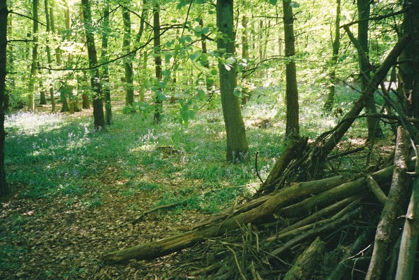
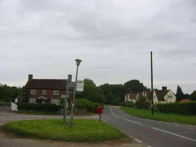
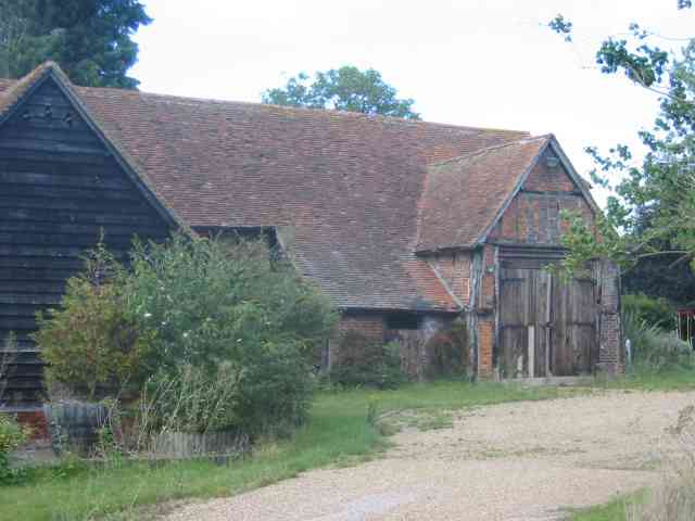
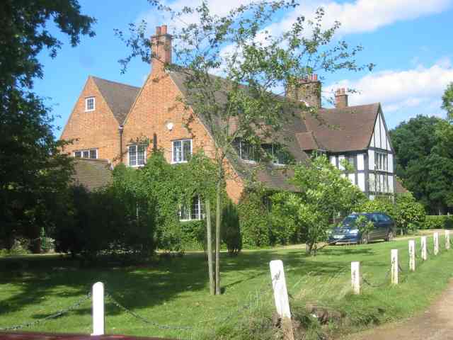
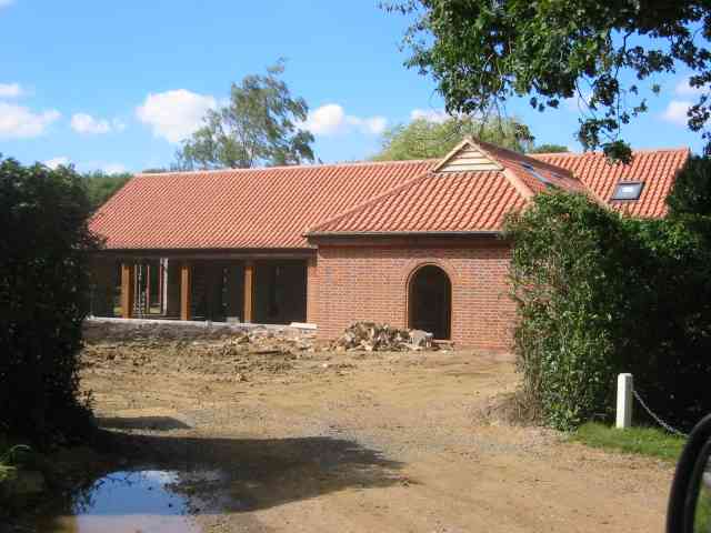
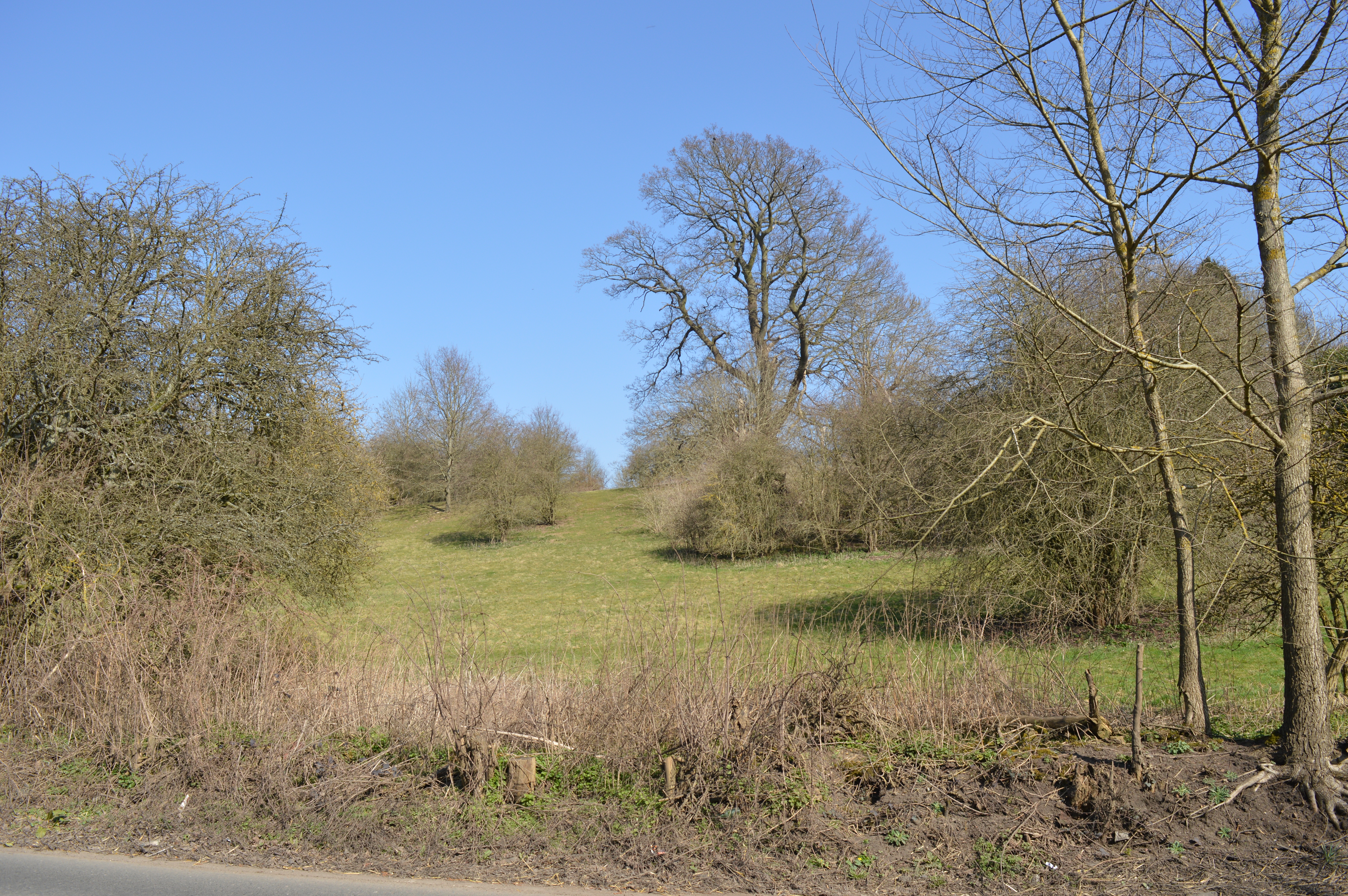
Nup End is a small village located in the county of Hertfordshire, England. Situated around 3 miles north of the town of Berkhamsted, Nup End falls within the administrative district of Dacorum. The village is nestled amidst picturesque countryside, surrounded by rolling hills and lush green fields.

The history of Nup End can be traced back several centuries, with evidence of settlements dating back to the medieval period. The village was primarily an agricultural community, with farming being the main occupation for its residents. Over the years, Nup End has retained its rural charm, with a scattering of traditional cottages and farmhouses dotting the landscape.

Despite its small size, Nup End offers a peaceful and idyllic setting for its residents. The village is well-connected to nearby towns and cities, with good transportation links and access to amenities. The surrounding area provides ample opportunities for outdoor activities such as walking, cycling, and horse riding, making it a haven for nature enthusiasts.

In terms of facilities, Nup End has a small number of amenities including a local pub and a village hall. The village is also within close proximity to Berkhamsted, which offers a wider range of shops, restaurants, and other amenities.

Overall, Nup End presents itself as a serene and charming village, perfect for those seeking a tranquil countryside lifestyle within easy reach of urban conveniences.

If you have any feedback on the listing, please let us know in the comments section below.

Nup End Images

Images are sourced within 2km of 51.856263/-0.2299424 or Grid Reference TL2219. Thanks to Geograph Open Source API. All images are credited.

Bluebells in "Winter Wood" This photograph was taken during a cycle ride.  Bluebells have become quite a rarity these days.
Bluebells in "Winter Wood"
This photograph was taken during a cycle ride. Bluebells have become quite a rarity these days.
Nup End  near Knebworth The houses on the right have just been tarted up.
{could be Council property ? }
Nup End near Knebworth
The houses on the right have just been tarted up. {could be Council property ? }
Three Houses Farm Early design for the great barns
Three Houses Farm
Early design for the great barns
Mansion at Crouch Green There must be at least five or six bedrooms in this house.
Mansion at Crouch Green
There must be at least five or six bedrooms in this house.
Brash new House in Couch Green I wonder if it is an annexe for next door?
Brash new House in Couch Green
I wonder if it is an annexe for next door?
The Node  Conference Centre  off B656 This estate is quite large and has many points of interest but is private.
The Node Conference Centre off B656
This estate is quite large and has many points of interest but is private.
Crouch Green Wood This is the junction of Three Houses Lane with an unnamed lane to Rusling End in the middle of Crouch Green Wood. The road sign points along Three Houses Lane to Whitwell to the right and Codicote to the left.
Crouch Green Wood
This is the junction of Three Houses Lane with an unnamed lane to Rusling End in the middle of Crouch Green Wood. The road sign points along Three Houses Lane to Whitwell to the right and Codicote to the left.
Jubilee Lodge East, Old Knebworth (circa 1890) One of a pair of picturesque lodges flanking the Park Lane entrance to the Knebworth Estate. Grade II listed <span class="nowrap"><a title="http://www.britishlistedbuildings.co.uk/en-162112-jubilee-lodges-walls-and-gate-posts-kneb" rel="nofollow ugc noopener" href="http://www.britishlistedbuildings.co.uk/en-162112-jubilee-lodges-walls-and-gate-posts-kneb">Link</a><img style="margin-left:2px;" alt="External link" title="External link - shift click to open in new window" src="https://s1.geograph.org.uk/img/external.png" width="10" height="10"/></span>
Jubilee Lodge East, Old Knebworth (circa 1890)
One of a pair of picturesque lodges flanking the Park Lane entrance to the Knebworth Estate. Grade II listed LinkExternal link
"Lytton Arms" public house, Old Knebworth Named after the Lytton family, owners of the nearby Knebworth estate since the fifteenth century
"Lytton Arms" public house, Old Knebworth
Named after the Lytton family, owners of the nearby Knebworth estate since the fifteenth century
Lytton Almshouses, Old Knebworth Built 1836 by Elizabeth Bulwer Lytton. Grade II listed <span class="nowrap"><a title="http://www.britishlistedbuildings.co.uk/en-162117-lytton-almshouses-5-dwellings-knebworth" rel="nofollow ugc noopener" href="http://www.britishlistedbuildings.co.uk/en-162117-lytton-almshouses-5-dwellings-knebworth">Link</a><img style="margin-left:2px;" alt="External link" title="External link - shift click to open in new window" src="https://s1.geograph.org.uk/img/external.png" width="10" height="10"/></span>. Not in the best state of repair.
Lytton Almshouses, Old Knebworth
Built 1836 by Elizabeth Bulwer Lytton. Grade II listed LinkExternal link. Not in the best state of repair.
Lytton Almshouses, Old Knebworth View of on centre gable of Lytton Almshouses, Old Knebworth, showing with arms of the Lytton family and inscription reading "These almshouses were erected by Mrs Elizabeth Barbara Bulwer Lytton, Anno Domini 1836".
Lytton Almshouses, Old Knebworth
View of on centre gable of Lytton Almshouses, Old Knebworth, showing with arms of the Lytton family and inscription reading "These almshouses were erected by Mrs Elizabeth Barbara Bulwer Lytton, Anno Domini 1836".
Knebworth House fauna
Knebworth House flora
Codicote Village The green seems a bit too small to qualify
Codicote Village
The green seems a bit too small to qualify
Codicote Village Ye Olde building is now a Chinese restaurant,
Codicote Village
Ye Olde building is now a Chinese restaurant,
Clump of trees in Three Houses Lane This was a spot for lunch and soaking in the scenery
Clump of trees in Three Houses Lane
This was a spot for lunch and soaking in the scenery
Show me another place!

Nup End is located at Grid Ref: TL2219 (Lat: 51.856263, Lng: -0.2299424)

Administrative County: Hertfordshire

District: North Hertfordshire

Police Authority: Hertfordshire

What 3 Words

///empire.rewarding.remedy. Near Codicote, Hertfordshire

Related Wikis

Codicote F.C.

Codicote Football Club is a football club based in Codicote, near Hitchin, Hertfordshire, England. They are currently members of the Spartan South Midlands...

Codicote

Codicote ( KO-dih-kət) is a large village, and civil parish about seven miles (11 km) south of Hitchin in Hertfordshire, England. It has timber-framed...
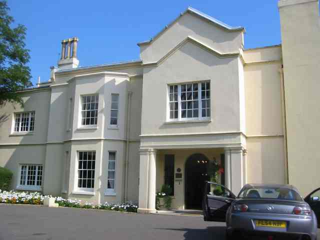
Homewood, Knebworth

Homewood is an Arts and Crafts style country house in Knebworth, Hertfordshire, England. Designed and built by architect Edwin Lutyens around 1900–3, using...
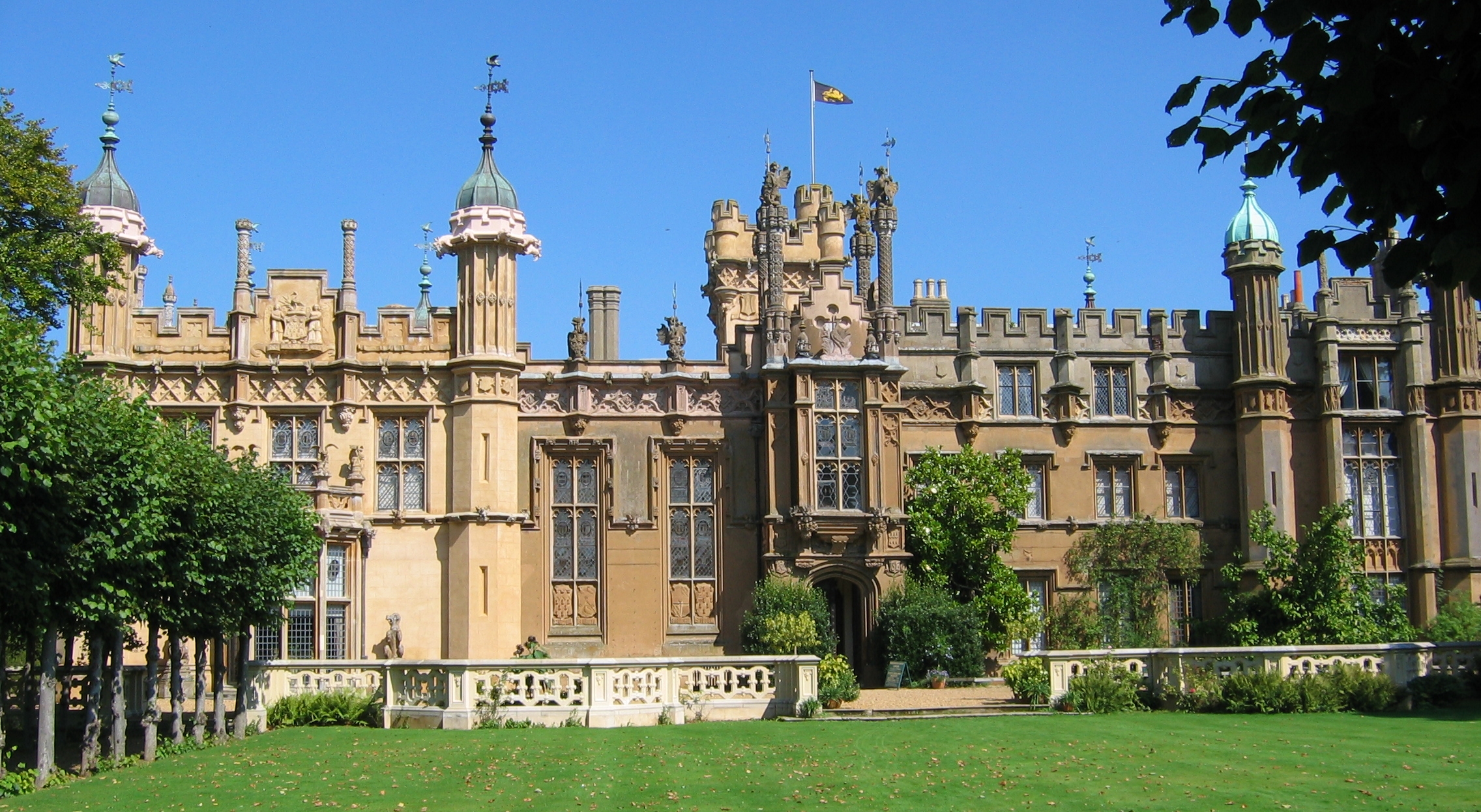
Knebworth House

Knebworth House is an English country house in the parish of Knebworth in Hertfordshire, England. It is a Grade II* listed building. Its gardens are also...
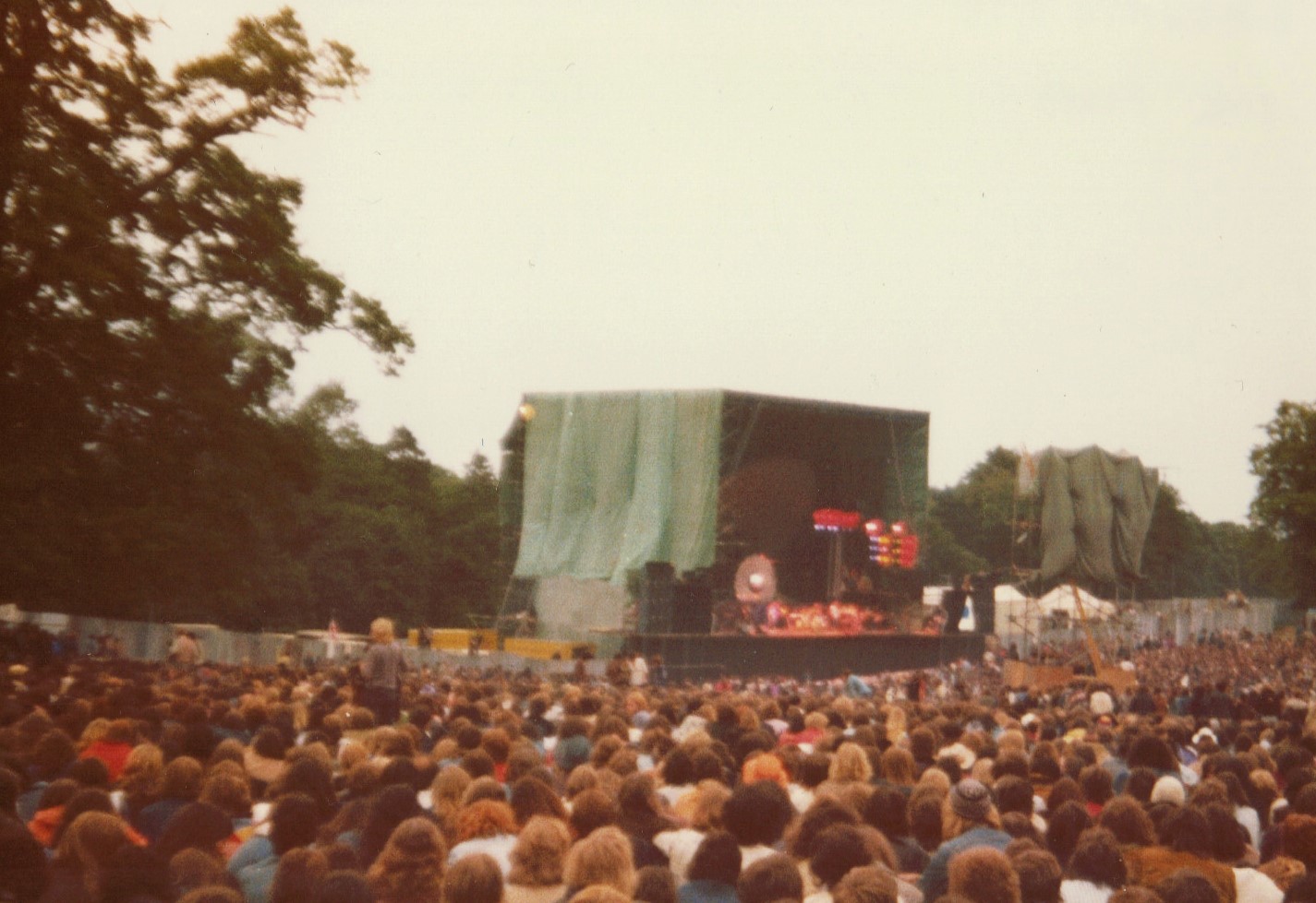
Knebworth Festival

The Knebworth Festival is a recurring open-air rock and pop concert held on the grounds of the Knebworth House in Knebworth, England. The festival first...

BOB fm (Hertfordshire)

BOB fm was an Independent Local Radio station broadcasting to north Hertfordshire in the United Kingdom. Programming originated from studios at the Old...

Church of St Mary and St Thomas, Knebworth

The Church of St Mary and St Thomas is one of two Anglican churches in Knebworth, Hertfordshire, England. The church dates from the twelfth century and...

Danesbury Park

Danesbury Park is a 24.5-hectare (61-acre) public park and Local Nature Reserve in Welwyn in Hertfordshire. It is owned and managed by Welwyn Hatfield...

Related Videos

Walking the Hertfordshire Way Backwards - 13

The Hertfordshire Way offers many picturesque walks through the English countryside. A relatively easy section of the trail runs ...

Liam Gallagher Knebworth Saturday 4 June 2022 Stand By Me Oasis

oasis #liamgallagher #noelgallagher #britpop #s #music #oasismusic #oasisfans #madferit #rocknroll #manchester #rock #blur ...

Welcome to Welwyn

Sometimes referred to as Old Welwyn or Welwyn Village, to distinguish it from the much newer settlement of Welwyn Garden City ...

Knebworth house

Knebworth house #dannysloggettvision.

Nearby Amenities

Located within 500m of 51.856263,-0.2299424
Created By: osmeditor2
Lat/Long: 51.8597067/-0.2289017
Created By: osmeditor2
Lat/Long: 51.8595467/-0.22905
Created By: osmeditor2
Lat/Long: 51.8591883/-0.229055
Created By: osmeditor2
Lat/Long: 51.8589133/-0.2292583
Created By: osmeditor2
Lat/Long: 51.8585333/-0.229745
Created By: osmeditor2
Lat/Long: 51.8576267/-0.2301467
Created By: osmeditor2
Lat/Long: 51.85687/-0.2304817
Created By: osmeditor2
Lat/Long: 51.8563733/-0.2307283
Created By: osmeditor2
Lat/Long: 51.8559133/-0.2309017
Created By: osmeditor2
Lat/Long: 51.8555283/-0.2311233
Created By: osmeditor2
Lat/Long: 51.855065/-0.2315283
Created By: osmeditor2
Lat/Long: 51.852445/-0.232675
Barrier: stile
Lat/Long: 51.8576485/-0.2347747
Barrier: kissing_gate
Lat/Long: 51.8601985/-0.2273454
Barrier: stile
Lat/Long: 51.857529/-0.2347468
Recycling
Lat/Long: 51.8545204/-0.2340553
Man Made: water_tower
Note: approximate location
Lat/Long: 51.85434/-0.2353642
Bus Stop
St Giles Church
Naptan AtcoCode: 210021101183
Naptan Bearing: NE
Naptan CommonName: St Giles Church
Naptan Indicator: opp
Naptan Landmark: Unknown
Naptan NaptanCode: hrtgmamt
Naptan PlusbusZoneRef: STEVNGE
Naptan ShortCommonName: NA
Naptan Street: Bury Lane
Naptan Verified: no
Source: naptan_import
Lat/Long: 51.8534124/-0.2330571
St Giles Road
Naptan AtcoCode: 210021101210
Naptan Bearing: E
Naptan BusStopType: CUS
Naptan CommonName: St Giles Road
Naptan Crossing: St Giles Road
Naptan Indicator: E-bound
Naptan Landmark: St Giles Road
Naptan NaptanCode: hrtgmagt
Naptan PlusbusZoneRef: STEVNGE
Naptan ShortCommonName: NA
Naptan Street: Tower Road
Naptan Verified: no
Source: naptan_import
Lat/Long: 51.8535027/-0.2354785
St Giles Church
Naptan AtcoCode: 210021106974
Naptan Bearing: SW
Naptan BusStopType: CUS
Naptan CommonName: St Giles Church
Naptan Indicator: adj
Naptan Landmark: Unknown
Naptan NaptanCode: hrtgjgpa
Naptan PlusbusZoneRef: STEVNGE
Naptan ShortCommonName: NA
Naptan Street: Bury Lane
Naptan Verified: no
Source: naptan_import
Lat/Long: 51.8534012/-0.2329123
Colour: yellow
Marker: post
Material: plastic
Utility: gas
Lat/Long: 51.8549252/-0.2315902
Colour: yellow
Marker: post
Material: plastic
Utility: gas
Lat/Long: 51.8549575/-0.2315603
The data included in this document is from www.openstreetmap.org. The data is made available under ODbL.

Have you been to Nup End?

Leave your review of Nup End below (or comments, questions and feedback).