Bicester

Settlement in Oxfordshire Cherwell

England

Bicester

Fane House, Bicester This is sheltered housing
Fane House, Bicester Credit: David Howard

Bicester is a historic market town located in the Cherwell district of Oxfordshire, England. Situated about 12 miles northeast of Oxford, Bicester has a population of around 33,000 residents. The town is well-known for its strategic location, being at the intersection of major road and rail routes, which has contributed to its growth and development.

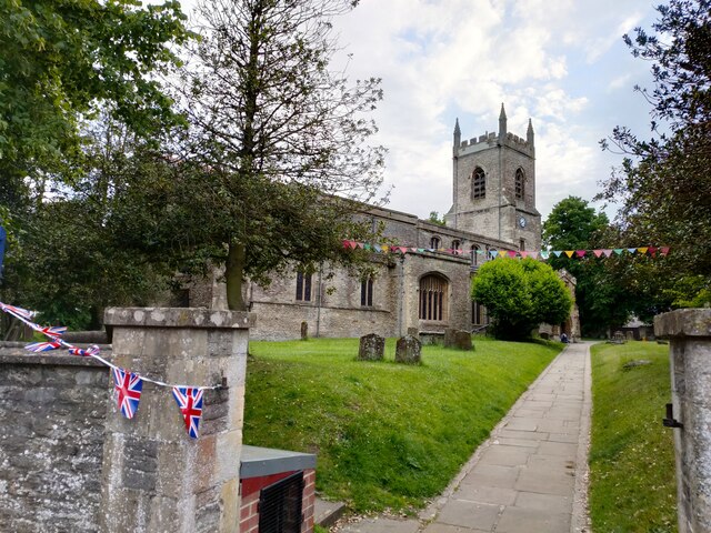
Bicester has a rich history dating back to the Saxon period, and evidence of Roman occupation has also been discovered in the area. The town thrived during the medieval period as a market town, primarily due to its proximity to the thriving wool trade. Today, Bicester retains its market town charm with a bustling center and a weekly market attracting locals and visitors alike.

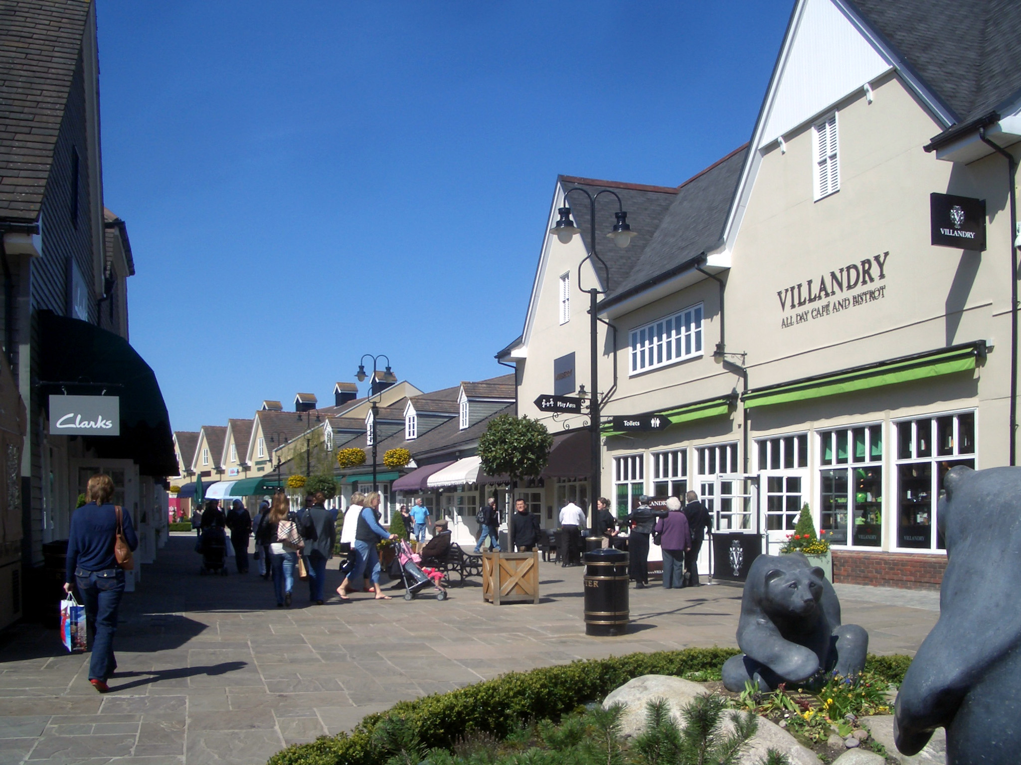
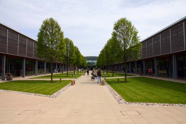
In recent years, Bicester has experienced significant expansion and development. The most notable development is Bicester Village, a luxury outlet shopping center that draws in tourists from around the world. The town has also seen the construction of new housing estates and the expansion of existing infrastructure to cater to the growing population.

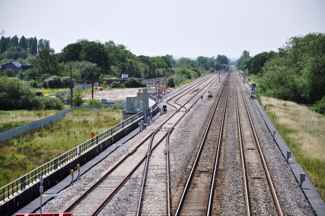
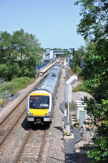
Bicester is well-connected to other major towns and cities in the region. The town has two railway stations, Bicester North and Bicester Village, which provide excellent transport links to London, Oxford, and Birmingham. Additionally, Bicester is conveniently located near major road networks, including the M40 motorway, making it easily accessible by car.

Bicester offers a range of amenities, including schools, healthcare facilities, and a variety of shops and restaurants. The town is also surrounded by beautiful countryside, with numerous walking and cycling routes, as well as several well-maintained parks and green spaces for residents and visitors to enjoy.

Overall, Bicester is a vibrant and growing market town with a rich history, excellent transport links, and a range of amenities that make it an attractive place to live or visit.

If you have any feedback on the listing, please let us know in the comments section below.
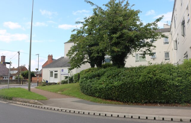
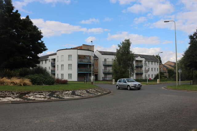
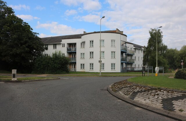
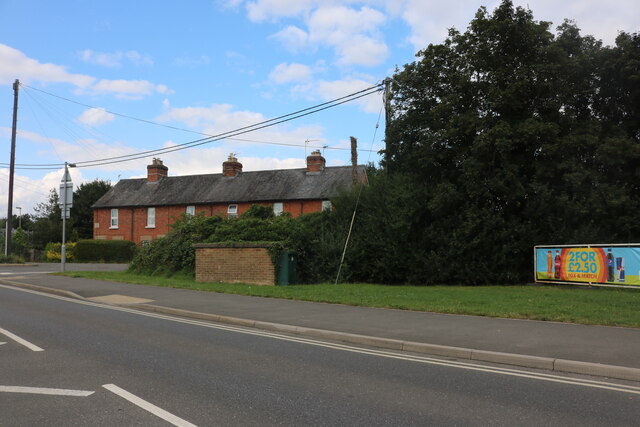
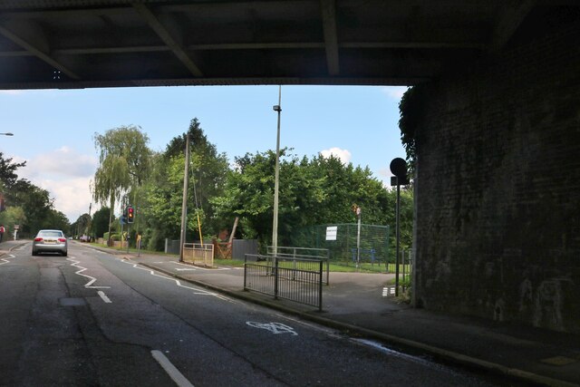
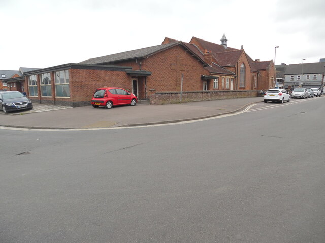
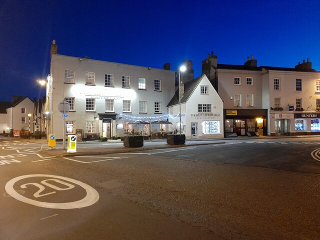
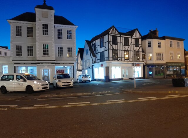
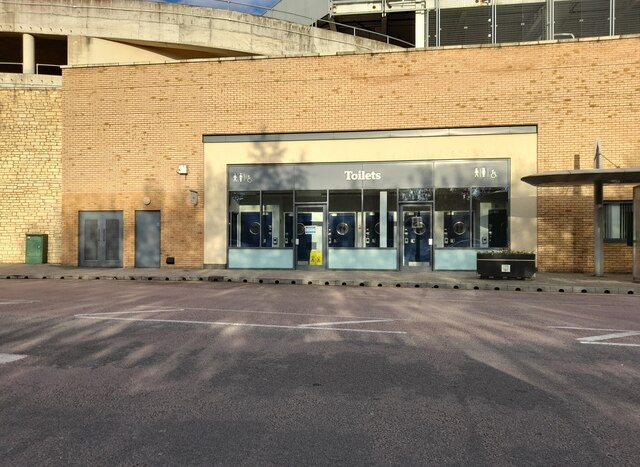
Bicester Images

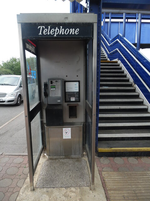
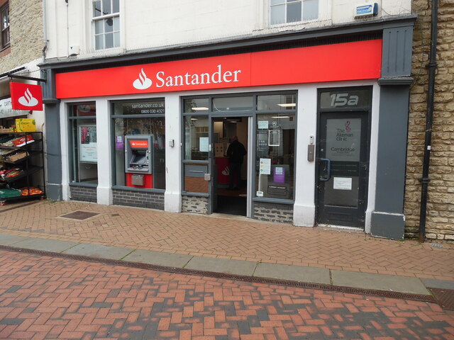
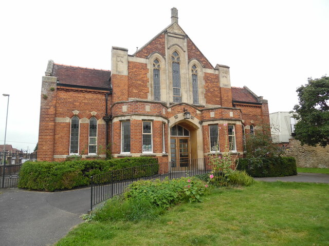
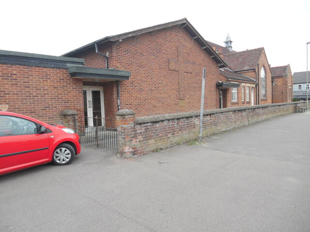
Images are sourced within 2km of 51.896606/-1.151876 or Grid Reference SP5822. Thanks to Geograph Open Source API. All images are credited.

Fane House, Bicester This is sheltered housing
Fane House, Bicester
This is sheltered housing
Flats on London Road, Bicester
Landscaped roundabout on London Road, Bicester
London Road, Bicester By the level crossing
London Road, Bicester
By the level crossing
Under the railway on Banbury Road, Bicester
View south west from the A41 bridge A view of the Bicester to Oxford railway line on the right and the loops and sidings on the left giving access to the Bicester Military Railway in the middle distance.  The MOD depot although these days reduced in size still retains rail access, with regular freight trains arriving and departing.
View south west from the A41 bridge
A view of the Bicester to Oxford railway line on the right and the loops and sidings on the left giving access to the Bicester Military Railway in the middle distance. The MOD depot although these days reduced in size still retains rail access, with regular freight trains arriving and departing.
View north east from A41 bridge Chiltern railways DMU No. 168322 has just departed from Bicester Village Station heading for Oxford.  The station was named Bicester Town until the line was rebuilt for Chiltern services to Oxford, and now serves the nearby Bicester Village retail outlet shopping centre.
View north east from A41 bridge
Chiltern railways DMU No. 168322 has just departed from Bicester Village Station heading for Oxford. The station was named Bicester Town until the line was rebuilt for Chiltern services to Oxford, and now serves the nearby Bicester Village retail outlet shopping centre.
Bicester Level Crossing Chiltern Railways dmu No. 168328 heads towards London after stopping at Bicester Village Station.  These services run regularly between Oxford and London Marylebone via the New Bicester Chord line, opened in 2015. This is the only level crossing on the route, as all others have been replaced with bridges.
Bicester Level Crossing
Chiltern Railways dmu No. 168328 heads towards London after stopping at Bicester Village Station. These services run regularly between Oxford and London Marylebone via the New Bicester Chord line, opened in 2015. This is the only level crossing on the route, as all others have been replaced with bridges.
KX100 Telephone Kiosk at Bicester North Railway Station This photo shows the telephone kiosk at the entrance to the railway station which is in Chiltern Approach off Buckingham Road OX26 6EF. The stairs to the right of the kiosk lead to the southbound platform for trains going to Marylebone Station in London.
KX100 Telephone Kiosk at Bicester North Railway Station
This photo shows the telephone kiosk at the entrance to the railway station which is in Chiltern Approach off Buckingham Road OX26 6EF. The stairs to the right of the kiosk lead to the southbound platform for trains going to Marylebone Station in London.
Santander Bank branch in Bicester This bank branch is located at 15 Sheep Street OX26 6JL. To the right of the branch can be seen No 15a leading to a private clinic.
Santander Bank branch in Bicester
This bank branch is located at 15 Sheep Street OX26 6JL. To the right of the branch can be seen No 15a leading to a private clinic.
Bicester Methodist Church Situated in Bell Lane OX26 6JQ, this church is known as the "Grainger 
Hargreaves Memorial Church" and dates from 1927. It is one of eight churches in the Buckingham, Bicester and Brackley Methodist Circuit, known as the 3Bs Methodist Circuit. Services are held here each Sunday at 10.45am with activities taking place during the week.
Bicester Methodist Church
Situated in Bell Lane OX26 6JQ, this church is known as the "Grainger Hargreaves Memorial Church" and dates from 1927. It is one of eight churches in the Buckingham, Bicester and Brackley Methodist Circuit, known as the 3Bs Methodist Circuit. Services are held here each Sunday at 10.45am with activities taking place during the week.
Side view of Bicester Methodist Church (1) This side view in Bell Lane shows a cross built into the red brickwork of this church. It is named after the Revd Grainger Hargreaves who was an early
Christian missionary in China, and the Methodist Minister from 1921 to 1923. The white double doors seen in the photo lead into the church hall behind the church.
Side view of Bicester Methodist Church (1)
This side view in Bell Lane shows a cross built into the red brickwork of this church. It is named after the Revd Grainger Hargreaves who was an early Christian missionary in China, and the Methodist Minister from 1921 to 1923. The white double doors seen in the photo lead into the church hall behind the church.
Side view of Bicester Methodist Church (2) Taken in Bell Lane, this photo shows the redbrick church hall behind the church. Victoria Road can just be seen to the left of the photo.
Side view of Bicester Methodist Church (2)
Taken in Bell Lane, this photo shows the redbrick church hall behind the church. Victoria Road can just be seen to the left of the photo.
London Road, Bicester
Public toilets at Pioneer Square, Bicester
St Edburg Church, Bichester
Show me another place!

Bicester is located at Grid Ref: SP5822 (Lat: 51.896606, Lng: -1.151876)

Administrative County: Oxfordshire

District: Cherwell

Police Authority: Thames Valley

What 3 Words

///rooms.damp.tigers. Near Bicester, Oxfordshire

Nearby Locations

King's End Bicester

Related Wikis

Bicester

Bicester ( BISS-tər) is a historical market town, garden town, and civil parish in the Cherwell district of northeastern Oxfordshire in south-central...

Bicester Village railway station

Bicester Village (2015–present, previously Bicester Town 1987–2014, Bicester London Road 1954–1968, Bicester 1850–1954) is one of two railway stations...

Bicester Village

Bicester Village is a designer outlet shopping centre on the outskirts of Bicester, a town in Oxfordshire, England. It is owned by Value Retail plc. The...

The Bicester School

The Bicester School (previously Bicester Community College) is a mixed, multi-heritage, secondary school, with 963 students (including a sixth form). It...

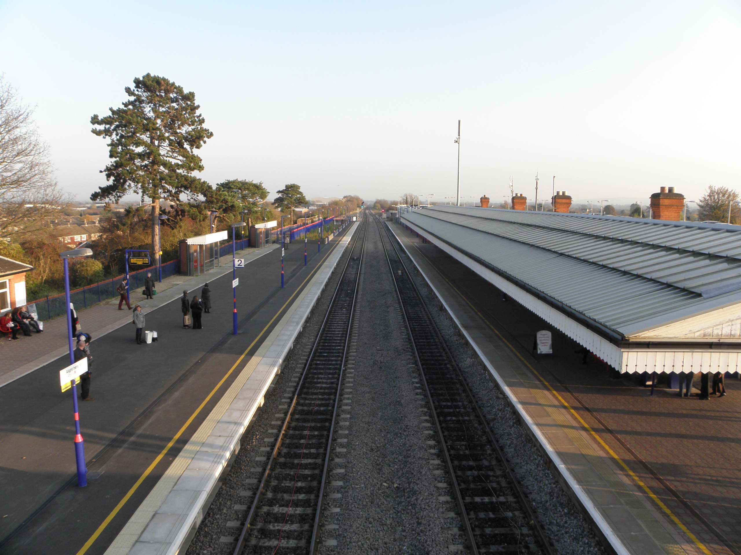
Bicester North railway station

Bicester North is a station on the Chiltern Main Line, one of two stations serving Bicester in Oxfordshire. Services operated by Chiltern Railways run...

Bicester Avenue

Bicester Avenue Home and Garden Centre is a shopping centre in Bicester, Oxfordshire, England, that opened in May 2007. Some of the stores at Bicester...

Cooper School, Bicester

The Cooper School is a co-educational secondary school and sixth form with academy status, located in the northern side of Bicester, Oxfordshire. ��2...

Bure Park

Bure Park is a 8.4-hectare (21-acre) Local Nature Reserve in Bicester in Oxfordshire. It is owned by Bicester Town Council and managed by Cherwell District...

Nearby Amenities

Located within 500m of 51.896606,-1.151876
Mini Roundabout
Direction: clockwise
Lat/Long: 51.895987/-1.1492535
Bicester
Name En: Bicester
Name Lt: Bisteris
Place: town
Postal Code: OX26
Wikidata: Q251903
Wikipedia: en:Bicester
Lat/Long: 51.8988832/-1.1518287
Bicester Village
Naptan AtcoCode: 9100BCSTRTN
Network: National Rail
Network Website: https://www.nationalrail.co.uk/stations/bit/
Network Wikidata: Q26334
Note Name: used to be Bicester Town, don't ask
Operator: Chiltern Rail
Postal Code: OX26 6HU
Public Transport: station
Railway: station
Ref Crs: BIT
Train: yes
Wikidata: Q1873632
Wikipedia: en:Bicester Village railway station
Lat/Long: 51.8924126/-1.1493759
London Road Level Crossing
Crossing Barrier: double_half
Crossing Bell: yes
Crossing Light: yes
Railway: level_crossing
Lat/Long: 51.8937974/-1.1478294
Traffic Signals
Crossing: no
Traffic Signals: traffic_lights
Traffic Signals Direction: forward
Lat/Long: 51.8988451/-1.1541957
Barrier: bollard
Lat/Long: 51.8968269/-1.1583895
Post Box
Ref: OX26 807
Lat/Long: 51.8987999/-1.1458241
Noexit: yes
Lat/Long: 51.8929032/-1.1485037
Noexit: yes
Lat/Long: 51.8936973/-1.1476529
Former Amenity: post_box
Note: no sign of this box on survey 2017-06
Lat/Long: 51.895231/-1.1484731
Post Box
Ref: OX26 338
Lat/Long: 51.8987333/-1.1484039
Give Way
Direction: forward
Lat/Long: 51.8987891/-1.1479483
Recycling
Recycling Cans: yes
Recycling Clothes: yes
Recycling Glass: yes
Lat/Long: 51.8974724/-1.1494472
Post Box
Brand: Royal Mail
Brand Wikidata: Q638098
Brand Wikipedia: en:Royal Mail
Collection Times: Mo-Fr 18:30; Sa 12:15
Operator: Royal Mail
Operator Wikidata: Q638098
Post Box Apertures: 2
Post Box Design: type_c
Post Box Type: pillar
Ref: OX26 11;OX26 1
Royal Cypher: EIIR
Royal Cypher Wikidata: Q33102113
Lat/Long: 51.8984426/-1.1513597
Access: permit
Barrier: bollard
Bollard: rising
Colour: black
Material: plastic
Lat/Long: 51.8991599/-1.1522739
Crossing
Crossing: unmarked
Lat/Long: 51.8977269/-1.1517934
Entrance: main
Lat/Long: 51.8999218/-1.1529123
Entrance: main
Lat/Long: 51.8993847/-1.1523376
Noexit: yes
Lat/Long: 51.9008278/-1.1531679
Noexit: yes
Lat/Long: 51.8966542/-1.1456256
Noexit: yes
Lat/Long: 51.8959873/-1.1496588
Noexit: yes
Lat/Long: 51.8958624/-1.14851
Crossing
Crossing: uncontrolled
Crossing Island: no
Crossing Markings: zebra;dots
Crossing Ref: zebra
Tactile Paving: yes
Lat/Long: 51.8953405/-1.1485972
Barrier: bollard
Lat/Long: 51.8963696/-1.1572283
Fixme: Connected?
Lat/Long: 51.8950325/-1.156554
Noexit: yes
Lat/Long: 51.9005879/-1.15437
Noexit: yes
Lat/Long: 51.9003864/-1.1540789
Turning Circle
Lat/Long: 51.8954648/-1.1503097
Noexit: yes
Lat/Long: 51.8954034/-1.1476705
Sport: bowls
Lat/Long: 51.895351/-1.1473844
Noexit: yes
Lat/Long: 51.8991885/-1.1486139
Noexit: yes
Lat/Long: 51.895489/-1.1454641
Crossing
Crossing: uncontrolled
Crossing Island: no
Crossing Markings: zebra;dots
Crossing Ref: zebra
Lat/Long: 51.8999501/-1.1564697
Traffic Signals
Lat/Long: 51.8979855/-1.1577833
Turning Circle
Lat/Long: 51.8986991/-1.1565871
Note: The courtyard youth arts centre
Lat/Long: 51.8965188/-1.148404
Noexit: yes
Lat/Long: 51.8977354/-1.1486907
Noexit: yes
Lat/Long: 51.8976193/-1.1490805
Noexit: yes
Lat/Long: 51.8980381/-1.1472801
Pub
The White Hart
Check Date: 2023-07-29
Postal Code: OX26 6TB
Wikidata: Q26298634
Lat/Long: 51.8973484/-1.1503073
Pub
The Kings Arms Hotel
Check Date: 2023-07-29
Postal Code: OX26 6AH
Wikidata: Q26496224
Lat/Long: 51.8965131/-1.1500878
Note: was Ye Olde Pioneer pub
Postal Code: OX26 6AG
Lat/Long: 51.8966277/-1.1507427
Post Box
Collection Times: Mo-Fr 09:00; Sa 07:00
Post Box Mounting: wall
Post Box Type: wall
Ref: OX26 323D
Royal Cypher: EIIR
Royal Cypher Wikidata: Q33102113
Lat/Long: 51.8964206/-1.1546215
Pub
The Six Bells
Wikidata: Q26298648
Lat/Long: 51.8966174/-1.1552696
Pub
The Swan Inn
Food: yes
Postal Code: OX26 6AY
Wikidata: Q26651039
Lat/Long: 51.8967615/-1.155552
Place Of Worship
Archdiocese of Birmingham Catholic Church of Immaculate Conception
Denomination: catholic
Religion: christian
Lat/Long: 51.8966549/-1.1530426
Pub
The Lamb Inn
Addr City: Bicester
Addr Housenumber: 59-61
Addr Postcode: OX26 6JW
Addr Street: Sheep Street
Fhrs Id: 828956
Fhrs Local Authority Id: 15/00201/C
Old Name: The Saxon
Operator: Stonegate
Operator Wikidata: Q7619176
Source Addr Postcode: FHRS Open Data
Website: https://www.greatukpubs.co.uk/lamb-inn-bicester
Lat/Long: 51.8990956/-1.1524347
Post Box
Collection Times: Mo-Fr 18:30; Sa 12:00
Post Box Apertures: 2
Post Box Design: type_c
Post Box Type: pillar
Ref: OX26 347
Royal Cypher: EIIR
Royal Cypher Wikidata: Q33102113
Lat/Long: 51.8970026/-1.1508586
Telephone
Booth: K6
Covered: booth
Listed Status: Grade II
Operator: BT
Phone: +44 1869 253698
Lat/Long: 51.8969892/-1.1510471
Crossing
Crossing: traffic_signals
Crossing Island: no
Crossing Markings: dots
Crossing Ref: pelican
Tactile Paving: yes
Traffic Signals Sound: yes
Traffic Signals Vibration: yes
Lat/Long: 51.8961999/-1.1484887
Fixme: Connected?
Lat/Long: 51.8952873/-1.156376
Barrier: kissing_gate
Lat/Long: 51.8948707/-1.1566581
Barrier: kissing_gate
Lat/Long: 51.8939578/-1.1544275
Noexit: yes
Lat/Long: 51.8966075/-1.1463107
Broadribbs
Addr City: Bicester
Addr Housenumber: 85
Addr Street: Sheep Street
Level: 0
Opening Hours: Mo-We 09:00-17:30; Th 09:00-19:30; Fr-Sa 09:00-17:30; Su 10:00-14:00
Phone: +44 1869 253170
Postal Code: OX26 6JS
Shop: bicycle
Website: http://www.broadribbcyclesbicester.co.uk/
Lat/Long: 51.8998383/-1.1531623
Restaurant
Denis Restaurant
Addr City: Bicester
Addr Full: 92, Sheep Street, Bicester, OX26 6LP
Addr Housenumber: 92
Addr Postcode: OX26 6LP
Addr Street: Sheep Street
Cuisine: turkish;mediterranean
Description: Turkish & Mediterranean Food
Fhrs Id: 222566
Fhrs Local Authority Id: 11/00128/C
Level: 0
Source Addr Postcode: FHRS Open Data
Website: http://www.denisrestaurant.co.uk
Lat/Long: 51.8996906/-1.1526319
Parking
Access: private
Lat/Long: 51.9002559/-1.1526237
Bicester Local
Addr City: Bicester
Addr Housenumber: 22
Addr Postcode: OX26 6TB
Addr Street: Sheep Street
Contact Facebook: https://www.facebook.com/bicesterpostoffice/
Phone: +44 1869 242711
Shop: newsagent
Lat/Long: 51.8979113/-1.1505546
Bus Stop
Piggy Lane
Bus: yes
Naptan AtcoCode: 340001554ENT
Naptan Bearing: S
Naptan CommonName: Piggy Lane
Naptan Crossing: Piggy Lane
Naptan Landmark: Hospital
Naptan NaptanCode: oxfgdjgp
Naptan ShortCommonName: Piggy Lane
Naptan Street: Kings End
Naptan Verified: no
Public Transport: platform
Source: naptan_import
Lat/Long: 51.8970848/-1.1584621
Bus Stop
Health Centre
Bus: yes
Naptan AtcoCode: 340001555HEA
Naptan CommonName: Health Centre
Naptan Indicator: opp
Naptan NaptanCode: oxfgpgjw
Naptan Street: Kings End
Naptan Verified: no
Public Transport: platform
Source: naptan_import
Lat/Long: 51.8974956/-1.1568121
Bus Stop
Bicester Village Station Forecourt
Bus: yes
Public Transport: platform
Shelter: yes
Lat/Long: 51.8927786/-1.1496001
Queens Avenue
Naptan AtcoCode: 340001797MAG
Naptan Bearing: NE
Naptan BusStopType: CUS
Naptan CommonName: Queens Avenue
Naptan Indicator: o/s Magistrates Court
Naptan Landmark: Community College
Naptan NaptanCode: oxfgamdp
Naptan ShortCommonName: Queens Avenue
Naptan Street: Queens Avenue
Naptan Verified: no
Source: naptan_import
Lat/Long: 51.8991441/-1.1572319
Bus Stop
Queens Avenue
Bus: yes
Naptan AtcoCode: 340001797QUA
Naptan Bearing: S
Naptan CommonName: Queens Avenue
Naptan Indicator: opp Police Station
Naptan Landmark: Community College
Naptan NaptanCode: oxfgdatj
Naptan Street: Queens Avenue
Naptan Verified: no
Public Transport: platform
Shelter: yes
Source: naptan_import
Tactile Paving: no
Lat/Long: 51.8994278/-1.1568449
Veterinary
Bicester Vets
Phone: +44 1869 252077
Postal Code: OX26 6PJ
Lat/Long: 51.898259/-1.1483037
Bar
The Ashton Club
Lat/Long: 51.8981177/-1.1502325
Bicycle Parking
Bicycle Parking: stands
Capacity: 4
Check Date: 2023-07-29
Covered: no
Lat/Long: 51.8971597/-1.1502739
Bicycle Parking
Bicycle Parking: stands
Capacity: 4
Check Date: 2023-07-29
Covered: no
Lat/Long: 51.8972092/-1.1504039
Bicycle Parking
Bicycle Parking: stands
Capacity: 4
Covered: no
Lat/Long: 51.899143/-1.1522138
Bicycle Parking
Bicycle Parking: stands
Capacity: 4
Check Date: 2024-03-09
Covered: no
Lat/Long: 51.8992031/-1.1523874
Fast Food
Subway
Brand: Subway
Brand Wikidata: Q244457
Brand Wikipedia: en:Subway (restaurant)
Contact Website: https://restaurants.subway.com/united-kingdom/en/bicester/manorfield-road
Cuisine: sandwich
Takeaway: yes
Lat/Long: 51.8972023/-1.1524859
Bicycle Parking
Bicycle Parking: stands
Capacity: 3
Covered: yes
Lat/Long: 51.8988981/-1.1521547
Recycling
Source: Bing
Lat/Long: 51.8967396/-1.1567964
Noexit: yes
Lat/Long: 51.8968899/-1.1479842
Noexit: yes
Lat/Long: 51.8969455/-1.1477506
Noexit: yes
Lat/Long: 51.8969883/-1.1475406
Noexit: yes
Lat/Long: 51.8972585/-1.1486368
Noexit: yes
Lat/Long: 51.8973255/-1.1484175
Noexit: yes
Lat/Long: 51.8974051/-1.1481983
Noexit: yes
Lat/Long: 51.8951902/-1.1518282
Atm
Check Date: 2021-01-01
Lat/Long: 51.8983306/-1.1524684
Restaurant
Nando's
Brand: Nando's
Brand Wikidata: Q3472954
Brand Wikipedia: en:Nando's
Cuisine: chicken;portuguese
Website: https://www.nandos.co.uk/restaurants/bicester-pioneer-square
Lat/Long: 51.8985696/-1.1522143
Bus Stop
Bicester Bus Station
Bus: yes
Local Ref: 3
Naptan AtcoCode: 340000093BP3
Naptan NaptanCode: oxfamtjw
Public Transport: platform
Ref: 3
Shelter: yes
Lat/Long: 51.898249/-1.1535678
Restaurant
Prezzo
Brand: Prezzo
Brand Wikidata: Q7242489
Brand Wikipedia: en:Prezzo (restaurant)
Cuisine: italian
Lat/Long: 51.8986818/-1.1530573
Bus Stop
Bicester Bus Station
Bus: yes
Local Ref: 1
Naptan AtcoCode: 340000093BP1
Naptan NaptanCode: oxfgtgpd
Public Transport: platform
Ref: 1
Shelter: yes
Lat/Long: 51.8986114/-1.1538728
Bus Stop
Bicester Bus Station
Bus: yes
Local Ref: 2
Naptan AtcoCode: 340000093BP2
Naptan NaptanCode: oxfamptj
Public Transport: platform
Ref: 2
Shelter: yes
Lat/Long: 51.898443/-1.1537237
Cinema
Vue
Brand: Vue
Brand Wikidata: Q2535134
Lat/Long: 51.898654/-1.1533469
Bicycle Parking
Lat/Long: 51.898255/-1.1523094
Bus Stop
Bicester Bus Station
Bus: yes
Local Ref: 4
Naptan AtcoCode: 340000093BP4
Naptan NaptanCode: oxfamtmd
Public Transport: platform
Ref: 4
Shelter: yes
Lat/Long: 51.8979974/-1.1533479
Atm
Lat/Long: 51.8984577/-1.152857
Disused Shop: variety_store
Old Name: Wilko
Lat/Long: 51.8969866/-1.149618
Vending Machine
Parking Meter
Check Date: 2024-03-17
Vending: parking_tickets
Lat/Long: 51.8969249/-1.1486234
Back in Line Complementary Therapy Centre
Addr City: Bicester
Addr Housename: The Corner House
Addr Postcode: OX26 6PB
Addr Street: Victoria Road
Office: therapist
Website: https://backinline-therapycentre.co.uk/
Lat/Long: 51.8996626/-1.1512898
Butterfly Bridal Boutique
Addr City: Bicester
Addr Housenumber: 7a
Addr Postcode: OX26 6RD
Addr Street: Deans Court
Clothes: wedding;Bridal
Phone: +44 1869 320556
Shop: clothes
Website: https://butterflybridalboutique.co.uk/
Lat/Long: 51.8965776/-1.1490574
London Road Level Crossing
Crossing Barrier: double_half
Crossing Bell: yes
Crossing Light: yes
Railway: level_crossing
Lat/Long: 51.8937553/-1.147819
Restaurant
brava
Lat/Long: 51.8966857/-1.1553997
Restaurant
picollo amore
Lat/Long: 51.8966548/-1.1553449
Addr Housenumber: 10
Addr Street: Church Street
Survey Date: 2015-11-13
Lat/Long: 51.8964381/-1.1542428
Addr Housenumber: 12
Addr Street: Church Street
Survey Date: 2015-11-13
Lat/Long: 51.8964528/-1.1543291
Addr Housenumber: 14
Addr Street: Church Street
Survey Date: 2015-11-13
Lat/Long: 51.8964715/-1.1544392
Addr Housenumber: 16
Addr Street: Church Street
Survey Date: 2015-11-13
Lat/Long: 51.8965031/-1.154625
Addr Housenumber: 18
Addr Street: Church Street
Survey Date: 2015-11-13
Lat/Long: 51.8965234/-1.15474
Addr Housenumber: 25
Addr Street: Church Street
Survey Date: 2015-11-13
Lat/Long: 51.8962704/-1.1530203
Addr Housenumber: 5
Addr Street: Cemetery Road
Survey Date: 2015-11-13
Lat/Long: 51.8963613/-1.1556621
Addr Housenumber: 6
Addr Street: Church Street
Survey Date: 2015-11-13
Lat/Long: 51.8963831/-1.1539189
Addr Housenumber: 7
Addr Street: Cemetery Road
Survey Date: 2015-11-13
Lat/Long: 51.8962836/-1.1556907
Addr Housenumber: 8
Addr Street: Church Street
Survey Date: 2015-11-13
Lat/Long: 51.8964176/-1.1541222
Cafe
Torino Lounge
Lat/Long: 51.8981475/-1.1509401
Lewis's butcher
Check Date: 2023-07-29
Shop: butcher
Lat/Long: 51.8980093/-1.1507375
Nash's bakery
Addr City: Bicester
Addr Housenumber: 28
Addr Postcode: OX26 6LG
Addr Street: Sheep Street
Check Date: 2023-07-29
Phone: +44 1869 252965
Shop: bakery
Website: http://www.nashsbakery.co.uk/nashsbakeryshop1.html
Lat/Long: 51.8980476/-1.1507762
Sue Ryder
Brand: Sue Ryder
Brand Wikidata: Q7634271
Shop: charity
Lat/Long: 51.8981164/-1.1508752
Chancellors
Shop: estate_agent
Lat/Long: 51.8968947/-1.1504042
Fast Food
Chol's sandwich makers
Phone: +44 1865 247268
Lat/Long: 51.8970324/-1.150098
Connells
Check Date: 2023-07-29
Shop: estate_agent
Lat/Long: 51.8969879/-1.1500975
Disused Shop: yes
Lat/Long: 51.8971317/-1.1504261
Shaw Trust
Brand: Shaw Trust
Brand Wikidata: Q7491206
Shop: charity
Lat/Long: 51.8971968/-1.1501821
Fast Food
market square fish bar
Lat/Long: 51.8970037/-1.1504522
shJones wines
Shop: alcohol
Lat/Long: 51.8970984/-1.1501687
Cafe
The Little Lamb Café
Lat/Long: 51.8970638/-1.1501349
Elevator
Lat/Long: 51.8923433/-1.1496612
Bank
NatWest
Brand: NatWest
Brand Wikidata: Q2740021
Brand Wikipedia: en:NatWest
Website: https://www.natwest.com/search-results/locator/branch.html?sortcode=517015&name=Bicester
Lat/Long: 51.8967094/-1.1520768
Restaurant
Zaara
Cuisine: bangladeshi
Lat/Long: 51.8965237/-1.1525749
anneveck
Shop: hairdresser
Lat/Long: 51.8962419/-1.1532832
Retirement Home
bicester house
Lat/Long: 51.8978092/-1.1566612
Dentist
causeway dental practice
Healthcare: dentist
Lat/Long: 51.8963158/-1.1529211
lisseters
Shop: antiques
Lat/Long: 51.8968671/-1.1558153
Littlebury Hotel
Tourism: hotel
Website: https://www.littleburyhotel.com
Lat/Long: 51.8970847/-1.1560198
Waste Basket
Lat/Long: 51.8964432/-1.1546644
Restaurant
suwanna
Lat/Long: 51.8964063/-1.1525231
the barbers shop
Shop: hairdresser
Lat/Long: 51.8962728/-1.1531156
Ahmeys Pharmacy
Addr Housenumber: 2A
Addr Postcode: OX26 6AA
Addr Street: Market Square
Check Date: 2023-07-29
Dispensing: yes
Disused Amenity: pharmacy
Name En: Ahmeys Pharmacy
Operator: Ahmeys Pharma
Phone: +44 1869 240460
Lat/Long: 51.8967269/-1.1497364
Addr Housenumber: 20
Addr Street: Church Street
Survey Date: 2016-05-15
Lat/Long: 51.896553/-1.1548424
Addr Housenumber: 3
Addr Street: Church Street
Survey Date: 2016-05-15
Lat/Long: 51.8965422/-1.1550861
Addr Housenumber: 9
Addr Street: King's End
Survey Date: 2016-05-15
Lat/Long: 51.897332/-1.1568406
Addr Housenumber: 2
Addr Street: Piggy Lane
Survey Date: 2016-05-15
Lat/Long: 51.8969063/-1.1583971
Addr Housenumber: 1
Addr Street: Piggy Lane
Survey Date: 2016-05-15
Lat/Long: 51.8969458/-1.1585511
Addr Housenumber: 36a
Addr Street: King's End
Survey Date: 2016-05-15
Lat/Long: 51.8966446/-1.1589853
Addr Housenumber: 38
Addr Street: King's End
Survey Date: 2016-05-15
Lat/Long: 51.8966027/-1.1590222
Addr Housenumber: 40
Addr Street: King's End
Survey Date: 2016-05-15
Lat/Long: 51.8965508/-1.1590678
Addr Housenumber: 42
Addr Street: King's End
Survey Date: 2016-05-15
Lat/Long: 51.8965097/-1.1591039
Addr Housenumber: 44
Addr Street: King's End
Survey Date: 2016-05-15
Lat/Long: 51.8964719/-1.1591372
Cafe
Little Italy
Lat/Long: 51.8926021/-1.1495146
Travelodge
Brand: Travelodge
Brand Wikidata: Q9361374
Brand Wikipedia: en:Travelodge_UK
Internet Access: wlan
Internet Access Fee: customers
Internet Access Ssid: Travelodge WiFi
Tourism: hotel
Lat/Long: 51.899382/-1.1537224
Coral
Addr City: Bicester
Addr Street: Sheep Street
Brand: Coral
Brand Wikidata: Q54621344
Brand Wikipedia: en:Coral (bookmaker)
Level: 0
Shop: bookmaker
Lat/Long: 51.8995645/-1.1528877
Dentist
Bicester Dental Care & Implant Centre
Addr City: Bicester
Addr Housenumber: 98
Addr Street: Sheep Street
Healthcare: dentist
Level: 0
Source Addr Housenumber: interpolation
Lat/Long: 51.8998377/-1.152778
Restaurant
Shakil's
Addr City: Bicester
Addr Housenumber: 94
Addr Postcode: OX26 6LP
Addr Street: Sheep Street
Alt Name: Shakils
Fhrs Id: 222275
Fhrs Local Authority Id: 08/00049/C
Level: 0
Source Addr Postcode: FHRS Open Data
Lat/Long: 51.8997415/-1.152696
Ross' alteration room
Craft: tailor
Phone: +44 1869 244199
Lat/Long: 51.8967349/-1.1491844
Age UK
Brand: Age UK
Brand Wikidata: Q4691850
Brand Wikipedia: en:Age UK
Shop: charity
Lat/Long: 51.8966542/-1.1490582
Waste Basket
Lat/Long: 51.8993814/-1.154082
Bench
Backrest: yes
Check Date: 2023-08-21
Material: wood
Lat/Long: 51.8931449/-1.1546548
Waste Basket
Check Date: 2023-08-21
Lat/Long: 51.8931962/-1.1544248
Bench
Backrest: yes
Check Date: 2023-08-21
Material: wood
Lat/Long: 51.8933161/-1.154297
Restaurant
Amici
Lat/Long: 51.8978577/-1.150497
Cafe
Costa
Addr Housenumber: 7
Addr Postcode: OX26 6JD
Addr Street: Sheep Street
Brand: Costa
Brand Wikidata: Q608845
Brand Wikipedia: en:Costa Coffee
Check Date: 2023-07-29
Cuisine: coffee_shop
Diet Vegan: yes
Diet Vegetarian: yes
Fhrs Id: 222705
Takeaway: yes
Lat/Long: 51.8975298/-1.1506977
Bank
Lloyds Bank
Addr Country: GB
Brand: Lloyds Bank
Brand Wikidata: Q1152847
Brand Wikipedia: en:Lloyds Bank
Check Date: 2023-07-29
Contact Website: https://branches.lloydsbank.com/bicester/9-sheep-street
Lat/Long: 51.8976489/-1.1508189
H.Samuel
Brand: H.Samuel
Brand Wikidata: Q5628558
Shop: jewelry
Lat/Long: 51.8978174/-1.1509953
Pharmacy
Superdrug
Addr City: Bicester
Addr Housenumber: 39
Addr Postcode: OX26 6JJ
Addr Street: Sheep Street
Brand: Superdrug
Brand Wikidata: Q7643261
Brand Wikipedia: en:Superdrug
Contact Website: https://www.superdrug.com/store/bicester
Dispensing: yes
Drive Through: no
Healthcare: pharmacy
Lat/Long: 51.8985369/-1.1517624
Cafe
Costa
Addr City: Bicester
Addr Housenumber: 37
Addr Postcode: OX26 6JJ
Addr Street: Sheep Street
Brand: Costa
Brand Wikidata: Q608845
Brand Wikipedia: en:Costa Coffee
Cuisine: coffee_shop
Fhrs Id: 612489
Takeaway: yes
Lat/Long: 51.8984926/-1.1517261
Pharmacy
Boots
Addr City: Bicester
Addr Housename: 33-35
Addr Housenumber: 33-35
Addr Postcode: OX26 6JJ
Addr Street: Sheep Street
Brand: Boots
Brand Wikidata: Q6123139
Brand Wikipedia: en:Boots UK
Dispensing: yes
Drive Through: no
Healthcare: pharmacy
Opening Hours: Mo-Sa 09:00-17:00
Lat/Long: 51.8984552/-1.1516772
Holland & Barrett
Brand Wikidata: Q5880870
Shop: gift
Lat/Long: 51.8986877/-1.1515086
Library
Bicester library
Internet Access: yes
Internet Access Fee: no
Operator: Oxfordshire County Council
Operator Type: public/private
Wikidata: Q55112944
Lat/Long: 51.8994922/-1.1539489
Bicycle Parking
Bicycle Parking: stands
Covered: no
Lat/Long: 51.8994107/-1.1540447
Bicycle Parking
Bicycle Parking: stands
Capacity: 116
Covered: yes
Lat/Long: 51.8926564/-1.1493028
British Heart Foundation
Brand: British Heart Foundation
Brand Wikidata: Q4970039
Brand Wikipedia: en:British Heart Foundation
Check Date: 2023-07-29
Shop: charity
Website: https://www.bhf.org.uk/what-we-do/find-bhf-near-you/bicester-bhf-shop
Lat/Long: 51.8981475/-1.1513646
Specsavers
Brand: Specsavers
Brand Wikidata: Q2000610
Brand Wikipedia: en:Specsavers
Check Date: 2023-07-29
Contact Website: https://www.specsavers.co.uk/stores/bicester
Shop: optician
Lat/Long: 51.8981753/-1.1514105
Alexander & Co
Office: estate_agent
Lat/Long: 51.8982227/-1.1514707
USA nails
Check Date: 2023-07-29
Shop: beauty
Lat/Long: 51.8982699/-1.1515098
Andy's barber shop
Shop: hairdresser
Lat/Long: 51.8982519/-1.1522377
bicester bakery
Shop: bakery
Lat/Long: 51.8983619/-1.1516031
New Look
Brand: New Look
Brand Wikidata: Q12063852
Brand Wikipedia: en:New Look (company)
Check Date: 2023-07-29
Shop: clothes
Lat/Long: 51.8982934/-1.1510328
Helen and Douglas house
Brand Wikidata: Q5701770
Fixme: Is this store still here? (Can't find a website.)
Shop: charity
Lat/Long: 51.8983518/-1.1511093
The Salvation Army
Brand: The Salvation Army
Brand Wikidata: Q188307
Brand Wikipedia: en:The Salvation Army
Check Date: 2023-07-29
Shop: charity
Lat/Long: 51.8984081/-1.1512213
Restaurant
Trinity Cabbages & Condoms
Name En: Trinity Cabbages & Condoms
Lat/Long: 51.8961291/-1.1516228
Crossing
Crossing: uncontrolled
Crossing Island: separate
Crossing Markings: zebra;dots
Crossing Ref: zebra
Surface: paving_stones
Tactile Paving: yes
Traffic Calming: table
Lat/Long: 51.8926598/-1.1552301
Crossing
Crossing: traffic_signals
Crossing Island: yes
Lat/Long: 51.8990064/-1.1540572
B&M Bargains
Brand: B&M Bargains
Brand Wikidata: Q4836931
Brand Wikipedia: en:B & M
Contact Website: https://www.bmstores.co.uk/stores/bicester-25
Shop: variety_store
Lat/Long: 51.8985878/-1.1524737
Atm
Lat/Long: 51.8986789/-1.1516111
Atm
Lat/Long: 51.8986795/-1.15183
Parking Entrance
Access: yes
Level: -1
Maxheight: 2.6
Parking: multi-storey
Lat/Long: 51.8990074/-1.1540423
Bus Stop
Bicester Village Station
Bus: yes
Naptan AtcoCode: 340001734APP
Naptan NaptanCode: oxfgmagw
Public Transport: platform
Shelter: yes
Lat/Long: 51.8928524/-1.1497749
Charging Station
Fixme: check exact location
Lat/Long: 51.8926164/-1.1505357
The Co-operative Funeralcare
Brand: The Co-operative Funeralcare
Brand Wikidata: Q7726521
Brand Wikipedia: en:Co-op Funeralcare
Operator: Central England Co-operative
Operator Wikidata: Q16986583
Shop: funeral_directors
Website: https://stores.centralengland.coop/bicester/11-manorsfield-road
Lat/Long: 51.8969485/-1.1522033
Bank
Nationwide
Atm: yes
Brand: Nationwide
Brand Wikidata: Q846735
Brand Wikipedia: en:Nationwide Building Society
Contact Website: https://locations.nationwidebranches.co.uk/bicester/33-market-square
Lat/Long: 51.8966348/-1.1509544
Railway: switch
Lat/Long: 51.8946081/-1.1469055
Railway: switch
Lat/Long: 51.8939535/-1.1475889
Bench: yes
Lat/Long: 51.8966115/-1.1580424
Bicycle Parking: yes
Covered: no
Lat/Long: 51.896588/-1.1586166
Crossing
Crossing: traffic_signals
Crossing Ref: toucan
Lat/Long: 51.8967663/-1.1587988
Noexit: yes
Lat/Long: 51.8963729/-1.1486561
Toilets
Fee: yes
Lat/Long: 51.8988287/-1.1539
Recycling
Recycling Clothes: yes
Recycling Glass Bottles: no
Recycling Type: container
Lat/Long: 51.898603/-1.1576766
Waste Basket
Lat/Long: 51.899964/-1.156223
Bar
Tropic Bar
Lat/Long: 51.8985537/-1.153679
Sterling Gentleman's Barber
Shop: hairdresser
Lat/Long: 51.8984207/-1.1535284
Fast Food
Bicester Kebab & Pizza
Lat/Long: 51.896631/-1.151286
Fast Food
Wan Hong Chinese takeaway
Lat/Long: 51.8966334/-1.1513531
Fine and country
Shop: estate_agent
Lat/Long: 51.8966116/-1.1514568
Restaurant
Singapore garden restaurant
Lat/Long: 51.8964259/-1.1523652
Taste of Poland
Shop: supermarket
Lat/Long: 51.8963463/-1.1528251
Relax spa and beauty
Shop: beauty
Lat/Long: 51.8963334/-1.1528784
Bench
Lat/Long: 51.8998905/-1.155828
Crossing
Crossing: uncontrolled
Crossing Island: no
Tactile Paving: yes
Lat/Long: 51.8965172/-1.1498368
Studio
Oyap trust @ StudiO2
Lat/Long: 51.8958289/-1.155939
Bench
Lat/Long: 51.8966119/-1.1580525
Bench
Lat/Long: 51.8963754/-1.1582045
Atm
Lat/Long: 51.8966437/-1.1505064
Bank
Barclays
Brand: Barclays
Brand Wikidata: Q245343
Brand Wikipedia: en:Barclays
Wikidata: Q26496242
Lat/Long: 51.8966073/-1.1505124
Disused Shop: yes
Lat/Long: 51.8977778/-1.1509593
Kumon
Office: educational_institution
Lat/Long: 51.8979558/-1.1519153
Bar
Frequently Asked Questions
Check Date: 2023-07-29
Lat/Long: 51.8966005/-1.1503361
Thomas Merrifields
Check Date: 2023-07-29
Shop: estate_agent
Lat/Long: 51.8965573/-1.1501859
A-Plan Insurance
Brand: A-Plan Insurance
Brand Wikidata: Q87070013
Office: insurance
Lat/Long: 51.8967832/-1.1502432
The Old Barber Shop
Addr City: Bicester
Addr Housenumber: 9
Addr Postcode: OX26 6AA
Addr Street: Market Square
Contact Facebook: https://www.facebook.com/theoldbarbershopbicester
Shop: hairdresser
Lat/Long: 51.8971463/-1.1501575
Forces Support
Shop: charity
Lat/Long: 51.8974415/-1.150232
Coral
Brand: Coral
Brand Wikidata: Q54621344
Brand Wikipedia: en:Coral (bookmaker)
Check Date: 2023-07-29
Shop: bookmaker
Lat/Long: 51.8975249/-1.1501877
Sharon's cutting room
Shop: hairdresser
Lat/Long: 51.8982906/-1.151815
Cafe
The Brunch Box
Lat/Long: 51.8982111/-1.1520364
Shop: locksmith
Lat/Long: 51.8981682/-1.1519372
Peacocks
Brand: Peacocks
Brand Wikidata: Q7157762
Brand Wikipedia: en:Peacocks (clothing)
Contact Website: https://www.peacocks.co.uk/store-finder/index/storeDetail/id/440/
Shop: clothes
Lat/Long: 51.898088/-1.1520128
Robert Stanley opticians
Shop: optician
Lat/Long: 51.898174/-1.1521584
Restaurant
Wildwood
Brand: Wildwood
Brand Wikidata: Q85300869
Cuisine: grill;pasta;pizza
Website: https://wildwoodrestaurants.co.uk/restaurant/bicester/
Lat/Long: 51.8987705/-1.1531703
Sports Direct
Brand: Sports Direct
Brand Wikidata: Q7579661
Brand Wikipedia: en:SportsDirect.com
Shop: sports
Lat/Long: 51.8989063/-1.1532692
In Health Endoscopy
Healthcare: yes
Lat/Long: 51.8990095/-1.1533633
Anytime Fitness
Brand: Anytime Fitness
Brand Wikidata: Q4778364
Brand Wikipedia: en:Anytime Fitness
Leisure: fitness_centre
Website: https://www.anytimefitness.co.uk/gyms/uk-0085/bicester-south-east-ox26-6fa/
Lat/Long: 51.8991634/-1.1535174
Dentist
Damira Dental
Branch: Bicester
Brand: Damira
Brand Wikidata: Q117210318
Healthcare: dentist
Website: https://damiradental.co.uk/location/bicester/
Lat/Long: 51.8993882/-1.153279
Coworking Space
perch
Lat/Long: 51.8993346/-1.1539187
Bus Stop
Queen's Avenue
Bus: yes
Naptan AtcoCode: 340001797MAG
Naptan NaptanCode: oxfgamdp
Public Transport: platform
Shelter: yes
Lat/Long: 51.8991542/-1.1572027
Bicester Food and Wine
Shop: convenience
Lat/Long: 51.8969808/-1.1521027
Freeman hair studio
Shop: hairdresser
Lat/Long: 51.8969531/-1.1520876
Bicester Print
Office: consulting
Shop: copyshop
Lat/Long: 51.8969859/-1.1518983
Atm
Lat/Long: 51.8966939/-1.1520276
Kings
Shop: antiques
Lat/Long: 51.8979147/-1.1579955
Taxi
Lat/Long: 51.8928781/-1.1496164
Bicycle Parking
Bicycle Parking: stands
Capacity: 80
Lat/Long: 51.8930485/-1.1483714
Crossing
Crossing: uncontrolled
Crossing Island: no
Crossing Markings: zebra;dots
Crossing Ref: zebra
Tactile Paving: yes
Lat/Long: 51.8942084/-1.1484631
Taxi
Lat/Long: 51.8929294/-1.1481895
Give Way
Direction: backward
Lat/Long: 51.8944216/-1.1481534
Shelter
Lat/Long: 51.8926978/-1.1489087
Crossing
Crossing: uncontrolled
Crossing Island: no
Crossing Ref: zebra
Tactile Paving: yes
Lat/Long: 51.8925951/-1.1517118
Studio
Radio Bicester Media C.I.C.
Description: Bicester's community online radio station.
Studio: radio
Lat/Long: 51.8954708/-1.156019
Studio
yWe Media LTD
Studio: radio
Lat/Long: 51.8953567/-1.1560763
Crossing
Crossing: unmarked
Lat/Long: 51.8981721/-1.15347
Barrier: bollard
Bicycle: yes
Foot: yes
Horse: yes
Motor Vehicle: permit
Lat/Long: 51.8982896/-1.1531431
Turning Circle
Lat/Long: 51.8982851/-1.1555461
quadrant
Shop: estate_agent
Lat/Long: 51.8971121/-1.150657
Katherine house hospice
Shop: charity
Lat/Long: 51.8970955/-1.1507755
thorne & wait
Office: employment_agency
Lat/Long: 51.8967549/-1.1506387
Restaurant
jaflong
Lat/Long: 51.8968325/-1.1506457
Restaurant
arzoo Indian restaurant
Lat/Long: 51.8970517/-1.1510521
cj's bicester barber
Shop: hairdresser
Lat/Long: 51.8970308/-1.1511296
bicester wool
Shop: craft
Lat/Long: 51.8969978/-1.1511849
signature flowers
Shop: florist
Website: https://signature-flowers.co.uk/
Lat/Long: 51.8969232/-1.1513227
b&b barbers
Shop: hairdresser
Lat/Long: 51.896974/-1.1512248
headmasters
Shop: hairdresser
Lat/Long: 51.8969542/-1.1512664
Crossing
Crossing: marked
Tactile Paving: yes
Lat/Long: 51.8928491/-1.1515535
Noexit: yes
Lat/Long: 51.8958623/-1.1449653
Noexit: yes
Lat/Long: 51.8956836/-1.145204
Charging Station
Lat/Long: 51.8930989/-1.1505012
Charging Station
Lat/Long: 51.8931269/-1.1505744
Charging Station
Lat/Long: 51.8931755/-1.1506752
Bicycle Repair Station
Lat/Long: 51.892681/-1.1492283
San Oriental
Check Date: 2023-07-29
Opening Hours: Mo-Su 11:00-15:00
Shop: convenience
Lat/Long: 51.8980802/-1.1508329
Generator Method: photovoltaic
Generator Output Electricity: yes
Generator Source: solar
Generator Type: solar_photovoltaic_panel
Location: roof
Power: generator
Lat/Long: 51.8959087/-1.1582208
Generator Method: photovoltaic
Generator Output Electricity: yes
Generator Source: solar
Generator Type: solar_photovoltaic_panel
Location: roof
Power: generator
Lat/Long: 51.8960179/-1.1581564
Generator Method: photovoltaic
Generator Output Electricity: yes
Generator Source: solar
Generator Type: solar_photovoltaic_panel
Location: roof
Power: generator
Lat/Long: 51.8962215/-1.1580062
Generator Method: photovoltaic
Generator Output Electricity: yes
Generator Source: solar
Generator Type: solar_photovoltaic_panel
Location: roof
Power: generator
Lat/Long: 51.8963051/-1.1579391
Noexit: yes
Lat/Long: 51.8982087/-1.1506018
Noexit: yes
Lat/Long: 51.8971448/-1.1491417
Noexit: yes
Lat/Long: 51.900127/-1.1537102
BIcester Green
Addr Housename: Garth Park
Opening Hours: Fr,Sa 10:00-14:00
Opening Hours Covid19: Sa 10:00-14:00
Payment Cash: yes
Payment Contactless: yes
Shop: bicycle
Website: https://www.bicestergreen.org.uk/
Lat/Long: 51.8966795/-1.145995
Crossing
Crossing: unmarked
Crossing Island: no
Crossing Markings: no
Tactile Paving: yes
Lat/Long: 51.8935634/-1.1477179
Crossing
Crossing: unmarked
Crossing Island: no
Crossing Markings: no
Surface: asphalt
Traffic Calming: hump
Lat/Long: 51.899657/-1.154243
Crossing
Crossing: uncontrolled
Crossing Island: no
Crossing Markings: zebra;dots
Crossing Ref: zebra
Surface: asphalt
Tactile Paving: yes
Traffic Calming: table
Lat/Long: 51.8999383/-1.1535098
Crossing
Crossing: uncontrolled
Crossing Island: no
Crossing Markings: zebra;dots
Crossing Ref: zebra
Tactile Paving: yes
Lat/Long: 51.9001815/-1.1543376
Access: no
Barrier: bollard
Bicycle: yes
Bollard: rising
Foot: yes
Horse: permit
Material: plastic
Motor Vehicle: private
Lat/Long: 51.8982197/-1.1533368
Noexit: yes
Lat/Long: 51.8985615/-1.1505962
Noexit: yes
Lat/Long: 51.8989305/-1.1500014
Noexit: yes
Lat/Long: 51.8992209/-1.1496333
Noexit: yes
Lat/Long: 51.8968934/-1.1474886
Noexit: yes
Lat/Long: 51.8937721/-1.1480605
Dragonfly Groomswear & Formal Hire
Addr City: Bicester
Addr Housenumber: 13
Addr Postcode: OX26 6RD
Addr Street: Deans Court
Phone: +44 1869 357941
Shop: clothes
Website: https://dragonflygroomswear.co.uk/
Lat/Long: 51.8968186/-1.1490898
Noexit: yes
Lat/Long: 51.8995381/-1.1534366
Telephone
Booth: K6
Covered: booth
Listed Status: Grade II
Operator: BT
Phone: +44 1869 253151
Lat/Long: 51.8969862/-1.15107
Crossing
Crossing: unmarked
Crossing Island: no
Crossing Markings: no
Tactile Paving: yes
Lat/Long: 51.8931913/-1.1477513
Barrier: kerb
Kerb: lowered
Tactile Paving: yes
Lat/Long: 51.8935169/-1.1477192
Barrier: kerb
Kerb: lowered
Tactile Paving: yes
Lat/Long: 51.8936108/-1.1477166
Crossing
Crossing: unmarked
Crossing Island: no
Crossing Markings: no
Tactile Paving: yes
Lat/Long: 51.8928818/-1.147938
Crossing
Crossing: unmarked
Crossing Island: no
Crossing Markings: no
Tactile Paving: yes
Lat/Long: 51.8932883/-1.1478961
Barrier: kerb
Kerb: lowered
Tactile Paving: yes
Lat/Long: 51.8970825/-1.1454675
Barrier: kerb
Kerb: lowered
Tactile Paving: yes
Lat/Long: 51.8969995/-1.1457254
Give Way
Direction: forward
Lat/Long: 51.8969907/-1.1457534
Barrier: kerb
Kerb: lowered
Tactile Paving: no
Lat/Long: 51.896658/-1.1468423
Barrier: kerb
Kerb: lowered
Tactile Paving: no
Lat/Long: 51.8966202/-1.1469663
Barrier: kerb
Kerb: lowered
Tactile Paving: yes
Lat/Long: 51.8963161/-1.1481824
Crossing
Crossing: unmarked
Crossing Island: yes
Crossing Markings: no
Tactile Paving: yes
Lat/Long: 51.8934337/-1.1478013
Crossing
Crossing: uncontrolled
Crossing Ref: zebra
Lat/Long: 51.8928832/-1.1501619
Entrance: main
Lat/Long: 51.8926462/-1.1494116
Crossing
Bicycle: yes
Crossing: unmarked
Crossing Island: no
Crossing Markings: no
Tactile Paving: yes
Lat/Long: 51.8970397/-1.1456006
Crossing
Bicycle: yes
Crossing: unmarked
Crossing Island: no
Crossing Markings: no
Tactile Paving: no
Lat/Long: 51.8966398/-1.146902
Crossing
Bicycle: yes
Crossing: traffic_signals
Crossing Island: separate
Crossing Markings: dots
Crossing Ref: toucan
Tactile Paving: yes
Lat/Long: 51.8991444/-1.1541548
Crossing
Bicycle: yes
Crossing: traffic_signals
Crossing Island: separate
Crossing Markings: dots
Crossing Ref: toucan
Tactile Paving: yes
Lat/Long: 51.8990851/-1.1542621
Traffic Signals
Crossing: no
Traffic Signals: traffic_lights
Traffic Signals Direction: forward
Lat/Long: 51.8991973/-1.1541552
Barrier: bollard
Lat/Long: 51.8959343/-1.1559986
Barrier: kerb
Kerb: flush
Tactile Paving: yes
Lat/Long: 51.8926874/-1.1551994
Crossing
Crossing: unmarked
Crossing Island: no
Crossing Markings: no
Lat/Long: 51.8983811/-1.1539854
Bicycle Parking
Lat/Long: 51.8973131/-1.1519149
Bicycle Parking
Lat/Long: 51.8978967/-1.1519981
Charging Station
7kW Cattle Market Car Park
Access: yes
Capacity: 10
Charge: 0.25 GBP/kWh
Fee: yes
Operator: EZ-Charge
Payment Electronic Purses: yes
Lat/Long: 51.8987794/-1.1476284
Parcel Locker
Amazon Hub Locker
Brand: Amazon Hub
Brand Wikidata: Q16974764
Operator: Amazon Logistics
Parcel Mail In: yes
Parcel Pickup: yes
Ref: Nails
Lat/Long: 51.8931306/-1.1474622
Crossing
Lat/Long: 51.8926858/-1.1500053
Bar
Shotz Pool And Sports Lounge
Addr City: Bicester
Addr Housenumber: 2
Addr Postcode: OX26 6HY
Addr Street: Crown Walk
Opening Hours: Mo 12:00-26:00; Tu 15:00-24:00; We 12:00-24:00; Th-Fr 12:00-26:00; Sa 11:00-26:00; Su 12:00-24:00
Lat/Long: 51.8976628/-1.1511648
Booth: K6
Man Made: telephone_box
Lat/Long: 51.8975253/-1.1495686
Crossing
Crossing: unmarked
Crossing Island: no
Crossing Markings: no
Tactile Paving: incorrect
Lat/Long: 51.896732/-1.1464523
Crossing
Crossing: unmarked
Crossing Island: no
Crossing Markings: no
Tactile Paving: yes
Lat/Long: 51.8963091/-1.1480313
Crossing
Crossing: unmarked
Crossing Island: no
Crossing Markings: no
Tactile Paving: yes
Lat/Long: 51.8965543/-1.1470736
Crossing
Crossing: unmarked
Crossing Island: no
Tactile Paving: yes
Lat/Long: 51.8955998/-1.1535937
Barrier: kerb
Kerb: flush
Tactile Paving: yes
Lat/Long: 51.8926322/-1.1552607
Barrier: kerb
Kerb: flush
Tactile Paving: yes
Lat/Long: 51.8926237/-1.1552702
Noexit: yes
Lat/Long: 51.8965842/-1.145835
Fountain
Artwork Type: sculpture
Material: metal
Tourism: artwork
Lat/Long: 51.8962944/-1.1469577
Crossing: no
Traffic Calming: island
Lat/Long: 51.8958819/-1.1491827
Description: Goods vehicles exceeding the maximum gross weight indicated prohibited, except for access
Direction: forward
Maxweightrating Hgv: 7.5
Maxweightrating Hgv Conditional: none @ destination
Traffic Sign: GB:622.1A
Lat/Long: 51.8958838/-1.1494705
Crossing
Crossing: unmarked
Crossing Island: yes
Crossing Markings: no
Tactile Paving: yes
Lat/Long: 51.8959098/-1.1494159
Description: Goods vehicles exceeding the maximum gross weight indicated prohibited, except for access
Direction: backward
Maxweightrating Hgv: 7.5
Maxweightrating Hgv Conditional: none @ destination
Traffic Sign: GB:622.1A
Lat/Long: 51.896103/-1.1493562
Traffic Signals
Crossing: no
Traffic Signals: pedestrian_crossing
Traffic Signals Direction: forward
Lat/Long: 51.8961911/-1.1485242
Traffic Signals
Crossing: no
Traffic Signals: pedestrian_crossing
Traffic Signals Direction: backward
Lat/Long: 51.8962105/-1.1484423
Bicycle: designated
Direction: forward
Foot: designated
Traffic Sign: GB:956
Lat/Long: 51.8963246/-1.148144
Barrier: kerb
Kerb: lowered
Tactile Paving: yes
Lat/Long: 51.8962269/-1.1485035
Barrier: kerb
Kerb: lowered
Tactile Paving: yes
Lat/Long: 51.8961823/-1.1484791
Barrier: kerb
Kerb: lowered
Tactile Paving: yes
Lat/Long: 51.8962755/-1.1483459
Man Made: street_cabinet
Lat/Long: 51.8962397/-1.1485336
Crossing
Crossing: unmarked
Crossing Island: no
Crossing Markings: no
Tactile Paving: yes
Lat/Long: 51.896294/-1.1482701
Barrier: kerb
Kerb: lowered
Tactile Paving: yes
Lat/Long: 51.8963261/-1.1480422
Barrier: kerb
Kerb: lowered
Tactile Paving: yes
Lat/Long: 51.8962921/-1.1480204
Barrier: kerb
Kerb: lowered
Lat/Long: 51.8965041/-1.14732
Noexit: yes
Lat/Long: 51.8966518/-1.1474302
Barrier: kerb
Kerb: lowered
Tactile Paving: yes
Lat/Long: 51.8965331/-1.1470589
Barrier: kerb
Kerb: lowered
Tactile Paving: yes
Lat/Long: 51.8965715/-1.1470856
Bicycle: designated
Direction: backward
Foot: designated
Traffic Sign: GB:956
Lat/Long: 51.8966061/-1.1470203
Give Way
Direction: forward
Lat/Long: 51.8966325/-1.1468962
Description: Goods vehicles exceeding the maximum gross weight indicated prohibited, except for access
Direction: backward
Maxweightrating Hgv: 7.5
Maxweightrating Hgv Conditional: none @ destination
Traffic Sign: GB:622.1A
Lat/Long: 51.8966754/-1.146938
Barrier: kerb
Kerb: lowered
Tactile Paving: incorrect
Lat/Long: 51.896754/-1.1464718
Give Way
Direction: backward
Lat/Long: 51.8970281/-1.1455916
Give Way
Direction: backward
Lat/Long: 51.8970883/-1.1454485
Description: Goods vehicles exceeding the maximum gross weight indicated prohibited, except for access
Direction: forward
Maxweightrating Hgv: 7.5
Maxweightrating Hgv Conditional: none @ destination
Traffic Sign: GB:622.1A
Lat/Long: 51.8970747/-1.1456292
Give Way
Direction: backward
Lat/Long: 51.898396/-1.1539336
Tactile Paving: yes
Lat/Long: 51.89914/-1.1543144
Traffic Signals
Crossing: no
Traffic Signals: traffic_lights
Traffic Signals Direction: backward
Lat/Long: 51.8990069/-1.15405
Bicycle: designated
Direction: backward
Foot: designated
Traffic Sign: GB:956
Lat/Long: 51.899128/-1.1543631
Barrier: kerb
Kerb: lowered
Tactile Paving: yes
Lat/Long: 51.8991435/-1.154126
Barrier: kerb
Kerb: flush
Tactile Paving: yes
Lat/Long: 51.8991451/-1.1541799
Barrier: kerb
Kerb: lowered
Tactile Paving: yes
Lat/Long: 51.8990859/-1.1542883
Barrier: kerb
Kerb: flush
Tactile Paving: yes
Lat/Long: 51.8990843/-1.1542355
Description: Motor vehicles prohibited, except for access
Direction: backward
Motor Vehicle: destination
Traffic Sign: GB:619
Lat/Long: 51.8996677/-1.1542669
Barrier: kerb
Kerb: flush
Tactile Paving: yes
Lat/Long: 51.8997847/-1.1540478
Barrier: kerb
Kerb: flush
Tactile Paving: yes
Lat/Long: 51.8997786/-1.1540208
Crossing
Crossing: unmarked
Crossing Island: separate
Crossing Markings: no
Tactile Paving: yes
Lat/Long: 51.8997711/-1.1539873
Crossing
Crossing: unmarked
Crossing Island: separate
Crossing Markings: no
Tactile Paving: yes
Lat/Long: 51.899791/-1.1540763
Bicycle Parking
Bicycle Parking: stands
Capacity: 10
Lat/Long: 51.8999835/-1.15307
Camera Mount: pole
Man Made: surveillance
Surveillance: public
Surveillance Type: camera
Surveillance Zone: town
Lat/Long: 51.8999765/-1.153087
Give Way
Direction: forward
Lat/Long: 51.8999663/-1.1531666
Direction: forward
Maxweightrating Hgv: 7.5
Traffic Sign: GB:622.1A
Lat/Long: 51.8950617/-1.1485825
Street Lamp
Lat/Long: 51.8991617/-1.1476639
Give Way
Direction: forward
Lat/Long: 51.9006099/-1.1490621
Street Lamp
Lat/Long: 51.8991022/-1.1472977
Street Lamp
Lat/Long: 51.8994218/-1.1476021
Noexit: yes
Lat/Long: 51.8984249/-1.1470681
Noexit: yes
Lat/Long: 51.8985324/-1.1471821
Noexit: yes
Lat/Long: 51.8984573/-1.1509527
Vending Machine
Vending: parking_tickets
Lat/Long: 51.8987454/-1.1503109
Noexit: yes
Lat/Long: 51.8978343/-1.1486006
Noexit: yes
Lat/Long: 51.8976089/-1.1494499
Noexit: yes
Lat/Long: 51.8970561/-1.149061
Give Way
Direction: backward
Lat/Long: 51.8977693/-1.1479076
Noexit: yes
Lat/Long: 51.8996275/-1.1523331
Give Way
Direction: backward
Lat/Long: 51.8996055/-1.151732
Give Way
Direction: backward
Lat/Long: 51.8996485/-1.151539
Noexit: yes
Lat/Long: 51.9006517/-1.1541506
Noexit: yes
Lat/Long: 51.9005526/-1.1543511
Give Way
Direction: forward
Lat/Long: 51.9006941/-1.1538777
Barrier: kerb
Kerb: lowered
Tactile Paving: yes
Lat/Long: 51.8928477/-1.1479417
Barrier: kerb
Kerb: lowered
Tactile Paving: yes
Lat/Long: 51.8929191/-1.1479343
Barrier: kerb
Kerb: lowered
Tactile Paving: yes
Lat/Long: 51.8932779/-1.1477416
Barrier: kerb
Kerb: lowered
Tactile Paving: yes
Lat/Long: 51.8931122/-1.1477604
Barrier: kerb
Kerb: lowered
Tactile Paving: yes
Lat/Long: 51.893313/-1.1478942
Barrier: kerb
Kerb: lowered
Tactile Paving: yes
Lat/Long: 51.8932612/-1.1478999
Give Way
Direction: forward
Lat/Long: 51.8932875/-1.1478738
Addr Housenumber: 1-6
Lat/Long: 51.893632/-1.1473863
Barrier: kerb
Kerb: lowered
Tactile Paving: yes
Lat/Long: 51.8934307/-1.147746
Barrier: kerb
Kerb: lowered
Tactile Paving: yes
Lat/Long: 51.8934366/-1.147855
Give Way
Direction: forward
Lat/Long: 51.8935634/-1.1477367
Give Way
Direction: forward
Lat/Long: 51.8936718/-1.1485236
Give Way
Direction: forward
Lat/Long: 51.8938034/-1.1486584
Give Way
Direction: backward
Lat/Long: 51.8940135/-1.1486738
Noexit: yes
Lat/Long: 51.8997303/-1.1534049
Ox Beauty
Addr City: Bicester
Addr Housenumber: 71A
Addr Street: Sheep Street
Level: 0
Shop: beauty
Lat/Long: 51.8994659/-1.1527906
O'Gormans
Addr City: Bicester
Addr Street: Sheep Street
Shop: electrical
Lat/Long: 51.899355/-1.1526679
Noexit: yes
Lat/Long: 51.8992511/-1.1527839
Fast Food
Sarnie 67
Addr City: Bicester
Addr Housenumber: 67
Addr Postcode: OX26 6JW
Addr Street: Sheep Street
Building Levels: 3
Cuisine: sandwich
Fhrs Id: 1396591
Fhrs Local Authority Id: 21/00235/C
Level: 0
Source: FHRS Open Data
Lat/Long: 51.8992735/-1.1525935
Restaurant
Bamboo House
Addr City: Bicester
Addr Housenumber: 63
Addr Postcode: OX26 6JW
Addr Street: Sheep Street
Cuisine: chinese
Fhrs Id: 1455411
Fhrs Local Authority Id: 71974
Level: 0
Old Name: Eat China
Source: FHRS Open Data
Lat/Long: 51.8991779/-1.152501
Addr City: Bicester
Addr Housenumber: 86
Addr Street: Sheep Street
Disused Shop: yes
Level: 0
Source Addr Housenumber: interpolation
Lat/Long: 51.8994737/-1.1523803
Restaurant
Givanni's
Addr City: Bicester
Addr Floor: Ground Floor
Addr Housenumber: 88
Addr Postcode: OX26 6LP
Addr Street: Sheep Street
Fhrs Id: 1455434
Fhrs Local Authority Id: 72074
Level: 0
Source: FHRS Open Data
Lat/Long: 51.8995284/-1.1524621
Fast Food
Wrapitta
Addr City: Bicester
Addr Housenumber: 88A
Addr Postcode: OX26 6LP
Addr Street: Sheep Street
Fhrs Id: 1603128
Fhrs Local Authority Id: 73798
Source: FHRS Open Data
Lat/Long: 51.899573/-1.1525238
Paula Jane Boutique
Addr City: Bicester
Addr Housenumber: 90
Addr Street: Sheep Street
Level: 0
Shop: yes
Source Addr Housenumber: interpolation
Lat/Long: 51.8996339/-1.1525828
Restaurant
Copper Kitchen
Addr City: Bicester
Addr Housenumber: 75
Addr Postcode: OX26 6JS
Addr Street: Sheep Street
Fhrs Id: 623529
Fhrs Local Authority Id: 13/00215/C
Source Addr Postcode: FHRS Open Data
Wikidata: Q26587977
Lat/Long: 51.8996295/-1.1529459
Dove & Conway Opticians
Addr City: Bicester
Addr Housenumber: 100
Addr Postcode: OX26 6LP
Addr Street: Sheep Street
Healthcare: optometrist
Level: 0
Shop: optician
Source Addr Housenumber: interpolation
Lat/Long: 51.8998784/-1.1528255
Fast Food
Caprinos Pizza
Addr City: Bicester
Addr Housenumber: 81
Addr Postcode: OX26 6JS
Addr Street: Sheep Street
Cuisine: pizza
Fhrs Id: 1220756
Fhrs Local Authority Id: 20/00016/C
Level: 0
Source Addr Postcode: FHRS Open Data
Lat/Long: 51.8997857/-1.1531098
Fast Food
Oriental Kitchen
Addr City: Bicester
Addr Housenumber: 104
Addr Postcode: OX26 6LP
Addr Street: Sheep Street
Cuisine: chinese
Fhrs Id: 772153
Fhrs Local Authority Id: 15/00093/C
Level: 0
Source Addr Postcode: FHRS Open Data
Lat/Long: 51.9000381/-1.1529569
Fast Food
The Broken Fork Kebab House
Addr City: Bicester
Addr Housenumber: 2
Addr Postcode: OX26 6ND
Addr Street: North Street
Cuisine: kebab
Fhrs Id: 221800
Fhrs Local Authority Id: 06/00379/C
Level: 0
Source Addr Postcode: FHRS Open Data
Lat/Long: 51.9001027/-1.1530991
Fast Food
Imperial Garden
Addr City: Bicester
Addr Floor: Ground Floor
Addr Housenumber: 4-8
Addr Postcode: OX26 6ND
Addr Street: North Street
Cuisine: chinese
Fhrs Id: 222351
Fhrs Local Authority Id: 10/00162/C
Level: 0
Source Addr Postcode: FHRS Open Data
Lat/Long: 51.90015/-1.1531558
Bus Stop
Manorsfield Road
Bus: yes
Local Ref: Stop 8
Public Transport: platform
Ref: 8
Lat/Long: 51.8976702/-1.1530468
Parking Entrance
Lat/Long: 51.8929942/-1.1511639
Coversure Insurance Services
Addr City: Bicester
Addr Housenumber: 45
Addr Postcode: OX26 6AJ
Addr Street: Market Square
Office: insurance
Lat/Long: 51.8969724/-1.1504338
Disused Amenity: bank
Disused Name: HSBC
Lat/Long: 51.8971718/-1.1504996
The data included in this document is from www.openstreetmap.org. The data is made available under ODbL.

Have you been to Bicester?

Leave your review of Bicester below (or comments, questions and feedback).