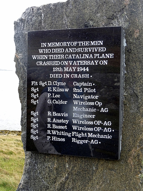
Vatersay

Settlement in Inverness-shire

Scotland

Vatersay

The Vatersey Coastal Walk - direction sign
The Vatersey Coastal Walk - direction sign Credit: John Lucas

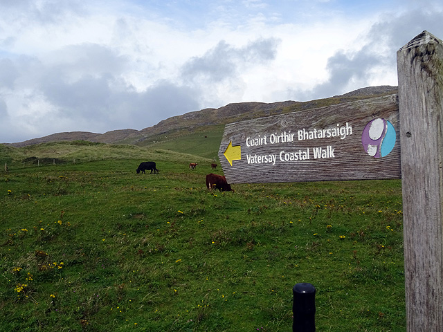
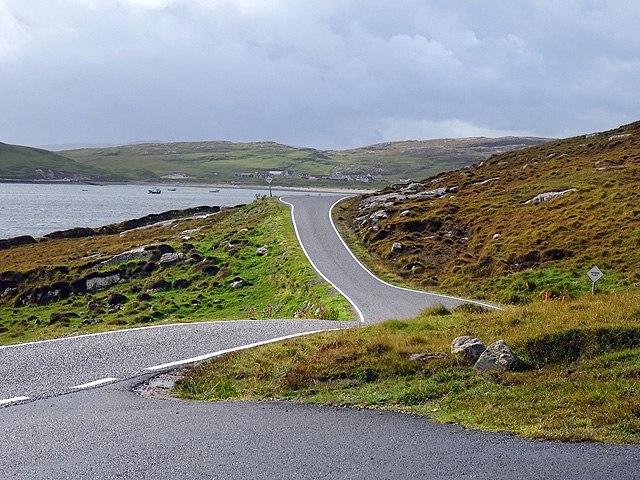
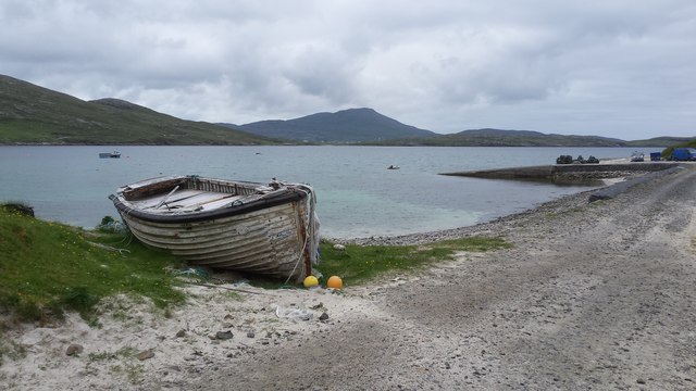
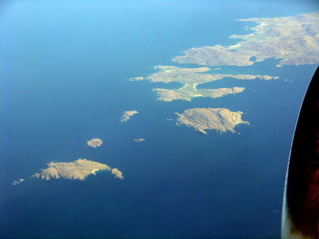
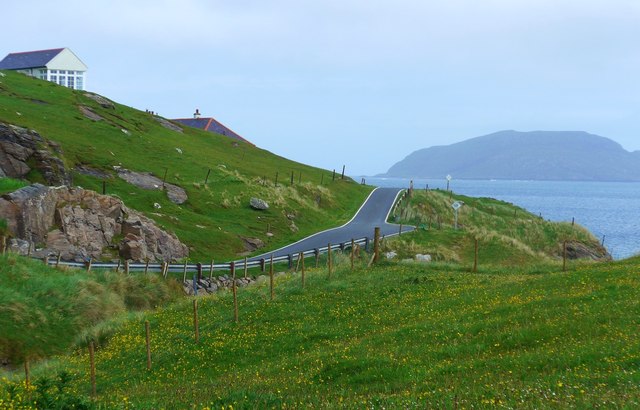
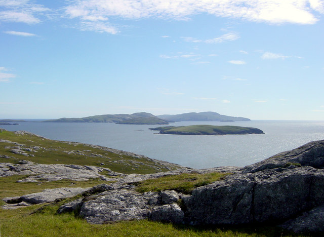
Vatersay is a small island located in the Outer Hebrides, off the west coast of Scotland, specifically in the region of Inverness-shire. It is the southernmost inhabited island in the Outer Hebrides and is connected to the neighboring island of Barra by a causeway. Vatersay covers an area of approximately 3 square miles (8 square kilometers) and has a population of around 80 residents.

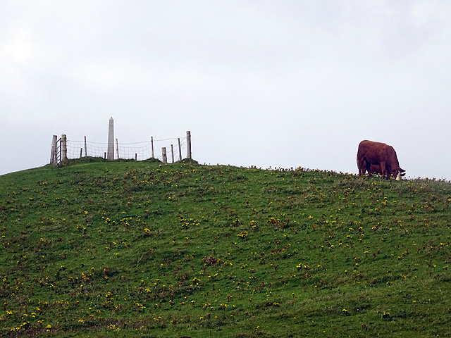
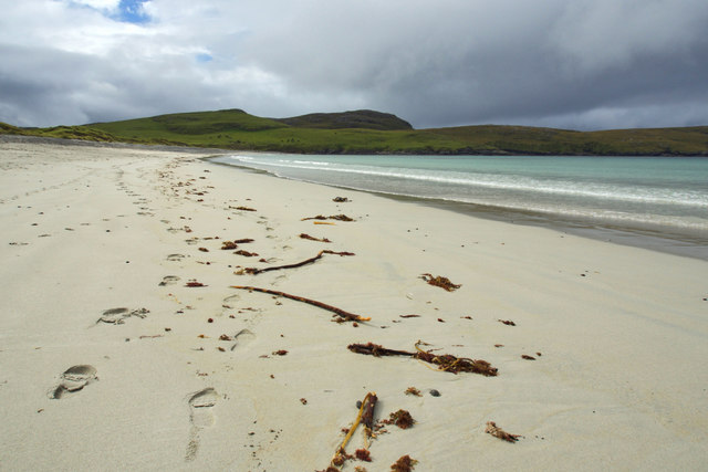
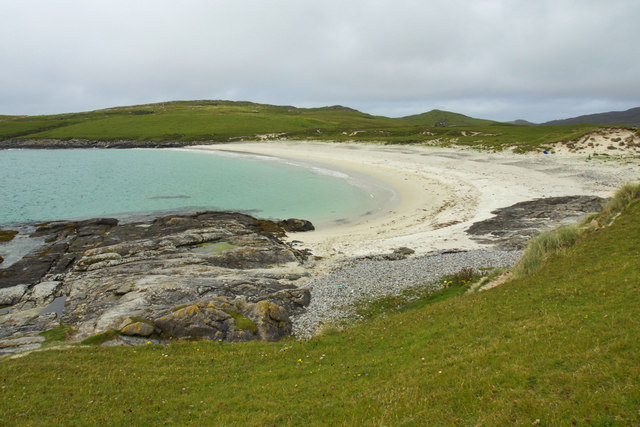
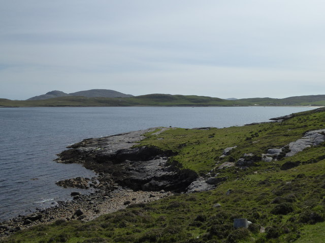
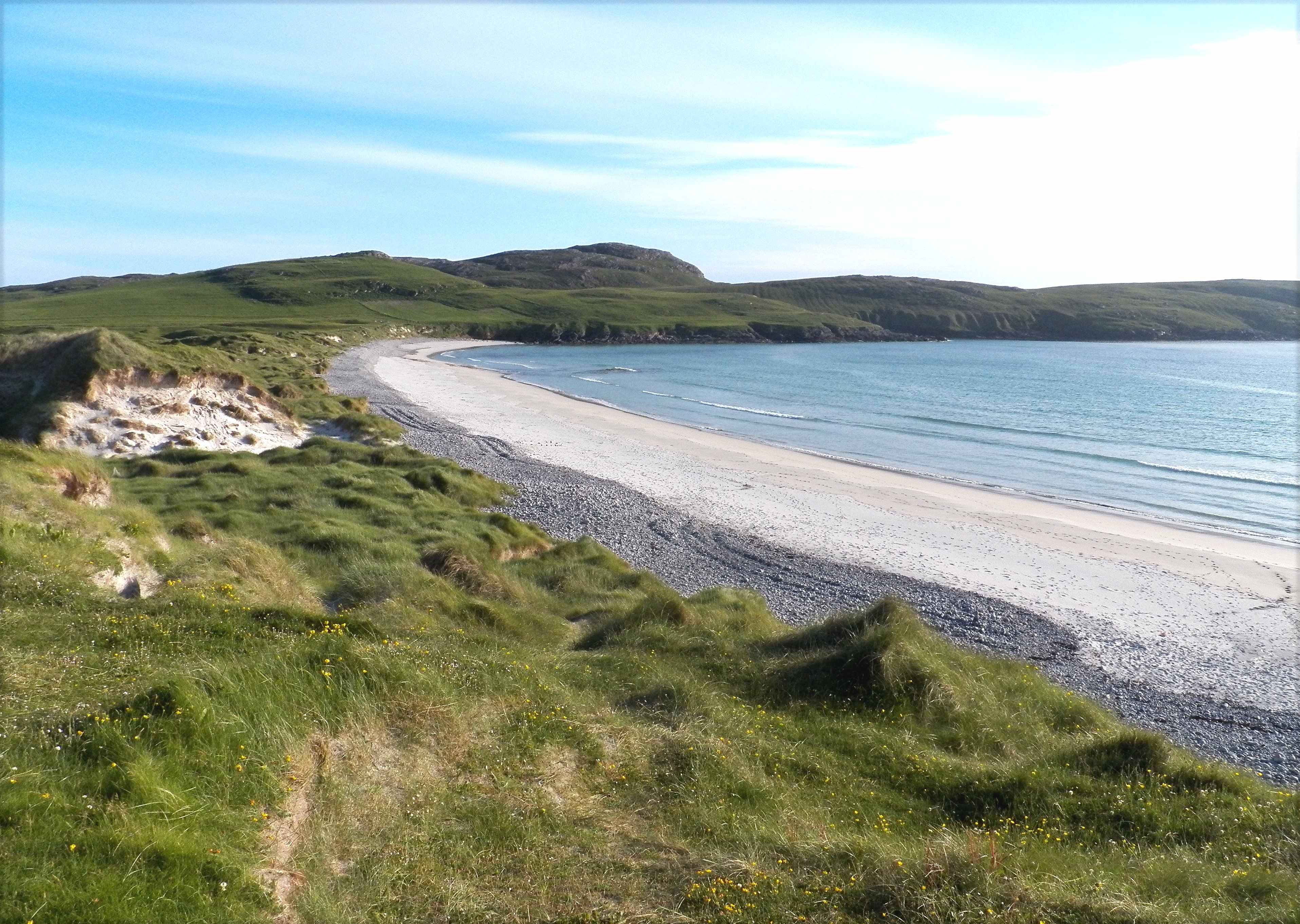
The island is known for its stunning natural beauty, with pristine sandy beaches, rolling hills, and breathtaking sea views. Traigh an Teampaill, the main beach on Vatersay, is particularly popular with visitors due to its white sand and crystal-clear turquoise waters. The island also boasts a diverse range of wildlife, including seals, otters, and various bird species.

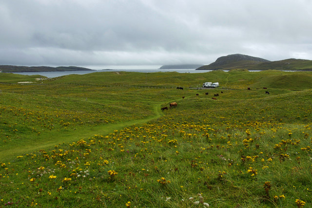
Despite its small size, Vatersay offers a range of amenities and services to both residents and visitors. There is a community shop and café which provides essential groceries and refreshments. The island also has a primary school, though older children typically travel to Barra for secondary education. Additionally, Vatersay has a well-maintained campsite, making it a popular destination for camping and outdoor enthusiasts.

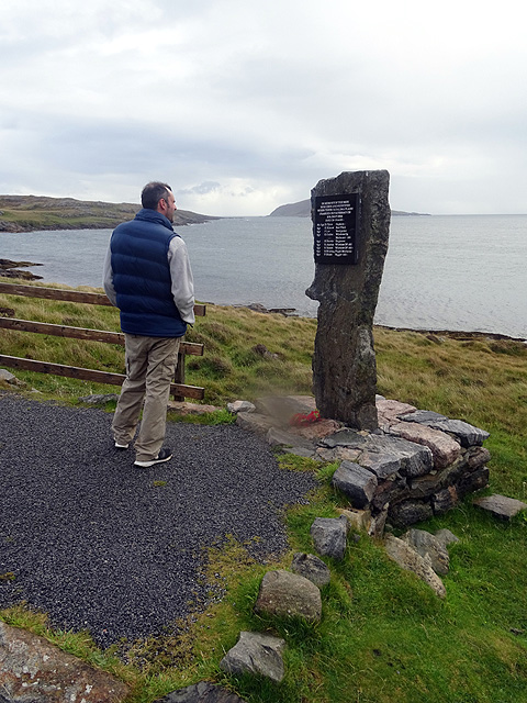
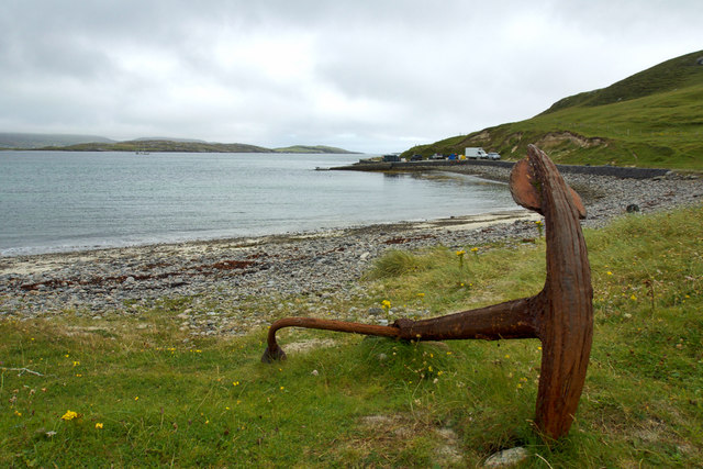
The island has a rich history, with evidence of human settlement dating back thousands of years. Ruins of ancient stone structures, known as "beehive huts," can still be seen on Vatersay, offering a glimpse into its past. Fishing and crofting (small-scale farming) have long been important industries on the island, with a small number of residents continuing these traditional practices today.

Overall, Vatersay is a picturesque island, offering tranquility and natural beauty to those who visit or call it home.

If you have any feedback on the listing, please let us know in the comments section below.

Vatersay Images

Images are sourced within 2km of 56.918832/-7.5372033 or Grid Reference NL6394. Thanks to Geograph Open Source API. All images are credited.

The Vatersey Coastal Walk - direction sign
A view towards the Annie Jane Memorial See <a href="https://www.geograph.org.uk/photo/4602423">NL6395 : The Annie Jane Memorial</a> for a full account of the Annie Jane tragedy.
A view towards the Annie Jane Memorial
See NL6395 : The Annie Jane Memorial for a full account of the Annie Jane tragedy.
Vatersay Road This is the road across the island of Vatersay towards the Vatersay/Bhatarsaigh settlement.
Vatersay Road
This is the road across the island of Vatersay towards the Vatersay/Bhatarsaigh settlement.
The 'Catalina' Monument on Vatersay On the shores of Bàgh Bhatarsaigh. An account of the crash is given here <a href="https://www.geograph.org.uk/photo/1377890">NL6495 : Memorial to the Catalina JX273</a>.
The 'Catalina' Monument on Vatersay
On the shores of Bàgh Bhatarsaigh. An account of the crash is given here NL6495 : Memorial to the Catalina JX273.
Catalina crash memorial plaque See also <a href="https://www.geograph.org.uk/photo/4678220">NL6495 : The 'Catalina' Monument on Vatersay</a> and <a href="https://www.geograph.org.uk/photo/1377890">NL6495 : Memorial to the Catalina JX273</a> for more details of the crash. Three of the nine crew were killed, six survived. It is interesting to note that none of the crew were commissioned officers.
Catalina crash memorial plaque
See also NL6495 : The 'Catalina' Monument on Vatersay and NL6495 : Memorial to the Catalina JX273 for more details of the crash. Three of the nine crew were killed, six survived. It is interesting to note that none of the crew were commissioned officers.
Vatersay shoreline and jetty The island of Vatersay is connected to Barra by a causeway.  The photograph shows part of its extensive coastline.
Vatersay shoreline and jetty
The island of Vatersay is connected to Barra by a causeway. The photograph shows part of its extensive coastline.
The southern Outer Hebrides From lower left:- Pabay, Lingeigh, Flodaigh, Sandray, Vatersay and Barra.
The southern Outer Hebrides
From lower left:- Pabay, Lingeigh, Flodaigh, Sandray, Vatersay and Barra.
There is a new extension to the Vatersay Community Hall Compare with <a href="https://www.geograph.org.uk/photo/2057865">NL6395 : Community Hall, Vatersay</a>.  A fine new cafeteria extension has been added.
There is a new extension to the Vatersay Community Hall
Compare with NL6395 : Community Hall, Vatersay. A fine new cafeteria extension has been added.
The long and winding road on Vatersay In the distance, the hump of the uninhabited island Maol Domhnaich;  in the upper left The School House, as indicated on the OS mapping.
The long and winding road on Vatersay
In the distance, the hump of the uninhabited island Maol Domhnaich; in the upper left The School House, as indicated on the OS mapping.
Tràigh Siar, Bhatarsaigh
Boulders, Traigh Siar
Traigh Siar
Traigh Siar
Bàgh a' Deas
Bàgh a' Deas
Bhatarsaigh jetty
Bhatarsaigh jetty
Path through the dunes, Bhatarsaigh
Rocky headland, Bàgh Bhatarsaigh
Beach on the east coast of Vatersay/Bhatarsaigh
Show me another place!

Vatersay is located at Grid Ref: NL6394 (Lat: 56.918832, Lng: -7.5372033)

Unitary Authority: Na h-Eileanan an Iar

Police Authority: Highlands and Islands

Also known as: Bhatarsaigh

What 3 Words

///body.pipe.crumb. Near CastleBay, Na h-Eileanan Siar

Related Wikis

Vatersay

The island of Vatersay (; Scottish Gaelic: Bhatarsaigh) is the southernmost and westernmost inhabited island in the Outer Hebrides of Scotland, and the...

Caolas

Caolas (Scottish Gaelic: An Caolas [ən̪ˠ ˈkʰɯːl̪ˠəs̪]), is a small settlement on the island of Vatersay, in the Outer Hebrides, Scotland. Caolas is within...

Flodday near Vatersay

Flodday (Scottish Gaelic: Flodaigh) is an uninhabited island, south west of Barra in the Western Islands of Scotland. == Geography and geology == Flodday...

Biruaslum

Biruaslum or Bioruaslam is a stack in the Barra Isles of Scotland, to the west of Vatersay. Approximately 2.5 kilometres (1+1⁄2 miles) from the nearest...

Nearby Amenities

Located within 500m of 56.918832,-7.5372033
Passing Place
Lat/Long: 56.9216202/-7.5377462
Passing Place
Lat/Long: 56.921102/-7.5377788
Passing Place
Lat/Long: 56.920486/-7.5379769
Barrier: cattle_grid
Lat/Long: 56.9194137/-7.5377909
Bus Stop
Vatersay
Naptan AtcoCode: 6010731876
Naptan Bearing: S
Naptan CommonName: Vatersay
Naptan Indicator: Island
Naptan Landmark: Island
Naptan NaptanCode: 94723232
Naptan Street: Island
Naptan Verified: no
Source: naptan_import
Lat/Long: 56.9190285/-7.5374088
Barrier: cattle_grid
Lat/Long: 56.9181703/-7.5386711
Barrier: cattle_grid
Lat/Long: 56.9186657/-7.5375125
Post Office
Vatersay
Ref Pol Id: 16492
Lat/Long: 56.9179733/-7.5387401
Post Box
Operator: Royal Mail
Ref: HS9 17
Lat/Long: 56.9190801/-7.5363262
Barrier: stile
Lat/Long: 56.9211783/-7.534051
Baile Bhatarsaigh
Name En: Vatersay
Name Gd: Baile Bhatarsaigh
Place: village
Lat/Long: 56.9188409/-7.5371087
Generator Method: photovoltaic
Generator Source: solar
Generator Type: solar_photovoltaic_panel
Location: roof
Power: generator
Lat/Long: 56.9182298/-7.5390016
Power: pole
Lat/Long: 56.9189713/-7.5371495
Power: pole
Lat/Long: 56.9194318/-7.5375921
Power: pole
Lat/Long: 56.9198351/-7.5382009
Power: pole
Lat/Long: 56.9202157/-7.5387441
Power: pole
Lat/Long: 56.9208416/-7.5385872
Power: pole
Lat/Long: 56.9213313/-7.5384799
Power: pole
Lat/Long: 56.9219022/-7.5383484
Power: pole
Lat/Long: 56.92252/-7.5381982
Power: pole
Lat/Long: 56.923208/-7.538036
Passing Place
Lat/Long: 56.9200873/-7.5380366
Passing Place
Lat/Long: 56.9227381/-7.5383858
Barrier: cattle_grid
Lat/Long: 56.9196731/-7.5351531
Power: pole
Lat/Long: 56.9187916/-7.5366968
Power: pole
Lat/Long: 56.9184389/-7.5358627
Power: pole
Lat/Long: 56.9179698/-7.534771
Power: pole
Lat/Long: 56.9175168/-7.5337279
Waterway: stream_end
Lat/Long: 56.9171991/-7.5408509
The data included in this document is from www.openstreetmap.org. The data is made available under ODbL.

Have you been to Vatersay?

Leave your review of Vatersay below (or comments, questions and feedback).