Bexleyheath

Settlement in Kent

England

Bexleyheath

River Cray at Hall Place
River Cray at Hall Place Credit: David Martin

Bexleyheath is a town located in the London Borough of Bexley, in the county of Kent, England. Situated approximately 12 miles southeast of central London, it is a suburban area that has developed from a small village to a bustling town.

The town is known for its vibrant shopping scene, with the Broadway Shopping Centre being a major attraction. It is one of the largest covered shopping centers in Southeast London, housing a variety of high street stores, independent boutiques, and eateries. Bexleyheath also boasts a wide range of other amenities, including supermarkets, banks, and a cinema complex.

Aside from its commercial offerings, Bexleyheath is a popular residential area due to its convenient transport links. The town is served by several bus routes and has its own railway station, offering frequent services to London Bridge, Charing Cross, and Victoria stations. Additionally, it is well-connected to major road networks, with the A2 and M25 motorway easily accessible.

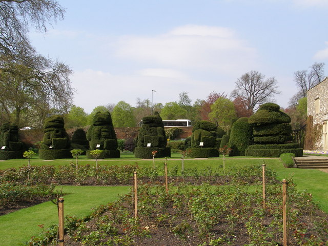
Bexleyheath is home to several green spaces, including Danson Park, which spans over 75 hectares and features a large lake, formal gardens, and sports facilities. The park offers a range of recreational activities, such as boating, fishing, and walking trails.

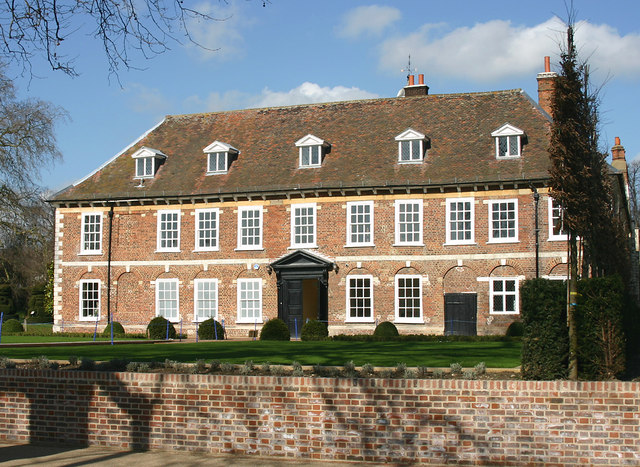
The town also has a rich history, with notable landmarks including the Red House, a beautiful Arts and Crafts building that was once the home of William Morris, a renowned designer and poet. Bexleyheath also hosts various cultural events throughout the year, such as the Bexleyheath Summer Festival and Christmas lights switch-on.

Overall, Bexleyheath offers a mix of modern amenities, transport links, green spaces, and historical attractions, making it an attractive place to live and visit.

If you have any feedback on the listing, please let us know in the comments section below.
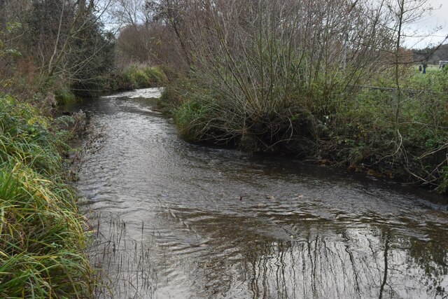
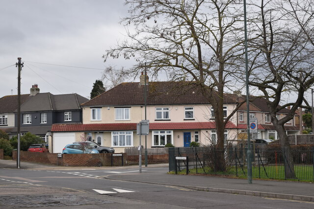
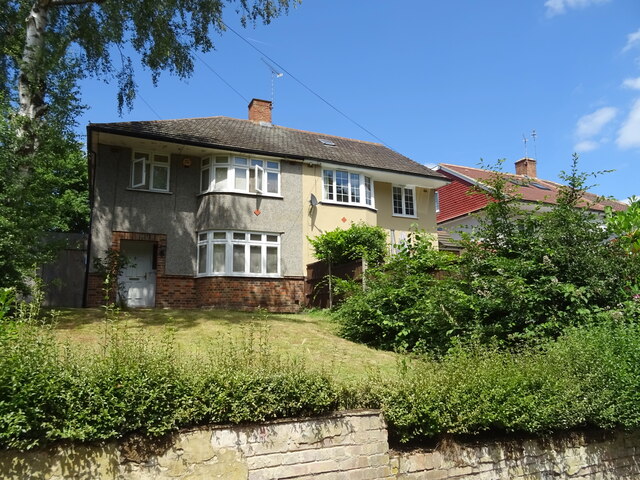
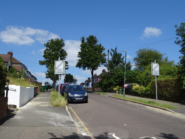
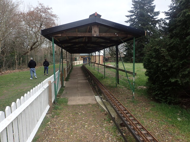
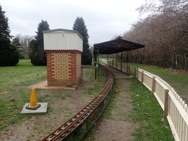
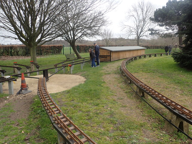
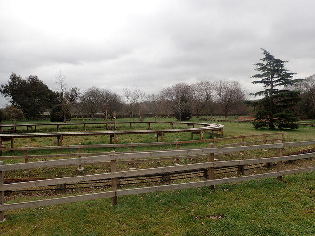
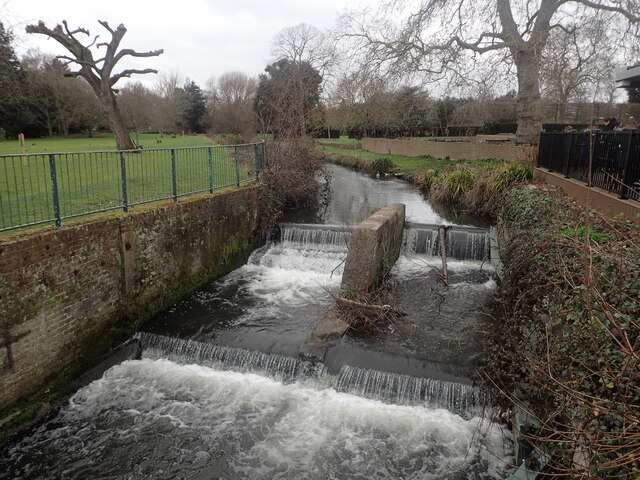
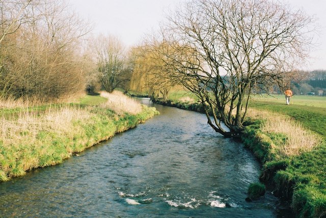
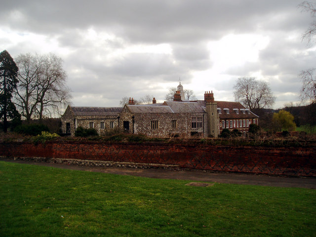
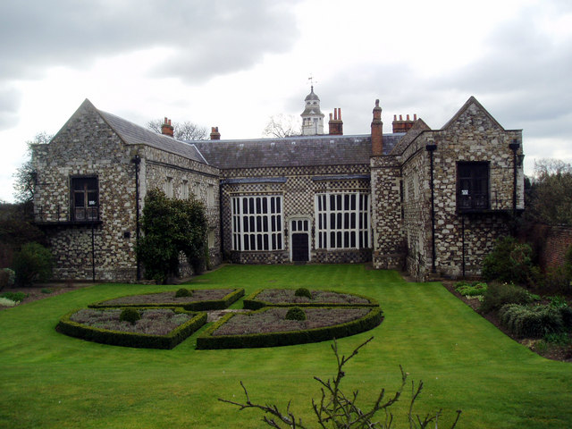
Bexleyheath Images

Images are sourced within 2km of 51.45661/0.14107 or Grid Reference TQ4875. Thanks to Geograph Open Source API. All images are credited.

River Cray at Hall Place
Suburban housing at Barnehurst
Houses on Watling Street, Bexleyheath
Park Grove Bexleyheath Off Watling Street.
Park Grove Bexleyheath
Off Watling Street.
Miniature railway at Hall Place The Welling & District Model Engineering Society moved their layout from their previous location at Falconwood to Hall Place & Gardens in 2022. This is the station.
Miniature railway at Hall Place
The Welling & District Model Engineering Society moved their layout from their previous location at Falconwood to Hall Place & Gardens in 2022. This is the station.
Miniature railway at Hall Place The Welling & District Model Engineering Society moved their layout from their previous location at Falconwood to Hall Place & Gardens in 2022.
Miniature railway at Hall Place
The Welling & District Model Engineering Society moved their layout from their previous location at Falconwood to Hall Place & Gardens in 2022.
Miniature railway at Hall Place The Welling & District Model Engineering Society moved their layout from their previous location at Falconwood to Hall Place & Gardens in 2022. This photograph gives some idea of the size of the layout.
Miniature railway at Hall Place
The Welling & District Model Engineering Society moved their layout from their previous location at Falconwood to Hall Place & Gardens in 2022. This photograph gives some idea of the size of the layout.
River Cray at Hall Place The River Cray is a very clean chalk stream with natural banks for much of its length. It is followed throughout its course in Bexley by the Cray Riverway. This view looks upriver at Hall Place.
River Cray at Hall Place
The River Cray is a very clean chalk stream with natural banks for much of its length. It is followed throughout its course in Bexley by the Cray Riverway. This view looks upriver at Hall Place.
River Cray near Hall Place, Sidcup, Kent Here the River Cray runs through pleasant open fields.  The path alongside forms part of the London Loop.
River Cray near Hall Place, Sidcup, Kent
Here the River Cray runs through pleasant open fields. The path alongside forms part of the London Loop.
Hall Place
Hall Place
Hall Place and Rose Garden Hall Place as seen from the rose garden.
Hall Place and Rose Garden
Hall Place as seen from the rose garden.
Model Vegetable Gardens at Hall Place Model gardens in the nursery area to the east of the house of Hall Place.
Model Vegetable Gardens at Hall Place
Model gardens in the nursery area to the east of the house of Hall Place.
Roadside blossom trees
Hall Place, near Sidcup, Kent
Hall Place, Bexley This is the rear, south side of the house facing the River Cray and dating from the C17.
Hall Place, Bexley
This is the rear, south side of the house facing the River Cray and dating from the C17.
'The Queen's Beasts' Topiary animals The topiary animals on the west side of the house, seen from across the rose garden.
'The Queen's Beasts' Topiary animals
The topiary animals on the west side of the house, seen from across the rose garden.
Show me another place!

Bexleyheath is located at Grid Ref: TQ4875 (Lat: 51.45661, Lng: 0.14107)

Unitary Authority: Bexley

Police Authority: Metropolitan

What 3 Words

///feels.demand.host. Near Bexleyheath, London

Nearby Locations

Bexleyheath Red House

Related Wikis

Central Library (Bexleyheath)

The Central Library is the main library for the London Borough of Bexley, now located on Townley Road in Bexleyheath. It also houses the borough's Local...

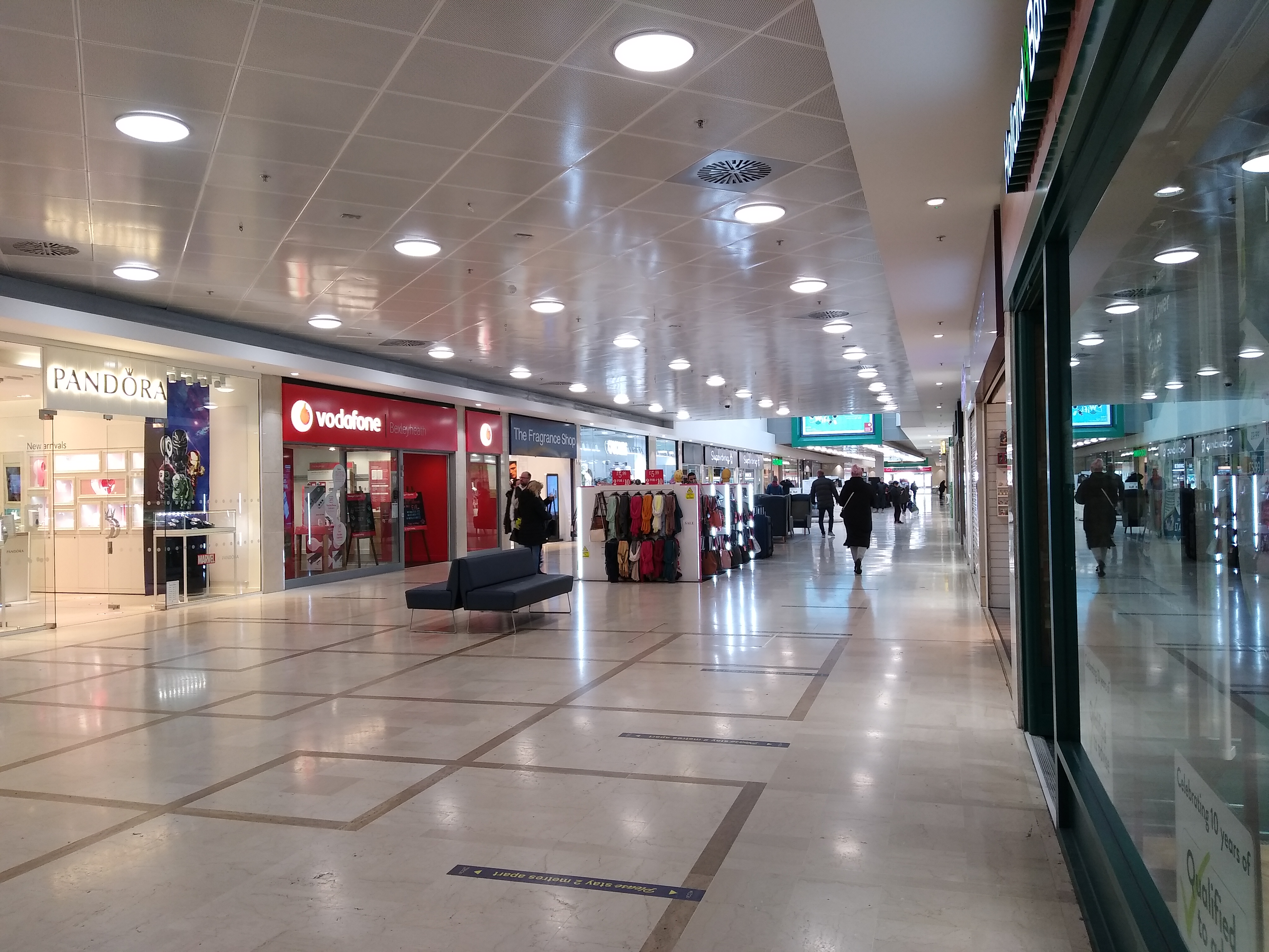
Broadway Shopping Centre, Bexleyheath

Broadway Shopping Centre (branded as The Mall Bexleyheath from c. 2004 until reverting to its original name in 2009) is the principal covered shopping...

Bexleyheath

Bexleyheath is a town in south-east London, England, located in the London Borough of Bexley. It had a population of 31,929 as at 2011. Bexleyheath is...

Bexleyheath Academy

Bexleyheath Academy is a mixed secondary school state school in Bexleyheath, in the London Borough of Bexley. Students typically join the school in year...

Bexley Hospital, Bexleyheath

Bexley Hospital, Bexleyheath was a cottage hospital on Upton Road in Bexleyheath, founded in 1884 and paid for by the Bexley United Charities. It was...

Townley Grammar School

Townley Grammar School is a grammar school with academy status for girls on Townley Road, Bexleyheath, in the London Borough of Bexley, England. It was...

Bexleyheath (UK Parliament constituency)

Bexleyheath was a parliamentary constituency in south-east London, which returned one Member of Parliament (MP) to the House of Commons of the Parliament...

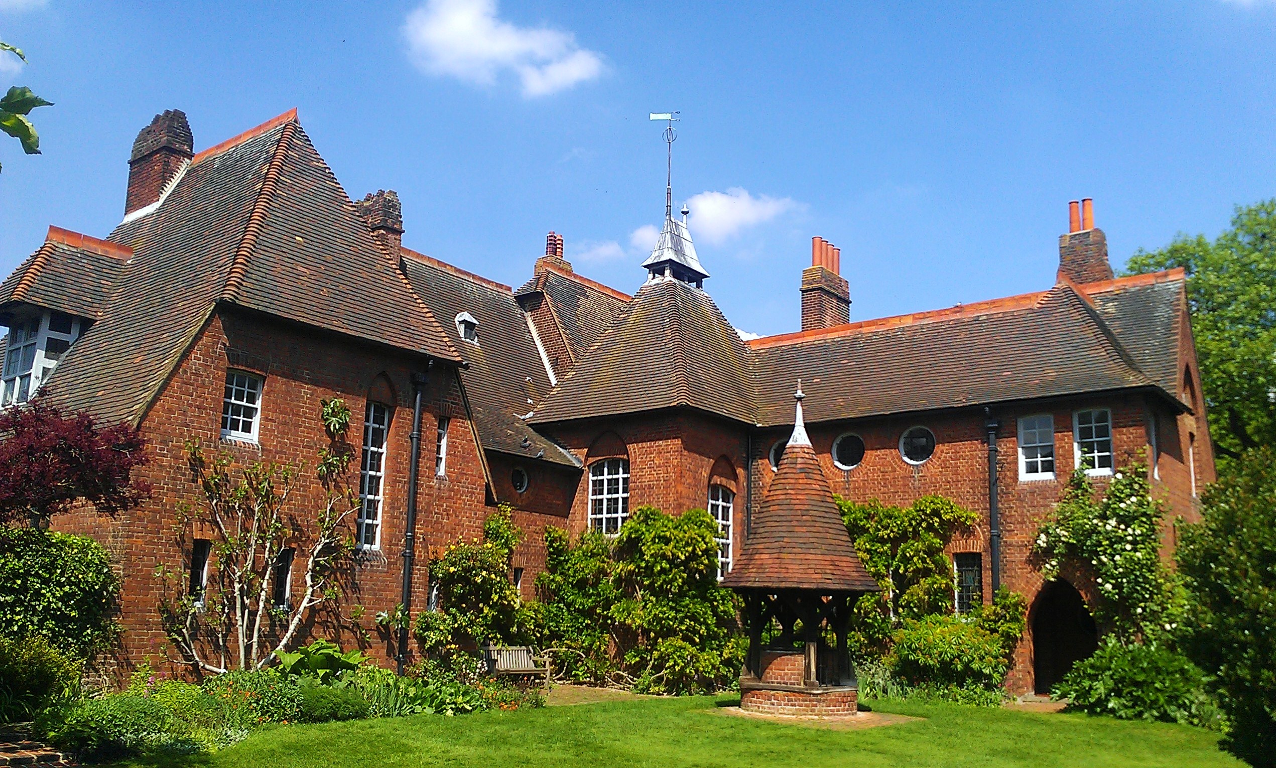
Red House, Bexleyheath

Red House is a significant Arts and Crafts building located in Bexleyheath, south-east London, England. Co-designed in 1859 by the architect Philip Webb...

Nearby Amenities

Located within 500m of 51.45661,0.14107
Crossing
Bicycle: yes
Crossing: uncontrolled
Crossing Island: no
Crossing Ref: tiger
Lat/Long: 51.4549489/0.1476934
Crossing
Bicycle: yes
Crossing: uncontrolled
Crossing Island: no
Crossing Ref: tiger
Lat/Long: 51.4554658/0.1435027
Crossing
Crossing: unmarked
Crossing Island: no
Crossing Markings: no
Lat/Long: 51.4566256/0.1388085
Turning Circle
Turning Circle: circle
Lat/Long: 51.4609809/0.1406233
Turning Circle
Turning Circle: circle
Lat/Long: 51.4600642/0.1406417
Access: foot
Barrier: swing_gate
Bicycle: no
Swing Gate Type: single
Vehicle: delivery
Lat/Long: 51.4564108/0.1442682
Parking
Created By: Potlatch 0.10b
Lat/Long: 51.4559203/0.143033
Parking
Created By: Potlatch 0.10b
Lat/Long: 51.4555031/0.1450328
Turning Circle
Turning Circle: circle
Lat/Long: 51.4578027/0.1449487
Parking
Created By: Potlatch 0.10b
Lat/Long: 51.4573108/0.1438913
Doctors
The Albion Surgery
Healthcare: doctor
Lat/Long: 51.4547222/0.1472902
Post Box
Note: Ref was shown as DA1 343 with a fixme tag due to likelhood of being wrong. Fixme now removed.
Ref: DA6 141
Source: Plate on the box itself
Lat/Long: 51.4539755/0.1361121
Crossing
Bicycle: yes
Crossing: uncontrolled
Crossing Island: no
Crossing Ref: tiger
Lat/Long: 51.4555329/0.1435398
Ref GB Tflcid: RWG183007
Traffic Calming: hump
Lat/Long: 51.4580031/0.1432663
Mini Roundabout
Lat/Long: 51.4575355/0.1433307
Bexleyheath War Memorial
Description: http://www.flickr.com/photos/kenjonbro/3231278078/
Historic: memorial
Memorial: war_memorial
Wikidata: Q27941659
Lat/Long: 51.4563845/0.1386558
Bus Stop
Trinity Place
Bus: yes
Local Ref: B
Naptan AtcoCode: 490003973B
Naptan Bearing: E
Naptan CommonName: Trinity Place
Naptan Indicator: B
Naptan Street: BROADWAY
Naptan Verified: yes
Network: London Buses
Network Wikidata: Q1192411
Network Wikipedia: en:London Buses
Operator: Transport for London
Public Transport: platform
Ref: 52254
Shelter: yes
Source: Survey of 2015-12-01
Wheelchair: yes
Lat/Long: 51.4571231/0.1417191
Bus Stop
Friswell Place
Bus: yes
Naptan AtcoCode: 490003975E
Naptan Bearing: E
Naptan CommonName: Bexleyheath Clock Tower
Naptan Street: FRISWELL PLACE BUS STAND
Note: Alighting point only.
Public Transport: platform
Ref: 49338
Lat/Long: 51.457171/0.1454783
Bus Stop
Bexleyheath Clock Tower
Alt Name: Bexleyheath Clock Tower Stop L
Bench: yes
Bin: yes
Bus: yes
Lit: yes
Local Ref: L
Naptan AtcoCode: 490003975L
Naptan Bearing: N
Naptan CommonName: Bexleyheath Clock Tower
Naptan Indicator: L
Naptan Street: MARKET PLACE
Public Transport: platform
Ref: 77784
Shelter: yes
Tactile Paving: no
Lat/Long: 51.4565231/0.1469579
Bus Stop
Bexleyheath Clock Tower
Alt Name: Bexleyheath Clock Tower Stop M
Bench: yes
Bin: yes
Bus: yes
Lit: yes
Local Ref: M
Naptan AtcoCode: 490003975M
Naptan Bearing: N
Naptan CommonName: Bexleyheath Clock Tower
Naptan Indicator: M
Naptan Street: MARKET PLACE
Public Transport: platform
Ref: 50051
Shelter: yes
Tactile Paving: no
Lat/Long: 51.4564876/0.1464628
Bus Stop
Mayplace Road West / Bexleyheath Clock Tower
Bench: yes
Bin: yes
Bus: yes
Local Ref: P
Naptan AtcoCode: 490003975P
Naptan Bearing: E
Naptan CommonName: Bexleyheath Clock Tower
Naptan Indicator: Stop P
Naptan Street: MAYPLACE ROAD WEST
Public Transport: platform
Ref: 59085
Shelter: yes
Lat/Long: 51.4568758/0.1479683
Bus Stop
Mayplace Road West / Bexleyheath Clock Tower
Bench: yes
Bus: yes
Local Ref: S
Naptan AtcoCode: 490003975S
Naptan Bearing: N
Naptan CommonName: Bexleyheath Clock Tower
Naptan Indicator: Stop S
Naptan Street: MAYPLACE ROAD WEST
Public Transport: platform
Ref: 73724
Shelter: yes
Lat/Long: 51.4569228/0.1479518
Bus Stop
Geddes Place
Bus: yes
Naptan AtcoCode: 490003975W
Naptan Bearing: N
Naptan CommonName: Bexleyheath Clock Tower
Naptan Street: GEDDES PLACE
Note: Alighting point only.
Public Transport: platform
Ref: 47214
Lat/Long: 51.4568894/0.1476166
Bus Stop
Arnsberg Way
Bench: no
Bus: yes
Local Ref: TA
Naptan AtcoCode: 490003975W1
Naptan Bearing: W
Naptan CommonName: Bexleyheath Market Place
Naptan Indicator: Stop TA
Public Transport: platform
Ref: 91506
Shelter: no
Lat/Long: 51.4572196/0.1453716
Bus Stop
Bexleyheath Library
Bus: yes
Local Ref: E
Naptan AtcoCode: 490003976E
Naptan Bearing: N
Naptan CommonName: Townley Road Albion Road
Naptan Indicator: E
Naptan Street: TOWNLEY ROAD
Naptan Verified: no
Public Transport: platform
Ref: 51739
Lat/Long: 51.4559054/0.1439334
Bus Stop
Bexleyheath Library
Bus: yes
Local Ref: F
Naptan AtcoCode: 490003976F
Naptan Bearing: S
Naptan CommonName: Townley Road Albion Road
Naptan Indicator: Stop F
Naptan Verified: no
Public Transport: platform
Ref: 72416
Lat/Long: 51.4558259/0.1439109
Bus Stop
Bexleyheath Library
Bus: yes
Local Ref: Z
Naptan AtcoCode: 490003976Z
Naptan Bearing: N
Naptan CommonName: Townley Road Albion Road
Naptan Indicator: Z
Naptan Street: TOWNLEY ROAD
Naptan Verified: no
Public Transport: platform
Ref: 13976
Lat/Long: 51.4558325/0.1440837
Bus Stop
Market Place
Bus: yes
Local Ref: TB
Naptan AtcoCode: 490007152TB
Naptan Bearing: SE
Naptan CommonName: Bexleyheath Market Place
Naptan Indicator: TB
Note: Bus stand.
Public Transport: platform
Lat/Long: 51.4570956/0.148233
Bus Stop
Geddes Place
Bus: yes
Naptan AtcoCode: 490007152W
Naptan Bearing: N
Naptan CommonName: Geddes Place
Naptan Street: GEDDES PLACE
Note: Alighting point only.
Public Transport: platform
Ref: 76460
Lat/Long: 51.4569881/0.1476219
Bus Stop
Latham Road
Bus: yes
Naptan AtcoCode: 490008989N
Naptan Bearing: N
Naptan CommonName: Latham Road
Naptan Street: TOWNLEY ROAD
Naptan Verified: no
Public Transport: platform
Ref: 51812
Source Ref: naptan
Lat/Long: 51.4532015/0.1428379
Bus Stop
Latham Road
Bus: yes
Naptan AtcoCode: 490008989S
Naptan Bearing: N
Naptan CommonName: Latham Road
Naptan Street: TOWNLEY ROAD
Naptan Verified: no
Public Transport: platform
Ref: 73438
Source Ref: naptan
Lat/Long: 51.4528403/0.1427275
Bus Stop
Lion Road
Bus: yes
Local Ref: BL
Naptan AtcoCode: 490009203E
Naptan Bearing: E
Naptan CommonName: Lion Road
Naptan Indicator: Stop BL
Naptan Street: BROADWAY
Naptan Verified: no
Network: London Buses
Network Wikidata: Q1192411
Network Wikipedia: en:London Buses
Public Transport: platform
Ref: 47188
Lat/Long: 51.4580065/0.1353986
Bus Stop
Pelham Road
Bench: no
Bin: no
Bus: yes
Local Ref: NE
Naptan AtcoCode: 490010890S
Naptan Bearing: S
Naptan CommonName: Pelham Road
Naptan Indicator: Stop NE
Naptan Street: WOOLWICH ROAD
Naptan Verified: no
Public Transport: platform
Ref: 71403
Shelter: no
Source Ref: naptan
Lat/Long: 51.459173/0.1463673
Post Office
Bexleyheath Post Office
Addr Country: GB
Addr Postcode: DA6 7JN
Brand: Post Office
Brand Wikidata: Q1783168
Contact Website: https://www.postoffice.co.uk/branch-finder/1590146/bexleyheath
Operator: WHSmith
Ref Pol Id: 94408
Lat/Long: 51.4563215/0.1454186
Bicycle Parking
Bicycle Parking: stands
Capacity: 8
Covered: no
Lat/Long: 51.457295/0.1391561
Bicycle Parking
Bicycle Parking: stands
Capacity: 16
Covered: no
Lat/Long: 51.4569094/0.142684
Toilets
Check Date: 2022-07-27
Fee: yes
Wheelchair: yes
Lat/Long: 51.4571036/0.1461723
Atm
Brand: Cashzone
Brand Wikidata: Q110738461
Fee: no
Network: Allpoint
Network Wikidata: Q4733264
Note: Free standing booth
Operator: Cash Zone
Lat/Long: 51.4578549/0.13676
Crossing
Crossing: uncontrolled
Lat/Long: 51.4573222/0.1386108
Traffic Signals
Lat/Long: 51.4576543/0.1433012
Traffic Signals
Traffic Signals Direction: forward
Lat/Long: 51.4574495/0.1432
Traffic Signals
Traffic Signals Direction: backward
Lat/Long: 51.4575462/0.1435036
Crossing
Button Operated: yes
Crossing: traffic_signals
Crossing Island: no
Crossing Ref: pelican
Lat/Long: 51.4576204/0.1377132
Trinity Place
Bus: yes
Local Ref: B
Public Transport: stop_position
Source: Survey of 2015-12-01
Lat/Long: 51.4570729/0.1416985
Bus Stop
Trinity Place
Bench: yes
Bus: yes
Local Ref: A
Naptan AtcoCode: 490003973A
Naptan Bearing: W
Naptan CommonName: Trinity Place
Naptan Indicator: A
Naptan Street: BROADWAY
Naptan Verified: no
Network: London Buses
Network Wikidata: Q1192411
Network Wikipedia: en:London Buses
Operator: Transport for London
Public Transport: platform
Ref: 55603
Shelter: yes
Source: Survey of 2015-12-01
Wheelchair: yes
Lat/Long: 51.4572111/0.1400268
Trinity Place
Bus: yes
Local Ref: A
Public Transport: stop_position
Source: Survey of 2015-12-01
Lat/Long: 51.4572659/0.1400218
Crossing
Crossing: uncontrolled
Lat/Long: 51.4573126/0.1387204
Crossing
Crossing: uncontrolled
Lat/Long: 51.4574117/0.1389778
Crossing
Crossing: uncontrolled
Lat/Long: 51.4574665/0.1389957
Crossing
Crossing: uncontrolled
Lat/Long: 51.4574755/0.1384003
Crossing
Crossing: uncontrolled
Lat/Long: 51.457549/0.1384289
Street Lamp
Source: Survey of 2015-12-01
Lat/Long: 51.4565748/0.1444242
Street Lamp
Source: Survey of 2015-12-01
Lat/Long: 51.4565965/0.1442698
Street Lamp
Source: Survey of 2015-12-01
Lat/Long: 51.4566734/0.1444585
Street Lamp
Source: Survey of 2015-12-01
Lat/Long: 51.4566947/0.1443054
Access: foot
Barrier: bollard
Bicycle: no
Bollard: removable
Material: metal
Vehicle: delivery
Lat/Long: 51.4568509/0.1429374
Crossing
Button Operated: yes
Crossing: traffic_signals
Crossing Island: no
Crossing Ref: pelican
Tactile Paving: yes
Traffic Signals Countdown: yes
Traffic Signals Sound: yes
Lat/Long: 51.456951/0.1427176
Leisure: playground
Lat/Long: 51.4581235/0.1415133
Post Box
Operator: Royal Mail
Operator Wikidata: Q638098
Post Box Type: lamp
Ref: DA7 139
Lat/Long: 51.4595086/0.1359966
Doghouse Music
Addr Housenumber: 301-303
Addr Street: Broadway
Phone: +44 20 8304 5331
Shop: music
Source: survey
Website: https://www.doghousemusic.net/
Lat/Long: 51.4580195/0.1342974
tgbaynes
Note: On ground floor between Acorn and Harveys Barbers. On 1st and 2nd floor between Hidden Hearing and Harveys Barbers
Office: lawyer
Source: survey
Lat/Long: 51.4576052/0.1392599
Bench
Backrest: no
Lat/Long: 51.4568717/0.1429559
Historic: memorial
Memorial: war_memorial
Source: survey
Lat/Long: 51.4573117/0.1408211
Addr Housenumber: 115
Addr Street: Broadway
Old Name: Café Thorntons
Lat/Long: 51.456577/0.1441452
Warhammer
Brand: Warhammer
Brand Wikidata: Q587270
Brand Wikipedia: en:Games Workshop
Shop: games
Source: survey
Website: https://www.games-workshop.com/
Lat/Long: 51.4571461/0.1401582
Herbal Court
Healthcare: alternative
Source: survey
Lat/Long: 51.4566485/0.1437076
Friswell Place
Bus: yes
Public Transport: stop_position
Lat/Long: 51.4571196/0.145443
Arnsberg Way
Bus: yes
Local Ref: TA
Public Transport: stop_position
Lat/Long: 51.457278/0.1453869
Market Place
Bus: yes
Local Ref: TB
Public Transport: stop_position
Lat/Long: 51.4570504/0.1481746
Geddes Place
Bus: yes
Public Transport: stop_position
Lat/Long: 51.4570437/0.1475457
Geddes Place
Bus: yes
Public Transport: stop_position
Lat/Long: 51.4569276/0.1475522
Bexleyheath Clock Tower
Bus: yes
Local Ref: M
Public Transport: stop_position
Lat/Long: 51.4565421/0.1465666
Bexleyheath Clock Tower
Bus: yes
Local Ref: L
Public Transport: stop_position
Lat/Long: 51.4565826/0.147148
Mayplace Road West / Bexleyheath Clock Tower
Bus: yes
Local Ref: S
Public Transport: stop_position
Lat/Long: 51.4568711/0.1480091
Mayplace Road West / Bexleyheath Clock Tower
Bus: yes
Local Ref: P
Public Transport: stop_position
Lat/Long: 51.456823/0.1480399
Bus Stop
Lion Road
Bus: yes
Local Ref: BM
Naptan AtcoCode: 490009203C
Network: London Buses
Network Wikidata: Q1192411
Network Wikipedia: en:London Buses
Public Transport: platform
Ref: 77290
Lat/Long: 51.4579432/0.1351041
Pub
Brewers Fayre
Brand: Brewers Fayre
Brand Wikidata: Q4962678
Brand Wikipedia: en:Brewers Fayre
Cuisine: british
Real Ale: yes
Lat/Long: 51.455812/0.1429912
Bicycle Parking
Capacity: 21
Lat/Long: 51.4557903/0.144099
Barrier: bollard
Lat/Long: 51.4566382/0.1427683
Crossing
Crossing: unmarked
Crossing Island: yes
Crossing Markings: no
Lat/Long: 51.4521542/0.1417161
Crossing
Bicycle: yes
Crossing: uncontrolled
Crossing Island: no
Crossing Ref: tiger
Lat/Long: 51.4548788/0.1476651
Drinking Water
Bottle: yes
Operator: London Drinking Fountain Fund
Lat/Long: 51.4565457/0.1462474
Board Type: public_transport
Information: board
Note: Live bus and train information, including buses to nearest train stations
Lat/Long: 51.4564412/0.1463172
Barrier: cycle_barrier
Material: metal
Lat/Long: 51.4553878/0.1342756
Barrier: bollard
Bollard Count: 1
Material: metal
Lat/Long: 51.4556977/0.1359588
Lion Road
Bus: yes
Network: London Buses
Public Transport: stop_position
Lat/Long: 51.4579546/0.1353813
Lion Road
Bus: yes
Network: London Buses
Public Transport: stop_position
Lat/Long: 51.4579893/0.1351126
Barrier: chain
Lat/Long: 51.4582138/0.1372052
Entrance: yes
Lat/Long: 51.4564492/0.1417195
Fire Hydrant
Couplings Type: 2 1/2 Inch BSRT
Emergency: fire_hydrant
Fire Hydrant Diameter: 100
Fire Hydrant Position: sidewalk
Fire Hydrant Type: underground
Operator: TW
Survey Date: 2020-04-19
Water Source: main
Lat/Long: 51.4582838/0.1390564
Fire Hydrant
Couplings: 1
Couplings Type: 2 1/2 Inch BSRT
Description: 3M
Emergency: fire_hydrant
Fire Hydrant Diameter: 100
Fire Hydrant Position: sidewalk
Fire Hydrant Type: underground
Operator: TW
Survey Date: 2020-04-19
Water Source: main
Lat/Long: 51.4578927/0.1388848
Fire Hydrant
Couplings Type: 2 1/2 Inch BSRT
Emergency: fire_hydrant
Fire Hydrant Diameter: 100
Fire Hydrant Position: sidewalk
Fire Hydrant Type: underground
Operator: TW
Survey Date: 2020-04-19
Water Source: main
Lat/Long: 51.4578994/0.1389223
Fire Hydrant
Couplings Type: 2 1/2 Inch BSRT
Emergency: fire_hydrant
Fire Hydrant Diameter: 100
Fire Hydrant Position: sidewalk
Fire Hydrant Type: underground
Operator: TW
Survey Date: 2020-04-19
Water Source: main
Lat/Long: 51.4577457/0.1379353
Crossing
Bicycle: yes
Crossing: uncontrolled
Crossing Island: no
Crossing Ref: parallel
Lat/Long: 51.4558119/0.1422705
Give Way
Direction: backward
Lat/Long: 51.4557903/0.1424803
Fixme: continue
Lat/Long: 51.4554412/0.1453098
Barrier: lift_gate
Lat/Long: 51.4579988/0.1400897
Barrier: lift_gate
Lat/Long: 51.4582288/0.1401014
Crossing
Crossing: unmarked
Crossing Markings: no
Lat/Long: 51.4568232/0.1384061
Crossing
Crossing: unmarked
Crossing Island: no
Crossing Markings: no
Lat/Long: 51.4566689/0.1389041
Crossing
Crossing: unmarked
Crossing Markings: no
Lat/Long: 51.4570078/0.1384516
Give Way
Direction: forward
Lat/Long: 51.4578405/0.1365177
Give Way
Direction: forward
Lat/Long: 51.4578027/0.1361808
Street Lamp
Lat/Long: 51.4577505/0.1360986
Crossing
Crossing: uncontrolled
Crossing Ref: zebra
Kerb: flush
Tactile Paving: yes
Lat/Long: 51.4577636/0.136167
Street Lamp
Lat/Long: 51.4578355/0.136613
Street Lamp
Lat/Long: 51.4577344/0.1366136
Street Lamp
Lat/Long: 51.4576684/0.1370441
Post Box
Brand: Royal Mail
Brand Wikidata: Q638098
Brand Wikipedia: en:Royal Mail
Collection Times: Mo-Fr 18:15; Sa 11:15
Image: hhttps://archive.org/details/bexleyheath-2019-03-28/Bexleyheath-2019-03-28/DSCN9054.JPG
Operator: Royal Mail
Operator Wikidata: Q638098
Post Box Type: pillar
Ref: DA6 134
Royal Cypher: EIIR
Royal Cypher Wikidata: Q33102113
Lat/Long: 51.4577875/0.1369331
Street Lamp
Lat/Long: 51.4575522/0.1377609
Street Lamp
Lat/Long: 51.4575104/0.1380469
Street Lamp
Lat/Long: 51.4579408/0.1345235
Street Lamp
Lat/Long: 51.4579613/0.1349644
Street Lamp
Lat/Long: 51.457857/0.1357684
Crossing
Crossing: uncontrolled
Crossing Island: yes
Crossing Ref: zebra
Kerb: flush
Tactile Paving: yes
Lat/Long: 51.4578902/0.1358586
Give Way
Direction: forward
Lat/Long: 51.4580323/0.1344893
Street Lamp
Lat/Long: 51.4579788/0.1355555
Dor Stocker Tattoos
Shop: tattoo
Lat/Long: 51.4582596/0.1352182
Street Lamp
Lat/Long: 51.4581842/0.1349989
Give Way
Direction: backward
Lat/Long: 51.4580395/0.135005
Street Lamp
Lat/Long: 51.4580743/0.1347589
Street Lamp
Lat/Long: 51.4581073/0.1345131
Street Lamp
Lat/Long: 51.4564657/0.1360363
Street Lamp
Lat/Long: 51.4566213/0.1359042
Street Lamp
Lat/Long: 51.4568524/0.1359002
Noexit: yes
Lat/Long: 51.4570887/0.1364455
Noexit: yes
Lat/Long: 51.4568854/0.1364051
Noexit: yes
Lat/Long: 51.4572297/0.136672
Noexit: yes
Lat/Long: 51.457274/0.1361979
Noexit: yes
Lat/Long: 51.4574106/0.1362066
Information: map
Network: legible_london
Tourism: information
Lat/Long: 51.4576245/0.1381485
Bicycle Parking
Bicycle Parking: stands
Capacity: 4
Lat/Long: 51.4576095/0.1382035
Street Lamp
Lat/Long: 51.4575915/0.1383651
Colour: green
Man Made: street_cabinet
Ref: 10
Lat/Long: 51.4576786/0.1376778
Street Lamp
Lat/Long: 51.4577043/0.1375128
Shard
Level: 1
Office: company
Lat/Long: 51.4578999/0.1374297
FWD Training & Consultancy
Level: 1
Office: company
Lat/Long: 51.4579011/0.1373894
Bus Stop
Bench: no
Bin: yes
Bus: yes
Naptan AtcoCode: 490009203E
Naptan NaptanCode: 47188
Public Transport: platform
Ref: BL
Shelter: yes
Lat/Long: 51.4577221/0.1373891
Surveyline
Level: 1
Office: surveyor
Phone: +44 20 8304 3440
Website: https://www.surveyline.com
Lat/Long: 51.4578994/0.1374076
Street Lamp
Lat/Long: 51.4577852/0.1369482
Street Lamp
Lat/Long: 51.4574315/0.1394353
Advertising: poster_box
Operator: JCDecaux
Operator Wikidata: Q74877
Lat/Long: 51.4574787/0.1391872
Bicycle Parking
Bicycle Parking: stands
Capacity: 4
Lat/Long: 51.4575531/0.1388291
Street Lamp
Lat/Long: 51.4575297/0.138748
Telephone
Booth: KX100
Operator: BT
Operator Wikidata: Q593786
Lat/Long: 51.4570688/0.1421779
Advertising: poster_box
Operator: JCDecaux
Operator Wikidata: Q74877
Lat/Long: 51.4570534/0.1422657
Street Lamp
Lat/Long: 51.4569827/0.1425688
Street Lamp
Lat/Long: 51.4570408/0.1421745
Street Lamp
Lat/Long: 51.457088/0.1418161
Telephone
Note: non-BT phonebox
Lat/Long: 51.4570876/0.1418319
Street Lamp
Lat/Long: 51.4571474/0.1414228
Bench
Backrest: yes
Lat/Long: 51.4572472/0.1410118
Bench
Backrest: yes
Lat/Long: 51.4572184/0.1410802
Street Lamp
Lat/Long: 51.4572033/0.1410238
Entrance: main
Lat/Long: 51.4573425/0.1409373
Information: map
Network: legible_london
Tourism: information
Lat/Long: 51.4572364/0.1407992
Vehicle Inspection
MOT Centre
Phone: +44 20 8303 1441
Lat/Long: 51.4576187/0.1405933
Colour: green
Man Made: street_cabinet
Lat/Long: 51.4573195/0.1401971
Street Lamp
Lat/Long: 51.4580732/0.1399473
Street Lamp
Lat/Long: 51.4575767/0.1397505
Entrance: yes
Lat/Long: 51.4574326/0.1399008
Entrance: shop
Lat/Long: 51.4574198/0.1399903
Street Lamp
Lat/Long: 51.4573132/0.1402373
Bicycle Parking
Bicycle Parking: stands
Capacity: 2
Lat/Long: 51.457355/0.1399526
Bicycle Parking
Bicycle Parking: stands
Capacity: 2
Lat/Long: 51.4573646/0.1398832
Telephone
Booth: KX100
Operator: BT
Operator Wikidata: Q593786
Lat/Long: 51.4573609/0.1399094
Street Lamp
Lat/Long: 51.4573738/0.1398269
Advertising: poster_box
Operator: JCDecaux
Operator Wikidata: Q74877
Lat/Long: 51.457378/0.1398095
Street Lamp
Lat/Long: 51.4568248/0.1435532
Street Lamp
Lat/Long: 51.4568591/0.1433071
Advertising: poster_box
Operator: JCDecaux
Operator Wikidata: Q74877
Lat/Long: 51.4568114/0.1430194
Street Lamp
Lat/Long: 51.4567734/0.1433366
Street Lamp
Lat/Long: 51.4567914/0.1431535
Street Lamp
Ref: 4
Lat/Long: 51.4568952/0.1430489
Bench
Backrest: no
Lat/Long: 51.4568902/0.143056
Telephone
Booth: ST6
Operator: BT
Operator Wikidata: Q593786
Lat/Long: 51.456886/0.1430845
Colour: green
Man Made: street_cabinet
Lat/Long: 51.4569079/0.1430124
Atm
Brand: Nationwide
Brand Wikidata: Q846735
Brand Wikipedia: en:Nationwide Building Society
Operator: Nationwide
Operator Wikidata: Q846735
Lat/Long: 51.4569356/0.1430557
Street Lamp
Lat/Long: 51.4569178/0.142947
Street Lamp
Lat/Long: 51.4570747/0.1427384
Entrance: shop
Lat/Long: 51.4563774/0.1455868
Street Lamp
Lat/Long: 51.4565515/0.1454522
Entrance: shop
Lat/Long: 51.4565658/0.1456504
Entrance: shop
Lat/Long: 51.4565836/0.1455365
Entrance: shop
Lat/Long: 51.4565967/0.1454445
Advertising: poster_box
Operator: JCDecaux
Operator Wikidata: Q74877
Lat/Long: 51.4564308/0.1455447
Entrance: shop
Lat/Long: 51.4563915/0.1454873
Telephone
Booth: KX100
Operator: BT
Operator Wikidata: Q593786
Lat/Long: 51.456445/0.1454176
Telephone
Booth: KX100
Operator: BT
Operator Wikidata: Q593786
Lat/Long: 51.4564471/0.1454039
Entrance: shop
Lat/Long: 51.4564365/0.1451708
Entrance: shop
Lat/Long: 51.4566264/0.1452385
Entrance: shop
Lat/Long: 51.456613/0.1453322
Entrance: main
Lat/Long: 51.4566513/0.1451792
Entrance: main
Lat/Long: 51.4566583/0.1451176
Entrance: shop
Lat/Long: 51.456654/0.1450447
Entrance: shop
Lat/Long: 51.456707/0.1434841
Entrance: shop
Lat/Long: 51.4567247/0.1433646
Entrance: shop
Lat/Long: 51.4567585/0.1431273
Entrance: shop
Lat/Long: 51.4569278/0.1431113
Entrance: shop
Lat/Long: 51.4568993/0.1433152
Entrance: shop
Lat/Long: 51.4568803/0.1434509
Entrance: shop
Lat/Long: 51.4568899/0.1433819
Entrance: shop
Lat/Long: 51.456873/0.1435031
Entrance: shop
Lat/Long: 51.4568562/0.1436233
Entrance: shop
Lat/Long: 51.4568465/0.1436945
Entrance: shop
Lat/Long: 51.4568294/0.1438401
Entrance: shop
Lat/Long: 51.4567623/0.1442862
Entrance: shop
Lat/Long: 51.4565204/0.1445693
Entrance: shop
Lat/Long: 51.456536/0.1444577
Entrance: main
Lat/Long: 51.4563225/0.1443568
Entrance: shop
Lat/Long: 51.4567557/0.1443352
Entrance: shop
Lat/Long: 51.4567295/0.1445245
Entrance: shop
Lat/Long: 51.4567428/0.1444285
Entrance: service
Note: Not sure whether this is a service entrance or entrance to premises above the shops
Lat/Long: 51.4567501/0.1443769
Entrance: shop
Lat/Long: 51.4566165/0.144118
Entrance: shop
Lat/Long: 51.4565974/0.1441966
Entrance: shop
Lat/Long: 51.4566793/0.1437114
Entrance: shop
Lat/Long: 51.4566613/0.1438284
Entrance: shop
Lat/Long: 51.4566512/0.1438934
Entrance: shop
Lat/Long: 51.4566304/0.1440272
Entrance: shop
Lat/Long: 51.4564416/0.1451368
Entrance: shop
Lat/Long: 51.4564736/0.144904
Entrance: shop
Lat/Long: 51.4565125/0.144626
Entrance: main
Lat/Long: 51.4564801/0.1447334
Entrance: shop
Lat/Long: 51.4566644/0.1449721
Entrance: shop
Lat/Long: 51.4566794/0.144867
Entrance: shop
Note: Entrance to Bellegrove Business Insurance
Lat/Long: 51.4566752/0.1448966
Entrance: shop
Lat/Long: 51.4566672/0.1449521
Bellegrove Business Insurance
Note: Entrance between Yorkshire Building Society and Subway. Presumably on 1st or 2nd floor
Office: insurance
Lat/Long: 51.4567559/0.1449251
Atm
Brand: Yorkshire Building Society
Brand Wikidata: Q12073381
Operator: Yorkshire Building Society
Operator Wikidata: Q12073381
Lat/Long: 51.4566861/0.14482
Street Lamp
Lat/Long: 51.4564308/0.1455353
Street Lamp
Lat/Long: 51.4565022/0.1450304
Street Lamp
Lat/Long: 51.4564667/0.1452886
Street Lamp
Lat/Long: 51.4565386/0.1447897
Advertising: poster_box
Operator: JCDecaux
Operator Wikidata: Q74877
Lat/Long: 51.4565089/0.1450029
Atm
Brand: Santander
Brand Wikidata: Q7420065
Brand Wikipedia: en:Santander UK
Operator: Santander
Operator Wikidata: Q7420065
Lat/Long: 51.4566759/0.1437336
Atm
Brand: Santander
Brand Wikidata: Q7420065
Brand Wikipedia: en:Santander UK
Operator: Santander
Operator Wikidata: Q7420065
Lat/Long: 51.456673/0.1437528
Street Lamp
Lat/Long: 51.4566531/0.1441278
Ryman
Brand: Ryman
Brand Wikidata: Q7385188
Brand Wikipedia: en:Ryman
Note: Included in Robert Dyas store
Shop: stationery
Lat/Long: 51.4568532/0.1445952
Information: map
Network: legible_london
Tourism: information
Lat/Long: 51.4566913/0.1443759
Atm
Brand: NatWest
Brand Wikidata: Q2740021
Brand Wikipedia: en:NatWest
Operator: NatWest
Operator Wikidata: Q2740021
Lat/Long: 51.4563018/0.1443499
Telephone
Booth: KX100
Operator: BT
Operator Wikidata: Q593786
Lat/Long: 51.4564684/0.1443582
Telephone
Colour: red
Note: non-BT phonebox
Lat/Long: 51.4564573/0.1443531
Street Lamp
Ref: 20
Lat/Long: 51.4564962/0.1443692
Advertising: poster_box
Operator: JCDecaux
Operator Wikidata: Q74877
Lat/Long: 51.456488/0.1443655
Advertising: poster_box
Operator: JCDecaux
Operator Wikidata: Q74877
Lat/Long: 51.4565699/0.1445784
Entrance: yes
Note: Entrance to no. 124 - Nordic Forest (UK) Ltd
Lat/Long: 51.4567863/0.1441182
Entrance: shop
Lat/Long: 51.4567959/0.1440511
Entrance: shop
Lat/Long: 51.4568084/0.1439752
Entrance: shop
Lat/Long: 51.4567817/0.1441489
Nordic Forest (UK) Ltd
Addr Housenumber: 124
Addr Street: Broadway
Level: 1
Note: Appears to be above Robinson-Jackson
Office: company
Lat/Long: 51.4568323/0.1440936
Atm
Brand: Lloyds Bank
Brand Wikidata: Q1152847
Brand Wikipedia: en:Lloyds Bank
Operator: Lloyds Bank
Operator Wikidata: Q1152847
Lat/Long: 51.4568402/0.1437661
Entrance: shop
Lat/Long: 51.4567547/0.1431537
Street Lamp
Lat/Long: 51.4567308/0.147378
Bench
Backrest: yes
Lat/Long: 51.4568261/0.1481532
Entrance: shop
Lat/Long: 51.4567768/0.1476054
Street Lamp
Lat/Long: 51.456361/0.1472385
Street Lamp
Lat/Long: 51.4563242/0.1466598
Advertising: poster_box
Operator: JCDecaux
Operator Wikidata: Q74877
Lat/Long: 51.4563393/0.1468121
Entrance: shop
Lat/Long: 51.4566151/0.1466976
Entrance: yes
Note: Entrance to Redeemed Christian Church of God
Lat/Long: 51.4566102/0.1466176
The Bexleyheath Coronation Memorial Clock Tower
Board Type: history
Image: https://archive.org/details/bexleyheath-2019-03-28/Bexleyheath-2019-03-28/DSCN9201.JPG
Information: board
Tourism: information
Lat/Long: 51.4564295/0.1466102
Clock
Display: analog
Lat/Long: 51.4564471/0.1466089
Colour: green
Erected By: Bexley Historical Society
Historic: memorial
Image: https://archive.org/details/bexleyheath-2019-03-28/Bexleyheath-2019-03-28/DSCN9199.JPG
Inscription: To mark the centenary of the Bexleyheath Coronation Memorial Clock Tower 1912-2012
Memorial: plaque
Openplaques Id: 53782
Lat/Long: 51.4564473/0.1465918
Location: indoor
Note: Inside the clock tower
Operator: UK Power Networks
Operator Wikidata: Q7864927
Power: substation
Ref: 73003
Substation: minor_distribution
Lat/Long: 51.4564655/0.1466106
Street Lamp
Lat/Long: 51.4564893/0.1464493
Street Lamp
Lat/Long: 51.4566088/0.1469703
Street Lamp
Ref: 40
Lat/Long: 51.4565896/0.1467074
Street Lamp
Lat/Long: 51.4565879/0.1464513
Place Of Worship
The Redeemed Christian Church of God
Note: Appears to be above Barclays
Religion: christian
Lat/Long: 51.4566631/0.1466122
Entrance: shop
Lat/Long: 51.4565812/0.1459557
Entrance: shop
Lat/Long: 51.4565694/0.145886
Entrance: shop
Lat/Long: 51.456592/0.1460202
Atm
Brand: Barclays
Brand Wikidata: Q245343
Brand Wikipedia: en:Barclays
Cash In: no
Operator: Barclays
Operator Wikidata: Q245343
Lat/Long: 51.4566107/0.1465539
Atm
Brand: Barclays
Brand Wikidata: Q245343
Brand Wikipedia: en:Barclays
Cash In: no
Operator: Barclays
Operator Wikidata: Q245343
Lat/Long: 51.4566106/0.1465697
Entrance: shop
Lat/Long: 51.4566208/0.1463975
Entrance: shop
Lat/Long: 51.4562864/0.1464931
Clock
Display: analog
Lat/Long: 51.4564655/0.1465836
Carphone Warehouse
Brand: Carphone Warehouse
Brand Wikidata: Q118046
Brand Wikipedia: en:Carphone Warehouse
Shop: mobile_phone
Lat/Long: 51.4558822/0.1459095
Peacocks
Brand: Peacocks
Brand Wikidata: Q7157762
Brand Wikipedia: en:Peacocks (clothing)
Shop: clothes
Lat/Long: 51.4560443/0.1461603
Street Lamp
Lat/Long: 51.456567/0.146049
Bench
Backrest: no
Lat/Long: 51.456525/0.1462511
Entrance: shop
Lat/Long: 51.4563146/0.146041
Post Box
Brand: Royal Mail
Brand Wikidata: Q638098
Brand Wikipedia: en:Royal Mail
Collection Times: Mo-Fr 18:00; Sa 12:15
Image: https://archive.org/details/bexleyheath-2019-03-28/Bexleyheath-2019-03-28/DSCN9187.JPG
Operator: Royal Mail
Operator Wikidata: Q638098
Post Box Apertures: 1
Post Box Manufacturer: Machan Eng Scotland
Post Box Type: pillar
Ref: DA6 406
Royal Cypher: EIIR
Royal Cypher Wikidata: Q33102113
Lat/Long: 51.456477/0.1463185
Post Box
Brand: Royal Mail
Brand Wikidata: Q638098
Brand Wikipedia: en:Royal Mail
Collection Times: Mo-Fr 18:00
Fixme: May have changed more recently, as many meter boxes are now also used as parcel postboxes
Image: https://archive.org/details/bexleyheath-2019-03-28/Bexleyheath-2019-03-28/DSCN9184.JPG
Opening Hours: Mo-Fr 13:00-18:00
Operator: Royal Mail
Operator Wikidata: Q638098
Post Box Type: meter
Ref: DA6 4061
Lat/Long: 51.4564853/0.1463175
Street Lamp
Ref: 36
Lat/Long: 51.4564705/0.1462314
Street Lamp
Lat/Long: 51.4564684/0.1459014
Street Lamp
Lat/Long: 51.456521/0.1456828
Advertising: poster_box
Operator: JCDecaux
Operator Wikidata: Q74877
Lat/Long: 51.4565102/0.1457553
Entrance: shop
Lat/Long: 51.4565599/0.1458083
Entrance: shop
Lat/Long: 51.4565619/0.1457225
Advertising: poster_box
Operator: JCDecaux
Operator Wikidata: Q74877
Lat/Long: 51.4573345/0.1391383
Street Lamp
Lat/Long: 51.4572744/0.1397853
Entrance: shop
Lat/Long: 51.4572429/0.1395186
Entrance: shop
Lat/Long: 51.4572009/0.1398219
Entrance: shop
Lat/Long: 51.4572164/0.1397074
Street Lamp
Lat/Long: 51.4572146/0.1401991
Entrance: shop
Lat/Long: 51.4571875/0.1399137
Entrance: yes
Lat/Long: 51.4571825/0.1399487
Entrance: shop
Lat/Long: 51.4571708/0.1400851
Entrance: shop
Lat/Long: 51.4571666/0.1401651
Entrance: shop
Lat/Long: 51.4571574/0.140237
Entrance: shop
Lat/Long: 51.4571501/0.1402942
Taxi
Bexley Borough Cars
Level: 1
Note: Signed above William Hill
Office: yes
Opening Hours: 24/7
Phone: +44 20 8301 3000;+44 20 8304 0044
Lat/Long: 51.4570567/0.1406168
Dentist
Bexleyheath Dental Centre
Healthcare: dentist
Note: A sign indicating the entrance is between William Hill and The Rose. Presumably located on 1st/2nd floor or at the back behind either of these.
Lat/Long: 51.4570872/0.1405695
Street Lamp
Ref: 12
Lat/Long: 51.4571586/0.1405826
Entrance: shop
Lat/Long: 51.4569948/0.1412678
Entrance: service
Lat/Long: 51.4570089/0.1411527
Entrance: shop
Lat/Long: 51.4571025/0.1404823
Entrance: shop
Lat/Long: 51.4570656/0.1407522
Entrance: shop
Lat/Long: 51.4570565/0.1408198
Street Lamp
Lat/Long: 51.4570383/0.1414007
Pollards
Note: Not sure what this is, signed above passageway
Lat/Long: 51.4569234/0.1416283
The Broadway Clinic
Lat/Long: 51.4569167/0.1416247
Entrance: shop
Lat/Long: 51.4569728/0.1414605
Entrance: shop
Lat/Long: 51.4569587/0.141576
Entrance: shop
Lat/Long: 51.4569409/0.1417098
Entrance: shop
Lat/Long: 51.456931/0.1417874
Entrance: yes
Note: Entrance probably for (residential?) premises on 1st floor
Lat/Long: 51.4569288/0.1418043
Entrance: shop
Lat/Long: 51.4569064/0.1419703
Entrance: shop
Lat/Long: 51.4568926/0.1420775
Entrance: shop
Lat/Long: 51.4568964/0.1420478
Street Lamp
Lat/Long: 51.4569309/0.1421356
Entrance: yes
Lat/Long: 51.456883/0.1421483
Entrance: shop
Lat/Long: 51.456876/0.1422062
Entrance: shop
Lat/Long: 51.4568631/0.1423125
Street Lamp
Lat/Long: 51.4568812/0.1425212
Unique Personnel (UK) Ltd
Addr Housenumber: 137
Addr Street: Broadway
Level: 1
Office: employment_agency
Website: https://www.unique-personnel.com
Lat/Long: 51.4568029/0.1423978
A.S.P Removals & Storage
Office: company
Lat/Long: 51.4568123/0.1423991
Mobile Phone
Note: Included within 'Gud Look' store, but is signed on the front as a separate store 'Mobile Phone'
Shop: mobile_phone
Lat/Long: 51.4568265/0.1424401
Entrance: shop
Lat/Long: 51.456856/0.1423706
Entrance: shop
Lat/Long: 51.4568508/0.1424134
Entrance: shop
Lat/Long: 51.4568183/0.1426814
Entrance: shop
Lat/Long: 51.4568291/0.1425921
Atm
Brand: Halifax
Brand Wikidata: Q3310164
Brand Wikipedia: en:Halifax (bank)
Operator: Halifax
Operator Wikidata: Q3310164
Lat/Long: 51.4566966/0.1435561
Atm
Brand: Halifax
Brand Wikidata: Q3310164
Brand Wikipedia: en:Halifax (bank)
Operator: Halifax
Operator Wikidata: Q3310164
Lat/Long: 51.4566939/0.1435749
Post Box
Brand: Royal Mail
Brand Wikidata: Q638098
Brand Wikipedia: en:Royal Mail
Operator: Royal Mail
Operator Wikidata: Q638098
Post Box Type: pillar
Lat/Long: 51.4561642/0.144042
Recycling
Note: 3 glass recycling containers
Recycling Glass: yes
Recycling Type: container
Lat/Long: 51.4562469/0.1440534
The Gym
Brand: The Gym
Brand Wikidata: Q48815022
Brand Wikipedia: en:The Gym Group
Contact Website: https://www.thegymgroup.com/find-a-gym/south-london-gyms/bexleyheath/
Leisure: fitness_centre
Operator: The Gym Group
Lat/Long: 51.4559666/0.144437
Street Lamp
Source: Survey of 2015-12-01
Lat/Long: 51.45643/0.1443391
Morleys
Shop: department_store
Website: https://www.morleysbexleyheath.co.uk/
Lat/Long: 51.4557928/0.1443873
Street Lamp
Lat/Long: 51.457462/0.1383262
Street Lamp
Lat/Long: 51.4571453/0.1387299
Street Lamp
Lat/Long: 51.4572727/0.138754
Advertising: column
Lat/Long: 51.4572094/0.1387631
Entrance: shop
Lat/Long: 51.4573285/0.1388949
Atm
Brand: HSBC UK
Brand Wikidata: Q64767453
Operator: HSBC UK
Operator Wikidata: Q64767453
Lat/Long: 51.457323/0.1388779
Street Lamp
Lat/Long: 51.4573772/0.1390444
1st Bed Guest House
Addr City: Bexleyheath
Addr Country: GB
Addr County: Kent
Addr Housenumber: 17,19
Addr Postcode: DA6 8NP
Addr Street: Heathfield Road
Fhrs Id: 1394176
Tourism: guest_house
Lat/Long: 51.4557535/0.1377717
Give Way
Direction: forward
Lat/Long: 51.4576391/0.1379665
Charging Station
Capacity: 1
Note: There are 2 cables on the unit but only one parking space. 2 different connector standards?
Operator: Instavolt
Lat/Long: 51.4554333/0.1480297
Crossing
Crossing: unmarked
Crossing Markings: no
Lat/Long: 51.4527217/0.1406979
Crossing
Crossing: unmarked
Crossing Markings: no
Lat/Long: 51.4527759/0.1408498
Crossing
Crossing: unmarked
Crossing Markings: no
Lat/Long: 51.4542158/0.1399964
Crossing
Crossing: unmarked
Crossing Markings: no
Lat/Long: 51.4542488/0.1398907
Crossing
Crossing: unmarked
Crossing Markings: no
Lat/Long: 51.4543211/0.1399998
Barrier: bollard
Lat/Long: 51.455563/0.142592
Crossing
Bicycle: yes
Crossing: uncontrolled
Crossing Island: no
Crossing Ref: parallel
Lat/Long: 51.4557521/0.1422244
Crossing
Bicycle: yes
Crossing: unmarked
Crossing Markings: no
Lat/Long: 51.4558541/0.1425207
Crossing
Bicycle: yes
Crossing: uncontrolled
Crossing Island: no
Crossing Ref: tiger
Lat/Long: 51.455396/0.1441896
Crossing
Bicycle: yes
Crossing: uncontrolled
Crossing Island: no
Crossing Ref: tiger
Lat/Long: 51.4554659/0.1442111
Crossing
Bicycle: yes
Crossing: unmarked
Lat/Long: 51.4553049/0.1437743
Crossing
Bicycle: yes
Crossing: unmarked
Lat/Long: 51.4552884/0.1438626
Crossing
Bicycle: yes
Crossing: unmarked
Lat/Long: 51.4554096/0.1448891
Crossing
Bicycle: yes
Crossing: unmarked
Lat/Long: 51.4550229/0.1475072
Crossing
Bicycle: yes
Crossing: unmarked
Crossing Markings: no
Lat/Long: 51.4556197/0.1439369
Barrier: bollard
Bollard: foldable
Bollard Count: 1
Height: 2.0
Locked: yes
Material: metal
Lat/Long: 51.4593643/0.1403526
Bench
Backrest: yes
Direction: W
Material: wood
Lat/Long: 51.4601518/0.1406782
Bench
Backrest: yes
Direction: S
Material: wood
Lat/Long: 51.4591763/0.1396358
Crossing
Lat/Long: 51.4559826/0.1481414
Crossing
Lat/Long: 51.4559773/0.1481488
Entrance: yes
Level: -1;0
Lat/Long: 51.456005/0.1481015
Water Point
Lat/Long: 51.4591742/0.1409414
Bench
Backrest: yes
Direction: W
Material: wood
Lat/Long: 51.4591023/0.1409186
Bench
Backrest: yes
Direction: W
Material: wood
Lat/Long: 51.4592385/0.1409373
Bench
Backrest: yes
Direction: E
Material: wood
Lat/Long: 51.4586991/0.1392368
Barrier: bollard
Bollard Count: 1
Height: 1.1
Material: metal
Lat/Long: 51.4585863/0.1402404
Bench
Backrest: yes
Direction: S
Material: wood
Lat/Long: 51.4585587/0.1403399
Bench
Backrest: yes
Direction: S
Material: wood
Lat/Long: 51.4585274/0.1405699
Water Point
Lat/Long: 51.4609538/0.1405994
Bench
Backrest: yes
Direction: E
Material: wood
Lat/Long: 51.4591725/0.1403191
Bench
Backrest: yes
Direction: SE
Material: wood
Lat/Long: 51.4588291/0.140238
Entrance: exit
Lat/Long: 51.4550695/0.1474687
Crossing
Crossing: uncontrolled
Crossing Island: no
Crossing Ref: zebra
Traffic Calming: table
Lat/Long: 51.4557359/0.1422851
Crossing
Crossing: uncontrolled
Crossing Island: no
Crossing Ref: zebra
Traffic Calming: table
Lat/Long: 51.4557945/0.1423289
Crossing
Lat/Long: 51.4571851/0.147687
Ref GB Tflcid: RWG182654
Traffic Calming: hump
Lat/Long: 51.4594553/0.1381832
Ref GB Tflcid: RWG182643
Traffic Calming: hump
Lat/Long: 51.458242/0.1380825
Ref GB Tflcid: RWG183008
Traffic Calming: hump
Lat/Long: 51.4584291/0.1433996
Ref GB Tflcid: RWG182659
Traffic Calming: hump
Lat/Long: 51.4600238/0.1380884
Bicycle Parking
Bicycle Parking: stands
Capacity: 4
Ref GB Tflcid: RWG171787
Lat/Long: 51.4576723/0.1370278
Bicycle Parking
Bicycle Parking: stands
Capacity: 2
Ref GB Tflcid: RWG171790
Lat/Long: 51.4576256/0.1362734
Bicycle Parking
Bicycle Parking: stands
Capacity: 2
Ref GB Tflcid: RWG171789
Lat/Long: 51.4576547/0.136321
Bicycle Parking
Bicycle Parking: stands
Capacity: 2
Ref GB Tflcid: RWG171791
Lat/Long: 51.4576874/0.1361736
Bicycle Parking
Bicycle Parking: stands
Capacity: 2
Ref GB Tflcid: RWG171781
Lat/Long: 51.4571619/0.1406171
Bicycle Parking
Bicycle Parking: stands
Capacity: 4
Ref GB Tflcid: RWG171779
Lat/Long: 51.4570355/0.1421516
Bicycle Parking
Bicycle Parking: stands
Capacity: 4
Ref GB Tflcid: RWG171780
Lat/Long: 51.4571555/0.1415224
Bicycle Parking
Bicycle Parking: stands
Capacity: 6
Ref GB Tflcid: RWG244279
Lat/Long: 51.4555086/0.1478759
Bicycle Parking
Bicycle Parking: stands
Capacity: 4
Ref GB Tflcid: RWG171774
Lat/Long: 51.4561664/0.1479181
Bicycle Parking
Bicycle Parking: stands
Capacity: 2
Ref GB Tflcid: RWG171788
Lat/Long: 51.4577421/0.1365712
The data included in this document is from www.openstreetmap.org. The data is made available under ODbL.

Have you been to Bexleyheath?

Leave your review of Bexleyheath below (or comments, questions and feedback).