North Grimston

Settlement in Yorkshire Ryedale

England

North Grimston

Shower clouds approaching over Duggleby Wold
Shower clouds approaching over Duggleby Wold Credit: Colin Park

North Grimston is a small village located in the Ryedale district of North Yorkshire, England. Situated approximately 6 miles east of Malton, it is nestled in the picturesque countryside of the Howardian Hills Area of Outstanding Natural Beauty.

The village itself is home to a population of around 300 residents, creating a close-knit and welcoming community. It exudes a peaceful and idyllic charm, with its quaint cottages and well-maintained gardens adding to its visual appeal.

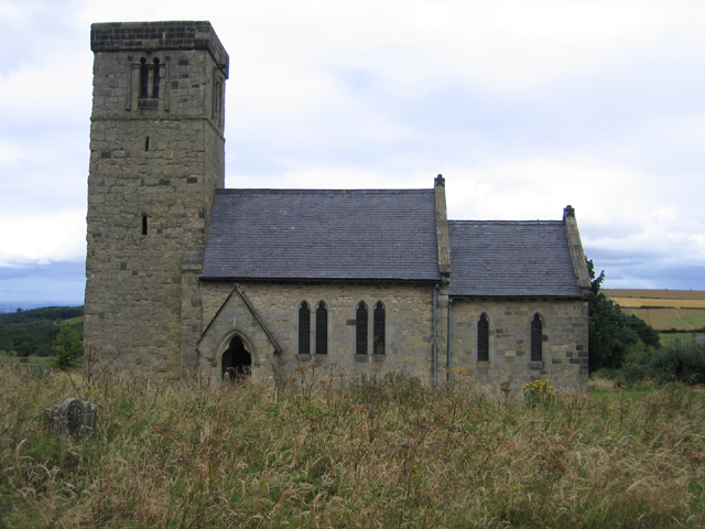
North Grimston boasts a rich historical heritage, dating back to the Roman period. Archaeological evidence suggests the presence of a Roman villa and a Roman road passing through the area. The village is also known for its centuries-old St. Nicholas Church, a Grade II listed building, which stands as a testament to its long-standing religious traditions.

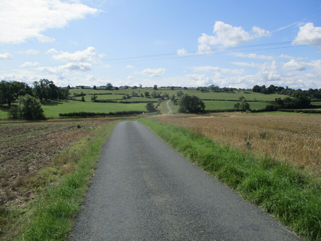
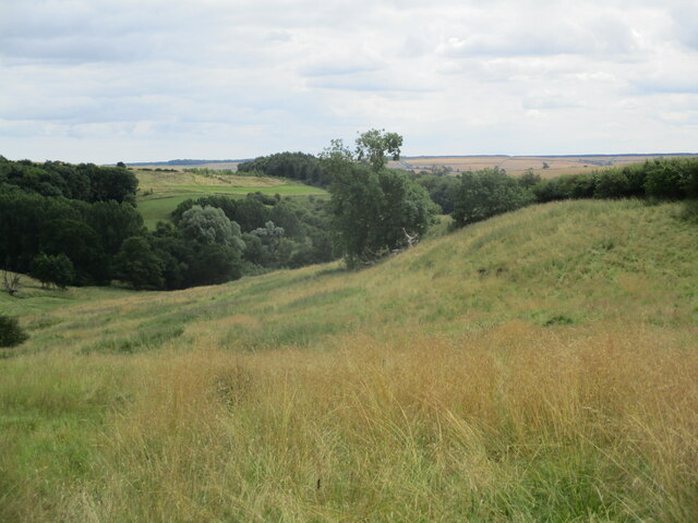
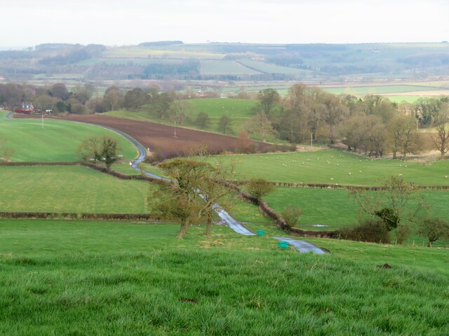
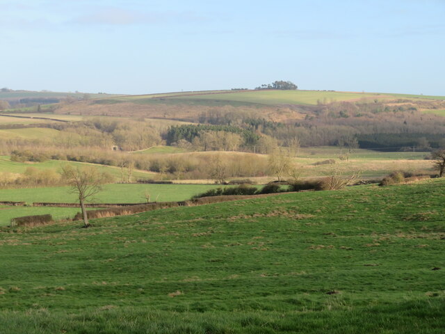
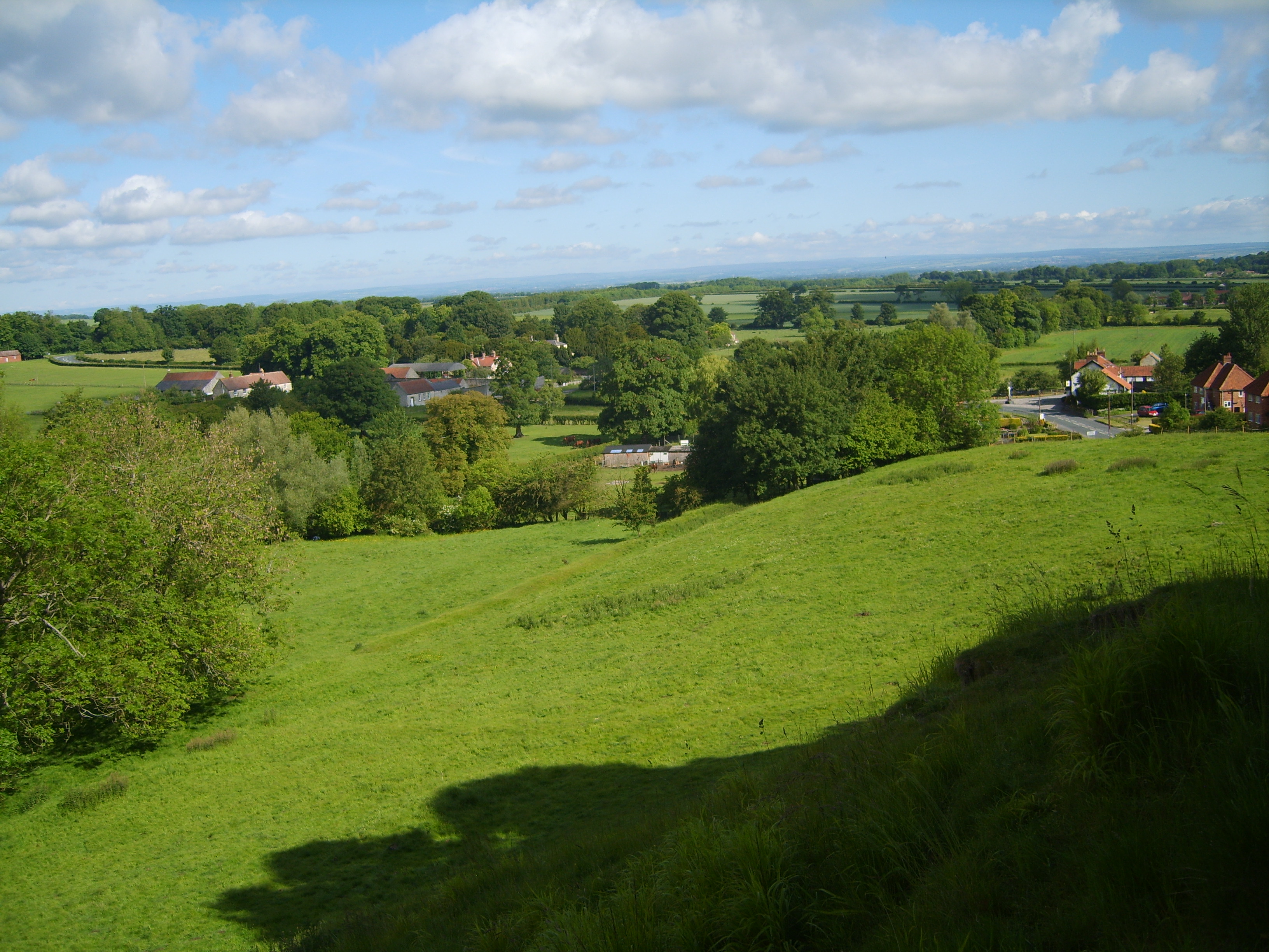
The surrounding countryside offers ample opportunities for outdoor enthusiasts to explore. The village is located close to the Howardian Hills, which provide a stunning backdrop for walking, cycling, and horse riding. The nearby Yorkshire Wolds Way, a long-distance footpath, attracts hikers from far and wide.

Although small in size, North Grimston is conveniently located near the bustling market town of Malton, which offers a wide range of amenities including shops, restaurants, and leisure facilities. The village is also within easy reach of popular tourist attractions such as Castle Howard and the North York Moors National Park.

Overall, North Grimston is a charming and historic village, offering both residents and visitors a tranquil retreat amidst the beautiful Yorkshire countryside.

If you have any feedback on the listing, please let us know in the comments section below.

North Grimston Images

Images are sourced within 2km of 54.099176/-0.710063 or Grid Reference SE8467. Thanks to Geograph Open Source API. All images are credited.
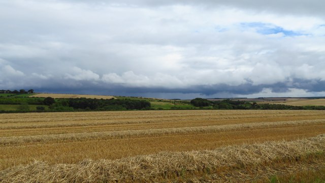
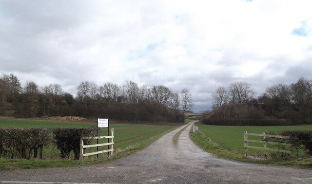
Shower clouds approaching over Duggleby Wold
Over  ploughed  field  to  Lund  Wood
Over ploughed field to Lund Wood
Wheat  field  from  unfenced  Luddith  Road Lund Wood to the right
Wheat field from unfenced Luddith Road
Lund Wood to the right
Wheat  field  toward  Grimston  Brow
Wheat field toward Grimston Brow
Cattle  grid  on  Luddith  Road Unfenced pasture land down Grimston Brow
Cattle grid on Luddith Road
Unfenced pasture land down Grimston Brow
Looking  south  on  Luddith  Road The Centenary Way goes left to right following the hedges in the dip
Looking south on Luddith Road
The Centenary Way goes left to right following the hedges in the dip
Luddith  Road  toward  Station  House The Station House is on the Malton-Driffield line. Opened in 1853 and closed to all traffic in 1958. Through the trees in the centre can be seen St Nicholas parish church at North Grimston
Luddith Road toward Station House
The Station House is on the Malton-Driffield line. Opened in 1853 and closed to all traffic in 1958. Through the trees in the centre can be seen St Nicholas parish church at North Grimston
Nine  Springs  Dale  and  Plantations The trees to the left are Nine Springs Dale Plantation, in the centre beyond lone tree is Duggleby Dale Plantation
Nine Springs Dale and Plantations
The trees to the left are Nine Springs Dale Plantation, in the centre beyond lone tree is Duggleby Dale Plantation
Field at Stone Ends The OS map shows 'Pits [dis]' in the foreground of this photo, but the ground has been levelled and brought under the plough. Old 6" maps show a quarry here, and one wonders if the local name of Stone Ends refers to this being an area where useful Jurassic stone faded out. Across the far side of the field one can see the road signs at the junction of B1248 and Grimston Lane.
Field at Stone Ends
The OS map shows 'Pits [dis]' in the foreground of this photo, but the ground has been levelled and brought under the plough. Old 6" maps show a quarry here, and one wonders if the local name of Stone Ends refers to this being an area where useful Jurassic stone faded out. Across the far side of the field one can see the road signs at the junction of B1248 and Grimston Lane.
Road to North Grimston Heading east towards the village of North Grimston with Grimston Plantation off to the right.
Road to North Grimston
Heading east towards the village of North Grimston with Grimston Plantation off to the right.
Centenary Way path The path doesn't look too inviting in soggy January conditions.
Centenary Way path
The path doesn't look too inviting in soggy January conditions.
Grimston Brow The scarp slope of the chalk Wolds, here looking north along the line of the minor road heading towards North Grimston. The hillside here rises just 60m or so and the road ascends with just a single arrow marked on the map.
Grimston Brow
The scarp slope of the chalk Wolds, here looking north along the line of the minor road heading towards North Grimston. The hillside here rises just 60m or so and the road ascends with just a single arrow marked on the map.
View from Luddith Road Looking north of east from Luddith Road near the top of Grimston Brow towards the plantations on Cow Cliff and the wold top beyond.
View from Luddith Road
Looking north of east from Luddith Road near the top of Grimston Brow towards the plantations on Cow Cliff and the wold top beyond.
Field edge above Grimston Brow Close to the edge of the chalk Wolds and with a pleasant view towards Grimston Hill where the B1253 road to Sledmere can be glimpsed to the right of the woodland.
Field edge above Grimston Brow
Close to the edge of the chalk Wolds and with a pleasant view towards Grimston Hill where the B1253 road to Sledmere can be glimpsed to the right of the woodland.
Entrance to Bellmanear Farm
Entrance to Grimston Fields Farm
Grimston Brow
Grimston Brow
Centenary Way
Centenary Way
Show me another place!

North Grimston is located at Grid Ref: SE8467 (Lat: 54.099176, Lng: -0.710063)

Division: East Riding

Administrative County: North Yorkshire

District: Ryedale

Police Authority: North Yorkshire

What 3 Words

///reports.campfires.curve. Near Norton, North Yorkshire

Related Wikis

North Grimston

North Grimston is a village in the civil parish of Birdsall, in North Yorkshire, England. It is situated between Norton-on-Derwent and Wharram-le-Street...

North Grimston railway station

North Grimston railway station was a railway station on the Malton & Driffield Railway. It opened on 19 May 1853, and served the village of North Grimston...

Settrington railway station

Settrington railway station was a railway station on the Malton & Driffield Railway in North Yorkshire, England. It opened on 19 May 1853, and served the...

Wharram-le-Street

Wharram-le-Street is a village and former civil parish, now in the parish of Wharram, in North Yorkshire, England. Until the 1974 local government reorganisation...

Wharram railway station

Wharram railway station was opened by the Malton and Driffield Railway in May 1853, serving the village of Wharram-le-Street in North Yorkshire, England...

Settrington

Settrington is a village and civil parish in North Yorkshire, England, about 3 miles (5 km) east of Malton. It was historically part of the East Riding...

Birdsall, North Yorkshire

Birdsall is a village and civil parish in North Yorkshire, England. According to the 2001 census it had a population of 180, increasing to 343 at the 2011...

Duggleby

Duggleby is a hamlet in the civil parish of Kirby Grindalythe, in North Yorkshire, England. It was historically part of the East Riding of Yorkshire until...

Nearby Amenities

Located within 500m of 54.099176,-0.710063
Telephone
Booth: K6
Covered: booth
Phone: +44 1944 768286
Lat/Long: 54.0978683/-0.7126789
North Grimston
Place: village
Wikidata: Q7055512
Wikipedia: en:North Grimston
Lat/Long: 54.0980053/-0.7118422
Addr City: Malton
Addr Postcode: YO17 8AX
Addr Street: Hogg Lane
Check Date: 2023-04-06
Disused Amenity: pub
Floor Material: carpet
Old Name: Middleton Arms
Wheelchair: limited
Wheelchair Description: Steps at entrance
Lat/Long: 54.0978972/-0.7104705
Disused Amenity: post_box
Old Ref: YO17 115
Post Box Type: wall
Postal Code: YO17
Lat/Long: 54.0982316/-0.7125342
Post Box
Collection Times: Mo-Fr 17:20; Sa 12:30
Operator: Royal Mail
Post Box Type: lamp
Postal Code: YO17
Ref: YO17 115
Lat/Long: 54.0979397/-0.7110178
Information: guidepost
Tourism: information
Lat/Long: 54.097869/-0.7127586
Information: guidepost
Tourism: information
Lat/Long: 54.0986389/-0.7129334
Barrier: kissing_gate
Lat/Long: 54.1018459/-0.7127517
Barrier: kissing_gate
Lat/Long: 54.1018314/-0.7127519
The data included in this document is from www.openstreetmap.org. The data is made available under ODbL.

Have you been to North Grimston?

Leave your review of North Grimston below (or comments, questions and feedback).