Grimston, North
Settlement in Yorkshire Ryedale
England
Grimston, North
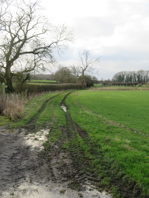
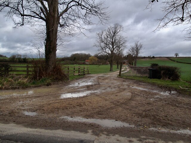
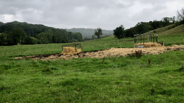
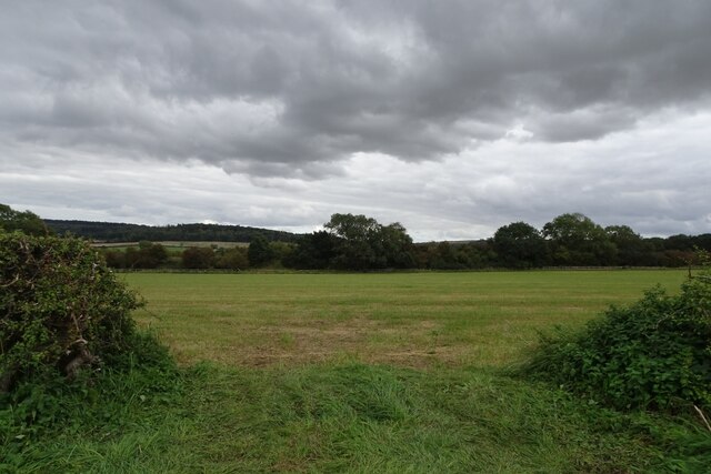
![Field at Stone Ends The OS map shows 'Pits [dis]' in the foreground of this photo, but the ground has been levelled and brought under the plough. Old 6" maps show a quarry here, and one wonders if the local name of Stone Ends refers to this being an area where useful Jurassic stone faded out. Across the far side of the field one can see the road signs at the junction of B1248 and Grimston Lane.](https://s0.geograph.org.uk/geophotos/07/06/58/7065884_a09f181f.jpg)
Grimston is a small village located in the North Riding of Yorkshire, England. Situated near the market town of Malton, it is nestled in the scenic Howardian Hills Area of Outstanding Natural Beauty. The village is home to a population of around 250 residents, making it a close-knit and tightly-knit community.
The origins of Grimston can be traced back to medieval times, with records of its existence dating back to the Domesday Book of 1086. The village showcases a rich history, with several historical landmarks and buildings still standing today. One such landmark is St. Nicholas' Church, a Grade II listed building dating back to the 12th century, featuring stunning Norman architecture.
Despite its small size, Grimston has a vibrant community spirit. The village is home to a local pub, The Blacksmiths Arms, where locals and visitors can enjoy a pint and traditional pub fare. Additionally, Grimston boasts a thriving community hall that serves as a hub for various events and activities, including social gatherings, fitness classes, and community meetings.
Surrounded by picturesque countryside, Grimston offers ample opportunities for outdoor activities. The village is a popular starting point for scenic walks and cycling routes, allowing residents and visitors to explore the stunning landscapes of the Howardian Hills.
Overall, Grimston is a charming village that seamlessly combines its rich history with a close-knit community and breathtaking natural surroundings.
If you have any feedback on the listing, please let us know in the comments section below.
Grimston, North Images
Images are sourced within 2km of 54.099176/-0.710063 or Grid Reference SE8467. Thanks to Geograph Open Source API. All images are credited.


Grimston, North is located at Grid Ref: SE8467 (Lat: 54.099176, Lng: -0.710063)
Division: East Riding
Administrative County: North Yorkshire
District: Ryedale
Police Authority: North Yorkshire
What 3 Words
///reports.campfires.curve. Near Norton, North Yorkshire
Nearby Locations
Related Wikis
North Grimston
North Grimston is a village in the civil parish of Birdsall, in North Yorkshire, England. It is situated between Norton-on-Derwent and Wharram-le-Street...

St Nicholas' Church, North Grimston
St Nicholas' Church is the parish church of North Grimston, a village in North Yorkshire, in England. The church was built in the 12th century. Its tower...

North Grimston railway station
North Grimston railway station was a railway station on the Malton & Driffield Railway. It opened on 19 May 1853, and served the village of North Grimston...

Settrington railway station
Settrington railway station was a railway station on the Malton & Driffield Railway in North Yorkshire, England. It opened on 19 May 1853, and served the...
Nearby Amenities
Located within 500m of 54.099176,-0.710063Have you been to Grimston, North?
Leave your review of Grimston, North below (or comments, questions and feedback).