North Greetwell

Settlement in Lincolnshire West Lindsey

England

North Greetwell

Sign, Nettleham Advertising "Beckside Newsagents Telephone 751331". It looks quite old, but is it fake old?
Sign, Nettleham Credit: Stephen Richards

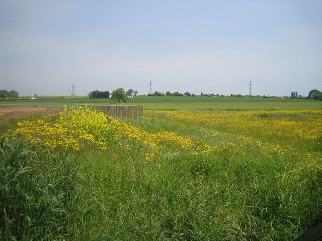
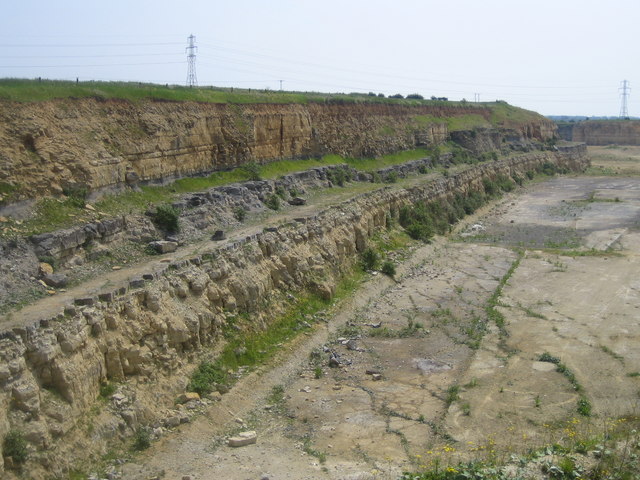
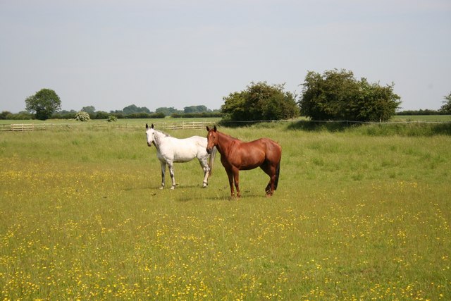
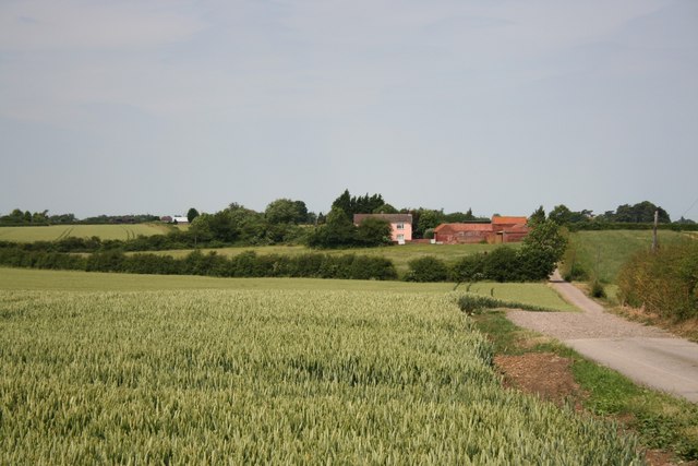
North Greetwell is a quaint village located in the county of Lincolnshire, England. Situated approximately 8 miles northeast of the city of Lincoln, it falls within the West Lindsey district. The village is nestled in the heart of the Lincolnshire Wolds, an Area of Outstanding Natural Beauty, offering residents and visitors stunning views of the surrounding countryside.

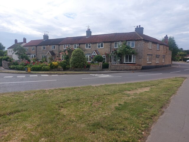
With a population of around 300, the village retains a close-knit community feel. It boasts a range of charming period properties, including thatched cottages and picturesque farmhouses, which add to its traditional rural charm.

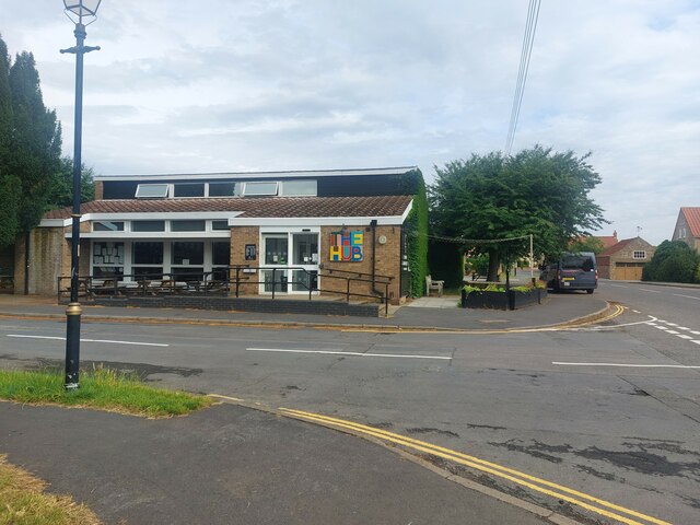
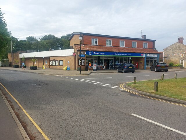
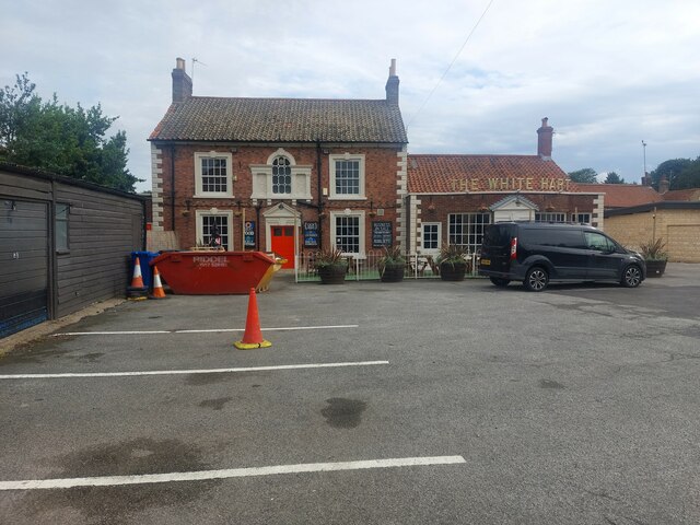
Despite its small size, North Greetwell is well-served by amenities. The village is home to a local pub, The White Hart, which provides a welcoming atmosphere for both residents and visitors. Additionally, the nearby market town of Market Rasen offers a wider range of amenities, including shops, schools, and healthcare facilities.

Nature enthusiasts are drawn to North Greetwell due to its proximity to natural attractions. The village is surrounded by an abundance of walking trails and cycling routes, allowing visitors to explore the stunning landscapes and enjoy the tranquility of the area. Nearby, the Lincolnshire Wolds offers opportunities for outdoor activities such as hiking, horse riding, and birdwatching.

Overall, North Greetwell offers a peaceful and idyllic setting, perfect for those seeking a quiet village lifestyle surrounded by natural beauty. Its close proximity to Lincoln and other nearby towns ensures residents have access to a range of amenities and services while still enjoying the charm of rural living.

If you have any feedback on the listing, please let us know in the comments section below.

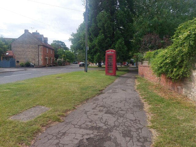
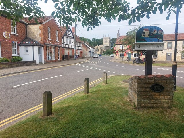
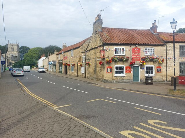
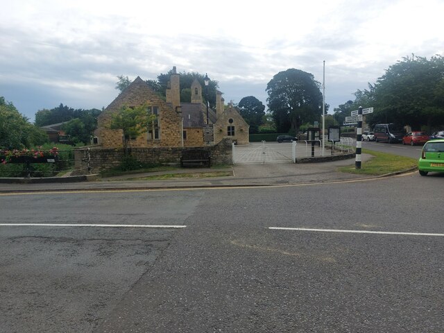
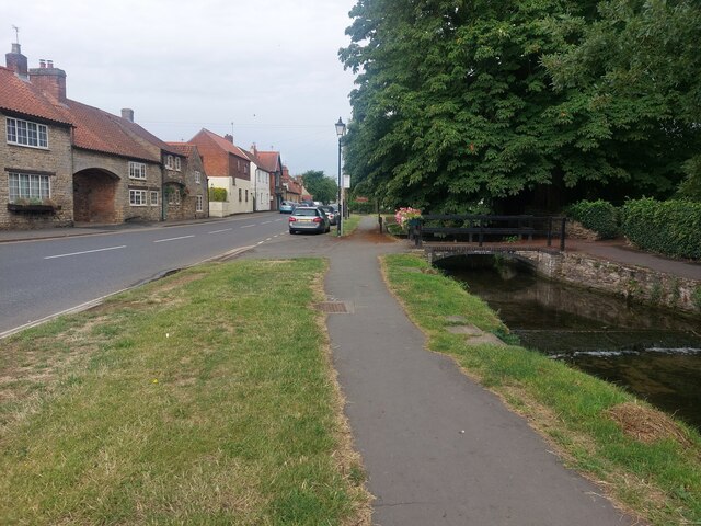
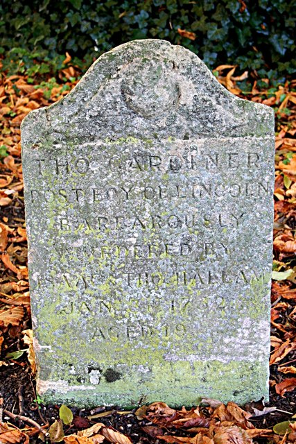
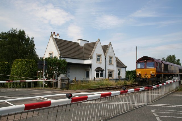
North Greetwell Images

Images are sourced within 2km of 53.252444/-0.483704 or Grid Reference TF0173. Thanks to Geograph Open Source API. All images are credited.

Sign, Nettleham Advertising "Beckside Newsagents Telephone 751331". It looks quite old, but is it fake old?
Sign, Nettleham
Advertising "Beckside Newsagents Telephone 751331". It looks quite old, but is it fake old?
Cottages in the middle of Nettleham The row of cottages which stand at the corner of East Street and The Crescent in Nettleham.
Cottages in the middle of Nettleham
The row of cottages which stand at the corner of East Street and The Crescent in Nettleham.
East Street, Nettleham A road in the middle of Nettleham with a wide grass verge and pavement.
East Street, Nettleham
A road in the middle of Nettleham with a wide grass verge and pavement.
The Hub, Nettleham A library and community cafe in the middle of Nettleham.
The Hub, Nettleham
A library and community cafe in the middle of Nettleham.
Co-op Food Store, Nettleham A branch of the Co-op supermarket business located in the centre of Nettleham. A local florists occupies a small shop next door.
Co-op Food Store, Nettleham
A branch of the Co-op supermarket business located in the centre of Nettleham. A local florists occupies a small shop next door.
Nettleham village sign A village sign stands on a triangle of grass in the centre of the village.
Nettleham village sign
A village sign stands on a triangle of grass in the centre of the village.
Church Street, Nettleham A street in the centre of Nettleham. The street passes the village church which can be seen in the background.
Church Street, Nettleham
A street in the centre of Nettleham. The street passes the village church which can be seen in the background.
The Old School, Nettleham As name and form suggest this building was once a village school. It is now owned by the parish council and operated as a facility for the community.
The Old School, Nettleham
As name and form suggest this building was once a village school. It is now owned by the parish council and operated as a facility for the community.
High Street, Nettleham A street in Nettleham with Nettleham Beck flowing in a channel alongside.
High Street, Nettleham
A street in Nettleham with Nettleham Beck flowing in a channel alongside.
The White Hart, Nettleham A pub in Nettleham in a nicely decorated building set back from the road. A skip in the car park suggests ongoing renovations.
The White Hart, Nettleham
A pub in Nettleham in a nicely decorated building set back from the road. A skip in the car park suggests ongoing renovations.
Cliff edge of the former Greetwell Quarry, Lincoln This photograph was taken on a mild, overcast morning in late August. Once upon a time the Greetwell Quarry was a site of extensive limestone and ironstone mining, but with the end of operations in 2003 the land has slowly been reclaimed by nature and now forms part of the Greetwell Hollow Nature Reserve, a Site of Special Scientific Interest.

This vacant plot of land has naturally drawn the attention of local councils and housing developers, and along the cliff top runs metal fencing marking the boundary of the Greetwell Fields residential development where up to 350 new homes are being constructed. If local news reporting is to be believed, a new estate within the quarry itself has also been proposed!

For a similar view from 2006, please see <a href="https://www.geograph.org.uk/photo/182162">TF0072 : Stone Quarry</a> by Matthew Smith.
Cliff edge of the former Greetwell Quarry, Lincoln
This photograph was taken on a mild, overcast morning in late August. Once upon a time the Greetwell Quarry was a site of extensive limestone and ironstone mining, but with the end of operations in 2003 the land has slowly been reclaimed by nature and now forms part of the Greetwell Hollow Nature Reserve, a Site of Special Scientific Interest. This vacant plot of land has naturally drawn the attention of local councils and housing developers, and along the cliff top runs metal fencing marking the boundary of the Greetwell Fields residential development where up to 350 new homes are being constructed. If local news reporting is to be believed, a new estate within the quarry itself has also been proposed! For a similar view from 2006, please see TF0072 : Stone Quarry by Matthew Smith.
Modern Residential Area of Nettleham: "Greenfields", Nettleham Lincolnshire 1970s housing estate with tree lined streets on the S edge of the village of Nettleham. The housing is mainly large, detached bungalows.
Modern Residential Area of Nettleham: "Greenfields", Nettleham Lincolnshire
1970s housing estate with tree lined streets on the S edge of the village of Nettleham. The housing is mainly large, detached bungalows.
All Saints' church, Nettleham, Lincs. Grand village church with a good Early English nave arcade, over restored by Victorian do-gooders ! <span class="nowrap"><a title="http://nettleham-all-saints.org.uk/" rel="nofollow ugc noopener" href="http://nettleham-all-saints.org.uk/">Link</a><img style="margin-left:2px;" alt="External link" title="External link - shift click to open in new window" src="https://s1.geograph.org.uk/img/external.png" width="10" height="10"/></span>
All Saints' church, Nettleham, Lincs.
Grand village church with a good Early English nave arcade, over restored by Victorian do-gooders ! LinkExternal link
Footpath: Hawthorn Road to Wragby Road The route of the footpath is hard to determine as it is very overgrown. The land to the left of the picture is about to be developed for housing.
Footpath: Hawthorn Road to Wragby Road
The route of the footpath is hard to determine as it is very overgrown. The land to the left of the picture is about to be developed for housing.
Stone Quarry Tucked away just behind Lincoln's industrial estates is this defunct stone quarry. Its size really has to be seen to be believed and it almost feels like your walking through a desert.
Stone Quarry
Tucked away just behind Lincoln's industrial estates is this defunct stone quarry. Its size really has to be seen to be believed and it almost feels like your walking through a desert.
Ponies in a meadow near Nettleham
Westfield Farm Seen from Hawthorn Road near Cherry Willingham
Westfield Farm
Seen from Hawthorn Road near Cherry Willingham
Thomas Gardiner's grave In Nettleham churchyard is the grave of Thomas Gardiner, the unfortunate murder victim of two villainous brothers. The stone reads "THO.GARDINER post boy of Lincoln, barbarously murdered by Isaac & Tho.Hallam, Jan 3 1732, aged 19"

Thomas and Isaac Hallam had murdered a Mr.Wright near Middle Rasen on January 2nd 1732 and murdered Thomas Gardiner the following night in Nettleham South Field, near a place called Bunker's Hill.

The Hallam brothers were soon caught and found guilty of the murder. Isaac was hanged in irons at Nettleham Field in March 1732 where his brother Thomas fainted at the sight, but he was taken away and hanged at Middle Rasen.
Thomas Gardiner's grave
In Nettleham churchyard is the grave of Thomas Gardiner, the unfortunate murder victim of two villainous brothers. The stone reads "THO.GARDINER post boy of Lincoln, barbarously murdered by Isaac & Tho.Hallam, Jan 3 1732, aged 19" Thomas and Isaac Hallam had murdered a Mr.Wright near Middle Rasen on January 2nd 1732 and murdered Thomas Gardiner the following night in Nettleham South Field, near a place called Bunker's Hill. The Hallam brothers were soon caught and found guilty of the murder. Isaac was hanged in irons at Nettleham Field in March 1732 where his brother Thomas fainted at the sight, but he was taken away and hanged at Middle Rasen.
Show me another place!

North Greetwell is located at Grid Ref: TF0173 (Lat: 53.252444, Lng: -0.483704)

Division: Parts of Lindsey

Administrative County: Lincolnshire

District: West Lindsey

Police Authority: Lincolnshire

What 3 Words

///harmlessly.gadget.boomers. Near Nettleham, Lincolnshire

Related Wikis

Nettleham F.C.

Nettleham Football Club is an English football club based in Nettleham, near Lincoln, in Lincolnshire. The club are currently members of the Lincolnshire...

Nettleham

Nettleham is a large village and civil parish within the West Lindsey district of Lincolnshire, England, 4 miles (6.4 km) north-east from the city of Lincoln...

Priory Pembroke Academy

The Priory Pembroke Academy (formerly Cherry Willingham Community School, Cherry Willingham Comprehensive School and Cherry Willingham Secondary Modern...

Greetwell, West Lindsey

Greetwell is a village and civil parish in the West Lindsey district of Lincolnshire, England. The population of the civil parish at the 2011 census was...

Cherry Willingham

Cherry Willingham is a large village and civil parish in the West Lindsey district of Lincolnshire, England. The population at the 2011 census was 3,506...

Reepham, Lincolnshire

Reepham is a small village in the West Lindsey district of Lincolnshire, England. It is situated 5 miles (8.0 km) north-east from the city and county town...

Reepham railway station (Lincolnshire)

Reepham railway station was a railway station in Reepham, Lincolnshire which opened in 1848 and closed in 1965, though the line is still in use. It was...

Lincoln Christ's Hospital School

Lincoln Christ's Hospital School is an English state secondary school with academy status located in Wragby Road in Lincoln. It was established in 1974...

Nearby Amenities

Located within 500m of 53.252444,-0.483704
Power: pole
Lat/Long: 53.252736/-0.4867052
Power Dismantled: tower
Source: NPE
Lat/Long: 53.2542173/-0.4860645
Power Dismantled: tower
Source: NPE
Lat/Long: 53.2563999/-0.4852079
Power: tower
Source: npe
Lat/Long: 53.2515218/-0.4881389
Power: tower
Source: npe
Lat/Long: 53.2533704/-0.4895122
Bus Stop
Westfield Avenue
Naptan AtcoCode: 270002700039
Naptan Bearing: SW
Naptan CommonName: Westfield Avenue
Naptan Indicator: adj
Naptan Landmark: Westfield Avenue
Naptan NaptanCode: linjtajp
Naptan Street: Westfield Drive
Naptan Verified: no
Source: naptan_import
Lat/Long: 53.2511007/-0.4790815
Bus Stop
Westfield Avenue
Naptan AtcoCode: 270002700040
Naptan Bearing: NE
Naptan CommonName: Westfield Avenue
Naptan Indicator: opp
Naptan Landmark: Westfield Avenue
Naptan NaptanCode: linjtajt
Naptan Street: Westfield Drive
Naptan Verified: no
Source: naptan_import
Lat/Long: 53.2511827/-0.4791685
Bus Stop
Service Station
Bench: no
Bin: no
Naptan AtcoCode: 2700LNGWRE66
Naptan Bearing: SW
Naptan CommonName: Service Station
Naptan Indicator: opp
Naptan Landmark: Service Station
Naptan NaptanCode: linadamj
Naptan Street: Wragby Road East
Naptan Verified: no
Shelter: no
Source: naptan_import
Lat/Long: 53.2515537/-0.4821379
Power: tower
Lat/Long: 53.2531823/-0.4880858
Power: tower
Lat/Long: 53.250942/-0.4866305
Power: pole
Lat/Long: 53.2480984/-0.484247
Power: pole
Lat/Long: 53.2491488/-0.4835262
Power: pole
Lat/Long: 53.2504943/-0.4847793
Power: pole
Lat/Long: 53.2517027/-0.485797
Power: pole
Lat/Long: 53.253877/-0.4876337
Power: pole
Lat/Long: 53.2547251/-0.489532
Power: pole
Lat/Long: 53.2548676/-0.4884219
Power: pole
Lat/Long: 53.255033/-0.4869787
Power: pole
Lat/Long: 53.255219/-0.4854871
Power: pole
Lat/Long: 53.2552294/-0.4889558
Power: pole
Lat/Long: 53.2553267/-0.4871661
Power: pole
Lat/Long: 53.2554448/-0.4836382
Power: pole
Lat/Long: 53.2556697/-0.483759
Power: pole
Lat/Long: 53.2556742/-0.4818115
Power: pole
Lat/Long: 53.2559109/-0.4798839
Power: pole
Lat/Long: 53.2562299/-0.4801824
Fuel
Wragby Road Service Station
Brand: Jet
Fuel Diesel: yes
Fuel Unleaded: yes
Lat/Long: 53.2517783/-0.4822093
North Greetwell
Place: village
Source: Bing
Lat/Long: 53.251302/-0.4800162
Truswells Joinery
Craft: joiner
Lat/Long: 53.2526121/-0.4785603
Bus Stop
Westfield Drv
Naptan AtcoCode: 2700LNGW2302
Naptan Bearing: SW
Naptan CommonName: Westfield Drv
Naptan Landmark: Westfield Drive
Naptan NaptanCode: linaptda
Naptan Street: Wragby Road East
Naptan Verified: no
Shelter: yes
Source: naptan_import
Lat/Long: 53.2528166/-0.478242
Power: pole
Lat/Long: 53.2562971/-0.4860377
Power: pole
Lat/Long: 53.2558206/-0.4874164
Power: pole
Lat/Long: 53.2553536/-0.4887629
Power: pole
Lat/Long: 53.2553456/-0.4855362
Generator Method: photovoltaic
Generator Output Electricity: yes
Generator Source: solar
Generator Type: solar_photovoltaic_panel
Location: roof
Power: generator
Lat/Long: 53.2514886/-0.4784807
Generator Method: photovoltaic
Generator Output Electricity: yes
Generator Source: solar
Generator Type: solar_photovoltaic_panel
Location: roof
Power: generator
Lat/Long: 53.2504382/-0.4806506
Generator Method: photovoltaic
Generator Output Electricity: yes
Generator Source: solar
Generator Type: solar_photovoltaic_panel
Location: roof
Power: generator
Lat/Long: 53.2506132/-0.4814124
Generator Method: photovoltaic
Generator Output Electricity: yes
Generator Source: solar
Generator Type: solar_photovoltaic_panel
Location: roof
Power: generator
Lat/Long: 53.2499183/-0.4831987
Generator Method: photovoltaic
Generator Output Electricity: yes
Generator Source: solar
Generator Type: solar_photovoltaic_panel
Location: roof
Power: generator
Lat/Long: 53.2496021/-0.4836091
Generator Method: photovoltaic
Generator Output Electricity: yes
Generator Source: solar
Generator Type: solar_photovoltaic_panel
Location: roof
Power: generator
Lat/Long: 53.249485/-0.4834938
Generator Method: photovoltaic
Generator Output Electricity: yes
Generator Source: solar
Generator Type: solar_photovoltaic_panel
Location: roof
Power: generator
Lat/Long: 53.2501718/-0.4841053
Generator Method: photovoltaic
Generator Output Electricity: yes
Generator Source: solar
Generator Type: solar_photovoltaic_panel
Location: roof
Power: generator
Lat/Long: 53.2516499/-0.4810852
Generator Method: photovoltaic
Generator Output Electricity: yes
Generator Source: solar
Generator Type: solar_photovoltaic_panel
Location: roof
Power: generator
Lat/Long: 53.251982/-0.4802698
Generator Method: photovoltaic
Generator Output Electricity: yes
Generator Source: solar
Generator Type: solar_photovoltaic_panel
Location: roof
Power: generator
Lat/Long: 53.2518039/-0.4827347
Defibrillator
Defibrillator Location: outside petrol station shop on Wragby Road East, North Greetwell
Emergency: defibrillator
Indoor: no
Lat/Long: 53.2519127/-0.4820846
Crossing
Crossing: traffic_signals
Lat/Long: 53.2514006/-0.4827895
Bus Stop
Shelter: no
Lat/Long: 53.2520447/-0.4810877
Advertising: totem
Lat/Long: 53.2516817/-0.482237
The data included in this document is from www.openstreetmap.org. The data is made available under ODbL.

Have you been to North Greetwell?

Leave your review of North Greetwell below (or comments, questions and feedback).