North Country

Settlement in Cornwall

England

North Country

Weighing Machine Redruth Station A redundant weighing machine at Redruth Station sits as it always has set into the platform.
Weighing Machine Redruth Station Credit: Tom Jolliffe

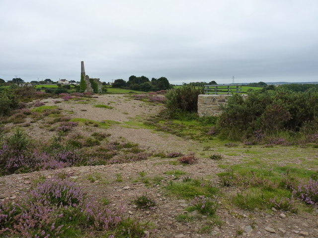
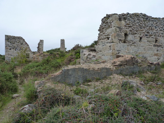
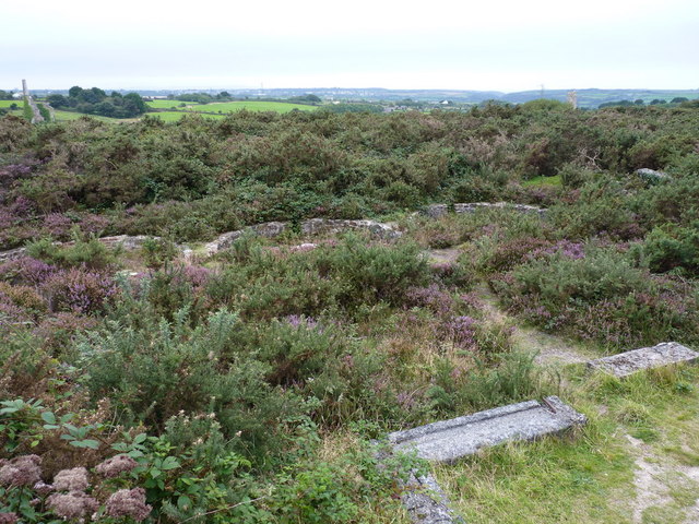
North Country is a picturesque region located in the southwestern part of Cornwall, England. It is known for its stunning natural beauty, rugged coastline, and rich cultural heritage. The area is dotted with charming villages and small towns, offering a tranquil and idyllic setting for residents and visitors alike.

One of the most prominent features of North Country is its dramatic coastline. Cliffs and rocky outcrops dominate the landscape, providing breathtaking views of the Atlantic Ocean. The ruggedness of the coastline attracts adventurers and nature enthusiasts who enjoy activities such as coastal walks, rock climbing, and birdwatching. The famous Bedruthan Steps, a series of towering rock formations, is a major attraction in the area.

The region is also home to several quaint fishing villages, including Padstow and Port Isaac. These villages have a strong maritime heritage and offer visitors a glimpse into Cornwall's past. Visitors can explore narrow cobbled streets, traditional fisherman's cottages, and enjoy freshly caught seafood in local restaurants.

North Country is also renowned for its cultural heritage. The area has inspired numerous artists and writers throughout history, including the famous author Daphne du Maurier. The landscape and historical sites, such as Tintagel Castle, provide a rich source of inspiration.

In summary, North Country in Cornwall is a captivating region that combines stunning natural landscapes, charming villages, and a rich cultural heritage. It is a haven for outdoor enthusiasts, history buffs, and those seeking a peaceful retreat amidst beautiful surroundings.

If you have any feedback on the listing, please let us know in the comments section below.

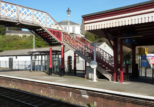
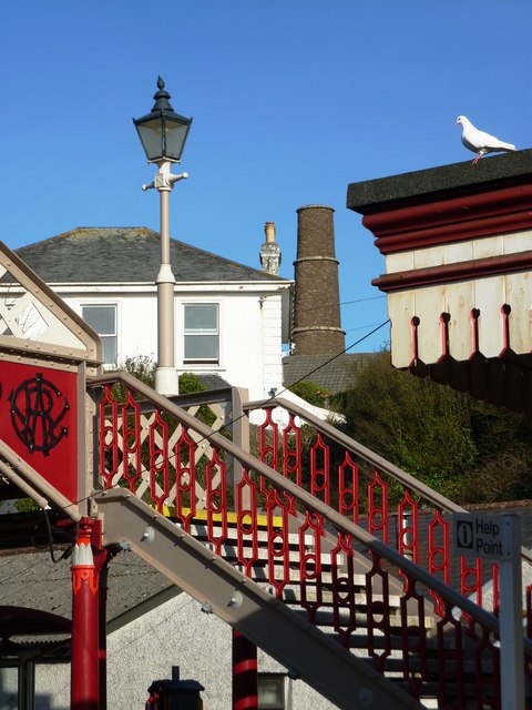
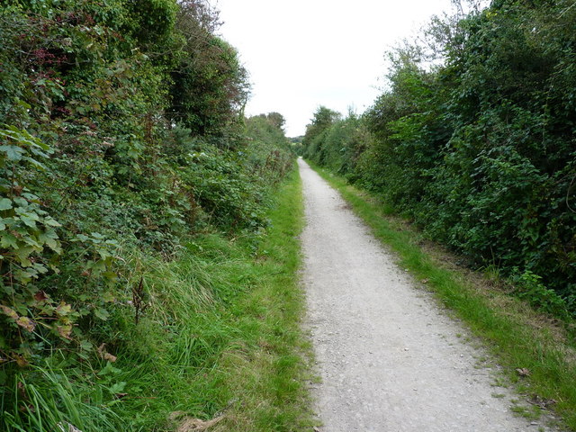
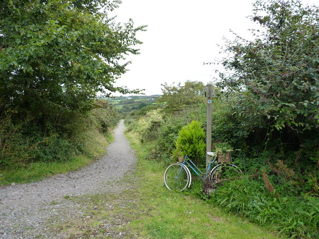
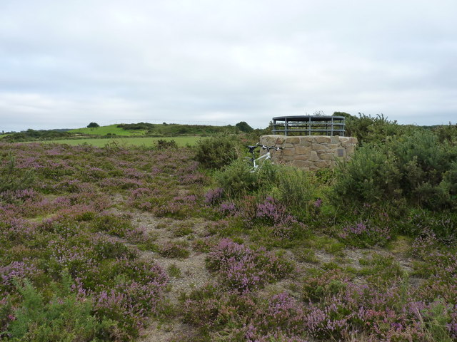
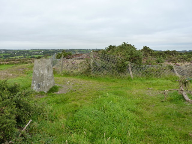
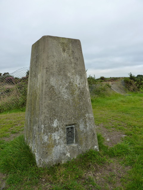
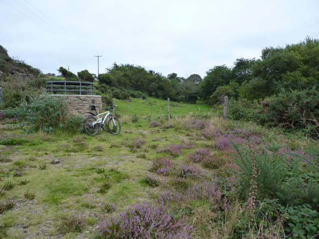
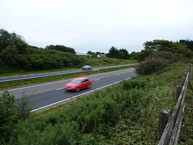
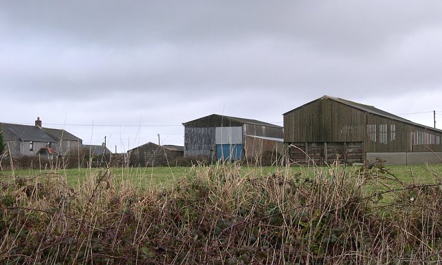
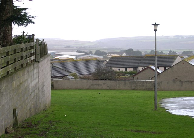
North Country Images

Images are sourced within 2km of 50.249576/-5.232019 or Grid Reference SW6943. Thanks to Geograph Open Source API. All images are credited.

Weighing Machine Redruth Station A redundant weighing machine at Redruth Station sits as it always has set into the platform.
Weighing Machine Redruth Station
A redundant weighing machine at Redruth Station sits as it always has set into the platform.
Farm at Wheal Prussia On the eastern outskirts of Redruth is this smallholding near the former Wheal Prussia.
This photo was taken from the 1158 Penzance to London Paddington train, having left Redruth at 1231.
Farm at Wheal Prussia
On the eastern outskirts of Redruth is this smallholding near the former Wheal Prussia. This photo was taken from the 1158 Penzance to London Paddington train, having left Redruth at 1231.
Redruth Station and Footbridge
Stamps Engine House, Wheal Peevor
Redruth Railway Station Footbridge The footbridge at Redruth Station was significantly renovated two years ago. The work is holding up well and shows how such investment improves the environment.
Redruth Railway Station Footbridge
The footbridge at Redruth Station was significantly renovated two years ago. The work is holding up well and shows how such investment improves the environment.
Redruth Railway Station Footbridge The renovation of the footbridge two years ago greatly enhanced the appearance of the station. Were these the original colours of the Great Western Railway? Between the house in the background and the end of the canopy on the platform the Pednandrea Stack can be seen marking the industrial history of Redruth. Also see <a href="https://www.geograph.org.uk/photo/1904221">SW7041 : Basset Street and Pednandrea Stack, Redruth</a>
Redruth Railway Station Footbridge
The renovation of the footbridge two years ago greatly enhanced the appearance of the station. Were these the original colours of the Great Western Railway? Between the house in the background and the end of the canopy on the platform the Pednandrea Stack can be seen marking the industrial history of Redruth. Also see SW7041 : Basset Street and Pednandrea Stack, Redruth
Footbridge Redruth Railway Station The colours of the footbridge look a little too bright and cheerful to be true to the original railway company. The Great Western locomotives were painted green and the coaches were brown and cream. Wagons were painted red at one time. Pednandrea Stack can be seen in the background.
Footbridge Redruth Railway Station
The colours of the footbridge look a little too bright and cheerful to be true to the original railway company. The Great Western locomotives were painted green and the coaches were brown and cream. Wagons were painted red at one time. Pednandrea Stack can be seen in the background.
The Portreath Tramroad near Mawla The tramroad originally connected the tin and copper mines in the hills around Redruth and Camborne with the sea at Portreath, which has a good harbour for export. It's now converted to a footpath and cycleway, part of an extensive network of old mine roads in the district.
The Portreath Tramroad near Mawla
The tramroad originally connected the tin and copper mines in the hills around Redruth and Camborne with the sea at Portreath, which has a good harbour for export. It's now converted to a footpath and cycleway, part of an extensive network of old mine roads in the district.
Not my bike, honest... A junction of bridleways, marked by a floral exhibit in the shopping baskets of the step-through bike.
Not my bike, honest...
A junction of bridleways, marked by a floral exhibit in the shopping baskets of the step-through bike.
Capped shaft at Wheal Briggan The Western Whim shaft of the Wheal Briggan workings, capped off in 2005.
Capped shaft at Wheal Briggan
The Western Whim shaft of the Wheal Briggan workings, capped off in 2005.
The North Downs trig A trig point sporting flushbracket S7758, situated immediately adjacent to an infilled shaft south of the Wheal Plenty complex.
The North Downs trig
A trig point sporting flushbracket S7758, situated immediately adjacent to an infilled shaft south of the Wheal Plenty complex.
North Downs trig - closeup The pillar itself is in good condition, as is the flushbracket. Sadly, the 'man with the allen key' has long since helped himself to the brasswork from the top.
North Downs trig - closeup
The pillar itself is in good condition, as is the flushbracket. Sadly, the 'man with the allen key' has long since helped himself to the brasswork from the top.
Capped shaft at Wheal Peevor An unnamed adit shaft of the Wheal Peevor mine, capped by the council in 2005. By (the highly unscientific method of) dropping a stone down it, I deduced that it was too deep to want to fall down, so they did the right thing by capping it off.
Capped shaft at Wheal Peevor
An unnamed adit shaft of the Wheal Peevor mine, capped by the council in 2005. By (the highly unscientific method of) dropping a stone down it, I deduced that it was too deep to want to fall down, so they did the right thing by capping it off.
Capped shaft and chimney at Wheal Peevor
Wheal Peevor - the remains of the calciners Brunton Calciners were an important part of the tin mining and processing system, as they removed a variety of impurities (copper, arsenic, iron) from the concentrate before it was further processed and smelted. Most of this involved huge amounts of heat, and took place in these calciners.
Wheal Peevor - the remains of the calciners
Brunton Calciners were an important part of the tin mining and processing system, as they removed a variety of impurities (copper, arsenic, iron) from the concentrate before it was further processed and smelted. Most of this involved huge amounts of heat, and took place in these calciners.
Buddles at Wheal Peevor mine The remains of three tin 'buddles' in front of the Stamps Engine House; these were separated tin particles from lighter materials, with water as a part of the process.
Buddles at Wheal Peevor mine
The remains of three tin 'buddles' in front of the Stamps Engine House; these were separated tin particles from lighter materials, with water as a part of the process.
Wheal Peevor - 3 buddles from near the calciner ruins The remains of three tin 'buddles' which were used, in conjunction with water, as a mechanism for separating tin particles from rock and waste products, prior to further refining. For a closer view, see <a href="https://www.geograph.org.uk/photo/3190691">SW7044 : Buddles at Wheal Peevor mine</a>
Wheal Peevor - 3 buddles from near the calciner ruins
The remains of three tin 'buddles' which were used, in conjunction with water, as a mechanism for separating tin particles from rock and waste products, prior to further refining. For a closer view, see SW7044 : Buddles at Wheal Peevor mine
Traffic on the A30 The main A30 dual carriageway near Radnor. A fast road; no place to be cycling on a dull evening.
Traffic on the A30
The main A30 dual carriageway near Radnor. A fast road; no place to be cycling on a dull evening.
Show me another place!

North Country is located at Grid Ref: SW6943 (Lat: 50.249576, Lng: -5.232019)

Unitary Authority: Cornwall

Police Authority: Devon and Cornwall

What 3 Words

///fatter.snapping.nicer. Near Redruth, Cornwall

Related Wikis

Parc Erissey

Parc Erissey is a hamlet north of Redruth, Cornwall, England. == References ==

Treleigh

Treleigh (Cornish: Trelegh) is a hamlet north of Redruth in Cornwall, England, United Kingdom.The ecclesiastical parish of Treleigh was taken out of the...

Gilbert's Coombe

Gilbert's Coombe is a hamlet north of Redruth in west Cornwall, England. It falls within the Redruth North division on Cornwall Council. == References ==
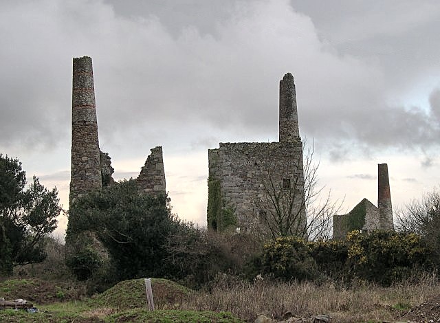
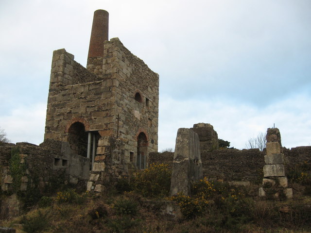
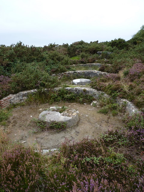
Wheal Peevor

Wheal Peevor was a metalliferous mine located on North Downs about 1.5 miles north-east of Redruth, Cornwall, England. The first mining sett was granted...

Highfields Private School

Highfields Private School was a fee paying coeducational independent day school in Redruth, England, catering for pupils aged 4 to 16 years. It closed...

Radnor, Cornwall

Radnor is a hamlet near Redruth in Cornwall, England. Radnor is northeast of Redruth and close to the A30 main road. == References ==

Mount Ambrose

Mount Ambrose is a northeastern suburb of Redruth in west Cornwall, England. It falls within Redruth Central division on Cornwall Council,The suburb is...

Forge, Cornwall

Forge is a hamlet in the parish of Redruth, Cornwall, England. == References ==

Nearby Amenities

Located within 500m of 50.249576,-5.232019
Bus Stop
Trenoweth Estate
Bench: no
Bin: no
Bus: yes
Covered: no
Description: On lamp post near lay-by used for parking with timetable board
Naptan AtcoCode: 0800COD41156
Naptan Bearing: SE
Naptan CommonName: Trenoweth Estate
Naptan NaptanCode: coramjwt
Naptan NptgLocalityCode: E0003310
Naptan PlusbusZoneRef: CBORNE
Naptan Street: Bassett Road
Passenger Information Display: no
Public Transport: platform
Shelter: no
Source: naptan_import;survey
Survey Date: 2020-10-28
Lat/Long: 50.249464/-5.2360657
Bus Stop
Trenoweth Estate
Bench: no
Bin: no
Bus: yes
Covered: no
Fixme: No signage or markings on road possiable location opposite marked stop heading SE, need to confirm location
Naptan AtcoCode: 0800COD41157
Naptan Bearing: NW
Naptan CommonName: Trenoweth Estate
Naptan NaptanCode: corampag
Naptan NptgLocalityCode: E0003310
Naptan PlusbusZoneRef: CBORNE
Naptan Street: Bassett Road
Naptan Verified: no
Passenger Information Display: no
Public Transport: platform
Shelter: no
Source: naptan_import
Lat/Long: 50.2493914/-5.2361343
Bus Stop
Top of Basset Road
Bus: yes
Fixme: No visable signage, need to confirm location, possible next to telephone pole
Naptan AtcoCode: 0800COD41158
Naptan Bearing: SE
Naptan CommonName: Top of Basset Road
Naptan NaptanCode: corampja
Naptan PlusbusZoneRef: CBORNE
Naptan Street: Bassett Road
Naptan Verified: no
Public Transport: platform
Source: naptan_import
Survey Date: 2020-10-28
Lat/Long: 50.2484173/-5.2336894
Bus Stop
Top of Basset Road
Bus: yes
Fixme: No visable signage, need to confirm location, possible next to humps road sign
Naptan AtcoCode: 0800COD41159
Naptan Bearing: NW
Naptan CommonName: Top of Basset Road
Naptan NaptanCode: corampgw
Naptan PlusbusZoneRef: CBORNE
Naptan Street: Bassett Road
Naptan Verified: no
Public Transport: platform
Source: naptan_import
Survey Date: 2020-10-28
Lat/Long: 50.2483666/-5.2337516
Bus Stop
Corner Cottage
Bus: yes
Naptan AtcoCode: 0800COD41222
Naptan Bearing: N
Naptan CommonName: Corner Cottage
Naptan Crossing: Bassett Road
Naptan NaptanCode: corampjg
Naptan PlusbusZoneRef: CBORNE
Naptan Street: Unclassified
Naptan Verified: no
Public Transport: platform
Source: naptan_import
Lat/Long: 50.2481748/-5.233746
Bus Stop
Corner Cottage
Bus: yes
Naptan AtcoCode: 0800COD41223
Naptan Bearing: S
Naptan CommonName: Corner Cottage
Naptan Crossing: Bassett Road
Naptan Indicator: Opp
Naptan NaptanCode: corampjp
Naptan PlusbusZoneRef: CBORNE
Naptan Street: Unclassified
Naptan Verified: no
Public Transport: platform
Source: naptan_import
Lat/Long: 50.2480209/-5.2336427
Bus Stop
Trenoweth Estate
Bus: yes
Naptan AtcoCode: 0800COD41224
Naptan Bearing: SW
Naptan CommonName: Trenoweth Estate
Naptan Crossing: Bassett Road
Naptan NaptanCode: coramjwj
Naptan PlusbusZoneRef: CBORNE
Naptan Street: Unclassified
Naptan Verified: no
Public Transport: platform
Source: naptan_import
Lat/Long: 50.2501429/-5.2364048
Barrier: bollard
Lat/Long: 50.2539834/-5.2311378
Power: tower
Source: bing
Lat/Long: 50.2517135/-5.2271393
Power: tower
Source: bing
Lat/Long: 50.2476058/-5.2345931
Power: tower
Source: bing
Lat/Long: 50.2507256/-5.2288023
Power: tower
Source: bing
Lat/Long: 50.2490037/-5.2320639
Trenoweth Estate
Place: locality
Source: OS_OpenData_StreetView
Lat/Long: 50.2495585/-5.2351147
Post Box
Brand: Royal Mail
Brand Wikidata: Q638098
Collection Times: Mo-Fr 09:00; Sa 07:00; Su off
Drive Through: no
Operator: Royal Mail
Operator Wikidata: Q638098
Post Box Mounting: wall
Post Box Type: wall
Ref: TR16 51D
Royal Cypher: EIIR
Royal Cypher Wikidata: Q33102113
Source: survey;gps;streetlevel imagery;aerial imagery
Lat/Long: 50.2483954/-5.2339499
Power: pole
Source: Bing; approxomate
Lat/Long: 50.2457528/-5.2334284
Power: pole
Source: Bing; approxomate
Lat/Long: 50.2465058/-5.2354132
Power: pole
Source: Bing; approxomate
Lat/Long: 50.2468814/-5.2339581
Power: pole
Source: Bing; approxomate
Lat/Long: 50.2475237/-5.2342492
Basset Road Farm
Addr City: Redruth
Addr Postcode: TR16 4BE
Addr Street: Bassett Road
Building: yes
Place: farm
Lat/Long: 50.2482867/-5.2309617
October Cottage
Addr City: Redruth
Addr Postcode: TR16 4BE
Addr Street: Bassett Road
Building: yes
Lat/Long: 50.2481689/-5.230636
Stoney Stile
Addr City: Redruth
Addr Postcode: TR16 4AN
Addr Street: Bassett Road
Building: house
Lat/Long: 50.2477226/-5.228909
Greenhills
Addr City: Redruth
Addr Postcode: TR16 4AN
Addr Street: Bassett Road
Building: yes
Lat/Long: 50.2477128/-5.2286533
Trudgeons Cottage Farm
Addr City: Redruth
Addr Postcode: TR16 4AS
Addr Street: Treleigh Downs
Building: yes
Lat/Long: 50.2491747/-5.2268262
Wood End
Addr City: Redruth
Addr Postcode: TR16 4AS
Addr Street: Treleigh Downs
Building: yes
Lat/Long: 50.2512103/-5.2260109
North Country Filling Station
Building: yes
Landuse: commercial
Shop: convenience
Shop 1: newsagent
Lat/Long: 50.2464215/-5.2341659
Northcountry Garage
Shop: car_repair
Lat/Long: 50.2465878/-5.2341766
The Old Work Houses
Building: yes
Lat/Long: 50.2463769/-5.2331412
Treveth
Addr City: Redruth
Building: yes
Lat/Long: 50.2538873/-5.2316091
Information: guidepost
Tourism: information
Lat/Long: 50.2534136/-5.2324956
Information: guidepost
Tourism: information
Lat/Long: 50.2531372/-5.2294174
Barrier: entrance
Lat/Long: 50.2518495/-5.2369729
Barrier: entrance
Lat/Long: 50.2517448/-5.2379733
Barrier: entrance
Lat/Long: 50.2524806/-5.2365357
Barrier: entrance
Lat/Long: 50.2506691/-5.237978
Generator Method: photovoltaic
Generator Output Electricity: small_installation
Generator Source: solar
Generator Type: solar_photovoltaic_panel
Location: roof
Power: generator
Source: bing
Lat/Long: 50.249824/-5.2329254
Information: board
Tourism: information
Lat/Long: 50.2492545/-5.2354105
Waste Basket
Source: survey;dashcam
Survey Date: 2020-10-28
Lat/Long: 50.2491353/-5.2352563
Waste Basket
Source: survey;dashcam
Survey Date: 2020-10-28
Lat/Long: 50.2485269/-5.2341612
Power: pole
Lat/Long: 50.2498943/-5.2256472
Power: pole
Lat/Long: 50.2492725/-5.2263942
Power: pole
Lat/Long: 50.248686/-5.2275074
Power: pole
Lat/Long: 50.2482091/-5.2283965
Power: pole
Lat/Long: 50.2478395/-5.2290818
Power: pole
Lat/Long: 50.2472203/-5.230258
Power: pole
Lat/Long: 50.2469712/-5.2307307
Power: pole
Lat/Long: 50.247102/-5.2264881
Power: pole
Lat/Long: 50.2467581/-5.2296209
Power: pole
Lat/Long: 50.2470205/-5.2287854
Material: wood
Power: pole
Lat/Long: 50.2470625/-5.227675
Power: pole
Lat/Long: 50.2462658/-5.230325
Power: pole
Lat/Long: 50.2463087/-5.2304994
Power: pole
Lat/Long: 50.2455711/-5.2297698
Power: pole
Lat/Long: 50.2455703/-5.2299549
Power: pole
Lat/Long: 50.2462813/-5.2306066
Power: pole
Lat/Long: 50.2464605/-5.2307569
Power: pole
Lat/Long: 50.2469279/-5.2308615
Power: pole
Lat/Long: 50.2469802/-5.2311163
Power: pole
Lat/Long: 50.2473018/-5.2327672
Power: pole
Lat/Long: 50.2472538/-5.2327833
Power: pole
Lat/Long: 50.2469142/-5.2310874
Power: pole
Lat/Long: 50.2468057/-5.2305731
Power: pole
Lat/Long: 50.2465698/-5.2302875
Power: pole
Lat/Long: 50.2464927/-5.2306214
The data included in this document is from www.openstreetmap.org. The data is made available under ODbL.

Have you been to North Country?

Leave your review of North Country below (or comments, questions and feedback).