Betsham

Settlement in Kent Dartford

England

Betsham

Bean Village sign
Bean Village sign Credit: Paul

Betsham is a small village located in the county of Kent, England. Situated approximately 16 miles southeast of London, it falls within the Dartford borough. The village is surrounded by a rural landscape, characterized by rolling fields and picturesque countryside.

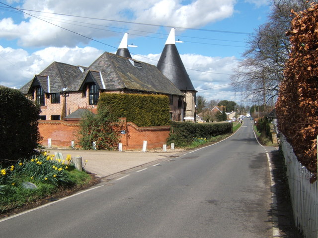
Betsham is known for its tranquil and idyllic setting, with a population of around 400 residents. The village itself consists of a mix of traditional and modern houses, giving it a charming and diverse architectural appeal. The community is tight-knit, with a friendly and welcoming atmosphere.

One of the notable landmarks in Betsham is the St. Michael and All Angels Church, which dates back to the 13th century. This historic church features a beautiful stained glass window and hosts regular services for locals and visitors alike.

Despite its small size, Betsham benefits from its proximity to Dartford, a larger town nearby. This grants residents easy access to a variety of amenities, including schools, shops, and recreational facilities.

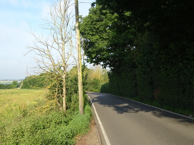
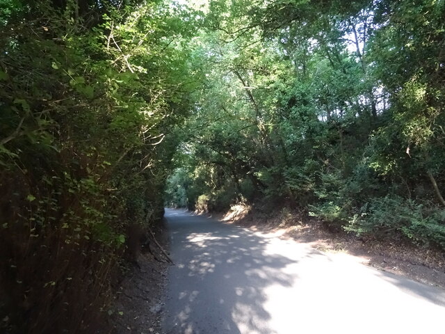
Surrounded by natural beauty, Betsham offers numerous opportunities for outdoor activities. The nearby countryside provides ample space for walking, cycling, and exploring the local flora and fauna.

Transport links in Betsham are well-developed, with the A2 road passing close by, connecting the village to both Dartford and London. There are also regular bus services that run through the area, providing convenient connections to neighboring towns and villages.

Overall, Betsham is a peaceful and charming village in the heart of the Kent countryside, offering a serene lifestyle and a close-knit community for its residents.

If you have any feedback on the listing, please let us know in the comments section below.

Betsham Images

Images are sourced within 2km of 51.421147/0.308424 or Grid Reference TQ6071. Thanks to Geograph Open Source API. All images are credited.

Bean Village sign
Bean Village sign
Merry Chest Cafe & Bar On Watling Street (A296).
Merry Chest Cafe & Bar
On Watling Street (A296).
Roadworks on National Cycle Route 1 Beside the A296 - towards Gravesend.
Roadworks on National Cycle Route 1
Beside the A296 - towards Gravesend.
Watling Street (A2)
Watling Street (A2)
Watling Street (A2) Looking east from a footbridge.
Watling Street (A2)
Looking east from a footbridge.
Crop field off the B262
B262 towards Green Street Green
Track off Sandbanks Hill
Sandbanks Hill (B262) Towards Green Street Green.
Sandbanks Hill (B262)
Towards Green Street Green.
The Hop House, Betsham This old oasthouse in Westwood Rd has been converted into a very desirable residence. The photo was taken looking towards the village.
The Hop House, Betsham
This old oasthouse in Westwood Rd has been converted into a very desirable residence. The photo was taken looking towards the village.
Church Cottages, Southfleet This row of cottages built around 1480 are near <a href="https://www.geograph.org.uk/photo/145162">TQ6171 : St Nicholas Church</a> and are appropriately in Church St Southfleet.
Church Cottages, Southfleet
This row of cottages built around 1480 are near TQ6171 : St Nicholas Church and are appropriately in Church St Southfleet.
Channel Tunnel Rail Link, Near Westwood This is the channel tunnel rail link looking northbound. At his point it follows the course of a pre-existing but dismantled single-track line. The taking of this photo caused “rail link” security to start a mini man-hunt. They caught up with their suspected terrorist while taking <a href="https://www.geograph.org.uk/photo/145121">TQ6271 : Bridleway and Railway near Northfleet Green</a> later on. Rail security now know all about Geographing!
Channel Tunnel Rail Link, Near Westwood
This is the channel tunnel rail link looking northbound. At his point it follows the course of a pre-existing but dismantled single-track line. The taking of this photo caused “rail link” security to start a mini man-hunt. They caught up with their suspected terrorist while taking TQ6271 : Bridleway and Railway near Northfleet Green later on. Rail security now know all about Geographing!
Friary Court; Southfleet A former Monastic Grange
Friary Court; Southfleet
A former Monastic Grange
St Nicholas Church There has been a church on this site since before the Norman conquest.
St Nicholas Church
There has been a church on this site since before the Norman conquest.
Sainsbury's Gravesend The march of the mega-stores continues its relentless pace. Gravesend Sainsbury's
Sainsbury's Gravesend
The march of the mega-stores continues its relentless pace. Gravesend Sainsbury's
Change for Ebbsfleet International This newly built roundabout will soon be the junction for Ebbsfleet International railway station (or so the sign says) however others think differently see <span class="nowrap"><a title="http://en.wikipedia.org/wiki/Ebbsfleet_International_station" rel="nofollow ugc noopener" href="http://en.wikipedia.org/wiki/Ebbsfleet_International_station">Link</a><img style="margin-left:2px;" alt="External link" title="External link - shift click to open in new window" src="https://s1.geograph.org.uk/img/external.png" width="10" height="10"/></span>
Change for Ebbsfleet International
This newly built roundabout will soon be the junction for Ebbsfleet International railway station (or so the sign says) however others think differently see LinkExternal link
A2 Near Gravesend This is the A2 south of Gravesend the shot was taken looking Rochester bound
A2 Near Gravesend
This is the A2 south of Gravesend the shot was taken looking Rochester bound
The Old Oast This old oast house is northeast of Betsham
The Old Oast
This old oast house is northeast of Betsham
Show me another place!

Betsham is located at Grid Ref: TQ6071 (Lat: 51.421147, Lng: 0.308424)

Administrative County: Kent

District: Dartford

Police Authority: Kent

What 3 Words

///patch.never.reader. Near Longfield, Kent

Nearby Locations

Betsham

Related Wikis

Betsham

Betsham is a hamlet in the parish of Southfleet in Kent, England.Betsham is a mile north-west from the village of Southfleet, which is situated nearly...

Southfleet railway station

Southfleet (also known as Southfleet for Springhead) was a railway station on the Gravesend West Line which served the small village of Southfleet in Kent...

Southfleet

Southfleet is a small village and civil parish in the borough of Dartford in Kent, England. The village is located three miles southwest of Gravesend,...

Beacon Wood Country Park

Beacon Wood Country Park is a public woodland in Bean near Dartford, in Kent, England. It was previously an industrial claypit then re-claimed as woodland...

Westwood, Southfleet

Westwood is a hamlet in the parish of Southfleet in Kent, England, in the west of the parish. It is one mile west of the village of Southfleet. In the...

Ebbsfleet Valley

Ebbsfleet Valley is a new town and redevelopment area in Kent, South East England, and part of the Thames Gateway, southwest of Gravesend. Development...

Bean, Kent

Bean is a village and civil parish in the Borough of Dartford, Kent, England. It is located 4.4 miles south east of Dartford and 5.4 miles south west of...

Springhead, Kent

Springhead lies at the source of the River Ebbsfleet, just southwest of the Gravesend suburban conurbations. Springhead forms one of the major quarters...

Nearby Amenities

Located within 500m of 51.421147,0.308424
Betsham
Place: hamlet
Source: npe
Wikidata: Q4898239
Lat/Long: 51.4203149/0.3069689
Power: tower
Lat/Long: 51.4238498/0.3127526
Power: tower
Lat/Long: 51.4233809/0.3107037
Power: tower
Lat/Long: 51.4234779/0.3124114
Power: tower
Lat/Long: 51.4205175/0.3125983
Power: tower
Lat/Long: 51.4185959/0.310607
Power: tower
Tower: transition
Lat/Long: 51.4212601/0.3143339
Telephone
Booth: KX100
Covered: booth
Lat/Long: 51.4202724/0.3075315
Bus Stop
Colyer's Place
Naptan AtcoCode: 2400A016380A
Naptan Bearing: E
Naptan CommonName: Colyer's Place
Naptan Indicator: adj
Naptan Landmark: Colyer's Place
Naptan NaptanCode: kntatadm
Naptan Street: Station Road
Naptan Verified: no
Public Transport: platform
Ref: kntatadm
Source: naptan_import
Source Date: 2018-04-11T12:37:00
Lat/Long: 51.4202676/0.3076017
Bus Stop
Colyer's Place
Naptan AtcoCode: 2400A016390A
Naptan Bearing: W
Naptan CommonName: Colyer's Place
Naptan Indicator: opp
Naptan Landmark: Colyer's Place
Naptan NaptanCode: kntatadp
Naptan Street: Station Road
Naptan Verified: no
Public Transport: platform
Ref: kntatadp
Source: naptan_import
Source Date: 2013-04-24T10:13:00
Lat/Long: 51.4202226/0.3080597
Post Box
Post Box Type: lamp
Royal Cypher: EIIR
Royal Cypher Wikidata: Q33102113
Lat/Long: 51.4202506/0.3076546
Colyer's Place
Bus: yes
Public Transport: stop_position
Lat/Long: 51.4202838/0.3080356
Colyer's Place
Bus: yes
Public Transport: stop_position
Lat/Long: 51.4202128/0.3076398
Crossing
Lat/Long: 51.4200269/0.3100786
The data included in this document is from www.openstreetmap.org. The data is made available under ODbL.

Have you been to Betsham?

Leave your review of Betsham below (or comments, questions and feedback).