Betley

Settlement in Staffordshire Newcastle-under-Lyme

England

Betley

The southern end of Betley Looking north along the main road (the A531) through Betley. The junction with Church Lane is seen on the right.
The southern end of Betley Credit: David Weston

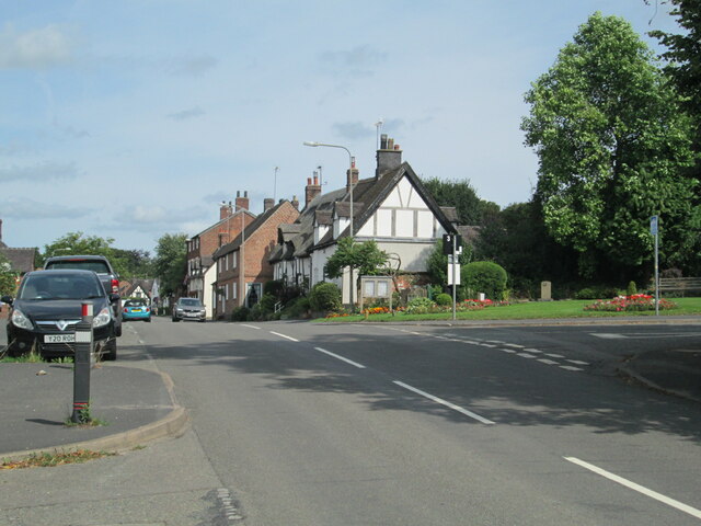
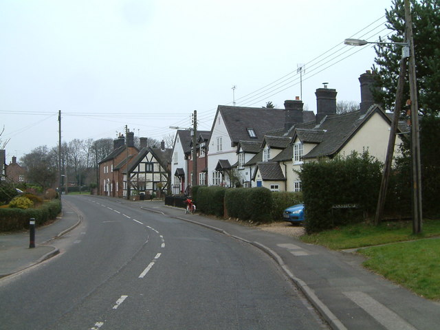
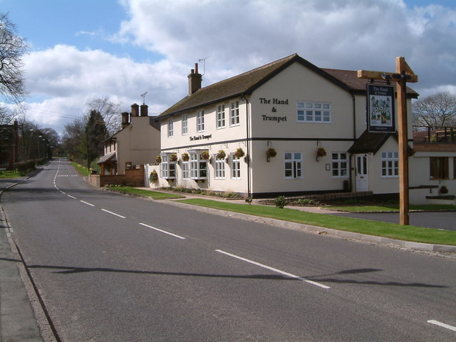
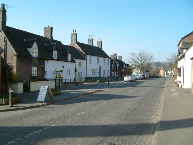
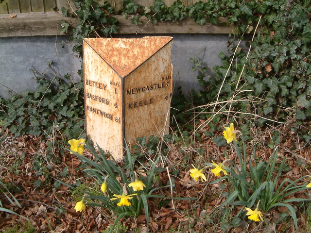
Betley is a small village located in the county of Staffordshire, England. Situated roughly 8 miles west of Stoke-on-Trent, it is nestled in the heart of the picturesque Cheshire countryside. With a population of around 1,000 residents, Betley offers a peaceful and close-knit community atmosphere.

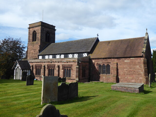
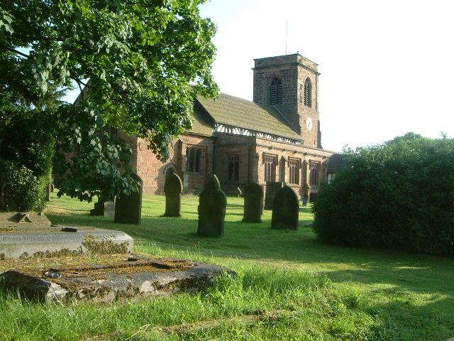
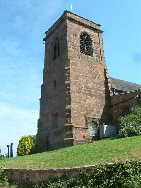
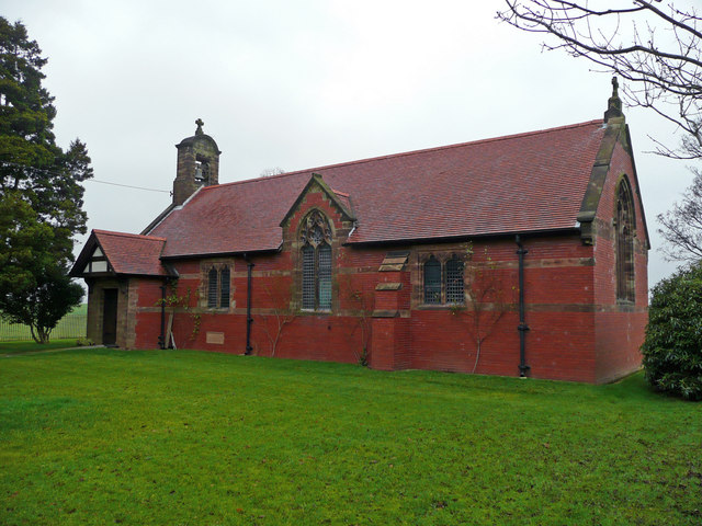
The village boasts a rich history, dating back to the medieval period when it was a prominent agricultural center. Today, remnants of this heritage can still be seen in the form of the historic St. Margaret's Church, which dates back to the 12th century and features stunning stained glass windows.

Betley is also known for its annual Betley Show, a popular agricultural event that has been running for over 150 years. The show attracts visitors from far and wide who come to enjoy a range of activities such as livestock shows, equestrian competitions, and various entertainment options.

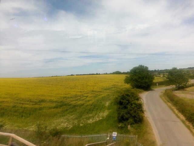
Surrounded by beautiful countryside, Betley offers numerous opportunities for outdoor activities. The nearby Betley Mere is a tranquil lake where visitors can enjoy fishing or take a leisurely stroll along its shores. The village is also close to several nature reserves and country parks, providing ample opportunities for hiking, cycling, and birdwatching.

While Betley may be a small village, it is well-connected to larger towns and cities in the area. The nearby town of Newcastle-under-Lyme is only a short drive away, offering a wider range of amenities such as shopping centers, restaurants, and leisure facilities.

Overall, Betley is a charming and historic village, offering a peaceful countryside escape with a strong sense of community and plenty of outdoor activities to enjoy.

If you have any feedback on the listing, please let us know in the comments section below.

Betley Images

Images are sourced within 2km of 53.033954/-2.366276 or Grid Reference SJ7548. Thanks to Geograph Open Source API. All images are credited.

The southern end of Betley Looking north along the main road (the A531) through Betley. The junction with Church Lane is seen on the right.
The southern end of Betley
Looking north along the main road (the A531) through Betley. The junction with Church Lane is seen on the right.
Betley, St Margaret
Betley, St Margaret
Checkley Lane, Wrinehill, from the train
St Margaret's Church, Betley Grade I Listed 

Parish church. Core of circa 1500 with C17 and C18 additions, heavily restored and partially rebuilt in 1842
St Margaret's Church, Betley
Grade I Listed Parish church. Core of circa 1500 with C17 and C18 additions, heavily restored and partially rebuilt in 1842
St Margarets Church - Betley Taken during Gravestone transcription project - June 1997
St Margarets Church - Betley
Taken during Gravestone transcription project - June 1997
Tower of St Margarets Church - Betley
The Butts - Betley.   A view of the Butts taken from the Church steps
The Butts - Betley. A view of the Butts taken from the Church steps
Bowhill Lane Farm - Betley All that remains of Bowhill farmhouse and barn
Bowhill Lane Farm - Betley
All that remains of Bowhill farmhouse and barn
Betley- The main road, looking north, the postmans bike at rest
A quiet road The new Hand & Trumpet public house on a quiet A531 through Wrinehill
A quiet road
The new Hand & Trumpet public house on a quiet A531 through Wrinehill
The Three Anchors & Black Horse A view along the A531 through Betley showing the lost public houses of Three Anchors and Black Horse
The Three Anchors & Black Horse
A view along the A531 through Betley showing the lost public houses of Three Anchors and Black Horse
A few miles to go Road sign in Wrinehill on the A531
A few miles to go
Road sign in Wrinehill on the A531
The Wilderness A look down "The Wilderness" Betley, a tree lined road, a bus shelter and cyclist.
The Wilderness
A look down "The Wilderness" Betley, a tree lined road, a bus shelter and cyclist.
Betley Court Betley Court through the trees
Betley Court
Betley Court through the trees
Betley  Mere Betley Mere is a site of Special Scientific Interest (SSSI) and is one of the few natural standing waters in Staffordshire and occupies a shallow valley in glacial deposits overlying Triassic strata  bounded on three sides by extensive peat deposits on which a very diverse range of vegetation types have developed.
Betley Mere
Betley Mere is a site of Special Scientific Interest (SSSI) and is one of the few natural standing waters in Staffordshire and occupies a shallow valley in glacial deposits overlying Triassic strata bounded on three sides by extensive peat deposits on which a very diverse range of vegetation types have developed.
Den Bridge View south from Den Bridge of the West Coast Main Line between Crewe and Stafford.
Den Bridge
View south from Den Bridge of the West Coast Main Line between Crewe and Stafford.
Converted Church A very nicely converted chapel at Wrinehill, Staffordshire.
Converted Church
A very nicely converted chapel at Wrinehill, Staffordshire.
Unusual Style of Stile This footpath does not seem to be used much so there is not a clear path. Helpfully the stiles round here do not have the yellow arrows on them either. Without the map I would be lost.
Unusual Style of Stile
This footpath does not seem to be used much so there is not a clear path. Helpfully the stiles round here do not have the yellow arrows on them either. Without the map I would be lost.
Show me another place!

Betley is located at Grid Ref: SJ7548 (Lat: 53.033954, Lng: -2.366276)

Administrative County: Staffordshire

District: Newcastle-under-Lyme

Police Authority: Staffordshire

What 3 Words

///providing.cupcake.crazy. Near Betley, Staffordshire

Nearby Locations

Betley Betley

Related Wikis

Betley

Betley is a village and civil parish in the borough of Newcastle-under-Lyme in Staffordshire, England, about halfway between the town of Newcastle-under...
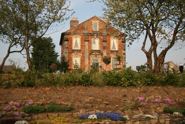
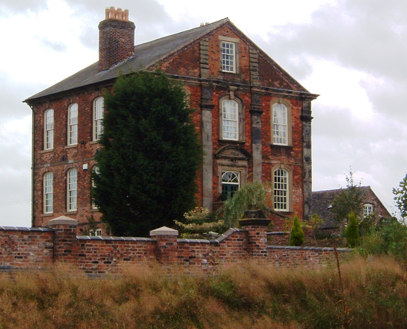
Betley Court

Betley Court is an 18th-century country house in the ancient village of Betley, near Newcastle-under-Lyme, Staffordshire. It is a Grade II* listed building...

Balterley Green

Balterley Green is a village in Staffordshire, England. The population at the 2011 population can be found under Balterley

Betley Road railway station

Betley Road was a station on the London and North Western Railway serving Betley, Staffordshire. It opened in 1875 and closed in 1945. == References... ==

Wrinehill

Wrinehill, also called Checkley cum Wrinehill, is a village in the north-west of Staffordshire on the A531 road lying adjacent to the southern border of...

Black Firs and Cranberry Bog

Black Firs and Cranberry Bog is a nature reserve of the Staffordshire Wildlife Trust, adjacent to Balterley Heath and about 1 mile (1.6 km) north of the...

Balterley

Balterley is a village and civil parish in the borough of Newcastle-under-Lyme in Staffordshire, England. According to the 2001 census it had a population...

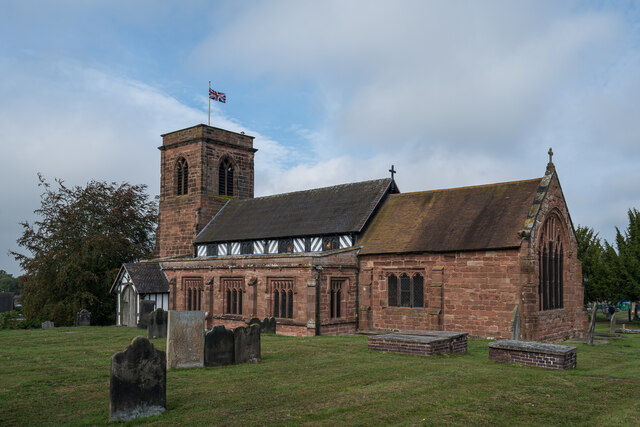
All Saints Church, Balterley

All Saints Church is in the village of Balterley, Staffordshire, England. It is an active Anglican parish church in the deanery of Congleton, the archdeaconry...

Nearby Amenities

Located within 500m of 53.033954,-2.366276
Pub
The Swan
Addr Postcode: CW3 9AA
Addr Street: Main Road
Fhrs Id: 65168
Website: https://theswanbetley.co.uk/
Lat/Long: 53.0341531/-2.36861
Post Office
Betley Post Office
Brand: Post Office
Brand Wikidata: Q1783168
Check Date: 2023-09-27
Ref Pol Id: 6701
Lat/Long: 53.0339813/-2.3686589
Betley
Place: village
Population: 1033
Wikidata: Q4898150
Lat/Long: 53.0355744/-2.3678642
Bus Stop
Black Horse Cottages
Bus: yes
Naptan AtcoCode: 3800C500400
Naptan Bearing: N
Naptan CommonName: Black Horse Cottages
Naptan Indicator: Adj
Naptan Landmark: Black Horse PH
Naptan Street: Main Road
Naptan Verified: no
Public Transport: platform
Source: naptan_import
Lat/Long: 53.0348002/-2.3685706
Bus Stop
Black Horse PH
Bus: yes
Naptan AtcoCode: 3800C500401
Naptan Bearing: S
Naptan CommonName: Black Horse PH
Naptan Indicator: Opp
Naptan Landmark: Black Horse PH
Naptan Street: Main Road
Naptan Verified: no
Public Transport: platform
Source: naptan_import
Lat/Long: 53.0348006/-2.3684513
Bus Stop
Court Walk
Bus: yes
Naptan AtcoCode: 3800C514301
Naptan Bearing: N
Naptan CommonName: Court Walk
Naptan Indicator: Adj
Naptan Landmark: Court Walk
Naptan Street: Main Road
Naptan Verified: no
Public Transport: platform
Source: naptan_import
Lat/Long: 53.0325171/-2.3684915
Bus Stop
Court Walk
Bus: yes
Naptan AtcoCode: 3800C514302
Naptan Bearing: S
Naptan CommonName: Court Walk
Naptan Indicator: Opp
Naptan Landmark: Court Walk
Naptan Street: Main Road
Naptan Verified: no
Public Transport: platform
Source: naptan_import
Lat/Long: 53.0323917/-2.3683413
Bus Stop
East Lawns
Bus: yes
Naptan AtcoCode: 3800C514501
Naptan Bearing: NW
Naptan CommonName: East Lawns
Naptan Indicator: Opp
Naptan Landmark: East Lawns
Naptan Street: Main Rd
Naptan Verified: no
Public Transport: platform
Source: naptan_import
Lat/Long: 53.037071/-2.3697085
Bus Stop
East Lawns
Bus: yes
Naptan AtcoCode: 3800C514502
Naptan Bearing: SE
Naptan CommonName: East Lawns
Naptan Indicator: Adj
Naptan Landmark: East Lawns
Naptan Street: Main Rd
Naptan Verified: no
Public Transport: platform
Source: naptan_import
Lat/Long: 53.0368385/-2.3693038
Barrier: stile
Lat/Long: 53.0314024/-2.3648321
Addr Housename: Betley Court Farm
Lat/Long: 53.0302593/-2.3695721
Telephone
Booth: K6
Covered: booth
Listed Status: Grade II
Operator: BT
Phone: +44 1270 820755
Lat/Long: 53.0348698/-2.3686516
Post Box
Post Box Type: wall
Lat/Long: 53.0340922/-2.3684739
The data included in this document is from www.openstreetmap.org. The data is made available under ODbL.

Have you been to Betley?

Leave your review of Betley below (or comments, questions and feedback).