Acton, North

Settlement in Middlesex

England

Acton, North

Signs and qr code on car for tattooing and piercing The Smart Car for Ink'D London has signs for tattooing, piercing, and tattoo numbing cream. It displays a qr code panel for scanning on a smart phone.
Signs and qr code on car for tattooing and piercing Credit: David Hawgood

Acton is a town located in the North Middlesex district of London, England. With a population of around 62,000, it is a vibrant and diverse community within the borough of Ealing. Acton is situated approximately 6 miles west of Charing Cross, making it a convenient location for commuting to central London.

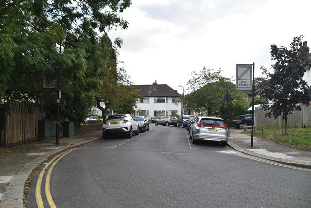
The town has a rich history, dating back to the 12th century when it was first recorded as a settlement. Over the years, Acton has transformed from a rural village to a bustling urban area. Its architecture reflects this evolution, with a mix of Victorian and Edwardian houses alongside modern developments.

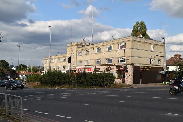
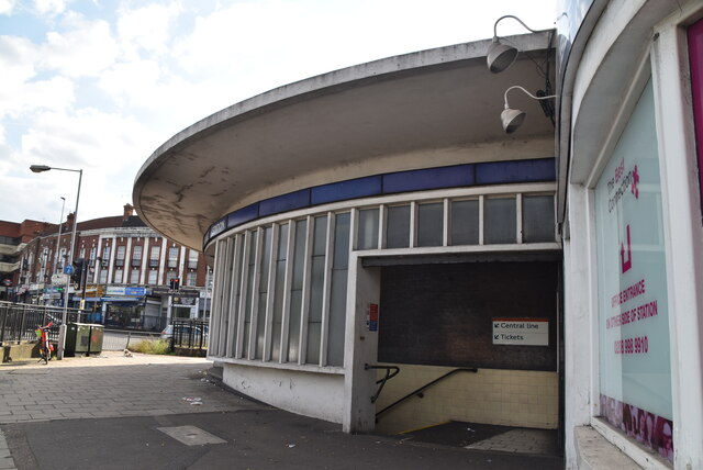
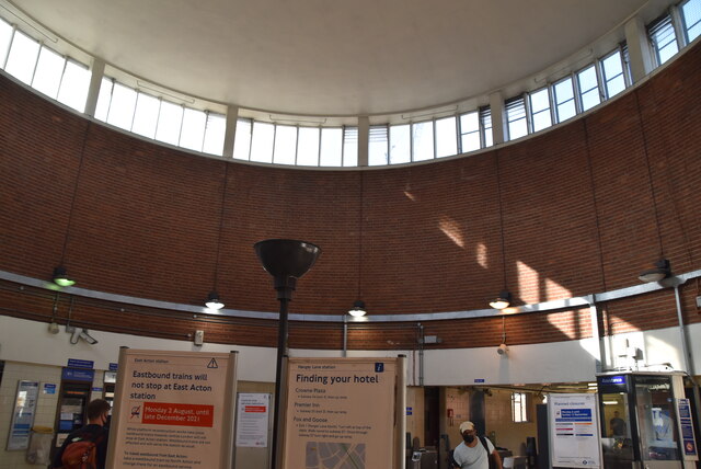
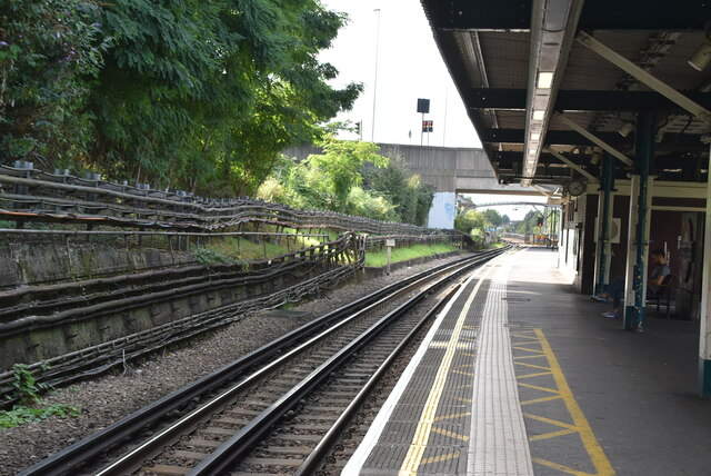
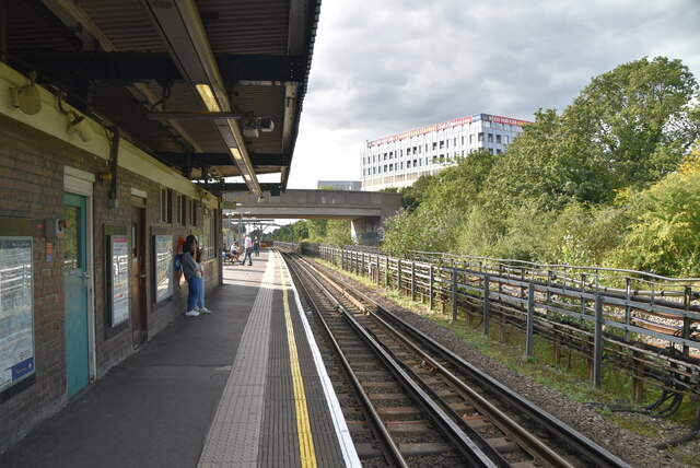
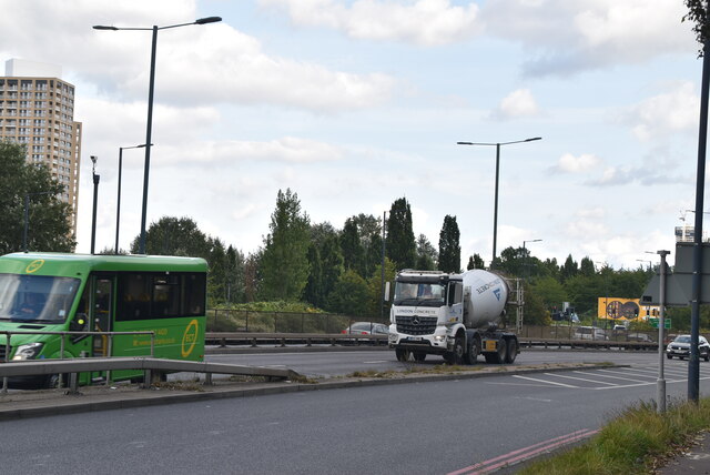
Acton is well-connected to the rest of London through its excellent transport links. The town is served by multiple Underground and Overground stations, including Acton Town, Acton Central, and Acton Main Line, allowing residents to easily travel across the city. Several bus routes also operate in the area, providing additional accessibility.

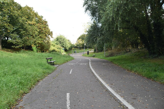
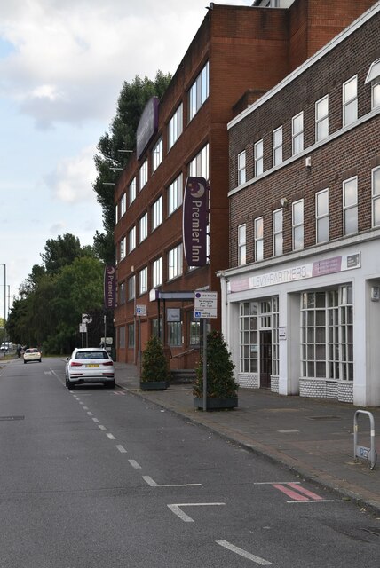
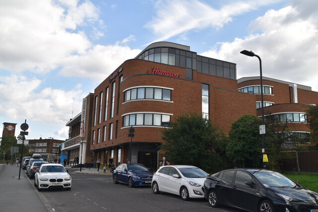
The town offers a range of amenities, including a variety of shops, cafes, and restaurants. Acton High Street is a popular destination for shopping, with both independent retailers and well-known chain stores. For green spaces, residents can enjoy Acton Park, a picturesque public park with tennis courts, a playground, and open fields.

Acton is home to a diverse community, with a mix of cultures and ethnicities. This diversity is reflected in the range of cuisines available, with numerous international restaurants and food markets offering flavors from around the world.

Overall, Acton is a lively and well-connected town, offering an attractive combination of urban convenience and a sense of community.

If you have any feedback on the listing, please let us know in the comments section below.
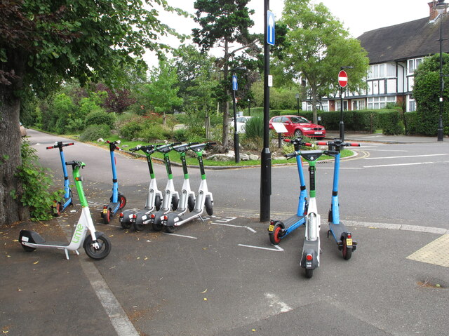
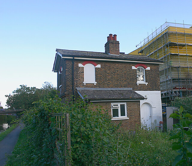
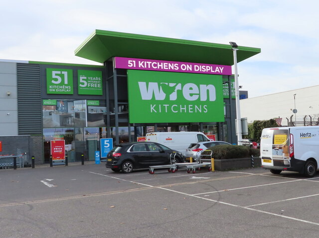
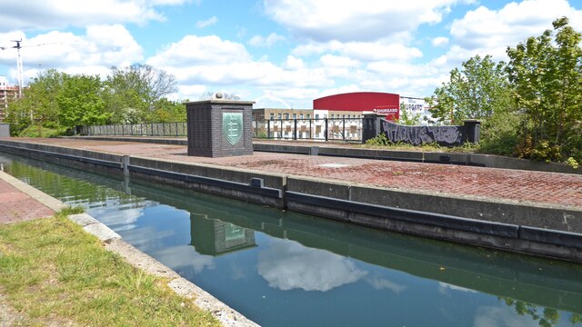
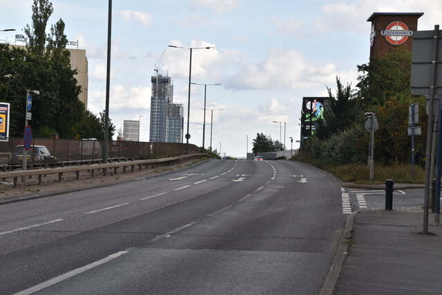
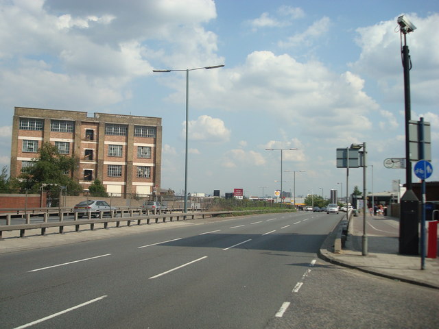
Acton, North Images

Images are sourced within 2km of 51.526196/-0.266525 or Grid Reference TQ2082. Thanks to Geograph Open Source API. All images are credited.

Signs and qr code on car for tattooing and piercing The Smart Car for Ink'D London has signs for tattooing, piercing, and tattoo numbing cream. It displays a qr code panel for scanning on a smart phone.
Signs and qr code on car for tattooing and piercing
The Smart Car for Ink'D London has signs for tattooing, piercing, and tattoo numbing cream. It displays a qr code panel for scanning on a smart phone.
E-scooters for hire, West Acton From 7 June 2021 there is a trial of legal hire of electric scooters. Ealing Borough is participating. The scooters shown in this designated area are from Lime and Dott. The location in Princes Gardens is near West Acton tube station.
E-scooters for hire, West Acton
From 7 June 2021 there is a trial of legal hire of electric scooters. Ealing Borough is participating. The scooters shown in this designated area are from Lime and Dott. The location in Princes Gardens is near West Acton tube station.
Unoccupied cottage, Grand Union Canal (Paddington Branch) This cottage is situated on land between the canal towpath and Twyford Abbey Road. Although the garden was overgrown, it looked as though the building was the subject of refurbishment.
Unoccupied cottage, Grand Union Canal (Paddington Branch)
This cottage is situated on land between the canal towpath and Twyford Abbey Road. Although the garden was overgrown, it looked as though the building was the subject of refurbishment.
Wren Kitchens, Acton This warehouse store sold office supplies for many years under different names, Staples, Office World, etc.
Wren Kitchens, Acton
This warehouse store sold office supplies for many years under different names, Staples, Office World, etc.
Stonebridge Park aqueduct The Stonebridge Park aqueduct carries the Paddington Arm of the Grand Union Canal across the A406 North Circular Road.

The original aqueduct was opened in 1933 and consisted of two arches across the new North Circular road.

The newer, larger structure dates from 1993 and has a single arch in order to accommodate a widened North Circular.  The Middlesex coat of arms on the centre island of the aqueduct is from the original 1933 structure.
Stonebridge Park aqueduct
The Stonebridge Park aqueduct carries the Paddington Arm of the Grand Union Canal across the A406 North Circular Road. The original aqueduct was opened in 1933 and consisted of two arches across the new North Circular road. The newer, larger structure dates from 1993 and has a single arch in order to accommodate a widened North Circular. The Middlesex coat of arms on the centre island of the aqueduct is from the original 1933 structure.
Cycle track, Hanger Lane London Cycle Network route 85 from Kew Bridge to Neasden passes through Hanger Lane Gyratory. There is a new crossing on Hanger Lane, just north of the gyratory. This set of photos shows the route from the A40 west, under the Central Line, across Hanger Lane, under the North Circular, and into Twyford Abbey Road for Park Royal.
Cycle track, Hanger Lane
London Cycle Network route 85 from Kew Bridge to Neasden passes through Hanger Lane Gyratory. There is a new crossing on Hanger Lane, just north of the gyratory. This set of photos shows the route from the A40 west, under the Central Line, across Hanger Lane, under the North Circular, and into Twyford Abbey Road for Park Royal.
Fernlea House
Fernlea House
Hanger Lane Station Hanger Lane Underground station is located on the West Ruislip branch of the Central line, between Perivale and North Acton stations, and is in Travelcard Zone 3. The station is located in Hanger Hill.
It is within walking distance of Park Royal station on the Piccadilly line. The two lines cross a little east of Hanger Lane station. The station opened in 1947.
Hanger Lane Station
Hanger Lane Underground station is located on the West Ruislip branch of the Central line, between Perivale and North Acton stations, and is in Travelcard Zone 3. The station is located in Hanger Hill. It is within walking distance of Park Royal station on the Piccadilly line. The two lines cross a little east of Hanger Lane station. The station opened in 1947.
Central Line, Hanger Lane Station Hanger Lane Underground station is located on the West Ruislip branch of the Central line, between Perivale and North Acton stations, and is in Travelcard Zone 3. The station is located in Hanger Hill.
It is within walking distance of Park Royal station on the Piccadilly line. The two lines cross a little east of Hanger Lane station. The station opened in 1947.
Central Line, Hanger Lane Station
Hanger Lane Underground station is located on the West Ruislip branch of the Central line, between Perivale and North Acton stations, and is in Travelcard Zone 3. The station is located in Hanger Hill. It is within walking distance of Park Royal station on the Piccadilly line. The two lines cross a little east of Hanger Lane station. The station opened in 1947.
Labyrinth #25, Hanger Lane Hanger Lane Underground station is located on the West Ruislip branch of the Central line, between Perivale and North Acton stations, and is in Travelcard Zone 3. The station is located in Hanger Hill.
It is within walking distance of Park Royal station on the Piccadilly line. The two lines cross a little east of Hanger Lane station. The station opened in 1947.
Labyrinth #25, Hanger Lane
Hanger Lane Underground station is located on the West Ruislip branch of the Central line, between Perivale and North Acton stations, and is in Travelcard Zone 3. The station is located in Hanger Hill. It is within walking distance of Park Royal station on the Piccadilly line. The two lines cross a little east of Hanger Lane station. The station opened in 1947.
Hanger Lane Station Hanger Lane Underground station is located on the West Ruislip branch of the Central line, between Perivale and North Acton stations, and is in Travelcard Zone 3. The station is located in Hanger Hill.
It is within walking distance of Park Royal station on the Piccadilly line. The two lines cross a little east of Hanger Lane station. The station opened in 1947.
Hanger Lane Station
Hanger Lane Underground station is located on the West Ruislip branch of the Central line, between Perivale and North Acton stations, and is in Travelcard Zone 3. The station is located in Hanger Hill. It is within walking distance of Park Royal station on the Piccadilly line. The two lines cross a little east of Hanger Lane station. The station opened in 1947.
Premier Inn, Hanger Lane Premier Inn is the largest Hotel chain in the UK, with over 600 budget hotels.
Website: <span class="nowrap"><a title="http://www.premierinn.com/en/" rel="nofollow ugc noopener" href="http://www.premierinn.com/en/">Link</a><img style="margin-left:2px;" alt="External link" title="External link - shift click to open in new window" src="https://s1.geograph.org.uk/img/external.png" width="10" height="10"/></span>
Premier Inn, Hanger Lane
Premier Inn is the largest Hotel chain in the UK, with over 600 budget hotels. Website: LinkExternal link
Connell Crescent
Connell Crescent
Western Avenue The A40 road runs 256 miles from the City of London to Fishguard. It is a major trunk road and runs through High Wycombe, Oxford, Cheltenham, Ross on Wye, Abergavenny, Llandeilo and Carmarthen.
Western Avenue
The A40 road runs 256 miles from the City of London to Fishguard. It is a major trunk road and runs through High Wycombe, Oxford, Cheltenham, Ross on Wye, Abergavenny, Llandeilo and Carmarthen.
Hampton
Hampton
Western Avenue The A40 road runs 256 miles from the City of London to Fishguard. It is a major trunk road and runs through High Wycombe, Oxford, Cheltenham, Ross on Wye, Abergavenny, Llandeilo and Carmarthen.
Western Avenue
The A40 road runs 256 miles from the City of London to Fishguard. It is a major trunk road and runs through High Wycombe, Oxford, Cheltenham, Ross on Wye, Abergavenny, Llandeilo and Carmarthen.
Show me another place!

Acton, North is located at Grid Ref: TQ2082 (Lat: 51.526196, Lng: -0.266525)

Unitary Authority: Ealing

Police Authority: Metropolitan

What 3 Words

///lives.aspect.fonts. Near Acton, London

Related Wikis

North Acton Halt railway station

North Acton Halt railway station served the North Acton area of Acton, London, England, from 1904 to 1913 on the Acton-Northolt line. == History == The...

Western Avenue, London

Western Avenue is part of the A40, a major road running in a north-westerly direction out of London. Western Avenue is approximately 10 miles (16 km) long...

North Acton tube station

North Acton is a London Underground station in North Acton, west London in the London Borough of Ealing. The station is on the Central line between East...

Central Middlesex Hospital

Central Middlesex Hospital is in the centre of the Park Royal business estate, on the border of two London boroughs, Brent and Ealing. It is managed by...

Nearby Amenities

Located within 500m of 51.526196,-0.266525
Mini Roundabout
Direction: clockwise
Lat/Long: 51.5226563/-0.2696338
Railway: switch
Lat/Long: 51.5250632/-0.2663816
Ref GB Tflcid: RWG272800
Traffic Calming: hump
Lat/Long: 51.5241972/-0.2705717
Mini Roundabout
Direction: clockwise
Lat/Long: 51.5283083/-0.2688455
Traffic Signals
Lat/Long: 51.5285123/-0.267969
Post Box
Operator: Royal Mail
Operator Wikidata: Q638098
Post Box Type: pillar
Ref: NW10 86
Lat/Long: 51.5268608/-0.2596678
Post Box
Operator: Royal Mail
Operator Wikidata: Q638098
Post Box Type: pillar
Ref: NW10 77
Lat/Long: 51.5274999/-0.2673006
Telephone
Booth: KX100
Covered: booth
Lat/Long: 51.5277655/-0.2675184
Post Box
Operator: Royal Mail
Operator Wikidata: Q638098
Post Box Type: pillar
Ref: NW10 47
Lat/Long: 51.5302613/-0.266702
Crossing
Crossing: uncontrolled
Crossing Ref: zebra
Lat/Long: 51.5302412/-0.266937
Crossing
Bicycle: yes
Crossing: unmarked
Crossing Island: no
Crossing Markings: no
Kerb: lowered
Tactile Paving: yes
Traffic Calming: table
Lat/Long: 51.5234798/-0.2659108
North Acton
Rcn: yes
Rcn Name: North Acton
Lat/Long: 51.5240392/-0.2670846
Post Box
Operator: Royal Mail
Operator Wikidata: Q638098
Post Box Type: pillar
Ref: W3 6D
Royal Cypher: GR
Royal Cypher Wikidata: Q33102273
Lat/Long: 51.5229538/-0.2682441
Post Box
Operator: Royal Mail
Operator Wikidata: Q638098
Post Box Design: type_k
Post Box Type: pillar
Ref: NW10 44
Lat/Long: 51.5262005/-0.2664664
Post Box
Operator: Royal Mail
Operator Wikidata: Q638098
Ref: NW10 105
Lat/Long: 51.5287693/-0.2697891
Post Box
Brand: Royal Mail
Brand Wikidata: Q638098
Operator: Royal Mail
Operator Wikidata: Q638098
Post Box Type: pillar
Ref: NW10 27
Lat/Long: 51.529492/-0.268205
Bus Stop
Allan Way
Bus: yes
Local Ref: Y
Naptan AtcoCode: 490003228W
Naptan Bearing: W
Naptan CommonName: Allan Way
Naptan Street: WESTERN AVENUE
Naptan Verified: no
Public Transport: platform
Ref: 50765
Source Ref: naptan
Lat/Long: 51.5237814/-0.2664038
Bus Stop
Abbey Road
Bus: yes
Local Ref: H
Naptan AtcoCode: 490003028E
Naptan Bearing: W
Naptan CommonName: Abbey Road Coronation Road
Naptan Indicator: Stop H
Naptan Street: CORONATION ROAD
Naptan Verified: no
Public Transport: platform
Ref: 71587
Lat/Long: 51.5292524/-0.2699765
Bus Stop
Acton Lane
Bus: yes
Local Ref: D
Naptan AtcoCode: 490003078S
Naptan Bearing: S
Naptan CommonName: Acton Lane Park Royal Road
Naptan Indicator: D
Naptan Street: PARK ROYAL ROAD
Naptan Verified: no
Public Transport: platform
Ref: 73729
Lat/Long: 51.5293575/-0.2682029
Bus Stop
Central Middlesex Hospital
Bus: yes
Local Ref: A
Naptan AtcoCode: 490004925A
Naptan Bearing: W
Naptan CommonName: Central Middlesex Hospital
Naptan Indicator: Stop A
Naptan Verified: no
Public Transport: platform
Ref: 52194
Lat/Long: 51.5302451/-0.2690703
Bus Stop
Central Middlesex Hospital
Bus: yes
Local Ref: T3
Naptan AtcoCode: 490004925B
Naptan Bearing: NW
Naptan CommonName: Central Middlesex Hospital
Naptan Indicator: Stop T3
Naptan Verified: no
Public Transport: platform
Lat/Long: 51.5298811/-0.2696938
Bus Stop
Central Middlesex Hospital
Bus: yes
Local Ref: T1
Naptan AtcoCode: 490004925E
Naptan Bearing: E
Naptan CommonName: Central Middlesex Hospital
Naptan Indicator: Stop T1
Naptan Street: ACTON LANE
Naptan Verified: no
Public Transport: platform
Lat/Long: 51.5304222/-0.2666878
Bus Stop
Central Middlesex Hospital
Bus: yes
Local Ref: T2
Naptan AtcoCode: 490004925W
Naptan Bearing: E
Naptan CommonName: Central Middlesex Hospital
Naptan Indicator: Stop T2
Naptan Verified: no
Public Transport: platform
Lat/Long: 51.5298825/-0.2678301
Bus Stop
Gypsy Corner
Bus: yes
Local Ref: R
Naptan AtcoCode: 490007188R
Naptan Bearing: N
Naptan CommonName: Gipsy Corner R S T
Naptan Indicator: Stop R
Naptan Street: WESTERN AVENUE
Naptan Verified: no
Public Transport: platform
Ref: 57418
Lat/Long: 51.5222307/-0.2639223
Bus Stop
Victoria Road
Bus: yes
Local Ref: S
Naptan AtcoCode: 490007188S
Naptan Bearing: N
Naptan CommonName: Gipsy Corner R S T
Naptan Indicator: Stop S
Naptan Street: PARK ROYAL ROAD
Naptan Verified: no
Public Transport: platform
Lat/Long: 51.5228382/-0.263903
Bus Stop
Gypsy Corner
Bus: yes
Local Ref: T
Naptan AtcoCode: 490007188T
Naptan Bearing: E
Naptan CommonName: Gipsy Corner R S T
Naptan Indicator: Stop T
Naptan Street: PARK ROYAL ROAD
Naptan Verified: no
Public Transport: platform
Ref: 56446
Lat/Long: 51.5228227/-0.2636674
Bus Stop
Minerva Road
Bus: yes
Local Ref: X
Naptan AtcoCode: 490009938E
Naptan Bearing: E
Naptan CommonName: Minerva Road
Naptan Indicator: Stop X
Naptan Street: MINERVA ROAD
Naptan Verified: no
Public Transport: platform
Ref: 49182
Lat/Long: 51.529198/-0.2642164
Bus Stop
Gorst Road
Bus: yes
Local Ref: F
Naptan AtcoCode: 490010824N
Naptan Bearing: N
Naptan CommonName: Park Royal Business Centre
Naptan Indicator: Stop F
Naptan Street: PARK ROYAL ROAD
Naptan Verified: no
Public Transport: platform
Lat/Long: 51.5259282/-0.2664423
Bus Stop
Gorst Road
Bus: yes
Local Ref: E
Naptan AtcoCode: 490010824S
Naptan Bearing: S
Naptan CommonName: Park Royal Business Centre
Naptan Indicator: Stop E
Naptan Verified: no
Public Transport: platform
Lat/Long: 51.5264623/-0.2665334
Bus Stop
Chase Road
Bus: yes
Local Ref: U
Naptan AtcoCode: 490010825U
Naptan Bearing: N
Naptan CommonName: Park Royal Road
Naptan Indicator: Stop U
Naptan Street: VICTORIA ROAD
Naptan Verified: no
Public Transport: platform
Lat/Long: 51.5229087/-0.2620515
Bus Stop
Standard Road
Bus: yes
Local Ref: Y
Naptan AtcoCode: 490012530K
Naptan Bearing: W
Naptan CommonName: Standard Road (Brent)
Naptan Indicator: Stop Y
Naptan Street: STANDARD ROAD
Naptan Verified: no
Public Transport: platform
Ref: 57567
Lat/Long: 51.5280447/-0.2638148
Bus Stop
Sunbeam Road
Bus: yes
Local Ref: PJ
Naptan AtcoCode: 490013003N
Naptan Bearing: S
Naptan CommonName: Sunbeam Road
Naptan Indicator: Stop PJ
Naptan Street: CHASE ROAD
Naptan Verified: no
Public Transport: platform
Ref: 71020
Lat/Long: 51.526208/-0.2598846
Bus Stop
Sunbeam Road
Bus: yes
Local Ref: PD
Naptan AtcoCode: 490013003S
Naptan Bearing: S
Naptan CommonName: Sunbeam Road
Naptan Indicator: Stop PD
Naptan Street: CHASE ROAD
Naptan Verified: no
Public Transport: platform
Ref: 58134
Lat/Long: 51.5265909/-0.2595906
Bus Stop
Wendover Court
Bench: yes
Bin: no
Bus: yes
Naptan AtcoCode: 490014388E
Naptan Bearing: E
Naptan CommonName: Wendover Court
Naptan Street: WESTERN AVENUE
Naptan Verified: no
Public Transport: platform
Ref: 76959
Shelter: yes
Source Ref: naptan
Lat/Long: 51.5257628/-0.2719261
Bus Stop
Wendover Court
Bench: yes
Bin: no
Bus: yes
Naptan AtcoCode: 490014388W
Naptan Bearing: W
Naptan CommonName: Wendover Court
Naptan Street: WESTERN AVENUE
Naptan Verified: no
Public Transport: platform
Ref: 76776
Shelter: yes
Source Ref: naptan
Lat/Long: 51.5255268/-0.2720038
Bus Stop
Gypsy Corner
Bench: yes
Bin: no
Bus: yes
Local Ref: P
Naptan AtcoCode: 490015319P
Naptan Bearing: W
Naptan CommonName: Gipsy Corner O P
Naptan Indicator: Stop P
Naptan Street: WESTERN AVENUE
Naptan Verified: no
Public Transport: platform
Ref: 76271
Shelter: yes
Lat/Long: 51.5230676/-0.2652039
Bus Stop
Park Royal Asda / Western Road
Bus: yes
Local Ref: K
Naptan AtcoCode: 490015414F1
Naptan Bearing: E
Naptan CommonName: Park Royal Asda Western Road
Naptan Indicator: Stop K
Naptan Verified: no
Public Transport: platform
Ref: 58710
Lat/Long: 51.5275509/-0.2687321
Park Royal Asda / Western Road
Local Ref: J
Naptan AtcoCode: 490015414F2
Naptan Bearing: E
Naptan CommonName: Park Royal Asda Western Road
Naptan Indicator: Stop J
Naptan Street: PARK ROYAL ROAD
Naptan Verified: no
Lat/Long: 51.5273607/-0.2697425
Bus Stop
Park Royal Asda
Bus: yes
Local Ref: G
Naptan AtcoCode: 490015414G
Naptan Bearing: N
Naptan CommonName: Park Royal Asda Western Road
Naptan Indicator: Stop G
Naptan Street: PARK ROYAL ROAD
Naptan Verified: no
Public Transport: platform
Ref: 76663
Lat/Long: 51.5295351/-0.2684789
Bus Stop
Western Road
Bus: yes
Local Ref: M
Naptan AtcoCode: 490014449E
Naptan Bearing: E
Naptan CommonName: Western Road (NW10)
Naptan Indicator: Stop M
Naptan Verified: no
Public Transport: platform
Lat/Long: 51.5290182/-0.2716799
Bicycle Parking
Bicycle Parking: stands
Capacity: 2
Lat/Long: 51.5297535/-0.2683629
Disused Amenity: bank
Old Name: HSBC UK
Lat/Long: 51.5297106/-0.2681755
Bicycle Parking
Bicycle Parking: stands
Capacity: 2
Lat/Long: 51.5294743/-0.2682782
Fast Food
Spice Shack
Cuisine: indian
Lat/Long: 51.5294536/-0.2681219
Telephone
Booth: KX100
Covered: booth
Lat/Long: 51.5295488/-0.2682077
Bicycle Parking
Bicycle Parking: stands
Capacity: 2
Lat/Long: 51.5299291/-0.2684512
Bicycle Parking
Bicycle Parking: stands
Capacity: 2
Lat/Long: 51.5297087/-0.269349
Atm
Brand: NatWest
Brand Wikidata: Q2740021
Operator: NatWest
Operator Wikidata: Q2740021
Lat/Long: 51.5297047/-0.269498
Bicycle Parking
Bicycle Parking: wall_loops
Capacity: 22
Lat/Long: 51.5287229/-0.2694246
Bicycle Parking
Bicycle Parking: wall_loops
Capacity: 22
Lat/Long: 51.5285296/-0.2693341
Car Wash
Opening Hours: Mo-Su 08:00-19:00
Lat/Long: 51.5294559/-0.26874
Railway: switch
Lat/Long: 51.5250251/-0.2663707
Crossing
Crossing: traffic_signals
Crossing Island: no
Tactile Paving: yes
Lat/Long: 51.5261637/-0.2737425
Ref GB Tflcid: RWG272792
Traffic Calming: hump
Lat/Long: 51.5227439/-0.2690723
London Hackspace
Addr City: London
Addr Country: GB
Addr Housenumber: 41-43
Addr Postcode: NW10 6HF
Addr Street: Standard Road
Addr Suburb: Park Royal
Contact Irc: irc://irc.freenode.net/#london-hack-space
Contact Website: https://london.hackspace.org.uk
Drink Club-mate: yes
Fee: yes
Internet Access: wlan;wired
Leisure: hackerspace
Opening Hours: 24/7
Payment Bank Transfer: yes
Wikidata: Q6670461
Lat/Long: 51.5277983/-0.2642631
Ref GB Tflcid: RWG272804
Traffic Calming: hump
Lat/Long: 51.5232057/-0.2683856
Ref GB Tflcid: RWG272802
Traffic Calming: hump
Lat/Long: 51.5236311/-0.26854
Traffic Signals
Traffic Signals Direction: forward
Lat/Long: 51.5300077/-0.2687221
The Heart of Gaming
Check Date: 2023-03-30
Disused Leisure: amusement_arcade
Lat/Long: 51.5250769/-0.2654367
Crossing
Crossing: uncontrolled
Not Crossing Ref: zebra
Lat/Long: 51.5229444/-0.2651307
Crossing
Crossing: traffic_signals
Crossing Island: no
Crossing Markings: yes
Lat/Long: 51.5296369/-0.2683687
Bench
Lat/Long: 51.5296021/-0.2682561
Artwork: statue
Tourism: artwork
Lat/Long: 51.5296271/-0.2682721
Entrance: yes
Lat/Long: 51.5286483/-0.2693697
Crossing
Crossing: uncontrolled
Crossing Ref: zebra
Lat/Long: 51.5287035/-0.2690713
Crossing
Crossing: uncontrolled
Crossing Ref: zebra
Lat/Long: 51.5288279/-0.2684471
Fuel
Brand: Asda
Brand Wikidata: Q297410
Brand Wikipedia: en:Asda
Contact Facebook: https://www.facebook.com/asda/
Contact Twitter: asda
Contact Website: https://storelocator.asda.com/london/london/2-20-western-road-park-royal
Operator: Asda Stores Ltd
Lat/Long: 51.5278941/-0.2684231
Crossing
Crossing: marked
Lat/Long: 51.528469/-0.2681835
Bus Stop
Bethune Road
Bus: yes
Local Ref: W
Naptan AtcoCode: 490000157N
Public Transport: platform
Ref: 59249
Lat/Long: 51.5245671/-0.2609504
Bus Stop
Central Middlesex Hospital
Bus: yes
Local Ref: Z1
Naptan AtcoCode: 4900004925Z1
Naptan Bearing: W
Naptan CommonName: Central Middlesex Hospital
Naptan Indicator: Stop Z1
Naptan Verified: no
Note: Bus stand.
Public Transport: platform
Lat/Long: 51.5301354/-0.2684381
Barrier: lift_gate
Lat/Long: 51.5292377/-0.2710704
Barrier: yes
Lat/Long: 51.5270992/-0.2704322
Crossing
Crossing: traffic_signals
Crossing Island: no
Tactile Paving: yes
Lat/Long: 51.5227639/-0.262041
Give Way
Direction: forward
Lat/Long: 51.5234551/-0.2658715
Give Way
Direction: backward
Lat/Long: 51.5229571/-0.2651476
Barrier: bollard
Bollard: fixed
Lat/Long: 51.5220369/-0.26424
Give Way
Direction: backward
Lat/Long: 51.5234974/-0.2659403
Give Way
Direction: forward
Lat/Long: 51.5229269/-0.265109
Give Way
Direction: forward
Lat/Long: 51.5226528/-0.2647764
Barrier: bollard
Bollard: fixed
Lat/Long: 51.524019/-0.2671093
Give Way
Direction: forward
Lat/Long: 51.5234451/-0.2659478
Pharmacy
Brand: Asda
Brand Wikidata: Q297410
Brand Wikipedia: en:Asda
Contact Phone: +44 20 8951 9000
Contact Website: https://storelocator.asda.com/london/london/2-20-western-road-park-royal/pharmacy
Fixme: Location not accurate
Operator: Asda Stores Ltd
Lat/Long: 51.5283069/-0.2698034
Brand: Asda
Brand Wikidata: Q297410
Brand Wikipedia: en:Asda
Contact Phone: +44 20 8951 9112
Contact Website: https://storelocator.asda.com/london/london/2-20-western-road-park-royal/opticians
Fixme: Location not accurate
Operator: Asda Stores Ltd
Shop: optician
Lat/Long: 51.5283386/-0.2696317
North Acton Junction
Railway: junction
Lat/Long: 51.5250422/-0.2663816
Crossing
Crossing: traffic_signals
Crossing Island: yes
Crossing Markings: yes
Lat/Long: 51.5295235/-0.2694397
Direction: SSW
Generator Method: photovoltaic
Generator Output Electricity: yes
Generator Solar Modules: 24
Generator Source: solar
Generator Type: solar_photovoltaic_panel
Location: roof
Power: generator
Lat/Long: 51.5269529/-0.271784
Direction: SE
Generator Method: photovoltaic
Generator Output Electricity: yes
Generator Solar Modules: 7
Generator Source: solar
Generator Type: solar_photovoltaic_panel
Location: roof
Power: generator
Lat/Long: 51.5235097/-0.2713372
Direction: SE
Generator Method: photovoltaic
Generator Output Electricity: yes
Generator Solar Modules: 6
Generator Source: solar
Generator Type: solar_photovoltaic_panel
Location: roof
Power: generator
Lat/Long: 51.5234735/-0.2712792
Direction: 170
Generator Method: photovoltaic
Generator Output Electricity: yes
Generator Solar Modules: 12
Generator Source: solar
Generator Type: solar_photovoltaic_panel
Location: roof
Power: generator
Lat/Long: 51.5223846/-0.2656577
Direction: 235
Generator Method: photovoltaic
Generator Output Electricity: yes
Generator Solar Modules: 9
Generator Source: solar
Generator Type: solar_photovoltaic_panel
Location: roof
Power: generator
Lat/Long: 51.5227839/-0.2653305
Direction: 235
Generator Method: photovoltaic
Generator Output Electricity: yes
Generator Solar Modules: 13
Generator Source: solar
Generator Type: solar_photovoltaic_panel
Location: roof
Power: generator
Lat/Long: 51.5227155/-0.2652344
Direction: 80
Generator Method: photovoltaic
Generator Output Electricity: yes
Generator Solar Modules: 5
Generator Source: solar
Generator Type: solar_photovoltaic_panel
Location: roof
Power: generator
Lat/Long: 51.5225422/-0.2665558
Direction: 170
Generator Method: photovoltaic
Generator Output Electricity: yes
Generator Solar Modules: 4
Generator Source: solar
Generator Type: solar_photovoltaic_panel
Location: roof
Power: generator
Lat/Long: 51.522523/-0.2665827
Direction: WSW
Generator Method: photovoltaic
Generator Output Electricity: yes
Generator Solar Modules: 7
Generator Source: solar
Generator Type: solar_photovoltaic_panel
Location: roof
Power: generator
Lat/Long: 51.5226902/-0.2653589
Direction: 235
Generator Method: photovoltaic
Generator Output Electricity: yes
Generator Solar Modules: 6
Generator Source: solar
Generator Type: solar_photovoltaic_panel
Location: roof
Power: generator
Lat/Long: 51.5224405/-0.264999
Direction: 145
Generator Method: photovoltaic
Generator Output Electricity: yes
Generator Solar Modules: 10
Generator Source: solar
Generator Type: solar_photovoltaic_panel
Location: roof
Power: generator
Lat/Long: 51.5241216/-0.2703413
Direction: SW
Generator Method: photovoltaic
Generator Output Electricity: yes
Generator Solar Modules: 19
Generator Source: solar
Generator Type: solar_photovoltaic_panel
Location: roof
Power: generator
Lat/Long: 51.5238438/-0.2671701
Direction: WSW
Generator Method: photovoltaic
Generator Output Electricity: yes
Generator Solar Modules: 21
Generator Source: solar
Generator Type: solar_photovoltaic_panel
Location: roof
Power: generator
Lat/Long: 51.5221028/-0.264609
Direction: SW
Generator Method: photovoltaic
Generator Output Electricity: yes
Generator Solar Modules: 6
Generator Source: solar
Generator Type: solar_photovoltaic_panel
Location: roof
Power: generator
Lat/Long: 51.5233805/-0.2664087
Direction: SW
Generator Method: photovoltaic
Generator Output Electricity: yes
Generator Solar Modules: 6
Generator Source: solar
Generator Type: solar_photovoltaic_panel
Location: roof
Power: generator
Lat/Long: 51.5235229/-0.2666508
Direction: SW
Generator Method: photovoltaic
Generator Output Electricity: yes
Generator Solar Modules: 6
Generator Source: solar
Generator Type: solar_photovoltaic_panel
Location: roof
Power: generator
Lat/Long: 51.5236546/-0.266898
Direction: 235
Generator Method: photovoltaic
Generator Output Electricity: yes
Generator Solar Modules: 6
Generator Source: solar
Generator Type: solar_photovoltaic_panel
Location: roof
Power: generator
Lat/Long: 51.5230008/-0.2657144
Direction: SW
Generator Method: photovoltaic
Generator Output Electricity: yes
Generator Solar Modules: 6
Generator Source: solar
Generator Type: solar_photovoltaic_panel
Location: roof
Power: generator
Lat/Long: 51.5234062/-0.2664529
Direction: 235
Generator Method: photovoltaic
Generator Output Electricity: yes
Generator Solar Modules: 6
Generator Source: solar
Generator Type: solar_photovoltaic_panel
Location: roof
Power: generator
Lat/Long: 51.5223787/-0.2649471
Direction: 235
Generator Method: photovoltaic
Generator Output Electricity: yes
Generator Solar Modules: 6
Generator Source: solar
Generator Type: solar_photovoltaic_panel
Location: roof
Power: generator
Lat/Long: 51.5222564/-0.2648306
Direction: SW
Generator Method: photovoltaic
Generator Output Electricity: yes
Generator Solar Modules: 6
Generator Source: solar
Generator Type: solar_photovoltaic_panel
Location: roof
Power: generator
Lat/Long: 51.5234499/-0.2665268
Direction: SE
Generator Method: photovoltaic
Generator Output Electricity: yes
Generator Solar Modules: 10
Generator Source: solar
Generator Type: solar_photovoltaic_panel
Location: roof
Power: generator
Lat/Long: 51.5241749/-0.2709169
Direction: 235
Generator Method: photovoltaic
Generator Output Electricity: yes
Generator Solar Modules: 13
Generator Source: solar
Generator Type: solar_photovoltaic_panel
Location: roof
Power: generator
Lat/Long: 51.522224/-0.2647215
Direction: 235
Generator Method: photovoltaic
Generator Output Electricity: yes
Generator Solar Modules: 6
Generator Source: solar
Generator Type: solar_photovoltaic_panel
Location: roof
Power: generator
Lat/Long: 51.5229175/-0.2656075
Direction: 235
Generator Method: photovoltaic
Generator Output Electricity: yes
Generator Solar Modules: 6
Generator Source: solar
Generator Type: solar_photovoltaic_panel
Location: roof
Power: generator
Lat/Long: 51.5224681/-0.2650303
Direction: 235
Generator Method: photovoltaic
Generator Output Electricity: yes
Generator Solar Modules: 6
Generator Source: solar
Generator Type: solar_photovoltaic_panel
Location: roof
Power: generator
Lat/Long: 51.52229/-0.2648572
Direction: SW
Generator Method: photovoltaic
Generator Output Electricity: yes
Generator Solar Modules: 6
Generator Source: solar
Generator Type: solar_photovoltaic_panel
Location: roof
Power: generator
Lat/Long: 51.5235891/-0.266773
Direction: 145
Generator Method: photovoltaic
Generator Output Electricity: yes
Generator Solar Modules: 10
Generator Source: solar
Generator Type: solar_photovoltaic_panel
Location: roof
Power: generator
Lat/Long: 51.5241396/-0.2702889
Direction: SW
Generator Method: photovoltaic
Generator Output Electricity: yes
Generator Solar Modules: 6
Generator Source: solar
Generator Type: solar_photovoltaic_panel
Location: roof
Power: generator
Lat/Long: 51.5236822/-0.2669499
Direction: 235
Generator Method: photovoltaic
Generator Output Electricity: yes
Generator Solar Modules: 6
Generator Source: solar
Generator Type: solar_photovoltaic_panel
Location: roof
Power: generator
Lat/Long: 51.5228054/-0.2654666
Direction: 235
Generator Method: photovoltaic
Generator Output Electricity: yes
Generator Solar Modules: 6
Generator Source: solar
Generator Type: solar_photovoltaic_panel
Location: roof
Power: generator
Lat/Long: 51.5223479/-0.2649154
Direction: 235
Generator Method: photovoltaic
Generator Output Electricity: yes
Generator Solar Modules: 6
Generator Source: solar
Generator Type: solar_photovoltaic_panel
Location: roof
Power: generator
Lat/Long: 51.5230551/-0.2657827
Direction: SW
Generator Method: photovoltaic
Generator Output Electricity: yes
Generator Solar Modules: 6
Generator Source: solar
Generator Type: solar_photovoltaic_panel
Location: roof
Power: generator
Lat/Long: 51.5236141/-0.2668242
Direction: 235
Generator Method: photovoltaic
Generator Output Electricity: yes
Generator Solar Modules: 6
Generator Source: solar
Generator Type: solar_photovoltaic_panel
Location: roof
Power: generator
Lat/Long: 51.5228351/-0.2655034
Direction: SW
Generator Method: photovoltaic
Generator Output Electricity: yes
Generator Solar Modules: 6
Generator Source: solar
Generator Type: solar_photovoltaic_panel
Location: roof
Power: generator
Lat/Long: 51.5235476/-0.2666888
Direction: SW
Generator Method: photovoltaic
Generator Output Electricity: yes
Generator Solar Modules: 6
Generator Source: solar
Generator Type: solar_photovoltaic_panel
Location: roof
Power: generator
Lat/Long: 51.5237869/-0.2670505
Direction: 235
Generator Method: photovoltaic
Generator Output Electricity: yes
Generator Solar Modules: 6
Generator Source: solar
Generator Type: solar_photovoltaic_panel
Location: roof
Power: generator
Lat/Long: 51.5228892/-0.2655698
Direction: 235
Generator Method: photovoltaic
Generator Output Electricity: yes
Generator Solar Modules: 6
Generator Source: solar
Generator Type: solar_photovoltaic_panel
Location: roof
Power: generator
Lat/Long: 51.5229719/-0.265677
Direction: SW
Generator Method: photovoltaic
Generator Output Electricity: yes
Generator Solar Modules: 6
Generator Source: solar
Generator Type: solar_photovoltaic_panel
Location: roof
Power: generator
Lat/Long: 51.5234769/-0.2665699
Shelter
Shelter Type: shopping_cart
Lat/Long: 51.5285966/-0.2686732
Shelter
Shelter Type: shopping_cart
Lat/Long: 51.5286867/-0.2689805
Shelter
Shelter Type: shopping_cart
Lat/Long: 51.5288971/-0.2688265
Shelter
Shelter Type: shopping_cart
Lat/Long: 51.5291712/-0.268969
Shelter
Shelter Type: shopping_cart
Lat/Long: 51.5292517/-0.2693156
Shelter
Shelter Type: shopping_cart
Lat/Long: 51.5288999/-0.2695467
Shelter
Shelter Type: shopping_cart
Lat/Long: 51.5279267/-0.2692423
Shelter
Shelter Type: shopping_cart
Lat/Long: 51.5280096/-0.2688327
Fast Food
McDonald's
Addr City: London
Addr Housename: Asda
Addr Housenumber: 2-20
Addr Postcode: NW10 7LW
Addr Street: Western Road
Brand: McDonald's
Brand Wikidata: Q38076
Brand Wikipedia: en:McDonald's
Contact Website: https://www.mcdonalds.com/gb/en-gb/location/park-royal/park-royal---asda/2-20-western-road/8261569.html
Cuisine: burger
Drive Through: no
Opening Hours: Mo 07:00-23:59; Tu-Fr 06:00-23:59; Sa 07:00-22:00; Su 11:00-17:00
Takeaway: yes
Lat/Long: 51.5288766/-0.2697674
Bench
Lat/Long: 51.5288652/-0.2683908
Bench
Lat/Long: 51.5287962/-0.2683553
Telephone
Booth: KX100
Covered: booth
Lat/Long: 51.5299423/-0.2686098
Traffic Signals
Lat/Long: 51.5296535/-0.268949
Traffic Signals
Traffic Signals Direction: forward
Lat/Long: 51.5294941/-0.2695471
Traffic Signals
Lat/Long: 51.52976/-0.2692299
Crossing
Crossing: traffic_signals
Crossing Island: no
Crossing Ref: pelican
Lat/Long: 51.5299448/-0.268695
Traffic Signals
Traffic Signals Direction: forward
Lat/Long: 51.5295903/-0.2684513
Crossing
Crossing: traffic_signals
Crossing Island: no
Crossing Ref: pelican
Lat/Long: 51.5299669/-0.2688705
Traffic Signals
Lat/Long: 51.5298218/-0.2690999
Cycleway: asl
Direction: forward
Lat/Long: 51.5298206/-0.2690327
Traffic Signals
Lat/Long: 51.5297444/-0.2689386
Traffic Signals
Lat/Long: 51.5298435/-0.2682618
Crossing
Crossing: traffic_signals
Crossing Island: no
Crossing Ref: pelican
Tactile Paving: yes
Lat/Long: 51.5298322/-0.2683104
Crossing
Crossing: traffic_signals
Crossing Island: no
Crossing Ref: pelican
Tactile Paving: yes
Lat/Long: 51.5299228/-0.2682287
Traffic Signals
Lat/Long: 51.5299163/-0.2682739
Crossing
Crossing: uncontrolled
Crossing Ref: zebra
Lat/Long: 51.530314/-0.2667696
Crossing
Crossing: traffic_signals
Crossing Island: yes
Crossing Markings: yes
Lat/Long: 51.5297302/-0.2691883
Cycleway: asl
Direction: forward
Lat/Long: 51.5295118/-0.2694807
Crossing
Crossing: traffic_signals
Crossing Island: no
Crossing Markings: yes
Lat/Long: 51.5298225/-0.2689698
Give Way
Direction: forward
Lat/Long: 51.5305296/-0.2680186
Railway: switch
Lat/Long: 51.5245608/-0.260505
Bicycle: yes
Brand: Cycleways
Colour: #93d50a
Information: guidepost
Tourism: information
Lat/Long: 51.5240194/-0.2669891
Crossing
Crossing: unmarked
Lat/Long: 51.5284411/-0.2626747
Crossing
Crossing: unmarked
Lat/Long: 51.5293243/-0.2631848
Crossing
Crossing: unmarked
Lat/Long: 51.5244364/-0.2610573
Crossing
Crossing: unmarked
Lat/Long: 51.526416/-0.2598223
Crossing
Crossing: marked
Lat/Long: 51.5270516/-0.2596683
Crossing
Crossing: unmarked
Lat/Long: 51.5284816/-0.2619218
Crossing
Crossing: unmarked
Lat/Long: 51.5284694/-0.2610479
Crossing
Crossing: unmarked
Lat/Long: 51.5284575/-0.2602857
Crossing
Crossing: unmarked
Lat/Long: 51.5272842/-0.2613864
Crossing
Crossing: unmarked
Lat/Long: 51.526845/-0.2595508
Crossing
Crossing: unmarked
Lat/Long: 51.5257468/-0.2599327
Crossing
Crossing: unmarked
Lat/Long: 51.5252942/-0.260234
Crossing
Crossing: traffic_signals
Crossing Island: no
Tactile Paving: yes
Lat/Long: 51.5232452/-0.261585
Crossing
Crossing: traffic_signals
Crossing Island: no
Tactile Paving: yes
Lat/Long: 51.5232755/-0.2614861
Crossing
Lat/Long: 51.5223914/-0.2630819
Bicycle Parking
Bicycle Parking: stands
Capacity: 6
Ref GB Tflcid: RWG261084
Lat/Long: 51.5236127/-0.2617598
Bicycle Parking
Bicycle Parking: stands
Capacity: 6
Ref GB Tflcid: RWG260841
Lat/Long: 51.5231909/-0.2611662
Bicycle Parking
Bicycle Parking: stands
Capacity: 2
Ref GB Tflcid: RWG261083
Lat/Long: 51.5266456/-0.2597295
Bicycle Parking
Bicycle Parking: stands
Capacity: 2
Ref GB Tflcid: RWG261079
Lat/Long: 51.5268439/-0.2669638
Bicycle Parking
Bicycle Parking: stands
Capacity: 2
Ref GB Tflcid: RWG261080
Lat/Long: 51.5275954/-0.2675259
Bicycle Parking
Bicycle Parking: stands
Capacity: 8
Ref GB Tflcid: RWG260853
Lat/Long: 51.523392/-0.2614381
Bicycle Parking
Bicycle Parking: stands
Capacity: 4
Ref GB Tflcid: RWG260851
Lat/Long: 51.5233135/-0.2611228
Railway: switch
Lat/Long: 51.5247654/-0.260519
Ref GB Tflcid: RWG272795
Traffic Calming: cushion
Lat/Long: 51.5226093/-0.270061
Ref GB Tflcid: RWG272794
Traffic Calming: cushion
Lat/Long: 51.5223664/-0.269535
Ref GB Tflcid: RWG272805
Traffic Calming: hump
Lat/Long: 51.523574/-0.2674631
Ref GB Tflcid: RWG272791
Traffic Calming: hump
Lat/Long: 51.5229166/-0.2678594
Ref GB Tflcid: RWG272790
Traffic Calming: hump
Lat/Long: 51.5230392/-0.2669664
Ref GB Tflcid: RWG272801
Traffic Calming: hump
Lat/Long: 51.5242235/-0.2694087
Traffic Signals
Traffic Signals Direction: forward
Lat/Long: 51.52229/-0.2629719
Cycleway: asl
Direction: forward
Lat/Long: 51.5226217/-0.2621815
Traffic Signals
Traffic Signals: signal
Traffic Signals Direction: forward
Lat/Long: 51.5226056/-0.2622389
Traffic Signals
Traffic Signals Direction: forward
Lat/Long: 51.5228249/-0.2618941
Cycleway: asl
Direction: forward
Lat/Long: 51.5227872/-0.2618913
Give Way
Direction: backward
Lat/Long: 51.5226891/-0.2648192
Give Way
Direction: forward
Lat/Long: 51.5235109/-0.2658809
Give Way
Direction: backward
Lat/Long: 51.5238574/-0.2650746
Charging Station
Source London
Access: yes
Brand: Source London
Brand Wikidata: Q7565133
Capacity: 3
Fee: yes
Operator: Source London
Operator Wikidata: Q7565133
Payment App: yes
Socket Type2: 3
Socket Type2 Output: 7kW
Lat/Long: 51.527199/-0.2596028
Auto Key Specialist
Addr City: London
Addr Housename: Unit 6 Minerva Business Centre
Addr Housenumber: 58-60
Addr Postcode: NW10 6HJ
Addr Street: Minerva Road
Addr Suburb: Park Royal
Opening Hours: Mo-Sa 09:30-18:00
Operator: LTD
Payment Cards: yes
Payment Cash: yes
Payment Coins: yes
Payment Contactless: yes
Payment Credit Cards: yes
Payment Debit Cards: yes
Payment Maestro: yes
Payment Mastercard: yes
Payment Notes: yes
Payment Visa: yes
Phone: +44 20 8965 3647
Services: Key Programming, Car Key Repair, Lock Repair, Emergency Service, Lock Picking
Shop: locksmith
Toilets: yes
Website: https://autokeyspecialist.uk/
Lat/Long: 51.5292176/-0.2666242
Bench
Lat/Long: 51.5251101/-0.2607759
Bench
Lat/Long: 51.5243786/-0.2613402
Bench
Lat/Long: 51.5244107/-0.2611731
Bench
Lat/Long: 51.5243433/-0.2612289
Bench
Lat/Long: 51.5245854/-0.2619047
Bench
Lat/Long: 51.5247589/-0.2621473
Bench
Lat/Long: 51.5258616/-0.2619766
Bench
Lat/Long: 51.525104/-0.2629453
Bench
Lat/Long: 51.5236845/-0.2628235
Bench
Lat/Long: 51.5232877/-0.263642
Historic: monument
Lat/Long: 51.5238621/-0.2644019
Bench
Lat/Long: 51.5237171/-0.2634185
Waste Basket
Lat/Long: 51.5227995/-0.2636228
Waste Basket
Lat/Long: 51.5233366/-0.2639077
Information: board
Tourism: information
Lat/Long: 51.523337/-0.2641183
Drinking Water
Lat/Long: 51.5233001/-0.263724
Waste Basket
Lat/Long: 51.52373/-0.2634394
Waste Basket
Lat/Long: 51.5235831/-0.2629922
Drinking Water
Lat/Long: 51.5236035/-0.26296
Waste Basket
Lat/Long: 51.5238065/-0.2624277
Drinking Water
Lat/Long: 51.5238295/-0.2623832
Bench
Lat/Long: 51.5240424/-0.2624725
Waste Basket
Lat/Long: 51.5240477/-0.2625125
Waste Basket
Lat/Long: 51.5239686/-0.2634837
Bench
Lat/Long: 51.5239416/-0.2635239
Drinking Water
Lat/Long: 51.5236446/-0.2639989
Waste Basket
Lat/Long: 51.5239124/-0.2642994
Drinking Water
Lat/Long: 51.5238944/-0.2642879
Waste Basket
Lat/Long: 51.5245853/-0.2619389
Waste Basket
Lat/Long: 51.5244418/-0.2612853
Information: board
Tourism: information
Lat/Long: 51.524475/-0.2611308
Bench
Lat/Long: 51.5253696/-0.2614376
Waste Basket
Lat/Long: 51.5249632/-0.2618386
Drinking Water
Lat/Long: 51.5249746/-0.2618313
Waste Basket
Lat/Long: 51.5250826/-0.2608442
Drinking Water
Lat/Long: 51.5250679/-0.2608546
Bench
Lat/Long: 51.5255905/-0.2613474
Waste Basket
Lat/Long: 51.525449/-0.2626142
Waste Basket
Lat/Long: 51.524784/-0.2627831
Drinking Water
Lat/Long: 51.5248008/-0.262798
Post Office
Royal Mail Post Office
Lat/Long: 51.5283781/-0.2672533
Crossing
Crossing: unmarked
Crossing Island: no
Crossing Markings: no
Tactile Paving: yes
Lat/Long: 51.5227657/-0.2621753
Give Way
Direction: forward
Lat/Long: 51.5229065/-0.2620114
Crossing
Crossing: traffic_signals
Crossing Island: no
Tactile Paving: yes
Lat/Long: 51.5233364/-0.261368
Crossing
Crossing: traffic_signals
Crossing Island: no
Tactile Paving: yes
Lat/Long: 51.5232109/-0.2614239
Crossing
Crossing: traffic_signals
Crossing Island: no
Tactile Paving: yes
Lat/Long: 51.5232547/-0.2616759
Traffic Signals
Traffic Signals: signal
Traffic Signals Direction: forward
Lat/Long: 51.5232662/-0.2613995
Traffic Signals
Traffic Signals: signal
Traffic Signals Direction: forward
Lat/Long: 51.5232215/-0.2612874
Cycleway: asl
Direction: forward
Lat/Long: 51.5232169/-0.2613473
Cycleway: asl
Direction: forward
Lat/Long: 51.5232156/-0.2616825
Traffic Signals
Traffic Signals: signal
Traffic Signals Direction: forward
Lat/Long: 51.5231868/-0.2616874
Cycleway: asl
Direction: forward
Lat/Long: 51.5234107/-0.2616208
Traffic Signals
Traffic Signals: signal
Traffic Signals Direction: forward
Lat/Long: 51.5234366/-0.2616347
Give Way
Direction: forward
Lat/Long: 51.5228505/-0.2617863
Barrier: bollard
Lat/Long: 51.5233509/-0.2659224
Barrier: cycle_barrier
Lat/Long: 51.5233759/-0.2658176
Give Way
Direction: backward
Lat/Long: 51.5229106/-0.2682819
Crossing
Crossing: traffic_signals
Crossing Island: no
Crossing Markings: yes
Lat/Long: 51.5296128/-0.2684698
Crossing
Crossing: traffic_signals
Crossing Island: yes
Crossing Markings: yes
Lat/Long: 51.5296928/-0.269276
Barrier: lift_gate
Lat/Long: 51.526075/-0.2601783
The data included in this document is from www.openstreetmap.org. The data is made available under ODbL.

Have you been to Acton, North?

Leave your review of Acton, North below (or comments, questions and feedback).