Bethel

Settlement in Cornwall

England

Bethel

Charlestown Beach A view south west along Charlestown beach from the western harbour wall.
Charlestown Beach Credit: Kevin Pearson

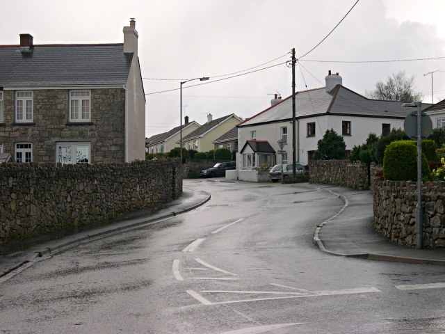
Bethel is a charming village located in the county of Cornwall, England. Situated near the popular town of St Austell, Bethel offers a peaceful and picturesque atmosphere, surrounded by stunning countryside and natural beauty. The village is nestled in the heart of Cornwall, making it an ideal base for exploring the region's many attractions.

Bethel is renowned for its quaint and traditional cottages, which exude a sense of history and character. The village is home to a tight-knit community, and residents often gather at the local pub or community center for social events and activities.

Nature enthusiasts will find plenty to enjoy in and around Bethel. The nearby Luxulyan Valley is a designated World Heritage Site and boasts a network of walking trails that wind through ancient woodlands, along rivers, and past historic mining sites. Visitors can also explore the nearby Eden Project, a world-famous attraction that features stunning botanical gardens within massive Biomes.

For those seeking a taste of local culture, the town of St Austell is just a short drive away. Here, visitors can explore the St Austell Brewery and sample some of Cornwall's finest ales, or browse the local shops and markets for unique souvenirs.

Overall, Bethel offers a tranquil and idyllic setting for those looking to escape the hustle and bustle of city life. With its rich history, natural beauty, and friendly community, Bethel is a hidden gem in the heart of Cornwall.

If you have any feedback on the listing, please let us know in the comments section below.
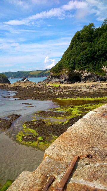
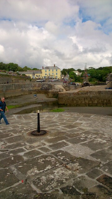
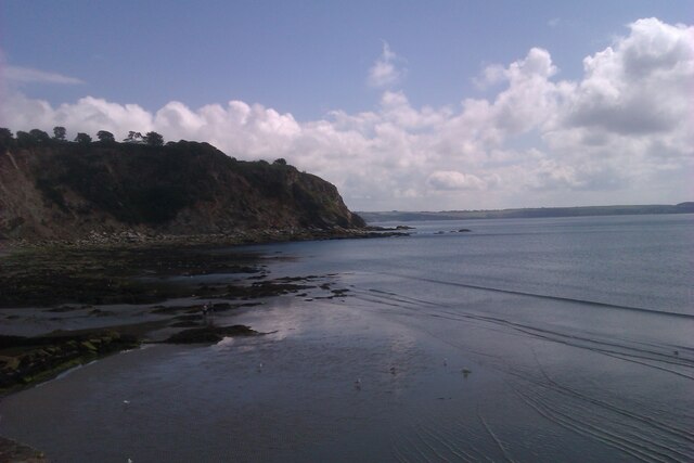
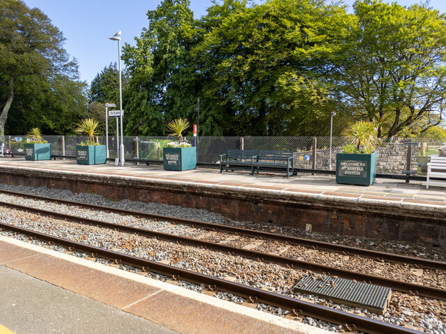
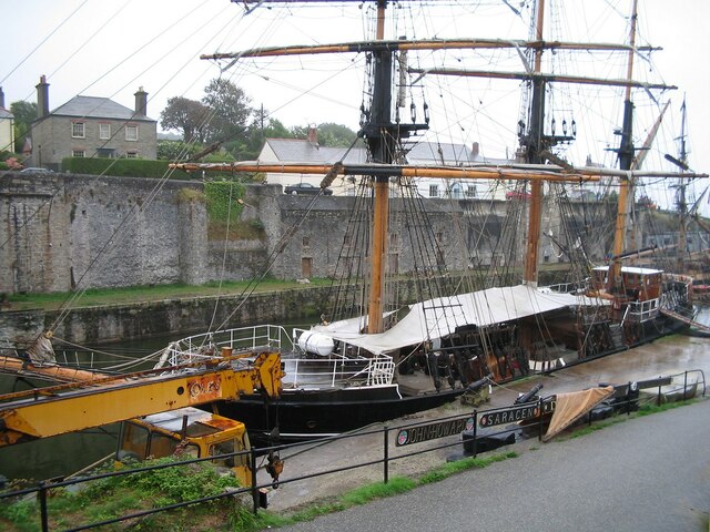
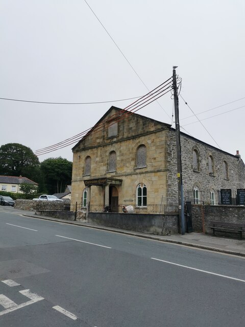
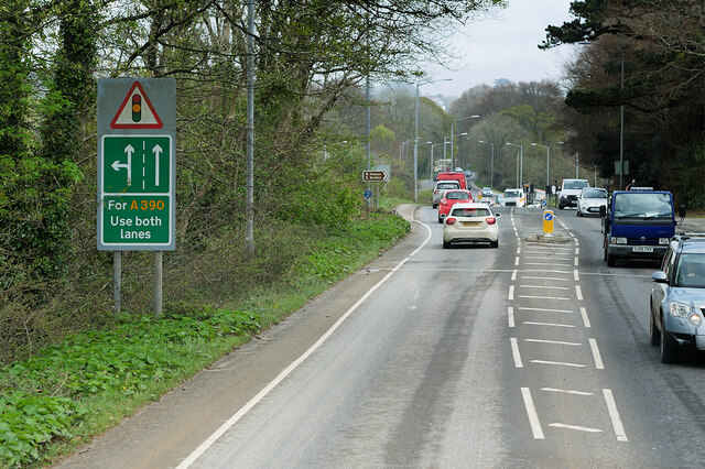
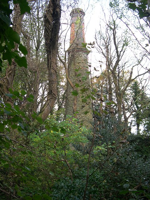
Bethel Images

Images are sourced within 2km of 50.343239/-4.76437 or Grid Reference SX0352. Thanks to Geograph Open Source API. All images are credited.

Charlestown Beach A view south west along Charlestown beach from the western harbour wall.
Charlestown Beach
A view south west along Charlestown beach from the western harbour wall.
Charletown Harbour Photograph of the entrance into Charlestown Harbour, taken from the western harbour wall.
Charletown Harbour
Photograph of the entrance into Charlestown Harbour, taken from the western harbour wall.
Charlestown Beach Charlestown Beach, looking east from the harbour entrance.
Charlestown Beach
Charlestown Beach, looking east from the harbour entrance.
St Austell station platforms and the top of High Cross Street
Tall Ship in Charlestown Harbour Charlestown is a village and port on the south coast of Cornwall. It is situated approximately 2 miles south east of St Austell town centre.
The port at Charlestown developed in the late-18th century from the fishing village of West Polmear. Charlestown has remained relatively unchanged since. Today the main focus of the village is tourism.
Wikipedia: <span class="nowrap"><a title="https://en.wikipedia.org/wiki/Charlestown,_Cornwall" rel="nofollow ugc noopener" href="https://en.wikipedia.org/wiki/Charlestown,_Cornwall">Link</a><img style="margin-left:2px;" alt="External link" title="External link - shift click to open in new window" src="https://s1.geograph.org.uk/img/external.png" width="10" height="10"/></span>
Tall Ship in Charlestown Harbour
Charlestown is a village and port on the south coast of Cornwall. It is situated approximately 2 miles south east of St Austell town centre. The port at Charlestown developed in the late-18th century from the fishing village of West Polmear. Charlestown has remained relatively unchanged since. Today the main focus of the village is tourism. Wikipedia: LinkExternal link
Charlestown Chapel Charlestown is a village and port on the south coast of Cornwall. It is situated approximately 2 miles south east of St Austell town centre.
The port at Charlestown developed in the late-18th century from the fishing village of West Polmear. Charlestown has remained relatively unchanged since. Today the main focus of the village is tourism.
Wikipedia: <span class="nowrap"><a title="https://en.wikipedia.org/wiki/Charlestown,_Cornwall" rel="nofollow ugc noopener" href="https://en.wikipedia.org/wiki/Charlestown,_Cornwall">Link</a><img style="margin-left:2px;" alt="External link" title="External link - shift click to open in new window" src="https://s1.geograph.org.uk/img/external.png" width="10" height="10"/></span>
Charlestown Chapel
Charlestown is a village and port on the south coast of Cornwall. It is situated approximately 2 miles south east of St Austell town centre. The port at Charlestown developed in the late-18th century from the fishing village of West Polmear. Charlestown has remained relatively unchanged since. Today the main focus of the village is tourism. Wikipedia: LinkExternal link
St Austell, Southbourne Road The A390 on the southern outskirts of St Austell.
St Austell, Southbourne Road
The A390 on the southern outskirts of St Austell.
St Austell, Polmear Road A390 approaching Mount Charles Roundabout.
St Austell, Polmear Road
A390 approaching Mount Charles Roundabout.
Railway Bridge Crossing Holmbush Road The A390 on the outskirts of St Austell.
Railway Bridge Crossing Holmbush Road
The A390 on the outskirts of St Austell.
Holmbush Road, St Austell The A390  runs for 60 miles between Tavistock and a roundabout with the A30 at Three Burrows, 5 miles north west of the city of Truro in Cornwall, via Lostwithiel, St Blazey, and St Austell. It is an important road as it forms part of the main route (the Truro to Dobwalls section) from Truro to Plymouth. It can be used to travel along the spine of Cornwall as a more leisurely drive instead of using the A30.
Holmbush Road, St Austell
The A390 runs for 60 miles between Tavistock and a roundabout with the A30 at Three Burrows, 5 miles north west of the city of Truro in Cornwall, via Lostwithiel, St Blazey, and St Austell. It is an important road as it forms part of the main route (the Truro to Dobwalls section) from Truro to Plymouth. It can be used to travel along the spine of Cornwall as a more leisurely drive instead of using the A30.
A390 Holmbush Road The A390  runs for 60 miles between Tavistock and a roundabout with the A30 at Three Burrows, 5 miles north west of the city of Truro in Cornwall, via Lostwithiel, St Blazey, and St Austell. It is an important road as it forms part of the main route (the Truro to Dobwalls section) from Truro to Plymouth. It can be used to travel along the spine of Cornwall as a more leisurely drive instead of using the A30.
A390 Holmbush Road
The A390 runs for 60 miles between Tavistock and a roundabout with the A30 at Three Burrows, 5 miles north west of the city of Truro in Cornwall, via Lostwithiel, St Blazey, and St Austell. It is an important road as it forms part of the main route (the Truro to Dobwalls section) from Truro to Plymouth. It can be used to travel along the spine of Cornwall as a more leisurely drive instead of using the A30.
Holmbush Road (A390) The A390  runs for 60 miles between Tavistock and a roundabout with the A30 at Three Burrows, 5 miles north west of the city of Truro in Cornwall, via Lostwithiel, St Blazey, and St Austell. It is an important road as it forms part of the main route (the Truro to Dobwalls section) from Truro to Plymouth. It can be used to travel along the spine of Cornwall as a more leisurely drive instead of using the A30.
Holmbush Road (A390)
The A390 runs for 60 miles between Tavistock and a roundabout with the A30 at Three Burrows, 5 miles north west of the city of Truro in Cornwall, via Lostwithiel, St Blazey, and St Austell. It is an important road as it forms part of the main route (the Truro to Dobwalls section) from Truro to Plymouth. It can be used to travel along the spine of Cornwall as a more leisurely drive instead of using the A30.
Signpost in Charlestown Shipwreck centre
Harbour front
Beach
Signpost in Charlestown
Shipwreck centre Harbour front Beach
Signpost in Charlestown Art gallery
Signpost in Charlestown
Art gallery
Old Milestone by Victoria Road, Mount Charles, St Austell Carved stone post by the UC road, in parish of ST AUSTELL (RESTORMEL District), Victoria Road, by No.11, Mount Charles, half buried in pavement until 1992, on North side of road. Erected by a private estate in the 19th century. 

Inscription reads:-
: PENRICE / 2 MILES : : ST / AUSTLE / 3/4 : 

Grade II listed. List Entry Number: 1394421

Milestone Society National ID: CW_PCSA02.
Old Milestone by Victoria Road, Mount Charles, St Austell
Carved stone post by the UC road, in parish of ST AUSTELL (RESTORMEL District), Victoria Road, by No.11, Mount Charles, half buried in pavement until 1992, on North side of road. Erected by a private estate in the 19th century. Inscription reads:- : PENRICE / 2 MILES : : ST / AUSTLE / 3/4 : Grade II listed. List Entry Number: 1394421 Milestone Society National ID: CW_PCSA02.
Fingerpost on Poltair Road National ID
CW_SX0152
Fingerpost on Poltair Road
National ID CW_SX0152
Great Western Railway boundary 1911 CW_GWRAUS01em
Great Western Railway boundary 1911
CW_GWRAUS01em
GPO stone
GPO stone
Show me another place!

Bethel is located at Grid Ref: SX0352 (Lat: 50.343239, Lng: -4.76437)

Unitary Authority: Cornwall

Police Authority: Devon and Cornwall

What 3 Words

///century.mango.school. Near St Austell, Cornwall

Related Wikis

Bethel, Cornwall

Bethel is a suburb on the east side of St Austell in Cornwall, England, United Kingdom (where the population was included). Bethel is included within the...

Holmbush, Cornwall

Holmbush is a village in Cornwall, England that is situated in the suburban area of St Austell (where the population at the 2011 census was included)....

Penrice Academy

Penrice Academy is a secondary academy school and former specialist Language College in St Austell, Cornwall, England. The school has an enrollment of...

Boscoppa

Boscoppa (Cornish: Boskoppa) is a settlement in the amalgamation of St Austell in Cornwall, England, United Kingdom. Originally Boscoppa was a separate...

Nearby Amenities

Located within 500m of 50.343239,-4.76437
Mini Roundabout
Direction: clockwise
Lat/Long: 50.3400933/-4.7606026
Traffic Calming: cushion
Lat/Long: 50.342977/-4.7705176
Mini Roundabout
Direction: clockwise
Lat/Long: 50.3430393/-4.7703568
Traffic Signals
Note: reciently changed, surveryed 2012
Source: survey
Traffic Signals Direction: both
Lat/Long: 50.3434719/-4.7690064
Mini Roundabout
Direction: clockwise
Lat/Long: 50.3440559/-4.7640794
Mini Roundabout
Direction: clockwise
Lat/Long: 50.3440443/-4.7637798
Mini Roundabout
Direction: clockwise
Lat/Long: 50.346312/-4.7650606
Mini Roundabout
Direction: clockwise
Lat/Long: 50.3461301/-4.7650772
Bus Stop
Tesco
Bus: yes
Naptan AtcoCode: 0800COC31002
Naptan Bearing: NE
Naptan CommonName: Tesco
Naptan NaptanCode: cordjtaw
Naptan PlusbusZoneRef: STAUSTL
Naptan Street: Car Park
Naptan Verified: no
Public Transport: platform
Source: naptan_import
Lat/Long: 50.3402125/-4.7602529
Bus Stop
Chapel Field
Bus: yes
Long Name: Bethel, opp Chapel Field
Naptan AdministrativeAreaCode: 73
Naptan AtcoCode: 0800COC31008
Naptan Bearing: W
Naptan BusStopType: MKD
Naptan CommonName: Chapel Field
Naptan Crossing: Chapel Field
Naptan Indicator: opp
Naptan LocalityName: Bethel
Naptan ModificationDate: 2021-07-07 13:30
Naptan NaptanCode: cordjtda
Naptan NptgLocalityCode: E0004465
Naptan ParentLocalityName: St Austell
Naptan PlusbusZoneRef: STAUSTL
Naptan RegionCode: cordjtda
Naptan Street: Trenowah Road
Public Transport: platform
Source: naptan_import
Lat/Long: 50.344623/-4.7603662
Bus Stop
Stennack Road
Bus: yes
Naptan AtcoCode: 0800COZ06405
Naptan Bearing: W
Naptan CommonName: Stennack Road
Naptan NaptanCode: corgajtd
Naptan PlusbusZoneRef: STAUSTL
Naptan Street: Stennack Road
Naptan Verified: no
Public Transport: platform
Source: naptan_import
Lat/Long: 50.3418239/-4.7586877
Bus Stop
Stennack Rd
Bus: yes
Naptan AtcoCode: 0800COZ06406
Naptan Bearing: W
Naptan CommonName: Stennack Rd
Naptan Crossing: Daniels Lane
Naptan NaptanCode: corgajtg
Naptan PlusbusZoneRef: STAUSTL
Naptan Street: Stennack Road
Naptan Verified: no
Public Transport: platform
Source: naptan_import
Lat/Long: 50.3415582/-4.7619193
Bus Stop
Daniel Close
Bus: yes
Long Name: Bethel Daniel Close (N-bound)
Naptan AdministrativeAreaCode: 73
Naptan AtcoCode: 0800COZ06436
Naptan Bearing: N
Naptan BusStopType: MKD
Naptan CommonName: Daniel Close
Naptan Crossing: Daniel Close
Naptan Indicator: N-bound
Naptan LocalityName: Bethel
Naptan ModificationDate: 2020-02-25 08:31
Naptan NaptanCode: corgamgp
Naptan NptgLocalityCode: E0004465
Naptan ParentLocalityName: St Austell
Naptan PlusbusZoneRef: STAUSTL
Naptan RegionCode: corgamgp
Naptan Street: Daniels Lane
Public Transport: platform
Source: naptan_import
Lat/Long: 50.3434638/-4.7638713
Bus Stop
Daniel Close
Bus: yes
Long Name: Bethel Daniel Close (S-bound)
Naptan AdministrativeAreaCode: 73
Naptan AtcoCode: 0800COZ06437
Naptan Bearing: S
Naptan BusStopType: MKD
Naptan CommonName: Daniel Close
Naptan Crossing: Daniel Close
Naptan Indicator: S-bound
Naptan LocalityName: Bethel
Naptan ModificationDate: 2020-02-25 08:31
Naptan NaptanCode: corgamgt
Naptan NptgLocalityCode: E0004465
Naptan ParentLocalityName: St Austell
Naptan PlusbusZoneRef: STAUSTL
Naptan RegionCode: corgamgt
Naptan Street: Daniels Lane
Public Transport: platform
Source: naptan_import
Lat/Long: 50.3434572/-4.7637725
Bus Stop
Stennack Rd
Bus: yes
Naptan AtcoCode: 0800COZ06447
Naptan Bearing: E
Naptan CommonName: Stennack Rd
Naptan Crossing: Daniels Lane
Naptan NaptanCode: corgampd
Naptan PlusbusZoneRef: STAUSTL
Naptan Street: Stennack Road
Naptan Verified: no
Public Transport: platform
Source: naptan_import
Lat/Long: 50.3416198/-4.7619791
Bus Stop
Stennack Road
Bus: yes
Naptan AtcoCode: 0800COZ06448
Naptan Bearing: E
Naptan CommonName: Stennack Road
Naptan Crossing: Bucklers Lane
Naptan NaptanCode: corgampg
Naptan PlusbusZoneRef: STAUSTL
Naptan Street: Stennack Road
Naptan Verified: no
Public Transport: platform
Source: naptan_import
Lat/Long: 50.3418858/-4.7587335
Bus Stop
Bucklers lane
Bus: yes
Naptan AdministrativeAreaCode: 73
Naptan AtcoCode: 0800COZ06449
Naptan Bearing: N
Naptan BusStopType: CUS
Naptan CommonName: Bucklers lane
Naptan Crossing: Stennack Road
Naptan Indicator: opp
Naptan LocalityName: Holmbush
Naptan ModificationDate: 2019-09-05 15:10:41
Naptan NaptanCode: corgampj
Naptan NptgLocalityCode: E0004572
Naptan ParentLocalityName: St Austell
Naptan PlusbusZoneRef: STAUSTL
Naptan RegionCode: corgampj
Naptan Street: Bucklers Lane
Public Transport: platform
Source: naptan_import
Was Name: Mercedes Garage
Was Naptan CommonName: Mercedes Garage
Lat/Long: 50.3422927/-4.7578856
Bus Stop
Tesco Store
Bus: yes
Long Name: Holmbush Tesco Store (N-bound)
Naptan AtcoCode: 0800FWW38529
Naptan Bearing: N
Naptan CommonName: Tesco Store
Naptan Crossing: Shelley Road
Naptan Indicator: N-bound
Naptan NaptanCode: cordjpwp
Naptan PlusbusZoneRef: STAUSTL
Naptan Street: Daniels Lane
Naptan Verified: no
Public Transport: platform
Source: naptan_import
Lat/Long: 50.3404436/-4.7621861
Place Of Worship
Seventh Day Adventist Church
Addr City: St Austell
Addr Street: Bucklers Lane
Religion: christian
Lat/Long: 50.3431363/-4.7615759
Place Of Worship
Bethel Methodist Church
Building: chapel
Denomination: methodist
Religion: christian
Lat/Long: 50.3442523/-4.7636346
Mini Roundabout
Direction: clockwise
Lat/Long: 50.3471871/-4.7671766
Turning Circle
Lat/Long: 50.3400746/-4.7661679
Turning Circle
Lat/Long: 50.3389364/-4.7653436
Post Office
Holmbush Post Office
Addr Country: GB
Addr Postcode: PL25 3HT
Brand: Post Office
Brand Wikidata: Q1783168
Contact Website: https://www.postoffice.co.uk/branch-finder/4335392/holmbush
Ref Pol Id: 15015
Lat/Long: 50.3393059/-4.7621759
Post Office
Brockstone Road Post Office
Addr Country: GB
Addr Postcode: PL25 3DW
Brand: Post Office
Brand Wikidata: Q1783168
Contact Website: https://www.postoffice.co.uk/branch-finder/4225392/brockstone-road
Ref Pol Id: 14861
Lat/Long: 50.3445234/-4.7645577
Post Box
Collection Times: Mo-Fr 17:30; Sa 11:45
Operator: Royal Mail
Operator Wikidata: Q638098
Ref: PL25 158
Royal Cypher: EIIR
Royal Cypher Wikidata: Q33102113
Survey Date: 2022-04-09
Lat/Long: 50.3397989/-4.7598252
Traffic Calming: table
Lat/Long: 50.3453047/-4.758258
Traffic Calming: table
Lat/Long: 50.3449351/-4.7595527
Traffic Calming: table
Lat/Long: 50.3446423/-4.7606166
Crossing
Crossing Island: yes
Crossing Markings: no
Crossing Signals: no
Traffic Calming: table
Lat/Long: 50.3431705/-4.7699585
Traffic Calming: table
Lat/Long: 50.3447612/-4.7601393
Access: yes
Leisure: playground
Lat/Long: 50.3436119/-4.7693446
Access: yes
Leisure: playground
Lat/Long: 50.3439538/-4.7632021
Fast Food
Cuisine: chinese
Lat/Long: 50.3396422/-4.7621734
Fast Food
Cuisine: fish_and_chips
Lat/Long: 50.3394299/-4.7621975
Shop: butcher
Lat/Long: 50.3396319/-4.7622646
Shop: bakery
Lat/Long: 50.3396627/-4.7620232
Turning Circle
Lat/Long: 50.3440706/-4.7597568
Atm
Check Date: 2024-04-11
Wheelchair: yes
Lat/Long: 50.3398684/-4.759786
Pharmacy
Wheal Northey Pharmacy
Addr Housename: Belmont Surgery
Addr Housenumber: 1
Addr Postcode: PL25 3EF
Addr Street: Wheal Northey
Dispensing: yes
Healthcare: pharmacy
Website: http://www.daylewisplc.co.uk
Lat/Long: 50.3442517/-4.7612479
Shop: car_repair
Lat/Long: 50.3433816/-4.7609186
Post Box
Collection Times: Mo-Fr 17:30; Sa 13:00
Operator: Royal Mail
Operator Wikidata: Q638098
Post Box Type: pillar
Ref: PL25 4
Royal Cypher: EIIR
Lat/Long: 50.341635/-4.7593331
Crossing
Crossing: zebra
Tactile Paving: yes
Lat/Long: 50.339805/-4.7598997
Generator Method: photovoltaic
Generator Output Electricity: yes
Generator Source: solar
Generator Type: solar_photovoltaic_panel
Location: roof
Power: generator
Lat/Long: 50.345053/-4.7658134
Generator Method: photovoltaic
Generator Output Electricity: yes
Generator Source: solar
Generator Type: solar_photovoltaic_panel
Location: roof
Power: generator
Lat/Long: 50.3459534/-4.7699735
Generator Method: photovoltaic
Generator Output Electricity: yes
Generator Source: solar
Generator Type: solar_photovoltaic_panel
Location: roof
Power: generator
Lat/Long: 50.3461468/-4.7692117
Generator Method: photovoltaic
Generator Output Electricity: yes
Generator Source: solar
Generator Type: solar_photovoltaic_panel
Location: roof
Power: generator
Lat/Long: 50.341484/-4.7708184
Generator Method: photovoltaic
Generator Output Electricity: yes
Generator Source: solar
Generator Type: solar_photovoltaic_panel
Location: roof
Power: generator
Lat/Long: 50.339928/-4.7689676
Generator Method: photovoltaic
Generator Output Electricity: yes
Generator Source: solar
Generator Type: solar_photovoltaic_panel
Location: roof
Power: generator
Lat/Long: 50.3412324/-4.7686243
Generator Method: photovoltaic
Generator Output Electricity: yes
Generator Source: solar
Generator Type: solar_photovoltaic_panel
Location: roof
Power: generator
Lat/Long: 50.3410663/-4.7690696
Generator Method: photovoltaic
Generator Output Electricity: yes
Generator Source: solar
Generator Type: solar_photovoltaic_panel
Location: roof
Power: generator
Lat/Long: 50.3409996/-4.7692922
Generator Method: photovoltaic
Generator Output Electricity: yes
Generator Source: solar
Generator Type: solar_photovoltaic_panel
Location: roof
Power: generator
Lat/Long: 50.3408044/-4.770003
Generator Method: photovoltaic
Generator Output Electricity: yes
Generator Source: solar
Generator Type: solar_photovoltaic_panel
Location: roof
Power: generator
Lat/Long: 50.3405357/-4.7698125
Generator Method: photovoltaic
Generator Output Electricity: yes
Generator Source: solar
Generator Type: solar_photovoltaic_panel
Location: roof
Power: generator
Lat/Long: 50.3402224/-4.769437
Generator Method: photovoltaic
Generator Output Electricity: yes
Generator Source: solar
Generator Type: solar_photovoltaic_panel
Location: roof
Power: generator
Lat/Long: 50.3402207/-4.7692546
Generator Method: photovoltaic
Generator Output Electricity: yes
Generator Source: solar
Generator Type: solar_photovoltaic_panel
Location: roof
Power: generator
Lat/Long: 50.3402344/-4.7686458
Generator Method: photovoltaic
Generator Output Electricity: yes
Generator Source: solar
Generator Type: solar_photovoltaic_panel
Location: roof
Power: generator
Lat/Long: 50.3392449/-4.7650194
Generator Method: photovoltaic
Generator Output Electricity: yes
Generator Source: solar
Generator Type: solar_photovoltaic_panel
Location: roof
Power: generator
Lat/Long: 50.3393357/-4.7643757
Generator Method: photovoltaic
Generator Output Electricity: yes
Generator Source: solar
Generator Type: solar_photovoltaic_panel
Location: roof
Power: generator
Lat/Long: 50.3395753/-4.7640404
Generator Method: photovoltaic
Generator Output Electricity: yes
Generator Source: solar
Generator Type: solar_photovoltaic_panel
Location: roof
Power: generator
Lat/Long: 50.3398989/-4.7647995
Generator Method: photovoltaic
Generator Output Electricity: yes
Generator Source: solar
Generator Type: solar_photovoltaic_panel
Location: roof
Power: generator
Lat/Long: 50.3411862/-4.7645259
Generator Method: photovoltaic
Generator Output Electricity: yes
Generator Source: solar
Generator Type: solar_photovoltaic_panel
Location: roof
Power: generator
Lat/Long: 50.341241/-4.7643113
Generator Method: photovoltaic
Generator Output Electricity: yes
Generator Source: solar
Generator Type: solar_photovoltaic_panel
Location: roof
Power: generator
Lat/Long: 50.3421225/-4.7640941
Generator Method: photovoltaic
Generator Output Electricity: yes
Generator Source: solar
Generator Type: solar_photovoltaic_panel
Location: roof
Power: generator
Lat/Long: 50.3429493/-4.7650597
Generator Method: photovoltaic
Generator Output Electricity: yes
Generator Source: solar
Generator Type: solar_photovoltaic_panel
Location: roof
Power: generator
Lat/Long: 50.3446439/-4.7613153
Generator Method: photovoltaic
Generator Output Electricity: yes
Generator Source: solar
Generator Type: solar_photovoltaic_panel
Location: roof
Power: generator
Lat/Long: 50.3441903/-4.761326
Generator Method: photovoltaic
Generator Output Electricity: yes
Generator Source: solar
Generator Type: solar_photovoltaic_panel
Location: roof
Power: generator
Lat/Long: 50.3430383/-4.7596872
Generator Method: photovoltaic
Generator Output Electricity: yes
Generator Source: solar
Generator Type: solar_photovoltaic_panel
Location: roof
Power: generator
Lat/Long: 50.346068/-4.7589335
Generator Method: photovoltaic
Generator Output Electricity: yes
Generator Source: solar
Generator Type: solar_photovoltaic_panel
Location: roof
Power: generator
Lat/Long: 50.3458096/-4.7606152
Generator Method: photovoltaic
Generator Output Electricity: yes
Generator Source: solar
Generator Type: solar_photovoltaic_panel
Location: roof
Power: generator
Lat/Long: 50.346484/-4.7604758
Generator Method: photovoltaic
Generator Output Electricity: yes
Generator Source: solar
Generator Type: solar_photovoltaic_panel
Location: roof
Power: generator
Lat/Long: 50.3470249/-4.7619563
Generator Method: photovoltaic
Generator Output Electricity: yes
Generator Source: solar
Generator Type: solar_photovoltaic_panel
Location: roof
Power: generator
Lat/Long: 50.347588/-4.7629648
Generator Method: photovoltaic
Generator Output Electricity: yes
Generator Source: solar
Generator Type: solar_photovoltaic_panel
Location: roof
Power: generator
Lat/Long: 50.3426112/-4.7680154
Generator Method: photovoltaic
Generator Output Electricity: yes
Generator Source: solar
Generator Type: solar_photovoltaic_panel
Location: roof
Power: generator
Lat/Long: 50.3396797/-4.7651468
Generator Method: photovoltaic
Generator Output Electricity: yes
Generator Source: solar
Generator Type: solar_photovoltaic_panel
Location: roof
Power: generator
Lat/Long: 50.3399177/-4.7688201
Generator Method: photovoltaic
Generator Output Electricity: yes
Generator Source: solar
Generator Type: solar_photovoltaic_panel
Location: roof
Power: generator
Lat/Long: 50.3398972/-4.7684205
Generator Method: photovoltaic
Generator Output Electricity: yes
Generator Source: solar
Generator Type: solar_photovoltaic_panel
Location: roof
Power: generator
Lat/Long: 50.3392278/-4.7670418
Generator Method: photovoltaic
Generator Output Electricity: yes
Generator Source: solar
Generator Type: solar_photovoltaic_panel
Location: roof
Power: generator
Lat/Long: 50.3394144/-4.764947
Generator Method: photovoltaic
Generator Output Electricity: yes
Generator Source: solar
Generator Type: solar_photovoltaic_panel
Location: roof
Power: generator
Lat/Long: 50.3402515/-4.7653735
Generator Method: photovoltaic
Generator Output Electricity: yes
Generator Source: solar
Generator Type: solar_photovoltaic_panel
Location: roof
Power: generator
Lat/Long: 50.3403285/-4.765867
Generator Method: photovoltaic
Generator Output Electricity: yes
Generator Source: solar
Generator Type: solar_photovoltaic_panel
Location: roof
Power: generator
Lat/Long: 50.3418041/-4.7653359
Generator Method: photovoltaic
Generator Output Electricity: yes
Generator Source: solar
Generator Type: solar_photovoltaic_panel
Location: roof
Power: generator
Lat/Long: 50.3419873/-4.764955
Generator Method: photovoltaic
Generator Output Electricity: yes
Generator Source: solar
Generator Type: solar_photovoltaic_panel
Location: roof
Power: generator
Lat/Long: 50.3419342/-4.7649041
Generator Method: photovoltaic
Generator Output Electricity: yes
Generator Source: solar
Generator Type: solar_photovoltaic_panel
Location: roof
Power: generator
Lat/Long: 50.3470608/-4.7666609
Generator Method: photovoltaic
Generator Output Electricity: yes
Generator Source: solar
Generator Type: solar_photovoltaic_panel
Location: roof
Power: generator
Lat/Long: 50.3464669/-4.7676131
Generator Method: photovoltaic
Generator Output Electricity: yes
Generator Source: solar
Generator Type: solar_photovoltaic_panel
Location: roof
Power: generator
Lat/Long: 50.3465011/-4.767538
Generator Method: photovoltaic
Generator Output Electricity: yes
Generator Source: solar
Generator Type: solar_photovoltaic_panel
Location: roof
Power: generator
Lat/Long: 50.3462358/-4.7673368
Generator Method: photovoltaic
Generator Output Electricity: yes
Generator Source: solar
Generator Type: solar_photovoltaic_panel
Location: roof
Power: generator
Lat/Long: 50.3463453/-4.7664034
Generator Method: photovoltaic
Generator Output Electricity: yes
Generator Source: solar
Generator Type: solar_photovoltaic_panel
Location: roof
Power: generator
Lat/Long: 50.3463796/-4.7658187
Generator Method: photovoltaic
Generator Output Electricity: yes
Generator Source: solar
Generator Type: solar_photovoltaic_panel
Location: roof
Power: generator
Lat/Long: 50.3454655/-4.7656658
Generator Method: photovoltaic
Generator Output Electricity: yes
Generator Source: solar
Generator Type: solar_photovoltaic_panel
Location: roof
Power: generator
Lat/Long: 50.3475092/-4.7650328
Generator Method: photovoltaic
Generator Output Electricity: yes
Generator Source: solar
Generator Type: solar_photovoltaic_panel
Location: roof
Power: generator
Lat/Long: 50.3447415/-4.7629327
Generator Method: photovoltaic
Generator Output Electricity: yes
Generator Source: solar
Generator Type: solar_photovoltaic_panel
Location: roof
Power: generator
Lat/Long: 50.3473603/-4.7624499
Millennium Milepost Sandy Hill
Description: 1) St Austell town Centre 1.5, Mevagissey 8.75 2) Eden 2.75, Bodmin 13.5
Image: https://www.cyclestreets.net/location/194725/cyclestreets194725.jpg
Information: guidepost
Ncn Milepost: rowe
Sustrans Ref: MP 481
Tourism: information
Lat/Long: 50.3434393/-4.7694093
Boscoppa
Name Kw: Boskoppa
Place: suburb
Lat/Long: 50.3455424/-4.7643904
Barrier: yes
Lat/Long: 50.339508/-4.7642016
Generator Method: photovoltaic
Generator Output Electricity: yes
Generator Source: solar
Generator Type: solar_photovoltaic_panel
Location: roof
Power: generator
Lat/Long: 50.343925/-4.7619268
Generator Method: photovoltaic
Generator Output Electricity: yes
Generator Source: solar
Generator Type: solar_photovoltaic_panel
Location: roof
Power: generator
Lat/Long: 50.3442092/-4.7625974
Generator Method: photovoltaic
Generator Output Electricity: yes
Generator Source: solar
Generator Type: solar_photovoltaic_panel
Location: roof
Power: generator
Lat/Long: 50.3444265/-4.7625893
Generator Method: photovoltaic
Generator Output Electricity: yes
Generator Source: solar
Generator Type: solar_photovoltaic_panel
Location: roof
Power: generator
Lat/Long: 50.3470694/-4.7672161
Generator Method: photovoltaic
Generator Output Electricity: yes
Generator Source: solar
Generator Type: solar_photovoltaic_panel
Location: roof
Power: generator
Lat/Long: 50.3453166/-4.7641584
Generator Method: photovoltaic
Generator Output Electricity: yes
Generator Source: solar
Generator Type: solar_photovoltaic_panel
Location: roof
Power: generator
Lat/Long: 50.343634/-4.7656739
Generator Method: photovoltaic
Generator Output Electricity: yes
Generator Source: solar
Generator Type: solar_photovoltaic_panel
Location: roof
Power: generator
Lat/Long: 50.343622/-4.7656149
Generator Method: photovoltaic
Generator Output Electricity: yes
Generator Source: solar
Generator Type: solar_photovoltaic_panel
Location: roof
Power: generator
Lat/Long: 50.3431137/-4.7665188
Generator Method: photovoltaic
Generator Output Electricity: yes
Generator Source: solar
Generator Type: solar_photovoltaic_panel
Location: roof
Power: generator
Lat/Long: 50.3431256/-4.7664383
Generator Method: photovoltaic
Generator Output Electricity: yes
Generator Source: solar
Generator Type: solar_photovoltaic_panel
Location: roof
Power: generator
Lat/Long: 50.3425539/-4.7644481
Generator Method: photovoltaic
Generator Output Electricity: yes
Generator Source: solar
Generator Type: solar_photovoltaic_panel
Location: roof
Power: generator
Lat/Long: 50.3417631/-4.7650543
Generator Method: photovoltaic
Generator Output Electricity: yes
Generator Source: solar
Generator Type: solar_photovoltaic_panel
Location: roof
Power: generator
Lat/Long: 50.3419462/-4.7668594
Generator Method: photovoltaic
Generator Output Electricity: yes
Generator Source: solar
Generator Type: solar_photovoltaic_panel
Location: roof
Power: generator
Lat/Long: 50.3410715/-4.7643435
Generator Method: photovoltaic
Generator Output Electricity: yes
Generator Source: solar
Generator Type: solar_photovoltaic_panel
Location: roof
Power: generator
Lat/Long: 50.3410253/-4.7642952
Generator Method: photovoltaic
Generator Output Electricity: yes
Generator Source: solar
Generator Type: solar_photovoltaic_panel
Location: roof
Power: generator
Lat/Long: 50.3396643/-4.7648478
Generator Method: photovoltaic
Generator Output Electricity: yes
Generator Source: solar
Generator Type: solar_photovoltaic_panel
Location: roof
Power: generator
Lat/Long: 50.3397876/-4.7643998
Generator Method: photovoltaic
Generator Output Electricity: yes
Generator Source: solar
Generator Type: solar_photovoltaic_panel
Location: roof
Power: generator
Lat/Long: 50.3406504/-4.7695202
Generator Method: photovoltaic
Generator Output Electricity: yes
Generator Source: solar
Generator Type: solar_photovoltaic_panel
Location: roof
Power: generator
Lat/Long: 50.3420352/-4.7685787
Generator Method: photovoltaic
Generator Output Electricity: yes
Generator Source: solar
Generator Type: solar_photovoltaic_panel
Location: roof
Power: generator
Lat/Long: 50.3420113/-4.7684982
Generator Method: photovoltaic
Generator Output Electricity: yes
Generator Source: solar
Generator Type: solar_photovoltaic_panel
Location: roof
Power: generator
Lat/Long: 50.3422201/-4.7689945
Generator Method: photovoltaic
Generator Output Electricity: yes
Generator Source: solar
Generator Type: solar_photovoltaic_panel
Location: roof
Power: generator
Lat/Long: 50.342227/-4.7689328
Generator Method: photovoltaic
Generator Output Electricity: yes
Generator Source: solar
Generator Type: solar_photovoltaic_panel
Location: roof
Power: generator
Lat/Long: 50.3429493/-4.7694477
Generator Method: photovoltaic
Generator Output Electricity: yes
Generator Source: solar
Generator Type: solar_photovoltaic_panel
Location: roof
Power: generator
Lat/Long: 50.3441133/-4.7688952
Generator Method: photovoltaic
Generator Output Electricity: yes
Generator Source: solar
Generator Type: solar_photovoltaic_panel
Location: roof
Power: generator
Lat/Long: 50.344519/-4.7695631
Generator Method: photovoltaic
Generator Output Electricity: yes
Generator Source: solar
Generator Type: solar_photovoltaic_panel
Location: roof
Power: generator
Lat/Long: 50.3444111/-4.7688711
Generator Method: photovoltaic
Generator Output Electricity: yes
Generator Source: solar
Generator Type: solar_photovoltaic_panel
Location: roof
Power: generator
Lat/Long: 50.3446491/-4.7704214
Traffic Calming: table
Lat/Long: 50.346673/-4.7640548
Turning Circle
Lat/Long: 50.3398944/-4.7652571
Crossing
Crossing: marked
Crossing Island: no
Crossing Markings: yes
Tactile Paving: yes
Lat/Long: 50.3402728/-4.7613463
Crossing
Crossing: zebra
Lat/Long: 50.3415617/-4.762508
Entrance: yes
Lat/Long: 50.3422313/-4.7608994
Smoking Area
Lat/Long: 50.3424605/-4.7608472
Tricky's Autos
Shop: car_repair
Lat/Long: 50.340674/-4.7600394
Waste Basket
Survey Date: 2022-04-09
Lat/Long: 50.3393267/-4.7618305
Waste Basket
Survey Date: 2022-04-09
Lat/Long: 50.3392808/-4.7620802
Post Box
Collection Times: Mo-Fr 17:00; Sa 11:45
Mapillary: 7881572045188735
Post Box Type: pillar
Ref: PL25 220
Royal Cypher: GR
Royal Cypher Wikidata: Q33102273
Survey Date: 2024-04-13
Lat/Long: 50.3392838/-4.7621171
Waste Basket
Survey Date: 2022-04-09
Lat/Long: 50.3395084/-4.7622436
Waste Basket
Survey Date: 2022-04-09
Lat/Long: 50.3395881/-4.7620433
Bench
Backrest: yes
Survey Date: 2022-04-09
Lat/Long: 50.3399231/-4.759918
Telephone
Booth: KX100
Check Date: 2024-04-13
Covered: booth
Lat/Long: 50.3395681/-4.7618943
Bench
Backrest: yes
Survey Date: 2022-04-09
Lat/Long: 50.3400028/-4.7599468
Life Ring
Emergency: life_ring
Survey Date: 2022-04-09
Lat/Long: 50.3400522/-4.7604599
Waste Basket
Survey Date: 2022-04-09
Lat/Long: 50.3399586/-4.7599393
Bicycle Parking
Bicycle Parking: stands
Capacity: 5
Covered: no
Survey Date: 2022-04-09
Lat/Long: 50.3402254/-4.7601291
Give Way
Direction: forward
Lat/Long: 50.3395552/-4.7651561
Give Way
Direction: backward
Lat/Long: 50.3396164/-4.7653142
Post Box
Collection Times: Mo-Fr 16:00; Sa 12:15
Image: https://www.bing.com/maps?osid=c2724586-14ce-4af4-9827-781ea02e79cb&cp=50.344479~-4.764364&lvl=19&dir=255.1619&pi=4.145&style=x&mo=z.0&v=2&sV=2&form=S00027
Mapillary: 495882729052407
Note: Reference number not visible
Operator: Royal Mail
Operator Wikidata: Q638098
Post Box Type: pillar
Royal Cypher: EIIR
Lat/Long: 50.3444348/-4.7644011
Telephone
Booth: KX100
Mapillary: 8038648829538689
Lat/Long: 50.3439021/-4.7634726
Bus Stop
Bucklers Lane
Bus: yes
Naptan AdministrativeAreaCode: 73
Naptan AtcoCode: 0800COC31005
Naptan Bearing: SE
Naptan BusStopType: CUS
Naptan CommonName: Bucklers Lane
Naptan Indicator: SE-bound
Naptan LocalityName: Holmbush
Naptan ModificationDate: 2019-09-05 15:11:38
Naptan NptgLocalityCode: E0004572
Naptan ParentLocalityName: St Austell
Naptan RegionCode: cordjtjt
Naptan Street: Bucklers Lane
Naptan Verified: no
Public Transport: platform
Lat/Long: 50.3422089/-4.7576335
Bus Stop
Bethel Road
Bus: yes
Naptan AdministrativeAreaCode: 73
Naptan AtcoCode: 0800COC30988
Naptan Bearing: E
Naptan BusStopType: CUS
Naptan CommonName: Bethel Road
Naptan Indicator: E-bound
Naptan LocalityName: Bethel
Naptan ModificationDate: 2021-07-07 13:30:46
Naptan NptgLocalityCode: E0004465
Naptan ParentLocalityName: St Austell
Naptan RegionCode: cordjptd
Naptan Street: Bethel Road
Naptan Verified: no
Public Transport: platform
Lat/Long: 50.34389/-4.76513
Bus Stop
Bethel Road
Bus: yes
Naptan AdministrativeAreaCode: 73
Naptan AtcoCode: 0800COC30987
Naptan Bearing: W
Naptan BusStopType: CUS
Naptan CommonName: Bethel Road
Naptan Indicator: W-bound
Naptan LocalityName: Bethel
Naptan ModificationDate: 2021-07-07 13:30:46
Naptan NptgLocalityCode: E0004465
Naptan ParentLocalityName: St Austell
Naptan RegionCode: cordjpta
Naptan Street: Bethel Road
Naptan Verified: no
Public Transport: platform
Lat/Long: 50.3438286/-4.7651173
Bus Stop
Carlyon Arms
Bus: yes
Naptan AdministrativeAreaCode: 73
Naptan AtcoCode: 0800COC30989
Naptan Bearing: SW
Naptan BusStopType: CUS
Naptan CommonName: Carlyon Arms
Naptan Indicator: SW-bound
Naptan LocalityName: Bethel
Naptan ModificationDate: 2021-07-07 13:30:46
Naptan NptgLocalityCode: E0004465
Naptan ParentLocalityName: St Austell
Naptan RegionCode: cordjpdj
Naptan Street: Sandy Hill
Naptan Verified: no
Public Transport: platform
Lat/Long: 50.34269/-4.77113
Bus Stop
Carlyon Arms
Bench: no
Bus: yes
Naptan AdministrativeAreaCode: 73
Naptan AtcoCode: 0800COC30990
Naptan Bearing: NE
Naptan BusStopType: CUS
Naptan CommonName: Carlyon Arms
Naptan Indicator: opp
Naptan LocalityName: Bethel
Naptan ModificationDate: 2021-07-07 13:30:44
Naptan NptgLocalityCode: E0004465
Naptan ParentLocalityName: St Austell
Naptan RegionCode: cordjpdg
Naptan Street: Sandy Hill
Naptan Verified: no
Public Transport: platform
Shelter: no
Lat/Long: 50.34275/-4.77126
Bus Stop
Bethel, opp Spar Shop
Bench: no
Bin: no
Bus: yes
Lit: yes
Long Name: Bethel, opp Spar Shop
Naptan AdministrativeAreaCode: 73
Naptan AtcoCode: 0800COA15811
Naptan Bearing: S
Naptan BusStopType: MKD
Naptan CommonName: Spar Shop
Naptan Indicator: opp
Naptan LocalityName: Bethel
Naptan ModificationDate: 2021-07-07 13:30:44
Naptan NptgLocalityCode: E0004465
Naptan ParentLocalityName: St Austell
Naptan RegionCode: corgjwgp
Naptan Verified: no
Public Transport: platform
Shelter: no
Tactile Paving: no
Was Name: Bethel Spar Shop
Lat/Long: 50.3444946/-4.7642897
Bus Stop
Brockstone Road
Bus: yes
Long Name: Boscoppa Brockstone Road (SE-bound)
Naptan AdministrativeAreaCode: 73
Naptan AtcoCode: 0800COA15643
Naptan Bearing: SE
Naptan BusStopType: CUS
Naptan CommonName: Brockstone Road
Naptan Indicator: SE-bound
Naptan LocalityName: Boscoppa
Naptan ModificationDate: 2018-11-07 15:18:37
Naptan NptgLocalityCode: E0004474
Naptan ParentLocalityName: St Austell
Naptan RegionCode: corgjgwm
Naptan Verified: no
Public Transport: platform
Lat/Long: 50.3467171/-4.7655908
Bus Stop
Chapel Field
Bus: yes
Long Name: Bethel Chapel Field (E-bound)
Naptan AdministrativeAreaCode: 73
Naptan AtcoCode: 0800COC31007
Naptan Bearing: E
Naptan BusStopType: CUS
Naptan CommonName: Chapel Field
Naptan Indicator: E-bound
Naptan LocalityName: Bethel
Naptan ModificationDate: 2021-07-07 13:30
Naptan NptgLocalityCode: E0004465
Naptan ParentLocalityName: St Austell
Naptan RegionCode: cordjtat
Naptan Street: Trenowah Road
Naptan Verified: no
Public Transport: platform
Lat/Long: 50.3447323/-4.7605344
Bus Stop
Bethel Recreation Ground
Bus: yes
Long Name: Bethel, opp Recreation Ground
Naptan AdministrativeAreaCode: 73
Naptan AtcoCode: 0800COZ06288
Naptan Bearing: E
Naptan BusStopType: CUS
Naptan CommonName: Recreation Ground
Naptan Indicator: opp
Naptan LocalityName: Bethel
Naptan ModificationDate: 2020-02-25 08:31
Naptan NptgLocalityCode: E0004465
Naptan ParentLocalityName: St Austell
Naptan RegionCode: cordjpwj
Naptan Street: Trenowah Road
Naptan Verified: no
Public Transport: platform
Lat/Long: 50.34425/-4.76304
Bus Stop
Bethel Recreation Ground
Bus: yes
Long Name: Bethel Recreation Ground (W-bound)
Naptan AdministrativeAreaCode: 73
Naptan AtcoCode: 0800COC31006
Naptan Bearing: W
Naptan BusStopType: CUS
Naptan CommonName: Recreation Ground
Naptan Indicator: W-bound
Naptan LocalityName: Bethel
Naptan ModificationDate: 2021-07-07 13:30
Naptan NptgLocalityCode: E0004465
Naptan ParentLocalityName: St Austell
Naptan RegionCode: cordjptm
Naptan Street: Trenowah Road
Naptan Verified: no
Public Transport: platform
Lat/Long: 50.3441483/-4.7632224
Bus Stop
Holmbush Road
Bench: no
Bin: no
Bus: yes
Long Name: Holmbush Road (E-bound)
Naptan AdministrativeAreaCode: 73
Naptan AtcoCode: 0800COC31012
Naptan Bearing: E
Naptan BusStopType: CUS
Naptan CommonName: Holmbush Road
Naptan Indicator: E-bound
Naptan LocalityName: Holmbush
Naptan ModificationDate: 2021-07-07 13:30
Naptan NptgLocalityCode: E0004572
Naptan ParentLocalityName: St Austell
Naptan RegionCode: cordjpwd
Naptan Street: Holmbush Road
Naptan Verified: no
Public Transport: platform
Shelter: no
Lat/Long: 50.33886/-4.76277
Bus Stop
Holmbush Tesco
Bus: yes
Long Name: Holmbush Tesco (S-bound)
Naptan AdministrativeAreaCode: 73
Naptan AtcoCode: 0800COA15368
Naptan Bearing: S
Naptan BusStopType: MKD
Naptan CommonName: Tesco
Naptan Indicator: S-bound
Naptan LocalityName: Holmbush
Naptan ModificationDate: 2019-03-25 09:50
Naptan NptgLocalityCode: E0004572
Naptan ParentLocalityName: St Austell
Naptan RegionCode: corgdpgj
Naptan Verified: no
Public Transport: platform
Lat/Long: 50.3402327/-4.7619924
Bus Stop
Bethel Spar Shop
Bus: yes
Long Name: Bethel Spar Shop (N-bound)
Naptan AdministrativeAreaCode: 73
Naptan AtcoCode: 0800COA15810
Naptan Bearing: N
Naptan BusStopType: CUS
Naptan CommonName: Spar Shop
Naptan Indicator: N-bound
Naptan LocalityName: Bethel
Naptan ModificationDate: 2017-01-04 09:42
Naptan NptgLocalityCode: E0004465
Naptan ParentLocalityName: St Austell
Naptan RegionCode: corgjwgm
Naptan Verified: no
Public Transport: platform
Lat/Long: 50.34446/-4.76439
Defibrillator
Access: yes
Defibrillator Location: On outside wall of post office, facing car park
Emergency: defibrillator
Indoor: no
Mapillary: 7881572045188735
Survey Date: 2024-04-13
Lat/Long: 50.3393038/-4.7621244
Bicycle Parking
Bicycle Parking: stands
Survey Date: 2024-04-13
Lat/Long: 50.3401067/-4.7600103
Fire Hydrant
Emergency: fire_hydrant
Fire Hydrant Diameter: 150
Fire Hydrant Position: sidewalk
Fire Hydrant Type: underground
Survey Date: 2024-04-13
Lat/Long: 50.3421243/-4.7579202
Post Box
Collection Times: Mo-Fr 18:00; Sa 13:00
Description: Parcels and Franked Mail
Operator: Royal Mail
Operator Wikidata: Q638098
Post Box Type: meter
Ref: PL25 222P
Survey Date: 2024-04-13
Lat/Long: 50.3416241/-4.7593582
Fire Hydrant
Emergency: fire_hydrant
Fire Hydrant Position: sidewalk
Fire Hydrant Type: underground
Survey Date: 2024-04-13
Lat/Long: 50.341963/-4.7608133
Post Box
Collection Times: Mo-Fr 09:00; Sa 07:00
Operator: Royal Mail
Operator Wikidata: Q638098
Post Box Mounting: pier
Post Box Type: lamp
Ref: PL25 112D
Royal Cypher: EIIR
Survey Date: 2024-04-13
Lat/Long: 50.3416517/-4.7677186
Fire Hydrant
Emergency: fire_hydrant
Fire Hydrant Position: sidewalk
Fire Hydrant Type: underground
Survey Date: 2024-04-13
Lat/Long: 50.342649/-4.7692388
Defibrillator
Defibrillator Location: On outside wall of Carlyon Arms, facing Sandy Hill
Emergency: defibrillator
Indoor: no
Survey Date: 2024-04-13
Lat/Long: 50.3426947/-4.7711624
Bicycle Rental
Survey Date: 2024-04-13
Lat/Long: 50.3434686/-4.7691757
Fire Hydrant
Emergency: fire_hydrant
Fire Hydrant Position: sidewalk
Fire Hydrant Type: underground
Survey Date: 2024-04-13
Lat/Long: 50.3435168/-4.7691878
Post Box
Collection Times: Mo-Fr 09:00; Sa 07:00
Operator: Royal Mail
Operator Wikidata: Q638098
Post Box Mounting: rendered_pillar
Post Box Type: wall
Ref: PL25 195D
Royal Cypher: EIIR
Survey Date: 2024-04-13
Lat/Long: 50.343803/-4.7690013
Fire Hydrant
Emergency: fire_hydrant
Fire Hydrant Position: sidewalk
Fire Hydrant Type: underground
Survey Date: 2024-04-13
Lat/Long: 50.3441133/-4.7682472
Fire Hydrant
Emergency: fire_hydrant
Fire Hydrant Diameter: 100
Fire Hydrant Position: sidewalk
Fire Hydrant Type: underground
Survey Date: 2024-04-13
Lat/Long: 50.3446334/-4.7672638
Post Box
Collection Times: Mo-Fr 09:00; Sa 07:00
Operator: Royal Mail
Operator Wikidata: Q638098
Post Box Mounting: renedered_pillar
Post Box Type: wall
Ref: PL25 106D
Survey Date: 2024-04-13
Lat/Long: 50.3468149/-4.7629057
Bus Stop
Bench: no
Shelter: no
Survey Date: 2024-04-13
Lat/Long: 50.3468415/-4.7635249
Fire Hydrant
Emergency: fire_hydrant
Fire Hydrant Diameter: 150
Fire Hydrant Position: lane
Fire Hydrant Type: underground
Survey Date: 2024-04-13
Lat/Long: 50.3462378/-4.7650442
Spar
Shop: convenience
Survey Date: 2024-04-13
Lat/Long: 50.3445176/-4.7645846
Fire Hydrant
Emergency: fire_hydrant
Fire Hydrant Position: sidewalk
Fire Hydrant Type: underground
Survey Date: 2024-04-13
Lat/Long: 50.3439904/-4.7638037
Defibrillator
Defibrillator Location: On outside wall of Bethel Social Club, facing Bucklers Lane
Emergency: defibrillator
Indoor: no
Survey Date: 2024-04-13
Lat/Long: 50.3436133/-4.7632544
Bench
Backrest: yes
Survey Date: 2024-04-13
Lat/Long: 50.3440086/-4.7633376
Waste Basket
Survey Date: 2024-04-13
Lat/Long: 50.3441183/-4.763086
Waste Basket
Survey Date: 2024-04-13
Lat/Long: 50.3448133/-4.7605357
Post Box
Collection Times: Mo-Fr 09:00; Sa 07:00
Operator: Royal Mail
Operator Wikidata: Q638098
Post Box Mounting: pier
Post Box Type: lamp
Ref: PL25 230D
Royal Cypher: EIIR
Survey Date: 2024-04-13
Lat/Long: 50.3453761/-4.7616779
Barrier: cycle_barrier
Lat/Long: 50.3411717/-4.7667441
Traffic Calming: yes
Lat/Long: 50.3460622/-4.7683778
Traffic Calming: yes
Lat/Long: 50.3455642/-4.7685861
Traffic Calming: yes
Lat/Long: 50.3450113/-4.7688656
Traffic Calming: yes
Lat/Long: 50.3444991/-4.7691483
Traffic Calming: yes
Lat/Long: 50.3439413/-4.769184
Traffic Calming: yes
Lat/Long: 50.3464797/-4.7680221
Traffic Calming: yes
Lat/Long: 50.3469066/-4.7675239
The data included in this document is from www.openstreetmap.org. The data is made available under ODbL.

Have you been to Bethel?

Leave your review of Bethel below (or comments, questions and feedback).