Newtown

Settlement in Glamorgan

Wales

Newtown

Splott Beach Splott beach is sandwiched between the Bristol Channel and the Tremorfa waste water treatment works. The area behind the outfall has been used for burning rubbish
Splott Beach Credit: Eirian Evans

Newtown, Glamorgan is a small town located in the county borough of Rhondda Cynon Taf, Wales. Situated in the historic county of Glamorgan, Newtown has a population of around 5,000 people.

The town is nestled in the heart of the South Wales Valleys, surrounded by picturesque rolling hills and lush green countryside. It is conveniently located just 6 miles north of the larger town of Pontypridd and approximately 15 miles northwest of the capital city, Cardiff.

Newtown has a rich history, with evidence of human habitation in the area dating back to prehistoric times. In the 19th century, the town experienced significant growth due to its proximity to the coal mining industry, which was thriving in the region during that time.

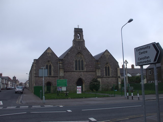
Today, Newtown is a quiet residential area with a close-knit community. It offers a range of amenities, including a local primary school, a community center, and several shops and pubs. The town also benefits from excellent transport links, with regular bus services connecting it to neighboring towns and cities.

Nature lovers will appreciate the town's proximity to the beautiful countryside, which provides ample opportunities for outdoor activities such as hiking, cycling, and fishing. Additionally, Newtown is within easy reach of the Brecon Beacons National Park, offering stunning landscapes and scenic walks.

Overall, Newtown, Glamorgan is a charming and peaceful town, offering a blend of rural tranquility and convenient access to nearby urban centers.

If you have any feedback on the listing, please let us know in the comments section below.
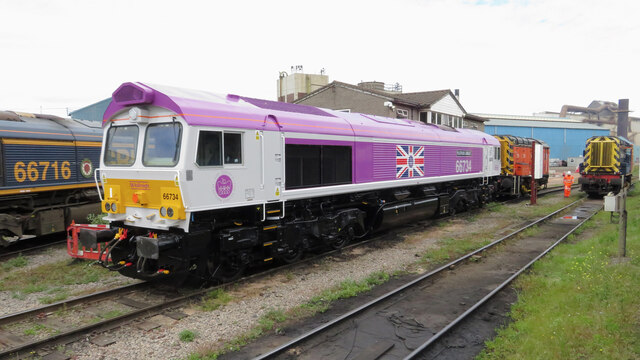
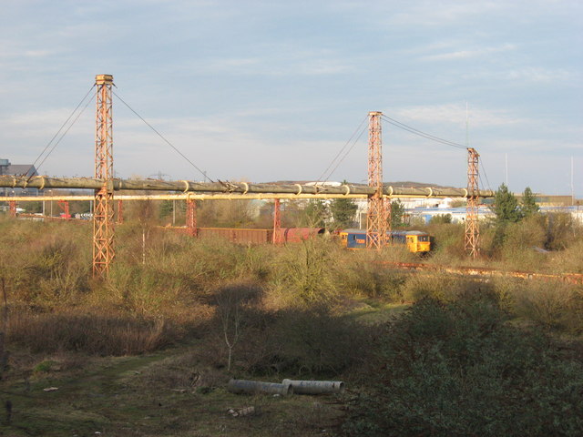
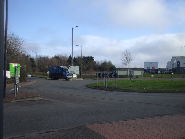
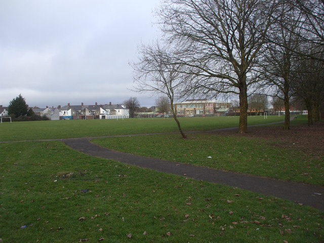
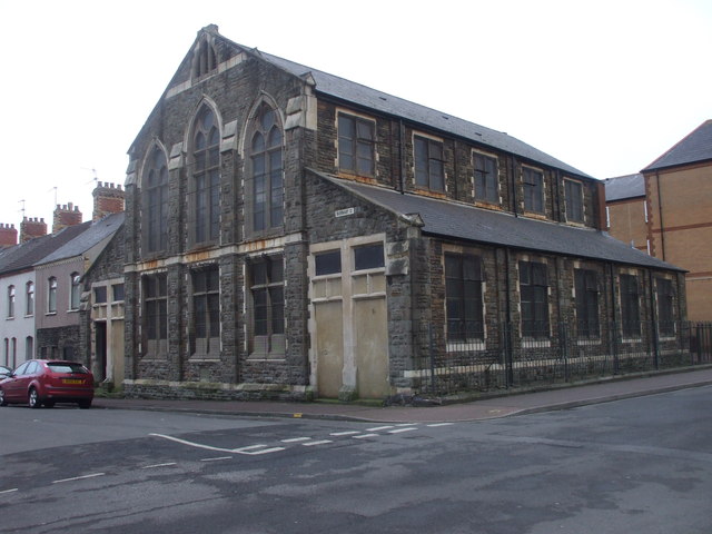
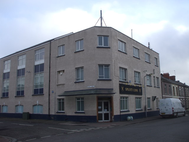
Newtown Images

Images are sourced within 2km of 51.477138/-3.1677243 or Grid Reference ST1976. Thanks to Geograph Open Source API. All images are credited.

Splott Beach Splott beach is sandwiched between the Bristol Channel and the Tremorfa waste water treatment works. The area behind the outfall has been used for burning rubbish
Splott Beach
Splott beach is sandwiched between the Bristol Channel and the Tremorfa waste water treatment works. The area behind the outfall has been used for burning rubbish
Pipeline near Celsa Steelworks Looking at a map, the pipeline seems to run from/to the Steelworks at its northern end but disappears into the ground at the southern end.
Pipeline near Celsa Steelworks
Looking at a map, the pipeline seems to run from/to the Steelworks at its northern end but disappears into the ground at the southern end.
Ambra in Roath Dock The ship is loaded with scrap metal for export.
Ambra in Roath Dock
The ship is loaded with scrap metal for export.
Scrap metal mountain in the Port of Cardiff
Cars for scrapping at the Port of Cardiff
Platinum Jubilee class 66 at the Celsa steelworks GBRf have recently acquired their 100th locomotive - class 66 No. 66734, which replaces one of the same number scrapped after a derailment at Loch Treig in 2012 - and it has entered traffic in a purple and grey livery and named Platinum Jubilee. It is seen at the Celsa steelworks in Cardiff upon arrival from Eastleigh Works where it was repainted.
Platinum Jubilee class 66 at the Celsa steelworks
GBRf have recently acquired their 100th locomotive - class 66 No. 66734, which replaces one of the same number scrapped after a derailment at Loch Treig in 2012 - and it has entered traffic in a purple and grey livery and named Platinum Jubilee. It is seen at the Celsa steelworks in Cardiff upon arrival from Eastleigh Works where it was repainted.
View over Celsa / Cardiff Tidal sidings The foreground is the site of former sidings. In the background, locomotive 73209 shunts wagons at the Celsa site.
View over Celsa / Cardiff Tidal sidings
The foreground is the site of former sidings. In the background, locomotive 73209 shunts wagons at the Celsa site.
Sidings at Celsa works, Tremorfa Locomotive 08925 sits in the sidings at Tremorfa.
Sidings at Celsa works, Tremorfa
Locomotive 08925 sits in the sidings at Tremorfa.
Splott Beach, Cardiff A less-observed part of the south Wales coastline.
Splott Beach, Cardiff
A less-observed part of the south Wales coastline.
Roundabout at the junction of Ocean Way and Portmanmoor Rd, Cardiff
Moorland Park, Cardiff
Railway St, Cardiff
Railway St, Cardiff
St Saviour's Church, Splott, Cardiff
Plaque on Beresford Rd, railway bridge, Cardiff
Sikh Gurdwara, Pearl St, Cardiff
Splott Rd Baptist Church, Cardiff
Splott Conservative Club, Cardiff
Ocean Way, Cardiff
Ocean Way, Cardiff
Show me another place!

Newtown is located at Grid Ref: ST1976 (Lat: 51.477138, Lng: -3.1677243)

Unitary Authority: Cardiff

Police Authority: South Wales

What 3 Words

///maple.quiz.themes. Near Cardiff

Related Wikis

Newtown, Cardiff

Newtown was a residential area of Cardiff, Wales that was also known as 'Little Ireland' because of its population of Irish families. Its six streets and...

The Vulcan, Cardiff

The Vulcan Hotel is a historic hotel and public house, that was located in Adamsdown suburb of Cardiff, South Wales. Scheduled for demolition in 2009,...

Tŷ Pont Haearn

Tŷ Pont Haearn (meaning: 'Iron Bridge House') is a residential building and is also seventh tallest building in Cardiff, Wales. The building is currently...

Atrium, Cardiff

Atrium (styled as ATRiuM), officially ATRiuM: Cardiff Faculty of Creative and Cultural Industries and also known as ATRiuM Building, forms part of the...

Nearby Amenities

Located within 500m of 51.477138,-3.1677243
Traffic Signals
Traffic Signals: signal
Traffic Signals Direction: forward
Lat/Long: 51.4757945/-3.1734792
Motorway Junction
Lat/Long: 51.4747964/-3.163489
Traffic Signals
Traffic Signals: signal
Traffic Signals Direction: forward
Lat/Long: 51.47561/-3.1726344
Traffic Signals
Traffic Signals Direction: forward
Lat/Long: 51.4754393/-3.1726466
Traffic Signals
Lat/Long: 51.4803901/-3.1714827
Traffic Signals
Lat/Long: 51.4799014/-3.172646
Crossing
Crossing: marked
Lat/Long: 51.4805428/-3.1715155
Cinema
Cineworld
Addr City: Cardiff
Addr Postcode: CF10 2EN
Addr Street: Mary Ann Street
Brand: Cineworld
Brand Wikidata: Q5120901
Brand Wikipedia: en:Cineworld
Fhrs Id: 970346
Website: https://www.cineworld.co.uk/cinemas/cardiff/055
Wikidata: Q39007623
Lat/Long: 51.4789084/-3.173075
Mini Roundabout
Lat/Long: 51.4782814/-3.1733553
Traffic Signals
Traffic Signals Direction: forward
Lat/Long: 51.4781565/-3.1717976
Mini Roundabout
Direction: clockwise
Lat/Long: 51.4727023/-3.1670695
Crossing
Crossing: unmarked
Crossing Markings: no
Lat/Long: 51.4776656/-3.1648986
Note: CF1 was split into 10/11 years ago
Old Uk Postcode Centroid: CF1
Source: www.npemap.org.uk
Lat/Long: 51.4800364/-3.165847
Crossing
Crossing: unmarked
Crossing Markings: no
Lat/Long: 51.474655/-3.1723358
Crossing
Bicycle: yes
Crossing: marked
Crossing Markings: yes
Crossing Ref: zebra
Tactile Paving: yes
Lat/Long: 51.4776989/-3.1748831
Railway: switch
Lat/Long: 51.4782161/-3.1708911
Railway: switch
Lat/Long: 51.4786319/-3.1706312
Cafe
Mingle
Addr City: Cardiff
Addr Postcode: CF24 2FN
Addr Street: Adam Street
Lat/Long: 51.4789061/-3.1699882
Crossing
Bicycle: designated
Crossing: uncontrolled
Lat/Long: 51.4764932/-3.1687069
Traffic Signals
Traffic Signals: signal
Traffic Signals Direction: forward
Lat/Long: 51.4768575/-3.1742002
Parking Entrance
Parking: underground
Lat/Long: 51.4776614/-3.1746039
Bench
Material: wood
Lat/Long: 51.4741799/-3.1701439
Waste Basket
Lat/Long: 51.4751271/-3.170816
Barrier: kissing_gate
Foot: yes
Lat/Long: 51.4750415/-3.1713549
Waste Basket
Lat/Long: 51.4738315/-3.1691081
Bench
Material: wood
Lat/Long: 51.4747083/-3.1705333
Bench
Material: wood
Lat/Long: 51.4744477/-3.1703308
Barrier: kissing_gate
Foot: yes
Lat/Long: 51.4738857/-3.1689646
Bench
Material: wood
Lat/Long: 51.4739156/-3.1699338
Crossing
Bicycle: yes
Crossing: marked
Crossing Markings: yes
Lat/Long: 51.4749523/-3.1716125
Barrier: kissing_gate
Foot: yes
Lat/Long: 51.4736294/-3.1698468
Waste Basket
Lat/Long: 51.4736553/-3.1697185
Bench
Material: wood
Lat/Long: 51.4748219/-3.1702484
Bus Stop
Bench: yes
Bin: yes
Local Ref: JJ
Mapillary: 2964882160393618
Naptan AtcoCode: 5710WDB47539
Naptan NaptanCode: cditgwm
Public Transport: platform
Shelter: yes
Survey Date: 2021-06-27
Lat/Long: 51.4774622/-3.1736414
Bus Stop
Hayes Bridge Road
Bench: yes
Bus: yes
Departures Board: timetable; realtime
Local Ref: JH
Naptan AtcoCode: 5710WDB25428
Naptan NaptanCode: cditdmj
Passenger Information Display: yes
Public Transport: platform
Ref: JH
Shelter: yes
Tactile Paving: no
Lat/Long: 51.4773815/-3.1743052
Bus Stop
Customhouse Street JG
Alt Name: Custom House Street Stop JG
Bench: yes
Bin: yes
Bus: yes
Lit: yes
Local Ref: JG
Naptan AtcoCode: 5710CAA02623
Naptan NaptanCode: cdijdw
Public Transport: platform
Shelter: yes
Tactile Paving: no
Lat/Long: 51.4768752/-3.174766
Bus Stop
Bench: yes
Bus: yes
Public Transport: platform
Shelter: yes
Lat/Long: 51.4792382/-3.1725288
Bus Stop
Guildford Crescent (NW)
Local Ref: HG
Lat/Long: 51.4798266/-3.170822
Bus Stop
Bench: yes
Bus: yes
Public Transport: platform
Shelter: yes
Lat/Long: 51.4792074/-3.1723585
Bus Stop
Lat/Long: 51.4797177/-3.1723276
Bus Stop
Churchill Way
Bus: yes
Local Ref: HL
Naptan AtcoCode: 5710WDB47953
Naptan NaptanCode: cditjdm
Public Transport: platform
Lat/Long: 51.4806907/-3.1718608
Pub
Traders Tavern
Addr City: Cardiff
Addr Housenumber: 6
Addr Postcode: CF10 2EH
Addr Street: David Street
Fhrs Id: 1094698
Source: survey
Wikidata: Q80584742
Lat/Long: 51.479762/-3.1723475
Bus Stop
Herbert Street
Bench: yes
Bin: yes
Check Date Shelter: 2021-08-09
Mapillary: 521881315930660
Naptan AtcoCode: 5710AWA10759
Naptan NaptanCode: cdiagwp
Passenger Information Display: yes
Public Transport: platform
Route Ref: 2;89
Shelter: yes
Survey Date: 2021-05-19
Tactile Paving: yes
Wheelchair: yes
Lat/Long: 51.4764247/-3.1691394
Bus Stop
Callaghan Square (SE)
Bench: no
Bin: yes
Local Ref: MA
Mapillary: 486606565910656
Name Cy: Sgwâr Callaghan (DDd)
Public Transport: platform
Route Ref: 6 (event days only);2;1
Shelter: no
Source: survey
Survey Date: 2021-05-19
Lat/Long: 51.4761763/-3.1733448
Gwdihw
Disused Amenity: bar
Website: https://gwdihw.co.uk/
Lat/Long: 51.4800397/-3.1707715
Thai House Restaurant
Cuisine: thai
Disused Amenity: restaurant
Source: survey
Website: http://thaihouse.biz/
Lat/Long: 51.4801389/-3.1709433
Madeira Restaurant
Addr Housenumber: 2
Addr Street: Guilford Cresent
Disused Amenity: restaurant
Source: survey
Website: https://www.madeirarestaurante.co.uk/
Lat/Long: 51.4802632/-3.1709998
Barrier: bollard
Bicycle: yes
Foot: yes
Lat/Long: 51.4796599/-3.1669557
Barrier: cycle_barrier
Lat/Long: 51.4793488/-3.1663618
Crossing
Crossing: marked
Crossing Ref: pelican
Lat/Long: 51.4794703/-3.1674184
Crossing
Crossing: marked
Crossing Ref: pelican
Lat/Long: 51.4795901/-3.1673854
Restaurant
Filini Bar and Restaurant
Note: Located inside hotel
Source: survey
Lat/Long: 51.4772218/-3.173357
Addr City: Cardiff
Addr Housenumber: 20
Source: survey
Lat/Long: 51.4801441/-3.1648714
Barrier: kissing_gate
Foot: yes
Source: survey
Lat/Long: 51.4795174/-3.1651841
Barrier: kissing_gate
Foot: yes
Source: survey
Lat/Long: 51.4791708/-3.165808
The Magic Roundabout
Artist Name: Pierre Vivant
Artwork Type: sculpture
Note: Sculptures made from old road signs
Tourism: artwork
Lat/Long: 51.4784162/-3.1608314
Crossing
Bicycle: yes
Crossing: unmarked
Crossing Markings: no
Lat/Long: 51.4770601/-3.1657816
Crossing
Bicycle: designated
Crossing: marked
Crossing Markings: yes
Crossing Ref: toucan
Segregated: no
Tactile Paving: yes
Lat/Long: 51.4734264/-3.1702584
Railway: switch
Lat/Long: 51.4791334/-3.1703838
Crossing
Crossing: marked
Tactile Paving: yes
Lat/Long: 51.4771263/-3.1740436
Cycleway: asl
Direction: forward
Lat/Long: 51.4786271/-3.1709639
Traffic Signals
Traffic Signals: signal
Lat/Long: 51.4804422/-3.1714099
Crossing
Bicycle: yes
Crossing: marked
Crossing Markings: yes
Crossing Ref: toucan
Tactile Paving: yes
Lat/Long: 51.4758038/-3.1733886
Telephone
Booth: KX100
Covered: booth
Operator: BT
Source: survey
Lat/Long: 51.4806853/-3.164661
Railway: switch
Lat/Long: 51.4784749/-3.1668414
Railway: switch
Lat/Long: 51.4789291/-3.1650602
Railway: switch
Lat/Long: 51.4777971/-3.1693044
Railway: switch
Lat/Long: 51.4763443/-3.174706
Railway: switch
Lat/Long: 51.4763388/-3.1744744
Railway: switch
Lat/Long: 51.4766388/-3.1733523
Railway: switch
Lat/Long: 51.4762763/-3.1745603
Railway: switch
Lat/Long: 51.4777646/-3.1712244
Railway: switch
Lat/Long: 51.477756/-3.1711796
Railway: owner_change
Lat/Long: 51.4771384/-3.1718677
Railway: switch
Lat/Long: 51.476611/-3.1718873
Railway: switch
Lat/Long: 51.4775789/-3.1701169
Railway: switch
Lat/Long: 51.479544/-3.1627929
Railway: switch
Lat/Long: 51.4755835/-3.1623745
Railway: switch
Lat/Long: 51.4763238/-3.1623553
Railway: switch
Lat/Long: 51.477354/-3.1626068
Railway: switch
Lat/Long: 51.478206/-3.1623168
Railway: switch
Lat/Long: 51.4773725/-3.1625218
Access: yes
Entrance: main
Lat/Long: 51.4781355/-3.1742674
Bench
Backrest: no
Material: wood
Lat/Long: 51.4729157/-3.1698687
Bench
Backrest: no
Material: wood
Lat/Long: 51.4729339/-3.1698804
Bus Stop
Vellacott Close
Bench: yes
Bin: yes
Local Ref: MH
Mapillary: 842429213149155
Naptan AtcoCode: 5710WDB46604
Naptan NaptanCode: cditdpd
Public Transport: platform
Shelter: yes
Survey Date: 2020-09-26
Lat/Long: 51.4730482/-3.1701537
Post Box
Collection Times: Mo-Fr 09:00; Sa 07:00
Operator: Royal Mail
Operator Wikidata: Q638098
Post Box Type: pillar
Ref: CF10 26D
Royal Cypher: EIIR
Royal Cypher Wikidata: Q33102113
Source: survey
Lat/Long: 51.4730738/-3.1701654
Artwork Type: sculpture
Tourism: artwork
Lat/Long: 51.4736586/-3.1704211
Post Box
Collection Times: Mo-Fr 16:00; Sa 11:30
Operator: Royal Mail
Operator Wikidata: Q638098
Post Box Type: pillar
Ref: CF10 182
Royal Cypher: EIIR
Royal Cypher Wikidata: Q33102113
Source: survey
Lat/Long: 51.4737974/-3.1652372
Bus Stop
Bench: no
Bus: yes
Naptan AtcoCode: 5710AWA11676
Naptan NaptanCode: cdiajgt
Public Transport: platform
Shelter: no
Lat/Long: 51.4739208/-3.1653036
Waste Basket
Lat/Long: 51.4741024/-3.1707588
Bus Stop
Bench: no
Bus: yes
Naptan AtcoCode: 5710AWA11677
Naptan NaptanCode: cdiajaj
Public Transport: platform
Shelter: no
Lat/Long: 51.4746181/-3.1660385
Bus Stop
Bench: no
Bus: yes
Naptan AtcoCode: 5710AWA11678
Naptan NaptanCode: cdiagwj
Public Transport: platform
Shelter: no
Lat/Long: 51.4758276/-3.1669267
Bus Stop
Bench: yes
Bin: yes
Mapillary: 230134531986983
Public Transport: platform
Shelter: yes
Survey Date: 2021-05-19
Lat/Long: 51.4760985/-3.1700108
Crossing
Crossing: uncontrolled
Crossing Ref: zebra
Lat/Long: 51.476268/-3.1697774
Traffic Signals
Traffic Signals: signal
Lat/Long: 51.4808495/-3.1663942
Crossing
Crossing: marked
Crossing Ref: zebra
Kerb: lowered
Tactile Paving: yes
Lat/Long: 51.4797077/-3.1732287
Restaurant
Mount Fuji
Addr City: Cardiff
Addr Housenumber: 20
Addr Postcode: CF10 2EF
Addr Street: Bridge Street
Cuisine: japanese
Fhrs Id: 970048
Source: local knowledge
Website: https://www.mountfuji.co.uk/cardiff/
Lat/Long: 51.4794781/-3.1736782
Restaurant
TGI Friday's
Addr City: Cardiff
Addr Housename: St David's Dewi Sant
Addr Postcode: CF10 2EF
Addr Street: Bridge Street
Addr Unit: 15-17
Brand: TGI Friday's
Brand Wikidata: Q1524184
Brand Wikipedia: en:TGI Fridays
Cuisine: american
Fhrs Id: 969483
Website: https://www.tgifridays.co.uk/locations/cardiff-st-david's/
Lat/Long: 51.4795917/-3.1737587
McGarvey Immigration & Asylum Practitioners Limited
Addr City: Cardiff
Addr Housenumber: 8
Addr Postcode: CF10 4BY
Addr Street: Columbus Walk, Brigantine Place
Office: lawyer
Opening Hours: Mo-Fr 09:00-17:00
Phone: +44 2920 480048
Website: http://mgiap.co.uk
Wheelchair: yes
Lat/Long: 51.4759796/-3.1699474
Railway: switch
Lat/Long: 51.4791921/-3.1702451
Bus Stop
Bute Terrace JK
Bus: yes
Local Ref: JK
Public Transport: platform
Shelter: yes
Lat/Long: 51.4775205/-3.1735183
Bus Stop
Callaghan Square (NW)
Bench: yes
Bin: no
Local Ref: MB
Mapillary: 229330248726199
Name Cy: Sgwâr Callaghan (GO)
Naptan AtcoCode: 5710WDB25091
Naptan NaptanCode: cditagt
Public Transport: platform
Shelter: yes
Survey Date: 2021-05-19
Lat/Long: 51.4755246/-3.1731555
Bus Stop
Bench: yes
Bus: yes
Local Ref: HY
Public Transport: platform
Shelter: yes
Lat/Long: 51.4812032/-3.1707038
Bus Stop
Herbert Street
Bench: yes
Bin: no
Bus: yes
Local Ref: ME
Mapillary: 1353209988391140
Naptan AtcoCode: 5710WDB46608
Naptan NaptanCode: cditdpt
Public Transport: platform
Shelter: yes
Survey Date: 2020-09-26
Lat/Long: 51.4745272/-3.1715672
Bus Stop
North Church Street (SE)
Bus: yes
Local Ref: MF
Public Transport: platform
Lat/Long: 51.4738853/-3.1716994
Bus Stop
North Church Street (NW)
Bus: yes
Local Ref: MG
Naptan AtcoCode: 5710CAA02605
Naptan NaptanCode: cdidwd
Public Transport: platform
Lat/Long: 51.4742305/-3.1720887
Addr City: Cardiff
Addr Housenumber: 42
Addr Postcode: CF10 2HL
Addr Street: Churchill Way
Lat/Long: 51.480541/-3.1711091
Addr City: Cardiff
Addr Housenumber: 40
Addr Postcode: CF10 2HL
Addr Street: Churchill Way
Lat/Long: 51.4805234/-3.1711126
Crossing
Bicycle: yes
Crossing: marked
Crossing Markings: yes
Crossing Ref: toucan
Lat/Long: 51.4768776/-3.174255
Railway: switch
Lat/Long: 51.4806332/-3.1700319
Railway: switch
Lat/Long: 51.480056/-3.1701191
Crossing
Bicycle: designated
Crossing: marked
Crossing Markings: yes
Crossing Ref: toucan
Lat/Long: 51.4752853/-3.1729578
Crossing
Bicycle: designated
Crossing: marked
Crossing Markings: yes
Crossing Ref: toucan
Lat/Long: 51.4751864/-3.1728983
Crossing
Bicycle: yes
Crossing: unmarked
Crossing Markings: no
Lat/Long: 51.4771313/-3.1658038
Crossing
Crossing: marked
Crossing Ref: pelican
Lat/Long: 51.4796397/-3.1672553
Crossing
Crossing: marked
Crossing Ref: pelican
Lat/Long: 51.4795923/-3.1677453
Crossing
Crossing: marked
Crossing Ref: pelican
Lat/Long: 51.4794667/-3.1677094
Crossing
Crossing: unmarked
Lat/Long: 51.4794636/-3.1680709
Crossing
Bicycle: yes
Crossing: marked
Crossing Ref: toucan
Lat/Long: 51.4787964/-3.1694707
Crossing
Bicycle: yes
Crossing: marked
Crossing Ref: toucan
Lat/Long: 51.4787095/-3.1694032
Crossing
Bicycle: yes
Crossing: marked
Crossing Ref: toucan
Lat/Long: 51.4786886/-3.1691527
Traffic Signals
Traffic Signals: signal
Traffic Signals Direction: forward
Lat/Long: 51.4787699/-3.1690422
Crossing
Bicycle: yes
Crossing: marked
Crossing Markings: yes
Crossing Ref: toucan
Tactile Paving: yes
Lat/Long: 51.476969/-3.1742728
Crossing
Crossing: marked
Lat/Long: 51.4803151/-3.1713225
Crossing
Bicycle: yes
Crossing: traffic_signals
Crossing Ref: toucan
Lat/Long: 51.4803118/-3.1716204
Crossing
Bicycle: yes
Crossing: marked
Crossing Ref: toucan
Lat/Long: 51.4804997/-3.1713423
Crossing
Crossing: traffic_signals
Crossing Ref: pelican
Lat/Long: 51.4799366/-3.1725159
Crossing
Crossing: marked
Lat/Long: 51.4804977/-3.1715845
Traffic Signals
Traffic Signals: signal
Traffic Signals Direction: forward
Lat/Long: 51.4784515/-3.1712774
Crossing
Crossing: traffic_signals
Crossing Ref: pelican
Lat/Long: 51.4782878/-3.1717973
Cycleway: asl
Lat/Long: 51.4797792/-3.1725388
Cycleway: asl
Direction: forward
Lat/Long: 51.4780672/-3.1722528
Crossing
Crossing: traffic_signals
Lat/Long: 51.4790145/-3.1728851
Parking Entrance
St Davids Car Park Exit
Parking: multi-storey
Lat/Long: 51.4793609/-3.1737191
Crossing
Crossing: unmarked
Crossing Markings: no
Lat/Long: 51.4746928/-3.1725482
Crossing
Crossing: marked
Crossing Markings: yes
Crossing Ref: pelican
Lat/Long: 51.475942/-3.1707791
Crossing
Crossing: traffic_signals
Crossing Ref: pelican
Lat/Long: 51.4760187/-3.1707603
Crossing
Crossing: unmarked
Lat/Long: 51.4760647/-3.1731784
Railway: switch
Lat/Long: 51.4801066/-3.1701678
Railway: switch
Lat/Long: 51.4769423/-3.1724698
Crossing
Crossing: unmarked
Crossing Markings: no
Lat/Long: 51.4774455/-3.1635958
Crossing
Bicycle: designated
Crossing: marked
Crossing Markings: yes
Crossing Ref: toucan
Lat/Long: 51.4775976/-3.1635511
Crossing
Bicycle: designated
Crossing: marked
Crossing Markings: yes
Crossing Ref: toucan
Lat/Long: 51.4775335/-3.1634161
Bicycle Parking
Mary Ann Street
Bicycle Parking: stands
Capacity: 14
Covered: no
Fee: no
Lat/Long: 51.479121/-3.1729405
Cafe
Zen Bar
Addr City: Cardiff
Addr Housename: ATRiuM
Addr Postcode: CF24 2FN
Addr Street: Adam Street
Fhrs Id: 970415
Lat/Long: 51.478773/-3.1701067
Bicycle Parking
Bicycle Parking: stands
Capacity: 8
Lat/Long: 51.4796412/-3.1731503
Tesco Express
Addr City: Cardiff
Addr Housenumber: 78-79
Addr Street: Tredegar Street
Brand: Tesco Express
Brand Wikidata: Q98456772
Fhrs Id: 1204977
Opening Hours: Mo-Su 06:00-23:00
Shop: convenience
Website: https://www.tesco.com/store-locator/cardiff/78-79-tredegar-st
Lat/Long: 51.4782524/-3.1737303
Cafe
The Little Man Coffee Co.
Addr City: Cardiff
Addr Housename: Ivor House
Addr Housenumber: 5
Addr Postcode: CF10 2EE
Addr Street: Bridge Street
Cuisine: coffee_shop
Diet Vegetarian: yes
Fhrs Id: 970463
Internet Access: wlan
Opening Hours: Mo-Sa 08:30-15:30
Phone: +44 7933 844 234
Website: https://littlemancoffee.co.uk/
Lat/Long: 51.479856/-3.1723934
Addr Housenumber: 42
Lat/Long: 51.473204/-3.1690801
Addr Housenumber: 43
Lat/Long: 51.4733059/-3.1691807
Addr Housenumber: 44
Lat/Long: 51.4734729/-3.1693913
Addr Housenumber: 45
Lat/Long: 51.473513/-3.1692035
Addr Housenumber: 2
Survey Date: 2017-02-26
Lat/Long: 51.4728901/-3.1673986
Addr Housenumber: 3
Survey Date: 2017-02-26
Lat/Long: 51.4728691/-3.167549
Addr Housenumber: 4
Survey Date: 2017-02-26
Lat/Long: 51.4728534/-3.167607
Addr Housenumber: 6
Survey Date: 2017-02-26
Lat/Long: 51.472764/-3.1679049
Addr Housenumber: 24
Survey Date: 2017-02-26
Lat/Long: 51.4730513/-3.168168
Addr Housenumber: 1
Survey Date: 2017-02-26
Lat/Long: 51.4730891/-3.1677213
Addr Housenumber: 25
Survey Date: 2017-02-26
Lat/Long: 51.4730868/-3.1682039
Addr City: Cardiff
Addr Housenumber: 27
Addr Postcode: CF10 4BN
Addr Street: Craiglee Drive
Survey Date: 2017-02-26
Lat/Long: 51.4732432/-3.1683477
Addr Housenumber: 11
Survey Date: 2017-02-26
Lat/Long: 51.4732214/-3.1678501
Addr City: Cardiff
Addr Housenumber: 28
Addr Postcode: CF10 4BN
Addr Street: Craiglee Drive
Survey Date: 2017-02-26
Lat/Long: 51.473235/-3.1683975
Addr Housenumber: 21
Survey Date: 2017-02-26
Lat/Long: 51.4742923/-3.1689994
Addr Housenumber: 22
Survey Date: 2017-02-26
Lat/Long: 51.4743778/-3.169013
Addr Housenumber: 23
Survey Date: 2017-02-26
Lat/Long: 51.4744257/-3.1690754
Addr Housenumber: 24
Survey Date: 2017-02-26
Lat/Long: 51.474468/-3.1691112
Addr Housenumber: 3
Survey Date: 2017-02-26
Lat/Long: 51.4746054/-3.1692095
Addr Housenumber: 2
Survey Date: 2017-02-26
Lat/Long: 51.4745699/-3.1691961
Addr Housenumber: 1
Survey Date: 2017-02-26
Lat/Long: 51.4745397/-3.1691664
Addr Housenumber: 22
Survey Date: 2017-02-26
Lat/Long: 51.4746889/-3.1686581
Addr Housenumber: 21
Survey Date: 2017-02-26
Lat/Long: 51.4747361/-3.1686919
Addr Housenumber: 19
Survey Date: 2017-02-26
Lat/Long: 51.4748064/-3.1687295
Addr Housenumber: 18
Survey Date: 2017-02-26
Lat/Long: 51.4748477/-3.1687636
Addr Housenumber: 8
Survey Date: 2017-02-26
Lat/Long: 51.4749447/-3.1690653
Addr Housenumber: 7
Survey Date: 2017-02-26
Lat/Long: 51.4749309/-3.1691262
Addr Housenumber: 4
Survey Date: 2017-02-26
Lat/Long: 51.4748637/-3.1693435
Addr Housenumber: 5
Survey Date: 2017-02-26
Lat/Long: 51.4748791/-3.1692889
233 Bute St (1964); Social Club
Barrier: bollard
Historic: memorial
Tourism: artwork
Lat/Long: 51.4733577/-3.1715366
Information: map
Map Size: site
Tourism: information
Lat/Long: 51.4762786/-3.1700954
Atlantic
Tourism: artwork
Lat/Long: 51.4767187/-3.1682068
Traffic Signals
Traffic Signals Direction: forward
Lat/Long: 51.4754971/-3.172872
Newtown
Historic: yes
Note: Historic neighbourhood name. Not well known or widely recognised today.
Place: neighbourhood
Wikidata: Q7020578
Lat/Long: 51.4767463/-3.1694933
Crossing
Crossing: traffic_signals
Crossing Ref: pelican
Lat/Long: 51.4781299/-3.1718599
Traffic Signals
Traffic Signals Direction: forward
Lat/Long: 51.47808/-3.1722271
Traffic Signals
Asl Direction: forward
Traffic Signals: signal
Lat/Long: 51.4790793/-3.1726221
Cycleway: asl
Traffic Signals Direction: forward
Lat/Long: 51.4790947/-3.1726028
Crossing
Crossing: traffic_signals
Lat/Long: 51.4790357/-3.172666
Traffic Signals
Traffic Signals: signal
Traffic Signals Direction: forward
Lat/Long: 51.4788165/-3.1727237
Crossing
Crossing: traffic_signals
Lat/Long: 51.4782878/-3.1722175
Crossing
Crossing: traffic_signals
Lat/Long: 51.4782822/-3.1720366
Traffic Signals
Traffic Signals Direction: forward
Lat/Long: 51.4783268/-3.1720851
Cycleway: asl
Direction: forward
Lat/Long: 51.478345/-3.1721049
Traffic Signals
Traffic Signals: yes
Traffic Signals Direction: forward
Lat/Long: 51.4790643/-3.172953
Crossing
Crossing: traffic_signals
Lat/Long: 51.4789733/-3.17295
Parking Entrance
St Davids Car Park Entrance
Parking: multi-storey
Lat/Long: 51.479319/-3.173454
Cycleway: asl
Direction: forward
Lat/Long: 51.4788027/-3.1727054
Entrance: yes
Lat/Long: 51.4795477/-3.1735669
Camera Mount: pole
Camera Type: panning
Man Made: surveillance
Surveillance Type: camera
Lat/Long: 51.4753497/-3.1725876
Camera Mount: pole
Camera Type: panning
Man Made: surveillance
Surveillance Type: camera
Lat/Long: 51.4804469/-3.1713046
Jobcentre Plus
Brand: Jobcentre Plus
Brand Wikidata: Q6206793
Brand Wikipedia: en:Jobcentre Plus
Name Cy: Canolfan byd Gwaith
Office: employment_agency
Lat/Long: 51.4799445/-3.1729245
Restaurant
The Stable
Addr City: Cardiff
Addr Housename: Tŷ Admiral
Addr Postcode: CF10 2EH
Addr Street: Bridge Street
Contact Facebook: StableCardiff
Cuisine: pizza
Fhrs Id: 970698
Internet Access: wlan
Internet Access Fee: no
Internet Access Ssid: The Stable
Opening Hours: Mo-Th 11:30-23:00; Fr-Sa 11:30-23:00; Su 11:30-23:00
Outdoor Seating: yes
Website: https://stablepizza.com/locations/cardiff/
Wikidata: Q80859242
Lat/Long: 51.4794989/-3.1731326
Restaurant
PizzaExpress
Addr City: Cardiff
Addr Housename: St David's Dewi Sant
Addr Housenumber: 16
Addr Postcode: CF10 2EF
Addr Street: Bridge Street Arcade
Addr Unit: KUG07
Brand: PizzaExpress
Brand Wikidata: Q662845
Brand Wikipedia: en:PizzaExpress
Cuisine: pizza
Delivery: yes
Fhrs Id: 971130
Internet Access: wlan
Internet Access Fee: no
Internet Access Ssid: _PizzaExpressWifi
Level: 2
Takeaway: yes
Website: https://www.pizzaexpress.com/cardiff-st-davids-shopping-centre
Lat/Long: 51.479339/-3.1740034
Entrance: yes
Lat/Long: 51.4740352/-3.1729033
Entrance: main
Lat/Long: 51.4741406/-3.1729762
Entrance: yes
Lat/Long: 51.4773105/-3.1740399
Pharmacy
Boots
Addr City: Cardiff
Addr Housenumber: 27
Addr Postcode: CF10 2ER
Addr Street: Grand Arcade
Brand: Boots
Brand Wikidata: Q6123139
Brand Wikipedia: en:Boots (company)
Dispensing: yes
Fhrs Id: 1158424
Healthcare: pharmacy
Level: 1
Lat/Long: 51.4781843/-3.1742003
Millennium Milepost Millennium Walk
Description: 1) Cardiff Bay 1, Bae Caerdydd 2) City Centre 0.66, Canol y Ddinas
Image: https://www.cyclestreets.net/location/195488/cyclestreets195488-size640.jpg
Information: guidepost
Ncn Milepost: mills
Sustrans Ref: MP 792
Tourism: information
Lat/Long: 51.4751109/-3.1714125
Barrier: yes
Lat/Long: 51.4780562/-3.1733698
Entrance: yes
Lat/Long: 51.478042/-3.1742391
Addr City: Cardiff
Addr Housenumber: 26
Addr Postcode: CF10 4BN
Addr Street: Craiglee Drive
Lat/Long: 51.4732155/-3.1683285
Crossing
Crossing: marked
Lat/Long: 51.4732227/-3.1705632
Crossing
Crossing: marked
Crossing Markings: yes
Lat/Long: 51.4732209/-3.1703649
Traffic Signals
Traffic Signals: signal
Traffic Signals Direction: forward
Lat/Long: 51.4731914/-3.1705387
Traffic Signals
Traffic Signals: signal
Traffic Signals Direction: forward
Lat/Long: 51.4734941/-3.1705682
Crossing
Crossing: marked
Crossing Markings: yes
Lat/Long: 51.4734682/-3.1707474
Crossing
Crossing: marked
Crossing Markings: yes
Lat/Long: 51.4734652/-3.1705488
Crossing
Crossing: unmarked
Crossing Markings: no
Lat/Long: 51.4751483/-3.1715022
Traffic Signals
Traffic Signals: signal
Traffic Signals Direction: forward
Lat/Long: 51.475484/-3.1718657
Crossing
Crossing: marked
Crossing Markings: yes
Lat/Long: 51.4755138/-3.1718796
Crossing
Crossing: marked
Crossing Markings: yes
Lat/Long: 51.4754873/-3.1717517
Traffic Signals
Traffic Signals: signal
Traffic Signals Direction: forward
Lat/Long: 51.4749908/-3.1716285
Traffic Signals
Traffic Signals: signal
Traffic Signals Direction: backward
Lat/Long: 51.4749107/-3.1715959
Traffic Signals
Traffic Signals: signal
Traffic Signals Direction: forward
Lat/Long: 51.4734437/-3.1701981
Crossing
Crossing: unmarked
Crossing Markings: no
Lat/Long: 51.4788278/-3.1610881
Access: private
Barrier: swing_gate
Height: 3
Material: metal
Opening Hours: 24/7
Operator: Eversheds Sutherland LLP
Wheelchair: yes
Lat/Long: 51.4760442/-3.1741476
Keolis (UK) Limited
Addr City: Cardiff
Addr Housenumber: 2
Addr Postcode: CF10 5BT
Addr Street: Callaghan Square
Email: comms@keolis.co.uk
Office: engineering
Opening Hours: Mo-Fr 09:00-17:00
Phone: +44 20 3691 1715
Source Addr Postcode: code-point_open
Website: https://www.keolis.co.uk/contact-us/
Lat/Long: 51.4759457/-3.1738773
The Church in Wales
Addr City: Cardiff
Addr Housenumber: 2
Addr Postcode: CF10 5BT
Addr Street: Callaghan Square
Denomination: protestant
Email: information@churchinwales.org.uk
Office: religion
Opening Hours: Mo-Fr 09:00-17:00
Phone: +44 2920 348 200
Religion: christian
Website: https://www.churchinwales.org.uk/en/
Wikidata: Q1089788
Wikipedia: en:Church in Wales
Lat/Long: 51.4762113/-3.1738357
Addr City: Cardiff
Addr Housenumber: 2
Addr Postcode: CF10 5BT
Addr Street: Callaghan Square
Email: cardiff@mottmac.com
Office: engineering
Opening Hours: Mo-Fr 09:00-17:00
Phone: +44 2920 467 800
Website: https://www.mottmac.com/
Lat/Long: 51.4760526/-3.1736962
Pub
The Golden Cross
Addr City: Cardiff
Addr Housenumber: 282
Addr Postcode: CF10 1GH
Addr Street: Hayes Bridge Road
Brewery: brains
Fhrs Id: 971080
Opening Hours: Mo 00:00-02:00; Tu-Th off; Fr 14:00-24:00; Sa 00:00-02:00,14:00-24:00; Su 00:00-02:00,17:00-24:00
Operator: Brains
Phone: +44 2920 343 129
Real Ale: yes
Source: Bing;survey
Website: https://www.sabrain.com/golden-cross
Wikidata: Q19873574
Lat/Long: 51.477049/-3.1744498
Parking
NCP Pellett Street Car Park
Access: yes
Fee: yes
Note: Signs on car park call it 'Pellett Street Car Park' (with two Ts) while road name signs call the road 'Pellet Street' (one T)
Operator: NCP
Lat/Long: 51.477952/-3.1701097
Crossing
Crossing: uncontrolled
Crossing Ref: zebra
Lat/Long: 51.4761901/-3.1698087
Public Health Wales
Addr City: Cardiff
Addr Housename: Capital Quarter 2
Addr Postcode: CF10 4BZ
Addr Street: Tyndall Street
Email: PHW.data@wales.nhs.uk
Government: healthcare
Name Cy: Iechyd Cyhoeddus Cymru
Office: government
Opening Hours: Mo-Fr 09:00-17:00
Phone: +44 2920 227 744
Website: https://phw.nhs.wales/
Lat/Long: 51.476752/-3.1692019
Co-op Food
Addr City: Cardiff
Addr Postcode: CF10 4BZ
Addr Street: Tyndall Street
Brand: Co-op Food
Brand Wikidata: Q3277439
Brand Wikipedia: en:Co-op Food
Fhrs Id: 1501516
Opening Hours: Mo-Sa 07:00-22:00; Su 07:30-22:00
Operator: The Co-operative Group
Operator Wikidata: Q117202
Phone: +44 29 2048 3627
Shop: convenience
Website: https://www.coop.co.uk/store-finder/CF10-4BQ/tyndall-street
Lat/Long: 51.4766145/-3.1690675
Entrance: yes
Lat/Long: 51.4765922/-3.1690642
Atm
Cash In: no
Covered: no
Drive Through: no
Lat/Long: 51.4766923/-3.1690526
Street Lamp
Lamp Type: led
Lat/Long: 51.4764751/-3.1693989
Street Lamp
Lamp Type: led
Lat/Long: 51.4764921/-3.1693282
Street Lamp
Lamp Type: led
Lat/Long: 51.4765076/-3.1692677
Street Lamp
Lamp Type: led
Lat/Long: 51.4765258/-3.1692015
Street Lamp
Lamp Type: led
Lat/Long: 51.4765413/-3.1691411
Street Lamp
Lamp Type: led
Lat/Long: 51.4765571/-3.1690838
Waste Basket
Lat/Long: 51.4771153/-3.1680273
Waste Basket
Lat/Long: 51.4771117/-3.1680475
Waste Basket
Lat/Long: 51.4771004/-3.1680175
Street Lamp
Lat/Long: 51.476799/-3.1690977
EQ
Addr City: Cardiff
Addr Housename: Driscoll Buildings
Addr Housenumber: 1
Addr Postcode: CF10 4BP
Addr Street: Ellen Street
Office: financial
Opening Hours: Mo-Fr 09:00-17:00
Source Addr Postcode: code-point_open
Website: https://equiniti.com/uk/
Lat/Long: 51.4775768/-3.1679323
BUUK Infrastructure
Addr City: Cardiff
Addr Housename: Driscoll Buildings
Addr Housenumber: 2
Addr Postcode: CF10 4BP
Addr Street: Ellen Street
Email: enquiries@bu-uk.co.uk
Name Cy: Seilwaith BUUK
Office: telecommunication
Source Addr Postcode: code-point_open
Website: https://www.bu-uk.co.uk
Lat/Long: 51.4773358/-3.1677645
Waste Basket
Covered: no
Material: metal
Waste: trash
Lat/Long: 51.4773009/-3.1690999
Entrance: yes
Lat/Long: 51.477423/-3.1689653
Lumis - Reception
Addr City: Cardiff
Addr Housename: Lumis North
Addr Postcode: CF10 4BZ
Addr Street: Smart Quarter
Residential: apartments
Lat/Long: 51.4774337/-3.1689827
Waste Basket
Material: metal
Waste: trash
Lat/Long: 51.477129/-3.16906
Street Lamp
Lat/Long: 51.4774853/-3.1679573
Street Lamp
Lat/Long: 51.4774225/-3.1679163
Nextbike - Smart Way
Addr City: Cardiff
Addr Postcode: CF10 4BZ
Addr Street: Smart Way
Covered: no
Disused Amenity: bicycle_rental
Disused Bicycle Rental: docking_station
Disused Network: NextBike Cardiff
Disused Operator: Nextbike
Disused Operator Wikidata: Q2351279
Ref: 8735
Ref Gbfs: nextbike_uc:20812804
Lat/Long: 51.4771642/-3.1692694
Man Made: crane
Lat/Long: 51.4768445/-3.1708514
Street Lamp
Lat/Long: 51.4760688/-3.1711847
Waste Basket
Material: metal
Waste: trash
Lat/Long: 51.476276/-3.1713194
Waste Basket
Material: metal
Waste: trash
Lat/Long: 51.4762214/-3.1712826
Access: customers
Addr City: Cardiff
Addr Housename: Zenith
Addr Postcode: CF10 4BZ
Addr Street: Tyndall Street
Door: yes
Entrance: main
Level: 0
Wheelchair: yes
Lat/Long: 51.4763111/-3.1714492
First Aid Kit
Emergency: first_aid_kit
Indoor: no
Lat/Long: 51.4762607/-3.1710367
Addr City: Cardiff
Addr Housename: Capital Quarter 4
Addr Housenumber: 4
Addr Postcode: CF10 4BZ
Addr Street: Tyndall Street
Description: To let - A1/A2/A3 Use
Shop: vacant
Lat/Long: 51.4761816/-3.1708321
Addr City: Cardiff
Addr Housename: Capital Quarter
Addr Housenumber: 4
Addr Postcode: CF10 4BZ
Addr Street: Tyndall Street
Description: To let - A1/A2/A3 Use
Shop: vacant
Lat/Long: 51.4762176/-3.1706895
Access: customers
Addr City: Cardiff
Addr Housename: Capital Quarter 4
Addr Postcode: CF10 4BZ
Addr Street: Tyndall Street
Door: sliding
Entrance: main
Level: 0
Wheelchair: yes
Lat/Long: 51.4761915/-3.1705573
Fast Food
Magic Wrap
Addr Housenumber: 4
Addr Street: Capital Quarter
Cuisine: wrap
Name Cy: Lapio Hud
Lat/Long: 51.4762208/-3.1704354
Street Lamp
Lat/Long: 51.4767614/-3.1703223
Street Lamp
Lat/Long: 51.4768303/-3.1700382
Street Lamp
Lat/Long: 51.4769499/-3.1701611
Street Lamp
Lat/Long: 51.4769498/-3.1699885
Waste Basket
Waste: trash
Lat/Long: 51.4768309/-3.1704298
Street Lamp
Lat/Long: 51.4768833/-3.170451
Street Lamp
Lat/Long: 51.4769981/-3.1703376
Street Lamp
Lat/Long: 51.4770194/-3.1705157
Waste Basket
Waste: trash
Lat/Long: 51.4768071/-3.1699203
Man Made: street_cabinet
Waste: trash
Lat/Long: 51.4768133/-3.1698951
Street Lamp
Lat/Long: 51.4767791/-3.1698762
Street Lamp
Lat/Long: 51.4767539/-3.1699608
Street Lamp
Lat/Long: 51.4767287/-3.1700705
Street Lamp
Lat/Long: 51.4766996/-3.1701856
Street Lamp
Lat/Long: 51.4766777/-3.1702765
Street Lamp
Lat/Long: 51.4768351/-3.169735
Street Lamp
Lat/Long: 51.4768687/-3.1696046
Street Lamp
Lat/Long: 51.4769001/-3.1694895
Street Lamp
Lat/Long: 51.4769281/-3.1693707
Street Lamp
Lat/Long: 51.4769601/-3.1692484
Citrus Hotel
Tourism: hotel
Lat/Long: 51.4781299/-3.1715759
Park Inn
Addr City: Cardiff
Addr Postcode: CF10 2JH
Addr Street: Mary Ann Street
Brand: Park Inn
Brand Wikidata: Q60711675
Brand Wikipedia: ru:Park Inn by Radisson
Fhrs Id: 969835
Source: Bing;survey
Tourism: hotel
Lat/Long: 51.4784237/-3.172859
Post Box
Collection Times: Mo-Fr 16:15; Sa 11:30
Drive Through: no
Operator: Royal Mail
Ref: CF10 23
Survey Date: 2020-12-16
Lat/Long: 51.4799732/-3.1727807
Railway: switch
Lat/Long: 51.478719/-3.1658273
Railway: switch
Lat/Long: 51.4784055/-3.1671041
Railway: switch
Lat/Long: 51.4781695/-3.1678071
Crossing
Crossing: unmarked
Crossing Markings: no
Lat/Long: 51.4774903/-3.1640236
Crossing
Crossing: unmarked
Crossing Markings: no
Lat/Long: 51.4774152/-3.1639851
Crossing
Crossing: unmarked
Crossing Markings: no
Lat/Long: 51.4780521/-3.1607422
Crossing
Crossing: unmarked
Crossing Markings: no
Lat/Long: 51.4781296/-3.1613008
Crossing
Crossing: unmarked
Crossing Markings: no
Lat/Long: 51.4781799/-3.1613322
Crossing
Crossing: unmarked
Crossing Markings: no
Lat/Long: 51.4782738/-3.1614022
Crossing
Bicycle: designated
Button Operated: yes
Crossing: traffic_signals
Crossing Island: no
Crossing Markings: dots
Tactile Paving: yes
Lat/Long: 51.4807276/-3.1642519
Barrier: lift_gate
Lat/Long: 51.4759175/-3.1688305
Barrier: lift_gate
Lat/Long: 51.4759495/-3.1675843
Barrier: lift_gate
Lat/Long: 51.4759703/-3.167538
Traffic Signals
Traffic Signals: signal
Traffic Signals Direction: forward
Lat/Long: 51.4767841/-3.16714
Traffic Signals
Traffic Signals: signal
Traffic Signals Direction: forward
Lat/Long: 51.4756445/-3.1715836
Crossing
Crossing: marked
Crossing Markings: yes
Lat/Long: 51.4759192/-3.1707618
Crossing
Lat/Long: 51.476688/-3.1675293
Barrier: lift_gate
Lat/Long: 51.4798396/-3.1697668
Barrier: lift_gate
Lat/Long: 51.4797407/-3.1694915
Crossing
Crossing: unmarked
Lat/Long: 51.4790045/-3.168398
Crossing
Crossing: unmarked
Crossing Island: no
Lat/Long: 51.4784175/-3.1703093
Traffic Signals
Traffic Signals: signal
Lat/Long: 51.4797188/-3.1674109
Post Box
Collection Times: Mo-Fr 09:00, Sa 07:00
Post Box Type: pillar
Ref: CF24 165
Royal Cypher: EIIR
Royal Cypher Wikidata: Q33102113
Lat/Long: 51.4786004/-3.1694855
Telephone
Booth: WC
Colour: black
Covered: booth
Note: not BT
Wheelchair: yes
Lat/Long: 51.4784963/-3.1699677
Traffic Signals
Traffic Signals: signal
Traffic Signals Direction: forward
Lat/Long: 51.4788078/-3.1690762
Traffic Signals
Traffic Signals: signal
Traffic Signals Direction: forward
Lat/Long: 51.4787809/-3.1695204
Traffic Signals
Traffic Signals: signal
Lat/Long: 51.4794546/-3.167395
Traffic Signals
Traffic Signals: signal
Lat/Long: 51.4795723/-3.1677759
Traffic Signals
Traffic Signals: signal
Lat/Long: 51.479671/-3.1672589
Barrier: kerb
Kerb: lowered
Lat/Long: 51.4803618/-3.166583
Safestore Cardiff Central
Shop: storage_rental
Lat/Long: 51.4799786/-3.1666377
Traffic Signals
Traffic Signals: crossing
Lat/Long: 51.48079/-3.1662345
Traffic Signals
Traffic Signals: crossing
Lat/Long: 51.4812305/-3.1665562
Traffic Signals
Traffic Signals: signal
Lat/Long: 51.4812842/-3.166441
Traffic Signals
Traffic Signals: signal
Lat/Long: 51.481264/-3.1661109
Traffic Signals
Traffic Signals: signal
Lat/Long: 51.4808845/-3.1659006
Traffic Signals
Traffic Signals: signal
Lat/Long: 51.4813647/-3.1663745
Barrier: kerb
Kerb: lowered
Tactile Paving: yes
Lat/Long: 51.4813935/-3.1663249
Crossing
Button Operated: yes
Crossing: traffic_signals
Crossing Island: no
Crossing Markings: dots
Lat/Long: 51.4813623/-3.1663321
Crossing
Button Operated: yes
Crossing: traffic_signals
Crossing Island: no
Crossing Markings: dots
Lat/Long: 51.4812853/-3.1662606
Crossing
Button Operated: yes
Crossing: traffic_signals
Crossing Island: no
Crossing Markings: dots
Lat/Long: 51.4811964/-3.1661529
Crossing
Button Operated: yes
Crossing: traffic_signals
Crossing Island: no
Crossing Markings: dots
Lat/Long: 51.4812545/-3.1664175
Barrier: kerb
Kerb: flush
Tactile Paving: no
Lat/Long: 51.4812354/-3.1664645
Barrier: kerb
Kerb: lowered
Tactile Paving: no
Lat/Long: 51.4812532/-3.1666228
Crossing
Button Operated: yes
Crossing: traffic_signals
Crossing Island: no
Crossing Markings: dots
Lat/Long: 51.4812662/-3.1665808
Barrier: kerb
Kerb: flush
Tactile Paving: no
Lat/Long: 51.4812792/-3.1665387
Crossing
Crossing: unmarked
Lat/Long: 51.4808931/-3.1659603
Crossing
Crossing: unmarked
Lat/Long: 51.4809503/-3.1659439
Crossing
Button Operated: yes
Crossing: traffic_signals
Crossing Island: no
Crossing Markings: dots
Lat/Long: 51.4807585/-3.1662595
Crossing
Button Operated: yes
Crossing: traffic_signals
Crossing Island: no
Crossing Markings: dots
Lat/Long: 51.4808883/-3.1663928
Sinclair Volkswagen
Brand: Volkswagen
Brand Wikidata: Q246
Brand Wikipedia: en:Volkswagen
Shop: car
Lat/Long: 51.4761416/-3.1629336
Sinclair Volkswagen Van Centre
Brand: Volkswagen
Brand Wikidata: Q246
Brand Wikipedia: en:Volkswagen
Shop: car
Lat/Long: 51.4770589/-3.163656
Crossing
Crossing: unmarked
Crossing Markings: no
Lat/Long: 51.4726506/-3.1673275
John Lewis
Addr City: Cardiff
Addr Postcode: CF10 1EG
Addr Street: The Hayes
Brand: John Lewis
Brand Wikidata: Q1918981
Brand Wikipedia: en:John Lewis & Partners
Fhrs Id: 969380
Official Name: John Lewis & Partners
Shop: department_store
Website: https://www.johnlewis.com/our-shops/cardiff
Lat/Long: 51.477787/-3.1740107
Parking Entrance
Parking: underground
Lat/Long: 51.4776968/-3.1746457
Crossing
Crossing: unmarked
Lat/Long: 51.4776804/-3.1746845
Parking
John Lewis Car Park
Access: customers
Fee: yes
Layer: -1
Parking: underground
Lat/Long: 51.4776939/-3.1745872
Crossing
Crossing: unmarked
Lat/Long: 51.4776463/-3.174643
Crossing
Crossing: marked
Crossing Markings: yes
Lat/Long: 51.4752592/-3.172803
Crossing
Crossing: marked
Crossing Markings: yes
Lat/Long: 51.4752426/-3.1726601
Crossing
Crossing: unmarked
Crossing Markings: no
Lat/Long: 51.47581/-3.1739042
Crossing
Crossing: marked
Lat/Long: 51.4769267/-3.1741565
Crossing
Crossing: marked
Lat/Long: 51.476913/-3.1740356
Traffic Signals
Traffic Signals: signal
Traffic Signals Direction: forward
Lat/Long: 51.4758722/-3.1731507
Traffic Signals
Traffic Signals: signal
Traffic Signals Direction: forward
Lat/Long: 51.475639/-3.173133
Traffic Signals
Traffic Signals: signal
Traffic Signals Direction: forward
Lat/Long: 51.4752263/-3.1727772
Traffic Signals
Traffic Signals: signal
Traffic Signals Direction: forward
Lat/Long: 51.4751651/-3.1728292
Crossing
Crossing: marked
Crossing Markings: yes
Lat/Long: 51.4754209/-3.1726824
Crossing
Crossing: marked
Crossing Markings: yes
Lat/Long: 51.4756046/-3.172589
Crossing
Crossing: marked
Crossing Markings: yes
Lat/Long: 51.4758422/-3.1731285
Crossing
Crossing: marked
Crossing Markings: yes
Lat/Long: 51.4759472/-3.1733602
Crossing
Crossing: marked
Lat/Long: 51.4757507/-3.1716414
Crossing
Crossing: marked
Crossing Markings: yes
Lat/Long: 51.4756535/-3.1716584
Barrier: kerb
Kerb: lowered
Tactile Paving: yes
Lat/Long: 51.4770545/-3.1739472
Crossing
Crossing: marked
Tactile Paving: yes
Lat/Long: 51.4770941/-3.1740004
Barrier: kerb
Kerb: lowered
Tactile Paving: yes
Lat/Long: 51.4771288/-3.1742548
Crossing
Crossing: marked
Crossing Island: no
Tactile Paving: yes
Lat/Long: 51.4771458/-3.1742122
Crossing
Crossing: marked
Lat/Long: 51.4772315/-3.1740998
Radisson Blu
Addr Country: GB
Addr Postcode: CF10 2FL
Addr Street: Bute Terrace
Brand: Radisson Blu
Brand Wikidata: Q7281341
Brand Wikipedia: en:Radisson Blu
Fhrs Id: 997503
Tourism: hotel
Wikidata: Q111368724
Lat/Long: 51.4770062/-3.1735977
Vivienne Westwood
Shop: clothes
Lat/Long: 51.4781206/-3.1747223
Atm
Lat/Long: 51.4783164/-3.1735131
Restaurant
Steak of the Art
Addr City: Cardiff
Addr Housename: Helmont House
Addr Postcode: CF10 2HE
Addr Street: Churchill Way
Cuisine: steak_house
Email: cardiff@steakoftheart.co.uk
Fhrs Id: 1152380
Opening Hours: Tu-Sa 12:00-22:00
Phone: +44 2920 397284
Website: https://www.steakoftheart.co.uk/cardiff
Lat/Long: 51.4807667/-3.1714981
Cardiff East Branch Junction
Historic Railway: junction
Railway: site
Lat/Long: 51.4785159/-3.1706481
Queen Street South Junction
Railway: junction
Lat/Long: 51.4775322/-3.1713338
Railway: owner_change
Lat/Long: 51.4771172/-3.1718182
Cafe
KIN+ILK
Addr City: Cardiff
Addr Housename: Capital Quarter
Addr Housenumber: 1
Addr Postcode: CF10 4BZ
Addr Street: Tyndall Street
Cuisine: coffee_shop
Fhrs Id: 970754
Website: https://kinandilk.com
Lat/Long: 51.4772445/-3.1695569
Fast Food
Auntie Anne's
Addr City: Cardiff
Addr Housename: St David's Dewi Sant
Addr Housenumber: 68
Addr Postcode: CF10 2EL
Addr Street: Grand Arcade
Brand: Auntie Anne's
Brand Wikidata: Q4822010
Brand Wikipedia: en:Auntie Anne's
Cuisine: pretzel
Fhrs Id: 1070106
Takeaway: yes
Website: https://www.auntieannes.com
Lat/Long: 51.4784058/-3.1740795
Restaurant
Frankie & Benny's
Addr City: Cardiff
Addr Housename: St David's Dewi Sant
Addr Postcode: CF10 2EF
Addr Street: Bridge Street Arcade
Brand: Frankie & Benny's
Brand Wikidata: Q5490892
Brand Wikipedia: en:Frankie & Benny's
Contact Website: https://www.frankieandbennys.com/restaurants/wales/cardiff/cardiff-st-davids
Cuisine: american
Fhrs Id: 970664
Level: 2
Lat/Long: 51.4793754/-3.1738615
Treetop Adventure Golf
Addr City: Cardiff
Addr Housename: St David's Dewi Sant
Addr Housenumber: 109
Addr Postcode: CF10 2EL
Addr Street: Grand Arcade
Fhrs Id: 970682
Leisure: miniature_golf
Website: https://adventuregolf.com/cardiff
Lat/Long: 51.4790615/-3.1741996
Cycleway: asl
Lat/Long: 51.4812273/-3.1661348
Crossing
Crossing: marked
Lat/Long: 51.4802785/-3.171412
Cycleway: asl
Lat/Long: 51.4805416/-3.1712872
Cycleway: asl
Lat/Long: 51.4802524/-3.1713956
Cycleway: asl
Lat/Long: 51.4802869/-3.171663
Cycleway: asl
Lat/Long: 51.4805894/-3.1715604
Cycleway: asl
Lat/Long: 51.4795589/-3.1677963
Cycleway: asl
Direction: forward
Lat/Long: 51.4788182/-3.1690487
Cycleway: asl
Direction: forward
Lat/Long: 51.4787731/-3.1695463
Cycleway: asl
Direction: forward
Lat/Long: 51.4784368/-3.1709066
Cycleway: asl
Direction: forward
Lat/Long: 51.4771284/-3.1739309
Cycleway: asl
Direction: forward
Lat/Long: 51.4772451/-3.1741863
Cycleway: asl
Direction: backward
Lat/Long: 51.4771932/-3.1742634
Cycleway: asl
Direction: forward
Lat/Long: 51.4769399/-3.174354
Cycleway: asl
Direction: forward
Lat/Long: 51.4768738/-3.1741094
Cycleway: asl
Lat/Long: 51.4798262/-3.1728584
Cycleway: asl
Lat/Long: 51.4800227/-3.1727564
Cycleway: asl
Lat/Long: 51.479961/-3.1724447
M2M
Office: architect
Lat/Long: 51.4756179/-3.1704783
Alert Logic Europe
Addr City: Cardiff
Addr Housename: Floor 2
Addr Housenumber: 1
Addr Postcode: CF10 4BZ
Addr Street: Capital Quarter
Email: info@alertlogic.com
Office: it
Opening Hours: Mo-Fr 09:00-17:00; Sa off; Su off
Opening Hours Covid19: Mo-Fr 09:00-17:00; Sa Off; Su Off
Phone: +44 20 3011 5533
Website: https://www.alertlogic.com/
Lat/Long: 51.4770636/-3.1696487
Traffic Signals
Traffic Signals: signal
Traffic Signals Direction: forward
Lat/Long: 51.4756716/-3.1716037
Cycleway: asl
Direction: forward
Lat/Long: 51.4756815/-3.171572
Cycleway: asl
Direction: forward
Lat/Long: 51.4754645/-3.1718564
Traffic Signals
Traffic Signals: signal
Traffic Signals Direction: forward
Lat/Long: 51.4756426/-3.1720102
Traffic Signals
Traffic Signals: signal
Traffic Signals Direction: forward
Lat/Long: 51.4784324/-3.1709357
Traffic Signals
Traffic Signals: signal
Traffic Signals Direction: forward
Lat/Long: 51.4786117/-3.1709701
Cycleway: asl
Direction: forward
Lat/Long: 51.4784464/-3.1712997
Traffic Signals
Traffic Signals: signal
Traffic Signals Direction: forward
Lat/Long: 51.4772401/-3.1741603
Traffic Signals
Traffic Signals: signal
Traffic Signals Direction: backward
Lat/Long: 51.4771826/-3.174252
Traffic Signals
Traffic Signals: signal
Traffic Signals Direction: forward
Lat/Long: 51.4771163/-3.1739554
Traffic Signals
Traffic Signals: signal
Traffic Signals Direction: forward
Lat/Long: 51.4768871/-3.1741212
Traffic Signals
Traffic Signals: signal
Traffic Signals Direction: forward
Lat/Long: 51.4769506/-3.1743223
Tyndall Street Junction
Railway: junction
Lat/Long: 51.4780524/-3.16238
Advertising: column
Mapillary: 613206769685417
Support: ground
Survey Date: 2021-06-27
Lat/Long: 51.4785842/-3.1695918
Traffic Signals
Traffic Signals: signal
Traffic Signals Direction: forward
Lat/Long: 51.4786536/-3.1691291
Drinking Water
Access: customers
Bottle: yes
Covered: yes
Fee: no
Indoor: yes
Level: 1
Lit: yes
Operator: University of South Wales
Wheelchair: yes
Lat/Long: 51.4787747/-3.1700826
Cafe
Brü Coffee and Gelato
Addr City: Cardiff
Addr Housename: Tŷ Admiral
Addr Postcode: CF10 2EH
Addr Street: David Street
Addr Unit: B
Branch: Cardiff
Cuisine: coffee_shop
Fhrs Id: 1053020
Opening Hours: Mo-Sa 07:30-00:00; Su 10:00-00:00
Phone: +44 29 2022 0795
Website: https://brucoffee.co.uk/cardiff/
Lat/Long: 51.4793896/-3.172936
a two bar relationship
Artist Name: Sean Edwards
Artwork Type: sculpture
Start Date: 2017
Tourism: artwork
Website: https://studio-response.com/projects/a-two-bar-relationship
Lat/Long: 51.479251/-3.1686528
Tyndall Street High Level Junction
Historic Railway: junction
Railway: site
Lat/Long: 51.4780898/-3.1633662
Advertising: column
Lat/Long: 51.4788082/-3.1697972
Traffic Signals
Traffic Signals: signal
Traffic Signals Direction: forward
Lat/Long: 51.4775483/-3.1633599
Traffic Signals
Traffic Signals: signal
Traffic Signals Direction: forward
Lat/Long: 51.4775847/-3.1636088
Barrier: bollard
Lat/Long: 51.4807608/-3.1637178
Crossing
Crossing: uncontrolled
Lat/Long: 51.4771435/-3.1657604
Crossing
Crossing: uncontrolled
Lat/Long: 51.4770574/-3.1657296
Crossing
Lat/Long: 51.4767093/-3.1674494
Cycleway: asl
Direction: forward
Lat/Long: 51.4766061/-3.1674548
Crossing
Lat/Long: 51.4766521/-3.167701
Traffic Signals
Traffic Signals: signal
Traffic Signals Direction: forward
Lat/Long: 51.4766163/-3.1675112
Traffic Signals
Traffic Signals: signal
Traffic Signals Direction: forward
Lat/Long: 51.4766429/-3.1674877
Crossing
Crossing: uncontrolled
Lat/Long: 51.4767949/-3.1671992
Crossing
Crossing: uncontrolled
Crossing Markings: yes
Lat/Long: 51.4767732/-3.1671892
Crossing
Crossing: uncontrolled
Lat/Long: 51.4768335/-3.1673341
Crossing
Crossing: unmarked
Crossing Markings: no
Lat/Long: 51.4768275/-3.167654
Crossing
Bicycle: designated
Crossing: uncontrolled
Crossing Markings: yes
Lat/Long: 51.4764246/-3.1686655
Crossing
Lat/Long: 51.4755893/-3.1717748
Crossing
Crossing: uncontrolled
Crossing Markings: yes
Lat/Long: 51.4755069/-3.1719217
Crossing
Lat/Long: 51.4755687/-3.1718914
Traffic Signals
Traffic Signals: signal
Traffic Signals Direction: backward
Lat/Long: 51.4754786/-3.1719082
Traffic Signals
Traffic Signals: signal
Traffic Signals Direction: forward
Lat/Long: 51.4759315/-3.1707202
Traffic Signals
Traffic Signals: signal
Traffic Signals Direction: backward
Lat/Long: 51.4759042/-3.1708128
Traffic Signals
Traffic Signals: signal
Traffic Signals Direction: forward
Lat/Long: 51.4759542/-3.1707367
Traffic Signals
Traffic Signals: signal
Traffic Signals Direction: backward
Lat/Long: 51.4759276/-3.1708288
Traffic Signals
Traffic Signals: signal
Traffic Signals Direction: backward
Lat/Long: 51.4764124/-3.1687108
Traffic Signals
Traffic Signals: signal
Traffic Signals Direction: forward
Lat/Long: 51.4764352/-3.1686128
Traffic Signals
Traffic Signals: signal
Traffic Signals Direction: backward
Lat/Long: 51.476608/-3.1678916
Traffic Signals
Traffic Signals: signal
Traffic Signals Direction: forward
Lat/Long: 51.4768052/-3.167152
Give Way
Direction: backward
Lat/Long: 51.4739973/-3.1719162
Crossing
Crossing: unmarked
Crossing Markings: no
Tactile Paving: yes
Lat/Long: 51.4733469/-3.1714497
Crossing
Crossing: unmarked
Crossing Markings: no
Tactile Paving: yes
Lat/Long: 51.4733671/-3.1713719
Crossing
Crossing: unmarked
Crossing Markings: no
Tactile Paving: yes
Lat/Long: 51.4739811/-3.1719729
Telephone
Colour: black
Covered: booth
Note: not BT
Operator: Infocus
Payment Coins: yes
Wheelchair: yes
Lat/Long: 51.4790138/-3.1725256
Bicycle Parking
Access: yes
Capacity: 6
Covered: no
Lat/Long: 51.4790477/-3.1724404
Bicycle Parking
Access: customers
Bicycle Parking: stands
Capacity: 10
Covered: no
Lat/Long: 51.4762253/-3.1713479
Drinking Water
Access: customers
Bottle: yes
Covered: yes
Fee: no
Indoor: yes
Level: 0
Lit: yes
Operator: University of South Wales
Wheelchair: yes
Lat/Long: 51.4792843/-3.1697078
Drinking Water
Access: customers
Bottle: yes
Covered: yes
Fee: no
Indoor: yes
Level: 0
Lit: yes
Operator: University of South Wales
Wheelchair: yes
Lat/Long: 51.4793667/-3.1685686
Drinking Water
Access: customers
Bottle: yes
Covered: yes
Fee: no
Indoor: yes
Level: 4
Lit: yes
Operator: University of South Wales
Wheelchair: yes
Lat/Long: 51.4793549/-3.1686707
Bus Stop
Bench: no
Bin: no
Covered: no
Naptan AtcoCode: 5710WDB46611
Naptan NaptanCode: cditdtd
Passenger Information Display: timetable
Public Transport: platform
Route Ref: Lower Churchill Way (HG)
Shelter: no
Tactile Paving: yes
Wheelchair: yes
Lat/Long: 51.4798606/-3.1712582
Superdry
Addr City: Cardiff
Addr Street: Grand Arcade
Brand: Superdry
Brand Wikidata: Q1684445
Level: 0
Shop: clothes
Website: https://stores.superdry.com/gb/cardiff/unit-lg-17-20
Lat/Long: 51.4788644/-3.1742982
Elevator
Lat/Long: 51.4786198/-3.1742617
Golf Fang
Addr City: Cardiff
Addr Postcode: CF10 2EN
Addr Street: Mary Ann Street
Bar: yes
Branch: Cardiff
Check Date: 2023-11-06
Contact Facebook: golffangcardiff
Contact Instagram: wearegolffang
Contact Twitter: golffanguk
Fee: yes
Fhrs Id: 1606178
Golf Course: 18_hole
Leisure: miniature_golf
Min Age: 18
Opening Hours: Mo-Th 15:00-01:00; Fr 12:00-01:00; Sa 10:30-01:00; Su 11:30-00:00
Website: https://golffang.co.uk/cardiff/
Lat/Long: 51.478637/-3.1731361
Traffic Signals
Traffic Signals: crossing
Traffic Signals Direction: forward
Lat/Long: 51.4807326/-3.1643063
Traffic Signals
Traffic Signals: crossing
Traffic Signals Direction: backward
Lat/Long: 51.4807226/-3.1641997
Alight
Artist Name: S Mark Gubb
Artwork Type: sculpture
Material: steel;glass
Start Date: 17-12-2014
Tourism: artwork
Lat/Long: 51.4796056/-3.1733572
Blue Flash, Power Box and Mesh Chips
Artist Name: John Gingell
Artwork Type: sculpture
Material: metal
Start Date: 1994
Tourism: artwork
Lat/Long: 51.478001/-3.1638912
Cycleway: asl
Lat/Long: 51.4768809/-3.1676275
Traffic Signals
Traffic Signals: signal
Lat/Long: 51.4768637/-3.1676075
Crossing
Crossing: unmarked
Crossing Markings: no
Lat/Long: 51.4768426/-3.1675914
Crossing
Bicycle: designated
Crossing: uncontrolled
Lat/Long: 51.476446/-3.1686801
The data included in this document is from www.openstreetmap.org. The data is made available under ODbL.

Have you been to Newtown?

Leave your review of Newtown below (or comments, questions and feedback).