Newport

Settlement in Norfolk Great Yarmouth

England

Newport

Scratby village sign, repainted Scratby and California share a sign featuring a lifebelt, the Royal Albert lifeboat, an oar and some ruins with a glazed window, probably representing Scratby church which was demolished in 1548. On the right is what I believe to be a lifeboat shed and perhaps a beacon.
Scratby village sign, repainted Credit: Jane Rackham

Newport, Norfolk is a small town located in the eastern part of England, specifically in the county of Norfolk. It is situated on the River Bure, just a few miles away from the city of Norwich. With a population of around 1,500 residents, Newport is known for its peaceful and picturesque surroundings.

The town has a rich history, dating back to medieval times when it was an important trading center. Today, visitors can still admire some of the historic buildings that have been preserved, including the 14th-century parish church of St. Peter and St. Paul.

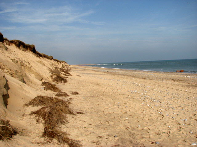
Nature lovers will find Newport particularly appealing as it is surrounded by beautiful countryside and scenic landscapes. The nearby Bure Marshes National Nature Reserve offers fantastic opportunities for birdwatching, with a variety of species to be spotted throughout the year. Additionally, the Norfolk Broads, a network of rivers and lakes, are easily accessible from Newport, providing further opportunities for boating, fishing, and exploring the unique wetland ecosystem.

Despite its small size, Newport has a strong sense of community, with several local shops, cafes, and pubs serving as meeting points for residents and visitors alike. Annual events, such as the Newport Jazz Festival and the Newport Carnival, add to the town's vibrant atmosphere.

In conclusion, Newport, Norfolk is a charming and historic town nestled in the heart of the English countryside. Its tranquil surroundings, rich history, and proximity to nature make it an appealing destination for those seeking a peaceful retreat or an opportunity to explore the natural beauty of Norfolk.

If you have any feedback on the listing, please let us know in the comments section below.
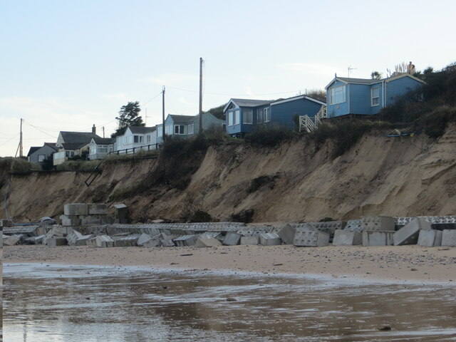
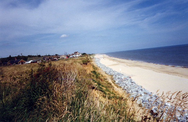
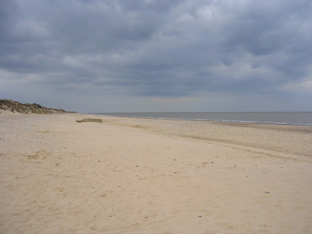
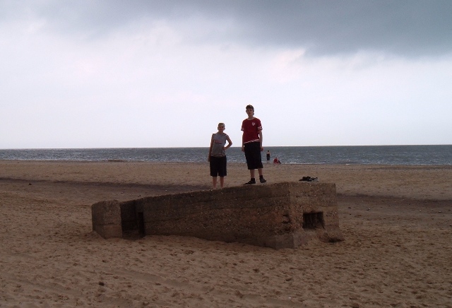
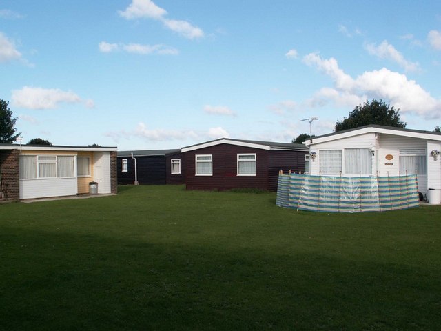
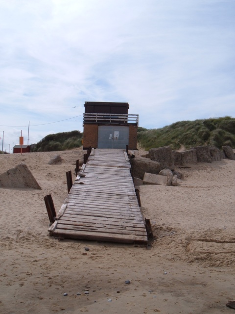
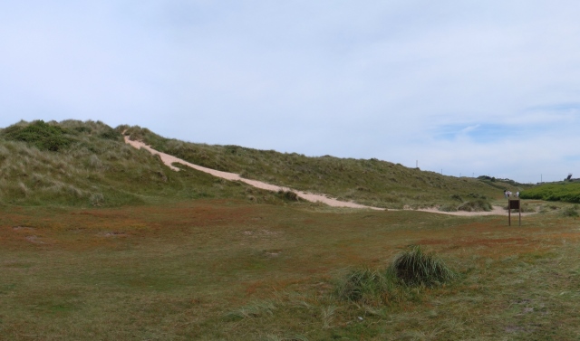
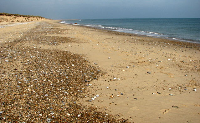
Newport Images

Images are sourced within 2km of 52.689988/1.70759 or Grid Reference TG5016. Thanks to Geograph Open Source API. All images are credited.

Scratby village sign, repainted Scratby and California share a sign featuring a lifebelt, the Royal Albert lifeboat, an oar and some ruins with a glazed window, probably representing Scratby church which was demolished in 1548. On the right is what I believe to be a lifeboat shed and perhaps a beacon.
Scratby village sign, repainted
Scratby and California share a sign featuring a lifebelt, the Royal Albert lifeboat, an oar and some ruins with a glazed window, probably representing Scratby church which was demolished in 1548. On the right is what I believe to be a lifeboat shed and perhaps a beacon.
Houses on edge of eroding cliff - Hemsby Houses exposed to coastal erosion after storms. November 2023
Houses on edge of eroding cliff - Hemsby
Houses exposed to coastal erosion after storms. November 2023
Beach  Scratby Nr Great Yarmouth Norfolk Beach at Scratby Nr Great Yarmouth.
Beach Scratby Nr Great Yarmouth Norfolk
Beach at Scratby Nr Great Yarmouth.
Caravan Site, California, Norfolk
Beach at Hemsby, Norfolk
Sunrise Taken on the beach early one April morning.
Sunrise
Taken on the beach early one April morning.
Look-out shelter on Hemsby Beach A view of a wartime look-out shelter on Hemsby beach - the shelter now sinking into the sand.
Look-out shelter on Hemsby Beach
A view of a wartime look-out shelter on Hemsby beach - the shelter now sinking into the sand.
Sundowner Chalet Park Hemsby near Great Yarmouth
Sundowner Chalet Park
Hemsby near Great Yarmouth
Station Road going in the direction of California Station Road, and to the right is Flint Cottage. At the extent to which the road can be seen in the picture, but out of view, is the B1159 and crossroad. The road straight over at the crossroad leads to California.
Station Road going in the direction of California
Station Road, and to the right is Flint Cottage. At the extent to which the road can be seen in the picture, but out of view, is the B1159 and crossroad. The road straight over at the crossroad leads to California.
Scratby Road in the direction of Hemsby Scratby Road, seen here running through farmland as it heads out of Scratby and towards Hemsby village.
Scratby Road in the direction of Hemsby
Scratby Road, seen here running through farmland as it heads out of Scratby and towards Hemsby village.
Scratby Road and Thoroughfare Lane junction The car is emerging onto Scratby Road from Thoroughfare Lane. Scratby Hall is behind the clump of trees to the right of the picture; in the years 1948-1986 it was a school for boys, named Duncan Hall School – See <span class="nowrap"><a title="www.home.earthlink.net/~duncanhallschool" rel="nofollow ugc noopener" href="http://www.home.earthlink.net/~duncanhallschool">Link</a><img style="margin-left:2px;" alt="External link" title="External link - shift click to open in new window" src="https://s1.geograph.org.uk/img/external.png" width="10" height="10"/></span>
Scratby Road and Thoroughfare Lane junction
The car is emerging onto Scratby Road from Thoroughfare Lane. Scratby Hall is behind the clump of trees to the right of the picture; in the years 1948-1986 it was a school for boys, named Duncan Hall School – See LinkExternal link
Beach Road - Scratby A well looked after and scenic area of Beach Road. Following this road all the way to the coast and then bearing right will take you to California.
Beach Road - Scratby
A well looked after and scenic area of Beach Road. Following this road all the way to the coast and then bearing right will take you to California.
B1159 Scratby Road & Beach Road Junction B1159 Scratby Road and Beach Road junction, not an easy junction to get out of, Scratby Road is quite a busy road this time of the year.
B1159 Scratby Road & Beach Road Junction
B1159 Scratby Road and Beach Road junction, not an easy junction to get out of, Scratby Road is quite a busy road this time of the year.
Lifeboat House, Hemsby A view of the Inshore Rescue Boat Station on Hemsby beach.
Lifeboat House, Hemsby
A view of the Inshore Rescue Boat Station on Hemsby beach.
Hemsby sand dunes A view of the sand dunes at Hemsby.
Showing the path leading from Kings Loke over the dunes to the beach.
Hemsby sand dunes
A view of the sand dunes at Hemsby. Showing the path leading from Kings Loke over the dunes to the beach.
View north on deserted beach The coastline at Winterton is historically known to be one of the most hazardous parts of the British coastline. On visiting Winterton-on-Sea in 1722, Daniel Defoe commented that all the houses of the village were constructed from the timbers of wrecked ships.  In order to stabilise the coastline against erosion marram grass was planted and by the early 19th century dunes had built up, forming a barrier between the high water mark and the ridge on which the lighthouse stands.  During the second half of the 20th century the coastline has again changed in that some of the dunes eroded.  The area is mostly situated at approximately sea level and erosion and flooding are constant potential risks to the village.
View north on deserted beach
The coastline at Winterton is historically known to be one of the most hazardous parts of the British coastline. On visiting Winterton-on-Sea in 1722, Daniel Defoe commented that all the houses of the village were constructed from the timbers of wrecked ships. In order to stabilise the coastline against erosion marram grass was planted and by the early 19th century dunes had built up, forming a barrier between the high water mark and the ridge on which the lighthouse stands. During the second half of the 20th century the coastline has again changed in that some of the dunes eroded. The area is mostly situated at approximately sea level and erosion and flooding are constant potential risks to the village.
Dunes and a deep blue North Sea The coastline at Winterton is historically known to be one of the most hazardous parts of the British coastline. On visiting Winterton-on-Sea in 1722, Daniel Defoe commented that all the houses of the village were constructed from the timbers of wrecked ships.  In order to stabilise the coastline against erosion marram grass was planted and by the early 19th century dunes had built up, forming a barrier between the high water mark and the ridge on which the lighthouse stands.  During the second half of the 20th century the coastline has again changed in that some of the dunes eroded.  The area is mostly situated at approximately sea level and erosion and flooding are constant potential risks to the village.
Dunes and a deep blue North Sea
The coastline at Winterton is historically known to be one of the most hazardous parts of the British coastline. On visiting Winterton-on-Sea in 1722, Daniel Defoe commented that all the houses of the village were constructed from the timbers of wrecked ships. In order to stabilise the coastline against erosion marram grass was planted and by the early 19th century dunes had built up, forming a barrier between the high water mark and the ridge on which the lighthouse stands. During the second half of the 20th century the coastline has again changed in that some of the dunes eroded. The area is mostly situated at approximately sea level and erosion and flooding are constant potential risks to the village.
All that remains of a house lost to the sea The coastline at Winterton is historically known to be one of the most hazardous parts of the British coastline. On visiting Winterton-on-Sea in 1722, Daniel Defoe commented that all the houses of the village were constructed from the timbers of wrecked ships.  In order to stabilise the coastline against erosion marram grass was planted and by the early 19th century dunes had built up, forming a barrier between the high water mark and the ridge on which the lighthouse stands.  During the second half of the 20th century the coastline has again changed in that some of the dunes eroded.  The area is mostly situated at approximately sea level and erosion and flooding are constant potential risks to the village. Here the low tide has exposed the location where a house once stood.
All that remains of a house lost to the sea
The coastline at Winterton is historically known to be one of the most hazardous parts of the British coastline. On visiting Winterton-on-Sea in 1722, Daniel Defoe commented that all the houses of the village were constructed from the timbers of wrecked ships. In order to stabilise the coastline against erosion marram grass was planted and by the early 19th century dunes had built up, forming a barrier between the high water mark and the ridge on which the lighthouse stands. During the second half of the 20th century the coastline has again changed in that some of the dunes eroded. The area is mostly situated at approximately sea level and erosion and flooding are constant potential risks to the village. Here the low tide has exposed the location where a house once stood.
Show me another place!

Newport is located at Grid Ref: TG5016 (Lat: 52.689988, Lng: 1.70759)

Administrative County: Norfolk

District: Great Yarmouth

Police Authority: Norfolk

What 3 Words

///verve.mountain.collision. Near Hemsby, Norfolk

Related Wikis

Blitz and Pieces

Blitz and Pieces is a museum in Scratby in Great Yarmouth, England, owned and operated by Darren Stride. Based on the British Home Front during World...

Hemsby railway station

Hemsby railway station was a station in Hemsby, Norfolk. It was on the line between Melton Constable and Great Yarmouth. It was closed in 1959. == References ==

Duncan Hall School

Duncan Hall School was a boys’ prep school at Scratby Hall in Ormesby St Margaret with Scratby, Norfolk from 1949 to 1986, with girls admitted from 1979...

Hemsby

Hemsby is a village, seaside resort and civil parish in the county of Norfolk, England. It is situated some 8 mi (13 km) north of the town of Great Yarmouth...

Ormesby St Margaret with Scratby

Ormesby St Margaret with Scratby is a civil parish in the English county of Norfolk. It is made up of the inland village of Ormesby St Margaret and the...

Great Ormesby railway station

Great Ormesby railway station was a station in Ormesby St Margaret, Norfolk. It was opened in 1877 and later became part of the Midland and Great Northern...

Scratby Halt railway station

Scratby Halt was a railway station on the Midland and Great Northern Joint Railway which served the Norfolk village of Scratby, England. == History... ==

California Halt railway station

California Halt was a railway station on the Midland and Great Northern Joint Railway which served the Norfolk village of California, England. == History... ==

Nearby Amenities

Located within 500m of 52.689988,1.70759
Source: PGS
Lat/Long: 52.6883602/1.7142302
Newport
Place: hamlet
Lat/Long: 52.6870248/1.7112155
Bus Stop
Caravan Park, opp
Naptan AtcoCode: 2900H2118
Naptan Bearing: W
Naptan BusStopType: CUS
Naptan CommonName: Caravan Park
Naptan Indicator: opp
Naptan Landmark: Sundowner Caravan Park
Naptan Locality: Newport
Naptan NaptanCode: nfoawgdw
Naptan Street: Newport Road
Naptan Verified: no
Source: naptan_import
Lat/Long: 52.6914552/1.7014041
Bus Stop
Seafield Holiday Park, opp
Naptan AtcoCode: 2900H2125
Naptan Bearing: NW
Naptan CommonName: Seafield Holiday Park
Naptan Indicator: opp
Naptan Locality: Hemsby
Naptan NaptanCode: nfogptjd
Naptan Street: Newport Road
Naptan Verified: no
Source: naptan_import
Lat/Long: 52.6902979/1.70591
Bus Stop
Camp, adj
Naptan AtcoCode: 2900H216
Naptan Bearing: E
Naptan BusStopType: CUS
Naptan CommonName: Camp
Naptan Indicator: adj
Naptan Landmark: Sundowner Caravan Park
Naptan Locality: Newport
Naptan NaptanCode: nfoawgjm
Naptan Street: Newport Road
Naptan Verified: no
Source: naptan_import
Lat/Long: 52.6913732/1.7043135
Pub
The Lacons
Lat/Long: 52.6944189/1.707629
Mini Roundabout
Direction: clockwise
Lat/Long: 52.6919427/1.7072066
Turning Circle
Lat/Long: 52.688451/1.7127046
Barrier: yes
Lat/Long: 52.6908404/1.7015287
Power: pole
Lat/Long: 52.6876133/1.7025308
The data included in this document is from www.openstreetmap.org. The data is made available under ODbL.

Have you been to Newport?

Leave your review of Newport below (or comments, questions and feedback).