Newpool

Settlement in Staffordshire Staffordshire Moorlands

England

Newpool

Biddulph Arms, Biddulph
Biddulph Arms, Biddulph Credit: Geoff Pick

Newpool is a small village located in the county of Staffordshire, England. Situated in the heart of the Staffordshire Moorlands, it lies approximately 5 miles southeast of the town of Leek and 12 miles northeast of the city of Stoke-on-Trent. The village is nestled amidst picturesque countryside, with rolling hills and lush green fields surrounding it.

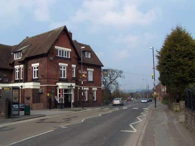
With a population of around 500 residents, Newpool is known for its tight-knit community and friendly atmosphere. The village primarily consists of traditional stone-built houses, giving it a charming and rustic feel. The main focal point of the village is the local village hall, which serves as a venue for community events and gatherings.

Newpool is fortunate to be surrounded by natural beauty, with several walking trails and footpaths in close proximity. This makes it an ideal location for outdoor enthusiasts and nature lovers. The nearby Hulme End is a popular spot for visitors, offering stunning views and opportunities for hiking, cycling, and bird watching.

Despite its small size, Newpool benefits from good transportation links. The A523 road runs through the village, connecting it to nearby towns and cities. Additionally, there are regular bus services that provide easy access to Leek and Stoke-on-Trent.

In terms of amenities, Newpool has a small convenience store that caters to the daily needs of its residents. However, for more extensive shopping and leisure activities, residents often visit the nearby towns and cities.

Overall, Newpool offers a peaceful and idyllic lifestyle in the heart of the Staffordshire countryside, making it a desirable place to live for those seeking a close-knit community and a connection to nature.

If you have any feedback on the listing, please let us know in the comments section below.

Newpool Images

Images are sourced within 2km of 53.108678/-2.185948 or Grid Reference SJ8756. Thanks to Geograph Open Source API. All images are credited.

Biddulph Arms, Biddulph
Mow Cop and the finishing line of The Killer Mile
Congleton Road north of Mow Cop
Old mill on Mow Lane
Mow Road crossing Biddulph Valley way
Wood Sorrel There are clumps of Wood Sorrel growing throughout the woods on Greenway Bank Country Park. For a close of one of the flowers see <a href="https://www.geograph.org.uk/photo/2370071">SJ8855 : Flower of the Wood Sorrel</a>.

Wood Sorrel (Oxalis acetosella) is one of the characteristic early spring-flowering plants of the woodland floor, often appearing alongside Wood Anemones, Bluebells and Ramsons. It is, when flowering with certain other species, used as an Ancient Woodland Indicator. It can be found across much of the UK but is less common in the east of the country. The flowers appear in April and May and are hermaphrodite, in that they have both male and female organs and are pollinated by Bees, flies and a type of self-pollination known as Cleistogomy, meaning that the flowers can pollinate without the flowers opening. During periods of rain and at night the flowers and leaves will close in on themselves. Both the leaves and flowers are edible, usually eaten raw as part of a salad.
Wood Sorrel
There are clumps of Wood Sorrel growing throughout the woods on Greenway Bank Country Park. For a close of one of the flowers see SJ8855 : Flower of the Wood Sorrel. Wood Sorrel (Oxalis acetosella) is one of the characteristic early spring-flowering plants of the woodland floor, often appearing alongside Wood Anemones, Bluebells and Ramsons. It is, when flowering with certain other species, used as an Ancient Woodland Indicator. It can be found across much of the UK but is less common in the east of the country. The flowers appear in April and May and are hermaphrodite, in that they have both male and female organs and are pollinated by Bees, flies and a type of self-pollination known as Cleistogomy, meaning that the flowers can pollinate without the flowers opening. During periods of rain and at night the flowers and leaves will close in on themselves. Both the leaves and flowers are edible, usually eaten raw as part of a salad.
Flower of the Wood Sorrel One of the flowers seen in the clump of <a href="https://www.geograph.org.uk/photo/2370062">SJ8855 : Wood Sorrel</a> on Greenway Bank Country Park.

Wood Sorrel (Oxalis acetosella) is one of the characteristic early spring-flowering plants of the woodland floor, often appearing alongside Wood Anemones, Bluebells and Ramsons. It is, when flowering with certain other species, used as an Ancient Woodland Indicator. It can be found across much of the UK but is less common in the east of the country. The flowers appear in April and May and are hermaphrodite, in that they have both male and female organs and are pollinated by Bees, flies and a type of self-pollination known as Cleistogomy, meaning that the flowers can pollinate without the flowers opening. During periods of rain and at night the flowers and leaves will close in on themselves. Both the leaves and flowers are edible, usually eaten raw as part of a salad.
Flower of the Wood Sorrel
One of the flowers seen in the clump of SJ8855 : Wood Sorrel on Greenway Bank Country Park. Wood Sorrel (Oxalis acetosella) is one of the characteristic early spring-flowering plants of the woodland floor, often appearing alongside Wood Anemones, Bluebells and Ramsons. It is, when flowering with certain other species, used as an Ancient Woodland Indicator. It can be found across much of the UK but is less common in the east of the country. The flowers appear in April and May and are hermaphrodite, in that they have both male and female organs and are pollinated by Bees, flies and a type of self-pollination known as Cleistogomy, meaning that the flowers can pollinate without the flowers opening. During periods of rain and at night the flowers and leaves will close in on themselves. Both the leaves and flowers are edible, usually eaten raw as part of a salad.
Seat by the path This seat looks down into the old arboretum on Greenway Bank Country Park.
Seat by the path
This seat looks down into the old arboretum on Greenway Bank Country Park.
Back along the path Looking back along the path above the old arboretum on Greenway Bank Country Park. The Bluebells on the right are, unfortunately, Spanish ones rather than the native ones.
Back along the path
Looking back along the path above the old arboretum on Greenway Bank Country Park. The Bluebells on the right are, unfortunately, Spanish ones rather than the native ones.
Top of the steps From here the path descends the steps to the western corner of Greenway Bank Country Park, I imagine the seat on the right is a welcome sight for those climbing up.
Top of the steps
From here the path descends the steps to the western corner of Greenway Bank Country Park, I imagine the seat on the right is a welcome sight for those climbing up.
Boggy land Looking from the public footpath just outside Greenway Bank Country Park across to what looks like a very marshy field.
Boggy land
Looking from the public footpath just outside Greenway Bank Country Park across to what looks like a very marshy field.
Muddy waters This very murky looking water has come down the ditch from the <a href="https://www.geograph.org.uk/photo/2371260">SJ8855 : Boggy land</a> and eventually empties into the Serpentine Lake on Greenway Bank Country Park.
Muddy waters
This very murky looking water has come down the ditch from the SJ8855 : Boggy land and eventually empties into the Serpentine Lake on Greenway Bank Country Park.
Marsh Marigolds This clump of Marsh Marigolds is growing beside the ditch carrying the <a href="https://www.geograph.org.uk/photo/2371275">SJ8855 : Muddy waters</a> on Greenway Bank Country Park. For a close-up of the flowers and more information see <a href="https://www.geograph.org.uk/photo/2371297">SJ8855 : Marsh Marigold flowers</a>.
Marsh Marigolds
This clump of Marsh Marigolds is growing beside the ditch carrying the SJ8855 : Muddy waters on Greenway Bank Country Park. For a close-up of the flowers and more information see SJ8855 : Marsh Marigold flowers.
Marsh Marigold flowers A close up of the flowers on the clump of <a href="https://www.geograph.org.uk/photo/2371287">SJ8855 : Marsh Marigolds</a>.

Marsh Marigold (Caltha palustris) is known in Britain by a number of names that vary by geographical regions, they include Kingcup, Mayflower, May Blobs, Mollyblobs, Pollyblobs, Horse Blob, Water Blobs, Water Bubbles, Gollins and the Publican. The common name of Marigold refers to its use in churches in medieval times at Easter time as a tribute to the Virgin Mary and its scientific name of palustris is Latin for “of the marsh”, the plant’s main habitat. It is thought to be one of the UK’s oldest native plants, surviving the ice age and flourishing in a landscape covered by marshes created by glacial melt-water. C. palustris will grow to 80 centimetres (31 inches) in height; the flowers are yellow with normally five petals (although it can vary from 4 to 9) and are between 2 and 5 centimetres (1-2 inches) across, the flowers appear between early spring and late summer and are visited by a wide range of insects. All parts of the plant are poisonous and it can also be an irritant; skin rashes and dermatitis have been reported from excessive handling of the plant.
Marsh Marigold flowers
A close up of the flowers on the clump of SJ8855 : Marsh Marigolds. Marsh Marigold (Caltha palustris) is known in Britain by a number of names that vary by geographical regions, they include Kingcup, Mayflower, May Blobs, Mollyblobs, Pollyblobs, Horse Blob, Water Blobs, Water Bubbles, Gollins and the Publican. The common name of Marigold refers to its use in churches in medieval times at Easter time as a tribute to the Virgin Mary and its scientific name of palustris is Latin for “of the marsh”, the plant’s main habitat. It is thought to be one of the UK’s oldest native plants, surviving the ice age and flourishing in a landscape covered by marshes created by glacial melt-water. C. palustris will grow to 80 centimetres (31 inches) in height; the flowers are yellow with normally five petals (although it can vary from 4 to 9) and are between 2 and 5 centimetres (1-2 inches) across, the flowers appear between early spring and late summer and are visited by a wide range of insects. All parts of the plant are poisonous and it can also be an irritant; skin rashes and dermatitis have been reported from excessive handling of the plant.
Greening up This marshy area on Greenway Bank Country Park will soon be covered by tall reeds and Reedmace plants. For another view of the Blackthorn blossom on the left see <a href="https://www.geograph.org.uk/photo/2371369">SJ8855 : Blackthorn blossom</a>.
Greening up
This marshy area on Greenway Bank Country Park will soon be covered by tall reeds and Reedmace plants. For another view of the Blackthorn blossom on the left see SJ8855 : Blackthorn blossom.
Blackthorn blossom Another view of the Blackthorn blossom also visible in <a href="https://www.geograph.org.uk/photo/2371355">SJ8855 : Greening up</a>, 2011 seems to have been an exceptional year for Blackthorn blossom with having such a dry Spring.

Blackthorn (Prunus spinosa) is also known as Sloe, Wild Plum, Mother of the Wood and Wishing Thorn. Because of its spiny branches and thick, bushy, growth it makes an ideal stock-proof hedging plant that can grow to 5 metres in height. It can be found in a wide range of habitats and will grow on just about any type of ground except extremely acid soil. It produces small white, five petalled, flowers from March to April; these are followed by small, blue-black, plum-like fruits that ripen in September to October. The fruits are an astringent, meaning they will dry your mouth when eaten raw; to harvest them it is better to wait until after a few frosts- this will sweeten them slightly and also reduce the tannin levels. The juice from the berries can be used as a dye, giving linen a reddish colour that will wash out to become a durable pale blue. Traditionally, straight Blackthorn stems have been used to make walking sticks; Blackthorn is also used to make the ‘swagger’ sticks carried by commissioned officers of the Royal Irish Regiment.
Blackthorn blossom
Another view of the Blackthorn blossom also visible in SJ8855 : Greening up, 2011 seems to have been an exceptional year for Blackthorn blossom with having such a dry Spring. Blackthorn (Prunus spinosa) is also known as Sloe, Wild Plum, Mother of the Wood and Wishing Thorn. Because of its spiny branches and thick, bushy, growth it makes an ideal stock-proof hedging plant that can grow to 5 metres in height. It can be found in a wide range of habitats and will grow on just about any type of ground except extremely acid soil. It produces small white, five petalled, flowers from March to April; these are followed by small, blue-black, plum-like fruits that ripen in September to October. The fruits are an astringent, meaning they will dry your mouth when eaten raw; to harvest them it is better to wait until after a few frosts- this will sweeten them slightly and also reduce the tannin levels. The juice from the berries can be used as a dye, giving linen a reddish colour that will wash out to become a durable pale blue. Traditionally, straight Blackthorn stems have been used to make walking sticks; Blackthorn is also used to make the ‘swagger’ sticks carried by commissioned officers of the Royal Irish Regiment.
Wood Anemones There are a lot of clumps of Wood Anemones dotted throughout the woods on Greenway Bank Country Park, this particular one is beside the path below the old arboretum. For a close-up of one of the flowers and more information see <a href="https://www.geograph.org.uk/photo/2371395">SJ8855 : Wood Anemone flower</a>.
Wood Anemones
There are a lot of clumps of Wood Anemones dotted throughout the woods on Greenway Bank Country Park, this particular one is beside the path below the old arboretum. For a close-up of one of the flowers and more information see SJ8855 : Wood Anemone flower.
Wood Anemone flower This pretty flower is one of the ones seen in the clump of <a href="https://www.geograph.org.uk/photo/2371384">SJ8855 : Wood Anemones</a> by the path below the old arboretum on Greenway Bank Country Park.

The Wood Anemone (Anemone nemorosa) is known by several names- Windflower, Thimbleweed and Smell Fox, the latter referring to the musky smell of the leaves. It is a perennial herbaceous plant, growing in early spring from 5 to 15 cm tall with a single, star-shaped, white flower on each stem.  Wood Anemones are native to Britain and can be found throughout the country, it prefers dry deciduous woodland and old hedgebanks; sometimes it will be found meadows indicating the past existence of an old wood. The Wood Anemone is poisonous. Although herbalists do not use the plant medicinally nowadays, various parts of this herb used to be recommended for a variety of complaints such as headaches, gout and rheumatism.
Wood Anemone flower
This pretty flower is one of the ones seen in the clump of SJ8855 : Wood Anemones by the path below the old arboretum on Greenway Bank Country Park. The Wood Anemone (Anemone nemorosa) is known by several names- Windflower, Thimbleweed and Smell Fox, the latter referring to the musky smell of the leaves. It is a perennial herbaceous plant, growing in early spring from 5 to 15 cm tall with a single, star-shaped, white flower on each stem. Wood Anemones are native to Britain and can be found throughout the country, it prefers dry deciduous woodland and old hedgebanks; sometimes it will be found meadows indicating the past existence of an old wood. The Wood Anemone is poisonous. Although herbalists do not use the plant medicinally nowadays, various parts of this herb used to be recommended for a variety of complaints such as headaches, gout and rheumatism.
Show me another place!

Newpool is located at Grid Ref: SJ8756 (Lat: 53.108678, Lng: -2.185948)

Administrative County: Staffordshire

District: Staffordshire Moorlands

Police Authority: Staffordshire

What 3 Words

///currently.mammoth.cave. Near Biddulph, Staffordshire

Nearby Locations

Brown Lees Newpool

Related Wikis

Braddocks Hay

Braddocks Hay is a village in Staffordshire, England. Population details for the 2011 census can be found under Biddulph

Tunstall Road

Tunstall Road, also known as Victoria and Knypersley Social Welfare Centre, is a cricket ground in Knypersley, Staffordshire. The ground is located along...

Knypersley Hall

Knypersley Hall is an 18th-century Georgian style country mansion at Biddulph, Staffordshire, England. It is protected as a Grade II* listed building....

Biddulph High School

Biddulph High School is a mixed upper school (termed 'high school') and sixth form located in the Knypersley area of Biddulph in the English county of...

Biddulph railway station

Biddulph railway station was a railway station opened by the North Staffordshire Railway in 1864. Originally named Gillow Heath the station was renamed...

Biddulph

Biddulph is a town in Staffordshire, England, 8.5 miles (14 km) north of Stoke-on-Trent and 4.5 miles (7 km) south-east of Congleton, Cheshire. == Origin... ==

Black Bull railway station

Black Bull railway station is a disused railway station in Staffordshire, England. The station was opened in 1864 by the North Staffordshire Railway on...

Harriseahead

Harriseahead is a village in the county of Staffordshire, England, just north of the Potteries (Stoke on Trent) and about 2 miles (3.2 km) south-west of...

Nearby Amenities

Located within 500m of 53.108678,-2.185948
Bus Stop
Park Middle School
Bus: yes
Naptan AtcoCode: 3800C853302
Naptan Bearing: W
Naptan CommonName: Park Middle School
Naptan Indicator: Opp
Naptan Landmark: Park Middle School
Naptan PlusbusZoneRef: STOKEOT
Naptan Street: Park Ln
Naptan Verified: no
Public Transport: platform
Source: naptan_import
Lat/Long: 53.1077086/-2.1788529
Bus Stop
Pentecostal Church
Bus: yes
Naptan AtcoCode: 3800C862501
Naptan Bearing: NW
Naptan CommonName: Pentecostal Church
Naptan Indicator: Adj
Naptan Landmark: Pentecostal Church
Naptan PlusbusZoneRef: STOKEOT
Naptan Street: Newpool Rd
Naptan Verified: no
Public Transport: platform
Source: naptan_import
Lat/Long: 53.1083599/-2.1821121
Bus Stop
Knypersley Primary School
Bus: yes
Naptan AtcoCode: 3800C862502
Naptan Bearing: SE
Naptan CommonName: Knypersley Primary School
Naptan Indicator: Opp
Naptan Landmark: Knypersley Primary Sch
Naptan PlusbusZoneRef: STOKEOT
Naptan Street: Newpool Rd
Naptan Verified: no
Public Transport: platform
Source: naptan_import
Lat/Long: 53.1083245/-2.1817534
Bus Stop
James Way
Bus: yes
Naptan AtcoCode: 3800C862601
Naptan Bearing: E
Naptan CommonName: James Way
Naptan Indicator: Opp
Naptan Landmark: James Way
Naptan PlusbusZoneRef: STOKEOT
Naptan Street: Newpool Rd
Naptan Verified: no
Public Transport: platform
Source: naptan_import
Lat/Long: 53.1078371/-2.1887723
Bus Stop
James Way
Bus: yes
Naptan AtcoCode: 3800C862602
Naptan Bearing: W
Naptan CommonName: James Way
Naptan Indicator: Adj
Naptan Landmark: James Way
Naptan PlusbusZoneRef: STOKEOT
Naptan Street: Newpool Rd
Naptan Verified: no
Public Transport: platform
Source: naptan_import
Lat/Long: 53.1076926/-2.1892198
Bus Stop
Meadow Stile Farm
Bus: yes
Naptan AtcoCode: 3800C862701
Naptan Bearing: NW
Naptan CommonName: Meadow Stile Farm
Naptan Indicator: Adj
Naptan Landmark: Meadow Stile Farm
Naptan PlusbusZoneRef: STOKEOT
Naptan Street: Tower Hill Rd
Naptan Verified: no
Public Transport: platform
Source: naptan_import
Lat/Long: 53.106098/-2.1914385
Bus Stop
Mansfield Drive
Bus: yes
Naptan AtcoCode: 3800C862801
Naptan Bearing: N
Naptan CommonName: Mansfield Drive
Naptan Indicator: Opp
Naptan Landmark: Mansfield Dr
Naptan PlusbusZoneRef: STOKEOT
Naptan Street: Tower Hill Rd
Naptan Verified: no
Public Transport: platform
Source: naptan_import
Lat/Long: 53.1046009/-2.1888179
Bus Stop
Newpool Road
Bus: yes
Naptan AtcoCode: 3800C892001
Naptan Bearing: E
Naptan CommonName: Newpool Road
Naptan Indicator: o/s 60
Naptan Landmark: Newpool Road
Naptan PlusbusZoneRef: STOKEOT
Naptan Street: Newpool Rd
Naptan Verified: no
Public Transport: platform
Source: naptan_import
Lat/Long: 53.107823/-2.1863373
Bus Stop
Newpool Road
Bus: yes
Naptan AtcoCode: 3800C892002
Naptan Bearing: W
Naptan CommonName: Newpool Road
Naptan Indicator: o/s 35
Naptan Landmark: Newpool Rd
Naptan PlusbusZoneRef: STOKEOT
Naptan Street: Newpool Rd
Naptan Verified: no
Public Transport: platform
Source: naptan_import
Lat/Long: 53.1077151/-2.1863219
Bus Stop
Lyndhurst Drive
Bus: yes
Naptan AtcoCode: 3800C862702
Naptan Bearing: SE
Naptan CommonName: Lyndhurst Drive
Naptan Indicator: Adj
Naptan Landmark: Lyndhurst Dr
Naptan PlusbusZoneRef: STOKEOT
Naptan Street: Tower Hill Rd
Naptan Verified: no
Public Transport: platform
Source: naptan_import
Lat/Long: 53.105732/-2.190261
Knypersley
Historic Railway: halt
Railway: site
Wikidata: Q18708286
Wikipedia: en:List of North Staffordshire Railway halts
Lat/Long: 53.1090842/-2.1828715
Knypersley Stores & News
Addr Housenumber: 141
Addr Postcode: ST8 7AE
Addr Street: Tunstall Road
Opening Hours: Mo-Su 06:00-21:00
Shop: convenience
Lat/Long: 53.1076273/-2.1802909
Brown Lees
Place: suburb
Lat/Long: 53.1053312/-2.1887027
Power: pole
Lat/Long: 53.1128663/-2.1878732
Power: pole
Lat/Long: 53.1125463/-2.1890563
Power: pole
Lat/Long: 53.1122671/-2.1899929
Power: pole
Lat/Long: 53.1119915/-2.190985
Generator Method: photovoltaic
Generator Output Electricity: yes
Generator Source: solar
Generator Type: solar_photovoltaic_panel
Location: roof
Power: generator
Lat/Long: 53.1083454/-2.1796918
ALDI
Addr Country: GB
Addr Postcode: ST8 7AB
Addr Street: Tunstall Road
Brand: ALDI
Brand Wikidata: Q41171672
Brand Wikipedia: en:Aldi
Contact Website: https://stores.aldi.co.uk/biddulph/tunstall-road
Fhrs Id: 1415853
Shop: supermarket
Lat/Long: 53.1098058/-2.1803463
Turning Circle
Lat/Long: 53.1061041/-2.1885618
Bus Stop
Biddulph, Aldi store
Naptan AtcoCode: 3800C828600
Naptan Bearing: NE
Naptan BusStopType: CUS
Naptan CommonName: Aldi store
Naptan Indicator: adj
Naptan LocalityName: Biddulph
Naptan ShortCommonName: Aldi store
Naptan Street: Aldi service road
Lat/Long: 53.110197/-2.179295
The data included in this document is from www.openstreetmap.org. The data is made available under ODbL.

Have you been to Newpool?

Leave your review of Newpool below (or comments, questions and feedback).