Brown Lees

Settlement in Staffordshire Staffordshire Moorlands

England

Brown Lees

Clump of Chionodoxa The upper part of Greenway Bank Country Park is a wonderful place to come and see spring flowers, later in the year the Beech canopy will be too thick to allow anything to grow. For a close-up of a flower see <a href="https://www.geograph.org.uk/photo/2342251">SJ8855 : Chionodoxa flower</a>.
Clump of Chionodoxa Credit: Jonathan Kington

Brown Lees is a small village located in the county of Staffordshire, England. Situated approximately 2 miles north of Stoke-on-Trent, it is nestled within the scenic landscape of the Staffordshire Moorlands. The village is characterized by its quaint charm and rural atmosphere.

Brown Lees has a rich history dating back to the 18th century, when it was primarily an agricultural community. Today, it has evolved into a residential area with a mix of traditional and modern housing. The village is known for its picturesque views and peaceful surroundings, making it an attractive place to live for those seeking a rural lifestyle.

Despite its small size, Brown Lees offers a range of amenities to its residents. The village has a local pub, The Red Lion, which serves as a social hub and meeting place for the community. There is also a primary school, Brown Lees Academy, providing education for the village's younger inhabitants. For outdoor enthusiasts, the nearby countryside offers ample opportunities for walking, cycling, and exploring the natural beauty of the area.

The village's location provides convenient access to larger towns and cities in the region. Stoke-on-Trent, with its shopping centers, restaurants, and cultural attractions, is just a short drive away. Additionally, the nearby A500 road connects Brown Lees to the wider road network, making it easily accessible for commuters.

In summary, Brown Lees is a peaceful and picturesque village in Staffordshire, offering a rural lifestyle with convenient access to larger towns and cities. Its rich history, friendly community, and beautiful surroundings make it a desirable place to call home.

If you have any feedback on the listing, please let us know in the comments section below.
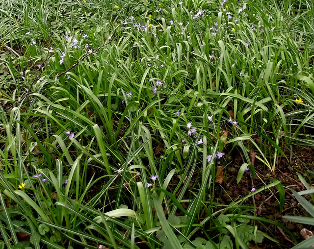
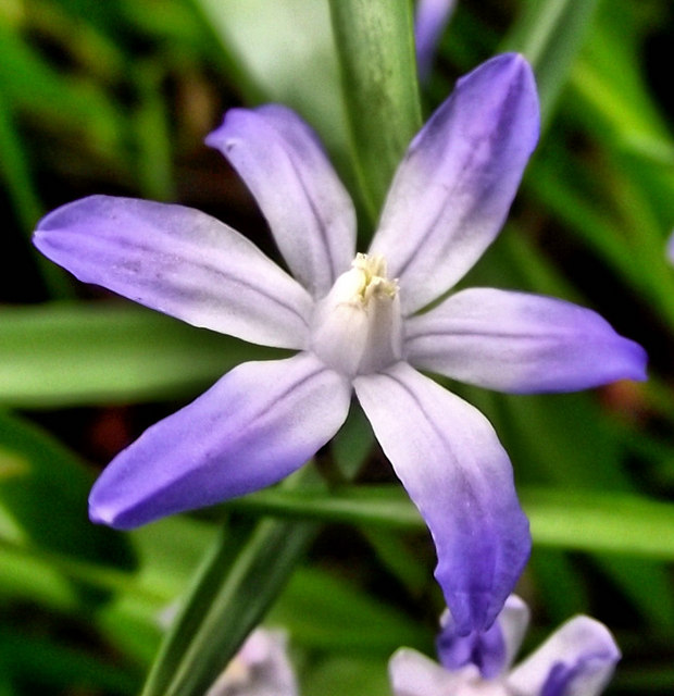
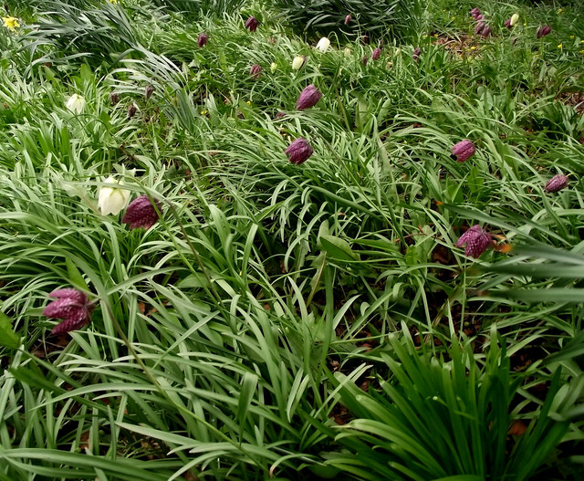
Brown Lees Images

Images are sourced within 2km of 53.104716/-2.190114 or Grid Reference SJ8756. Thanks to Geograph Open Source API. All images are credited.

Clump of Chionodoxa The upper part of Greenway Bank Country Park is a wonderful place to come and see spring flowers, later in the year the Beech canopy will be too thick to allow anything to grow. For a close-up of a flower see <a href="https://www.geograph.org.uk/photo/2342251">SJ8855 : Chionodoxa flower</a>.
Clump of Chionodoxa
The upper part of Greenway Bank Country Park is a wonderful place to come and see spring flowers, later in the year the Beech canopy will be too thick to allow anything to grow. For a close-up of a flower see SJ8855 : Chionodoxa flower.
Chionodoxa flower A close-up of one of the <a href="https://www.geograph.org.uk/photo/2342236">SJ8855 : Clump of Chionodoxa</a>. The Chionodoxa, or Glory-of-the-snow, is a garden flower that grows from a bulb. The flowers can be blue, white or pink and they appear in the early spring.
Chionodoxa flower
A close-up of one of the SJ8855 : Clump of Chionodoxa. The Chionodoxa, or Glory-of-the-snow, is a garden flower that grows from a bulb. The flowers can be blue, white or pink and they appear in the early spring.
Snake's Head Fritillary Greenway Bank Country Park always has a wonderful show of spring flowers- especially under the Beeches in the old gardens, later on the Beech canopy becomes so thick nothing grows under them. These will have been planted here.

Snake’s Head Fritillary (Fritillaria meleagris) is Britain’s only native Fritillary and goes by a variety of English names including Checkered Daffodil, Checkered Lily, Chess Flower, Common Fritillary, Frog-cup, Lazarus Bell and Leper Lily. The various shades of purple flower start to appear in spring, looking closely at the flower shows a checked pattern of silvery scales- not unlike a snake’s skin, it even shows on the white form.  They are usually found on the damp lowland meadows and pastures of south-east England but because they prefer land that has not been intensively farmed they are now becoming quite rare. The names Leper Lilies and Lazarus Bells come from the flowers resemblance to the bells that were worn by lepers during the Middle Ages to announce their presence.
Snake's Head Fritillary
Greenway Bank Country Park always has a wonderful show of spring flowers- especially under the Beeches in the old gardens, later on the Beech canopy becomes so thick nothing grows under them. These will have been planted here. Snake’s Head Fritillary (Fritillaria meleagris) is Britain’s only native Fritillary and goes by a variety of English names including Checkered Daffodil, Checkered Lily, Chess Flower, Common Fritillary, Frog-cup, Lazarus Bell and Leper Lily. The various shades of purple flower start to appear in spring, looking closely at the flower shows a checked pattern of silvery scales- not unlike a snake’s skin, it even shows on the white form. They are usually found on the damp lowland meadows and pastures of south-east England but because they prefer land that has not been intensively farmed they are now becoming quite rare. The names Leper Lilies and Lazarus Bells come from the flowers resemblance to the bells that were worn by lepers during the Middle Ages to announce their presence.
Mow Cop Road
Mow Cop Road
Mow Cop and the finishing line of The Killer Mile
Congleton Road north of Mow Cop
Apple blossom These old Apple trees, probably part of the old garden, are putting on a lovely show in the corner of the picnic area on Greenway Bank Country Park.
Apple blossom
These old Apple trees, probably part of the old garden, are putting on a lovely show in the corner of the picnic area on Greenway Bank Country Park.
Cherry blossom This Cherry is making a lovely arch over the path from the top car park on Greenway Bank Country Park.
Cherry blossom
This Cherry is making a lovely arch over the path from the top car park on Greenway Bank Country Park.
Rhododendron bush This pretty little Rhododenedron bush is growing in a corner of the old garden on Greenway Bank Country Park. For a detailed look at the flower see <a href="https://www.geograph.org.uk/photo/2369900">SJ8855 : Rhododendron flowers</a>.

Rhododendron (from the Greek rhódon "rose", and déndron "tree) is a genus of over 1000 species of woody plants in the heath family, most of which produce showy flowers. They can vary in height from small shrubs of 10-100 centimetres right up to small trees, the largest of which is reputed to be 30 metres. They can also vary between being evergreen and deciduous. Some species especially Rhododendron ponticum in Ireland and the United Kingdom have become highly invasive as introduced plants, spreading in woodland areas replacing the natural understory. R. ponticum is very difficult to eradicate, as its roots can make new shoots and therefore requires grubbing out. Rhododendrons are extensively hybridized in cultivation, and there are over 28,000 cultivars of Rhododendron in the International Rhododendron Registry held by the Royal Horticultural Society. Most have been bred for their flowers, but a few are of garden interest because of ornamental leaves and some for ornamental bark or stems. Most species of Rhododendron originate from South-East Asia, the Far East (China and Nepal) and parts of Australasia and were mainly introduced to the UK by Victorian plant hunters.
Rhododendron bush
This pretty little Rhododenedron bush is growing in a corner of the old garden on Greenway Bank Country Park. For a detailed look at the flower see SJ8855 : Rhododendron flowers. Rhododendron (from the Greek rhódon "rose", and déndron "tree) is a genus of over 1000 species of woody plants in the heath family, most of which produce showy flowers. They can vary in height from small shrubs of 10-100 centimetres right up to small trees, the largest of which is reputed to be 30 metres. They can also vary between being evergreen and deciduous. Some species especially Rhododendron ponticum in Ireland and the United Kingdom have become highly invasive as introduced plants, spreading in woodland areas replacing the natural understory. R. ponticum is very difficult to eradicate, as its roots can make new shoots and therefore requires grubbing out. Rhododendrons are extensively hybridized in cultivation, and there are over 28,000 cultivars of Rhododendron in the International Rhododendron Registry held by the Royal Horticultural Society. Most have been bred for their flowers, but a few are of garden interest because of ornamental leaves and some for ornamental bark or stems. Most species of Rhododendron originate from South-East Asia, the Far East (China and Nepal) and parts of Australasia and were mainly introduced to the UK by Victorian plant hunters.
Rhododendron flowers These flowers are growing on the <a href="https://www.geograph.org.uk/photo/2369888">SJ8855 : Rhododendron bush</a> on Greenway Bank Country Park.

Rhododendron (from the Greek rhódon "rose", and déndron "tree) is a genus of over 1000 species of woody plants in the heath family, most of which produce showy flowers. They can vary in height from small shrubs of 10-100 centimetres right up to small trees, the largest of which is reputed to be 30 metres. They can also vary between being evergreen and deciduous. Some species especially Rhododendron ponticum in Ireland and the United Kingdom have become highly invasive as introduced plants, spreading in woodland areas replacing the natural understory. R. ponticum is very difficult to eradicate, as its roots can make new shoots and therefore requires grubbing out. Rhododendrons are extensively hybridized in cultivation, and there are over 28,000 cultivars of Rhododendron in the International Rhododendron Registry held by the Royal Horticultural Society. Most have been bred for their flowers, but a few are of garden interest because of ornamental leaves and some for ornamental bark or stems. Most species of Rhododendron originate from South-East Asia, the Far East (China and Nepal) and parts of Australasia and were mainly introduced to the UK by Victorian plant hunters.
Rhododendron flowers
These flowers are growing on the SJ8855 : Rhododendron bush on Greenway Bank Country Park. Rhododendron (from the Greek rhódon "rose", and déndron "tree) is a genus of over 1000 species of woody plants in the heath family, most of which produce showy flowers. They can vary in height from small shrubs of 10-100 centimetres right up to small trees, the largest of which is reputed to be 30 metres. They can also vary between being evergreen and deciduous. Some species especially Rhododendron ponticum in Ireland and the United Kingdom have become highly invasive as introduced plants, spreading in woodland areas replacing the natural understory. R. ponticum is very difficult to eradicate, as its roots can make new shoots and therefore requires grubbing out. Rhododendrons are extensively hybridized in cultivation, and there are over 28,000 cultivars of Rhododendron in the International Rhododendron Registry held by the Royal Horticultural Society. Most have been bred for their flowers, but a few are of garden interest because of ornamental leaves and some for ornamental bark or stems. Most species of Rhododendron originate from South-East Asia, the Far East (China and Nepal) and parts of Australasia and were mainly introduced to the UK by Victorian plant hunters.
Wood Sorrel There are clumps of Wood Sorrel growing throughout the woods on Greenway Bank Country Park. For a close of one of the flowers see <a href="https://www.geograph.org.uk/photo/2370071">SJ8855 : Flower of the Wood Sorrel</a>.

Wood Sorrel (Oxalis acetosella) is one of the characteristic early spring-flowering plants of the woodland floor, often appearing alongside Wood Anemones, Bluebells and Ramsons. It is, when flowering with certain other species, used as an Ancient Woodland Indicator. It can be found across much of the UK but is less common in the east of the country. The flowers appear in April and May and are hermaphrodite, in that they have both male and female organs and are pollinated by Bees, flies and a type of self-pollination known as Cleistogomy, meaning that the flowers can pollinate without the flowers opening. During periods of rain and at night the flowers and leaves will close in on themselves. Both the leaves and flowers are edible, usually eaten raw as part of a salad.
Wood Sorrel
There are clumps of Wood Sorrel growing throughout the woods on Greenway Bank Country Park. For a close of one of the flowers see SJ8855 : Flower of the Wood Sorrel. Wood Sorrel (Oxalis acetosella) is one of the characteristic early spring-flowering plants of the woodland floor, often appearing alongside Wood Anemones, Bluebells and Ramsons. It is, when flowering with certain other species, used as an Ancient Woodland Indicator. It can be found across much of the UK but is less common in the east of the country. The flowers appear in April and May and are hermaphrodite, in that they have both male and female organs and are pollinated by Bees, flies and a type of self-pollination known as Cleistogomy, meaning that the flowers can pollinate without the flowers opening. During periods of rain and at night the flowers and leaves will close in on themselves. Both the leaves and flowers are edible, usually eaten raw as part of a salad.
Flower of the Wood Sorrel One of the flowers seen in the clump of <a href="https://www.geograph.org.uk/photo/2370062">SJ8855 : Wood Sorrel</a> on Greenway Bank Country Park.

Wood Sorrel (Oxalis acetosella) is one of the characteristic early spring-flowering plants of the woodland floor, often appearing alongside Wood Anemones, Bluebells and Ramsons. It is, when flowering with certain other species, used as an Ancient Woodland Indicator. It can be found across much of the UK but is less common in the east of the country. The flowers appear in April and May and are hermaphrodite, in that they have both male and female organs and are pollinated by Bees, flies and a type of self-pollination known as Cleistogomy, meaning that the flowers can pollinate without the flowers opening. During periods of rain and at night the flowers and leaves will close in on themselves. Both the leaves and flowers are edible, usually eaten raw as part of a salad.
Flower of the Wood Sorrel
One of the flowers seen in the clump of SJ8855 : Wood Sorrel on Greenway Bank Country Park. Wood Sorrel (Oxalis acetosella) is one of the characteristic early spring-flowering plants of the woodland floor, often appearing alongside Wood Anemones, Bluebells and Ramsons. It is, when flowering with certain other species, used as an Ancient Woodland Indicator. It can be found across much of the UK but is less common in the east of the country. The flowers appear in April and May and are hermaphrodite, in that they have both male and female organs and are pollinated by Bees, flies and a type of self-pollination known as Cleistogomy, meaning that the flowers can pollinate without the flowers opening. During periods of rain and at night the flowers and leaves will close in on themselves. Both the leaves and flowers are edible, usually eaten raw as part of a salad.
Seat by the path This seat looks down into the old arboretum on Greenway Bank Country Park.
Seat by the path
This seat looks down into the old arboretum on Greenway Bank Country Park.
Back along the path Looking back along the path above the old arboretum on Greenway Bank Country Park. The Bluebells on the right are, unfortunately, Spanish ones rather than the native ones.
Back along the path
Looking back along the path above the old arboretum on Greenway Bank Country Park. The Bluebells on the right are, unfortunately, Spanish ones rather than the native ones.
Top of the steps From here the path descends the steps to the western corner of Greenway Bank Country Park, I imagine the seat on the right is a welcome sight for those climbing up.
Top of the steps
From here the path descends the steps to the western corner of Greenway Bank Country Park, I imagine the seat on the right is a welcome sight for those climbing up.
Boggy land Looking from the public footpath just outside Greenway Bank Country Park across to what looks like a very marshy field.
Boggy land
Looking from the public footpath just outside Greenway Bank Country Park across to what looks like a very marshy field.
Muddy waters This very murky looking water has come down the ditch from the <a href="https://www.geograph.org.uk/photo/2371260">SJ8855 : Boggy land</a> and eventually empties into the Serpentine Lake on Greenway Bank Country Park.
Muddy waters
This very murky looking water has come down the ditch from the SJ8855 : Boggy land and eventually empties into the Serpentine Lake on Greenway Bank Country Park.
Marsh Marigolds This clump of Marsh Marigolds is growing beside the ditch carrying the <a href="https://www.geograph.org.uk/photo/2371275">SJ8855 : Muddy waters</a> on Greenway Bank Country Park. For a close-up of the flowers and more information see <a href="https://www.geograph.org.uk/photo/2371297">SJ8855 : Marsh Marigold flowers</a>.
Marsh Marigolds
This clump of Marsh Marigolds is growing beside the ditch carrying the SJ8855 : Muddy waters on Greenway Bank Country Park. For a close-up of the flowers and more information see SJ8855 : Marsh Marigold flowers.
Show me another place!

Brown Lees is located at Grid Ref: SJ8756 (Lat: 53.104716, Lng: -2.190114)

Administrative County: Staffordshire

District: Staffordshire Moorlands

Police Authority: Staffordshire

What 3 Words

///lies.caged.swims. Near Biddulph, Staffordshire

Nearby Locations

Brown Lees Newpool

Related Wikis

Tunstall Road

Tunstall Road, also known as Victoria and Knypersley Social Welfare Centre, is a cricket ground in Knypersley, Staffordshire. The ground is located along...

Braddocks Hay

Braddocks Hay is a village in Staffordshire, England. Population details for the 2011 census can be found under Biddulph

Knypersley Hall

Knypersley Hall is an 18th-century Georgian style country mansion at Biddulph, Staffordshire, England. It is protected as a Grade II* listed building....

Harriseahead

Harriseahead is a village in the county of Staffordshire, England, just north of the Potteries (Stoke on Trent) and about 2 miles (3.2 km) south-west of...

Nearby Amenities

Located within 500m of 53.104716,-2.190114
Bus Stop
Post Office
Bus: yes
Naptan AtcoCode: 3800C803600
Naptan Bearing: SE
Naptan CommonName: Post Office
Naptan Indicator: Adj
Naptan Landmark: Chapel
Naptan PlusbusZoneRef: STOKEOT
Naptan Street: Brown Lees Rd
Naptan Verified: no
Public Transport: platform
Source: naptan_import
Lat/Long: 53.102401/-2.1872549
Bus Stop
Gardeners Close
Bus: yes
Naptan AtcoCode: 3800C803601
Naptan Bearing: NW
Naptan CommonName: Gardeners Close
Naptan Indicator: Adj
Naptan Landmark: Gardeners Cl
Naptan PlusbusZoneRef: STOKEOT
Naptan Street: Brown Lees Rd
Naptan Verified: no
Public Transport: platform
Source: naptan_import
Lat/Long: 53.102311/-2.1873142
Bus Stop
James Way
Bus: yes
Naptan AtcoCode: 3800C862601
Naptan Bearing: E
Naptan CommonName: James Way
Naptan Indicator: Opp
Naptan Landmark: James Way
Naptan PlusbusZoneRef: STOKEOT
Naptan Street: Newpool Rd
Naptan Verified: no
Public Transport: platform
Source: naptan_import
Lat/Long: 53.1078371/-2.1887723
Bus Stop
James Way
Bus: yes
Naptan AtcoCode: 3800C862602
Naptan Bearing: W
Naptan CommonName: James Way
Naptan Indicator: Adj
Naptan Landmark: James Way
Naptan PlusbusZoneRef: STOKEOT
Naptan Street: Newpool Rd
Naptan Verified: no
Public Transport: platform
Source: naptan_import
Lat/Long: 53.1076926/-2.1892198
Bus Stop
Meadow Stile Farm
Bus: yes
Naptan AtcoCode: 3800C862701
Naptan Bearing: NW
Naptan CommonName: Meadow Stile Farm
Naptan Indicator: Adj
Naptan Landmark: Meadow Stile Farm
Naptan PlusbusZoneRef: STOKEOT
Naptan Street: Tower Hill Rd
Naptan Verified: no
Public Transport: platform
Source: naptan_import
Lat/Long: 53.106098/-2.1914385
Bus Stop
Mansfield Drive
Bus: yes
Naptan AtcoCode: 3800C862801
Naptan Bearing: N
Naptan CommonName: Mansfield Drive
Naptan Indicator: Opp
Naptan Landmark: Mansfield Dr
Naptan PlusbusZoneRef: STOKEOT
Naptan Street: Tower Hill Rd
Naptan Verified: no
Public Transport: platform
Source: naptan_import
Lat/Long: 53.1046009/-2.1888179
Bus Stop
Stile Close
Bus: yes
Naptan AtcoCode: 3800C862802
Naptan Bearing: S
Naptan CommonName: Stile Close
Naptan Indicator: Adj
Naptan Landmark: Stile Close
Naptan PlusbusZoneRef: STOKEOT
Naptan Street: Tower Hill Rd
Naptan Verified: no
Public Transport: platform
Source: naptan_import
Lat/Long: 53.1039013/-2.1878588
Bus Stop
Newpool Road
Bus: yes
Naptan AtcoCode: 3800C892001
Naptan Bearing: E
Naptan CommonName: Newpool Road
Naptan Indicator: o/s 60
Naptan Landmark: Newpool Road
Naptan PlusbusZoneRef: STOKEOT
Naptan Street: Newpool Rd
Naptan Verified: no
Public Transport: platform
Source: naptan_import
Lat/Long: 53.107823/-2.1863373
Bus Stop
Newpool Road
Bus: yes
Naptan AtcoCode: 3800C892002
Naptan Bearing: W
Naptan CommonName: Newpool Road
Naptan Indicator: o/s 35
Naptan Landmark: Newpool Rd
Naptan PlusbusZoneRef: STOKEOT
Naptan Street: Newpool Rd
Naptan Verified: no
Public Transport: platform
Source: naptan_import
Lat/Long: 53.1077151/-2.1863219
Bus Stop
Lyndhurst Drive
Bus: yes
Naptan AtcoCode: 3800C862702
Naptan Bearing: SE
Naptan CommonName: Lyndhurst Drive
Naptan Indicator: Adj
Naptan Landmark: Lyndhurst Dr
Naptan PlusbusZoneRef: STOKEOT
Naptan Street: Tower Hill Rd
Naptan Verified: no
Public Transport: platform
Source: naptan_import
Lat/Long: 53.105732/-2.190261
Berries Personal Training
Addr City: Stoke-on-Trent
Addr Postcode: ST8 6SG
Addr Street: Hambleton Place
Description: Mobile Personal Training, Nutrition advice, REPS level 3 Trained. We bring everytihng to you.
Email: ritchieberriebpt@gmail.com
Phone: +44 7591445098
Website: https://www.berriespersonaltraining.co.uk/
Lat/Long: 53.1036158/-2.1837006
Pub
The Gardeners Arms
Addr Postcode: ST8 6PH
Addr Street: Brown Lees Road
Fhrs Id: 1259524
Opening Hours: Mo-Su 17:00-00:00
Website: https://robinsonsbrewery.com/
Lat/Long: 53.1018932/-2.1869215
Brown Lees
Place: suburb
Lat/Long: 53.1053312/-2.1887027
Turning Circle
Lat/Long: 53.1012393/-2.1872959
Power: pole
Lat/Long: 53.106506/-2.1962824
Power: pole
Lat/Long: 53.1060695/-2.1950808
Power: pole
Lat/Long: 53.1056182/-2.1938576
Power: pole
Lat/Long: 53.1051317/-2.1924619
Power: pole
Lat/Long: 53.104673/-2.1911956
Power: pole
Lat/Long: 53.104242/-2.1900125
Power: pole
Lat/Long: 53.1038221/-2.1888756
Power: pole
Lat/Long: 53.1035742/-2.1887061
Power: pole
Lat/Long: 53.1062059/-2.1966587
Power: pole
Lat/Long: 53.1052429/-2.1958781
Power: pole
Lat/Long: 53.1045457/-2.1953015
Power: pole
Lat/Long: 53.1039418/-2.1948026
Power: pole
Lat/Long: 53.10309/-2.1941025
Power: pole
Lat/Long: 53.1024072/-2.1935473
Power: pole
Lat/Long: 53.1014989/-2.1928016
Line Management: transition
Power: pole
Lat/Long: 53.1011189/-2.1924744
Turning Circle
Lat/Long: 53.1061041/-2.1885618
The data included in this document is from www.openstreetmap.org. The data is made available under ODbL.

Have you been to Brown Lees?

Leave your review of Brown Lees below (or comments, questions and feedback).