Berriowbridge

Settlement in Cornwall

England

Berriowbridge

Former Wesleyan Methodist Chapel
Former Wesleyan Methodist Chapel Credit: Paul Barnett

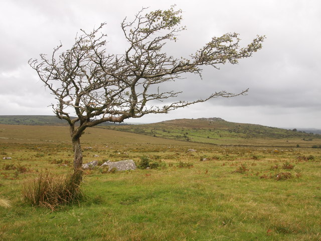
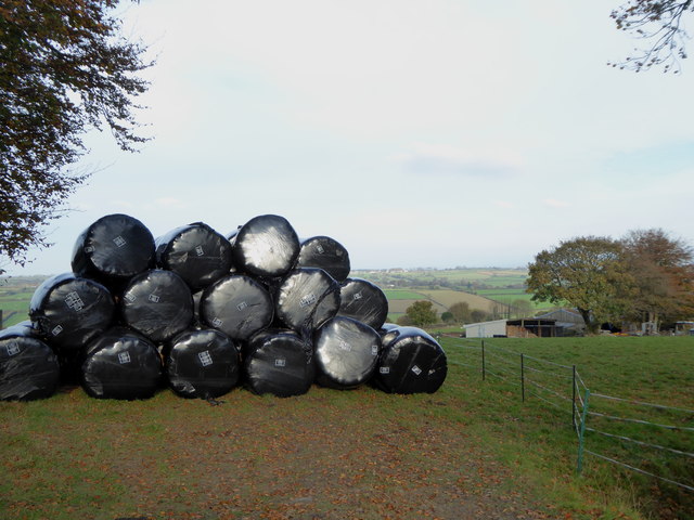
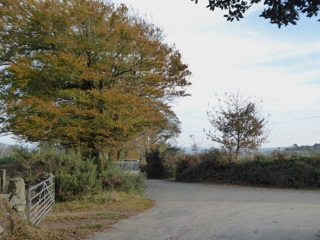
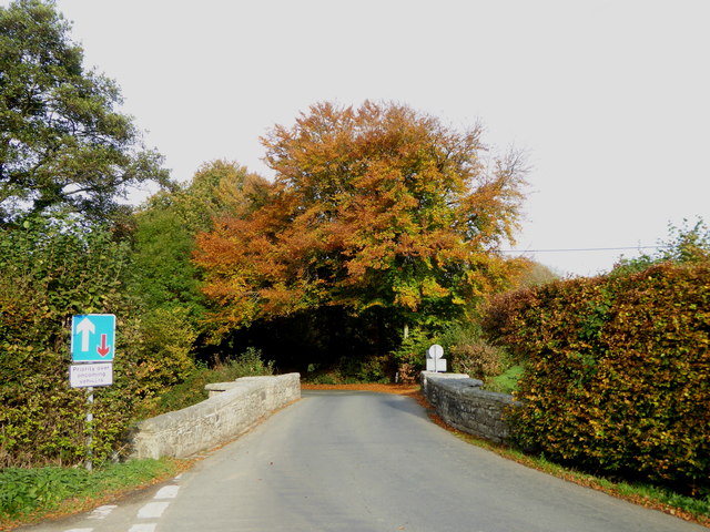
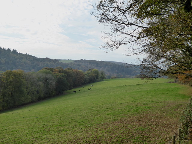
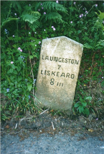
Berriowbridge is a small village located in the county of Cornwall, England. Situated in the southwestern part of the country, it lies approximately 4 miles northwest of the town of Liskeard. The village is nestled in a picturesque countryside setting, surrounded by rolling hills and beautiful rural landscapes.

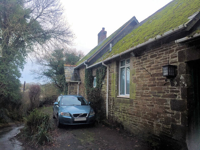
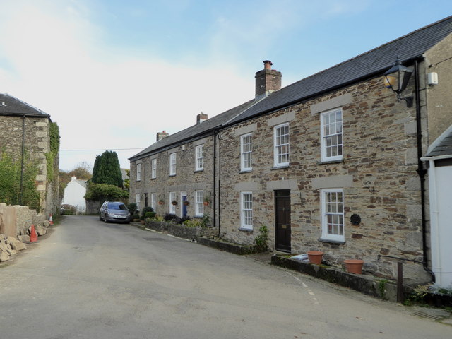
Despite its small size, Berriowbridge has a rich history dating back many centuries. The origins of the village can be traced to the medieval period, and it is believed to have been an important agricultural center in the past. Today, it retains its rural charm and tranquility, with several old stone cottages and buildings adding to its traditional character.

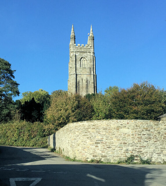
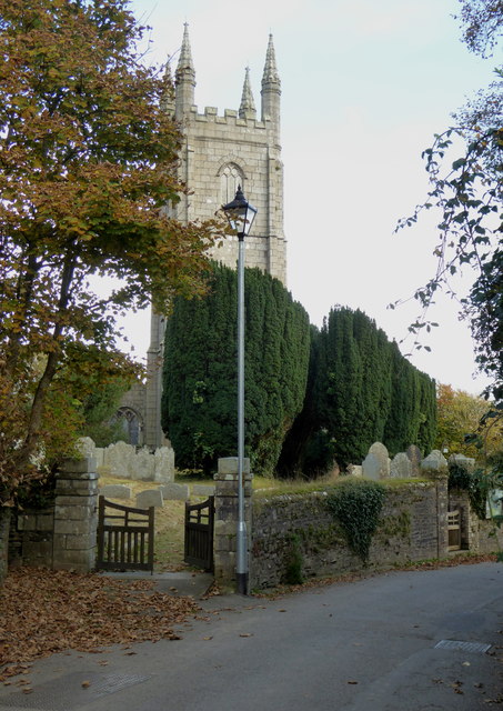
One notable feature of Berriowbridge is the presence of a historic church, St. Mary's Church, which is believed to be over 800 years old. This beautiful, Grade II listed building is a popular attraction for visitors interested in exploring the village's heritage.

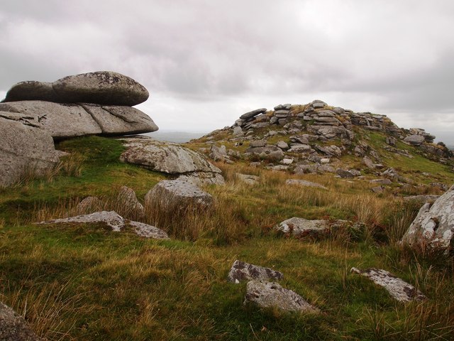
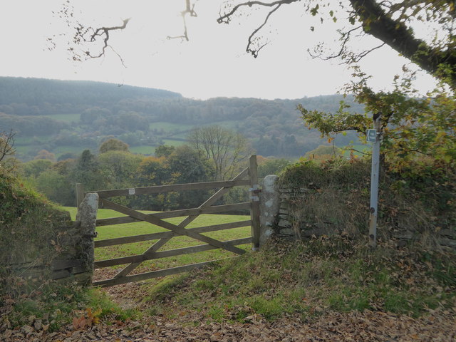
The village itself doesn't have many amenities, but it benefits from its proximity to Liskeard, which offers a wider range of services including shops, schools, and healthcare facilities. Additionally, Berriowbridge benefits from its close proximity to Bodmin Moor, a designated Area of Outstanding Natural Beauty, which provides opportunities for outdoor activities such as hiking, cycling, and wildlife watching.

In terms of transportation, Berriowbridge is well-connected by road, with the A38 running nearby, providing easy access to other parts of Cornwall. The nearest train station is in Liskeard, offering rail connections to major cities such as Plymouth and London.

Overall, Berriowbridge offers a peaceful and idyllic setting for those seeking a rural retreat, with its rich history and stunning natural surroundings making it a charming place to visit or call home.

If you have any feedback on the listing, please let us know in the comments section below.

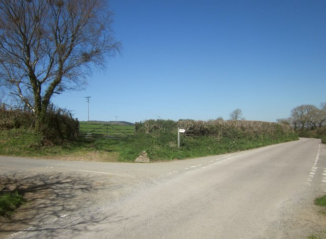
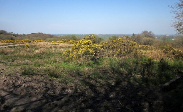
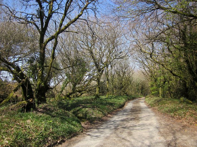
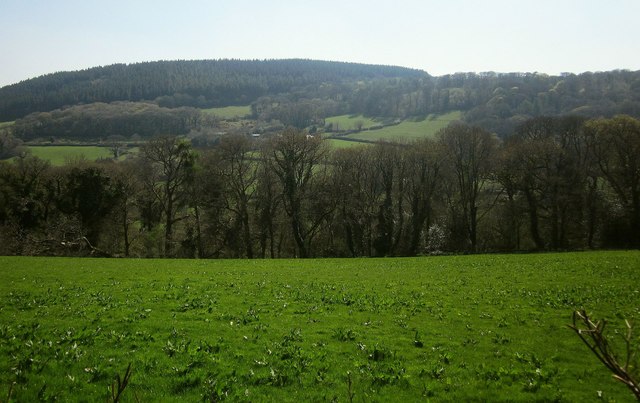
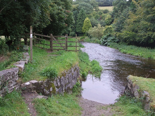
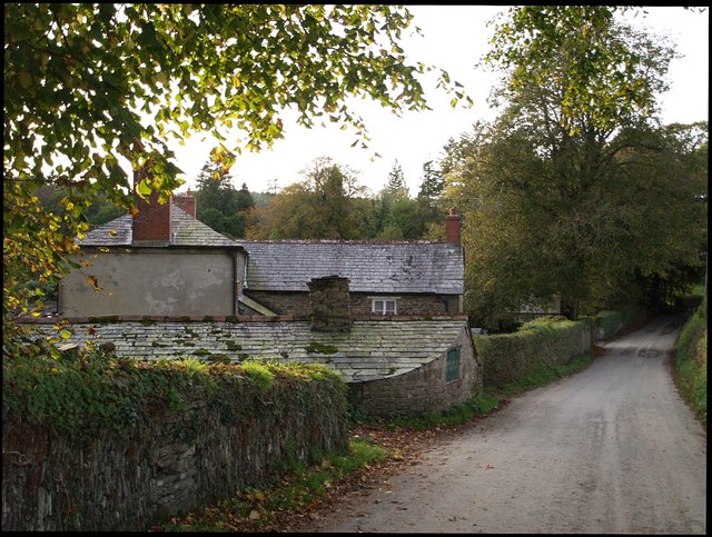
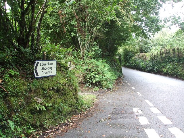
Berriowbridge Images

Images are sourced within 2km of 50.554956/-4.439461 or Grid Reference SX2775. Thanks to Geograph Open Source API. All images are credited.

Former Wesleyan Methodist Chapel
St Torney's Church
St Torney's Church
Bearah Tor
Bearah Tor
Twelve Men's Moor
Twelve Men's Moor
Treovis Cross A crossroads on the B3254 that is more or less on a grid line. The right turn here is shown in <a href="https://www.geograph.org.uk/photo/4446942">SX2873 : Lane to Treovis</a>.
Treovis Cross
A crossroads on the B3254 that is more or less on a grid line. The right turn here is shown in SX2873 : Lane to Treovis.
Gorse above East Castick Wood Seen from beside the lane to Twelve Men's Moor.
Gorse above East Castick Wood
Seen from beside the lane to Twelve Men's Moor.
Lane to Berriowbridge Skirting Bowdanoddon Wood on the right, this is the no through road from Twelve Men's Moor.
Lane to Berriowbridge
Skirting Bowdanoddon Wood on the right, this is the no through road from Twelve Men's Moor.
Across the Lynher valley From the same spot as <a href="https://www.geograph.org.uk/photo/4449140">SX2676 : Lynher valley near North Hill</a>, looking to the right, with overlap. The farm on the far slopes is East Castick. Again, Bowdanoddon Wood is on the horizon.
Across the Lynher valley
From the same spot as SX2676 : Lynher valley near North Hill, looking to the right, with overlap. The farm on the far slopes is East Castick. Again, Bowdanoddon Wood is on the horizon.
Silage bales at Kingbeare
The lane leading from Kingbeare to Botternell
Beriow Bridge over the River Lynher A Scheduled Monument and also Grade II* Listed. Dating from circa mid C16, repaired in 1640 (datestone) and widened on the upper side in 1890.
Beriow Bridge over the River Lynher
A Scheduled Monument and also Grade II* Listed. Dating from circa mid C16, repaired in 1640 (datestone) and widened on the upper side in 1890.
The tower of the Church of St Torney, North Hill Largely late C15 or early C16 and with some C14 internal details.  Grade I Listed.
The tower of the Church of St Torney, North Hill
Largely late C15 or early C16 and with some C14 internal details. Grade I Listed.
Cottages in North Hill Dating from early C19, all three cottages are Grade II Listed.
Cottages in North Hill
Dating from early C19, all three cottages are Grade II Listed.
Field gate in Lynher Way The public footpath leads down into the Lynher valley.
Field gate in Lynher Way
The public footpath leads down into the Lynher valley.
Field in the Lynher valley at North Hill
Old Milestone by the B3254, north of Trewithey Carved stone post by the B3254, in parish of NORTH HILL (NORTH CORNWALL District), 450m North of Trewithey, against bank on straight road, on West side of road. Liskeard iii stone, erected by the Local Highways Board in the 19th century. 

Inscription reads:-
LAUNCESTON
6
LISKEARD
9iii 

Grade II Listed. List Entry Number: 1249709
<span class="nowrap"><a title="https://historicengland.org.uk/listing/the-list/list-entry/1249709" rel="nofollow ugc noopener" href="https://historicengland.org.uk/listing/the-list/list-entry/1249709">Link</a><img style="margin-left:2px;" alt="External link" title="External link - shift click to open in new window" src="https://s1.geograph.org.uk/img/external.png" width="10" height="10"/></span>

Milestone Society National ID: CW_LALK06.
Old Milestone by the B3254, north of Trewithey
Carved stone post by the B3254, in parish of NORTH HILL (NORTH CORNWALL District), 450m North of Trewithey, against bank on straight road, on West side of road. Liskeard iii stone, erected by the Local Highways Board in the 19th century. Inscription reads:- LAUNCESTON 6 LISKEARD 9iii Grade II Listed. List Entry Number: 1249709 LinkExternal link Milestone Society National ID: CW_LALK06.
Old Milestone north west of North Hill Carved stone post by the UC road, in parish of NORTH HILL (NORTH CORNWALL District), Trebartha, against Cornish hedge, on North side of road. Liskeard iii stone, erected by the Local Highways Board in the 19th century. 

Inscription reads:-
LISKEARD
9iii

Grade II Listed. List Entry Number: 1249695
<span class="nowrap"><a title="https://historicengland.org.uk/listing/the-list/list-entry/1249695" rel="nofollow ugc noopener" href="https://historicengland.org.uk/listing/the-list/list-entry/1249695">Link</a><img style="margin-left:2px;" alt="External link" title="External link - shift click to open in new window" src="https://s1.geograph.org.uk/img/external.png" width="10" height="10"/></span>

Milestone Society National ID: CW_LALK06x.
Old Milestone north west of North Hill
Carved stone post by the UC road, in parish of NORTH HILL (NORTH CORNWALL District), Trebartha, against Cornish hedge, on North side of road. Liskeard iii stone, erected by the Local Highways Board in the 19th century. Inscription reads:- LISKEARD 9iii Grade II Listed. List Entry Number: 1249695 LinkExternal link Milestone Society National ID: CW_LALK06x.
Old Milestone by the B3254, north of Berriowbridge Carved stone post by the B3254, in parish of NORTH HILL (NORTH CORNWALL District), 160m North of East Berriow, in Cornish hedge on steep narrow descent, on East side of road. Liskeard iii stone, erected by the Local Highways Board in the 19th century. 

Inscription reads:-
LAUNCESTON
7
LISKEARD
8iii 

Grade II Listed. List Entry Number: 1249711
<span class="nowrap"><a title="https://historicengland.org.uk/listing/the-list/list-entry/1249711" rel="nofollow ugc noopener" href="https://historicengland.org.uk/listing/the-list/list-entry/1249711">Link</a><img style="margin-left:2px;" alt="External link" title="External link - shift click to open in new window" src="https://s1.geograph.org.uk/img/external.png" width="10" height="10"/></span>

Milestone Society National ID: CW_LALK07.
Old Milestone by the B3254, north of Berriowbridge
Carved stone post by the B3254, in parish of NORTH HILL (NORTH CORNWALL District), 160m North of East Berriow, in Cornish hedge on steep narrow descent, on East side of road. Liskeard iii stone, erected by the Local Highways Board in the 19th century. Inscription reads:- LAUNCESTON 7 LISKEARD 8iii Grade II Listed. List Entry Number: 1249711 LinkExternal link Milestone Society National ID: CW_LALK07.
Show me another place!

Berriowbridge is located at Grid Ref: SX2775 (Lat: 50.554956, Lng: -4.439461)

Unitary Authority: Cornwall

Police Authority: Devon and Cornwall

What 3 Words

///gone.inflamed.dolly. Near North Hill, Cornwall

Related Wikis

Berriowbridge

Berriowbridge is a hamlet in the parish of North Hill in east Cornwall, England, United Kingdom. It is situated in the River Lynher valley on the southeast...

Middlewood, Cornwall

Middlewood is a small village in the parish of North Hill, Cornwall, England, UK. Middlewood is in the valley of the River Lynher and on the B3254 road...

North Hill, Cornwall

North Hill (Cornish: Bre Gledh) is a village and civil parish in Cornwall, England, United Kingdom. The village is situated on the east side of the River...

Kingbeare

Kingbeare is a hamlet in the parish of North Hill, Cornwall, England. == References ==

Botternell

Botternell is a hamlet in the parish of North Hill, east Cornwall in the United Kingdom. The name means "Dornel's dwelling". Boturnell, also in Cornwall...

Bathpool, Cornwall

Bathpool (Cornish: Pollbath) is a small village in the civil parish of North Hill in east Cornwall, England, United Kingdom. It is situated in the River...

Trebartha

Trebartha is a hamlet in Cornwall, England, United Kingdom, in the parish of North Hill and in the valley of the River Lynher. == History == The manor...

North Darley

North Darley (Cornish: Dowr Legh, meaning rock slab river) is a hamlet in Cornwall, England. It is two miles south of North Hill on the B3254 road from...

Nearby Amenities

Located within 500m of 50.554956,-4.439461
Bus Stop
Berriowbridge
Bus: yes
Naptan AtcoCode: 0800COC56527
Naptan Bearing: N
Naptan CommonName: Berriowbridge
Naptan Crossing: Port Lane
Naptan NaptanCode: corgatwm
Naptan Street: B3254
Naptan Verified: no
Public Transport: platform
Source: naptan_import
Lat/Long: 50.5545632/-4.4392638
Berriow Bridge
Place: hamlet
Source: OS_OpenData_StreetView
Wikidata: Q4894731
Lat/Long: 50.5544945/-4.4386064
Post Box
Collection Times: Mo-Fr 09:00, Sa 07:00
Operator: Royal Mail
Operator Wikidata: Q638098
Post Box Mounting: pier
Post Box Type: lamp
Ref: PL15 118D
Royal Cypher: EIIR
Royal Cypher Wikidata: Q33102113
Survey Date: 2023-04-09
Lat/Long: 50.5525021/-4.4377817
The data included in this document is from www.openstreetmap.org. The data is made available under ODbL.

Have you been to Berriowbridge?

Leave your review of Berriowbridge below (or comments, questions and feedback).