Berrington

Settlement in Northumberland

England

Berrington

Bowsden
Bowsden Credit: Richard Webb

Berrington is a small village located in the county of Northumberland, in the northeastern part of England. Situated in the heart of the picturesque Tyne Valley, Berrington is surrounded by rolling hills, lush green fields, and breathtaking landscapes. The village is part of the larger parish of Bellingham, renowned for its natural beauty and tranquil atmosphere.

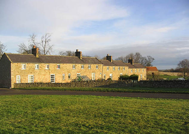
With a population of around 300 residents, Berrington maintains its rural charm and close-knit community feel. The village is characterized by a collection of traditional stone-built houses, many of which date back several centuries. The architecture reflects the historical significance of the area and adds to its timeless appeal.

The village's economy is primarily based on agriculture and tourism. Berrington's fertile soil and favorable weather conditions make it an ideal location for farming, with many residents engaged in agricultural activities. Additionally, the village's proximity to various tourist attractions, such as Hadrian's Wall and Kielder Water & Forest Park, attracts visitors throughout the year, boosting the local economy.

Berrington offers a range of amenities and services to cater to the needs of its residents. These include a village hall, a primary school, a church, and a pub, which serves as a social hub for the community. The village also benefits from its close proximity to Bellingham, where residents can access a wider range of facilities, including shops, healthcare services, and further educational opportunities.

Overall, Berrington's idyllic setting, strong sense of community, and connection to nature make it a desirable place to live or visit for those seeking a peaceful and rural retreat in the heart of Northumberland.

If you have any feedback on the listing, please let us know in the comments section below.
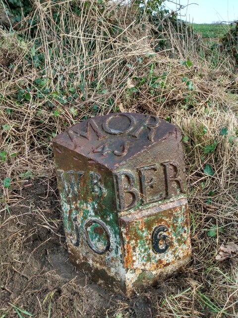
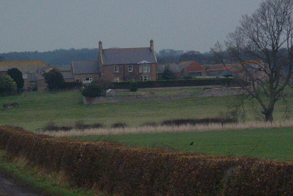
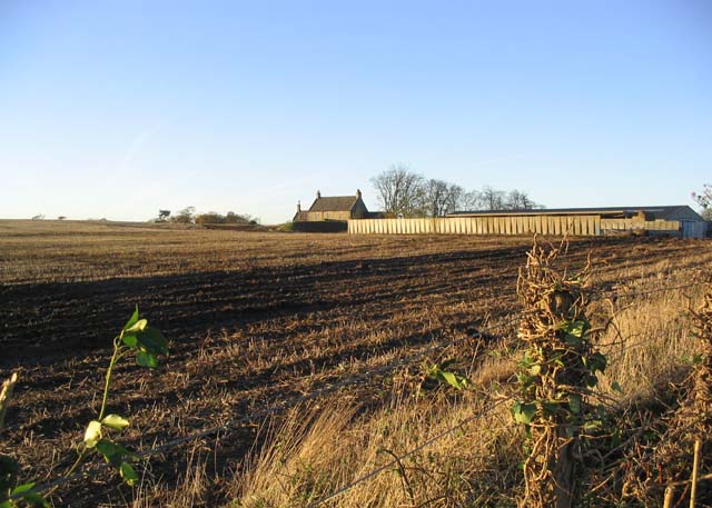
Berrington Images

Images are sourced within 2km of 55.682051/-1.988515 or Grid Reference NU0043. Thanks to Geograph Open Source API. All images are credited.

Bowsden
Bowsden
Field, Bowsden
Field, Bowsden
Old Milestone by B6525, 400m South of Berrington Lodge The Milestone is located on grass verge by wide gate on the East of the road.  Parish of Kyloe (Berwick upon Tweed District). Cast iron post, WR/BER MOR top iron post design, erected by the Deanburn Bridge, Berwick, Cornhill turnpike trust in the 19th Century. An earlier photograph can be found here: <a title="https://www.geograph.org.uk/photo/5361832" href="https://www.geograph.org.uk/photo/5361832">Link</a> 

Inscription reads:-  
WR / 10  : : BER / 6 : : MOR / 41  

Grade II listed. List Entry Number: 1042273 <span class="nowrap"><a title="https://historicengland.org.uk/listing/the-list/list-entry/1042273" rel="nofollow ugc noopener" href="https://historicengland.org.uk/listing/the-list/list-entry/1042273">Link</a><img style="margin-left:2px;" alt="External link" title="External link - shift click to open in new window" src="https://s1.geograph.org.uk/img/external.png" width="10" height="10"/></span> 

Milestone Society National ID: NB_BWWL06
Old Milestone by B6525, 400m South of Berrington Lodge
The Milestone is located on grass verge by wide gate on the East of the road.  Parish of Kyloe (Berwick upon Tweed District). Cast iron post, WR/BER MOR top iron post design, erected by the Deanburn Bridge, Berwick, Cornhill turnpike trust in the 19th Century. An earlier photograph can be found here: Link  Inscription reads:- WR / 10 : : BER / 6 : : MOR / 41 Grade II listed. List Entry Number: 1042273 LinkExternal link Milestone Society National ID: NB_BWWL06
Road junction Where a minor road from Berrington joins the B6525. An awkward spot for a postbox.
Road junction
Where a minor road from Berrington joins the B6525. An awkward spot for a postbox.
Access road to Berrington Law Farm
Farmland near Berrington Lodge
Arable farmland At Bowsden East Farm.
Arable farmland
At Bowsden East Farm.
View west of the B6525 Looking towards the swell of Bowsden Hill.
View west of the B6525
Looking towards the swell of Bowsden Hill.
The Tilesheds The OS marks this as Works disused. Presumably they made roof tiles.
The Tilesheds
The OS marks this as Works disused. Presumably they made roof tiles.
East Ancroft Farm South Facing Farmhouse with public right of way through it leading to Ancroft Church
East Ancroft Farm
South Facing Farmhouse with public right of way through it leading to Ancroft Church
Allerdean Burn Allerdean Burn taken from Tilesheds Bridge (1972)
Allerdean Burn
Allerdean Burn taken from Tilesheds Bridge (1972)
A ploughed field Beside the B6525 and the minor road to Ancroft Mill.
A ploughed field
Beside the B6525 and the minor road to Ancroft Mill.
Lickar Lea Farm
Lickar Lea Farm
Ivy clad trees near Lowick Mill
South Berrington Farm
Turnip field Near Old Dryburn.
Turnip field
Near Old Dryburn.
Houses at Berrington
Entrance to fields near Lickar Dean Rich agricultural land between Berrington and New Haggerston.
Entrance to fields near Lickar Dean
Rich agricultural land between Berrington and New Haggerston.
Show me another place!

Berrington is located at Grid Ref: NU0043 (Lat: 55.682051, Lng: -1.988515)

Unitary Authority: Northumberland

Police Authority: Northumbria

What 3 Words

///interlude.steer.chuckle. Near Ancroft, Northumberland

Nearby Locations

The Braes Berrington

Related Wikis

Berrington, Northumberland

Berrington is a village in Northumberland, in England. It is situated to the south of Berwick-upon-Tweed, inland from the North Sea coast. == Governance... ==

Ancroft

Ancroft is a village and civil parish (which includes the village of Scremerston) in Northumberland, England. Prior to 1844, Ancroft lay within the Islandshire...

Bowsden

Bowsden is a village and civil parish in Northumberland, England. It is about 6 miles (10 km) to the south of Berwick-upon-Tweed, inland from the North...

Norham and Islandshires Rural District

Norham and Islandshires was a rural district in Northumberland, England from 1894 to 1974.The district was formed under the Local Government Act 1894 from...

Nearby Amenities

Located within 500m of 55.682051,-1.988515
Berrington
Place: hamlet
Wikidata: Q4894723
Lat/Long: 55.6821001/-1.9906093
Weighbridge
Lat/Long: 55.681359/-1.9899813
The data included in this document is from www.openstreetmap.org. The data is made available under ODbL.

Have you been to Berrington?

Leave your review of Berrington below (or comments, questions and feedback).