Berrington

Settlement in Shropshire

England

Berrington

Cliff Hollow near Berrington The local red sandstone much in evidence.
This road is very narrow. Moments later a tractor appeared and I had to press myself into the embankment to avoid being harrowed (I may have invented that word).
Cliff Hollow near Berrington Credit: Stephen Richards

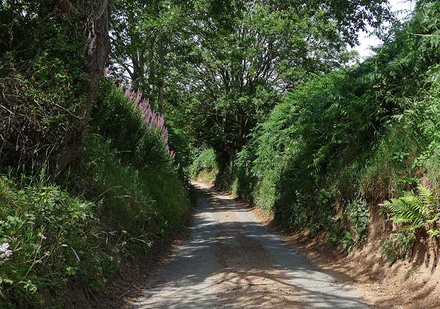
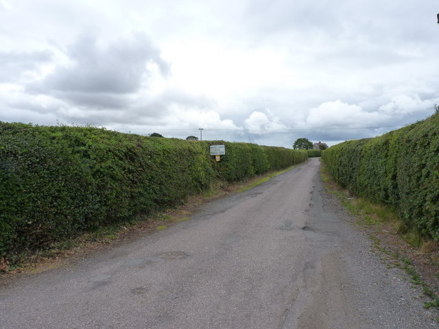
Berrington is a picturesque village located in the county of Shropshire, England. Situated just a few miles southwest of the market town of Shrewsbury, Berrington is nestled in the heart of the beautiful Shropshire countryside. The village is known for its idyllic setting, with rolling hills, lush green fields, and charming country lanes.

Berrington is a small community, with a population of around 500 residents. The village maintains a close-knit atmosphere, and its residents take pride in preserving its traditional character. The architecture in Berrington reflects its rich history, with many timber-framed cottages and historic buildings still standing.

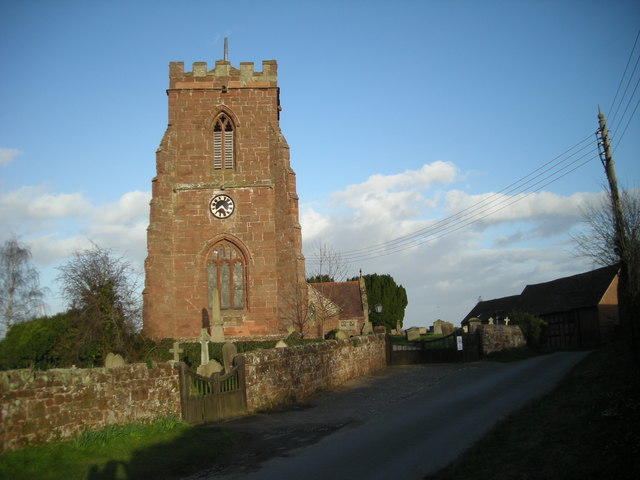
One of the notable landmarks in Berrington is St. Giles' Church, which dates back to the 12th century. This beautiful parish church features stunning medieval stained glass windows and a peaceful churchyard, making it a popular destination for visitors and locals alike.

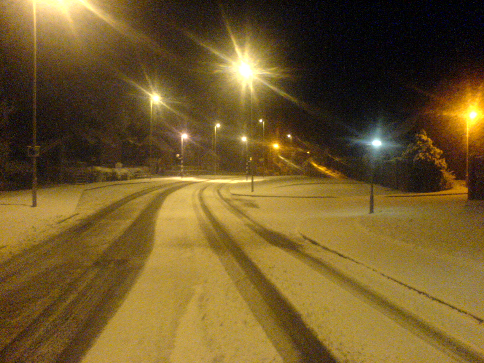
In terms of amenities, Berrington offers a range of facilities to cater to its residents' needs. These include a village hall, a community center, a post office, and a local pub. The village also has several footpaths and walking trails, allowing visitors to explore the surrounding countryside and enjoy the natural beauty of the area.

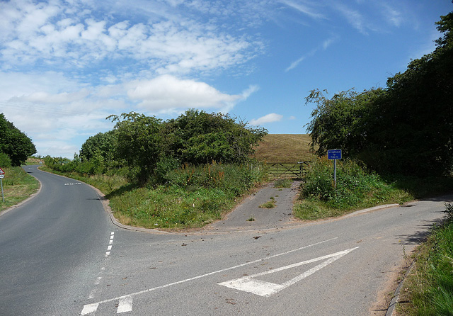
Berrington benefits from its proximity to Shrewsbury, which provides additional amenities such as shops, schools, and healthcare facilities. The village is well-connected to the wider region through road links, with the A5 and A49 nearby, making it easily accessible for both residents and visitors.

Overall, Berrington offers a peaceful and charming setting, making it an ideal place for those seeking a rural retreat while still having access to nearby amenities.

If you have any feedback on the listing, please let us know in the comments section below.

Berrington Images

Images are sourced within 2km of 52.659251/-2.6974385 or Grid Reference SJ5207. Thanks to Geograph Open Source API. All images are credited.

Cliff Hollow near Berrington The local red sandstone much in evidence.
This road is very narrow. Moments later a tractor appeared and I had to press myself into the embankment to avoid being harrowed (I may have invented that word).
Cliff Hollow near Berrington
The local red sandstone much in evidence. This road is very narrow. Moments later a tractor appeared and I had to press myself into the embankment to avoid being harrowed (I may have invented that word).
Country roads near Berrington The one on the left heads north towards Shrewsbury.
The one on the right is called Cliff Hollow (<a href="https://www.geograph.org.uk/photo/2487070">SJ5106 : Cliff Hollow near Berrington</a>) and heads east to Berrington.
Country roads near Berrington
The one on the left heads north towards Shrewsbury. The one on the right is called Cliff Hollow (SJ5106 : Cliff Hollow near Berrington) and heads east to Berrington.
The Bell, Cross Houses
Access to Betton Abbots Farm The owner of the farm had challenged me as I passed through, asking me to remove the pictures I'd taken of his farm buildings and front area of the grounds. To avoid antagonisation, I did so, but there are some interesting buildings, and a series of staddle stones at the farm.
Access to Betton Abbots Farm
The owner of the farm had challenged me as I passed through, asking me to remove the pictures I'd taken of his farm buildings and front area of the grounds. To avoid antagonisation, I did so, but there are some interesting buildings, and a series of staddle stones at the farm.
Cantlop Bridge This cast-iron bridge was built in 1813 as part of a strategy to improve the network of roads and communication in Shropshire, aimed at improving trade. It was overseen by no other than Thomas Telford who was County Surveyor of Bridges for the county between 1787 and 1834, during which time he oversaw some 42 bridge building enterprises, some seven being in cast-iron. This is the only cast-iron example remaining in-situ today.

Apparently the bridge was still used by traffic until the 1970's. Now it is by passed by a lovely 1970's concrete bridge immediately next door to it.
Cantlop Bridge
This cast-iron bridge was built in 1813 as part of a strategy to improve the network of roads and communication in Shropshire, aimed at improving trade. It was overseen by no other than Thomas Telford who was County Surveyor of Bridges for the county between 1787 and 1834, during which time he oversaw some 42 bridge building enterprises, some seven being in cast-iron. This is the only cast-iron example remaining in-situ today. Apparently the bridge was still used by traffic until the 1970's. Now it is by passed by a lovely 1970's concrete bridge immediately next door to it.
On the Cantlop Bridge This bridge is important in that it is an early cast-iron bridge (being built in 1813) and also in that it didn't follow the design of a wooden bridge (unlike for example the iron bridge at Ironbridge), plus it was a Thomas Telford bridge (the Scottish civil engineer being County Surveyor for Bridges between 1787 and 1834) and in that it is the only cast-iron bridge still in-situ in Shropshire today, having stood here for 199 years, and counting.
On the Cantlop Bridge
This bridge is important in that it is an early cast-iron bridge (being built in 1813) and also in that it didn't follow the design of a wooden bridge (unlike for example the iron bridge at Ironbridge), plus it was a Thomas Telford bridge (the Scottish civil engineer being County Surveyor for Bridges between 1787 and 1834) and in that it is the only cast-iron bridge still in-situ in Shropshire today, having stood here for 199 years, and counting.
Cantlop Bridge This bridge will be 200 years old next year. It has been superseded many, many times over in terms of bridge design and technology, but in terms of beauty and simplicity it would be hard to surpass.
Cantlop Bridge
This bridge will be 200 years old next year. It has been superseded many, many times over in terms of bridge design and technology, but in terms of beauty and simplicity it would be hard to surpass.
A458 View The A road near Cross Houses.
A458 View
The A road near Cross Houses.
Wrekin View The view from Berrington lane near the junction with the A458 towards the Shropshire Hill.
Wrekin View
The view from Berrington lane near the junction with the A458 towards the Shropshire Hill.
Berrington Manor The view of the 17th Century Timber Framed Hall next to the All Saints Church. The Manor was for sale in August 2011 for 1.5 million.
Berrington Manor
The view of the 17th Century Timber Framed Hall next to the All Saints Church. The Manor was for sale in August 2011 for 1.5 million.
Berrington Barn The view of the Timber Framed Barn next to the All Saints Church, and part of the Manor which was for sale in August 2011 for 1.5 million.
Berrington Barn
The view of the Timber Framed Barn next to the All Saints Church, and part of the Manor which was for sale in August 2011 for 1.5 million.
Berrington Church The view of All Saints Church parts of which are 13th Century, next to the Manor House.
Berrington Church
The view of All Saints Church parts of which are 13th Century, next to the Manor House.
Village Hall The Berrington Hall on the lane to All Saints Church.
Village Hall
The Berrington Hall on the lane to All Saints Church.
Berrington Junction The view in the small Shropshire Village.
Berrington Junction
The view in the small Shropshire Village.
Berrington Balloon The view of a hot air balloon passes over the small Shropshire Village.
Berrington Balloon
The view of a hot air balloon passes over the small Shropshire Village.
Church View The view over the fields to All Saints Church in the small Shropshire Village of Berrington.
Church View
The view over the fields to All Saints Church in the small Shropshire Village of Berrington.
Corner Shop The view of County Stores in the Shropshire Village of Cross Houses.
Corner Shop
The view of County Stores in the Shropshire Village of Cross Houses.
Lane View The view from the lane near the Shropshire Village of Cross Houses.
Lane View
The view from the lane near the Shropshire Village of Cross Houses.
Show me another place!

Berrington is located at Grid Ref: SJ5207 (Lat: 52.659251, Lng: -2.6974385)

Unitary Authority: Shropshire

Police Authority: West Mercia

What 3 Words

///marine.sprays.tribes. Near Berrington, Shropshire

Related Wikis

Berrington, Shropshire

Berrington is a small village and civil parish in Shropshire, England. According to the 2001 census the village had a population of 30, though the parish...

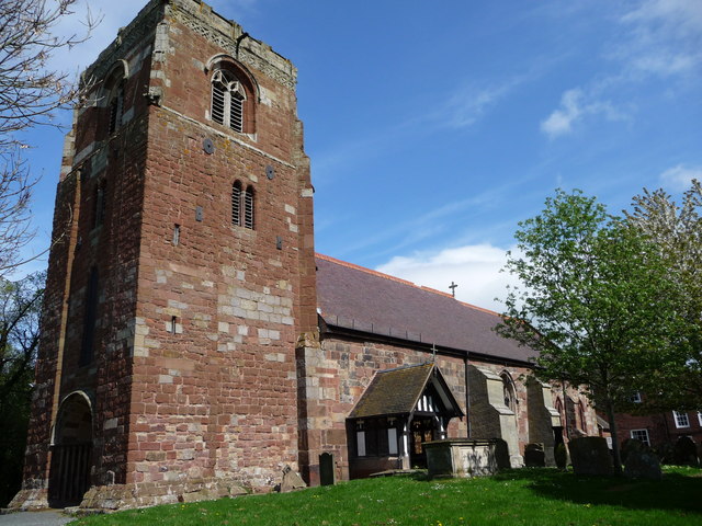
All Saints Church, Berrington

All Saints Church is in the village of Berrington, Shropshire, England. It is an active Anglican parish church in the deanery of Condover, the archdeaconry...

Berrington railway station

Berrington railway station was a railway station on the Severn Valley line serving the village of Berrington, Shropshire. It opened in 1862 with a single...

Cross Houses

Cross Houses is a village in Shropshire, England, the largest village in the Parish of Berrington. It is located on the A458 road and is 4 miles south...

Cronkhill

Cronkhill, Atcham, Shropshire, designed by John Nash, is "the earliest Italianate villa in England".Drawing on influences from the Italian Campagna and...
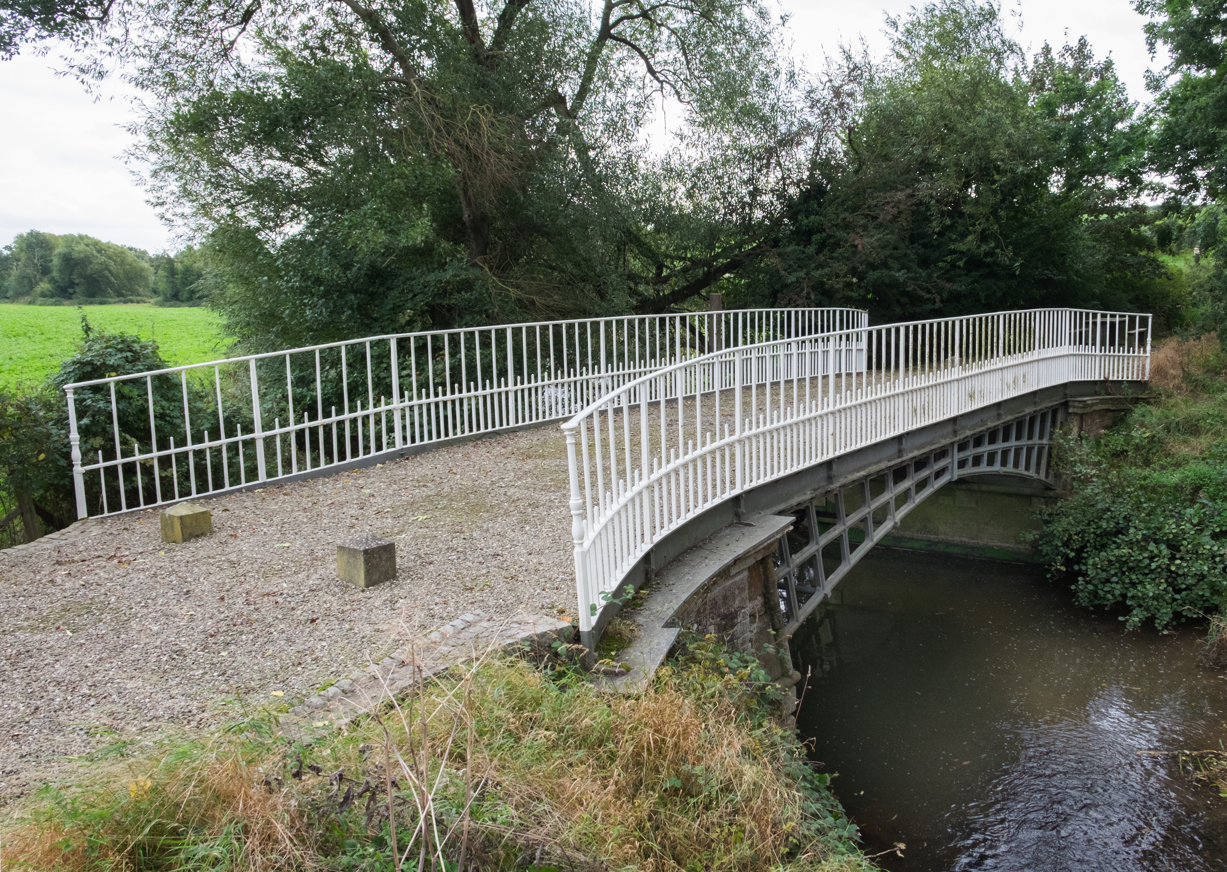
Cantlop Bridge

Cantlop Bridge is a single span cast-iron road bridge over the Cound Brook, located to the north of Cantlop in the parish of Berrington, Shropshire. It...
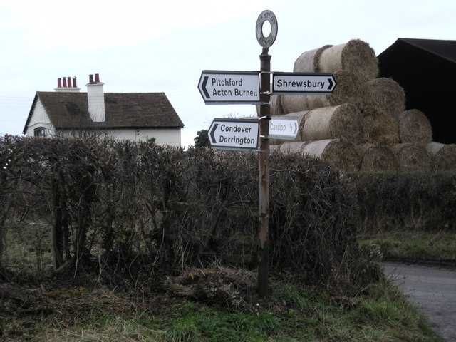
Cantlop

Cantlop is a small village in the English county of Shropshire. It is part of the civil parish of Berrington. Nearby villages include Condover, to the...

St Eata's Church, Atcham

St Eata's Church is in the village of Atcham, Shropshire, England. It is an active Anglican parish church in the deanery of Shrewsbury, the archdeaconry...

Nearby Amenities

Located within 500m of 52.659251,-2.6974385
Telephone
Booth: KX100
Covered: booth
Lat/Long: 52.6575788/-2.6976076
Post Box
Post Box Type: lamp
Royal Cypher: EIIR
Royal Cypher Wikidata: Q33102113
Lat/Long: 52.6575828/-2.6976715
Berrington
Is In: Shropshire
Place: village
Wikidata: Q2684727
Wikipedia: en:Berrington, Shropshire
Lat/Long: 52.6581407/-2.6992647
Give Way
Direction: forward
Lat/Long: 52.6592968/-2.6974328
Give Way
Direction: backward
Lat/Long: 52.6576862/-2.6985584
Give Way
Direction: backward
Lat/Long: 52.657806/-2.6983333
Give Way
Direction: backward
Lat/Long: 52.6566927/-2.7001611
Man Made: water_well
Lat/Long: 52.6577526/-2.6985722
The data included in this document is from www.openstreetmap.org. The data is made available under ODbL.

Have you been to Berrington?

Leave your review of Berrington below (or comments, questions and feedback).