Berrier

Settlement in Cumberland Eden

England

Berrier

Field and boundary of Greystoke Forest
Field and boundary of Greystoke Forest Credit: Steven Brown

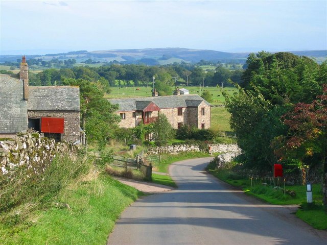
Berrier is a small village located in the county of Cumberland, England. Situated in the northern part of the Lake District National Park, it is surrounded by stunning landscapes and picturesque views. The village is nestled in the Eden Valley, a few miles east of Penrith, and is known for its tranquil atmosphere and rural charm.

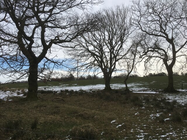
This idyllic village is home to a close-knit community that takes pride in preserving its historic character. Berrier boasts traditional Cumbrian architecture with a mix of stone cottages and farmhouses, giving it a timeless beauty. The village is also known for its well-kept gardens and colorful floral displays, which add to its visual appeal.

Despite its small size, Berrier offers a range of amenities for both residents and visitors. There is a local pub that serves as a social hub for the community, offering a friendly atmosphere and traditional pub food. The village also has a primary school, providing education to the local children.

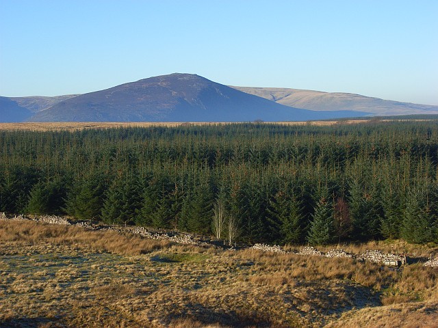
The surrounding area offers plenty of outdoor activities and attractions for nature enthusiasts. The Lake District National Park offers endless opportunities for hiking, cycling, and exploring the region's diverse wildlife. The nearby Ullswater Lake, one of the largest lakes in the region, is a popular destination for water sports and boating.

In conclusion, Berrier is a charming village in the heart of the Lake District National Park. With its stunning natural surroundings, traditional architecture, and friendly community, it is a hidden gem for those seeking a peaceful retreat in the beautiful countryside of Cumberland.

If you have any feedback on the listing, please let us know in the comments section below.

Berrier Images

Images are sourced within 2km of 54.658387/-2.929272 or Grid Reference NY4029. Thanks to Geograph Open Source API. All images are credited.
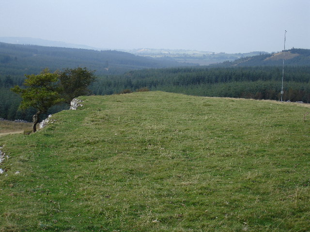
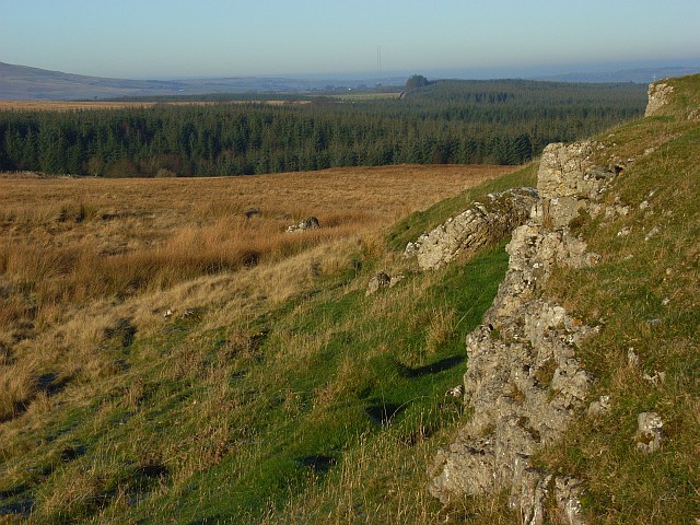
Field and boundary of Greystoke Forest
Farm track near Greystoke Forest
Outcrops of limestone on Highbanks [Murrah Hill] Highbanks and Murrah Hill are names which do not appear on OS maps and have been created perhaps as the hill feature qualifies as a TuMP - a hill with at least 30 metres or more prominence. There are several surface outcrops of limestone on the hill, almost in the form of pavement; this is one of the examples. There's surely a rogue boulder perched beside the outcrop, presumably an erratic.
The distant trees seen through thin mist are in the Greystoke Forest.
Outcrops of limestone on Highbanks [Murrah Hill]
Highbanks and Murrah Hill are names which do not appear on OS maps and have been created perhaps as the hill feature qualifies as a TuMP - a hill with at least 30 metres or more prominence. There are several surface outcrops of limestone on the hill, almost in the form of pavement; this is one of the examples. There's surely a rogue boulder perched beside the outcrop, presumably an erratic. The distant trees seen through thin mist are in the Greystoke Forest.
Berrier Hill View of Greystoke Forest to the north
Berrier Hill
View of Greystoke Forest to the north
Pasture and forest, Berrier Hill This is just outside of the Lake District National Park. In the background are Great Dodd and Clough Head.
Pasture and forest, Berrier Hill
This is just outside of the Lake District National Park. In the background are Great Dodd and Clough Head.
Pastures above Greystoke A view across the Petteril and Eden valleys to the highest of the Pennines. The scant remains of snow can just be made out on the tops of Cross Fell and the Dun Fells.
Pastures above Greystoke
A view across the Petteril and Eden valleys to the highest of the Pennines. The scant remains of snow can just be made out on the tops of Cross Fell and the Dun Fells.
Berrier Hill These rough pastures are the site of a proposed windfarm. The view takes in the hazy Eden valley. The Pennines beyond could be mistaken for a cloud.
Berrier Hill
These rough pastures are the site of a proposed windfarm. The view takes in the hazy Eden valley. The Pennines beyond could be mistaken for a cloud.
Limestone outcrops, Berrier Hill Two parallel outcrops cross Berrier Hill which is rough pasture beside Greystoke Forest. In the distance you can just make out the two Caldbeck transmitters.
Limestone outcrops, Berrier Hill
Two parallel outcrops cross Berrier Hill which is rough pasture beside Greystoke Forest. In the distance you can just make out the two Caldbeck transmitters.
Pastures above Greystoke Viewed from a limestone outcrop. The Pennines are in the distance. The woodland is on the eastern edge of the grid-square.
Pastures above Greystoke
Viewed from a limestone outcrop. The Pennines are in the distance. The woodland is on the eastern edge of the grid-square.
Pastures above Greystoke Blencathra appears beyond this southern part of Greystoke Forest.
Pastures above Greystoke
Blencathra appears beyond this southern part of Greystoke Forest.
Hawthorn on Berrier Hill Standing on the more northerly of two lines of limestone outcrops. None of the rocks on either of the scarps are visible as they face southwest.
Hawthorn on Berrier Hill
Standing on the more northerly of two lines of limestone outcrops. None of the rocks on either of the scarps are visible as they face southwest.
Greystoke Forest A view across the extensive forestry to Carrock Fell from Berrier Hill.
Greystoke Forest
A view across the extensive forestry to Carrock Fell from Berrier Hill.
Rough pasture beside Greystoke Forest The wall heading southeast towards Square Plantation.
Rough pasture beside Greystoke Forest
The wall heading southeast towards Square Plantation.
Greystoke Forest The frost persisting even in the bright sunshine.
Greystoke Forest
The frost persisting even in the bright sunshine.
On the edge of Greystoke Forest
Rally car in south Greystoke Barry Lindsay on the Greystoke Stages 2014 in the south of the forest
Rally car in south Greystoke
Barry Lindsay on the Greystoke Stages 2014 in the south of the forest
Stream through a field near Troutbeck
Trees at field edge near Berrier
Show me another place!

Berrier is located at Grid Ref: NY4029 (Lat: 54.658387, Lng: -2.929272)

Administrative County: Cumbria

District: Eden

Police Authority: Cumbria

What 3 Words

///swift.sharpness.chicken. Near Penrith, Cumbria

Nearby Locations

Berrier

Related Wikis

Berrier

Berrier is a hamlet in Cumbria, England. It is in the civil parish of Mungrisdale, which is made up of eight hamlets and had a population of 297 in the...

Beckces

Beckces is a hamlet approximately 800 yards (750 metres) west of Penruddock railway station on the former Cockermouth, Keswick & Penrith Railway within...

Troutbeck railway station

Troutbeck railway station was situated on the Cockermouth, Keswick and Penrith Railway between Penrith and Cockermouth in Cumberland (now in Cumbria),...

Penruddock railway station

Penruddock railway station was situated on the Cockermouth, Keswick and Penrith Railway between Penrith and Cockermouth in Cumberland (now in Cumbria)...

Nearby Amenities

Located within 500m of 54.658387,-2.929272
Cragg End Track End
Naptan AtcoCode: 090074471542
Naptan Bearing: W
Naptan BusStopType: CUS
Naptan CommonName: Cragg End Track End
Naptan Indicator: near
Naptan Landmark: telephone box
Naptan NaptanCode: cumdatdw
Naptan Street: No name
Naptan Verified: no
Source: naptan_import
Lat/Long: 54.6563916/-2.92857
Post Box
Ref: CA11 26
Source: survey
Lat/Long: 54.6573934/-2.9300705
Berrier Airfield
Aeroway: aerodrome
Check Date: 2022-04-07
Contact Facebook: https://www.facebook.com/profile.php?id=100064692846894
Lat/Long: 54.6562083/-2.9347282
Generator Method: photovoltaic
Generator Orientation: east
Generator Output Electricity: yes
Generator Solar Modules: 18
Generator Source: solar
Generator Type: solar_photovoltaic_panel
Location: roof
Power: generator
Lat/Long: 54.6594919/-2.9341231
Power: pole
Lat/Long: 54.6605598/-2.9349724
Power: pole
Lat/Long: 54.659941/-2.9340945
Power: pole
Lat/Long: 54.6593991/-2.9333445
Power: pole
Lat/Long: 54.6589681/-2.9319821
Power: pole
Lat/Long: 54.6585456/-2.9306493
Power: pole
Lat/Long: 54.6581928/-2.9296066
Power: pole
Lat/Long: 54.6575228/-2.9281312
Power: pole
Lat/Long: 54.6569524/-2.9269434
Power: pole
Lat/Long: 54.6563877/-2.9257631
Power: pole
Lat/Long: 54.655776/-2.9245188
The data included in this document is from www.openstreetmap.org. The data is made available under ODbL.

Have you been to Berrier?

Leave your review of Berrier below (or comments, questions and feedback).