Bernisdale

Settlement in Inverness-shire

Scotland

Bernisdale

A850 crossing the Treaslane River
A850 crossing the Treaslane River Credit: Alpin Stewart

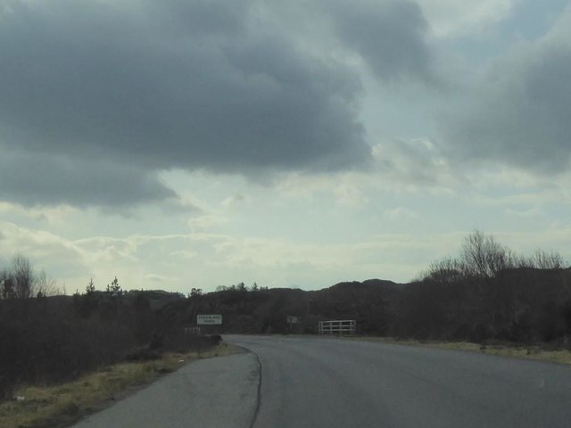
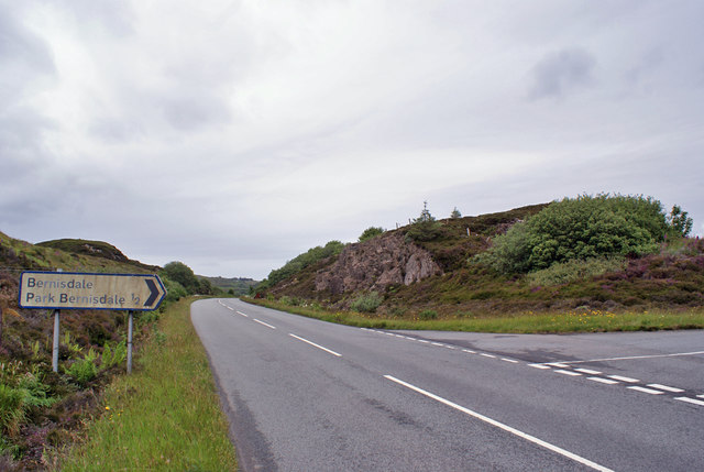
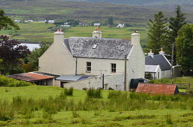
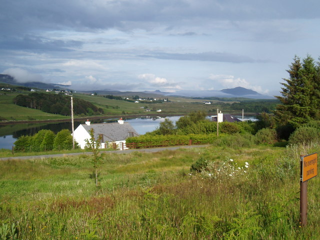
Bernisdale is a small village located in the Inverness-shire region of Scotland. Situated on the Isle of Skye, it is nestled between the Cuillin Mountains and Loch Snizort. The village is part of the Highland Council area and lies approximately 10 miles northwest of Portree, the island's largest town.

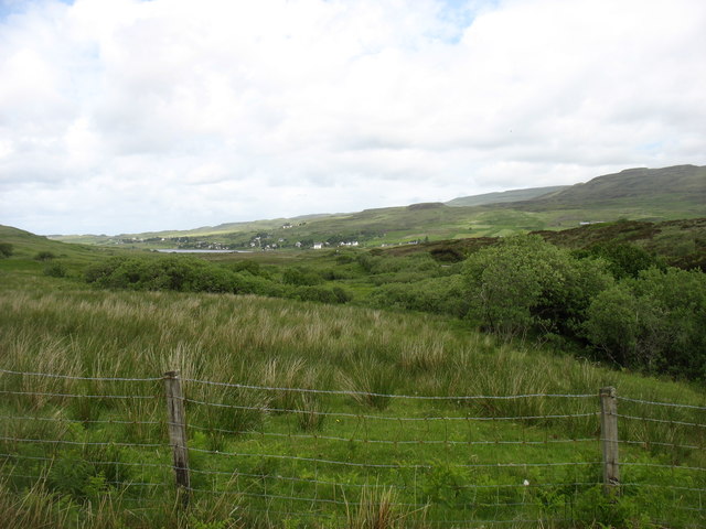
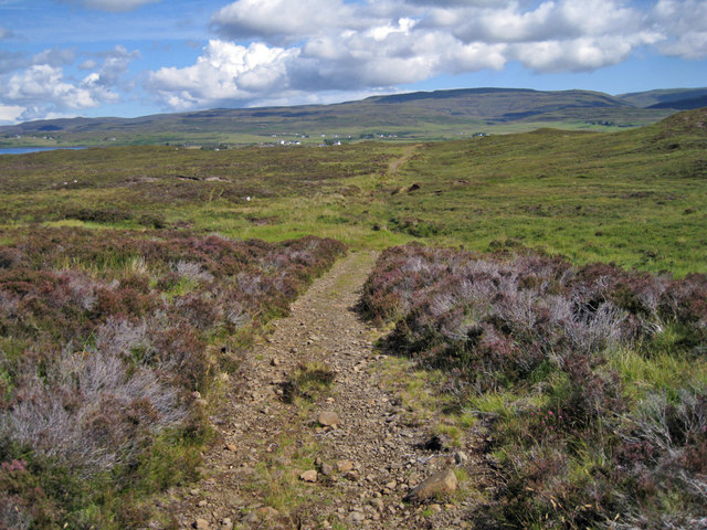
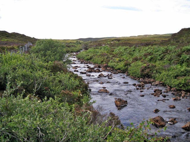
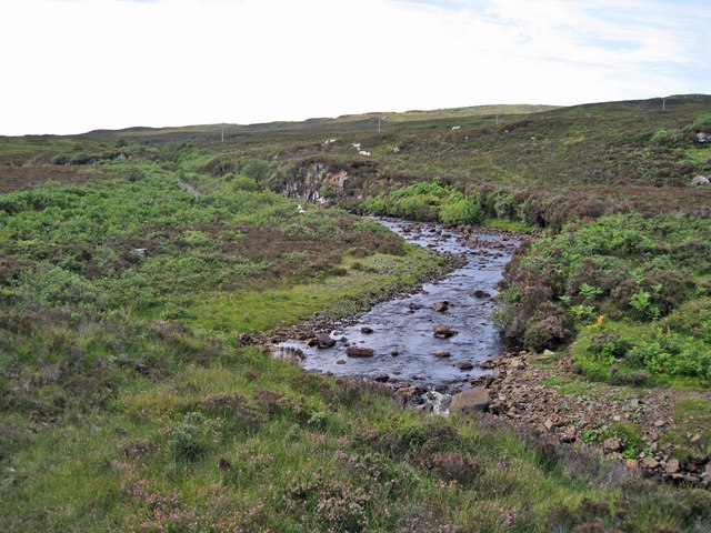
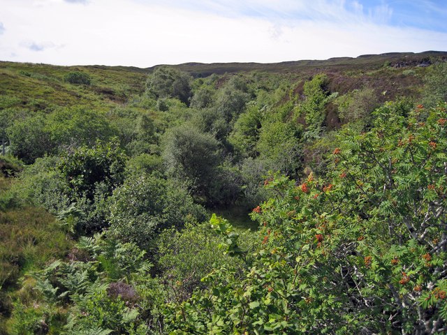
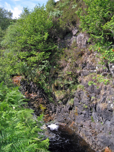
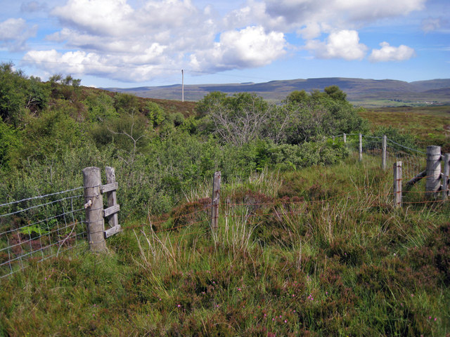
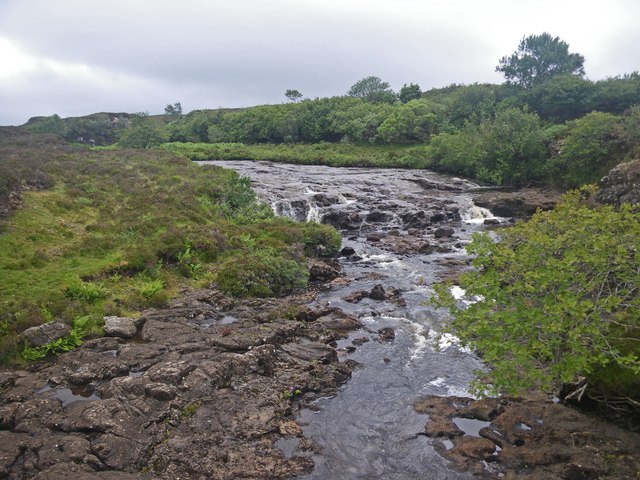
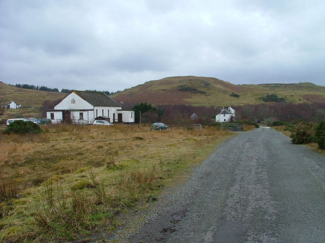
The landscape surrounding Bernisdale is breathtaking, with rolling hills, picturesque lochs, and stunning views of the surrounding mountains. The area is renowned for its natural beauty and attracts visitors from around the world who come to explore the rugged terrain and experience the tranquility of the Scottish Highlands.

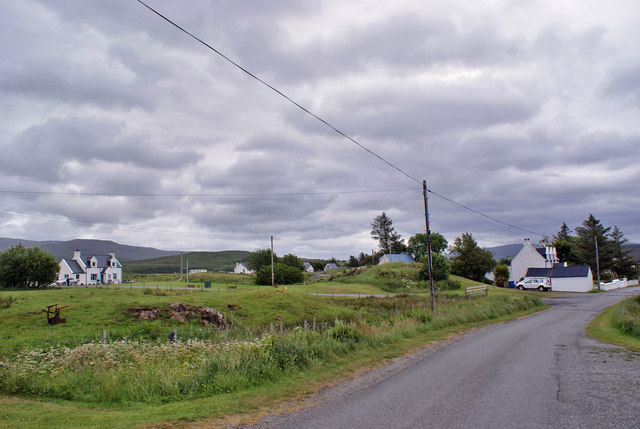
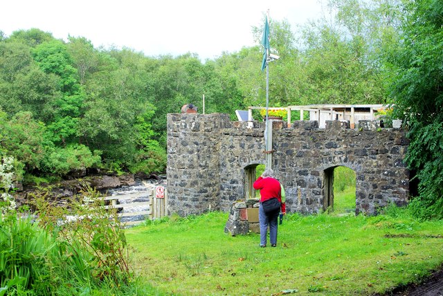
Despite its small size, Bernisdale offers a range of amenities for both residents and visitors. There is a local pub and a handful of guesthouses, providing accommodation options for those wishing to stay in the area. The village is also home to a primary school, ensuring that families have access to education for their children.

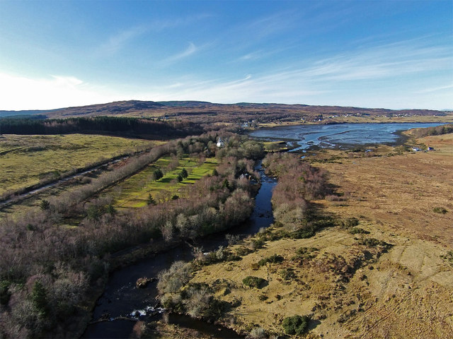
Outdoor enthusiasts will find plenty to do in and around Bernisdale. The nearby Loch Snizort offers opportunities for fishing, boating, and wildlife spotting, while the surrounding hills and mountains are a haven for hikers and climbers. The village is also a popular base for exploring the wider Isle of Skye, with its iconic landmarks such as the Old Man of Storr and the Fairy Pools.

Overall, Bernisdale is a charming village that offers a peaceful retreat in the heart of the Scottish Highlands. Its stunning natural surroundings and range of outdoor activities make it a popular destination for those seeking a true Scottish experience.

If you have any feedback on the listing, please let us know in the comments section below.

Bernisdale Images

Images are sourced within 2km of 57.465298/-6.333571 or Grid Reference NG4049. Thanks to Geograph Open Source API. All images are credited.

A850 crossing the Treaslane River
Bernisdale junction Looking north - a minor road junction off the A850.
Bernisdale junction
Looking north - a minor road junction off the A850.
Country south of Eyre
Old Milestone in Bernisdale, Portree parish Highland granite by the UC road (old A850), in parish of Portree (District), Bernisdale, just North of short connecting road to the A850, by low wall just North of large outbuilding at Veterinary Practice, East side of road.

Inscription once read:-
: (Portree / 7¼) : : (Tayinlone / 3) : 

Surveyed

Milestone Society National ID: HI_SKPODV07
Old Milestone in Bernisdale, Portree parish
Highland granite by the UC road (old A850), in parish of Portree (District), Bernisdale, just North of short connecting road to the A850, by low wall just North of large outbuilding at Veterinary Practice, East side of road. Inscription once read:- : (Portree / 7¼) : : (Tayinlone / 3) : Surveyed Milestone Society National ID: HI_SKPODV07
Bernisdale Bernisdale is a crofting township of many scattered dwellings, with its single-track access road now by-passed by the modern two-way A850.
Bernisdale
Bernisdale is a crofting township of many scattered dwellings, with its single-track access road now by-passed by the modern two-way A850.
Skerinish House The east elevation of the 19th century reworking of a Skye tacksman's house.
Skerinish House
The east elevation of the 19th century reworking of a Skye tacksman's house.
Track above Bernisdale This ancient track leads south onto the moorland to the west of Bernisdale. Although just here, the track is in quite good condition, further south it fades into a barely discernible path with sections of bog. There are no visible footprints or tyre marks, so the track looks to be completely unused nowadays.
Track above Bernisdale
This ancient track leads south onto the moorland to the west of Bernisdale. Although just here, the track is in quite good condition, further south it fades into a barely discernible path with sections of bog. There are no visible footprints or tyre marks, so the track looks to be completely unused nowadays.
Treaslane River The Allt Dearg and the Maraig Burn join close to here to become the Treaslane River, which flows north to meet the sea in Loch Snizort Beag.
Treaslane River
The Allt Dearg and the Maraig Burn join close to here to become the Treaslane River, which flows north to meet the sea in Loch Snizort Beag.
Allt Dearg Looking upstream, the river is here flowing out from a deep narrow gorge. A little downstream it is joined by the Maraig Burn and becomes the Treaslane River.
Allt Dearg
Looking upstream, the river is here flowing out from a deep narrow gorge. A little downstream it is joined by the Maraig Burn and becomes the Treaslane River.
Gorge of the Allt Dearg Completely unseen from above, the river flows through a straight and deep narrow gorge for almost a kilometre just here. (See <a href="https://www.geograph.org.uk/photo/3062176">NG3849 : Allt Dearg gorge</a> ). In stark contrast the heather moorland above, the shelter of the gorge allows the growth of a small woodland of trees, mostly Rowan and Birch. The gorge will also be a haven for a plethora of lichens and bryophytes.
Gorge of the Allt Dearg
Completely unseen from above, the river flows through a straight and deep narrow gorge for almost a kilometre just here. (See NG3849 : Allt Dearg gorge ). In stark contrast the heather moorland above, the shelter of the gorge allows the growth of a small woodland of trees, mostly Rowan and Birch. The gorge will also be a haven for a plethora of lichens and bryophytes.
Gorge of the Allt Dearg The river drops over a small waterfall within the sheer sided gorge just here - unfortunately hidden from view by the bracken.
Gorge of the Allt Dearg
The river drops over a small waterfall within the sheer sided gorge just here - unfortunately hidden from view by the bracken.
Fence above the gorge The dense foliage is the tops of trees growing in the almost sheer sided gorge of Allt Dearg. (See also <a href="https://www.geograph.org.uk/photo/3062176">NG3849 : Allt Dearg gorge</a> and <a href="https://www.geograph.org.uk/photo/3062161">NG3850 : Gorge of the Allt Dearg</a> ).It is not unusual for such gorges to be fenced to prevent wandering sheep and cattle from tumbling to their deaths. Just here however, a small section of older fence is in poor condition and would not be stock-proof.
Fence above the gorge
The dense foliage is the tops of trees growing in the almost sheer sided gorge of Allt Dearg. (See also NG3849 : Allt Dearg gorge and NG3850 : Gorge of the Allt Dearg ).It is not unusual for such gorges to be fenced to prevent wandering sheep and cattle from tumbling to their deaths. Just here however, a small section of older fence is in poor condition and would not be stock-proof.
Treaslane River in a riffle and rapids section Evidence of the geological youth of the glacially scraped surface is present here, evincing the minimal cutting of this stream through the rocky surface during the Holocene.
Treaslane River in a riffle and rapids section
Evidence of the geological youth of the glacially scraped surface is present here, evincing the minimal cutting of this stream through the rocky surface during the Holocene.
Bernisdale towards Tote
Defibrillator box, Bernisdale The former telephone box <a href="https://www.geograph.org.uk/photo/102441">NG3950 : Phone Box at Bernisdale</a> has been repurposed to house one of the many defibrillators being placed around the island.
Defibrillator box, Bernisdale
The former telephone box NG3950 : Phone Box at Bernisdale has been repurposed to house one of the many defibrillators being placed around the island.
Power station and Coire nan Ceann (The Cauldron of the Heads) Site of the Battle of Skeabost, just one of the recurring fixtures in the constant struggle between the two main Skye clans.  To quote the plaque on the small cairn: "In the battle of 1528 defeated MacLeods made their last stand against the MacDonalds.  The battle took place opposite Columba's Isle.  Where the golf course now stands the bodies were thrown into the River Snizort and collected in this pool.  The river ran red with the blood of the slain."

All is not what it seems.  What appear to be open arches are in fact filled in with mirrors to reflect the surrounding greenery.  The castellated structure, despite its appearance, was built only in the 1920s to house water turbines which generated electricity for Skeabost for thirty years, until the area was connected to the national grid in 1954.  More recently the turbines have been updated and again harness the waters of the Snizort as a microgeneration scheme.
Power station and Coire nan Ceann (The Cauldron of the Heads)
Site of the Battle of Skeabost, just one of the recurring fixtures in the constant struggle between the two main Skye clans. To quote the plaque on the small cairn: "In the battle of 1528 defeated MacLeods made their last stand against the MacDonalds. The battle took place opposite Columba's Isle. Where the golf course now stands the bodies were thrown into the River Snizort and collected in this pool. The river ran red with the blood of the slain." All is not what it seems. What appear to be open arches are in fact filled in with mirrors to reflect the surrounding greenery. The castellated structure, despite its appearance, was built only in the 1920s to house water turbines which generated electricity for Skeabost for thirty years, until the area was connected to the national grid in 1954. More recently the turbines have been updated and again harness the waters of the Snizort as a microgeneration scheme.
Lightning tree? I assume this pine, taller than the surrounding trees, has been the victim of a lightning strike.  Ironically, even in its demise it seems to be serving as an electricity pole, supporting a cable supplying a house screened behind the trees to the right.
Lightning tree?
I assume this pine, taller than the surrounding trees, has been the victim of a lightning strike. Ironically, even in its demise it seems to be serving as an electricity pole, supporting a cable supplying a house screened behind the trees to the right.
Mouth of the River Snizort Looking along the River Snizort to where it reaches the sea at the head of Loch Snizort Beag.

To the left can be seen the A850 heading towards Dunvegan. Between the road and the river is the nine-hole golf course of the Skeabost House Hotel, which is itself the white building just visible at the far end of the golf course.

The houses on the far shore of the sea loch are in Bernisdale.
Mouth of the River Snizort
Looking along the River Snizort to where it reaches the sea at the head of Loch Snizort Beag. To the left can be seen the A850 heading towards Dunvegan. Between the road and the river is the nine-hole golf course of the Skeabost House Hotel, which is itself the white building just visible at the far end of the golf course. The houses on the far shore of the sea loch are in Bernisdale.
Show me another place!

Bernisdale is located at Grid Ref: NG4049 (Lat: 57.465298, Lng: -6.333571)

Unitary Authority: Highland

Police Authority: Highlands and Islands

Also known as: Bearnasdal

What 3 Words

///node.highlighted.worth. Near Portree, Highland

Related Wikis

Bernisdale

Bernisdale (Scottish Gaelic: Beàrnasdal) is a small township, near the head of Loch Snizort Beag, Isle of Skye in the Highlands and Islands and is in the...

Dun Cruinn

Dun Cruinn is a prehistoric site about 10 kilometres (6.2 mi) north-west of Portree, on the Isle of Skye, Scotland. It is on the Skerinish Peninsula, between...

Skeabost

Skeabost (Scottish Gaelic: Sgeitheabost) is a township, at the head of the sea loch, Loch Snizort Beag in the southern end of the Trotternish peninsula...

Snizort Cathedral

Snizort Cathedral (Gaelic: Snìosort) was a small cathedral church located on an island (St Columba's Isle, Gaelic: Eilean Chaluim Chille) in the River...

Nearby Amenities

Located within 500m of 57.465298,-6.333571
Source: PGS
Lat/Long: 57.4621743/-6.3276632
Source: PGS
Lat/Long: 57.462925/-6.3282372
Source: PGS
Lat/Long: 57.4635713/-6.3282264
Source: PGS
Lat/Long: 57.4642667/-6.328253
Source: PGS
Lat/Long: 57.4643424/-6.3281948
Source: PGS
Lat/Long: 57.4647307/-6.3280507
Source: PGS
Lat/Long: 57.4651185/-6.3280937
Source: PGS
Lat/Long: 57.4655971/-6.328518
Source: PGS
Lat/Long: 57.4660299/-6.3282476
Source: PGS
Lat/Long: 57.4681645/-6.3282927
Source: PGS
Lat/Long: 57.4683507/-6.328389
Bernisdale
Name En: Bernisdale
Name Gd: Beàrnasdal
Name Sco: Bernisdal
Place: village
Wikidata: Q3777299
Wikipedia: en:Bernisdale
Lat/Long: 57.4672812/-6.3328902
Power: pole
Lat/Long: 57.4620111/-6.329016
Power: pole
Lat/Long: 57.4627181/-6.3292112
Power: pole
Lat/Long: 57.4634467/-6.3298272
Power: pole
Lat/Long: 57.4641634/-6.3304271
Power: pole
Lat/Long: 57.4646658/-6.3308578
Power: pole
Lat/Long: 57.4650263/-6.3311578
Power: pole
Lat/Long: 57.4655286/-6.3312463
Power: pole
Lat/Long: 57.4660114/-6.3313349
Power: pole
Lat/Long: 57.4665722/-6.3314275
Power: pole
Lat/Long: 57.467356/-6.3315724
Power: pole
Lat/Long: 57.4680683/-6.3316932
Power: pole
Lat/Long: 57.4684883/-6.3317496
Power: pole
Lat/Long: 57.468917/-6.3318301
Power: pole
Lat/Long: 57.4693402/-6.3319046
The data included in this document is from www.openstreetmap.org. The data is made available under ODbL.

Have you been to Bernisdale?

Leave your review of Bernisdale below (or comments, questions and feedback).