Sgeitheabost

Settlement in Inverness-shire

Scotland

Sgeitheabost

Bernisdale junction Looking north - a minor road junction off the A850.
Bernisdale junction Credit: Richard Dorrell

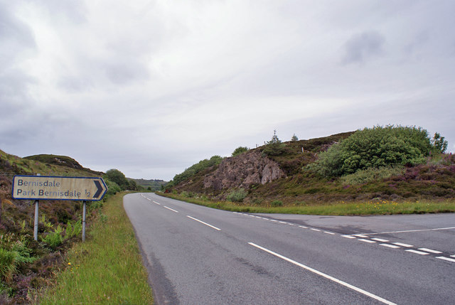
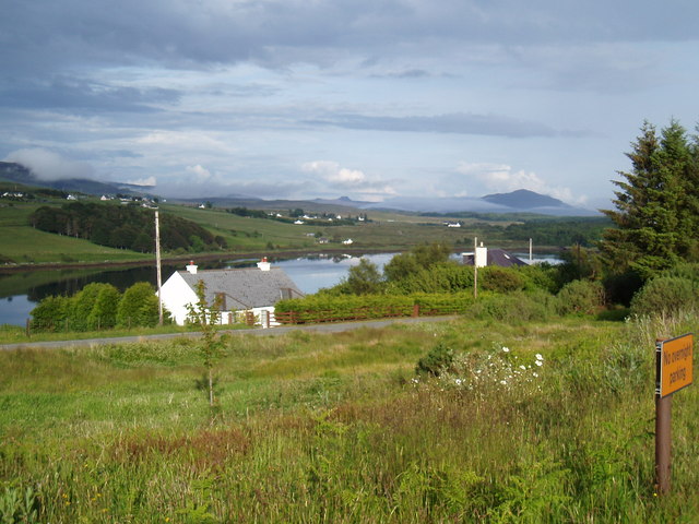
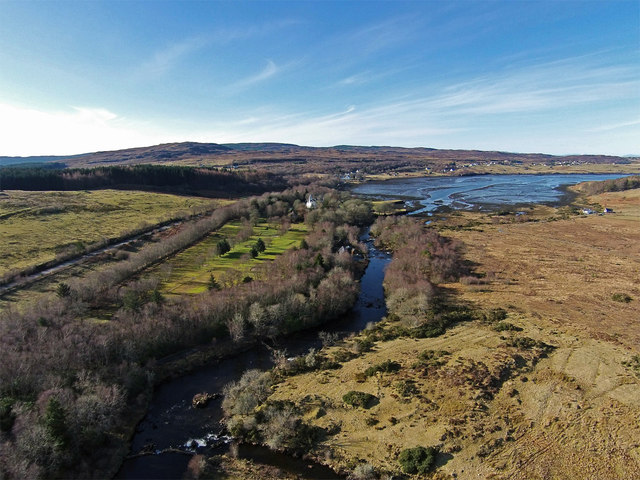
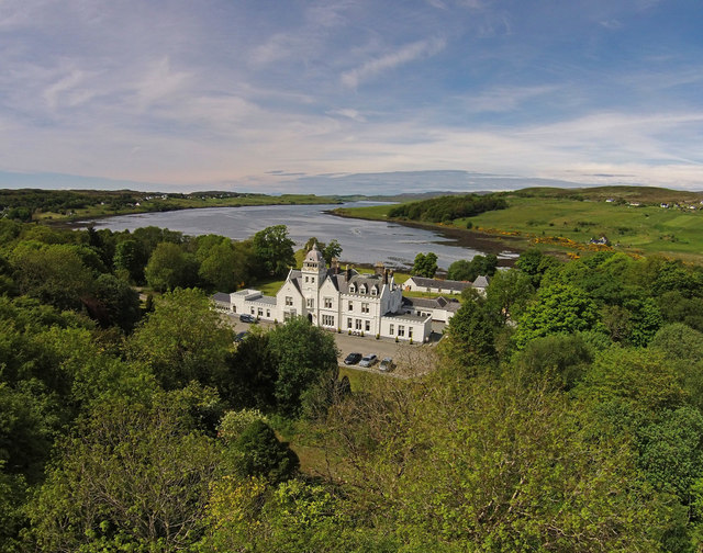
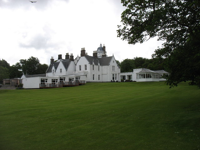
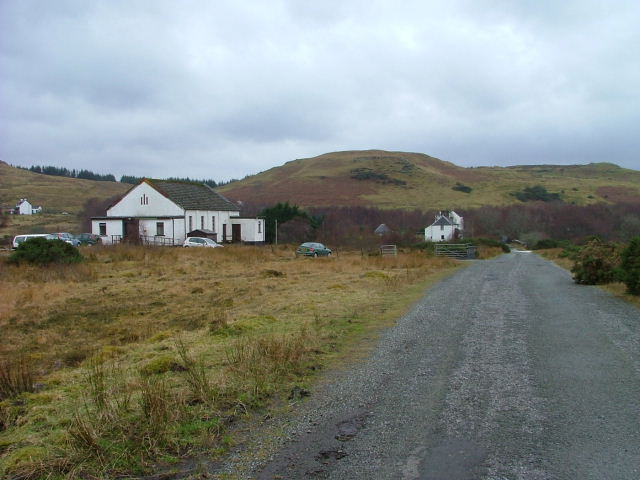
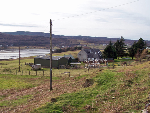
Sgeitheabost is a small village located in the county of Inverness-shire, Scotland. Situated in the northern part of the country, it lies approximately 11 miles southeast of the city of Inverness. The village is set amidst the picturesque Scottish Highlands, offering stunning views of the surrounding landscape.

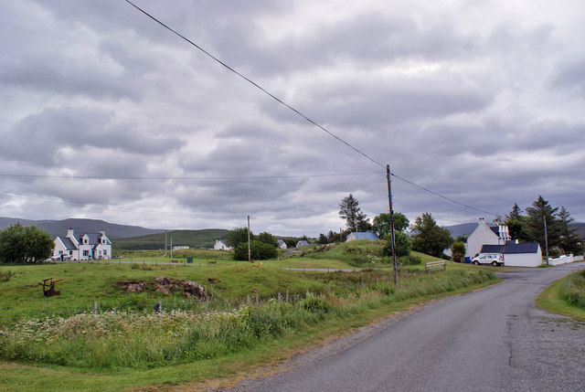
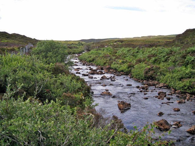
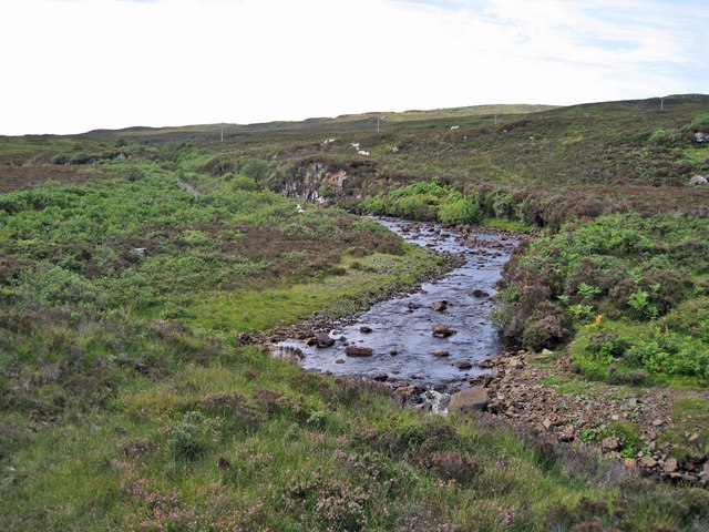
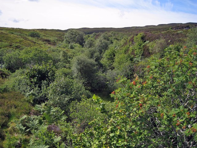
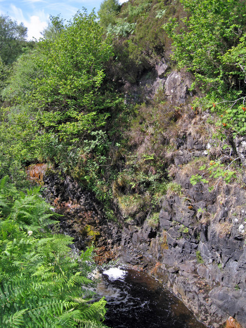
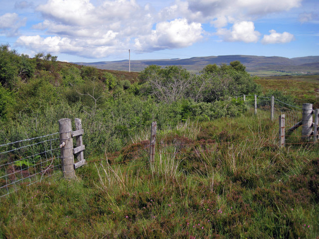
Sgeitheabost is characterized by its rural and tranquil atmosphere, making it an ideal destination for those seeking a peaceful retreat. The village is surrounded by vast expanses of green fields, rolling hills, and dense forests, providing ample opportunities for outdoor activities such as hiking, cycling, and birdwatching.

In terms of amenities, Sgeitheabost is relatively small and does not have many facilities. However, it is within close proximity to other towns and villages that offer a wider range of services, including shops, restaurants, and recreational activities. The village does have a local pub, where residents and visitors can enjoy a drink and experience the warm Scottish hospitality.

One notable attraction near Sgeitheabost is Loch Ness, famous for its mythical creature, the Loch Ness Monster. The lake is only a short distance away, allowing visitors to explore its beauty and perhaps catch a glimpse of this elusive creature.

Overall, Sgeitheabost offers a peaceful and idyllic setting, perfect for those looking to escape the hustle and bustle of city life and immerse themselves in the stunning natural beauty of the Scottish Highlands.

If you have any feedback on the listing, please let us know in the comments section below.

Sgeitheabost Images

Images are sourced within 2km of 57.457063/-6.3265869 or Grid Reference NG4049. Thanks to Geograph Open Source API. All images are credited.

Bernisdale junction Looking north - a minor road junction off the A850.
Bernisdale junction
Looking north - a minor road junction off the A850.
Old Milestone in Bernisdale, Portree parish Highland granite by the UC road (old A850), in parish of Portree (District), Bernisdale, just North of short connecting road to the A850, by low wall just North of large outbuilding at Veterinary Practice, East side of road.

Inscription once read:-
: (Portree / 7¼) : : (Tayinlone / 3) : 

Surveyed

Milestone Society National ID: HI_SKPODV07
Old Milestone in Bernisdale, Portree parish
Highland granite by the UC road (old A850), in parish of Portree (District), Bernisdale, just North of short connecting road to the A850, by low wall just North of large outbuilding at Veterinary Practice, East side of road. Inscription once read:- : (Portree / 7¼) : : (Tayinlone / 3) : Surveyed Milestone Society National ID: HI_SKPODV07
Bernisdale Bernisdale is a crofting township of many scattered dwellings, with its single-track access road now by-passed by the modern two-way A850.
Bernisdale
Bernisdale is a crofting township of many scattered dwellings, with its single-track access road now by-passed by the modern two-way A850.
Treaslane River The Allt Dearg and the Maraig Burn join close to here to become the Treaslane River, which flows north to meet the sea in Loch Snizort Beag.
Treaslane River
The Allt Dearg and the Maraig Burn join close to here to become the Treaslane River, which flows north to meet the sea in Loch Snizort Beag.
Allt Dearg Looking upstream, the river is here flowing out from a deep narrow gorge. A little downstream it is joined by the Maraig Burn and becomes the Treaslane River.
Allt Dearg
Looking upstream, the river is here flowing out from a deep narrow gorge. A little downstream it is joined by the Maraig Burn and becomes the Treaslane River.
Gorge of the Allt Dearg Completely unseen from above, the river flows through a straight and deep narrow gorge for almost a kilometre just here. (See <a href="https://www.geograph.org.uk/photo/3062176">NG3849 : Allt Dearg gorge</a> ). In stark contrast the heather moorland above, the shelter of the gorge allows the growth of a small woodland of trees, mostly Rowan and Birch. The gorge will also be a haven for a plethora of lichens and bryophytes.
Gorge of the Allt Dearg
Completely unseen from above, the river flows through a straight and deep narrow gorge for almost a kilometre just here. (See NG3849 : Allt Dearg gorge ). In stark contrast the heather moorland above, the shelter of the gorge allows the growth of a small woodland of trees, mostly Rowan and Birch. The gorge will also be a haven for a plethora of lichens and bryophytes.
Gorge of the Allt Dearg The river drops over a small waterfall within the sheer sided gorge just here - unfortunately hidden from view by the bracken.
Gorge of the Allt Dearg
The river drops over a small waterfall within the sheer sided gorge just here - unfortunately hidden from view by the bracken.
Fence above the gorge The dense foliage is the tops of trees growing in the almost sheer sided gorge of Allt Dearg. (See also <a href="https://www.geograph.org.uk/photo/3062176">NG3849 : Allt Dearg gorge</a> and <a href="https://www.geograph.org.uk/photo/3062161">NG3850 : Gorge of the Allt Dearg</a> ).It is not unusual for such gorges to be fenced to prevent wandering sheep and cattle from tumbling to their deaths. Just here however, a small section of older fence is in poor condition and would not be stock-proof.
Fence above the gorge
The dense foliage is the tops of trees growing in the almost sheer sided gorge of Allt Dearg. (See also NG3849 : Allt Dearg gorge and NG3850 : Gorge of the Allt Dearg ).It is not unusual for such gorges to be fenced to prevent wandering sheep and cattle from tumbling to their deaths. Just here however, a small section of older fence is in poor condition and would not be stock-proof.
Bernisdale towards Tote
Defibrillator box, Bernisdale The former telephone box <a href="https://www.geograph.org.uk/photo/102441">NG3950 : Phone Box at Bernisdale</a> has been repurposed to house one of the many defibrillators being placed around the island.
Defibrillator box, Bernisdale
The former telephone box NG3950 : Phone Box at Bernisdale has been repurposed to house one of the many defibrillators being placed around the island.
Power station and Coire nan Ceann (The Cauldron of the Heads) Site of the Battle of Skeabost, just one of the recurring fixtures in the constant struggle between the two main Skye clans.  To quote the plaque on the small cairn: "In the battle of 1528 defeated MacLeods made their last stand against the MacDonalds.  The battle took place opposite Columba's Isle.  Where the golf course now stands the bodies were thrown into the River Snizort and collected in this pool.  The river ran red with the blood of the slain."

All is not what it seems.  What appear to be open arches are in fact filled in with mirrors to reflect the surrounding greenery.  The castellated structure, despite its appearance, was built only in the 1920s to house water turbines which generated electricity for Skeabost for thirty years, until the area was connected to the national grid in 1954.  More recently the turbines have been updated and again harness the waters of the Snizort as a microgeneration scheme.
Power station and Coire nan Ceann (The Cauldron of the Heads)
Site of the Battle of Skeabost, just one of the recurring fixtures in the constant struggle between the two main Skye clans. To quote the plaque on the small cairn: "In the battle of 1528 defeated MacLeods made their last stand against the MacDonalds. The battle took place opposite Columba's Isle. Where the golf course now stands the bodies were thrown into the River Snizort and collected in this pool. The river ran red with the blood of the slain." All is not what it seems. What appear to be open arches are in fact filled in with mirrors to reflect the surrounding greenery. The castellated structure, despite its appearance, was built only in the 1920s to house water turbines which generated electricity for Skeabost for thirty years, until the area was connected to the national grid in 1954. More recently the turbines have been updated and again harness the waters of the Snizort as a microgeneration scheme.
Lightning tree? I assume this pine, taller than the surrounding trees, has been the victim of a lightning strike.  Ironically, even in its demise it seems to be serving as an electricity pole, supporting a cable supplying a house screened behind the trees to the right.
Lightning tree?
I assume this pine, taller than the surrounding trees, has been the victim of a lightning strike. Ironically, even in its demise it seems to be serving as an electricity pole, supporting a cable supplying a house screened behind the trees to the right.
St Columba's Isle St. Columba is much better known for his association with the island of Iona, but this site on an island in the River Snizort is where he founded the cathedral of the bishops of the Isles. This was the centre of Christianity in the Hebrides from 1079 to 1498. There are obvious ruins of two small buildings, and the outlines of others can be traced. The island is peppered with graves, ranging in age from the 11th century to the 1960s. Many of them have legible inscriptions, and a few others have plaques showing transcriptions.
A footbridge - constructed in 1990 by the Officers Training Corps of Edinburgh and Herriot-Watt Universities - crosses the narrower branch of the river and gives access to the island. It can be seen cutting through the trees at the right side of the picture.
St Columba's Isle
St. Columba is much better known for his association with the island of Iona, but this site on an island in the River Snizort is where he founded the cathedral of the bishops of the Isles. This was the centre of Christianity in the Hebrides from 1079 to 1498. There are obvious ruins of two small buildings, and the outlines of others can be traced. The island is peppered with graves, ranging in age from the 11th century to the 1960s. Many of them have legible inscriptions, and a few others have plaques showing transcriptions. A footbridge - constructed in 1990 by the Officers Training Corps of Edinburgh and Herriot-Watt Universities - crosses the narrower branch of the river and gives access to the island. It can be seen cutting through the trees at the right side of the picture.
Mouth of the River Snizort Looking along the River Snizort to where it reaches the sea at the head of Loch Snizort Beag.

To the left can be seen the A850 heading towards Dunvegan. Between the road and the river is the nine-hole golf course of the Skeabost House Hotel, which is itself the white building just visible at the far end of the golf course.

The houses on the far shore of the sea loch are in Bernisdale.
Mouth of the River Snizort
Looking along the River Snizort to where it reaches the sea at the head of Loch Snizort Beag. To the left can be seen the A850 heading towards Dunvegan. Between the road and the river is the nine-hole golf course of the Skeabost House Hotel, which is itself the white building just visible at the far end of the golf course. The houses on the far shore of the sea loch are in Bernisdale.
Skeabost Hotel A 4 star hotel at the head of Loch Snizort Beag.
Skeabost Hotel
A 4 star hotel at the head of Loch Snizort Beag.
Road junction at Bernisdale
Skeabost House Hotel I recall staying here a couple of times in the 1980s, but I have not had occasion to return.
Skeabost House Hotel
I recall staying here a couple of times in the 1980s, but I have not had occasion to return.
River Snizort estuary At or near high tide.
River Snizort estuary
At or near high tide.
Show me another place!

Sgeitheabost is located at Grid Ref: NG4049 (Lat: 57.457063, Lng: -6.3265869)

Unitary Authority: Highland

Police Authority: Highlands and Islands

Also known as: Skeabost

What 3 Words

///replaces.winemaker.trickster. Near Portree, Highland

Related Wikis

Skeabost

Skeabost (Scottish Gaelic: Sgeitheabost) is a township, at the head of the sea loch, Loch Snizort Beag in the southern end of the Trotternish peninsula...

Snizort Cathedral

Snizort Cathedral (Gaelic: Snìosort) was a small cathedral church located on an island (St Columba's Isle, Gaelic: Eilean Chaluim Chille) in the River...

Tote, Skye

Tote (Scottish Gaelic: Tobhta) is a small crofting township, situated on the southwest coast of the Trotternish peninsula, at the head of the sea loch...

Carbost, Trotternish

Carbost (Scottish Gaelic: Càrrabost) is a crofting settlement at the southern end of the Trotternish peninsula on the Isle of Skye in the Highlands of...

Nearby Amenities

Located within 500m of 57.457063,-6.3265869
Source: PGS
Lat/Long: 57.4556763/-6.3196334
Source: PGS
Lat/Long: 57.4558614/-6.3202717
Source: PGS
Lat/Long: 57.456199/-6.3210549
Source: PGS
Lat/Long: 57.456599/-6.3221825
Source: PGS
Lat/Long: 57.4568749/-6.3225001
Source: PGS
Lat/Long: 57.4570466/-6.3229421
Source: PGS
Lat/Long: 57.4572947/-6.3236781
Source: PGS
Lat/Long: 57.4577763/-6.3250176
Source: PGS
Lat/Long: 57.4579939/-6.3253157
Source: PGS
Lat/Long: 57.4584492/-6.3258221
Source: PGS
Lat/Long: 57.4590679/-6.3261601
Source: PGS
Lat/Long: 57.4595307/-6.3263146
Source: PGS
Lat/Long: 57.4600432/-6.3264787
Source: PGS
Lat/Long: 57.4609948/-6.3268531
Source: PGS
Lat/Long: 57.4612539/-6.3266622
Bus Stop
Inbhir Torra
Naptan AtcoCode: 670030005
Naptan Bearing: SE
Naptan CommonName: Inbhir Torra
Naptan Indicator: at Bus Shelter
Naptan Landmark: Church of Scotland
Naptan NaptanCode: 45323856
Naptan Street: A850
Naptan Verified: no
Source: naptan_import
Lat/Long: 57.4575155/-6.3263112
Bus Stop
Inbhir Torra
Naptan AtcoCode: 6700713110
Naptan Bearing: NW
Naptan CommonName: Inbhir Torra
Naptan Indicator: opp Bus Shelter
Naptan Landmark: Church of Scotland
Naptan NaptanCode: 45328528
Naptan Street: A850
Naptan Verified: no
Source: naptan_import
Lat/Long: 57.4574096/-6.3265156
Barrier: cattle_grid
Source: survey
Lat/Long: 57.4545258/-6.3273527
Note: last pole of this line
Power: pole
Lat/Long: 57.4566884/-6.3267242
Power: pole
Lat/Long: 57.4563178/-6.3254631
Post Box
Ref: IV51 18
Source: survey
Lat/Long: 57.4576233/-6.3265431
Parking
Source: survey
Lat/Long: 57.4575934/-6.326547
Power: pole
Lat/Long: 57.4557017/-6.323283
Power: pole
Lat/Long: 57.4554158/-6.3223168
Power: pole
Lat/Long: 57.455131/-6.3212761
Power: pole
Lat/Long: 57.4549123/-6.3204749
Power: pole
Lat/Long: 57.4575804/-6.3263145
Power: pole
Lat/Long: 57.4583049/-6.3268581
Power: pole
Lat/Long: 57.4589935/-6.3273855
Power: pole
Lat/Long: 57.4594483/-6.3277317
Power: pole
Lat/Long: 57.4598641/-6.3280437
Power: pole
Lat/Long: 57.4606263/-6.3286214
Power: pole
Lat/Long: 57.461316/-6.3288227
The data included in this document is from www.openstreetmap.org. The data is made available under ODbL.

Have you been to Sgeitheabost?

Leave your review of Sgeitheabost below (or comments, questions and feedback).