Berners Roding

Settlement in Essex Epping Forest

England

Berners Roding

Churchyard gate  and path, Berners Roding, Essex This path passes through the overgrown churchyard of All Saints Church. At least it was until it was deconsecrated in 1985. The path goes ahead alongside the buildings of Berners Hall Farm to join the roadway
Churchyard gate and path, Berners Roding, Essex Credit: Derek Voller

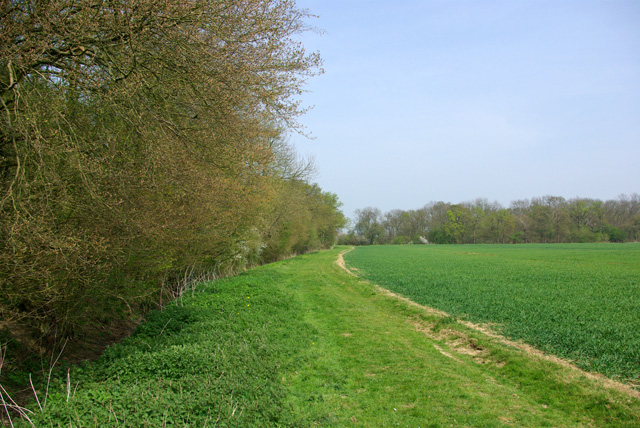
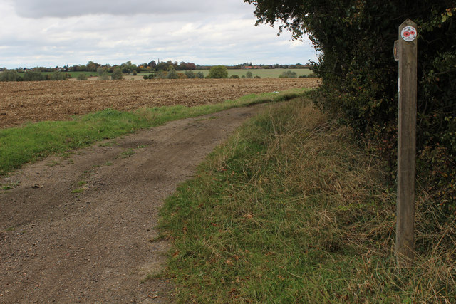
Berners Roding is a small village located in the county of Essex, England. Situated approximately 25 miles northeast of London, it falls within the Epping Forest district. The village is set in a rural landscape, surrounded by picturesque countryside and farmland, offering a serene and peaceful atmosphere.

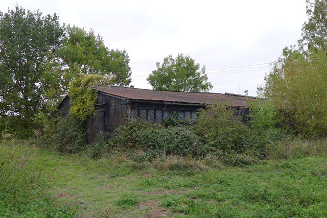
The history of Berners Roding can be traced back to medieval times when it was known as "Bernerus Rodings." The name is believed to have derived from the Berners family, who were prominent landowners in the area. The village retains its traditional charm, with a collection of historic buildings and cottages, some dating back to the 16th century.

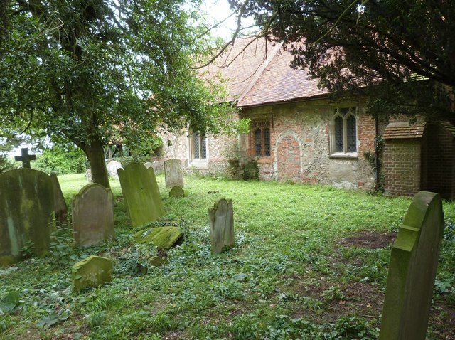
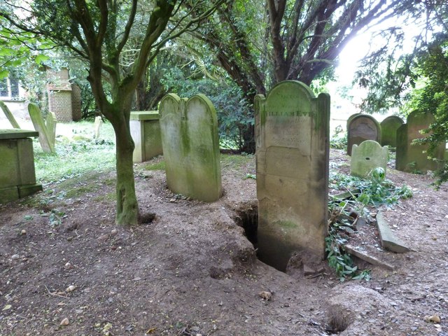
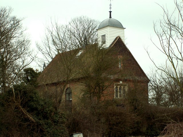
Despite its small size, Berners Roding boasts a strong sense of community, with various local events and activities organized throughout the year. The village has a small church, St. Andrew's, which serves as a focal point for religious and social gatherings.

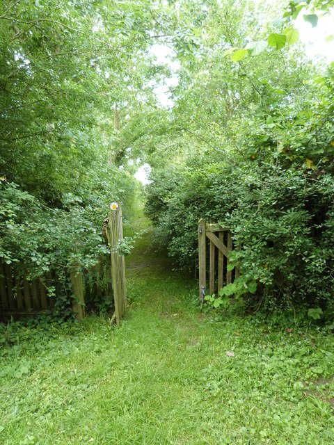
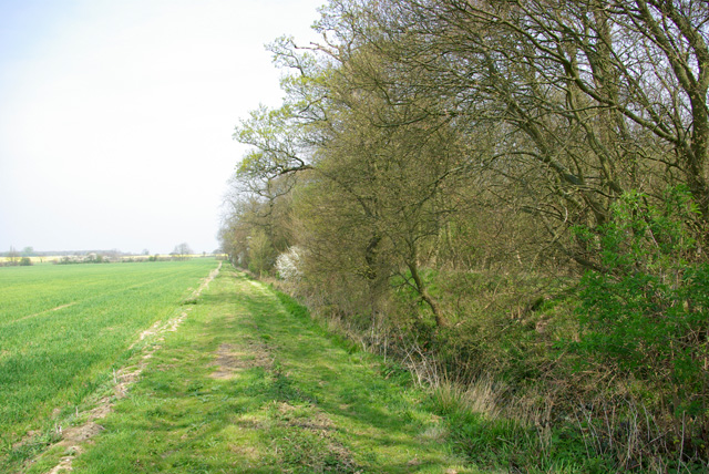
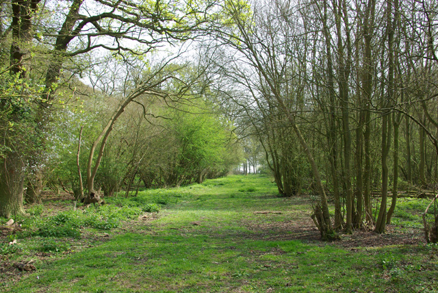
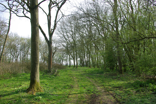
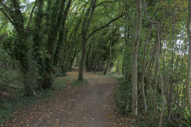
Nature enthusiasts will appreciate the surrounding countryside, offering ample opportunities for walking, cycling, and exploring the nearby Roding Valley Meadows Nature Reserve. The reserve is home to a diverse range of flora and fauna, making it a popular spot for wildlife observation and nature photography.

While Berners Roding may lack the amenities of larger towns, it benefits from its proximity to nearby villages and towns, such as Chipping Ongar and Harlow, where residents can find a wider range of services, including shops, schools, and healthcare facilities.

In summary, Berners Roding presents a tranquil and idyllic setting, perfect for those seeking a peaceful rural lifestyle, while still enjoying easy access to nearby towns and the bustling city of London.

If you have any feedback on the listing, please let us know in the comments section below.

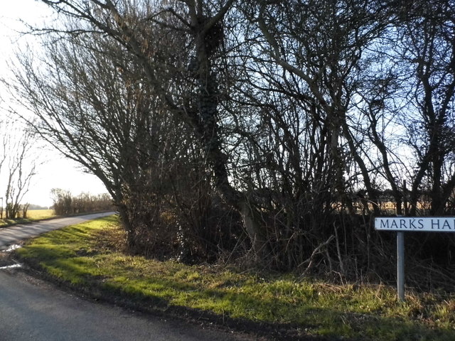
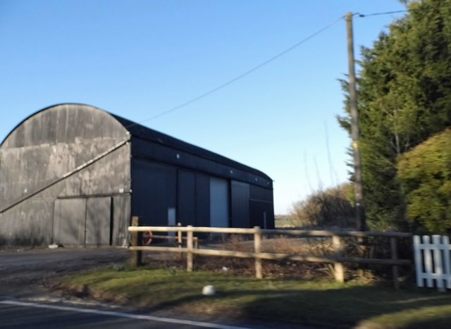
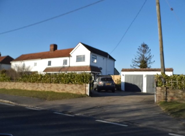
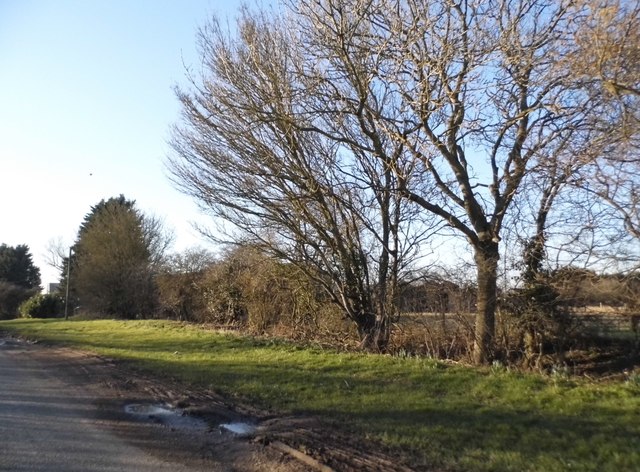
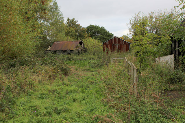
Berners Roding Images

Images are sourced within 2km of 51.764946/0.322593 or Grid Reference TL6009. Thanks to Geograph Open Source API. All images are credited.

Churchyard gate  and path, Berners Roding, Essex This path passes through the overgrown churchyard of All Saints Church. At least it was until it was deconsecrated in 1985. The path goes ahead alongside the buildings of Berners Hall Farm to join the roadway
Churchyard gate and path, Berners Roding, Essex
This path passes through the overgrown churchyard of All Saints Church. At least it was until it was deconsecrated in 1985. The path goes ahead alongside the buildings of Berners Hall Farm to join the roadway
All Saints Church, Berners Roding, Essex Constructed sometime during the 14th century in the tiny hamlet of Berners Roding (or Roothing in some historical references) It is one of nine Anglo Saxon settlements near the River Roding from which they all take their name.  All Saints once had a wooden belfry at its Western end and carried a single bell dated 1594, both now gone. The church fell into disuse probably because of its isolated location and was deconsecrated in 1985. The building is now in a poor structural state and privately owned, but the churchyard is under the care of "Epping Forest Countrycare".  For more information and some excellent interior pictures see <span class="nowrap"><a title="http://www.28dayslater.co.uk/all-saints-chruch-berners-roding-essex.t61284" rel="nofollow ugc noopener" href="http://www.28dayslater.co.uk/all-saints-chruch-berners-roding-essex.t61284">Link</a><img style="margin-left:2px;" alt="External link" title="External link - shift click to open in new window" src="https://s1.geograph.org.uk/img/external.png" width="10" height="10"/></span>
All Saints Church, Berners Roding, Essex
Constructed sometime during the 14th century in the tiny hamlet of Berners Roding (or Roothing in some historical references) It is one of nine Anglo Saxon settlements near the River Roding from which they all take their name. All Saints once had a wooden belfry at its Western end and carried a single bell dated 1594, both now gone. The church fell into disuse probably because of its isolated location and was deconsecrated in 1985. The building is now in a poor structural state and privately owned, but the churchyard is under the care of "Epping Forest Countrycare". For more information and some excellent interior pictures see LinkExternal link
The South wall and Churchyard of All Saints church, Berners Roding, Essex Berners Roding (or Roothing in some historical references) is one of nine Anglo Saxon settlements near the River Roding from which they all take their name. All Saints fell into disuse probably because of its isolated location and was deconsecrated in 1985. It is now privately owned and the churchyard under the care of Epping Forest Countrycare. For more information and some excellent interior pictures see <span class="nowrap"><a title="http://www.28dayslater.co.uk/all-saints-chruch-berners-roding-essex.t61284" rel="nofollow ugc noopener" href="http://www.28dayslater.co.uk/all-saints-chruch-berners-roding-essex.t61284">Link</a><img style="margin-left:2px;" alt="External link" title="External link - shift click to open in new window" src="https://s1.geograph.org.uk/img/external.png" width="10" height="10"/></span>
The South wall and Churchyard of All Saints church, Berners Roding, Essex
Berners Roding (or Roothing in some historical references) is one of nine Anglo Saxon settlements near the River Roding from which they all take their name. All Saints fell into disuse probably because of its isolated location and was deconsecrated in 1985. It is now privately owned and the churchyard under the care of Epping Forest Countrycare. For more information and some excellent interior pictures see LinkExternal link
Badger damage to the graves, All Saints churchyard, Berners Roding, Essex All Saints was the local parish church but was deconsecrated in 1985 and its graves are now apparently looked after by "Epping Forest Countrycare"
Badger damage to the graves, All Saints churchyard, Berners Roding, Essex
All Saints was the local parish church but was deconsecrated in 1985 and its graves are now apparently looked after by "Epping Forest Countrycare"
All Saints Church, Berners Roding, Essex
Path up west side of Berners Wood The wood has public paths all around it, but not through it.
Path up west side of Berners Wood
The wood has public paths all around it, but not through it.
Berners Wood An old wood, although not looking so. It appears, although not extending as far north, on the 1777 map of Chapman and Andre. It looks like coppice.
Berners Wood
An old wood, although not looking so. It appears, although not extending as far north, on the 1777 map of Chapman and Andre. It looks like coppice.
Ride, Berners Wood Extending from one side of the wood to the other.
Ride, Berners Wood
Extending from one side of the wood to the other.
Ride, Berners Wood Extending from one side of the wood to the other.
Ride, Berners Wood
Extending from one side of the wood to the other.
Path up east side of Berners Wood The wood has public paths all around it, but not through it. Beech Wood is to the right.
Path up east side of Berners Wood
The wood has public paths all around it, but not through it. Beech Wood is to the right.
Marks Hall Lane, Margaret Roding
Barn at Blue House Farm, Four Wantz
House on Chelmsford Road, Four Wantz
Ongar Road, Margaret Roding
Dilapidated Outbuildings at Pincher's Farm, Pepper's Green
Essex Way in Hardy's Plantation The long distance footpath just to the south of Pepper's Green
Essex Way in Hardy's Plantation
The long distance footpath just to the south of Pepper's Green
Essex Way at Salt's Green The long distance footpath heading north east away from the A1060
Essex Way at Salt's Green
The long distance footpath heading north east away from the A1060
Old building, Pinchers Farm, Pepper's Green
Show me another place!

Berners Roding is located at Grid Ref: TL6009 (Lat: 51.764946, Lng: 0.322593)

Administrative County: Essex

District: Epping Forest

Police Authority: Essex

What 3 Words

///drive.twins.stow. Near High Ongar, Essex

Related Wikis

Berners Roding

Berners Roding (pronounced Barnish) is a village and former civil parish, now in the parish of Abbess, Beauchamp and Berners Roding and the Epping Forest...

Willingale, Essex

Willingale is a village and civil parish in the Epping Forest district of Essex, England. The civil parish also includes the village of Shellow Bowells...

Birds Green

Birds Green is a hamlet in the civil parish of Abbess, Beauchamp and Berners Roding and the Epping Forest district of Essex, England. The hamlet is within...

Margaret Roding

Margaret Roding is a village and civil parish in the Uttlesford district of Essex, England. The village is included in the eight hamlets and villages called...

Shellow Bowells

Shellow Bowells (or occasionally misspelt as Shellow Bowels) is a village and former civil parish, now in the parish of Willingale, in the Epping Forest...

Beauchamp Roding

Beauchamp Roding ( BEECH-əm) is a village and former civil parish, now in the parish of Abbess, Beauchamp and Berners Roding, and in the Epping Forest...

Abbess, Beauchamp and Berners Roding

Abbess, Beauchamp and Berners Roding is a group of three small villages in the County of Essex, England. Collectively, they form one civil parish in the...

St Andrew's Church, Willingale

St Andrew's Church is a redundant Anglican church in the village of Willingale, Essex, England. It is recorded in the National Heritage List for England...

Nearby Amenities

Located within 500m of 51.764946,0.322593
Berners Roding
Place: hamlet
Lat/Long: 51.7652808/0.3212231
Telephone
Defibrillator
Access: yes
Booth: K6
Covered: booth
Defibrillator Location: inside old red phone box in Berners Roding
Emergency: defibrillator
Man Made: telephone_box
Lat/Long: 51.7651173/0.3225782
Post Box
Post Box Type: lamp
Lat/Long: 51.7649081/0.3205536
The data included in this document is from www.openstreetmap.org. The data is made available under ODbL.

Have you been to Berners Roding?

Leave your review of Berners Roding below (or comments, questions and feedback).